
Today I drove 122 miles traveling from Mackinaw City, Michigan to Paradise, Michigan.

I woke up this morning to another beautiful day in Michigan.
My first order of business today was to cross the Mackinac Bridge.
(Click HERE for a longer complete video of the bridge.) |
After crossing the Mackinac Bridge I was in the city of St. Ignace on Michigan's Upper Peninsula.
I spent an hour or so here exploring the town before heading further north.
Next it was only about a fifty mile drive to my primary stop of the day, Sault Ste. Marie, Michigan.
I visited historic Portage Avenue, watched the operations at the Soo Locks observation platform,
admired the views from the top of the Tower of History and took a two hour long Soo Locks boat tour.
Unfortunately my sunny skies disappeared toward the end of the boat ride.
I began my sixty mile journey to Paradise, Michigan via the Whitefish Bay Scenic Byway.
The route took me through the Hiawatha National Forest. I stopped at the Point Iroquois Lighthouse.
Once in Paradise I checked into the Magnuson Grand Hotel. This is when the light rain began to fall.
Next I drove 24 miles roundtrip to the Whitefish Point Lighthouse.
|
Hello everyone, After three fun days in Mackinaw City I left this morning. I crossed the Mackinac Bridge shortly before 7:00 this morning. When I got across the bridge I was in St. Ignace. The first place I visited there was Bridge View Park.  I spent some time crawling on the ground taking pictures of flowers with the bridge in the background. I didn't embarrass myself since I was the only one there at that early hour.  Next I scootered out to the Wawatam Lighthouse via the Huron Boardwalk.  My final stop in St. Ignace was at Castle Rock. That's Paul Bunyan and Babe the Blue Ox under the rock. I remember climbing up there with Dan about forty years ago. Today it was just a quick photo op and I was on my way.  Next I drove fifty miles north on Interstate 75 to Sault Ste. Marie. Once there I ditched the car and explored the downtown area on my scooter. Below is Portage Avenue across from the Soo Locks.  I made my way to the St. Marys Falls Canal Park on West Portage Avenue.  The picture below was taken from the observation deck at the Soo Locks Visitor Center which is inside the gates seen above. The locks pass an average of 10,000 ships per year, despite being closed during the winter from January through March, when ice shuts down shipping on the Great Lakes.   The view from the top was very nice. The prominent building in the front of the picture below is City Hall. That's the International Bridge in the back which connects the U.S. and Canada, which is on the right side of the St. Marys River. That's Portage Avenue running down the center of the picture.  Below is a closer look at Portage Ave from above. Those are the Soo Locks on the right. You can see a nice mural of a ship painted on a downtown building.  Next I boarded a boat with the Famous Soo Locks Boat Tours which has been locally owned and operated since 1959.  Below you can see a couple of tour boats coming out of the lock and we are about to go in.  Below you can see the observation platform which I visited earlier on the left.  After they raised our boat up they opened the gates on the other side and we sailed out. Below is a large ship waiting to go through. The lock they use for the big ships is broken so the ships are backing up to get through. 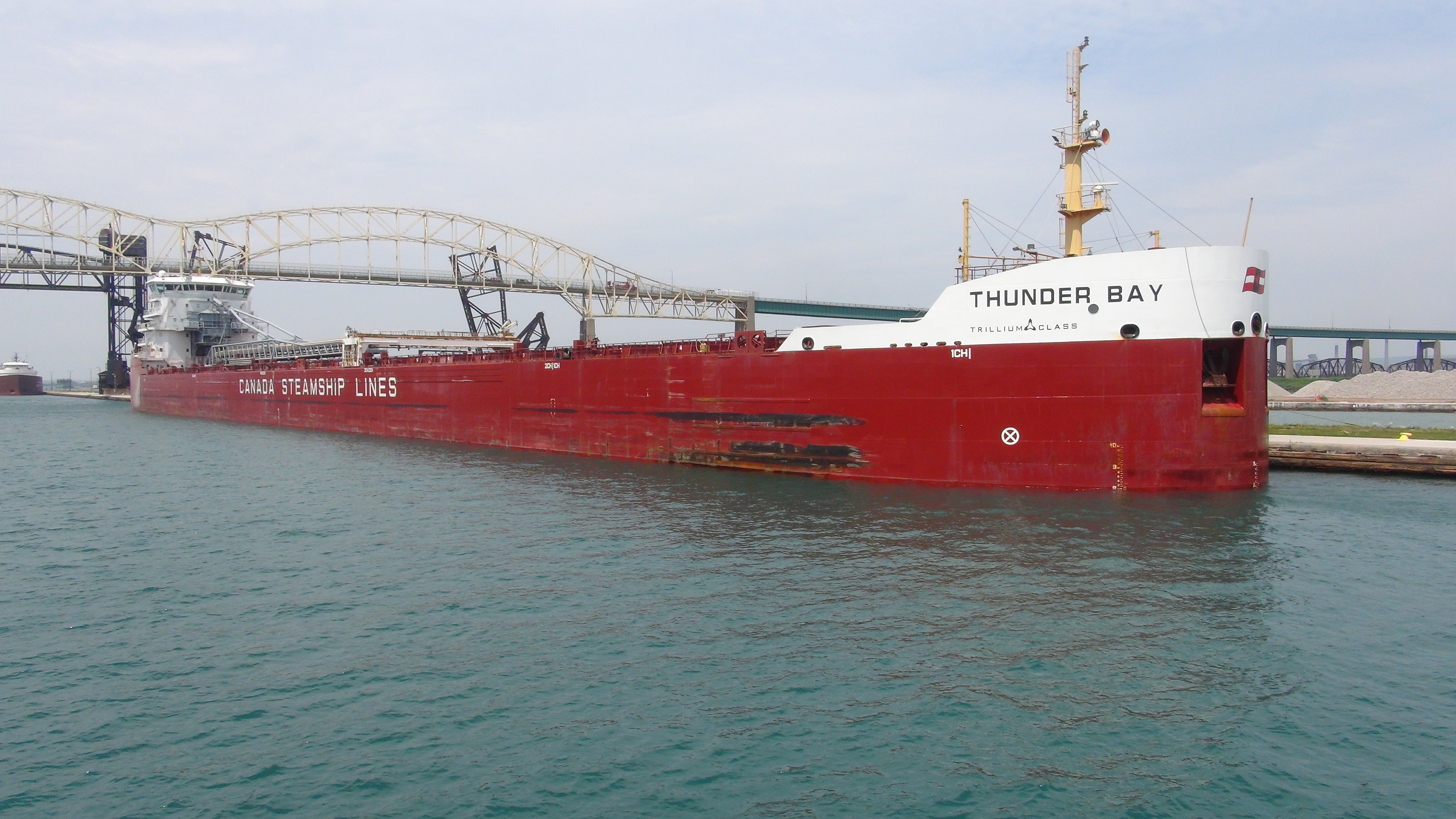 We sailed out a short way and then turned around and went back into the same lock. Below you can see the gates opening up as we are about to make our final exit.  By the time I got off the boat all the sunshine was gone and it was now totally gloomy. At this point I left Sault Ste. Marie and drove about thirty miles to the Point Iroquois Lighthouse. You can see Lake Superior behind the lighthouse. This was the point that the very light rain started.  It was raining a little harder by the time I got to Whitefish Point Lighthouse which was 48 miles away. It was a lot colder as well. This lighthouse is the oldest operating lighthouse in the Upper Peninsula.  I am spending the night in the very small town of Paradise, seen below, which is 12 miles south of Whitefish Point.  I'm staying at the Magnuson Grand Hotel. It's a very nice hotel. I have a nice room with a balcony overlooking Lake Superior.  And below is the gloomy view from my balcony. That is a very noisy seagull on that post out there.  Below is my comfortable hotel room. It was a busy day. I ate dinner from my cooler tonight.  It's getting late as I'm finishing this email. So I will say good night. Tim |
This over 4 hour unedited dash cam video includes St. Ignace, the Soo Locks and the Whitefish Bay Scenic Byway. |

Click on the arrow above for tomorrow's adventures.
| TIM'S HOME PAGE SITE INDEX | |||
|---|---|---|---|
| Areas | Description | # of Pages | |
| About Me | Current Picture of me and my home. Information about myself. | 2 | |
| Biography | Pictorial biography of myself. Pictures range from birth to adulthood. | 4 | |
| Family File | Pictures of my family and a little information about them. | 12 | |
| Local Spotlight | Pictures, Links, and Information for Indianapolis, Richmond, Plainfield, and Mooresville, Indiana. | 5 | |
| Tim's Travels | Pictures, videos and travelogs from my travels around the world. | 409 | |
| Vacation Videos | Over 1500 videos from my travels around the world. | 1 | |