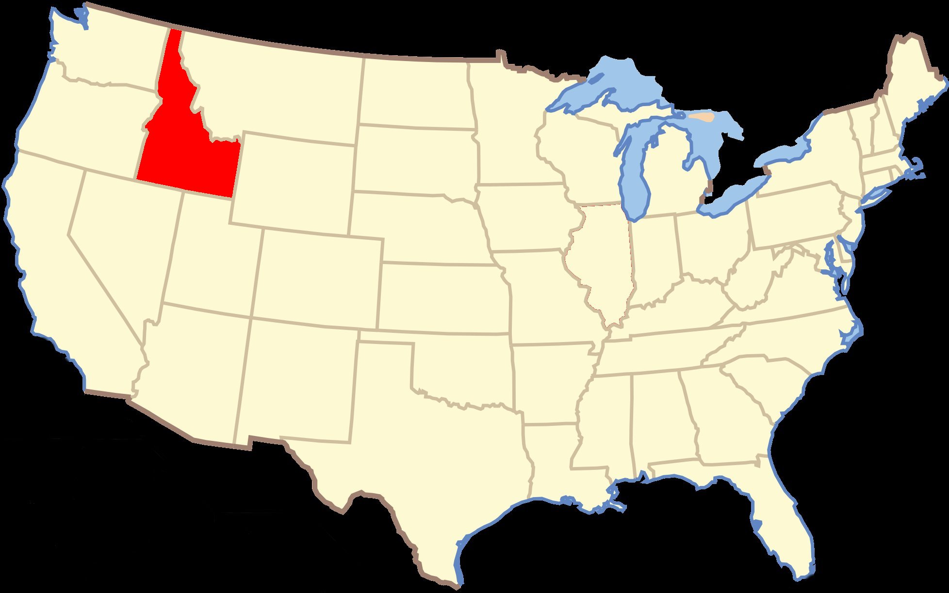
Today I drove 144 miles traveling from Boise, Idaho to Twin Falls, Idaho.
Today's adventures take from 0:21:58-1:16:51 in the video. (Don't like long videos? Click |
|
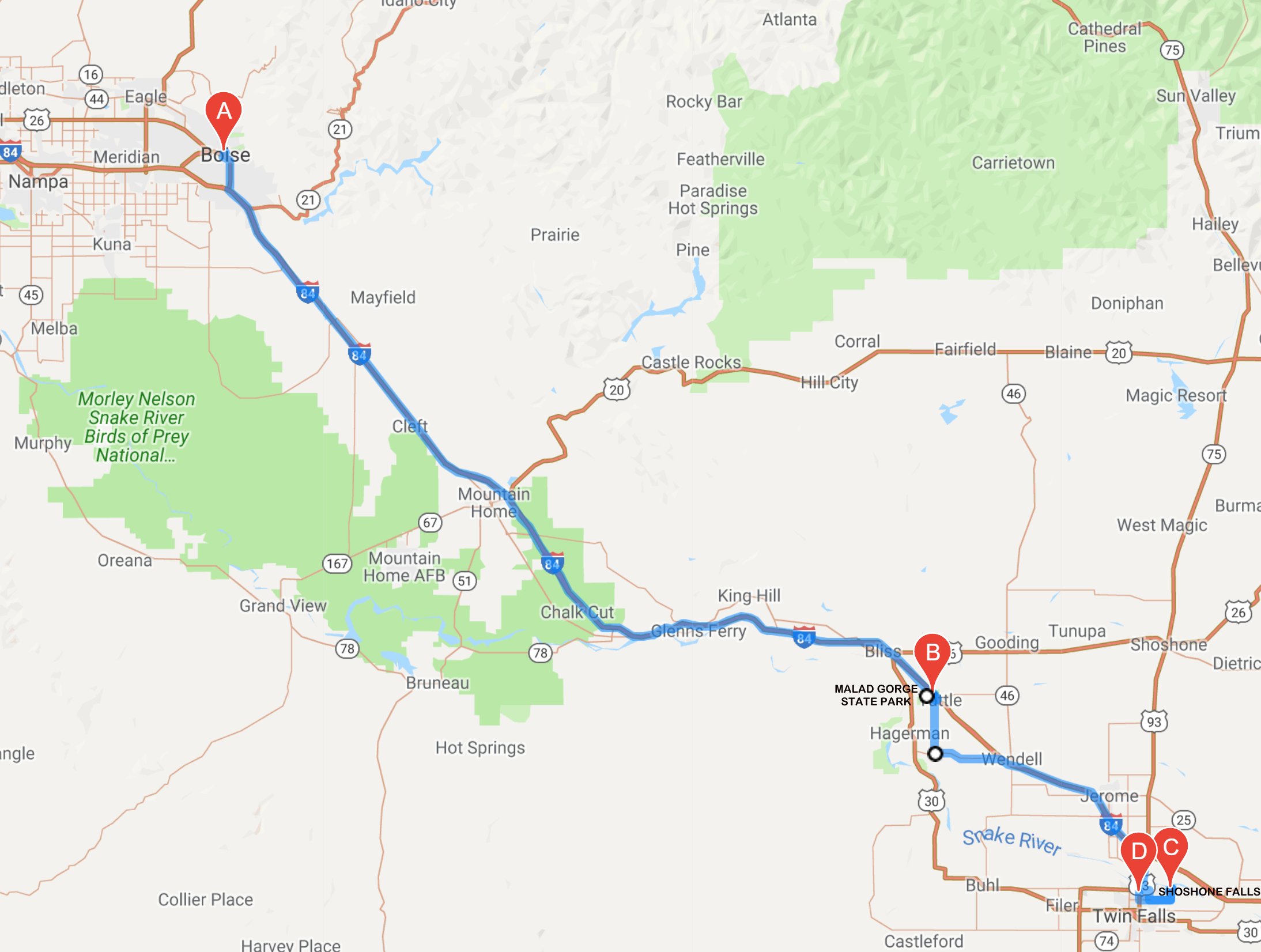
Greetings from the potato state, Today was day two of three here in Idaho. I left Boise at about 8:30 this morning. I drove 97˝ miles to Malad Gorge State Park. The Malad River crashes down stairstep falls and into the Devils Washbowl, then cuts through a beautiful 250-foot gorge on its way to the Snake River. 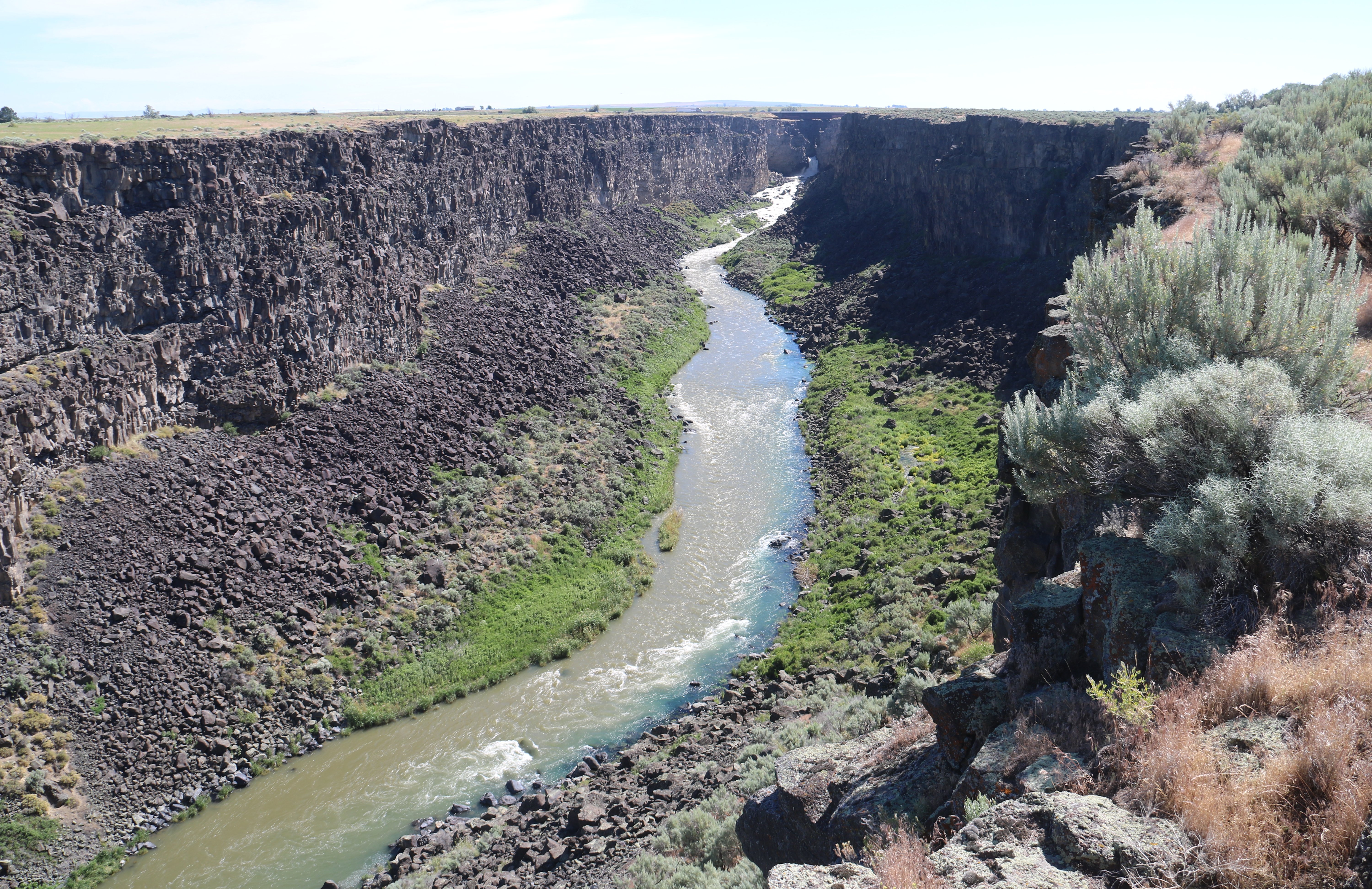 You can see the Devil's Washbowl at the top of the gorge in the picture above. Interstate 84 literally crosses right on top of it. You can see that better in the closer look below. 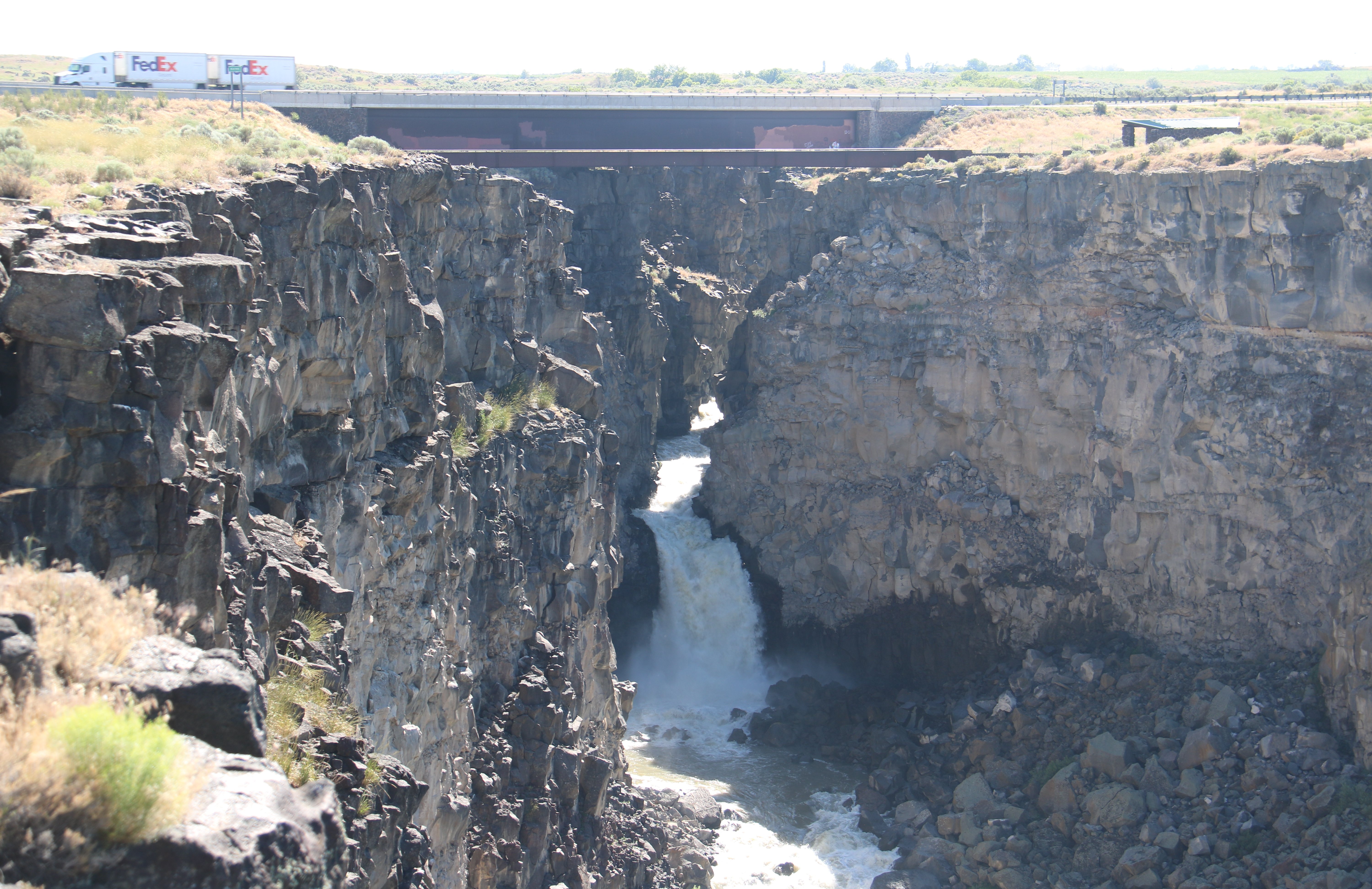 Next it was about a 35 mile drive to Twin Falls. My first stop here was at Shoshone Falls. 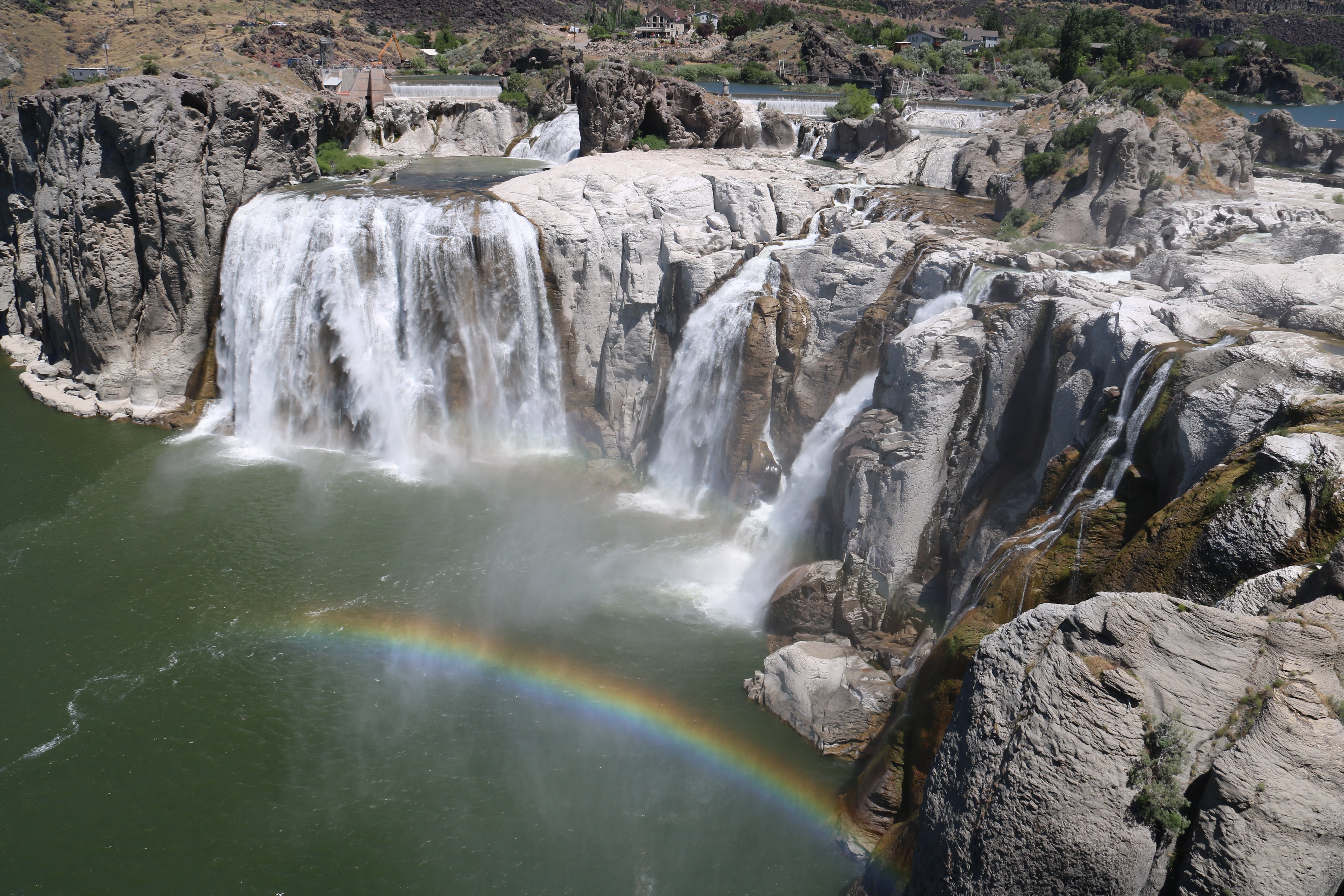 Shoshone Falls is a waterfall on the Snake River approximately 3 miles northeast of Twin Falls. Sometimes called the "Niagara of the West," Shoshone Falls is 212 feet high which is 45 feet higher than Niagara Falls and flows over a rim nearly 1,000 feet wide. 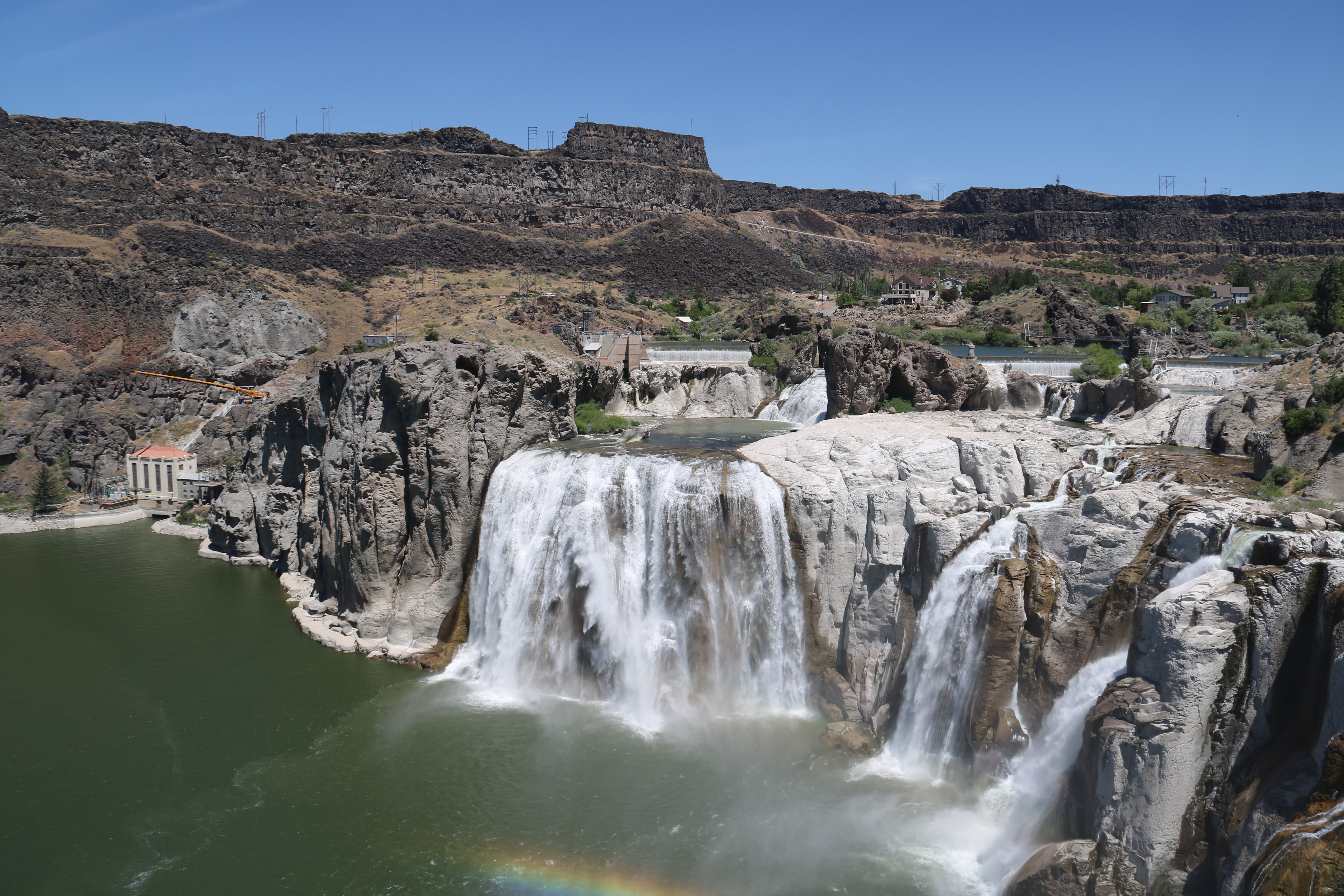 Weather was perfect again today. Shoshone Falls is in the Snake River Canyon. Below you can see the canyon above the falls. The falls are on the right just out of the picture. 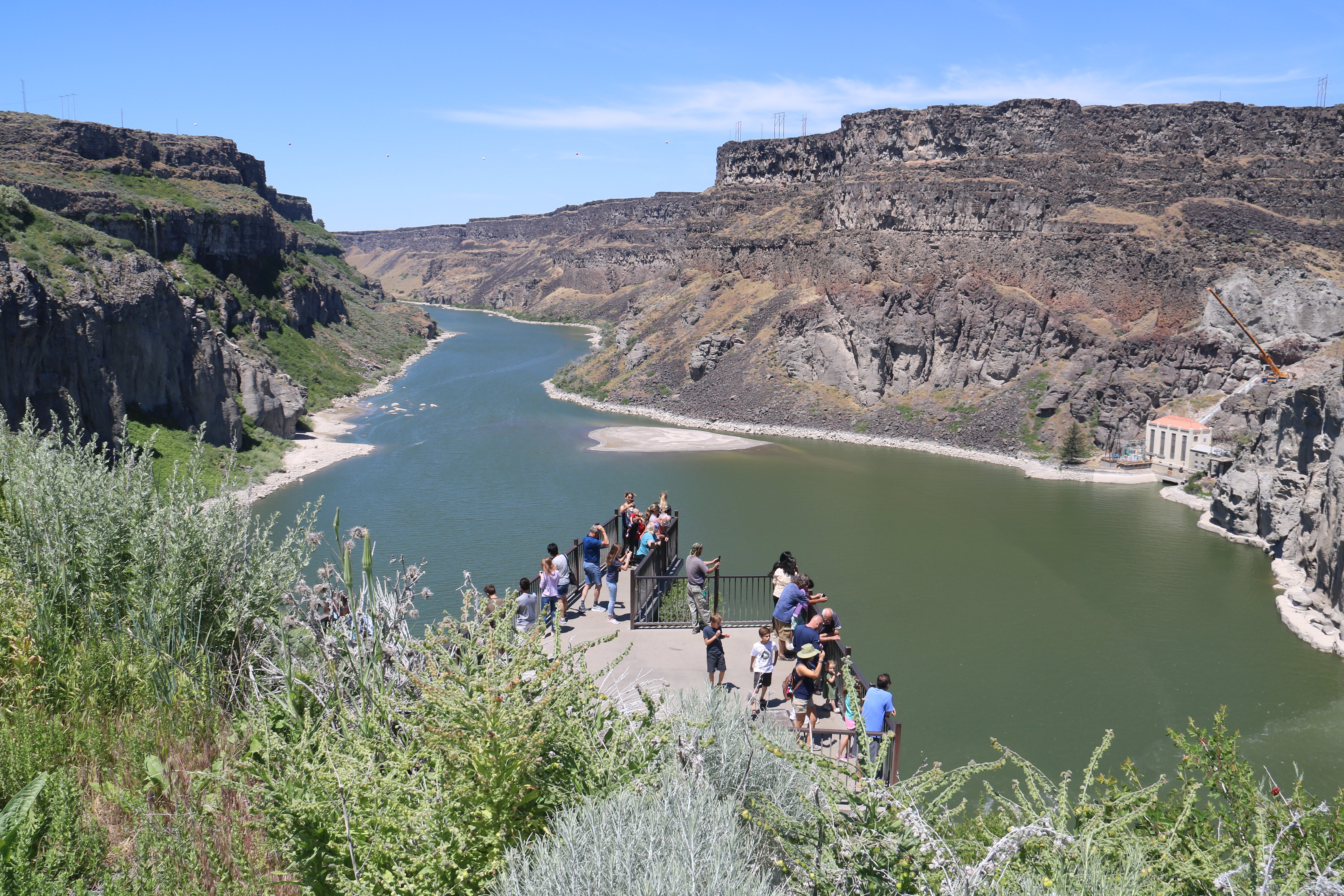 Next I drove back into Twin Falls. The I. B. Perrine Bridge is four-lane truss arch span carrying U.S. Highway 93 over the Snake River Canyon in Twin Falls. The Perrine Bridge is approximately 1,500 feet in total length, with a main span of 993 feet and a deck height of 486 feet above the Snake River it is the eighth highest bridge in the United States. The Perrine Bridge is a popular BASE jumping site known all over the world; it may be the only man-made structure in the United States where BASE jumping is allowed year-round without a permit. I saw two people jump off the bridge while I was there. 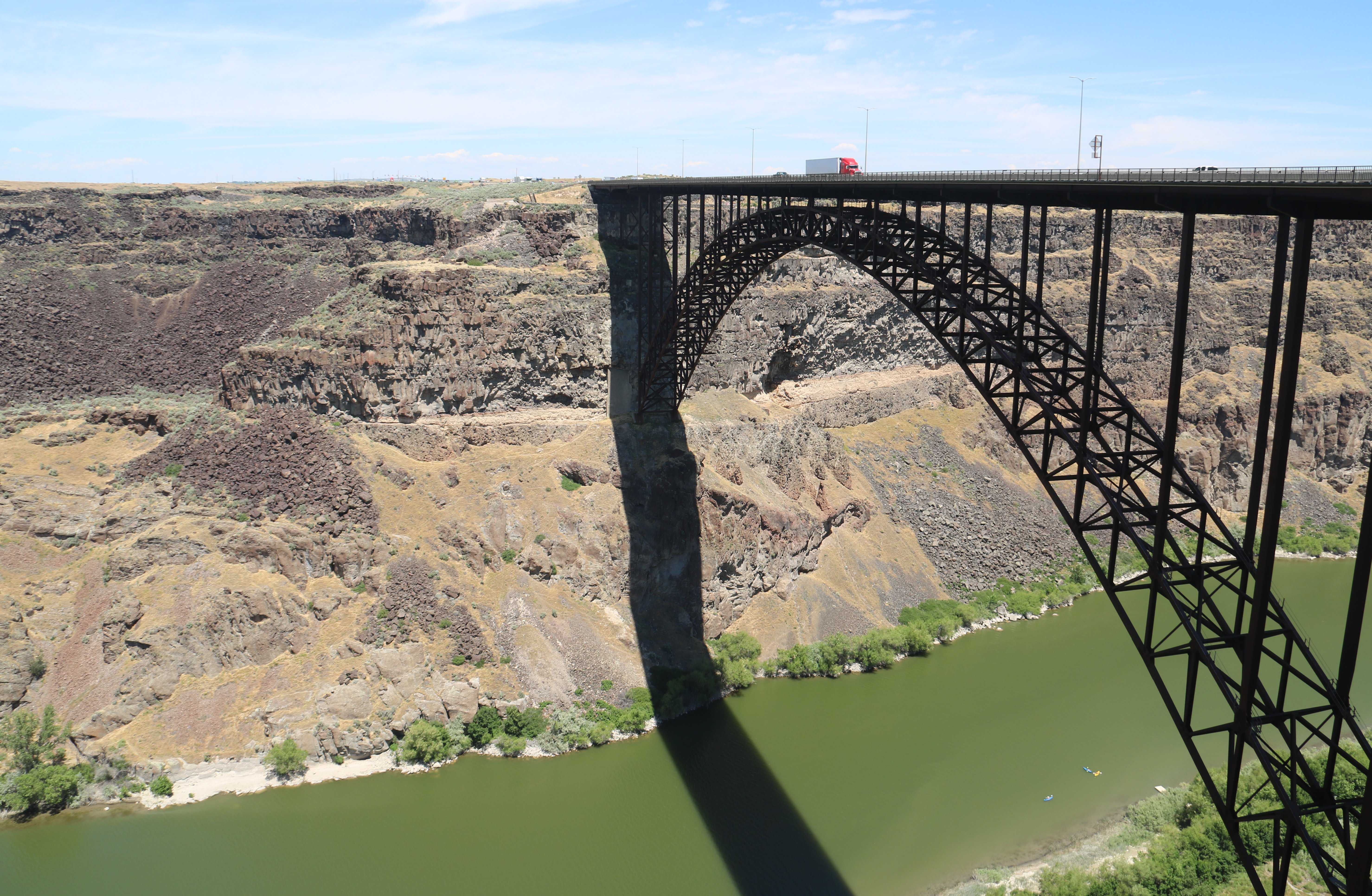 I explored the rim trail with the help of my trusty scooter. The picture below is looking west of the bridge. 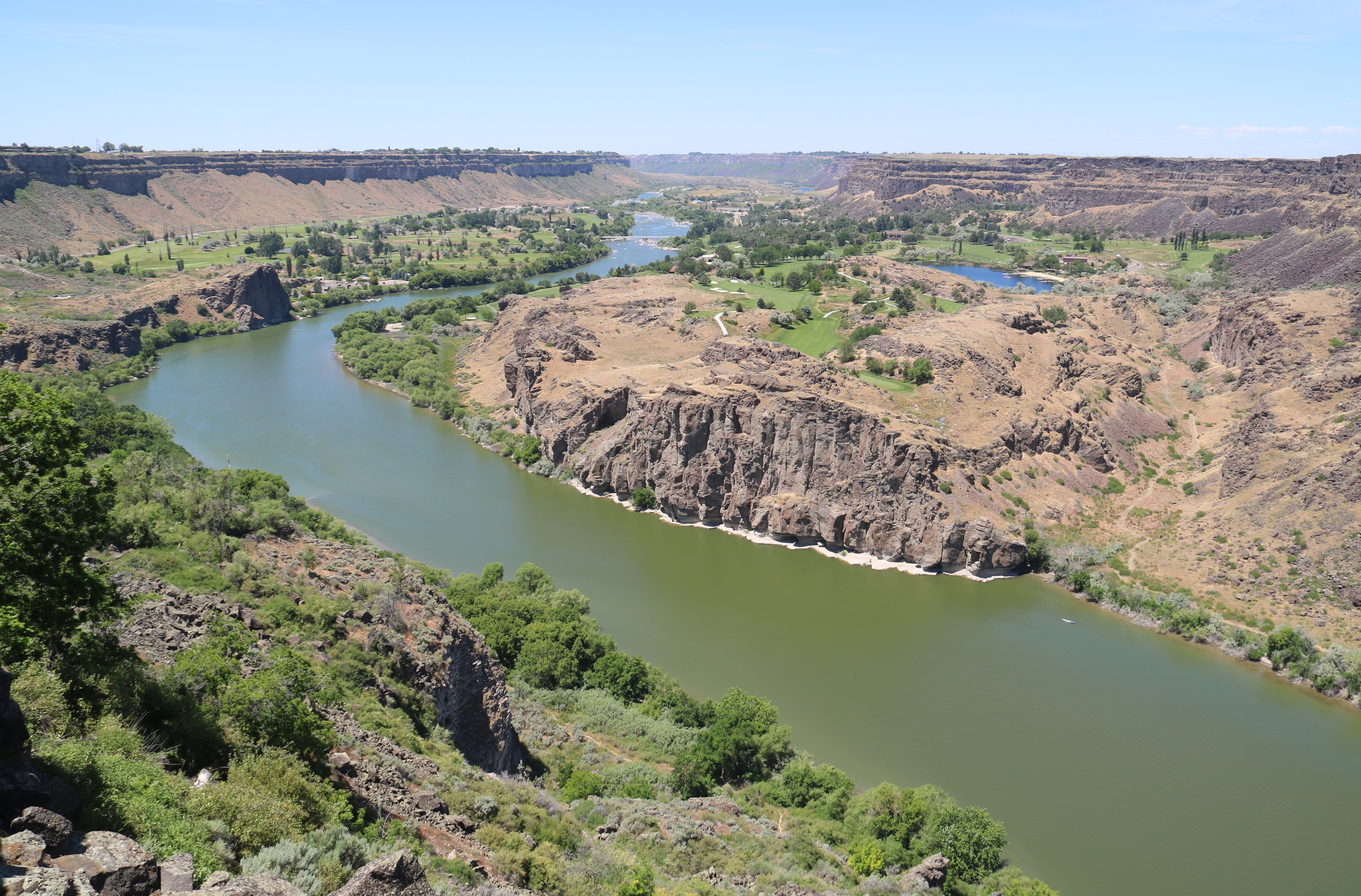 Below is east of the bridge looking toward Pillar Falls. This is the place where forty five years ago, Evel Knievel strapped himself into a rocket and tried to fly over the immense Snake River Canyon. He didn’t make it. 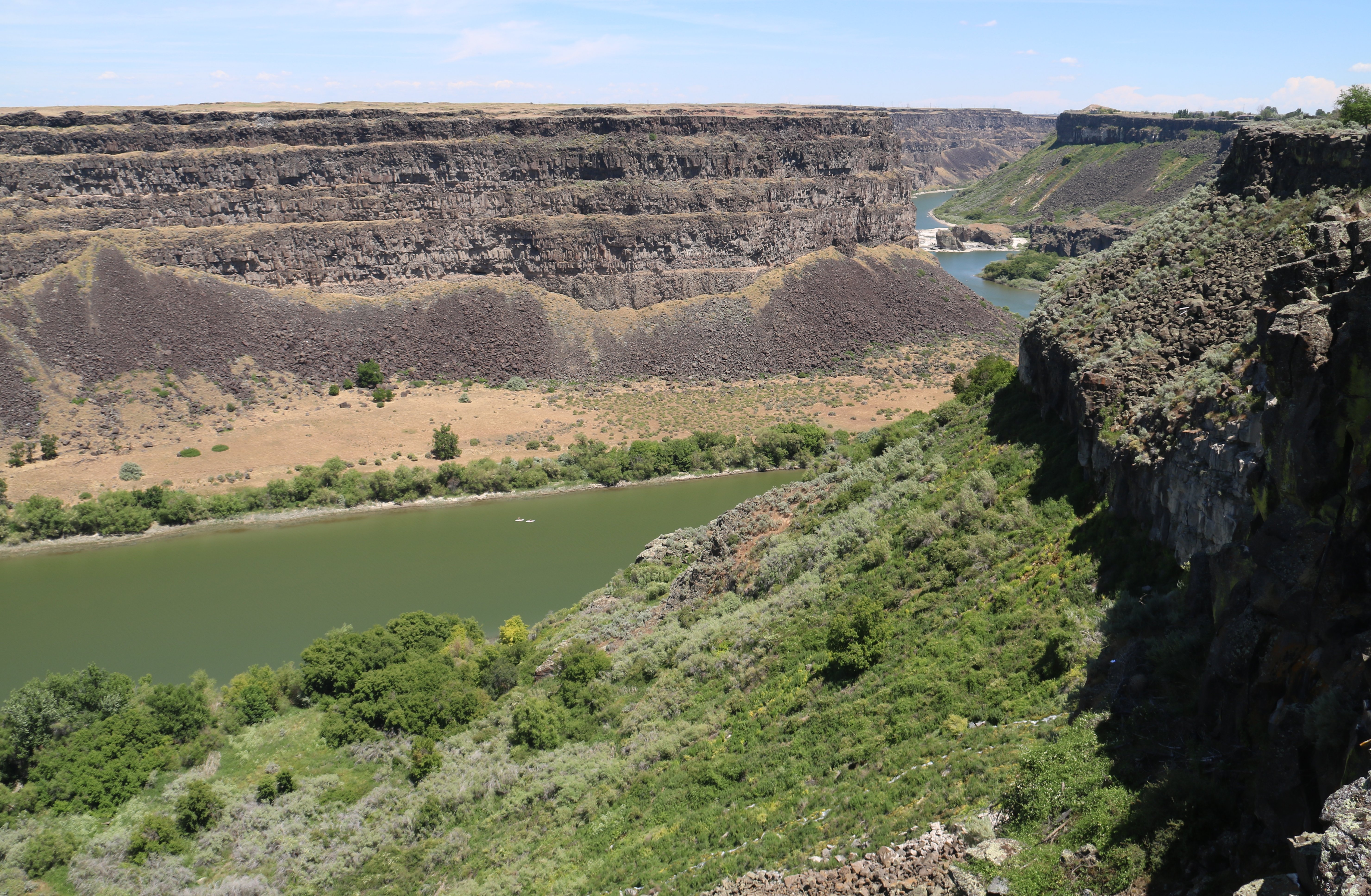 I am staying at the Best Western Plus here in Twin Falls. This is my 26th night of the trip. I have eight more nights to go. I just got done eating my dinner from Culver's. I seem to have caught a cold. So far just a mild sore throat and some sniffles. I hope it doesn't get worse. More to come, Tim |
100% of the original audio track is in tact on this video. |

Click on the arrow above for tomorrow's adventures.
| TIM'S HOME PAGE SITE INDEX | |||
|---|---|---|---|
| Areas | Description | # of Pages | |
| About Me | Current Picture of me and my home. Information about myself. | 2 | |
| Biography | Pictorial biography of myself. Pictures range from birth to adulthood. | 4 | |
| Family File | Pictures of my family and a little information about them. | 12 | |
| Local Spotlight | Pictures, Links, and Information for Indianapolis, Richmond, Plainfield, and Mooresville, Indiana. | 5 | |
| Tim's Travels | Pictures, videos and travelogs from my travels around the world. | 409 | |
| Vacation Videos | Over 1500 videos from my travels around the world. | 1 | |