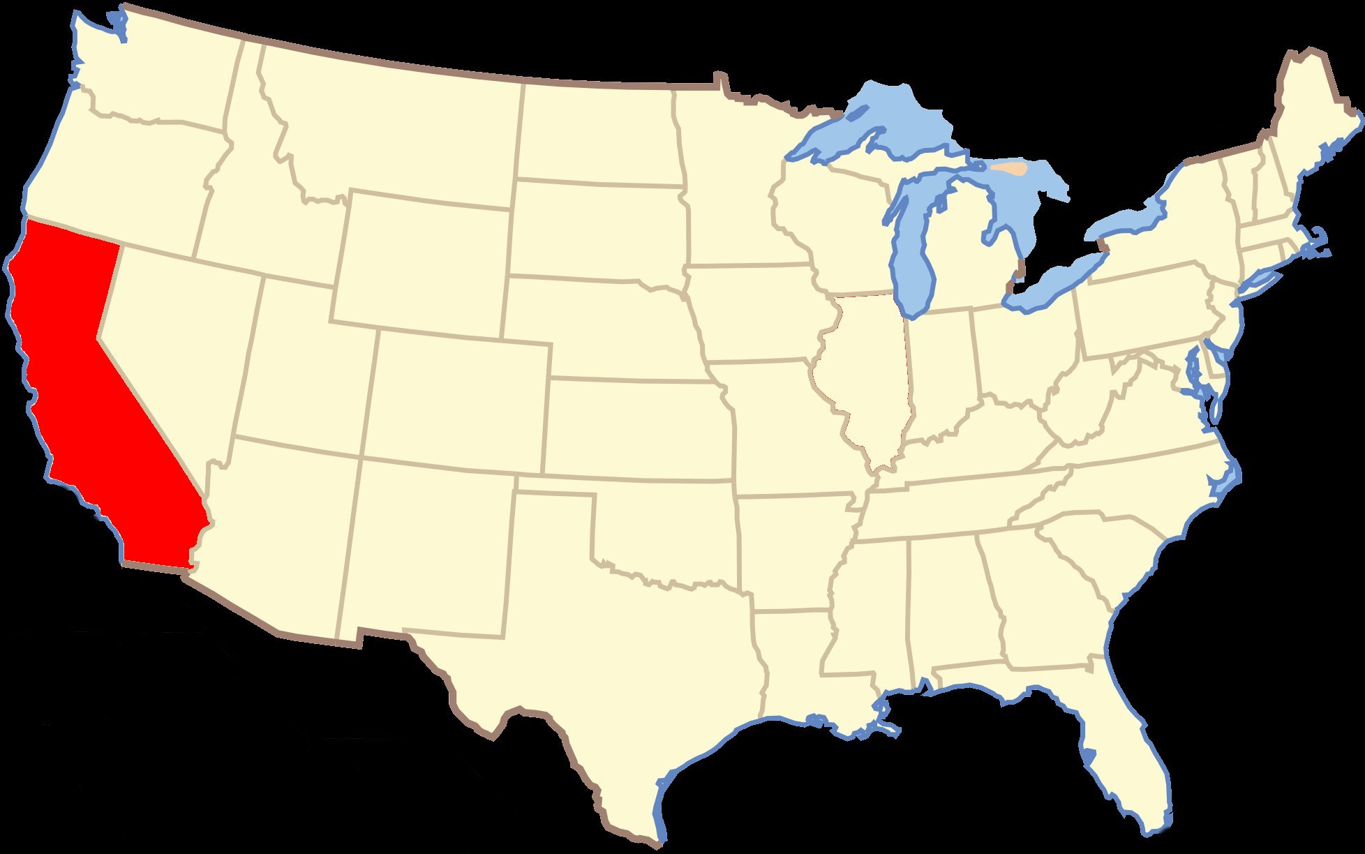
Today I drove 301 miles traveling from Mammoth Lakes, California to Oakhurst, California.
and all my activities within Yosemite National Park once I finally get there. (Don't like long videos? Click |
|
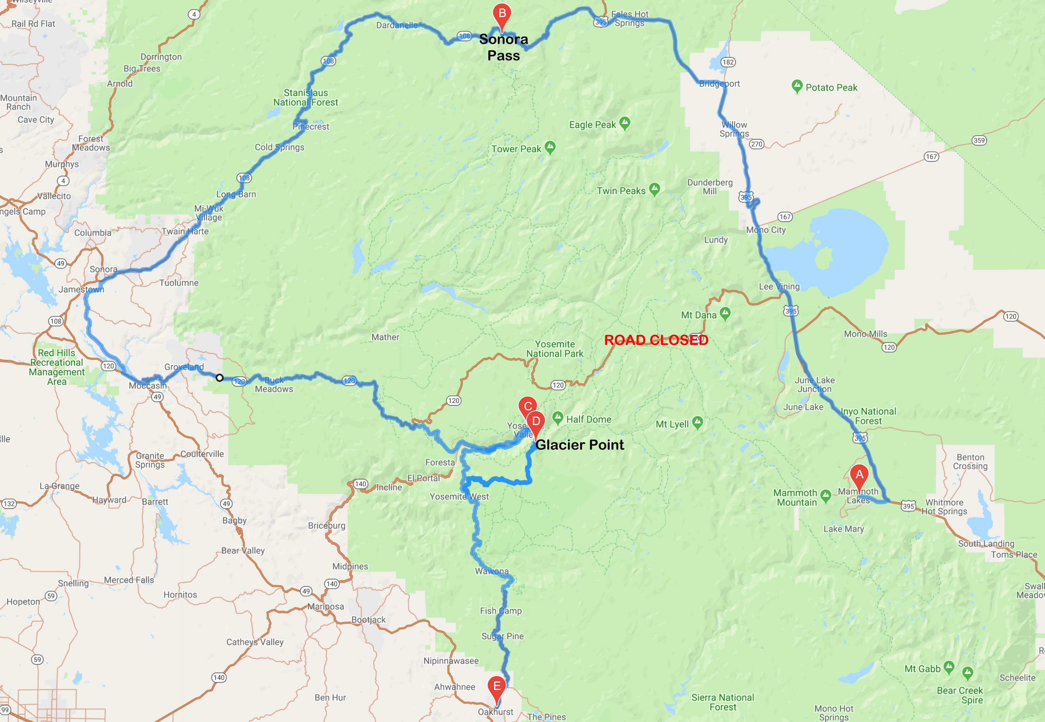
Hello Folks, I woke up early and hit the road shortly after sunrise at about 5:45. Since Tioga Pass is closed, my drive into Yosemite Valley was 220 miles instead of the 97 it would have been had Tioga Pass been open. I had to drive back north and then take California 108 over the Senora Pass. This road has only been open a week. Sonora Pass (9623 feet) is the second-highest highway pass in the Sierra Nevada, lower by 321 feet than Tioga Pass to the south. Below is a picture of the road shortly after I went over Sonora Pass. 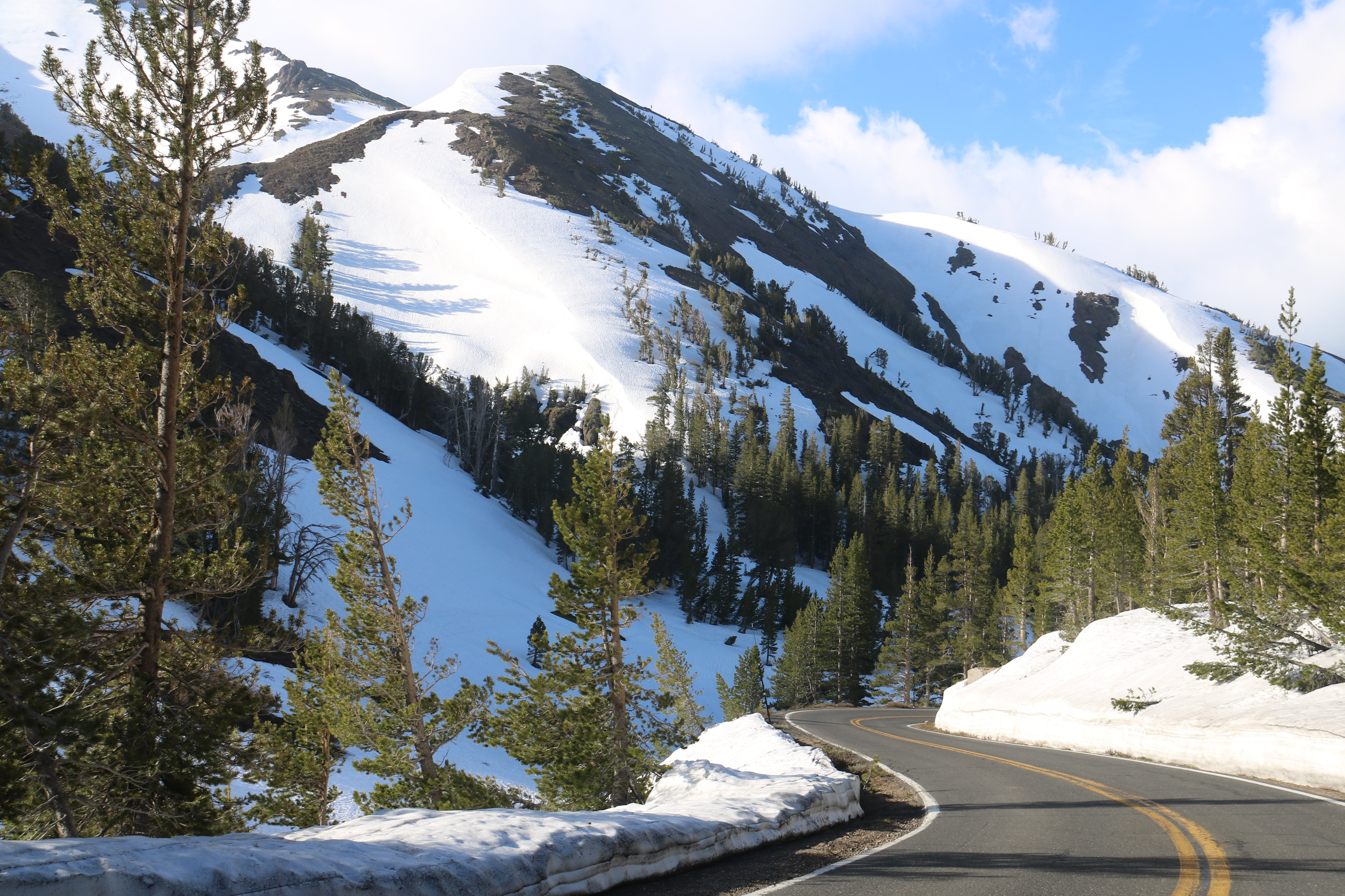 The road over Sonora Pass was interesting. It was really narrow, winding and at times up to a 26% grade. There were only a few other cars up there besides me. It took me just under five hours to get to Yosemite arriving at around 10:30. As I was walking back to the car from my first vista point in Yosemite the lady ahead of me pointed to my car and said "look a Colts fan." She saw my Colts plate. I asked if she was from Indy and she said she was from Lawrence. The problem with Yosemite is that it has way too many visitors and not enough places to park. The National Park web site clearly states that if you don't arrive before 9:00am all the parking will be gone. My walking problems probably helped me today because more often than not the only spaces not taken were for the disabled. Below was my first picture of Yosemite Valley. That is Ribbon Fall and El Capitan. 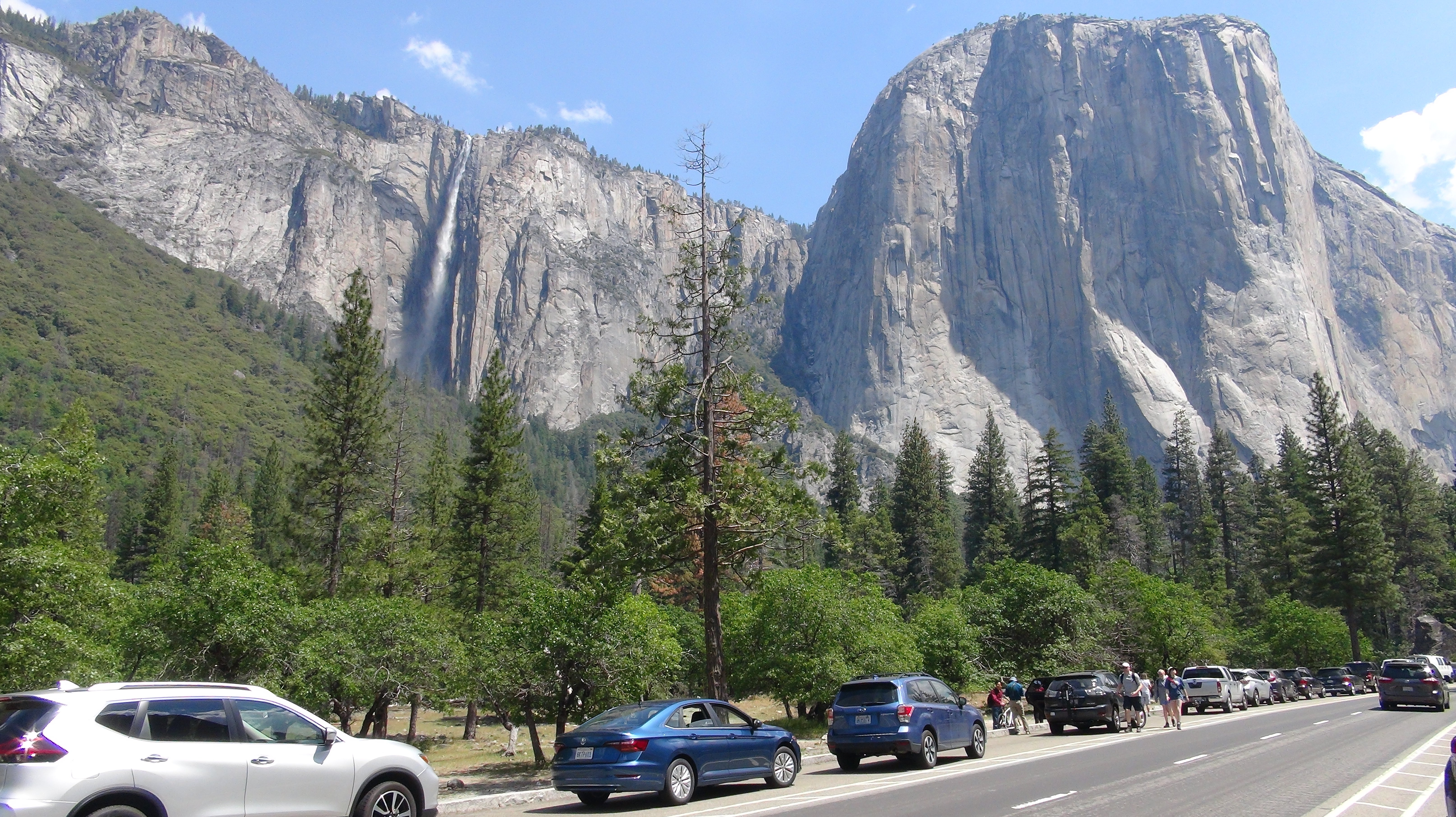 Below is Valley View. In it you again see Ribbon Fall on the left, El Capitan in the center and across the Merced River you can see Bridalveil Fall on the extreme right. 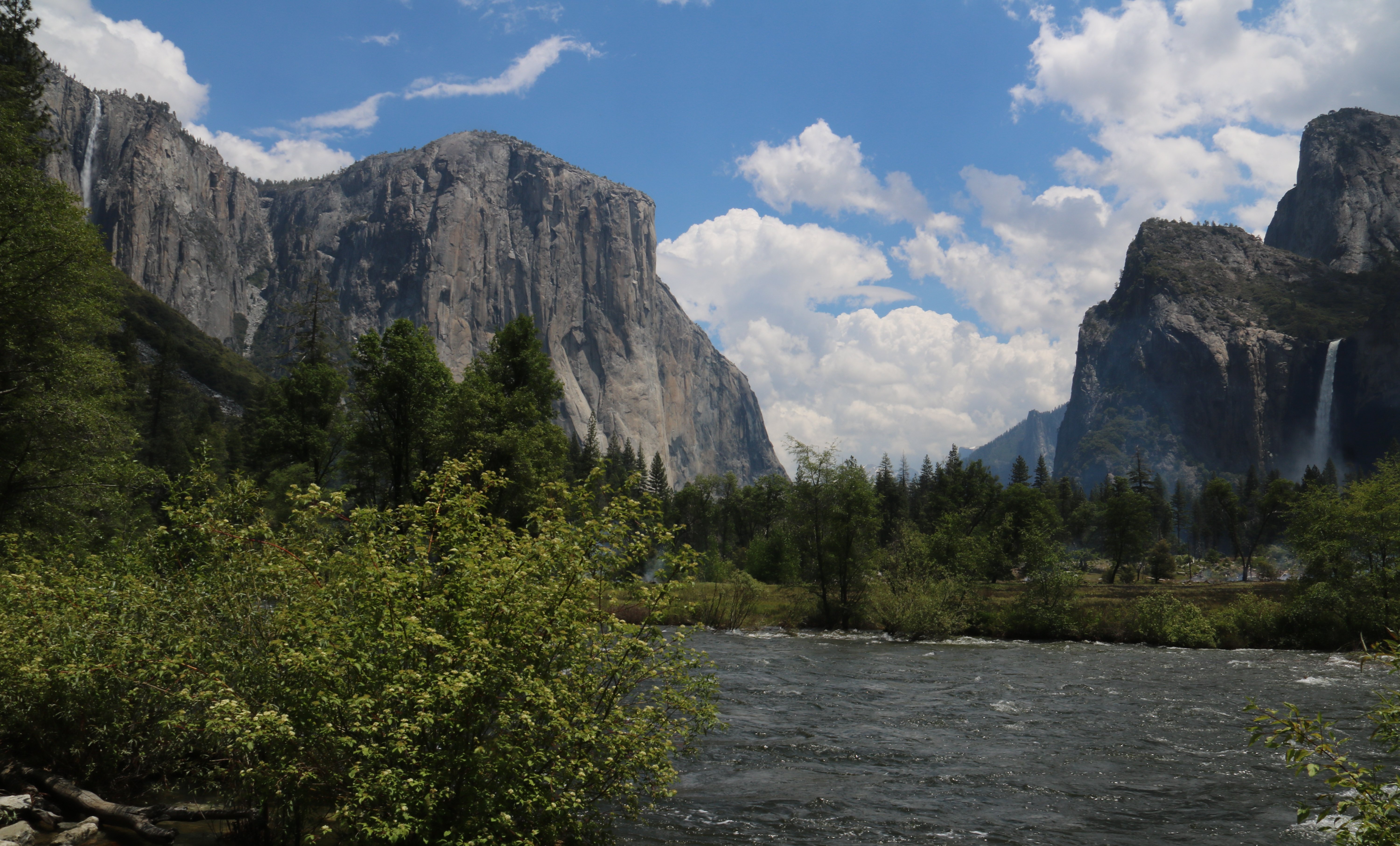 I didn't get to do all the things I wanted on my first circuit of Yosemite Valley so I went around a second time. I found a space to park near one of the lodges. So I ditched the burdensome car and headed out on my scooter. It was a beautiful day, absolutely perfect. I got a nice view of Yosemite Fall from across Cook's Meadow. You can see both the Upper and Lower fall. 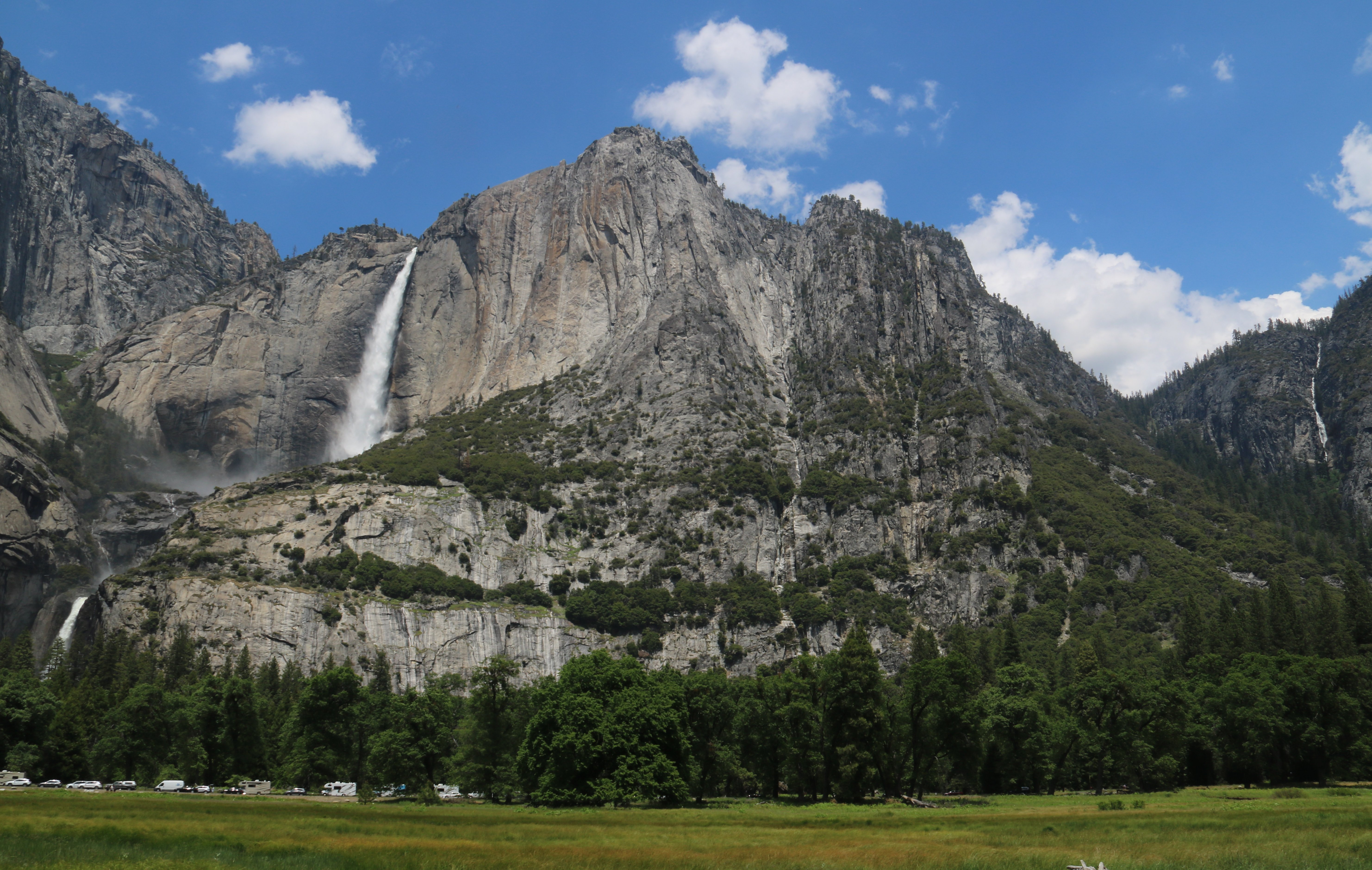 I continued around and across the Sentinel Pedestrian Bridge and snapped a picture of the Merced River. 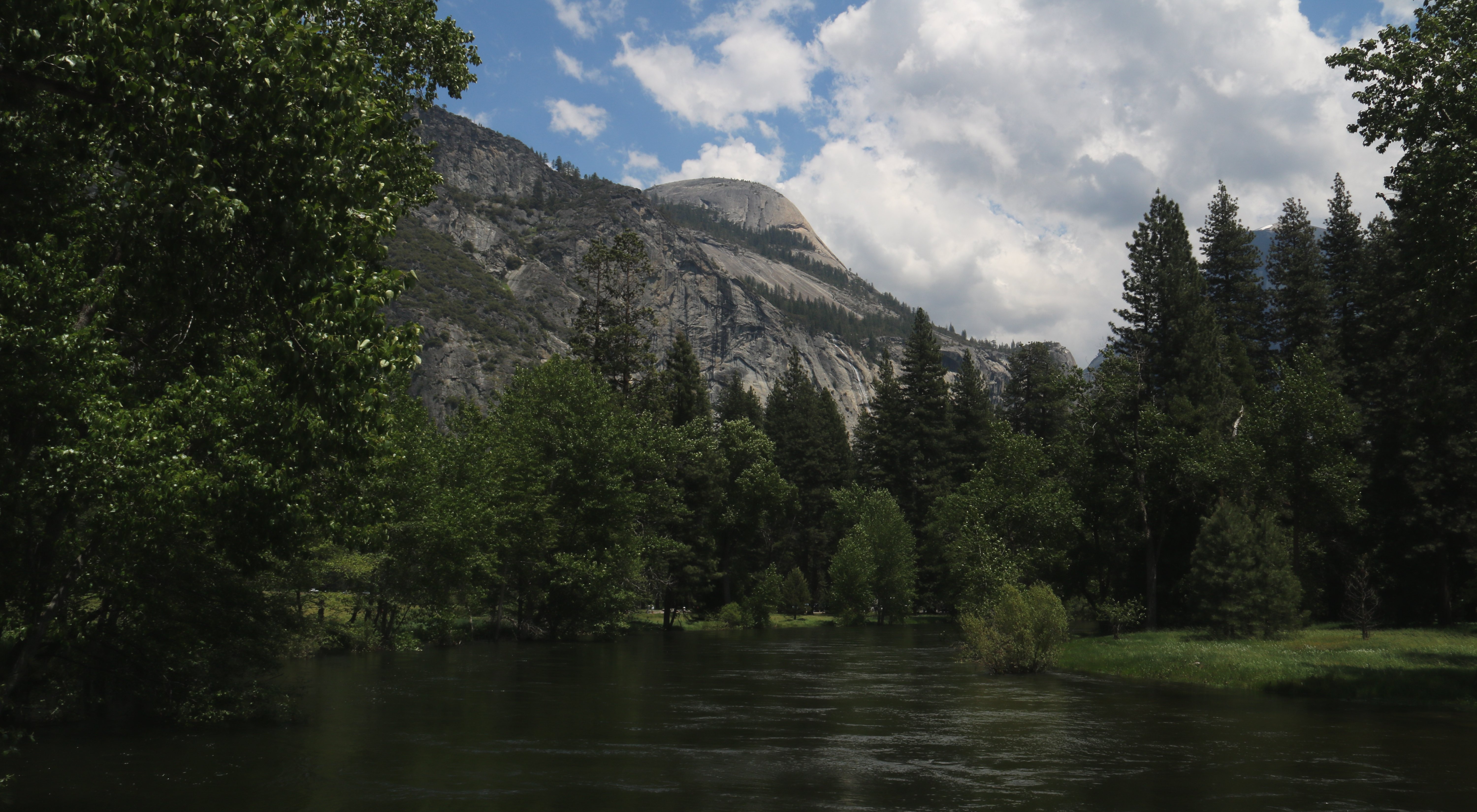 Next it was over to the Lower Yosemite Fall Trail. 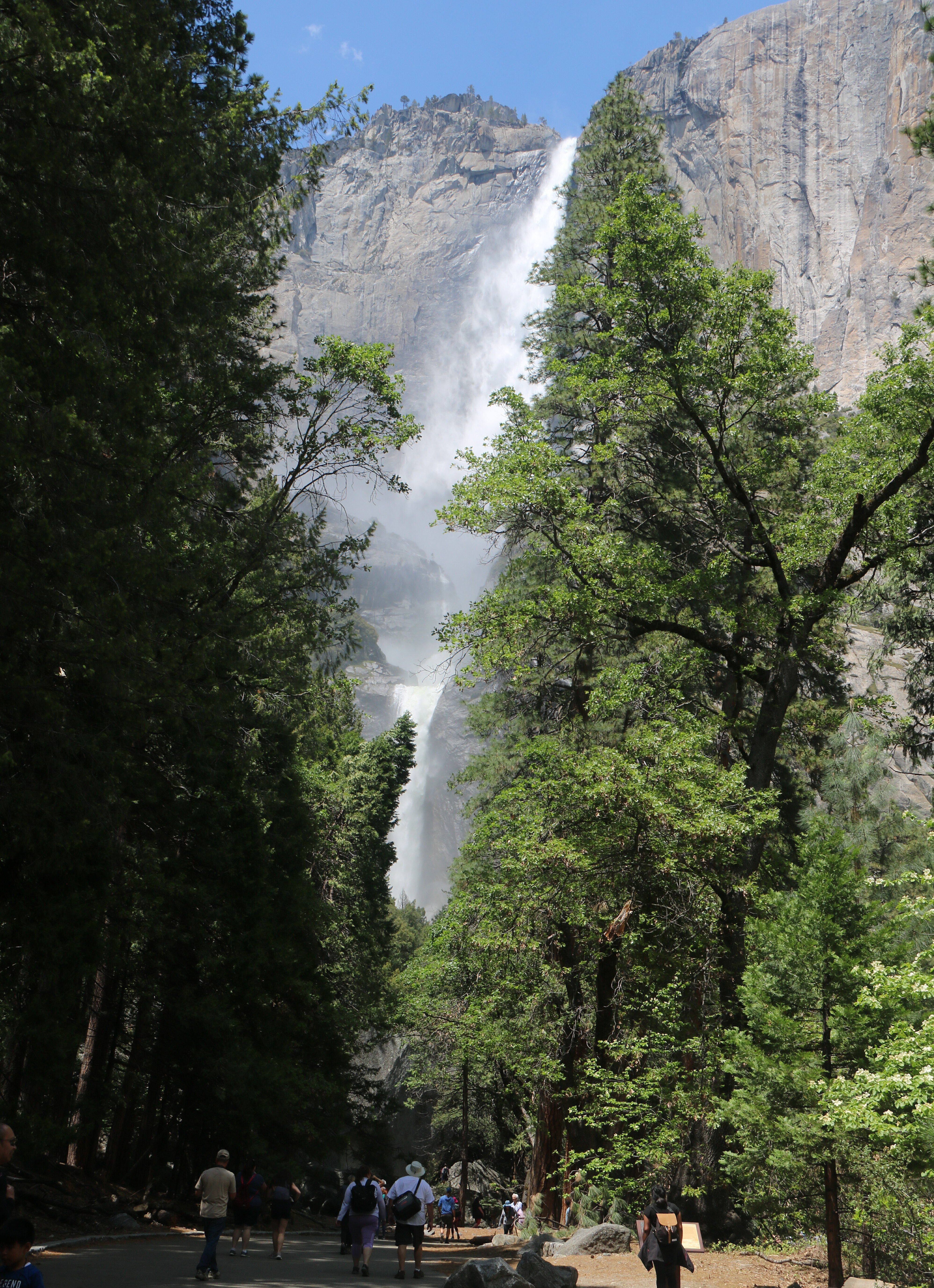 I actually drove my scooter up to the base of the Lower Fall. Below is a picture of that, such as it is. I got quite wet and that water was very cold. 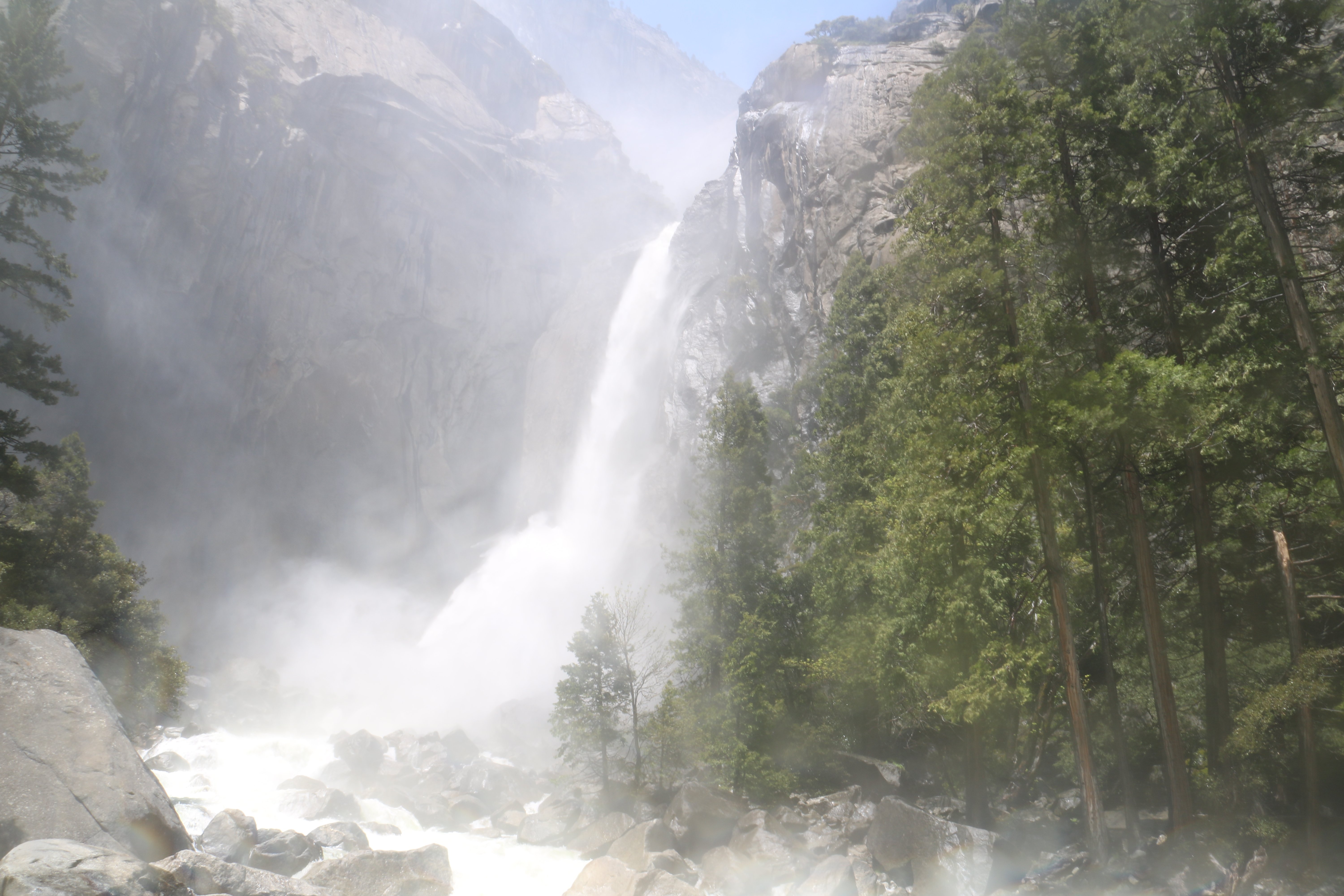 As I was coming back from the Lower Fall Trail I had to once again cross Cook's Meadow. Below is a nice shot of Half Dome from across Cook's Meadow. 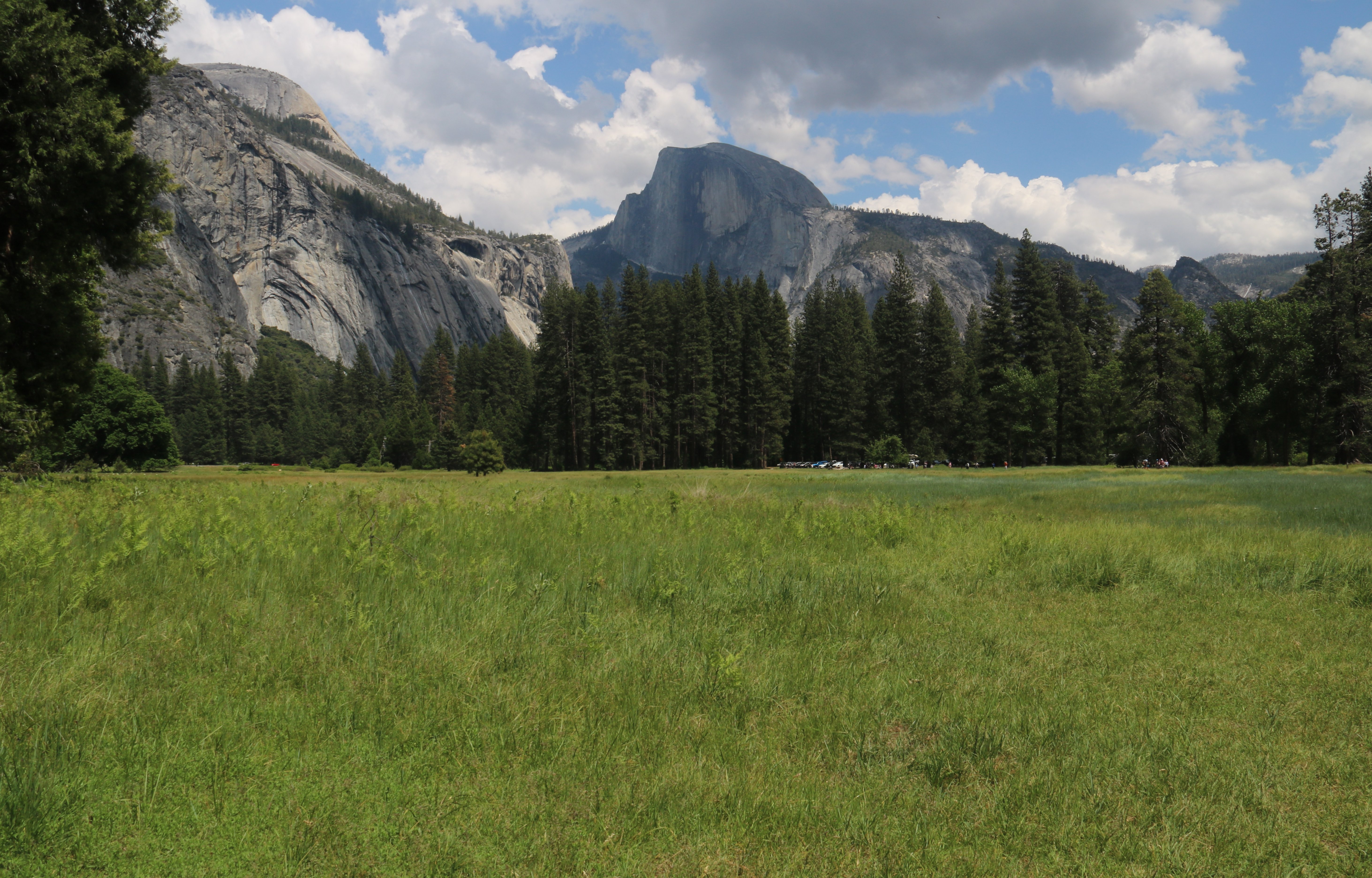 I couldn't drive my scooter to where I wanted to go next so I had to use the car. Below is THE iconic view of Yosemite, Tunnel View. That is El Capitan on the left, Half Dome in the center and Bridelveil Fall on the right. 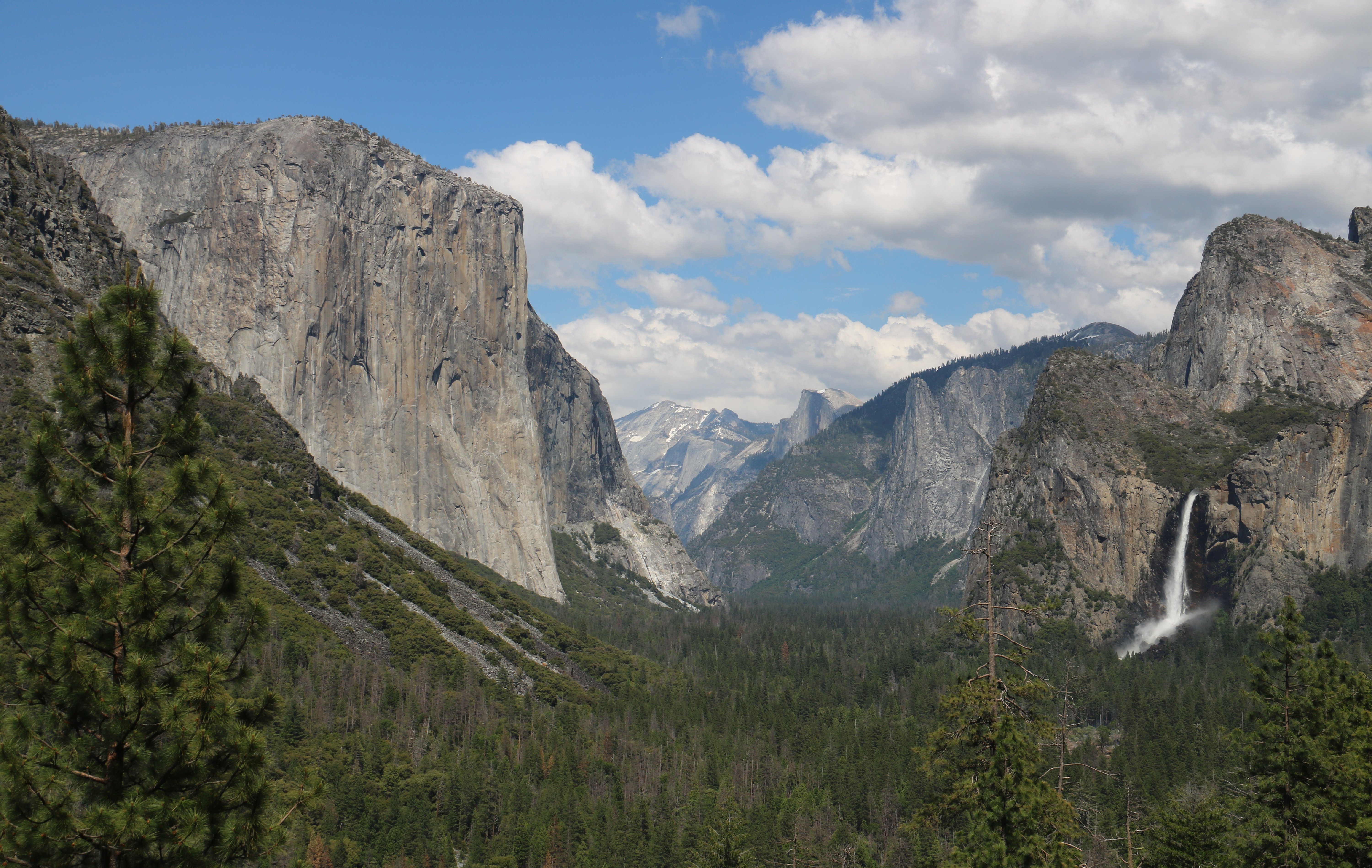 The waterfalls were spectacular. That is why I wanted to come early in the season. The waterfalls are all just melting snow. If you come later in the year they all but disappear. Next I drove up to Glacier Point. In the picture below, left to right: Tenaya Canyon, Half Dome, Liberty Cap, Little Yosemite Valley, Vernal Fall and Nevada Fall. If this isn't the most beautiful view on planet Earth, then I have not been to what is. 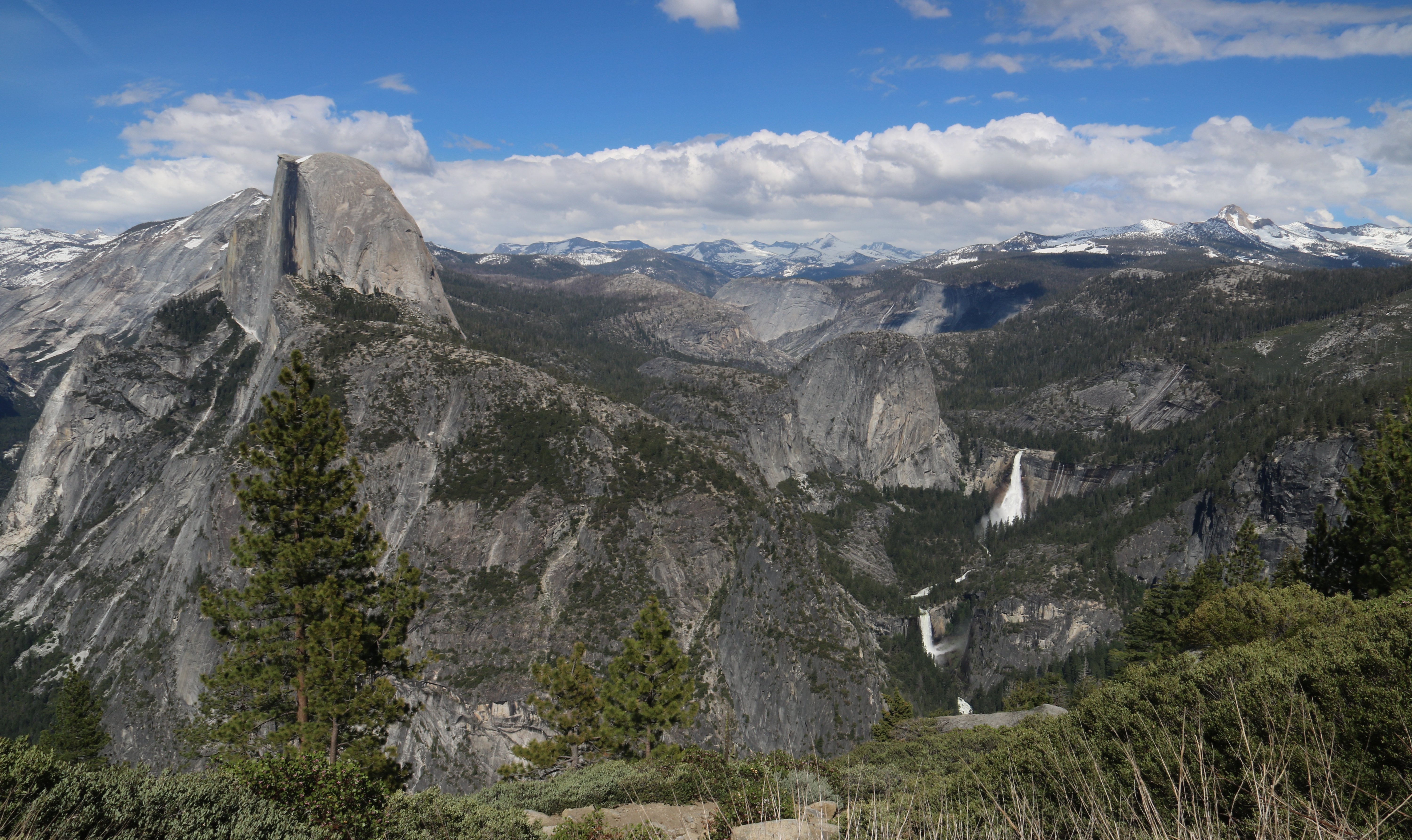 At an elevation of 7,214 feet, Glacier Point is 3,200 feet above the valley below. You can look straight down into the valley. You can also see both Lower & Upper Yosemite Fall and Cook's Meadow where I had been earlier in the afternoon. 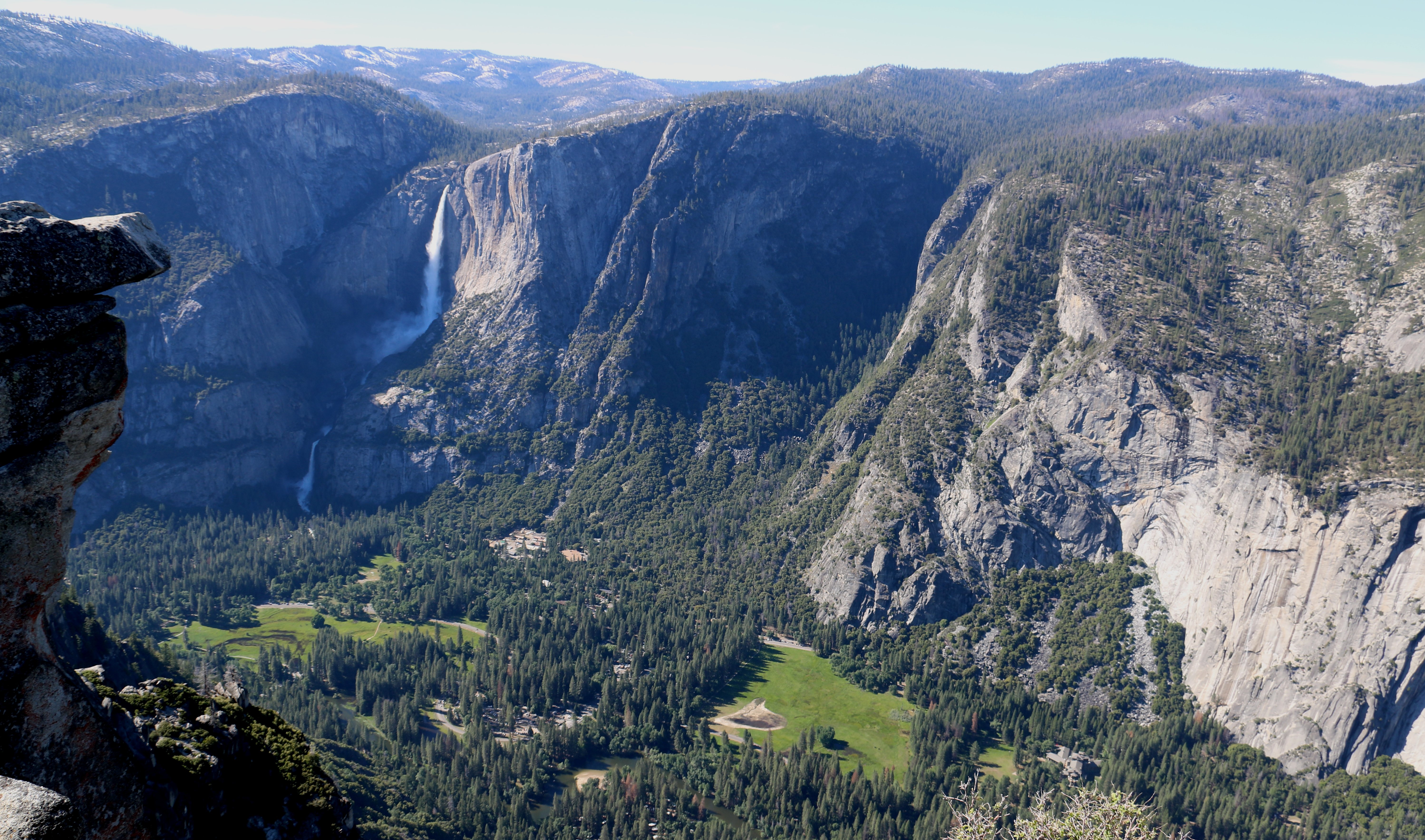 Yosemite isn't an easy place to visit. But it was well worth the considerable effort. I had a blast today. While I was scootering around Glacier Point a man saw my Colts Cap. As much as I hate caps I have to wear one when the sun is shining or my bald head burns. That made a second Hoosier I met today. I'll leave you with one more picture from Glacier Point. In it you will see my fellow tourists looking out toward Half Dome. 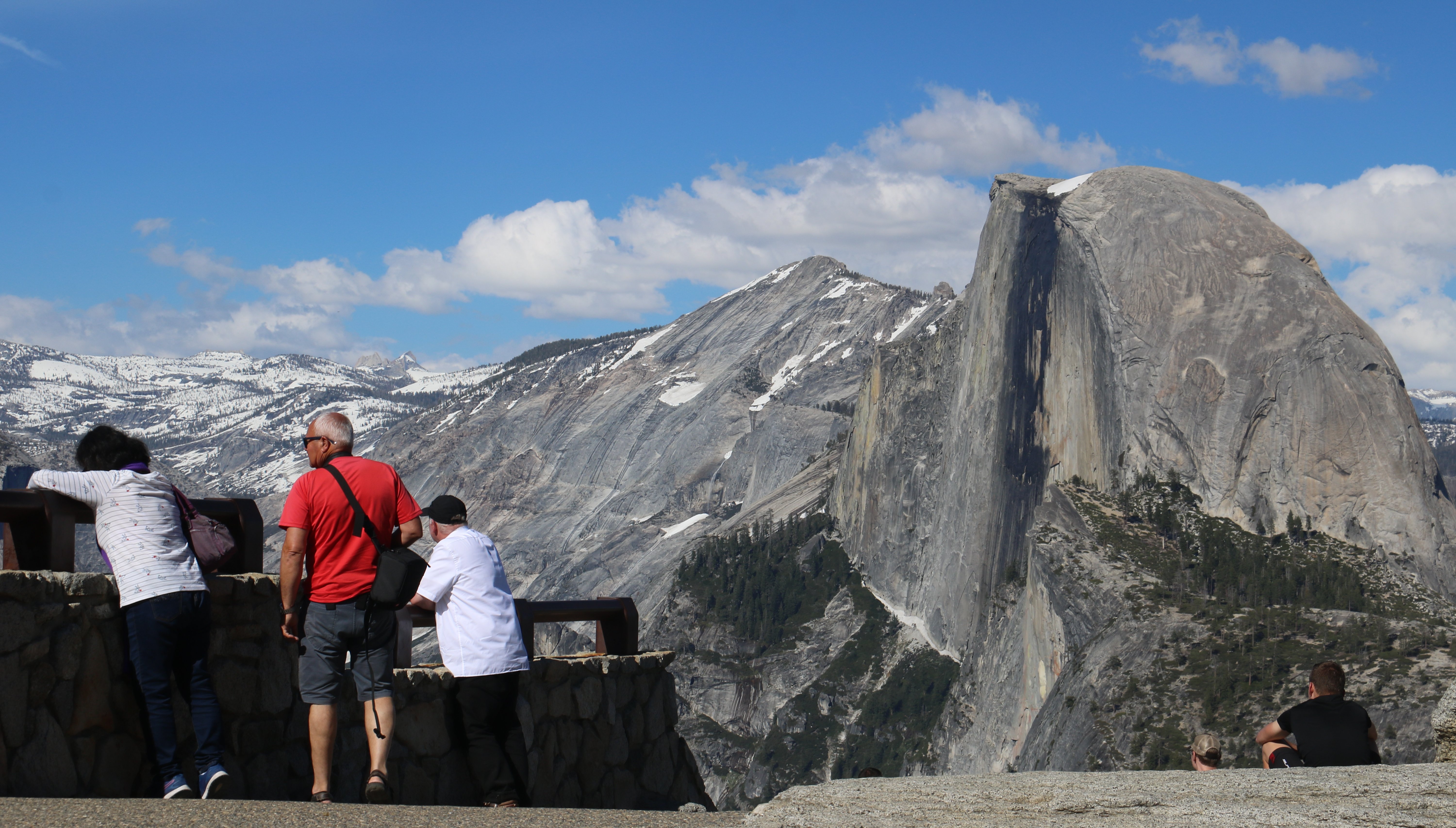 I didn't leave the park until 6:30 this evening. It was a 30 mile drive to my hotel from the park on the usual narrow winding road. And the idiot at the head of the line was just crawling along with about a hundred cars behind him. He refused to ever use one of the many pull-outs to let us pass. Then when we FINALLY got to Oakhurst he pulls into the same gas station as me. It was all I could do not to go over and tell him what an inconsiderate ass he is. I'm staying at a Comfort Inn right behind that gas station. I got dinner from Denny's tonight. I'm eating at a lot of restaurants that I haven't been to in years. It was the only restaurant in town that wasn't fast food. The food was good. It's getting late, I better sign off, Tim |
Most of the original audio track is in tact but when the radio was playing copyrighted music background music was used instead. |

Click on the arrow above for tomorrow's adventures.
| TIM'S HOME PAGE SITE INDEX | |||
|---|---|---|---|
| Areas | Description | # of Pages | |
| About Me | Current Picture of me and my home. Information about myself. | 2 | |
| Biography | Pictorial biography of myself. Pictures range from birth to adulthood. | 4 | |
| Family File | Pictures of my family and a little information about them. | 12 | |
| Local Spotlight | Pictures, Links, and Information for Indianapolis, Richmond, Plainfield, and Mooresville, Indiana. | 5 | |
| Tim's Travels | Pictures, videos and travelogs from my travels around the world. | 409 | |
| Vacation Videos | Over 1500 videos from my travels around the world. | 1 | |