(Tasmania Flag)
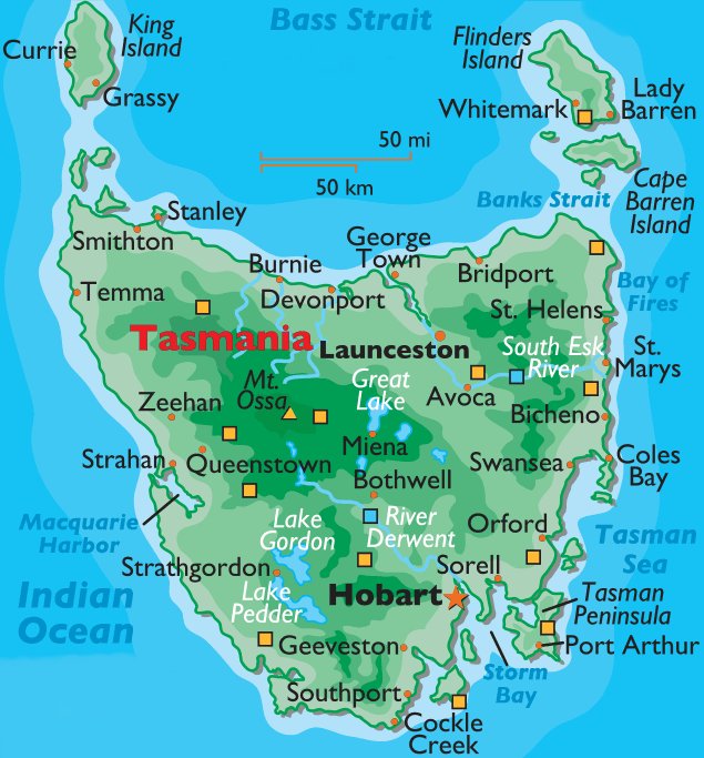
(Map of Tasmania)
THURSDAY, JANUARY 4, 2007:
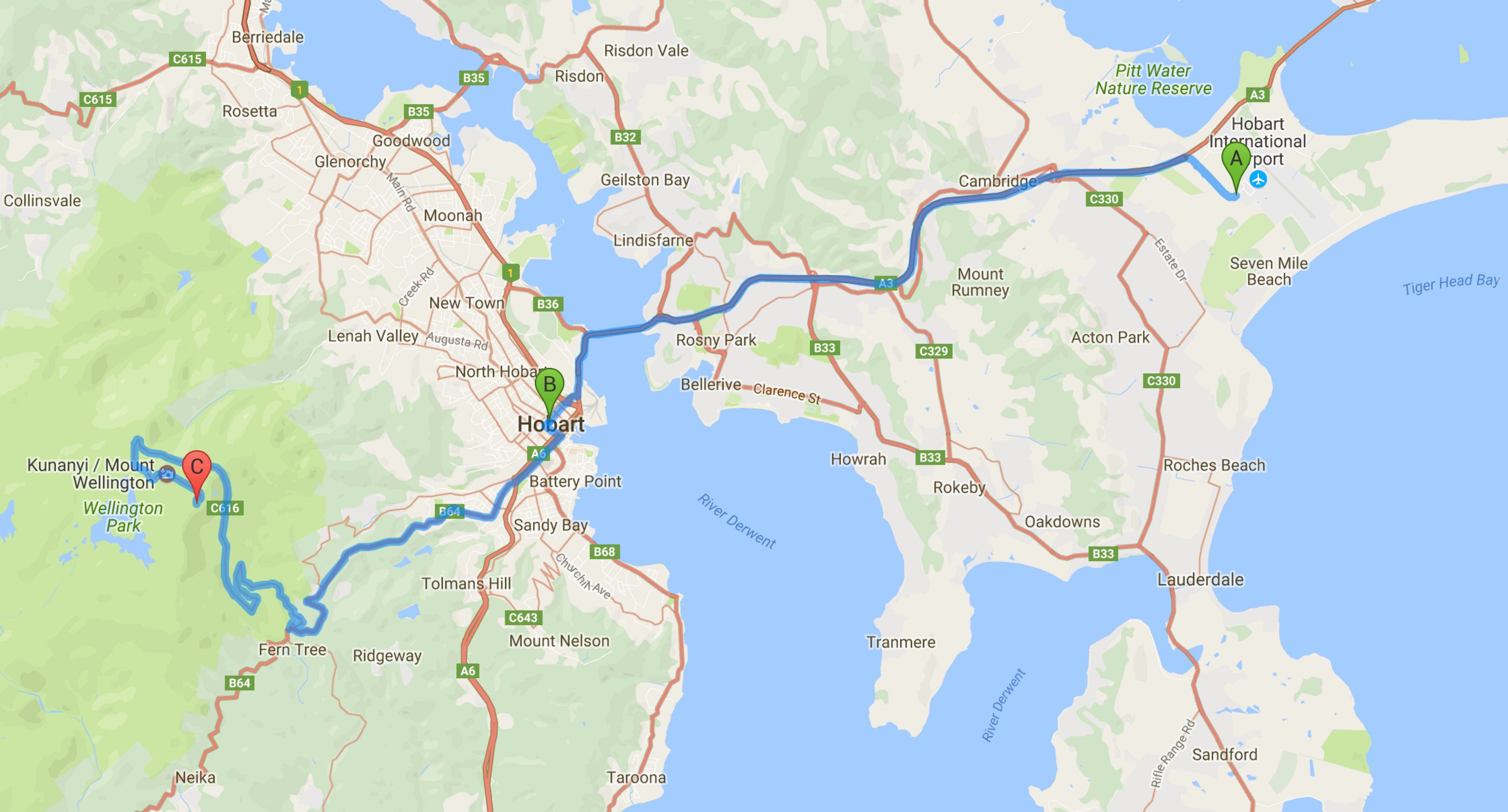
I drove 37 miles today in the Hobart area.
All of the images below are thumbnails and can be clicked on for a larger image.
After six great days in Sydney it was time to move on to Tasmania.
I arrived in Hobart late Thursday morning.
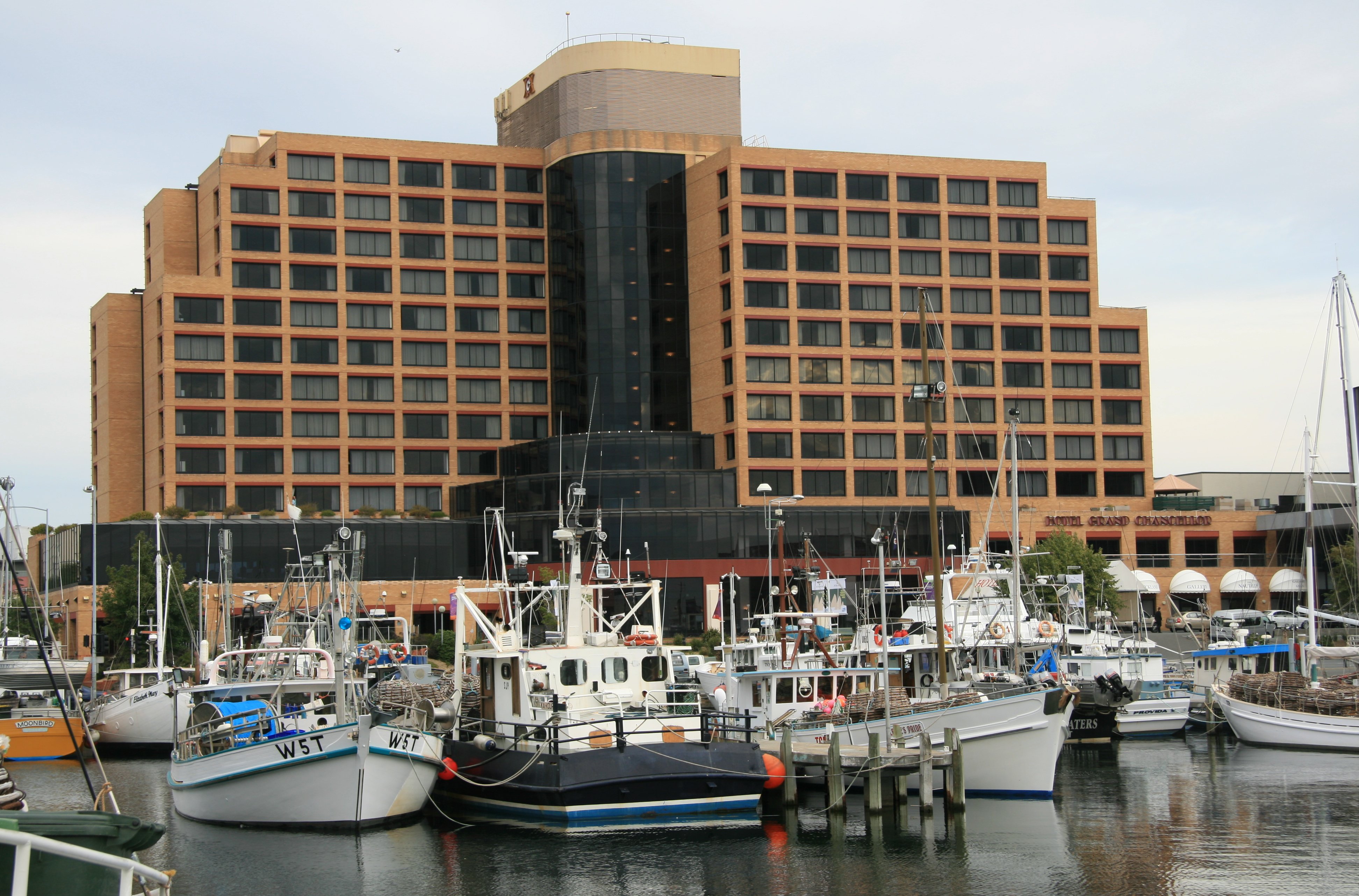
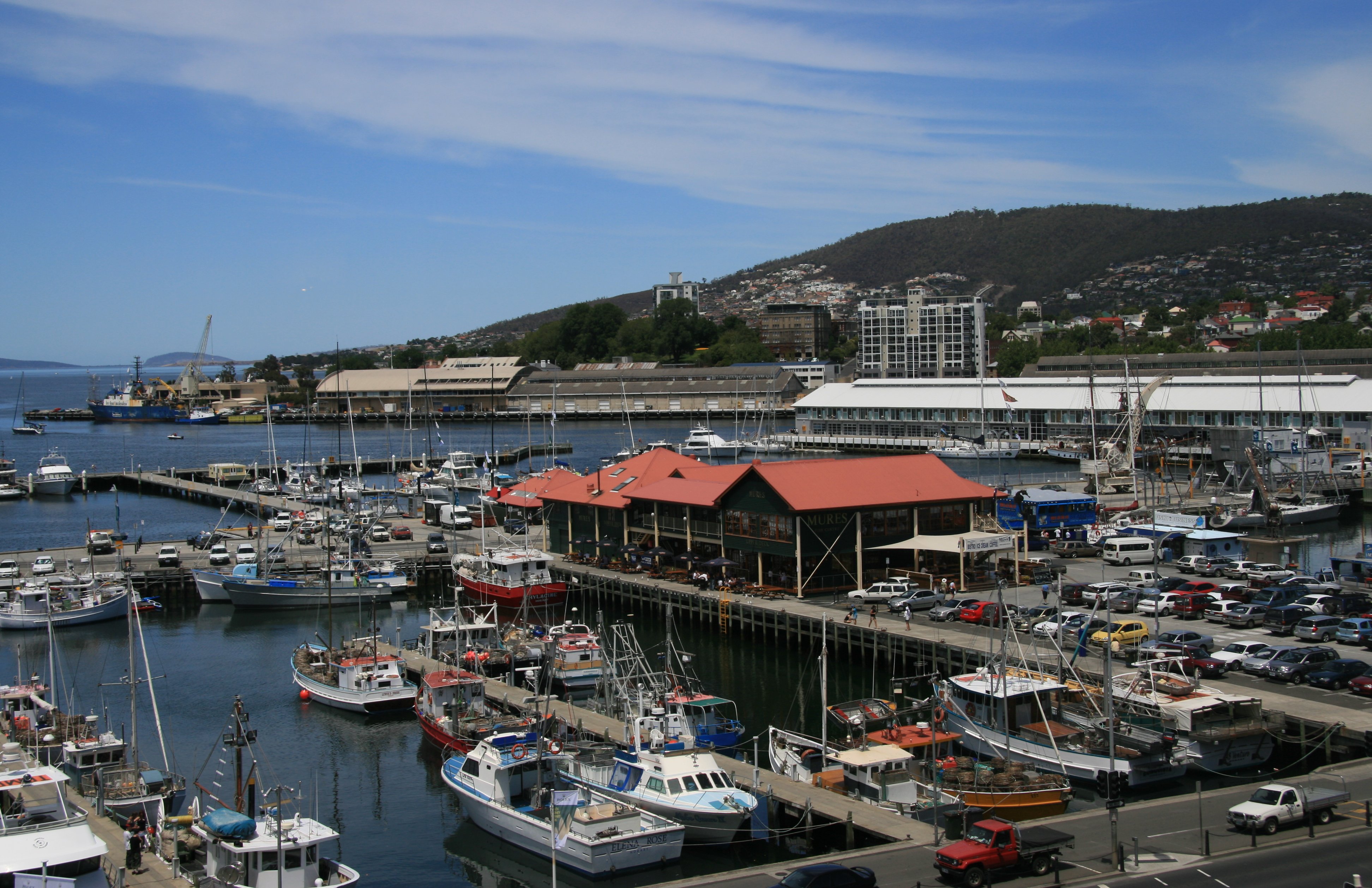
I stayed at the Grand Chancellor Hotel on the harbour.
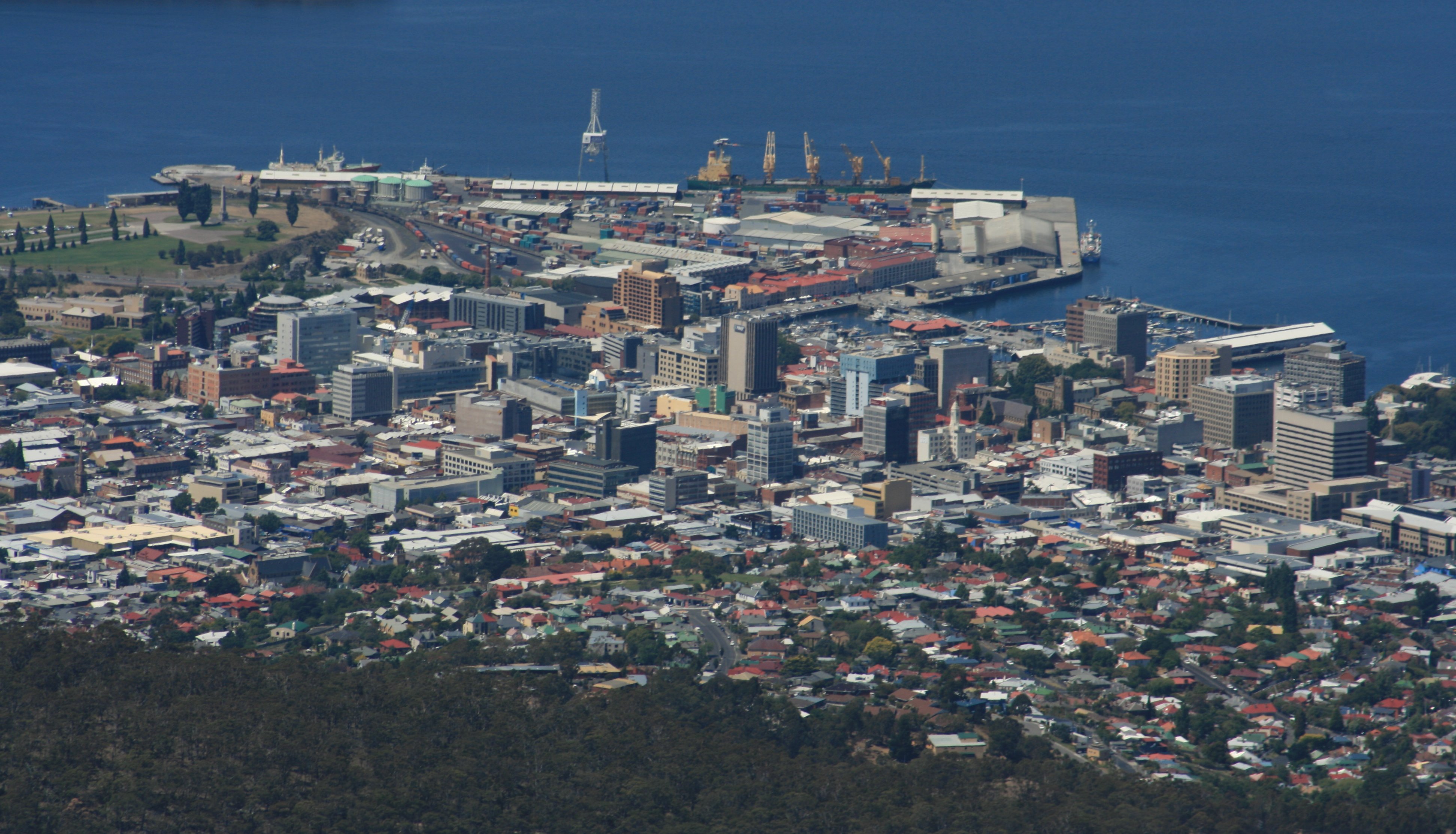
Mount Wellington is pictured below on the right.
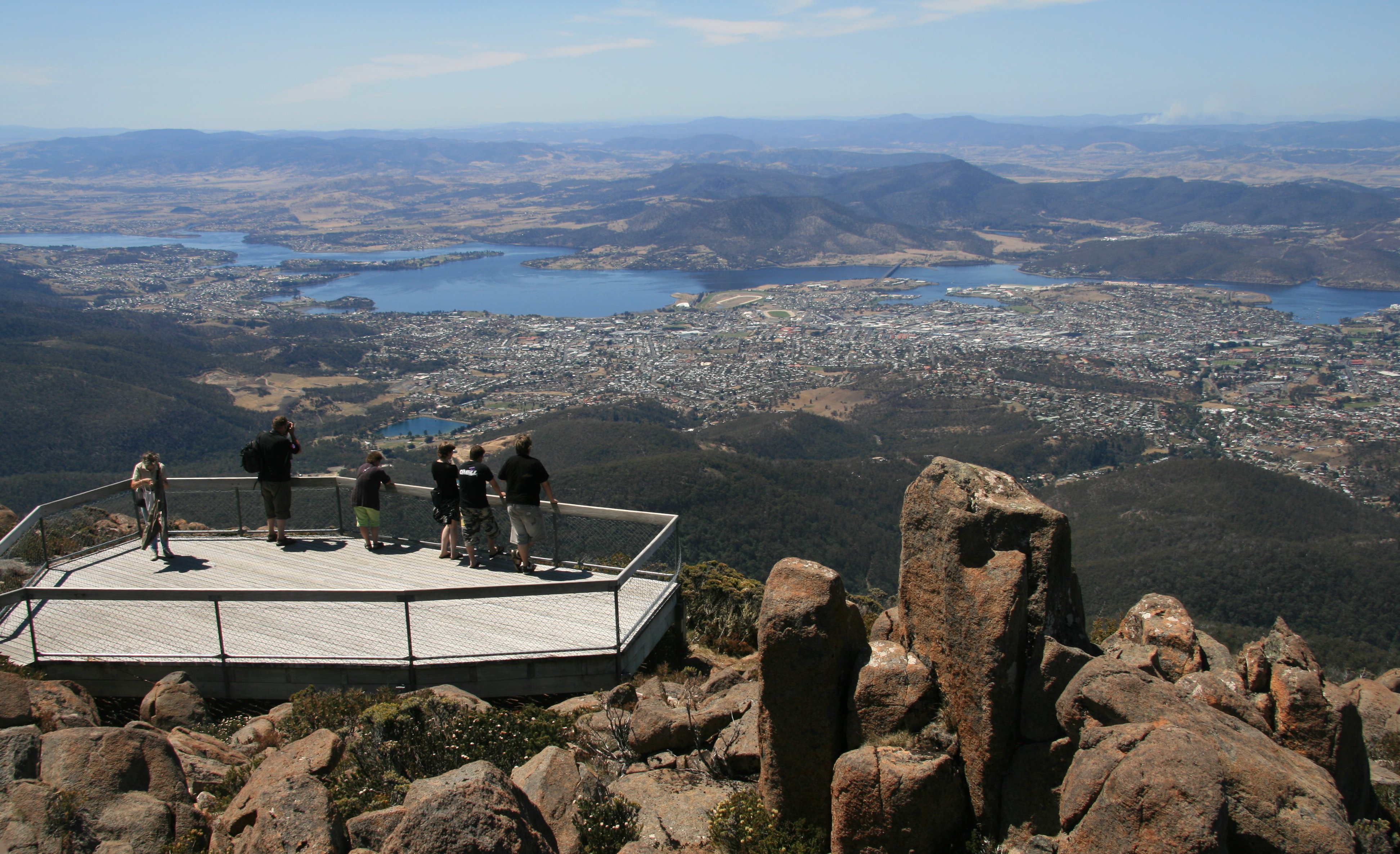
I drove to the summit of Mount Wellington Thursday afternoon for sweeping views of the area.
6 minute video of Hobart, Tasmania and Mount Wellington. |
|
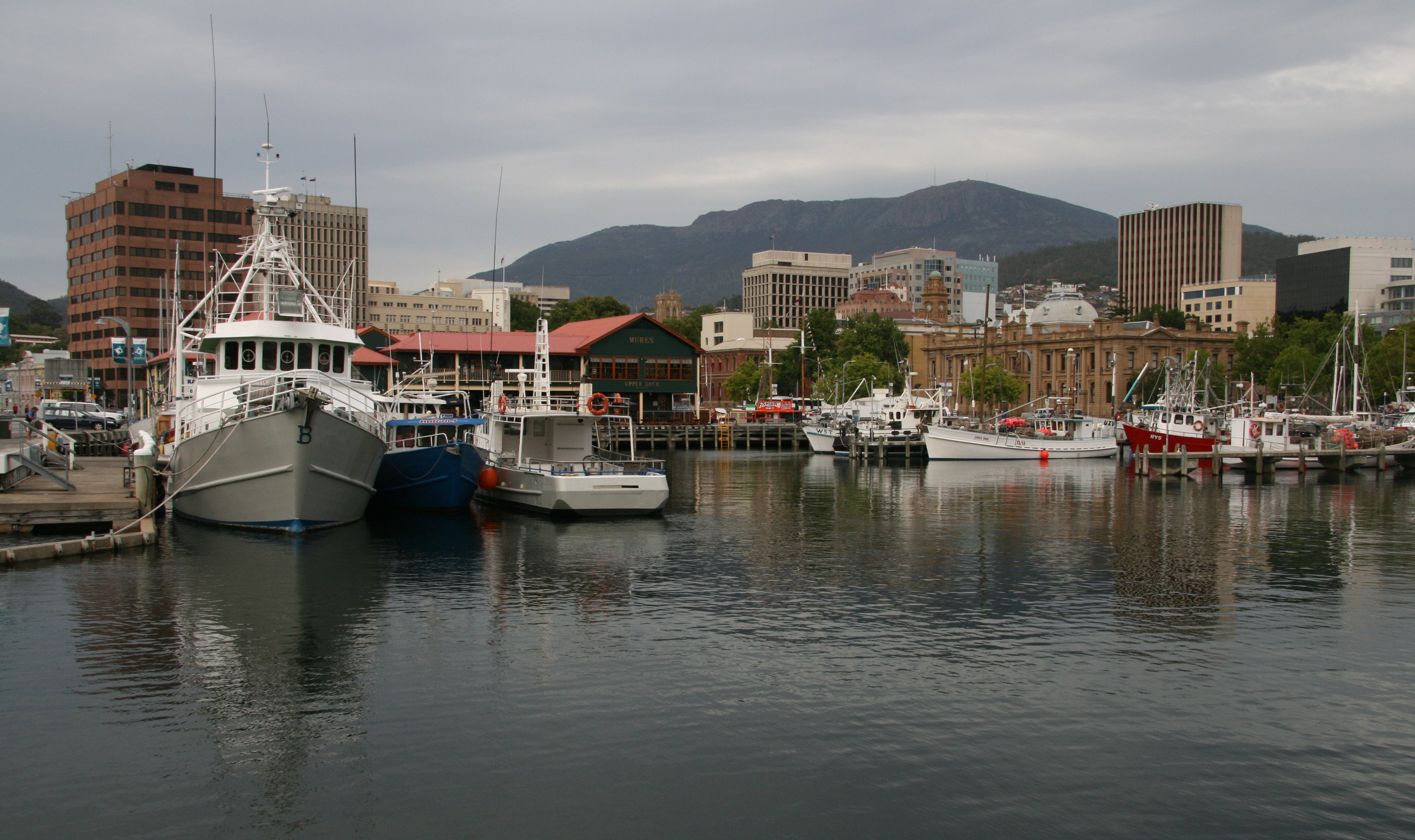
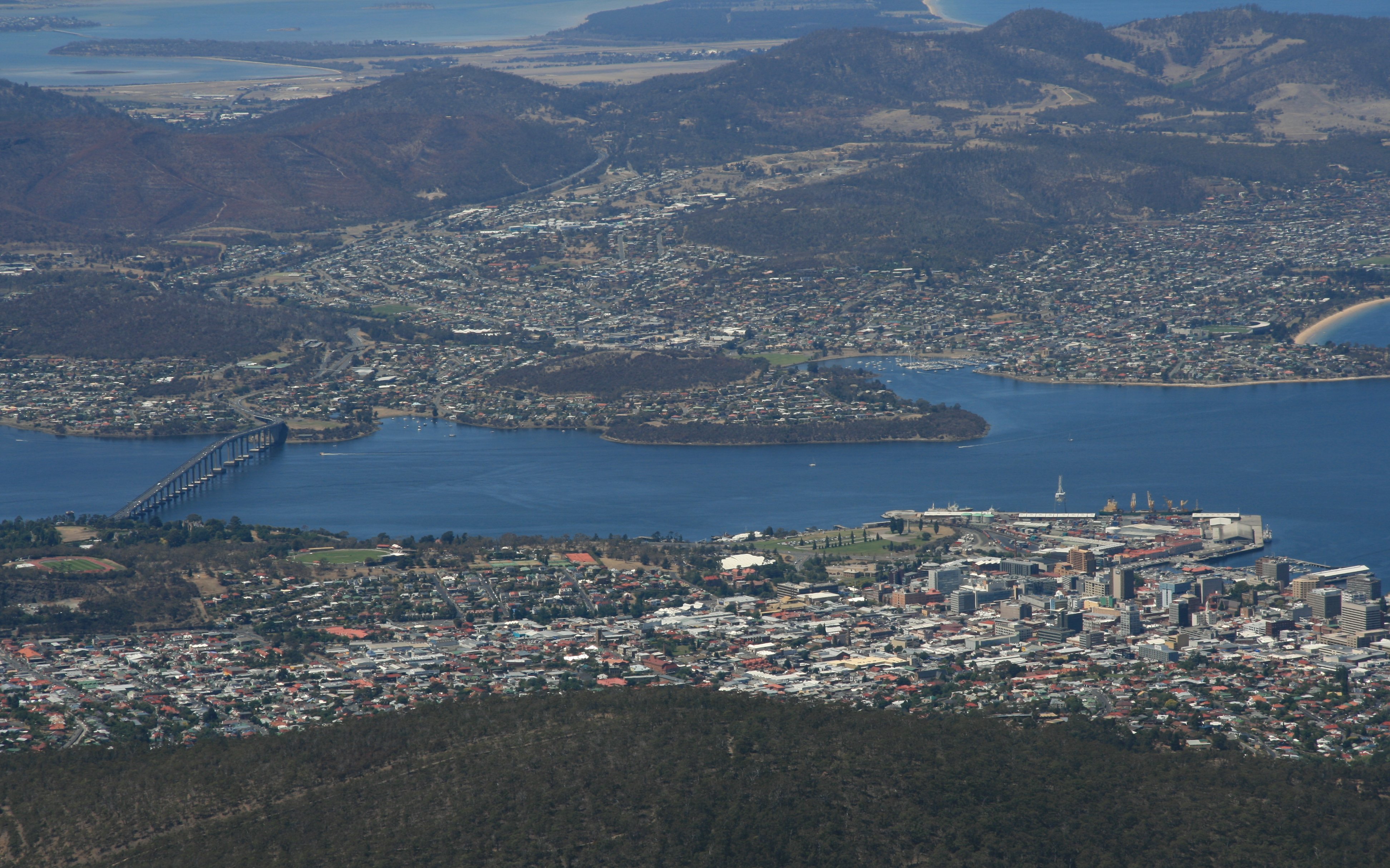
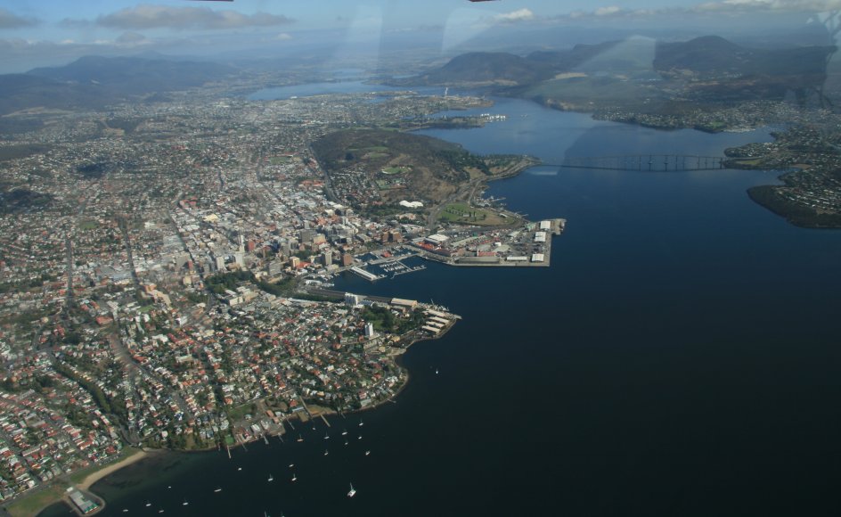
Hello Everyone, I had a great time in Sydney but had to move on this morning. It was raining when I left Sydney this morning but it is beautiful here in Hobart, and quite warm. Arrived here at 10:30 this morning. It is nice to have a car again. I didn't rent one in Sydney and used trains and ferries to get around. I hate driving on the wrong side of the road though. I did manage to stay to the left and not kill myself or too many others. I am staying at the Grand Chancellor Hotel in Hobart, Tasmania which you see pictured below. It is a nice hotel. Below is my corner room at the hotel. 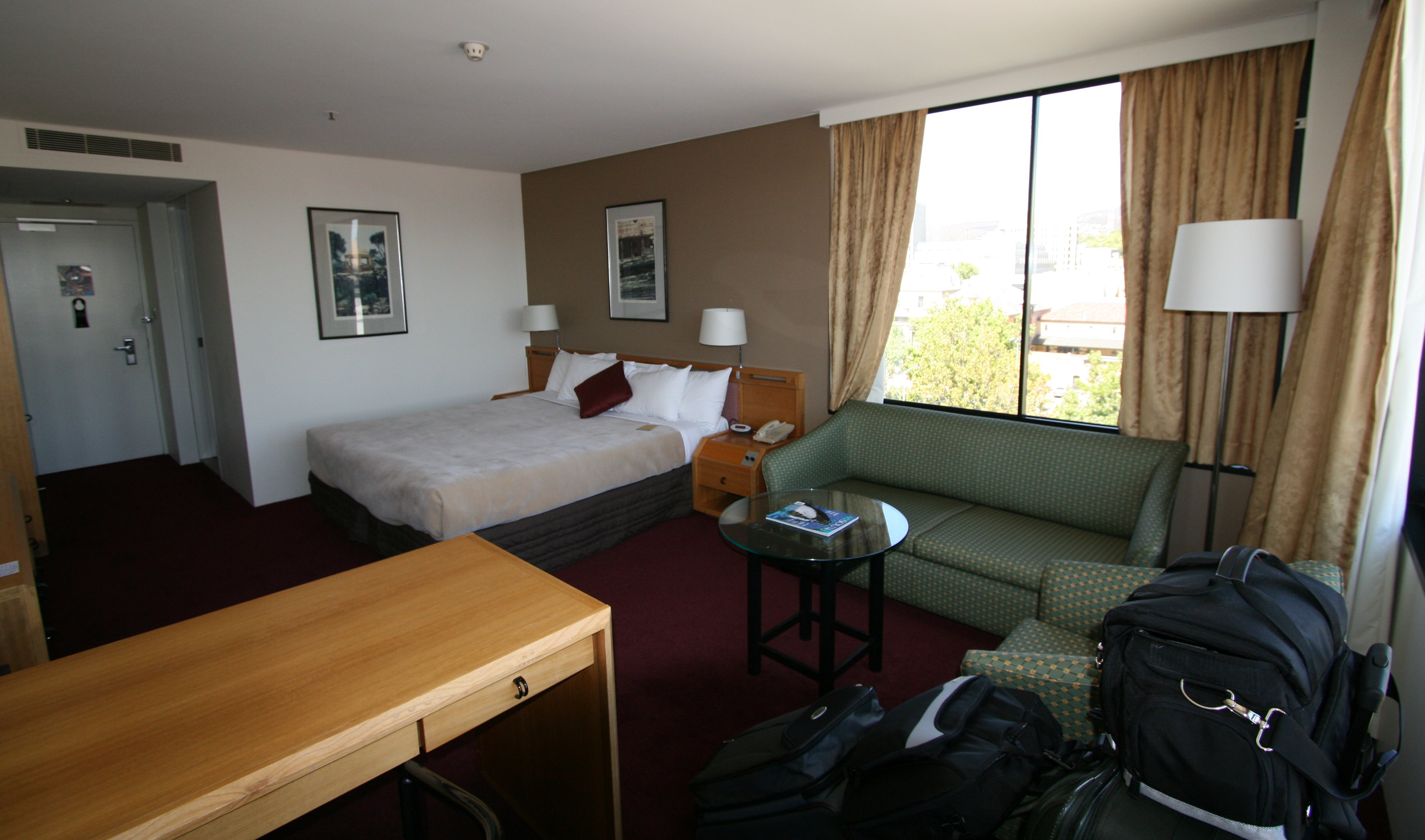 Below is Hobart's Constitution Dock. This is pretty much the view from my hotel room. I walked around the harbour early this afternoon. Hobart's harbour is a fairly unique mix of fishing boats, sailing yachts, motor cruisers and commercial vessels all mixed in one small area. It's a beautiful place to go for a stroll, conveniently situated between Salamanca and downtown. Hobart is located on the estuary of the Derwent River. 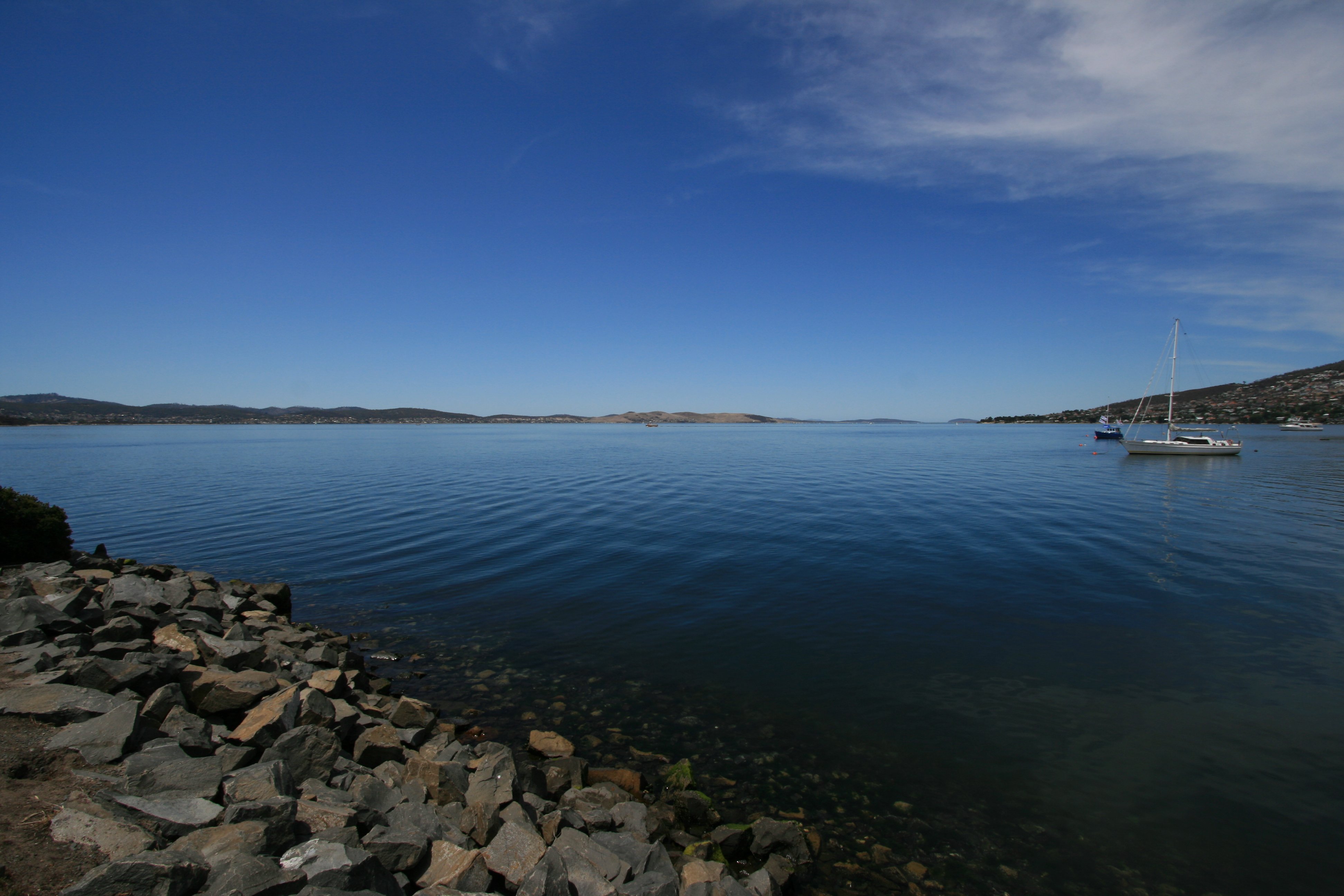 Hobart is known for its well-preserved historic architecture, much of it dating back to the Georgian and Victorian eras, giving the city a distinctly "Old World" feel. Hunter Street pictured below borders the harbour. 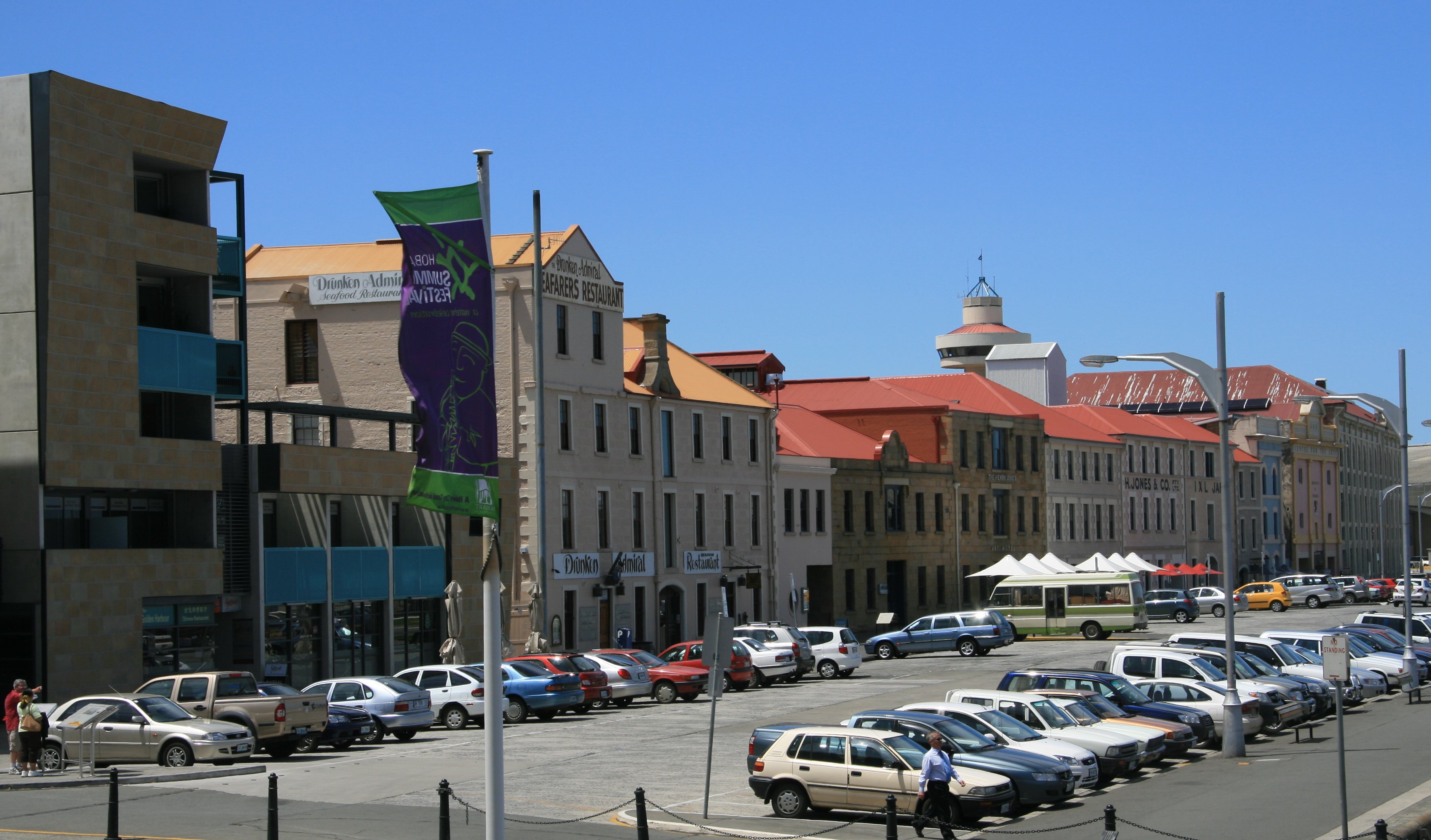 Hobart is the capital and most populous city of the Australian island state of Tasmania. It has a population around 200,000 people. The picture below is looking toward downtown. 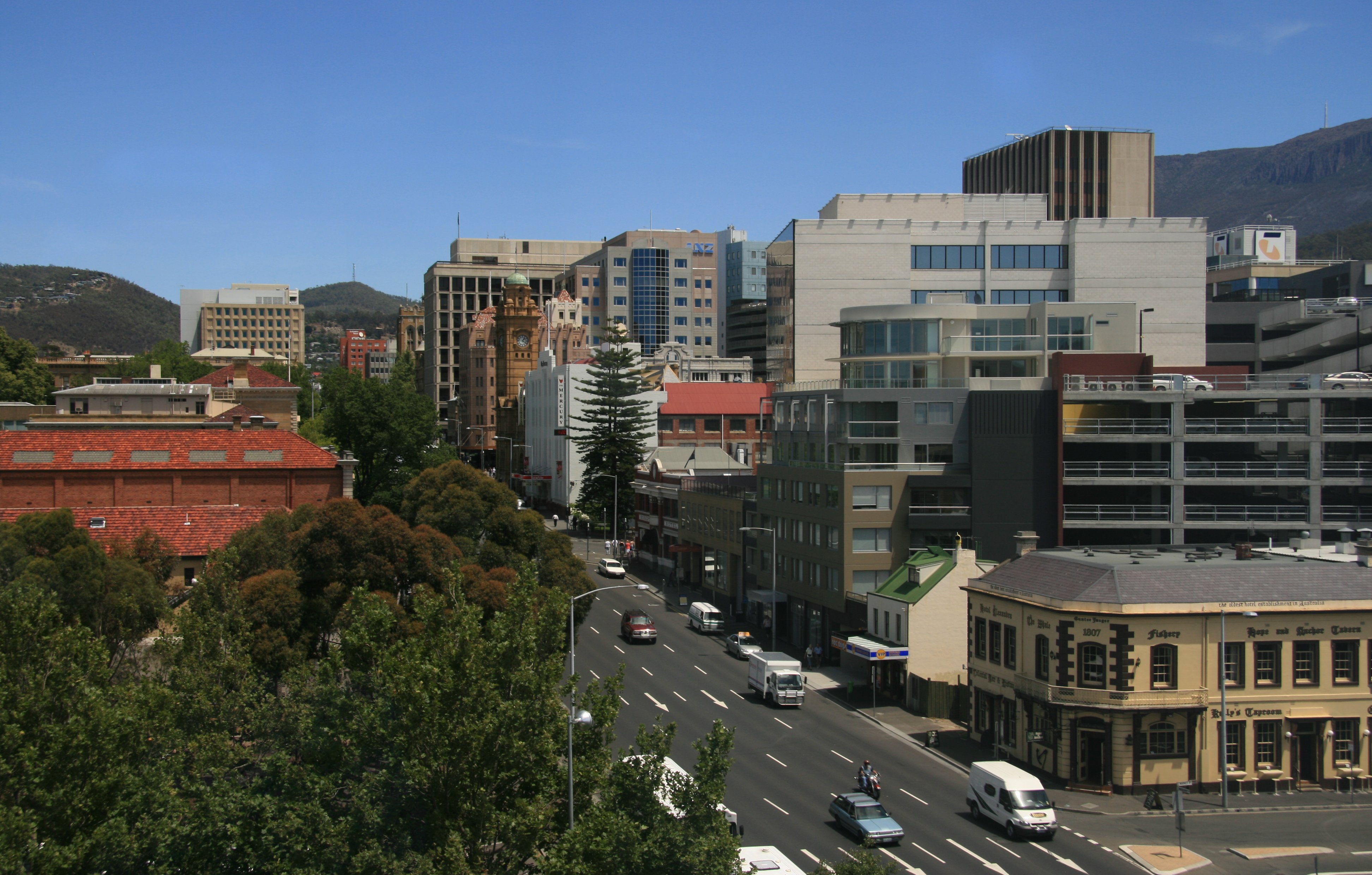 Salamanca Place (below) consists of rows of sandstone buildings, formerly warehouses for the port of Hobart Town that have since been converted into restaurants, galleries, craft shops and offices. Each Saturday, Salamanca Place is the site for Salamanca Market, which is popular with tourists and locals. 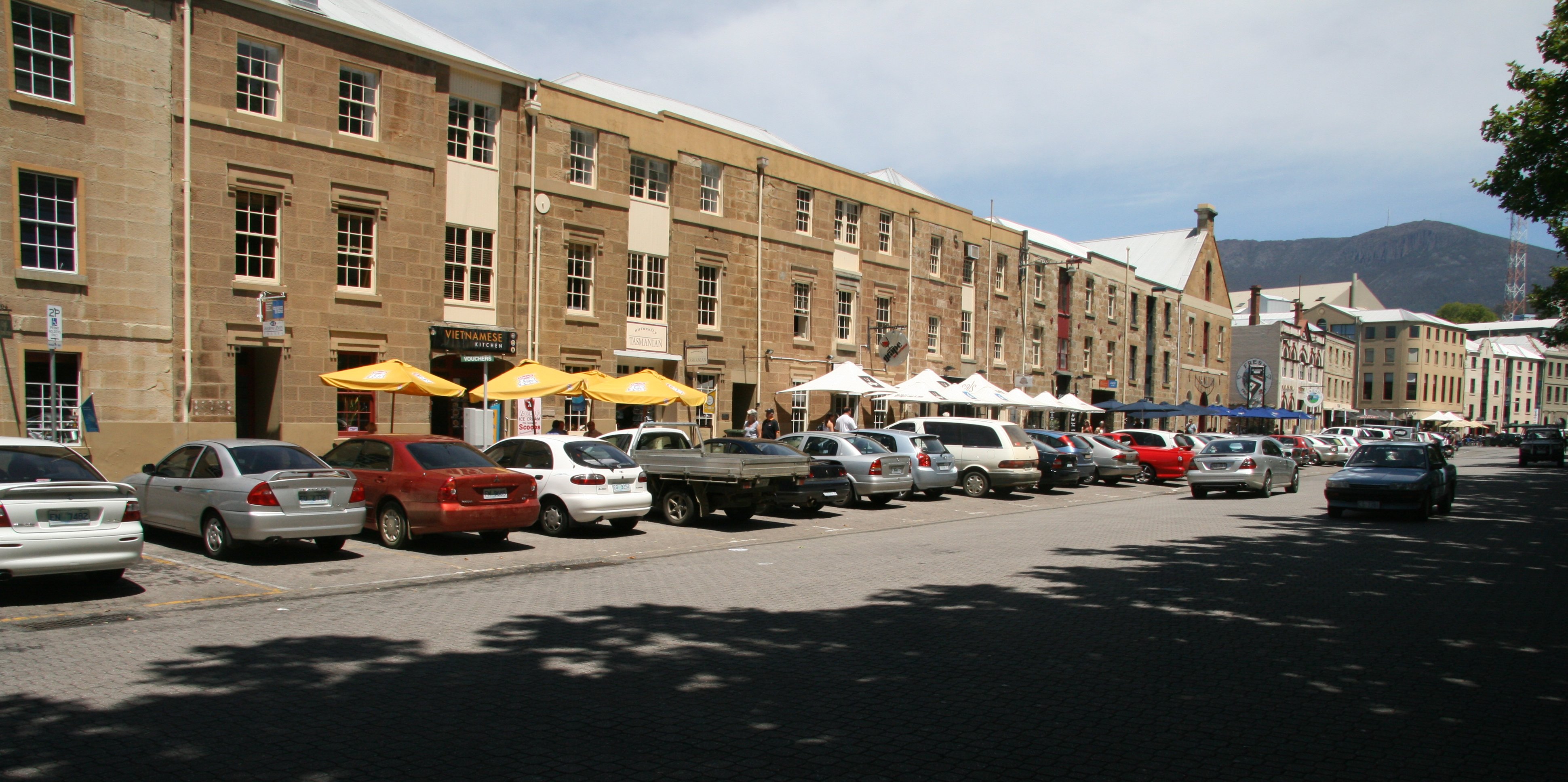 Franklin Square (below), with its towering oak trees, grassy knolls and central location, is a great spot to soak up the atmosphere of Hobart. 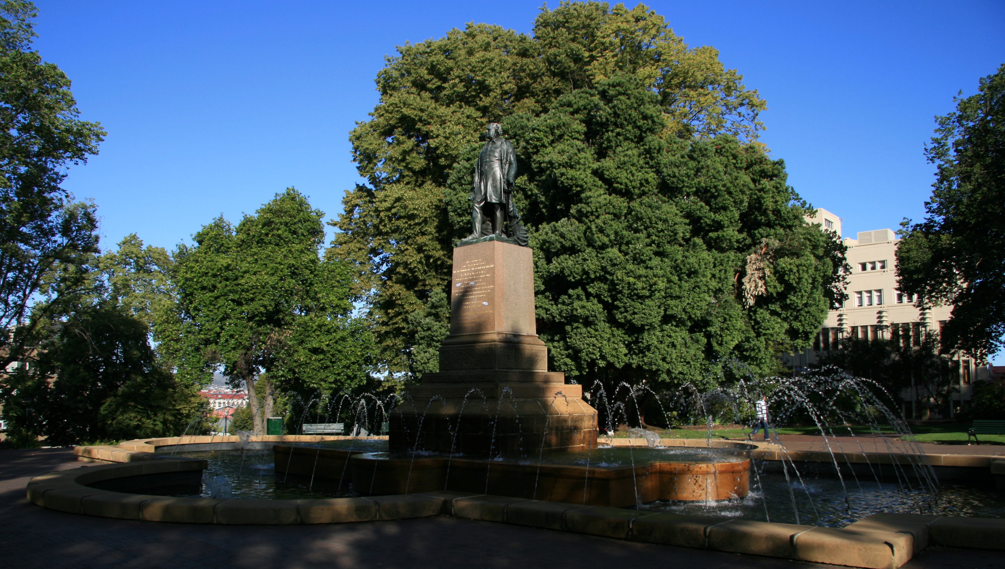 Later this afternoon I drove to the summit of Mount Wellington. 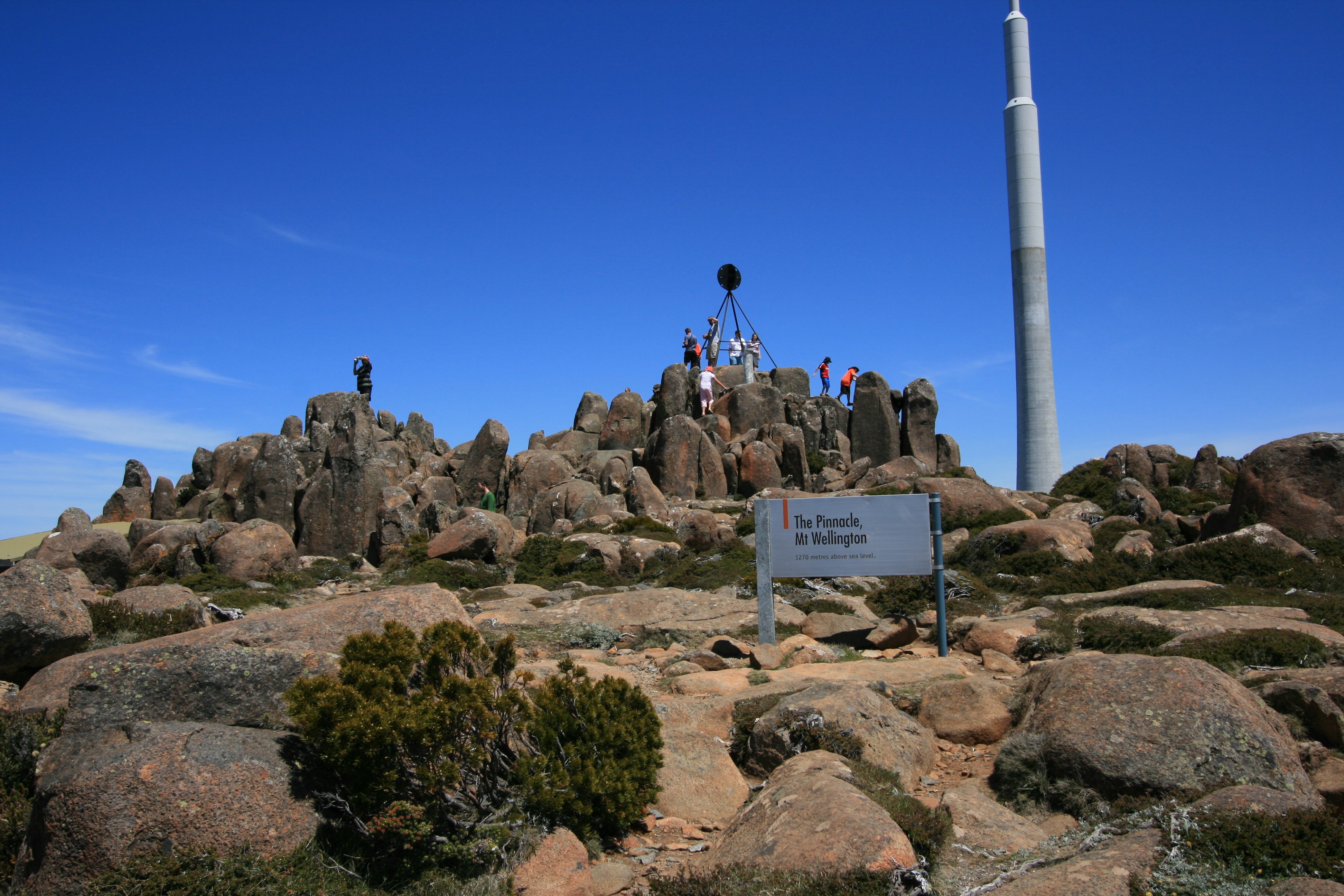 Mount Wellington rises to 4,170 feet above sea level and is frequently covered in snow, sometimes even in summer. The summit provides spectacular views of the city below and to the east, the Derwent estuary. 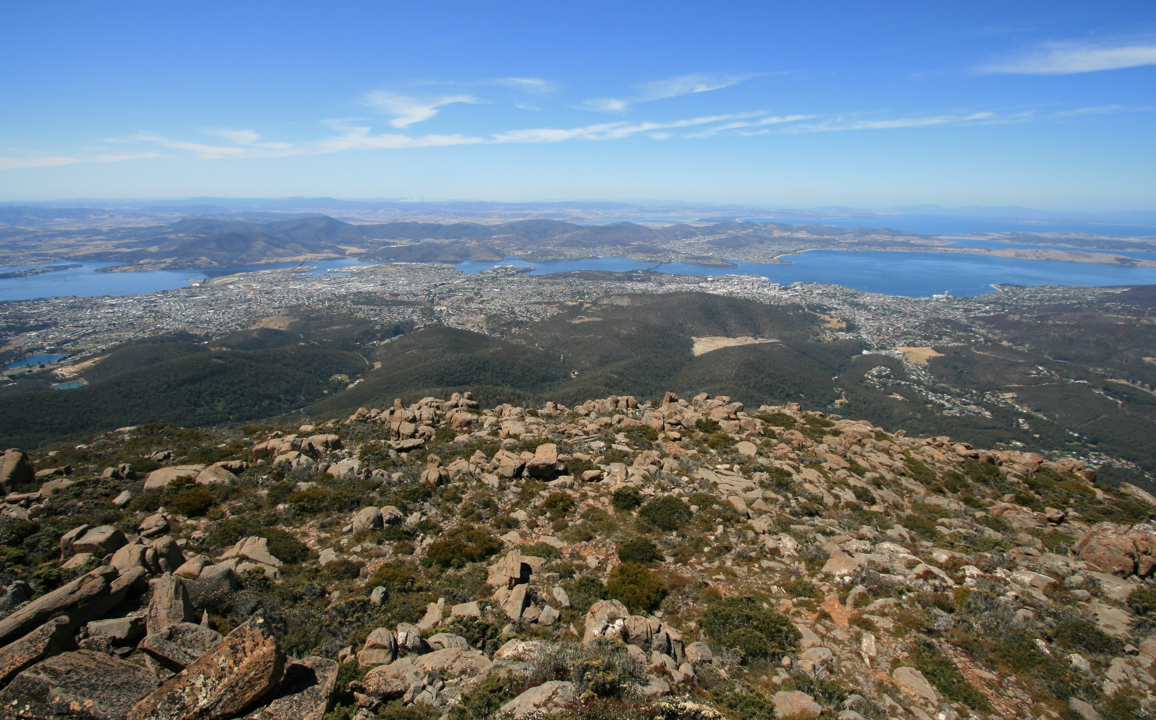 Below you can see people enjoying the spectacular view from the summit lookout. Below is the Tasman Bridge which I drove across earlier today coming in from the airport. The Hobart central business district is on the right. Below is a closer look at downtown Hobart. The Tasman Bridge is a five-lane bridge crossing the Derwent River. It provides the main traffic route from the CBD (on the western shore) to the eastern shore. You can take a closer look below. 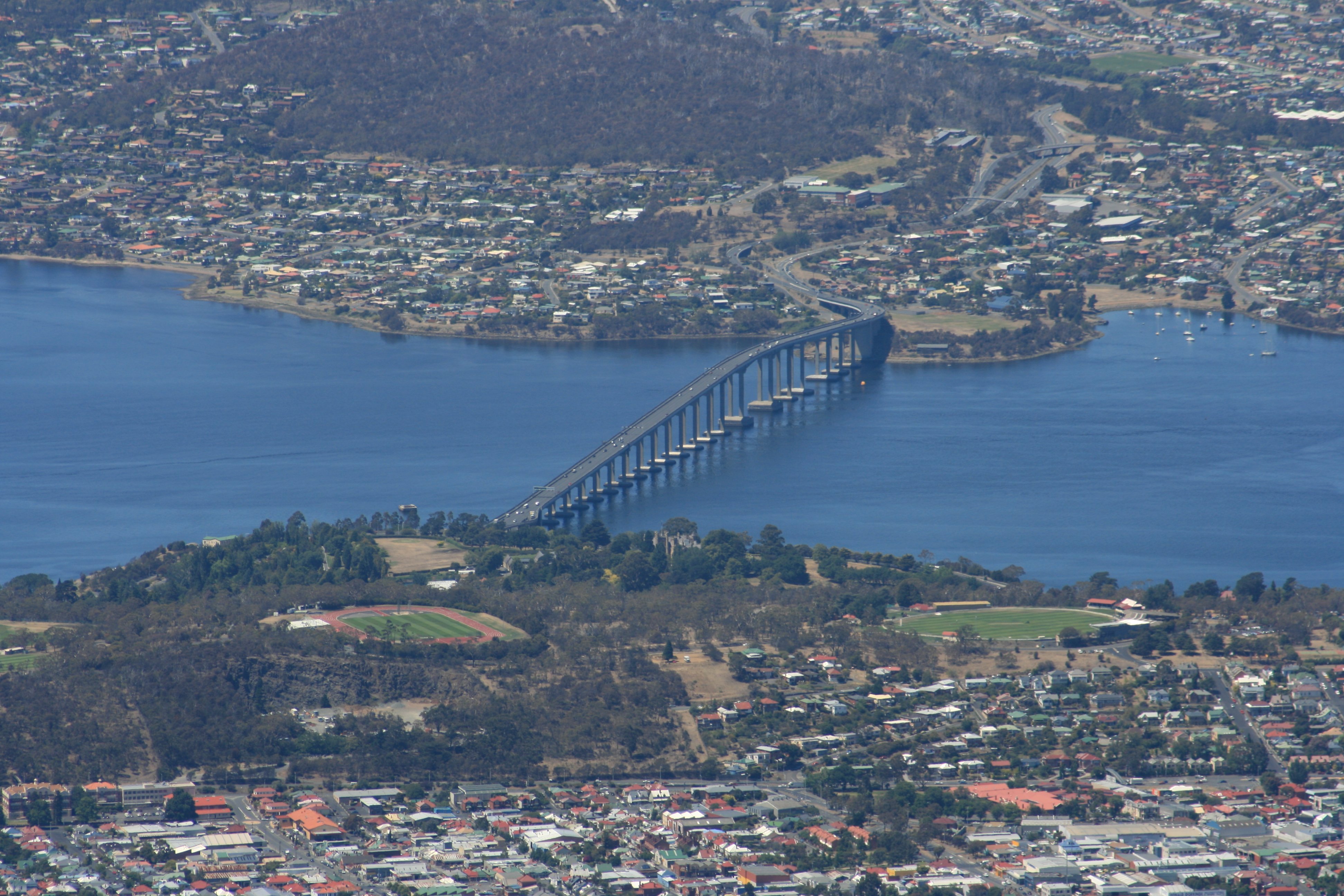 I was hoping things would be cheaper here in Tasmania away from the big city. NOT! Bought a few groceries to last the six days I am here, the bill was $95. The one exception was cashews. They must grow them here. Big enormous bag for only $8. More Later, Tim |
FRIDAY, JANUARY 5, 2007:
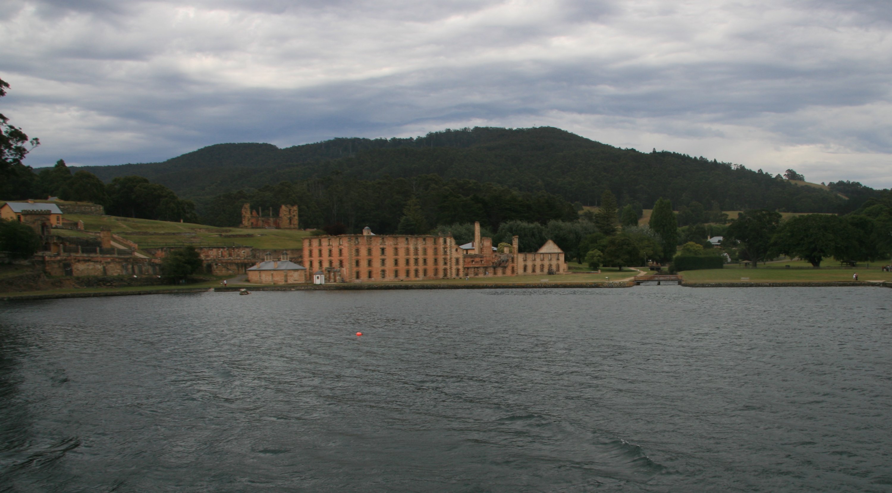
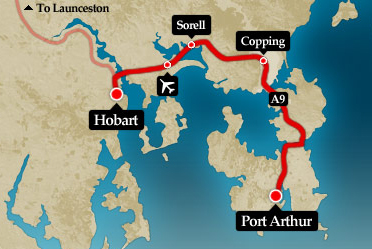
I took a cruise down to historic Port Aurthur on Friday morning.
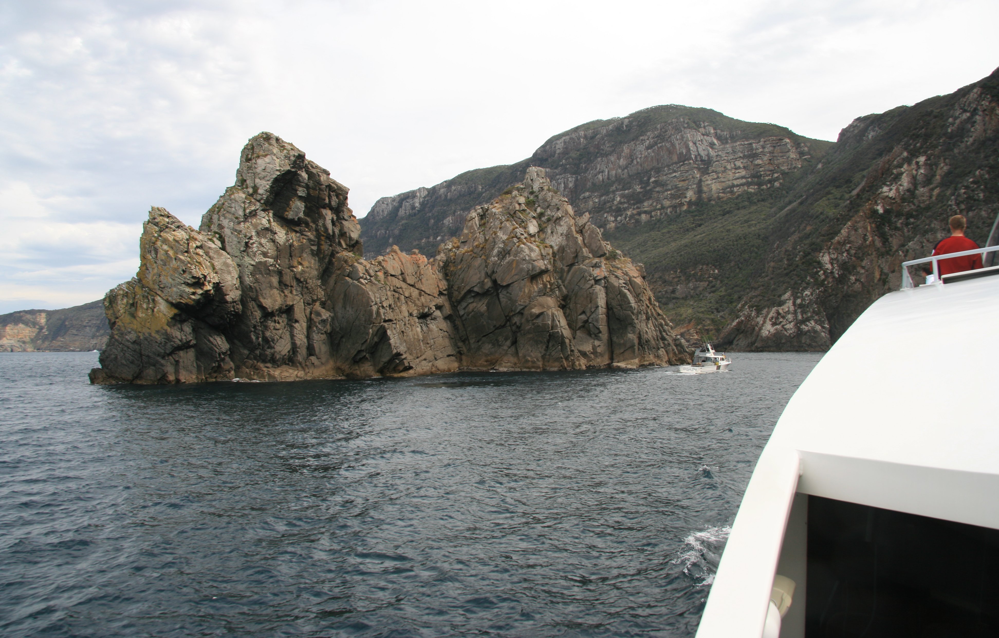
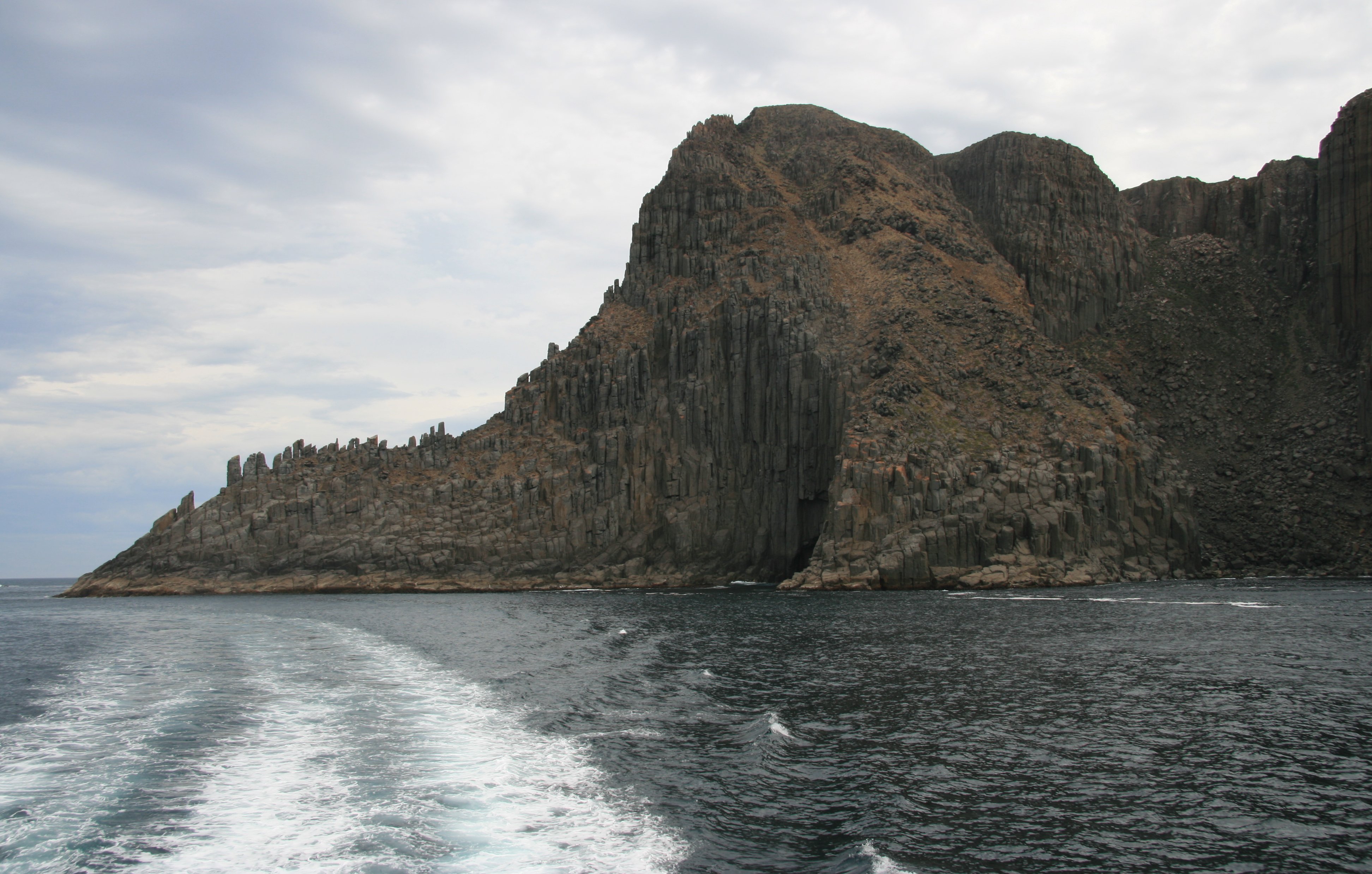
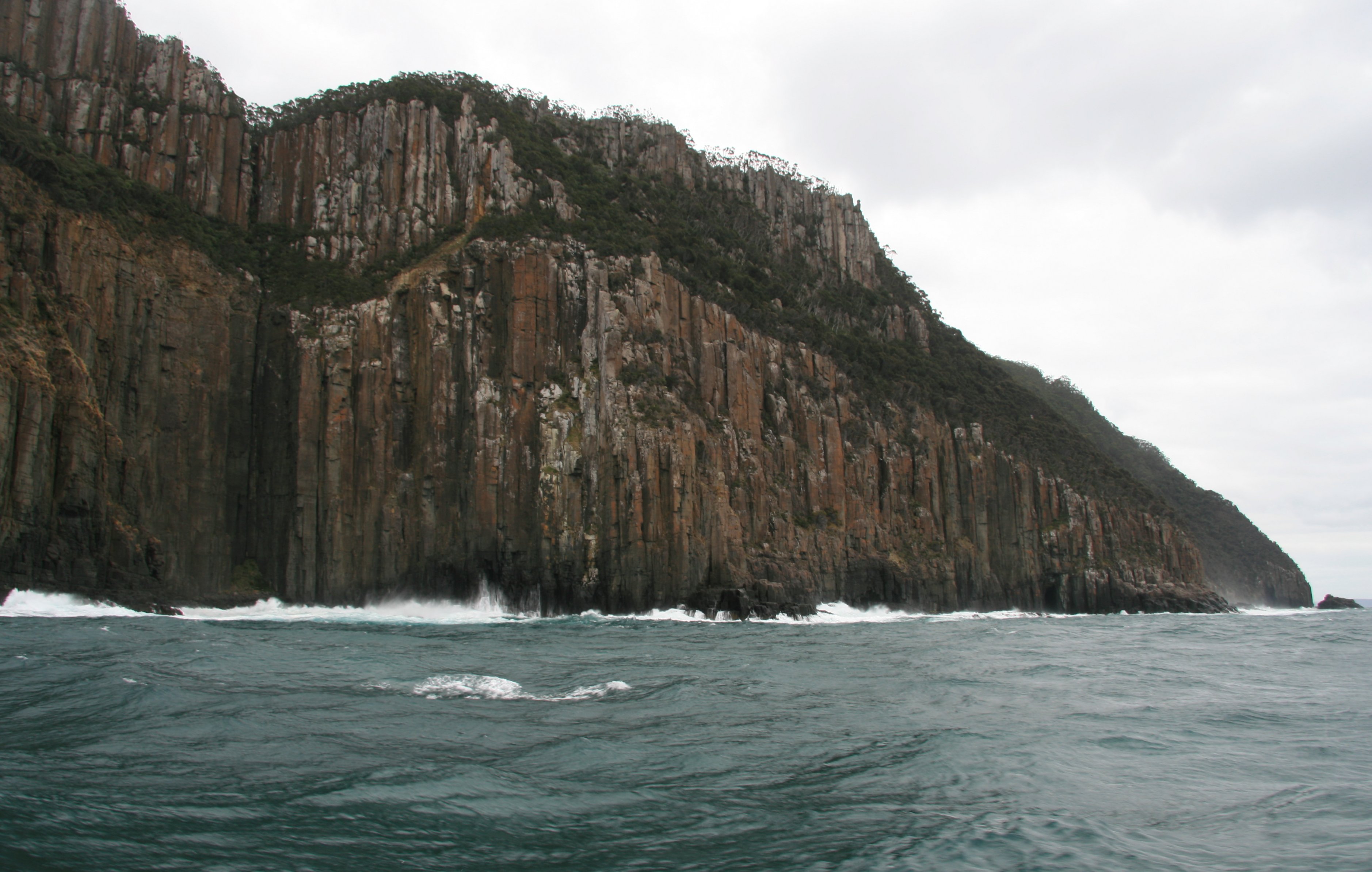
Many beautiful sea cliffs as we neared Port Aurthur.
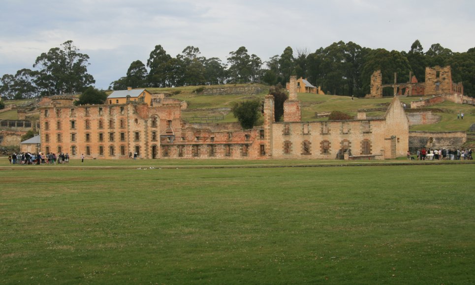
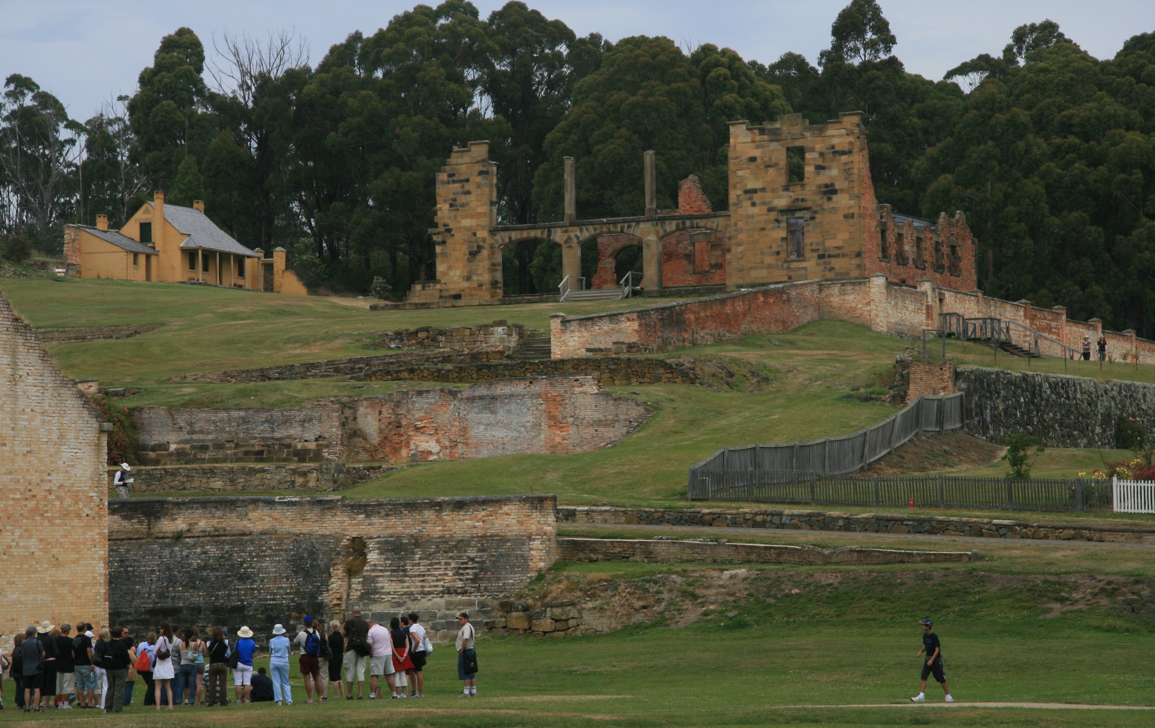
The Ruins of Port Aurthur used to harbor some of Australia's worst criminal offenders.
I returned to Hobart by bus after my time at Port Arthur.
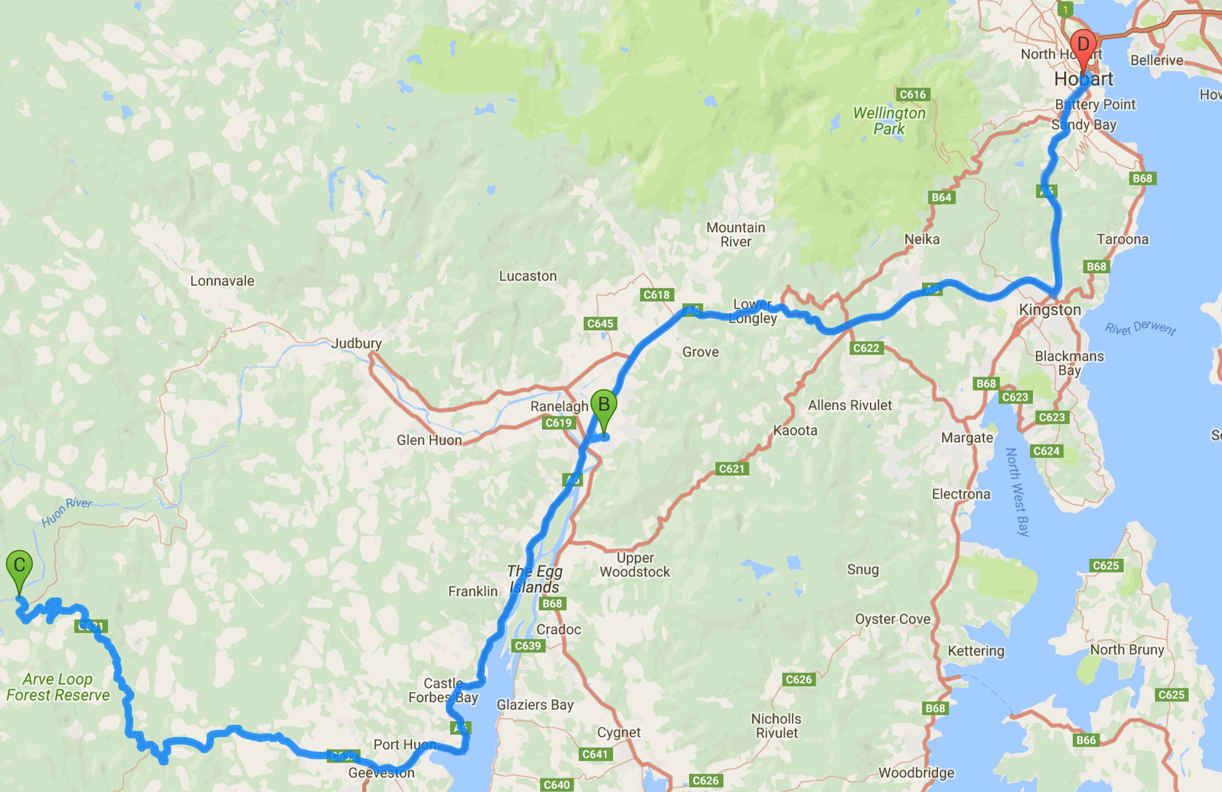
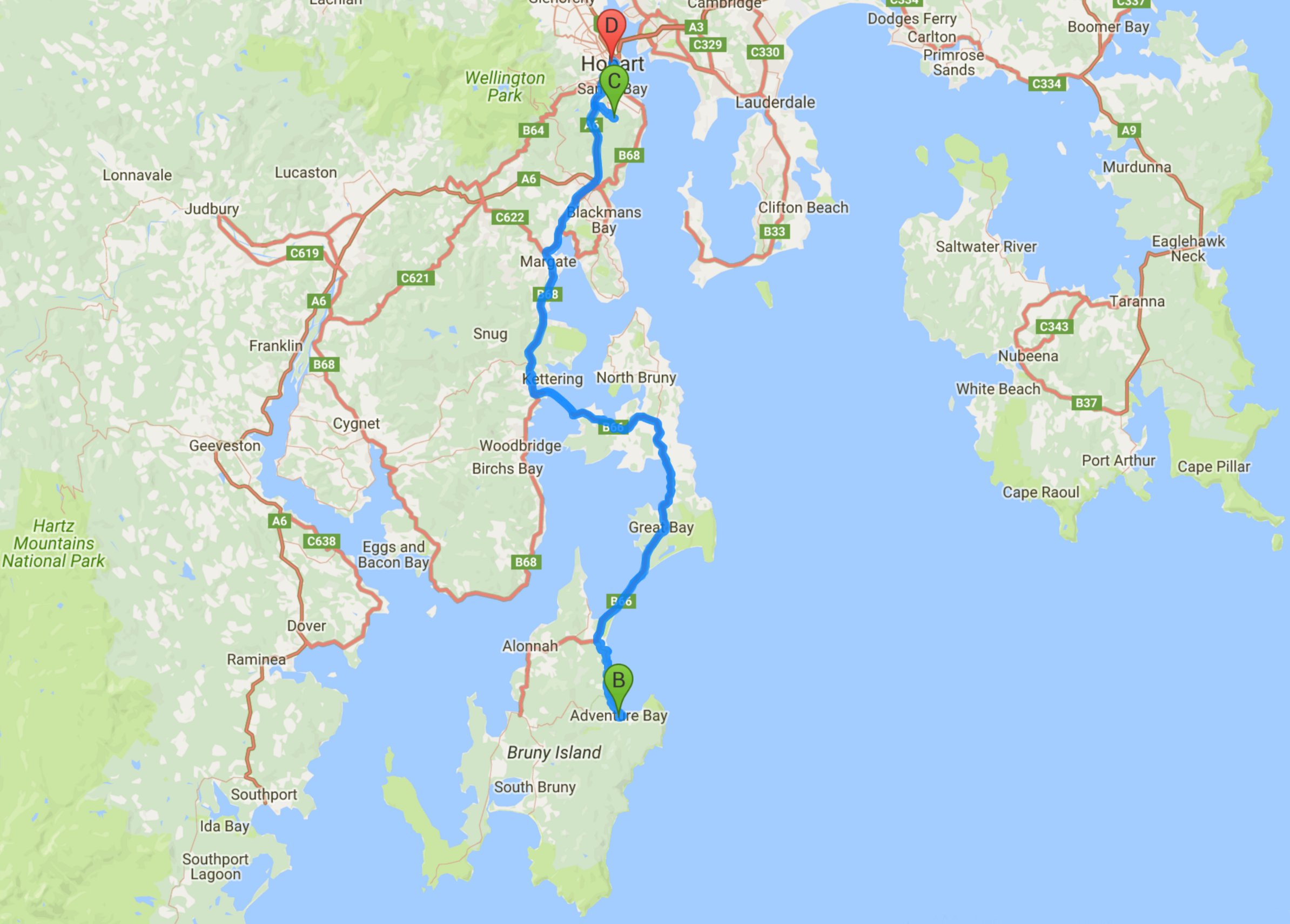
Below is a map of the area.
10 minute video of my boat trip from Hobart to historic Port Arthur, Tasmania. |
|
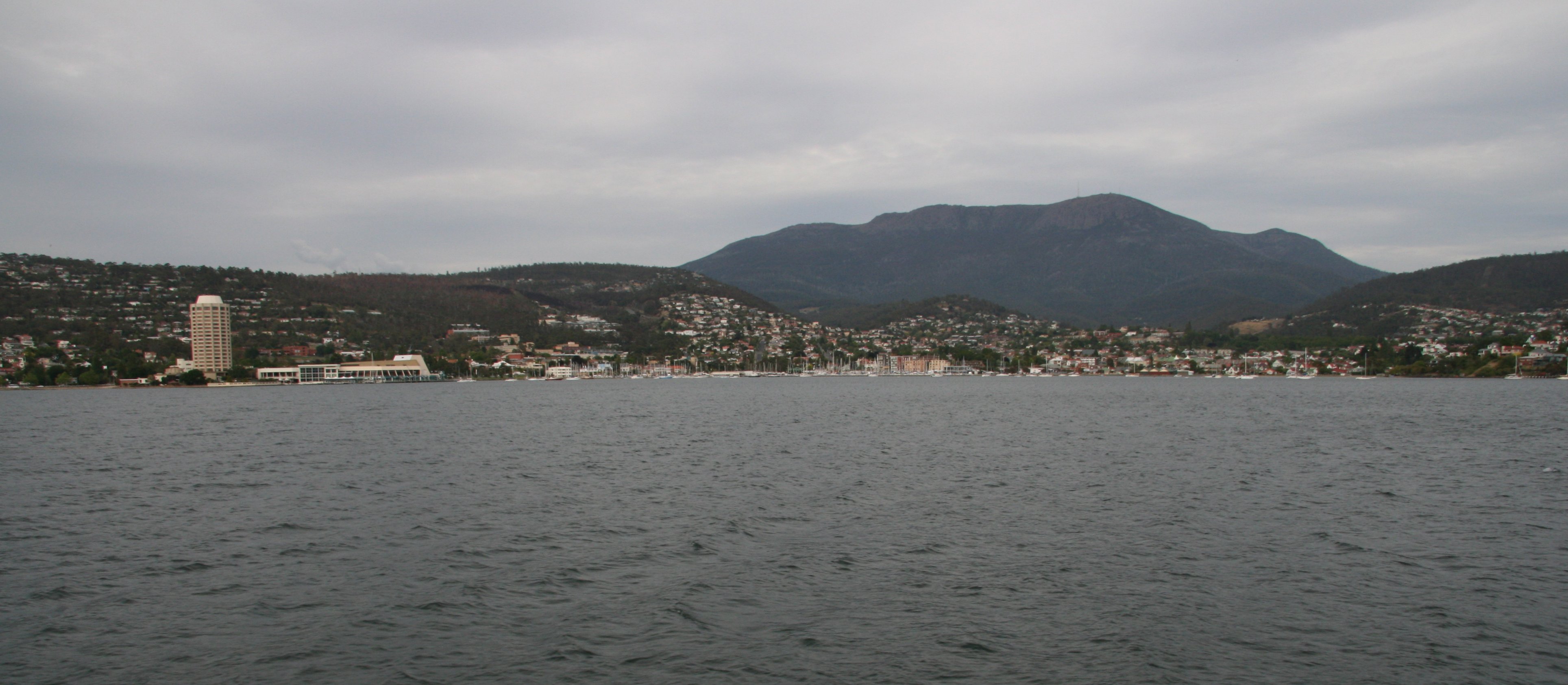
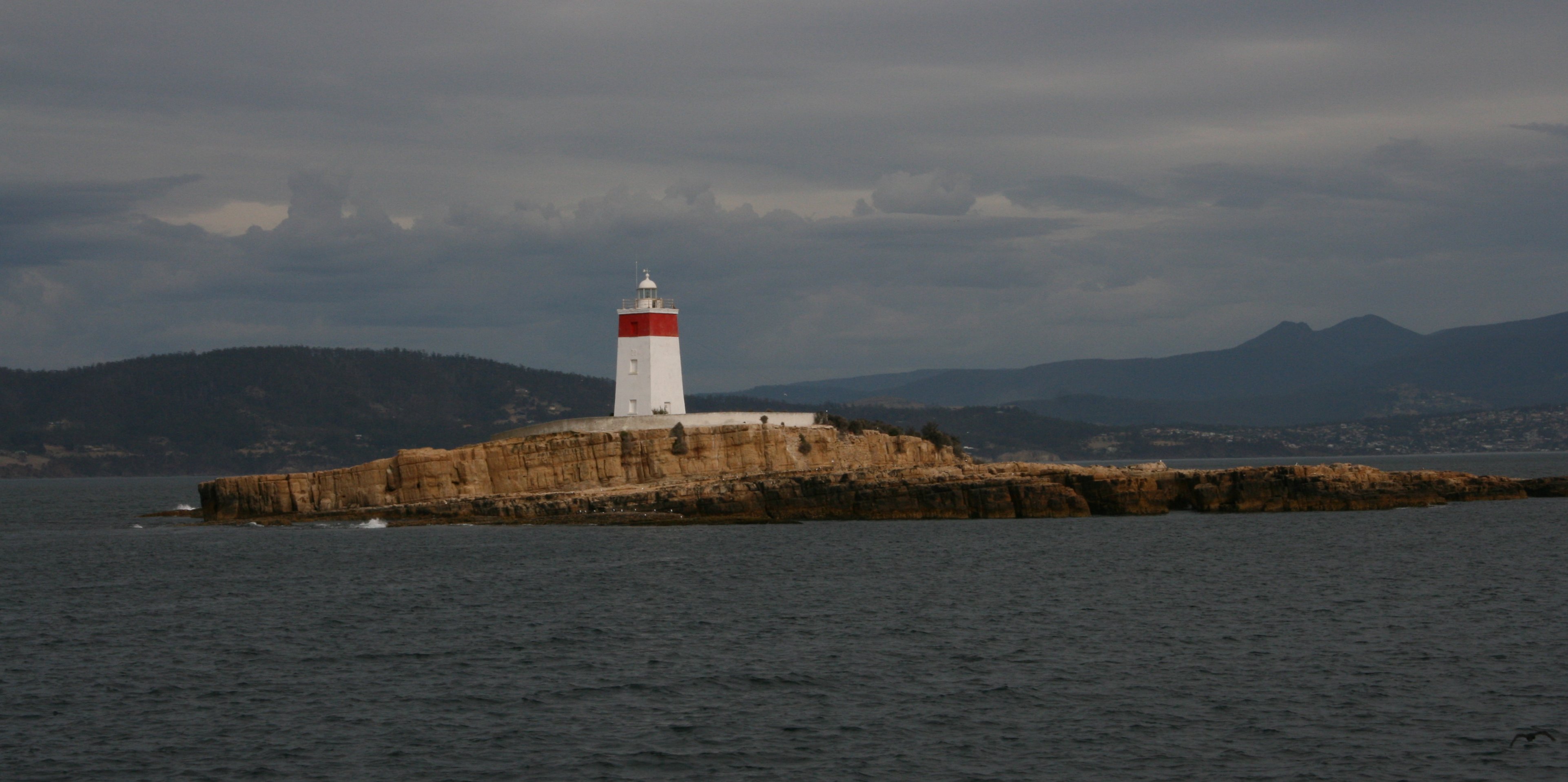
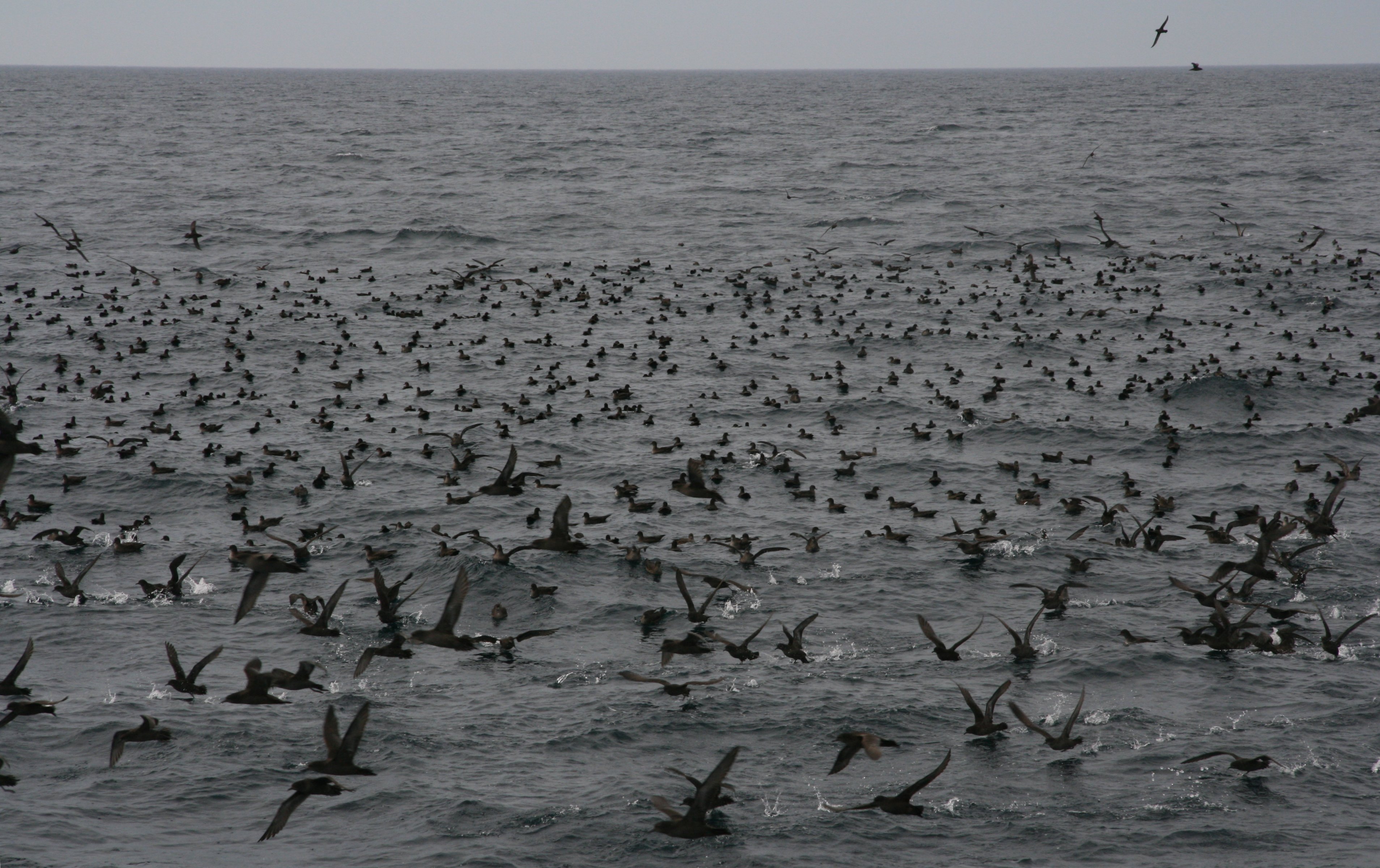
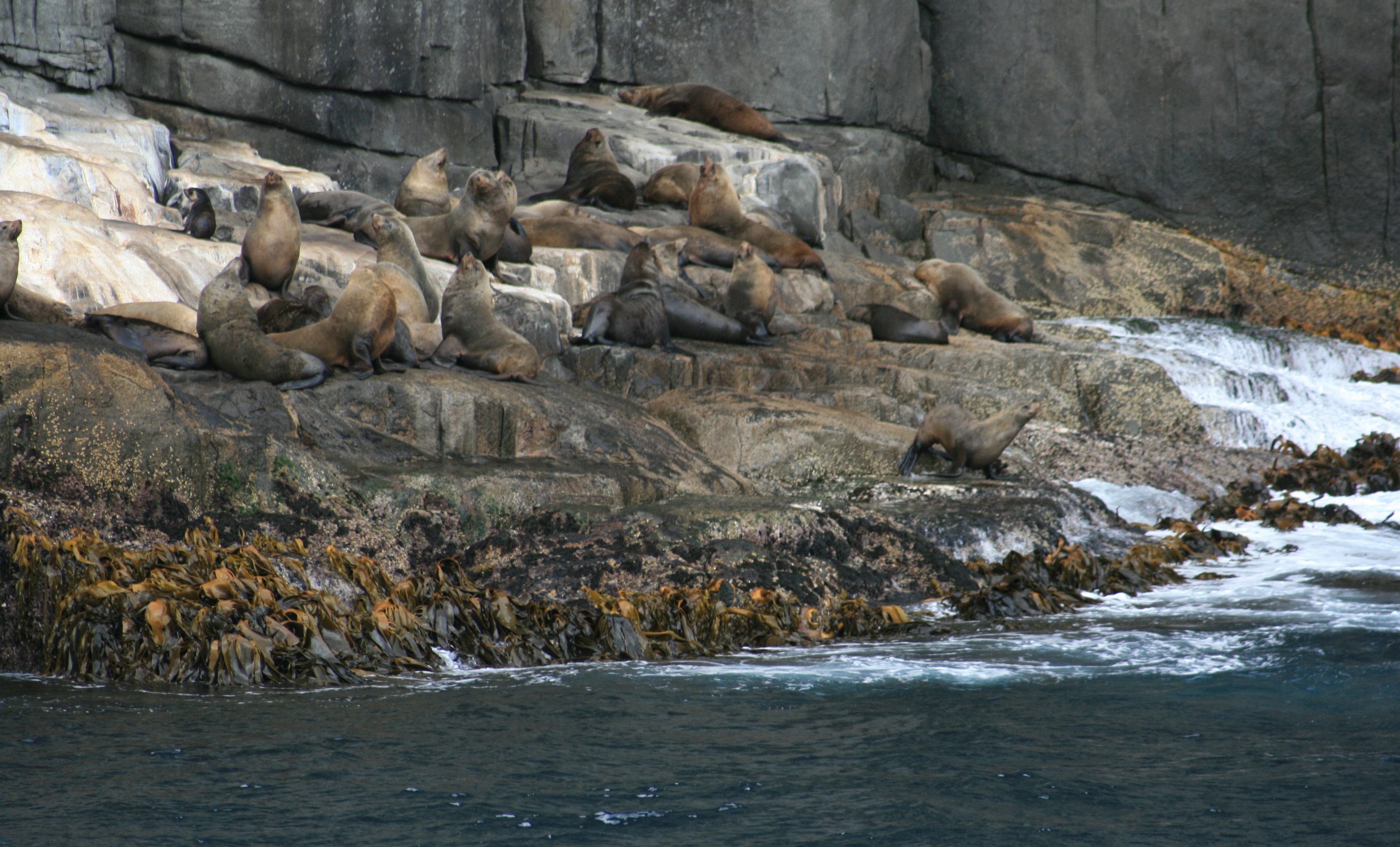
Howdy Howdy! Today I took a cruise down to Port Authur. The cruise left from just a few blocks from my hotel. Below you can see the harbour and my hotel as we are starting our cruise. 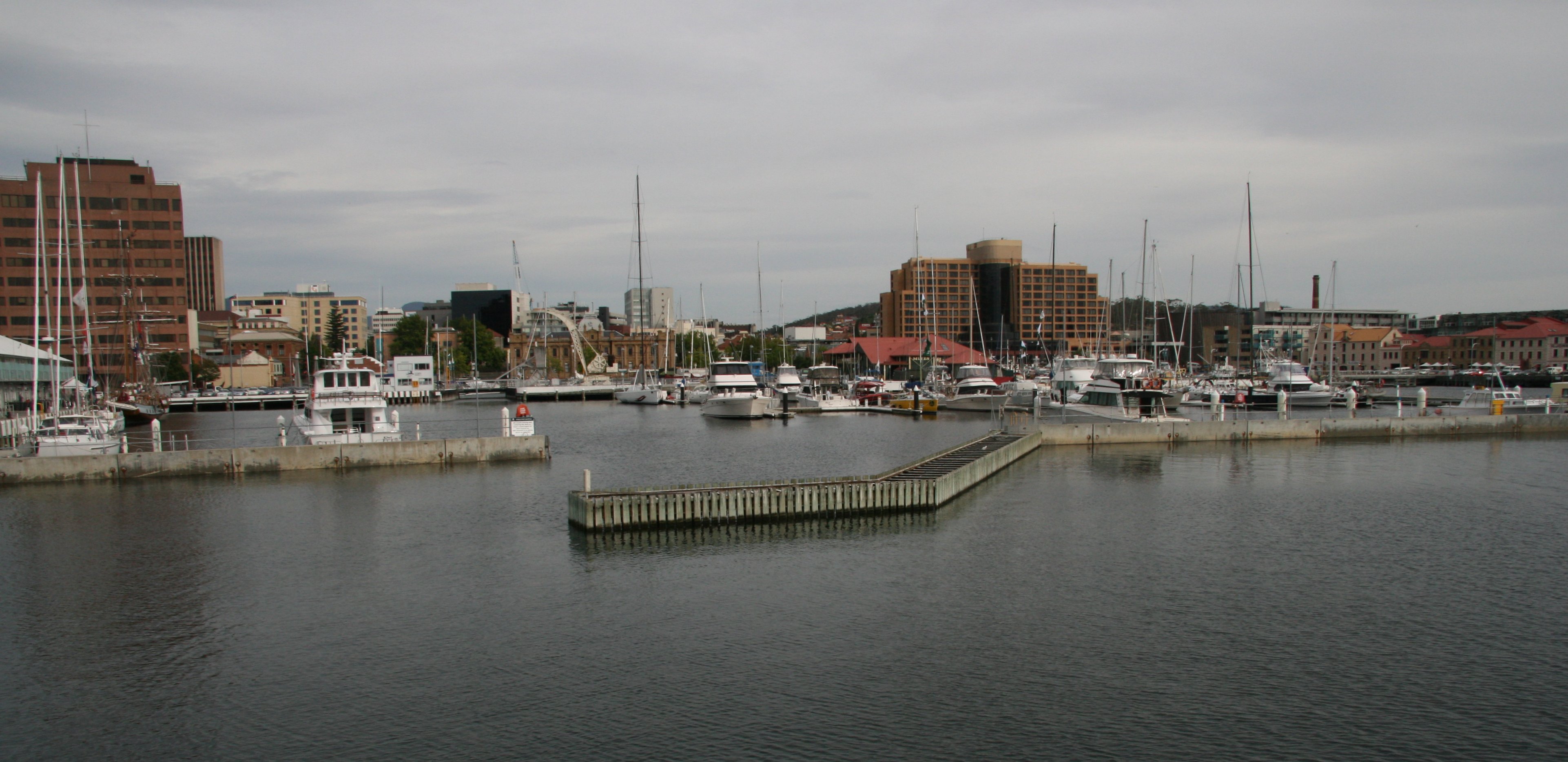 Below is a nice view of Mount Wellington that I drove to the top of yesterday. On the left of the photo is the Wrest Point Hotel and Casino. The Iron Pot Lighthouse (below), also known as the Derwent Lighthouse, is Tasmania's oldest lighthouse, and the second oldest in Australia. The short-tailed shearwater is the most abundant seabird species in Australian waters. The cruise down the Tasman Peninsula was really quite breathtaking. 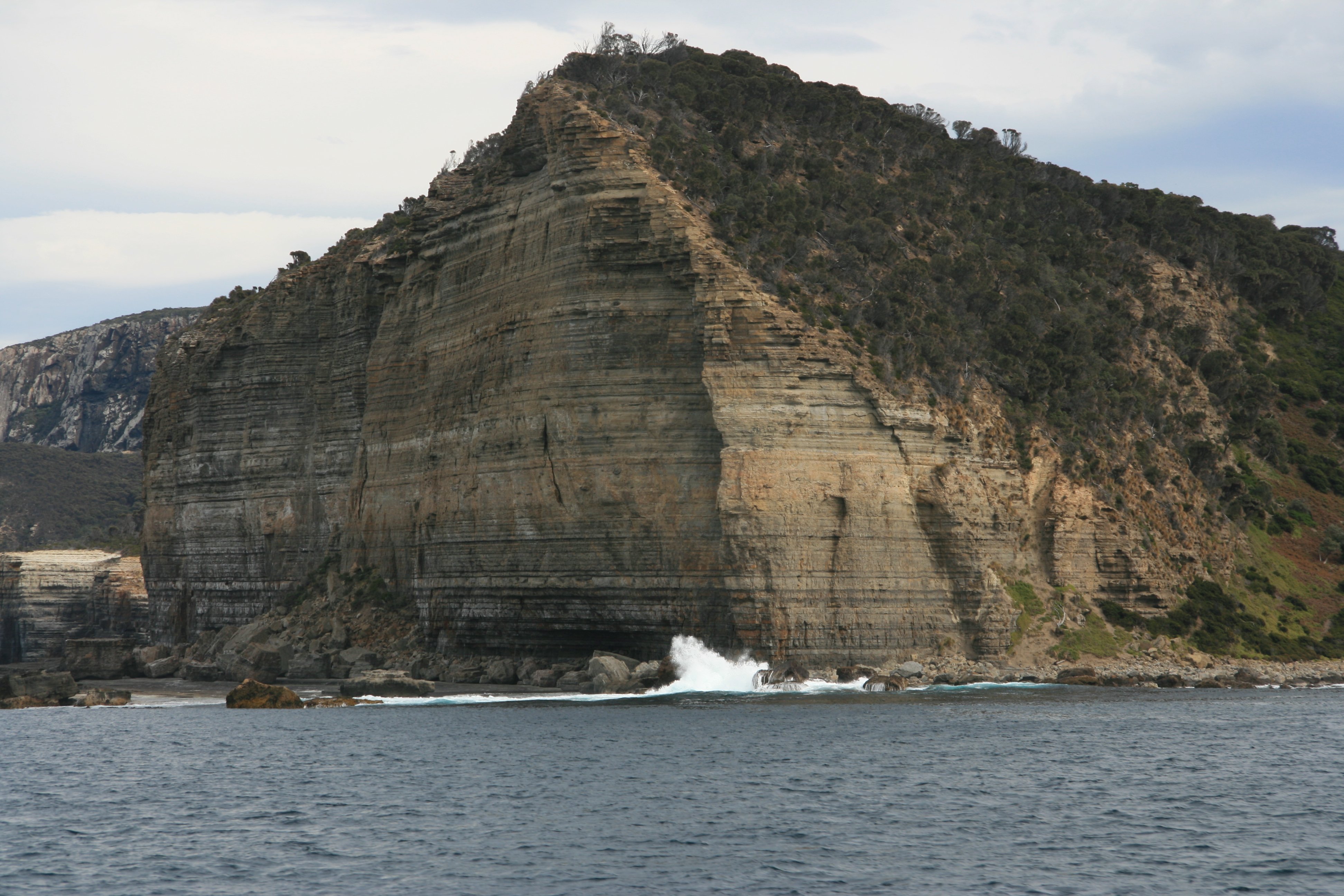 Cape Raoul is situated at the southernmost part of the Tasman Peninsula. It forms the coastline of Raoul Bay, and is part of the Dolerite landscape of the Tasman National Park. Stunning coastal seascapes that include rock platforms, towering cliffs and columns, off-shore islands and swirling seas. 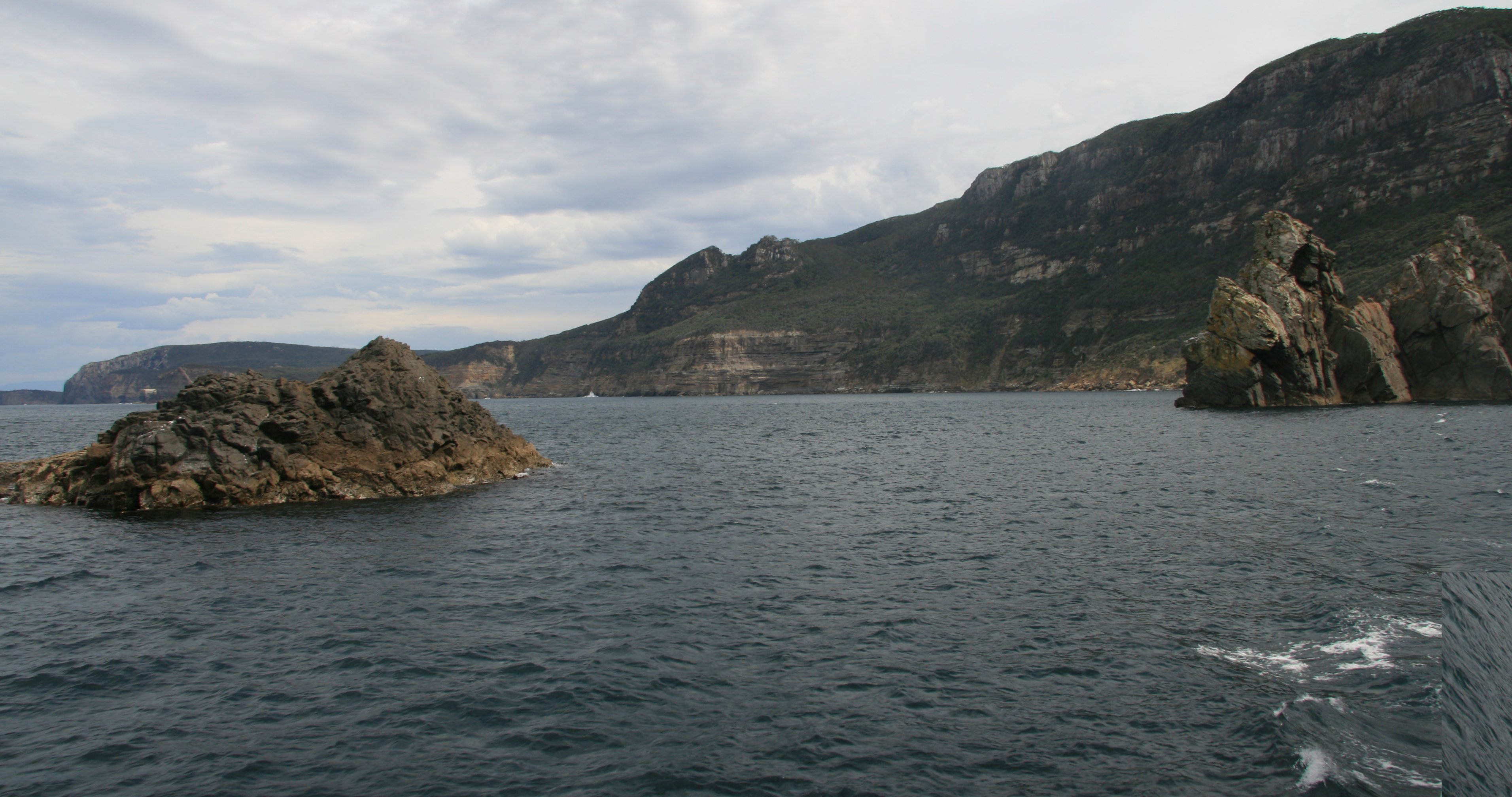 The spectacular dolomite pillar cape was beautiful. While dolerite sea columns do exist elsewhere in the world, Tasmania has the largest number of exposed columns. 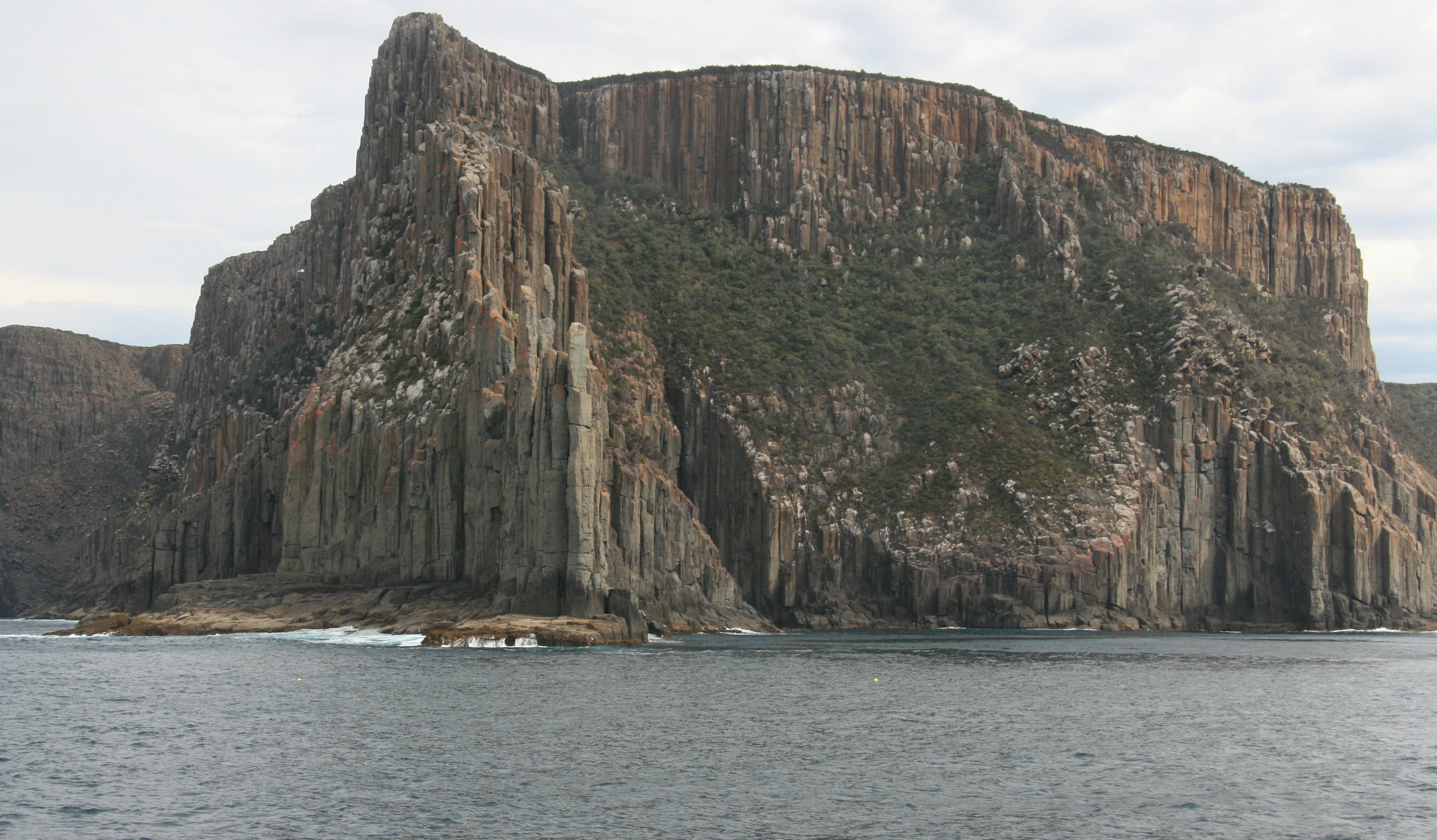 We saw some Australian fur seals on the rocky shore of Cape Raoul. The coastline of the southern Tasman Peninsula is composed of giant dolerite sea columns that protrude up to 1,000 feet from the sea. 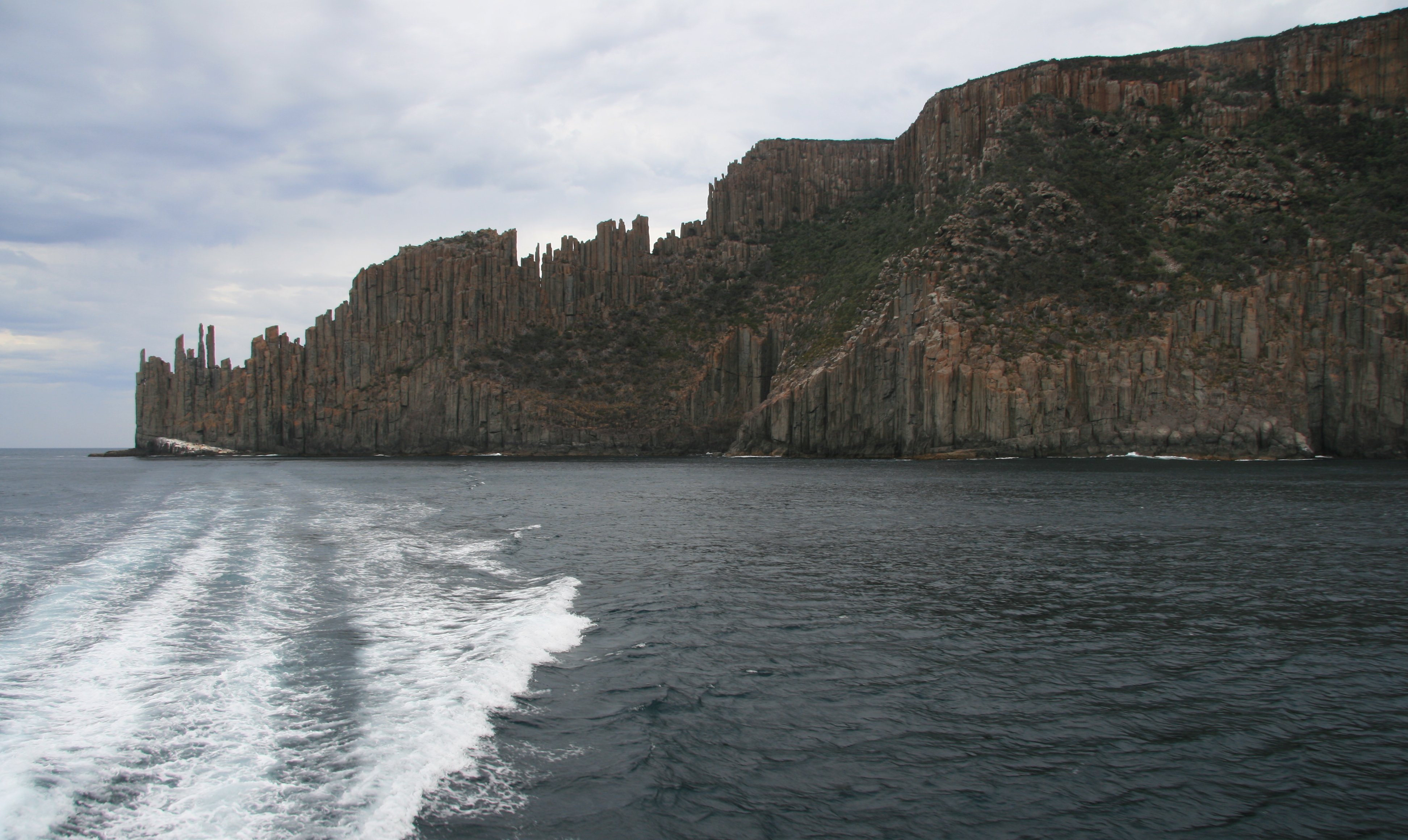 After 2+ hours on the boat we arrived at Port Authur. Port Arthur was established in the 1830s as a penal settlement. It remains a physical chronicle of a dramatic part of Australia's history. Its buildings and picturesque landscape offer visitors a challenging mix of both beauty and horror and have helped the site to become Tasmania's most popular tourist destination. 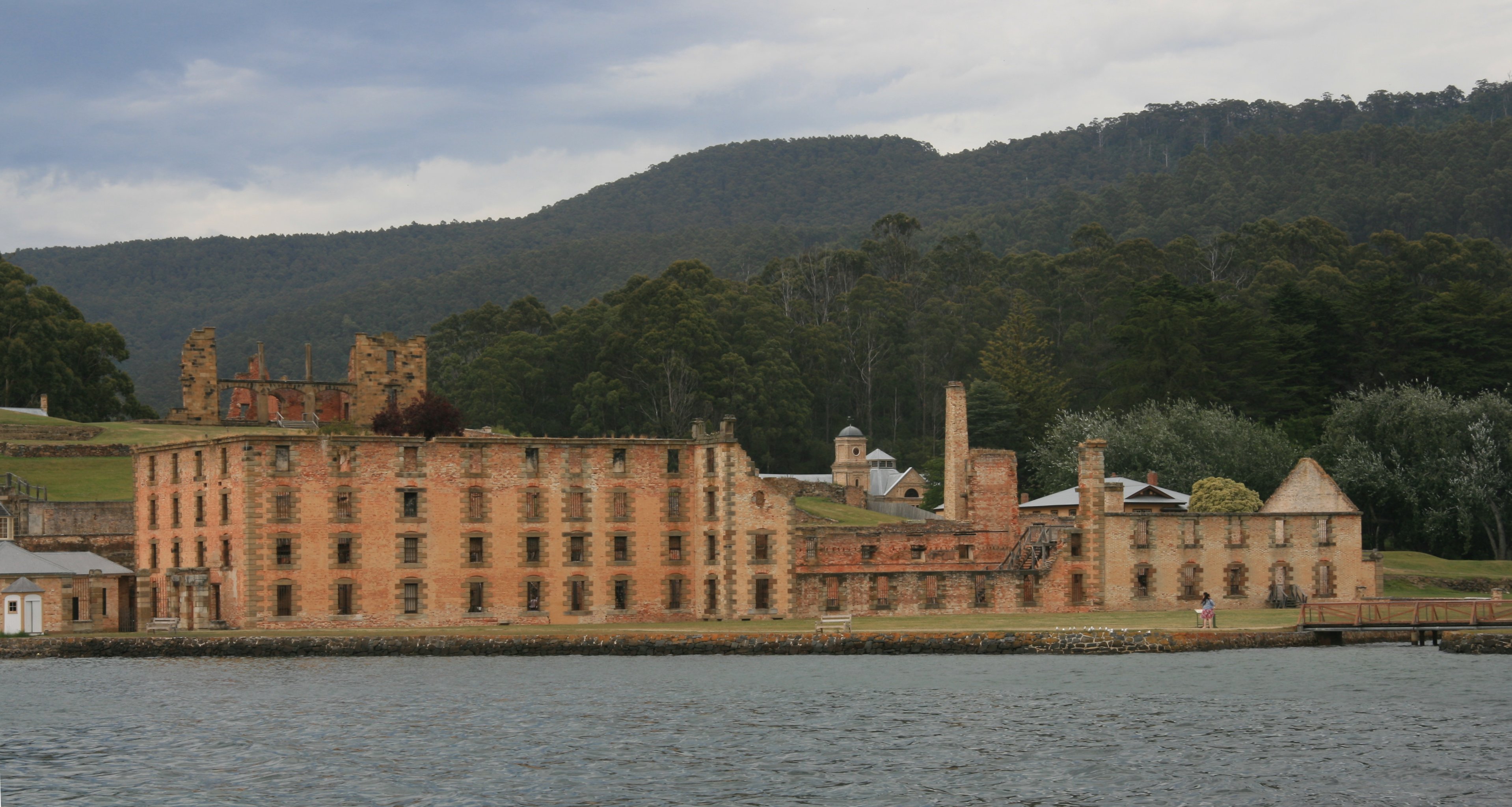 We had a little under four hours to explore the former penal colony. 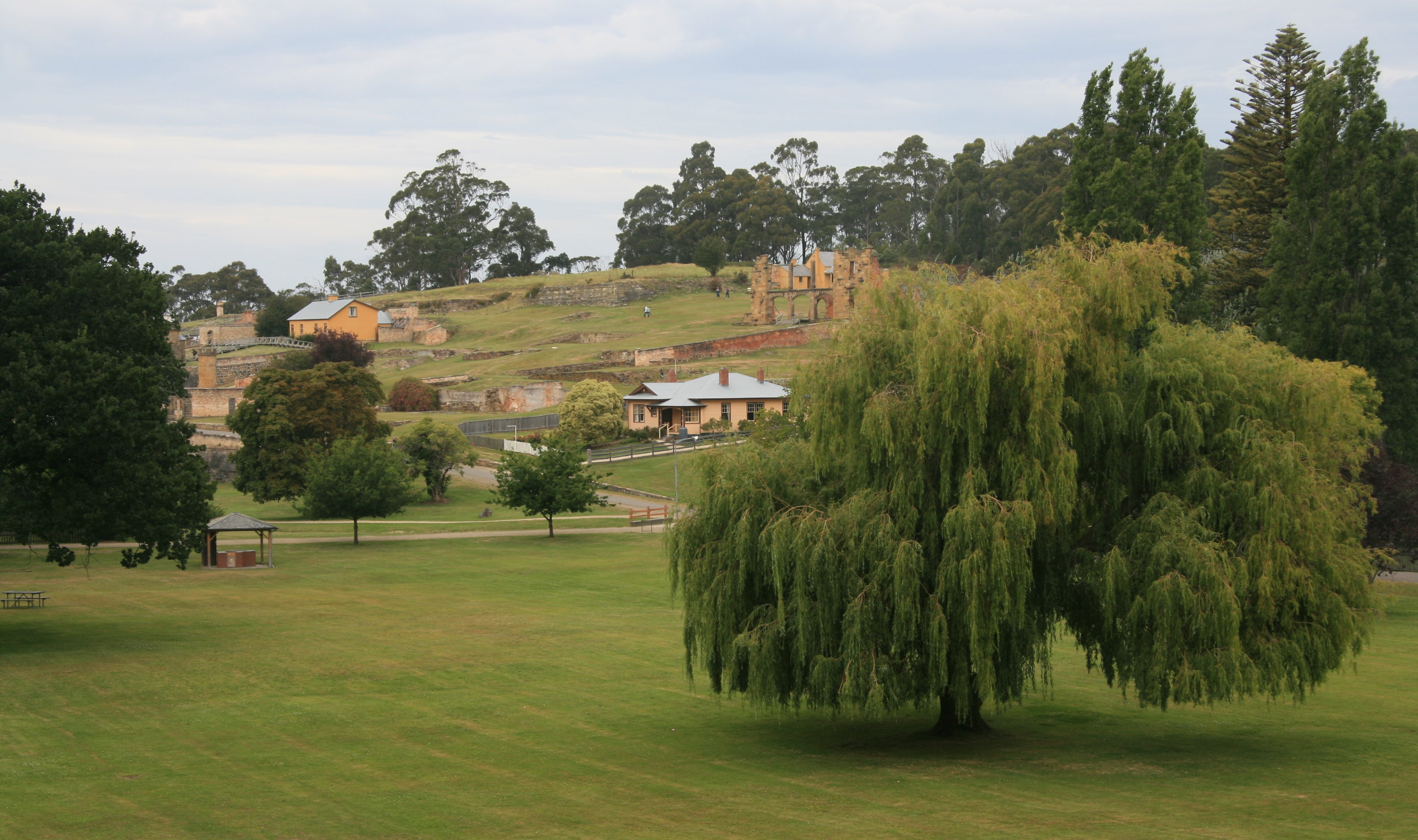 Below is the convict-built church. 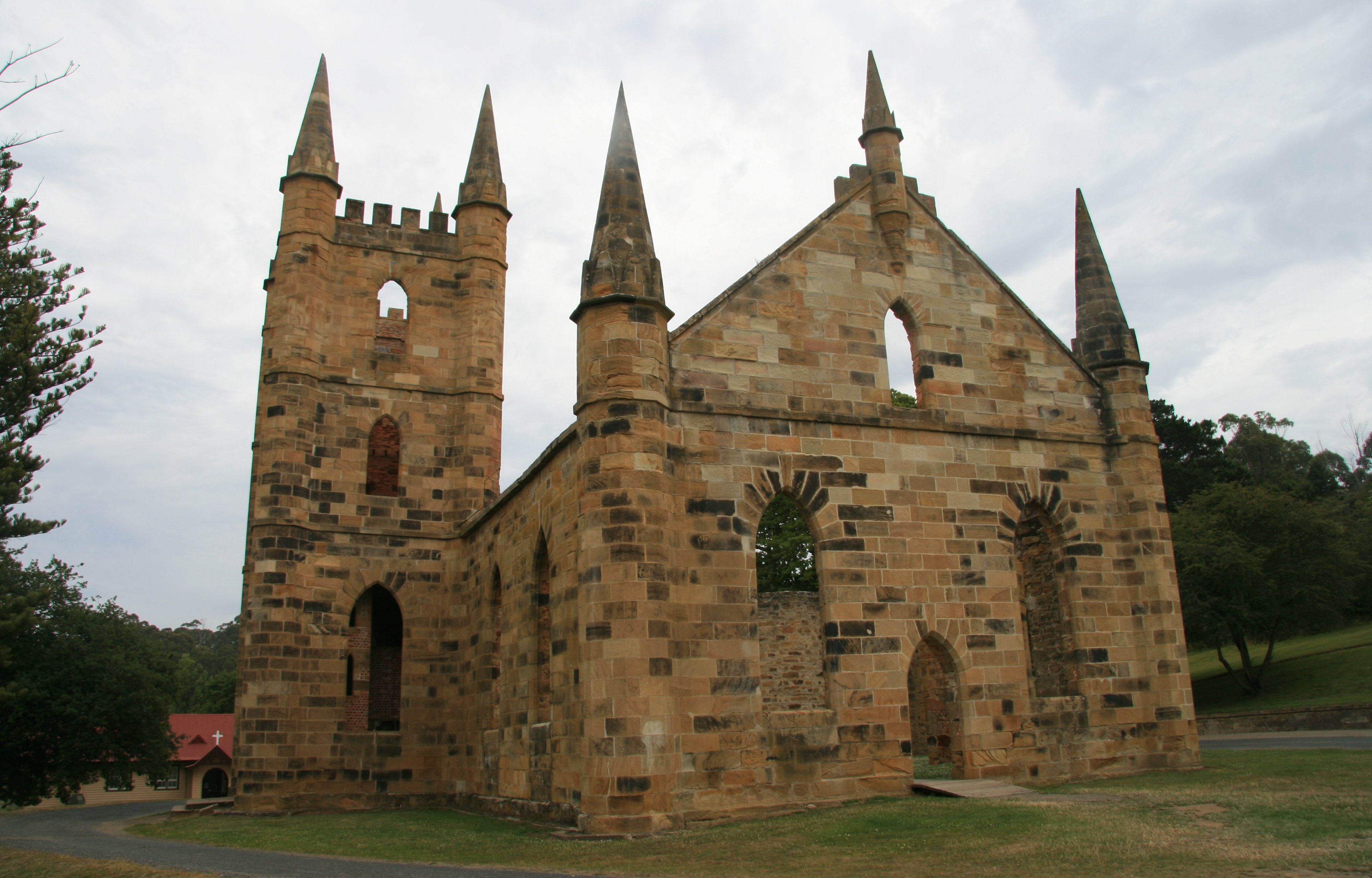 In April 1996 a young gunman fired bullets indiscriminately at the community, murdering 35 people and injuring 37 more. After burning down a guesthouse, he was finally captured and remains imprisoned north of Hobart. 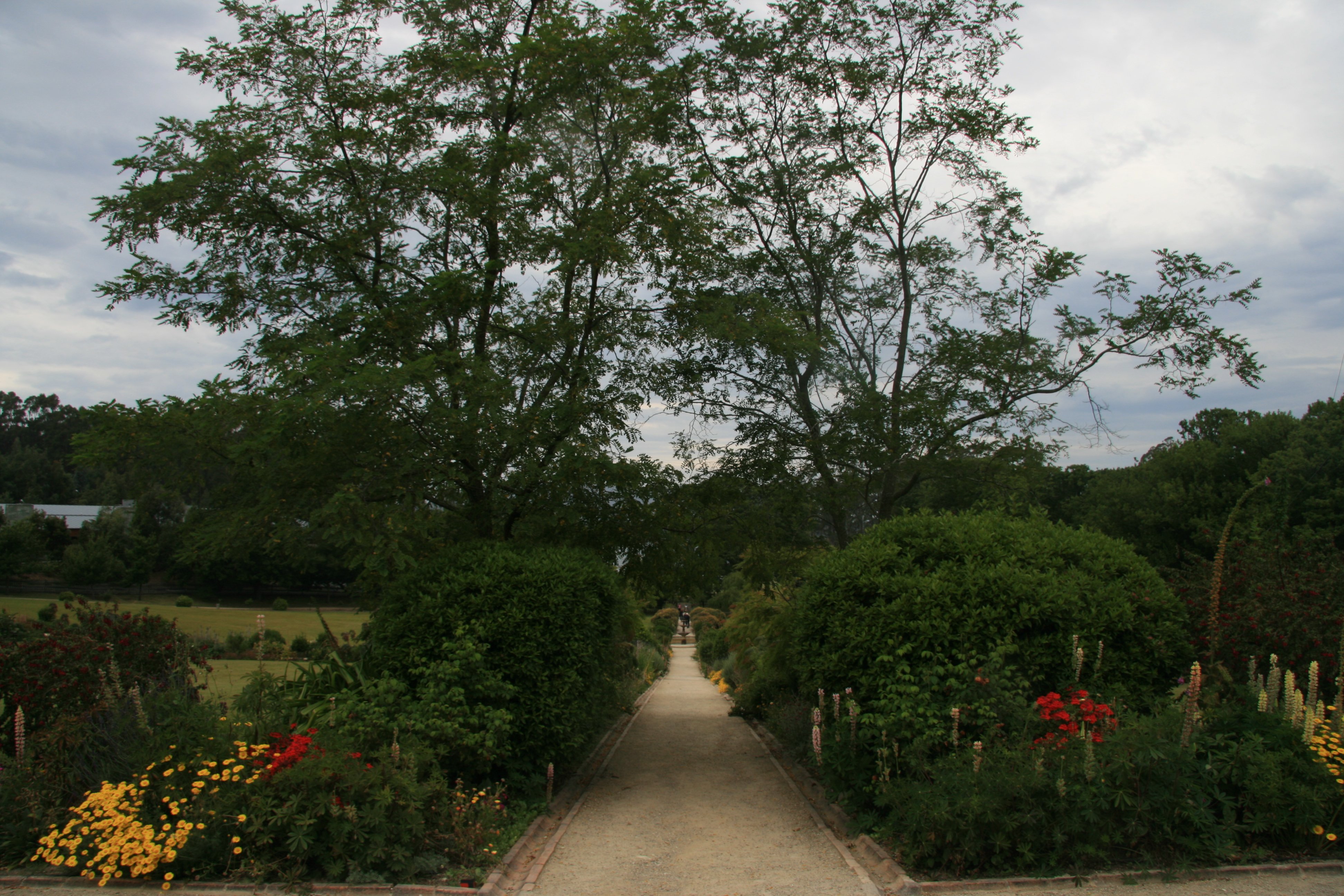 Despite its redemption as a major tourist site (the ruins here are undeniably amazing), Port Arthur remains a sombre place.  From 1833 until 1853, Port Arthur was the destination for the hardest of convicted British criminals. 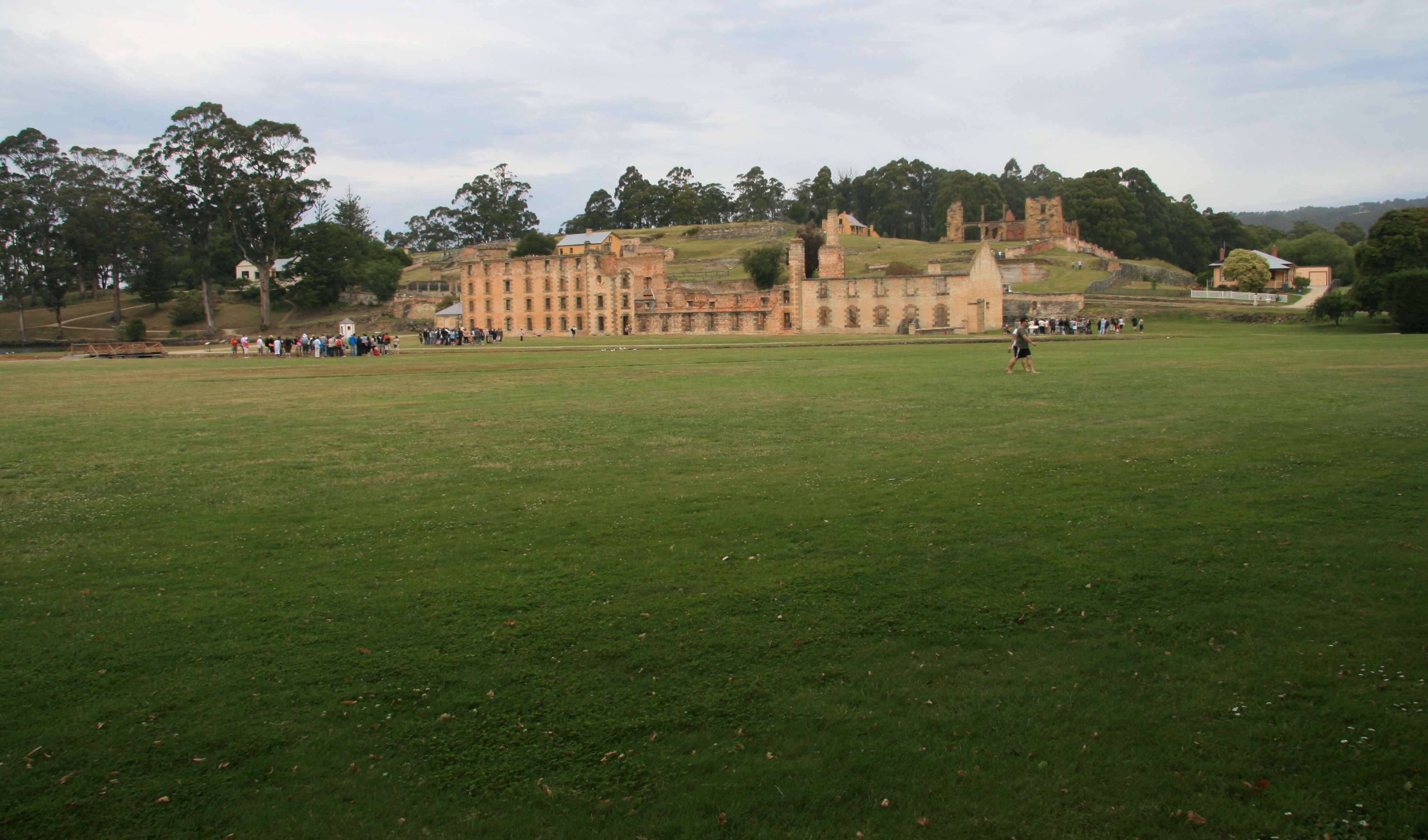 The Historic Site has over 30 buildings, ruins and restored period homes set in 40 hectares of landscaped grounds. 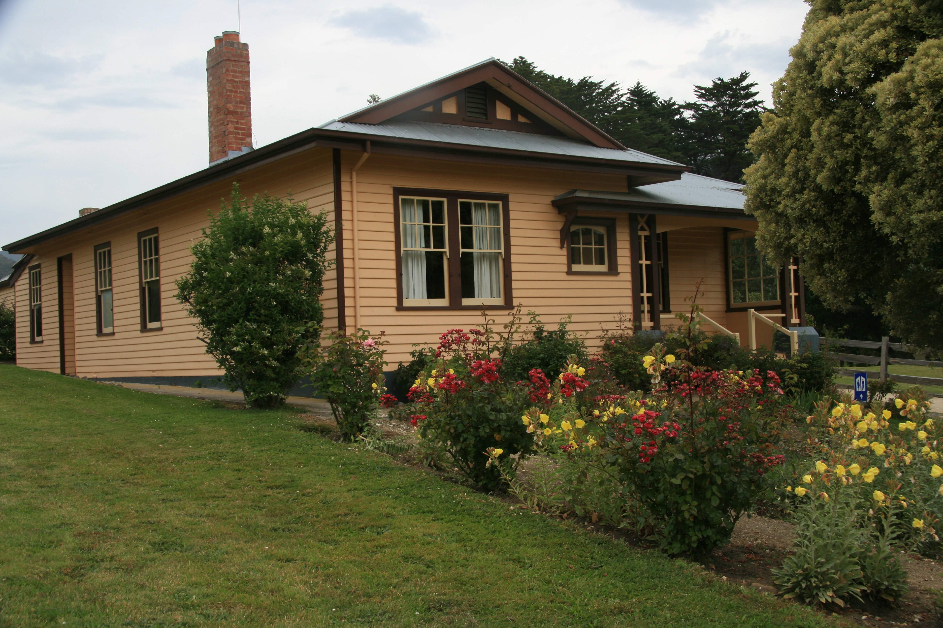 The Asylum (below) was the last major structure to be built on the Port Arthur site, being completed in 1868. 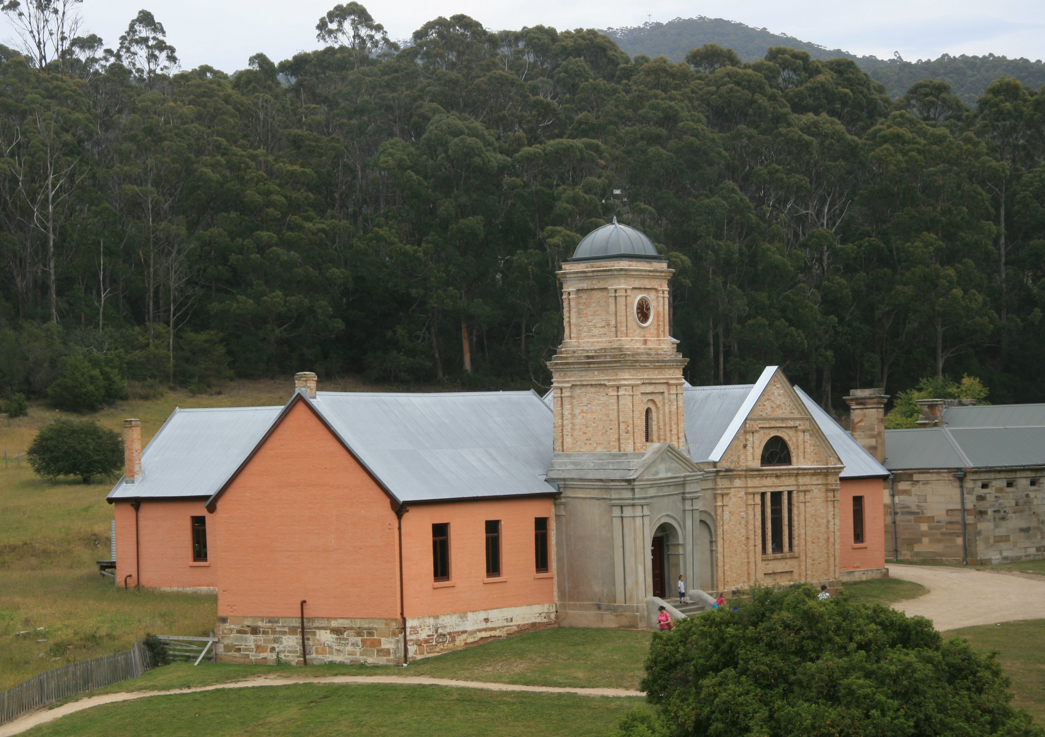 In 1830 Governor Arthur chose beautiful Port Arthur on the Tasman Peninsula as the ideal place to confine prisoners who had committed further crimes in the colony. It was a "natural penitentiary." The peninsula is connected to the mainland by Eaglehawk Neck, a strip of land less than 100m wide, where ferocious guard dogs and tales of shark-infested waters deterred escape. The prison closed in 1877. 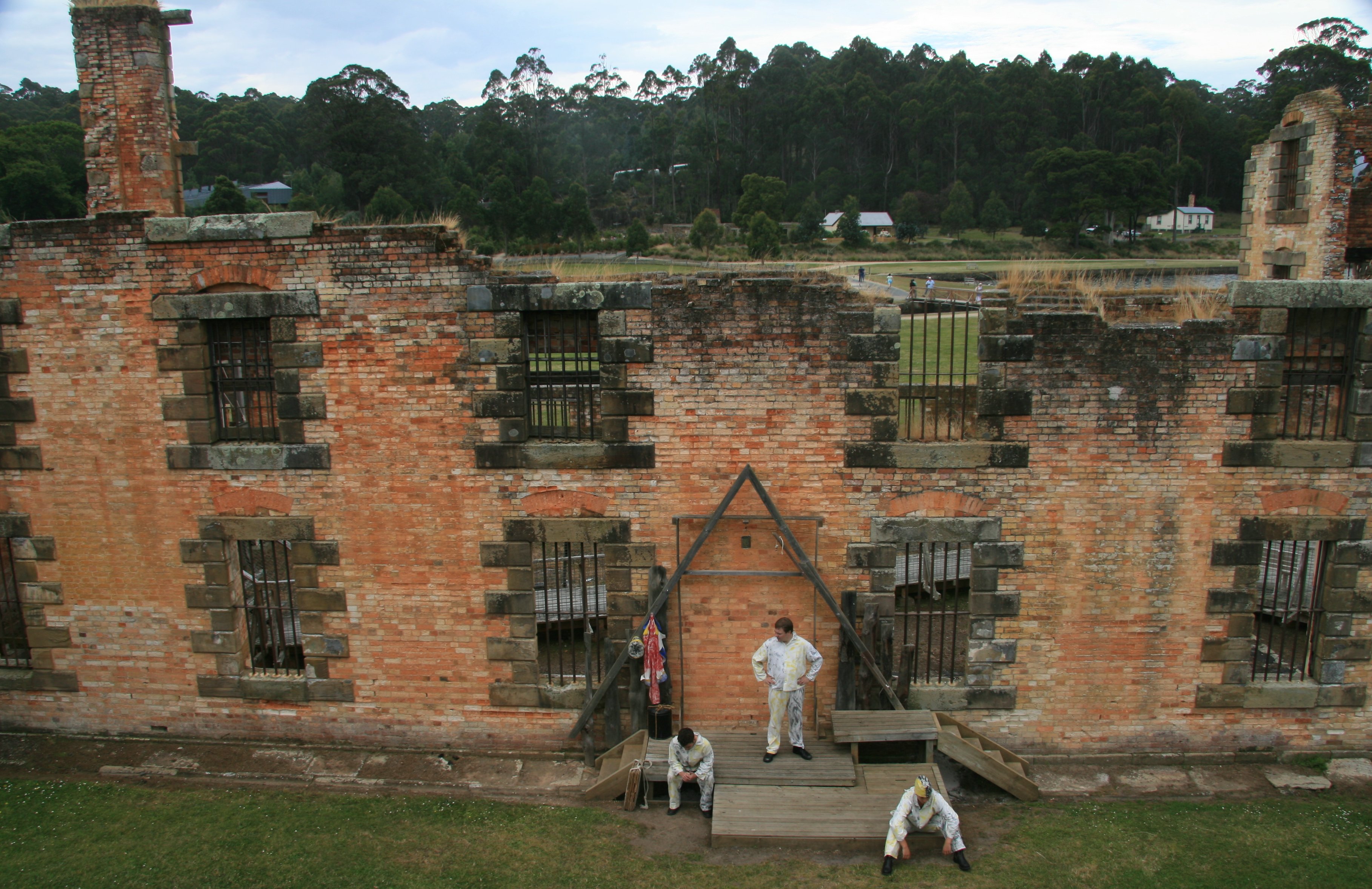 Many suggest that Port Arthur's use of psychological punishment, compounded with no hope of escape, made it one of the worst penal settlements. Some tales suggest that prisoners committed murder (an offence punishable by death) just to escape the desolation of life at the camp. 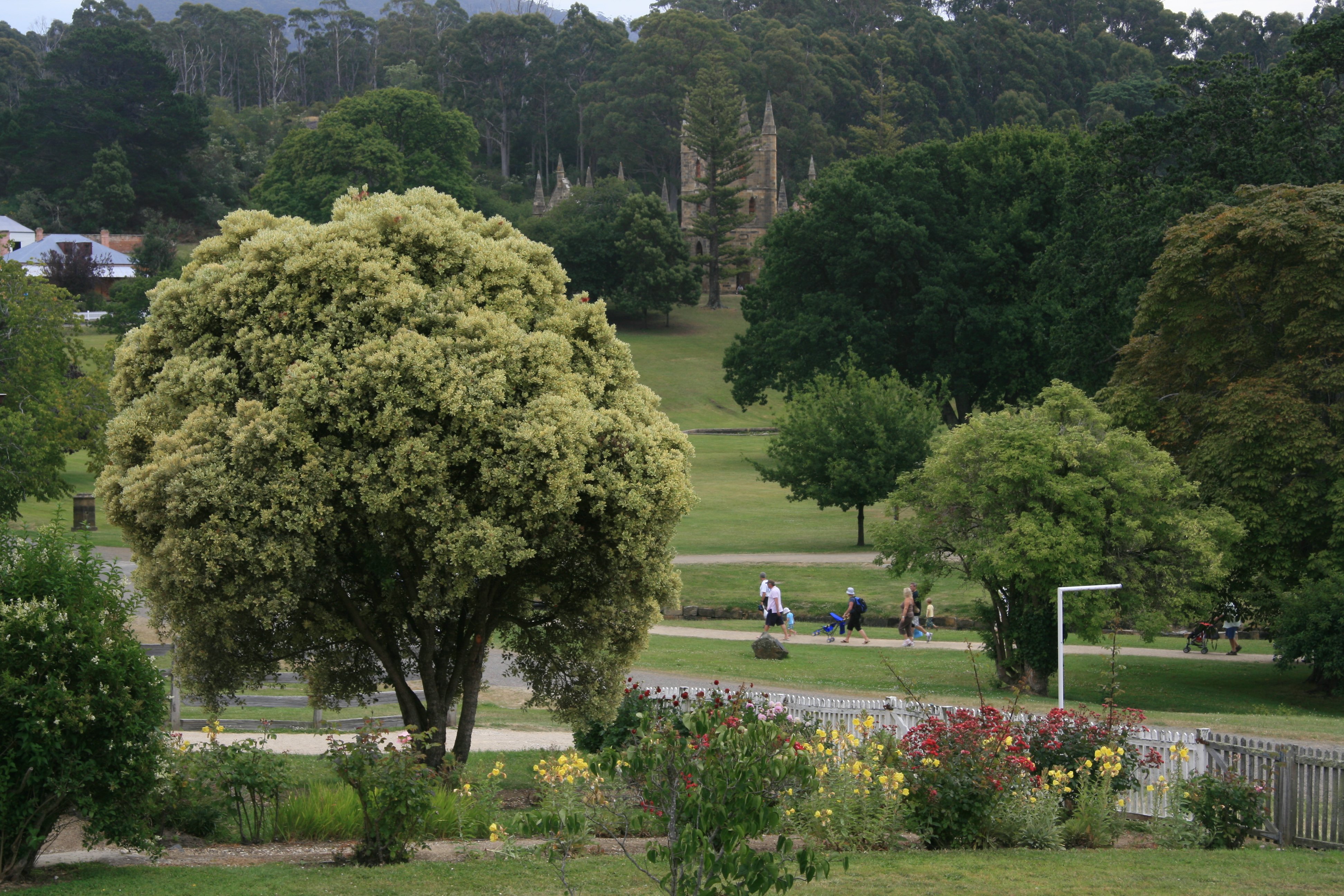 The Isle of the Dead was the destination for all who died inside the prison camps. I took a boat over to it. 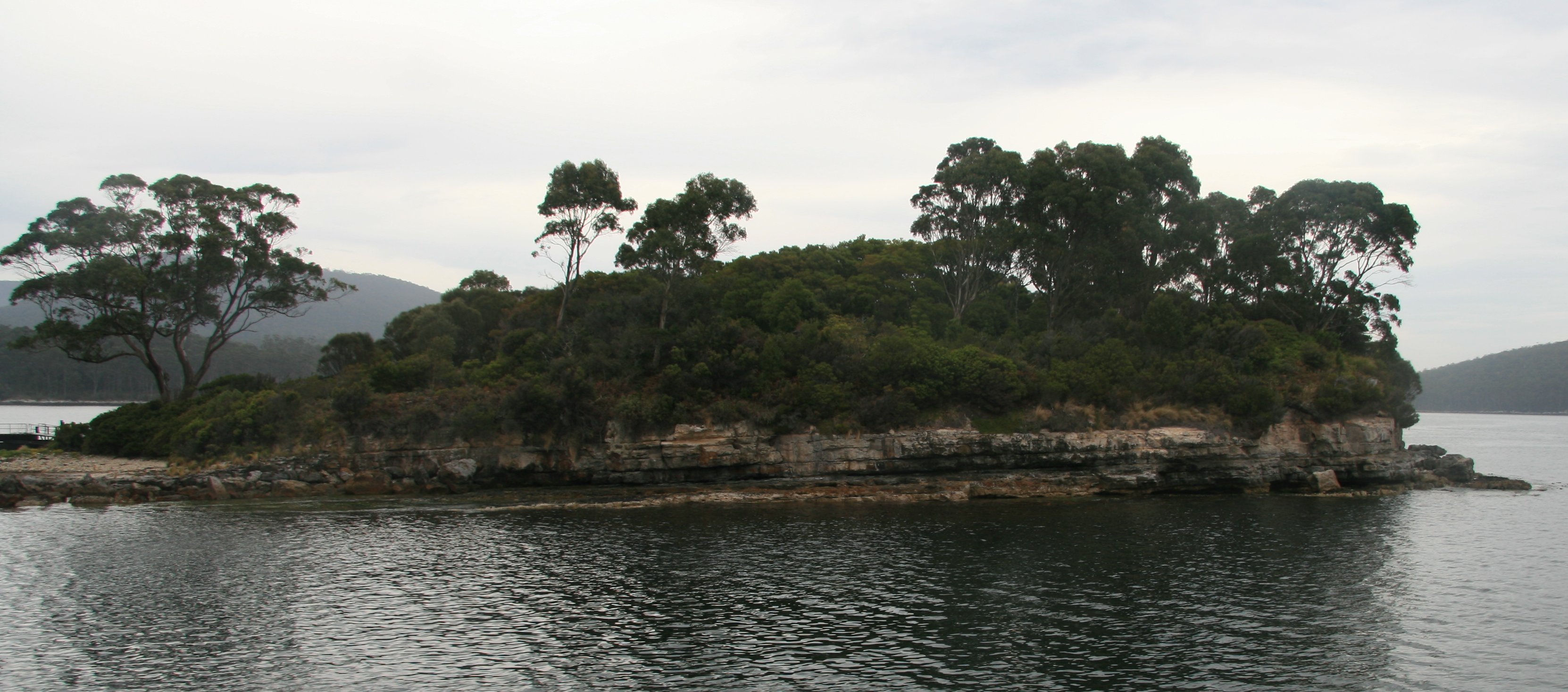 Of the 1646 graves recorded to exist here, only 180, those of prison staff and military personnel, are marked. 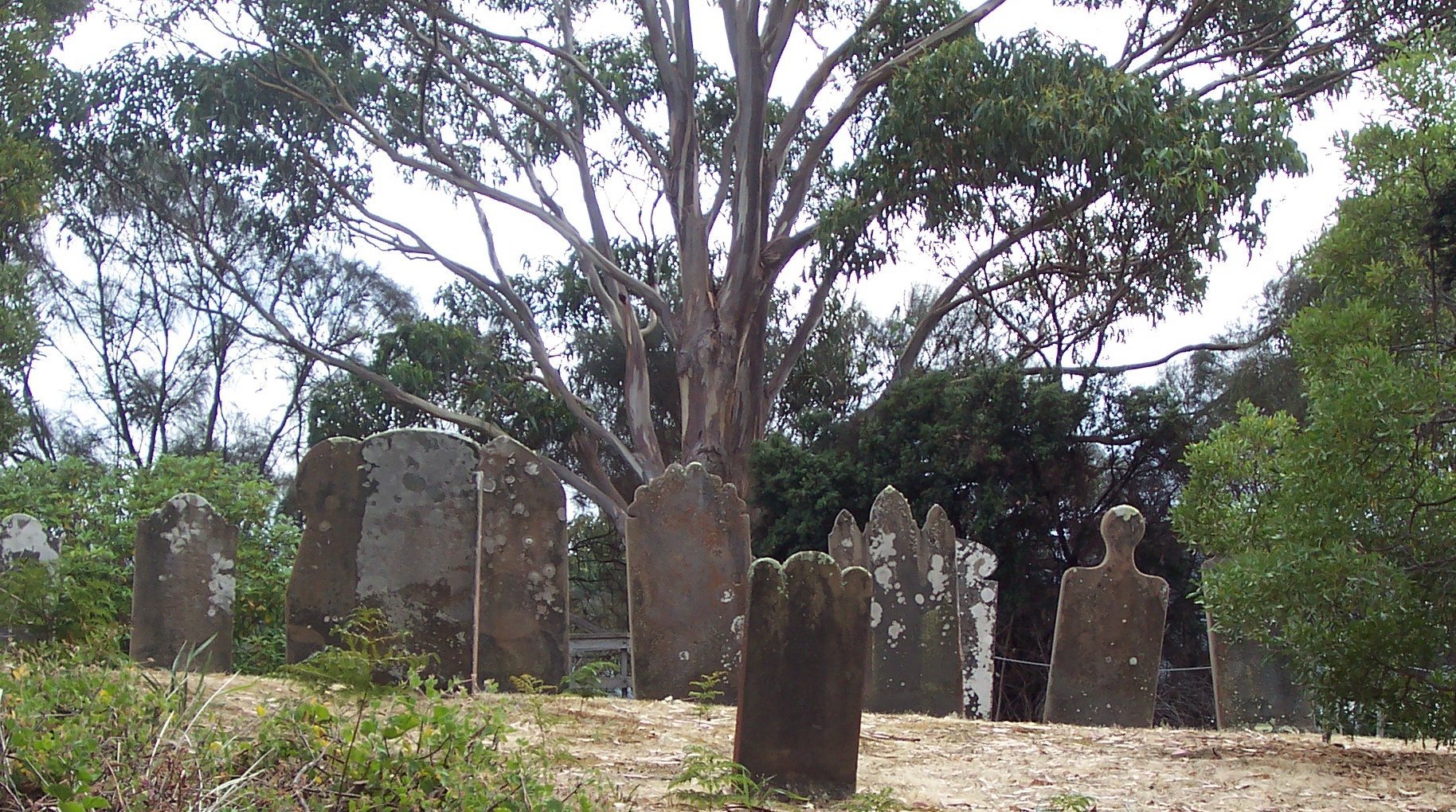 The home on the left in the picture below is the Commandant's House. 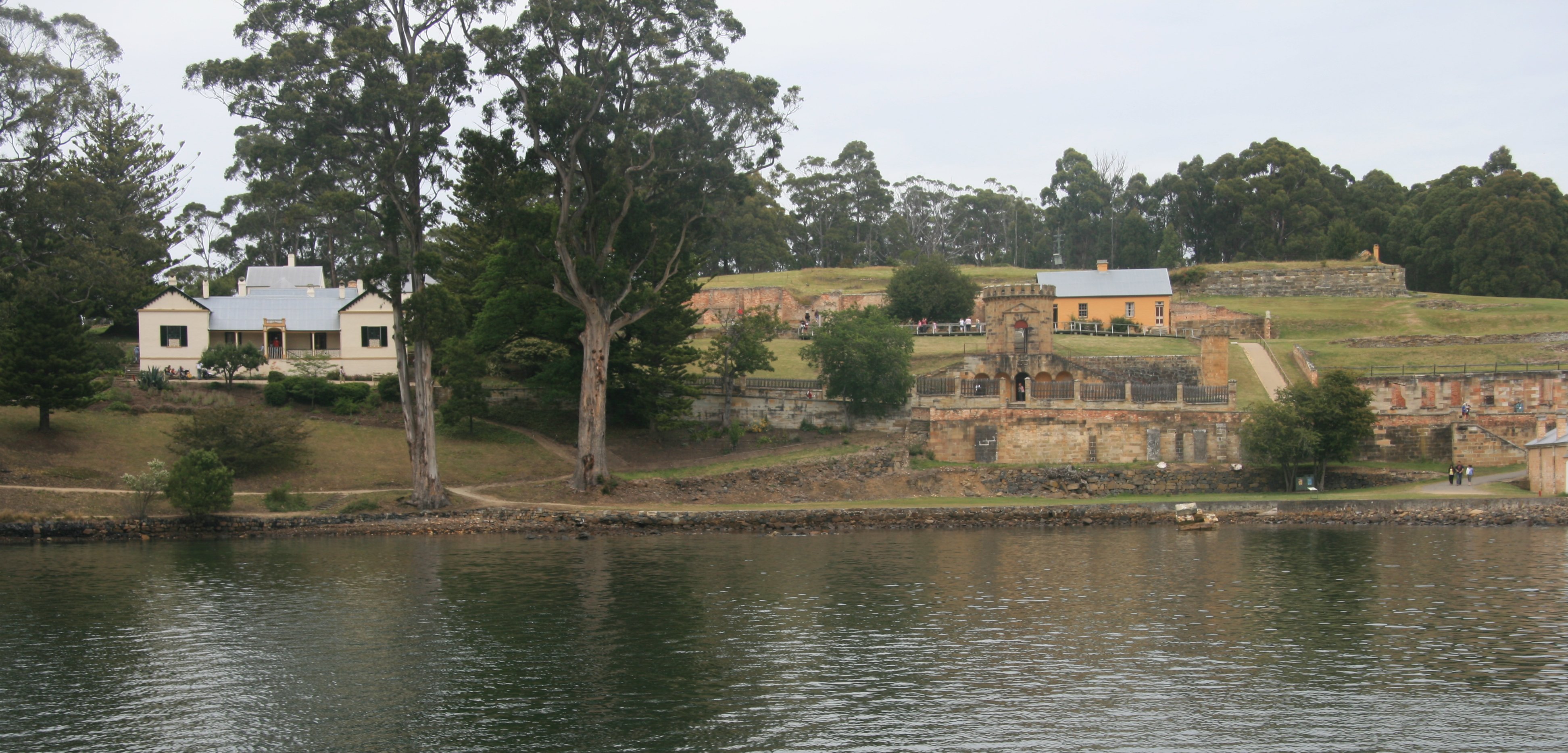 I enjoyed my visit to Port Arthur. The scenic cruise down the Tasman Peninsula was nicer than I expected. We returned to Hobart by bus. The weather is falling apart on me in Tasmania. It's been beautiful here for over a week, but when I get here the rains move in. Today wasn't too bad, no rain until I got back to the hotel late this afternoon. But the sun sure didn't show itself much and the forecast for the weekend is not looking good. I just got a call canceling the air tour I had booked for tomorrow. I rescheduled it for Tuesday my last day in Tas. I need to figure out how to entertain myself all weekend because everything I planned to do here is weather dependent. I'm washing clothes at the moment as I ran out of clean clothes. If you don't get an email from me for a couple of days it's probably because I didn't do anything because of the weather. I hope there are some good movies playing. Only 750,000 people live in the entire state of Tasmania. It's about the size of the state of West Virginia. Have a nice weekend, Tim |
SATURDAY, JANUARY 6, 2007:
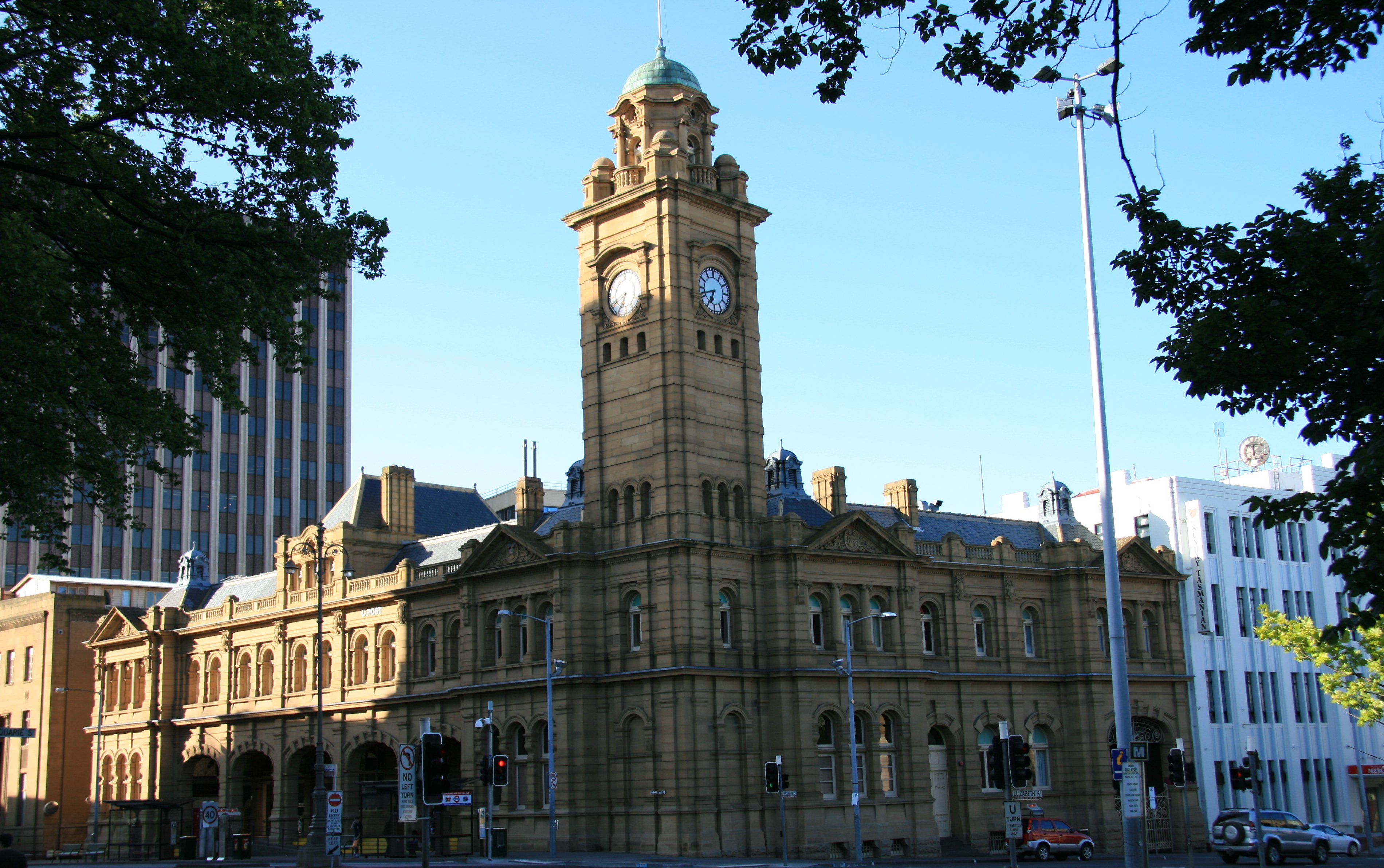
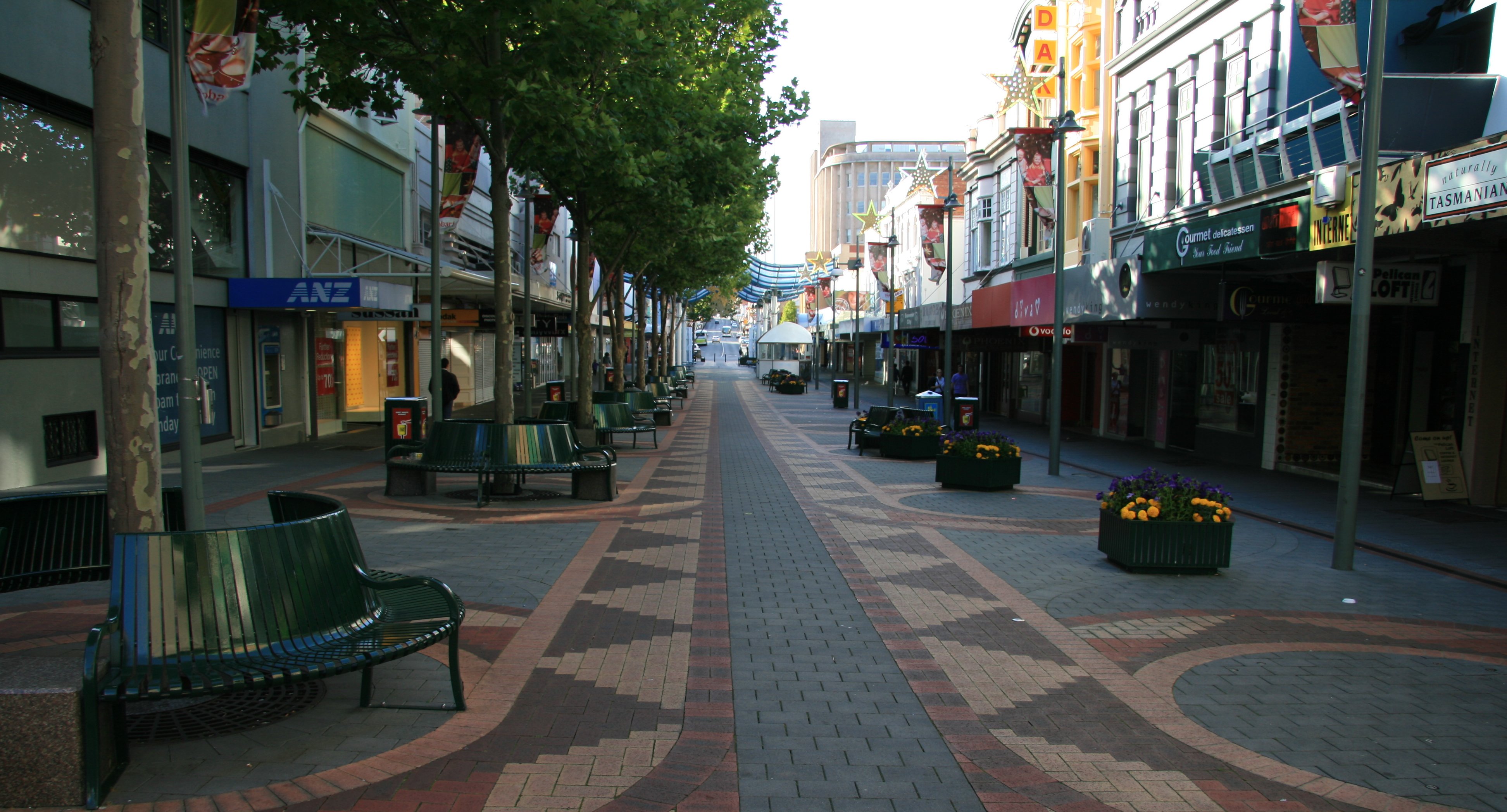
I spent all day Saturday in downtown Hobart as it rained all day.
|
Hello, As expected it rained all day today. It was kind of nice to take a day off from the sightseeing. This is the first day since Christmas that I haven't been dashing off somewhere by either jet, plane, boat or train. There is a movie theater within walking distance of my hotel. All the stores, restaurants and, etc., are located in downtown Hobart which is only a few blocks away from my hotel here on the wharf. Below is a picture of downtown Hobart. I saw two movies, both before 6:00pm, and got some popcorn. What do you think that cost? If you said $50.25 you are a winner! That will translate to about $40 in US money. But as you can see things are a bit pricey here. I saw the movies The Queen and Casino Royale. They seem to get things a little late down here. The movies released for Christmas back home were in the coming attractions down here. The picture below is also in downtown Hobart, it is the General Post Office. Weather looks a little better for tomorrow, only 20% chance of rain and then good for Monday and Tuesday. So hoping blue skies will return soon. More later, Tim |
SUNDAY, JANUARY 7, 2007:
I drove 115 miles today traveling roundtrip from Hobart.
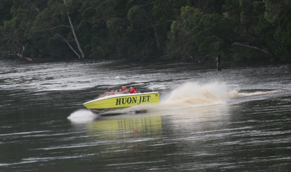
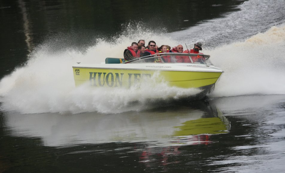
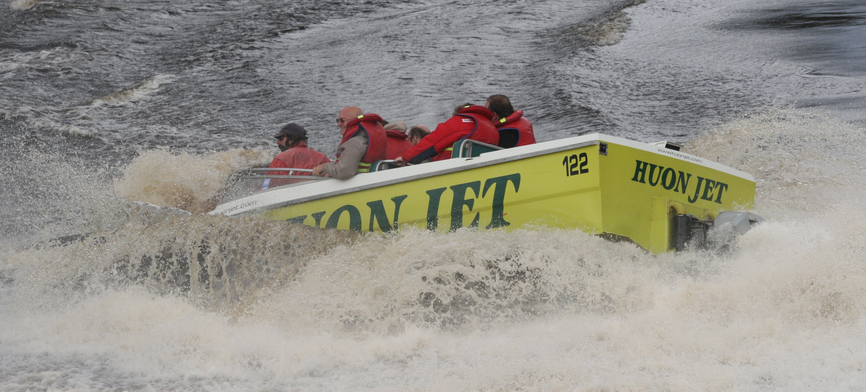
Sunday I drove south of Hobart into the Huon Valley. My first stop was Huon Jet.
The pictures below were taken by the Huon Jet staff of our actual trip.
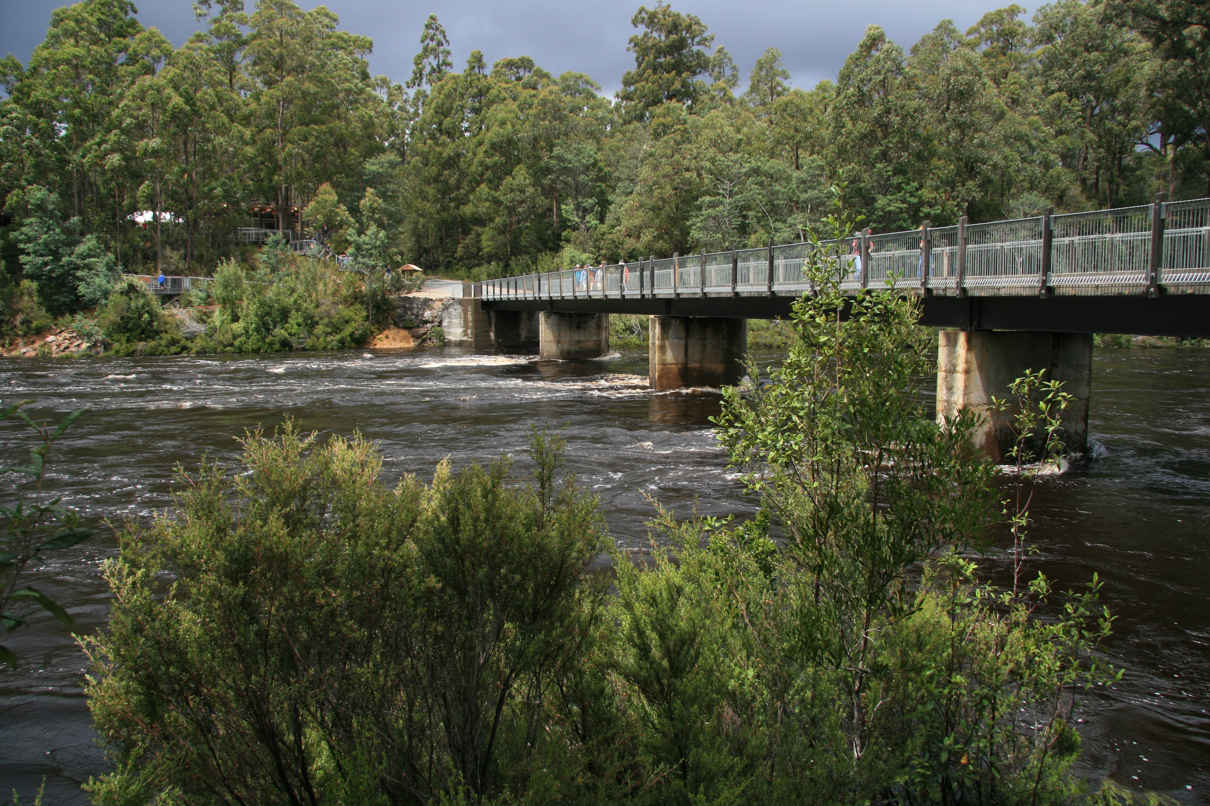
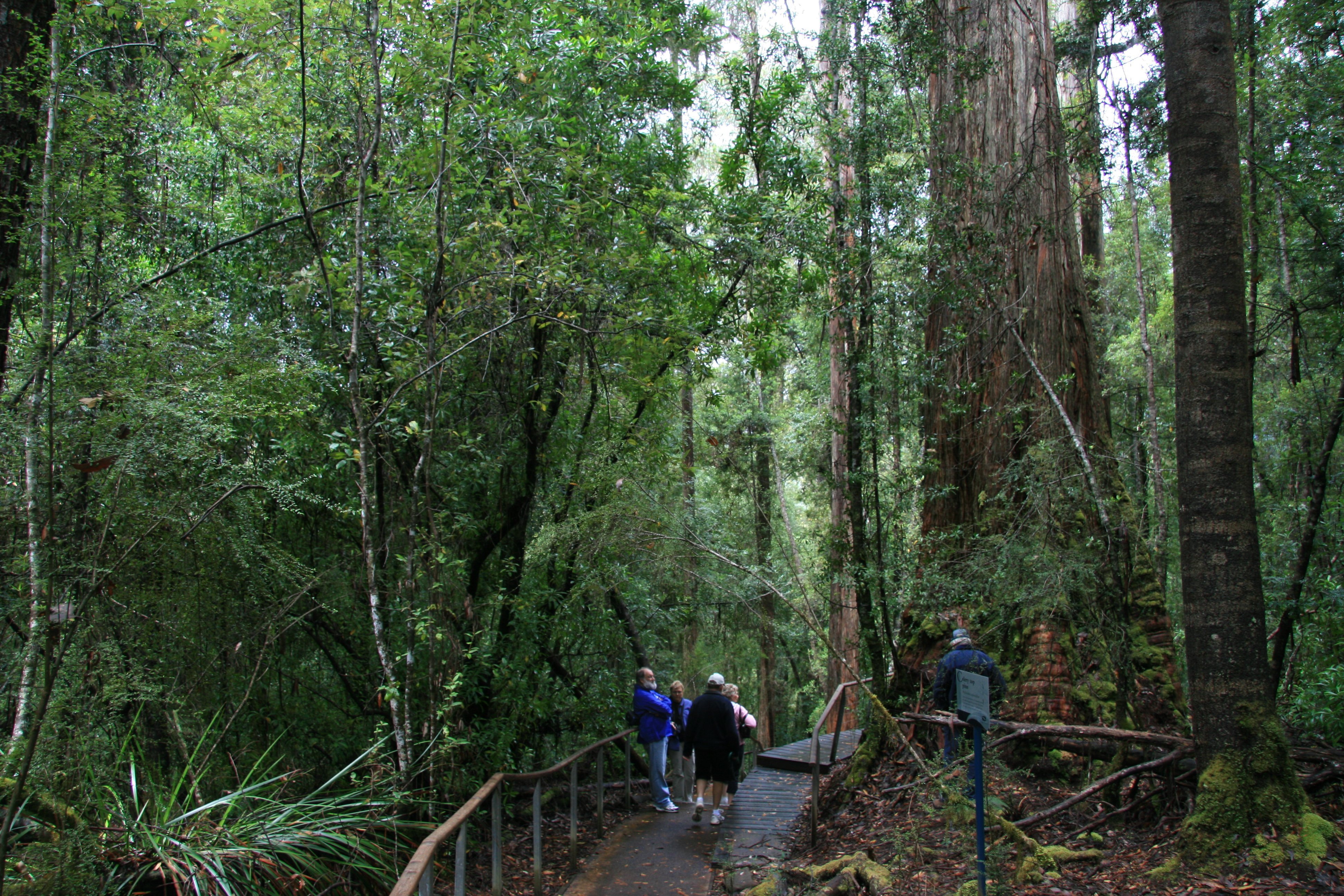
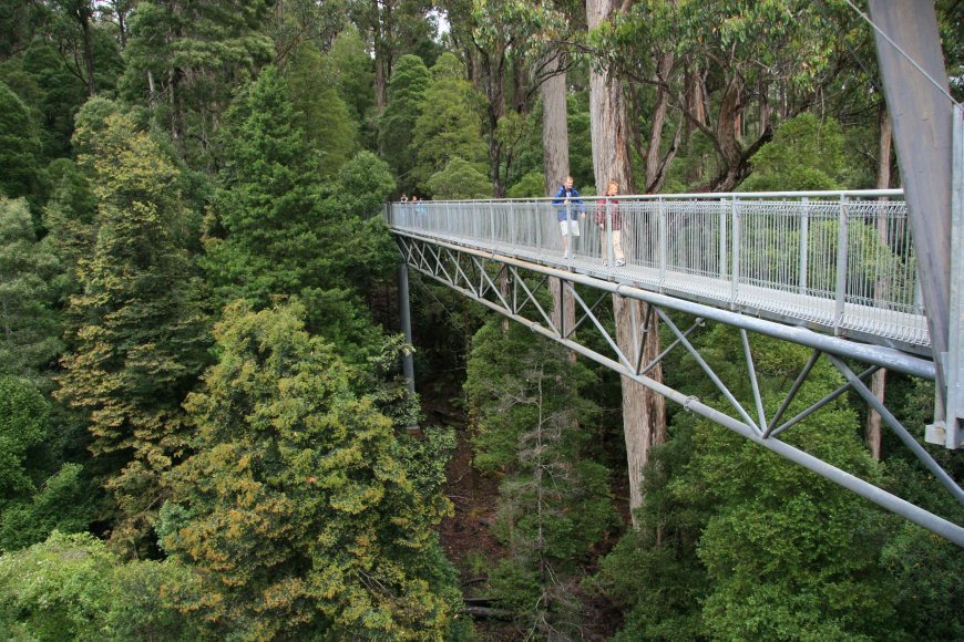
I drove further south from Huonville to the Tahune Forest Reserve and Airwalk.
8 minute movie filmed in the Huon Valley including the Tahune Forest Reserve and Airwalk. |
|
Hello Everyone: It rained all day yesterday so I spent most of the day at the movies. Today the weather was a little better although it is raining again right now. Today I drove down to Huonville where I took a jet boat ride down the Huon River.  The next two pictures were taken by the jetboat staff of our actual trip. 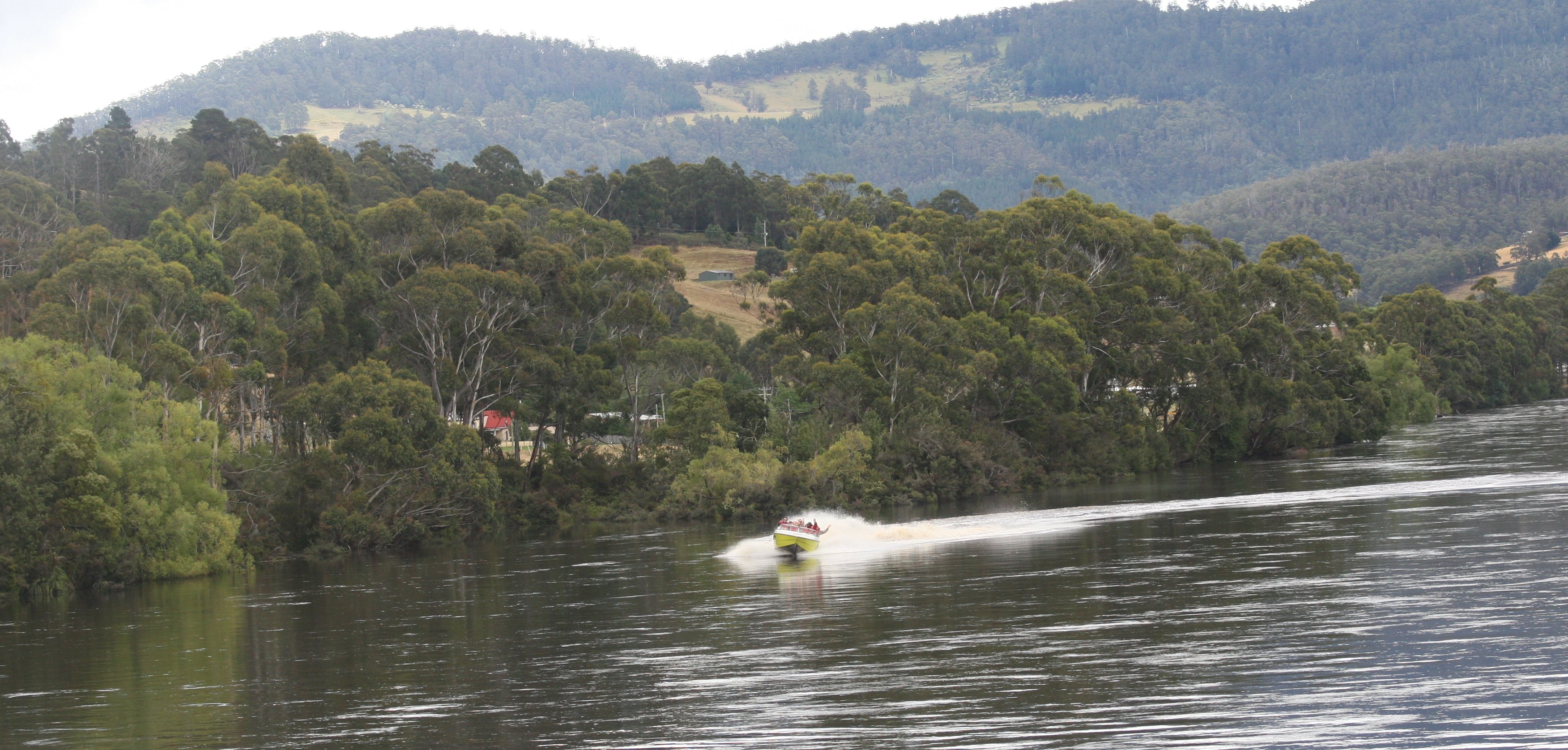 The pilot of the boat was a very colorful character. It was a scenic trip full of the 360 degree spins you expect on a jet boat. You can see my bald head in the center of the picture below. From Huonville I drove further south. The picture below was taken in Port Huon. 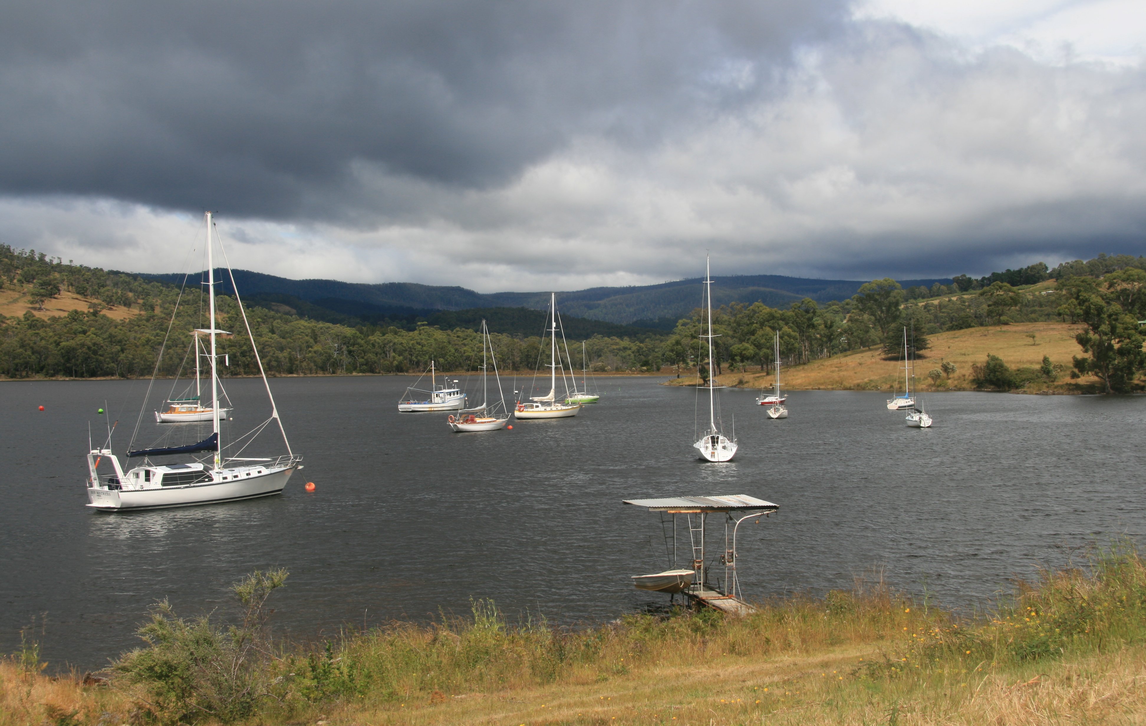 Next I visited the Tahune Airwalk. This was also along the Huon River in the middle of the forest. Very scenic and the scent of the Huon Pines was very strong. The walk is built 40 meters in the air along the river and through the forest. 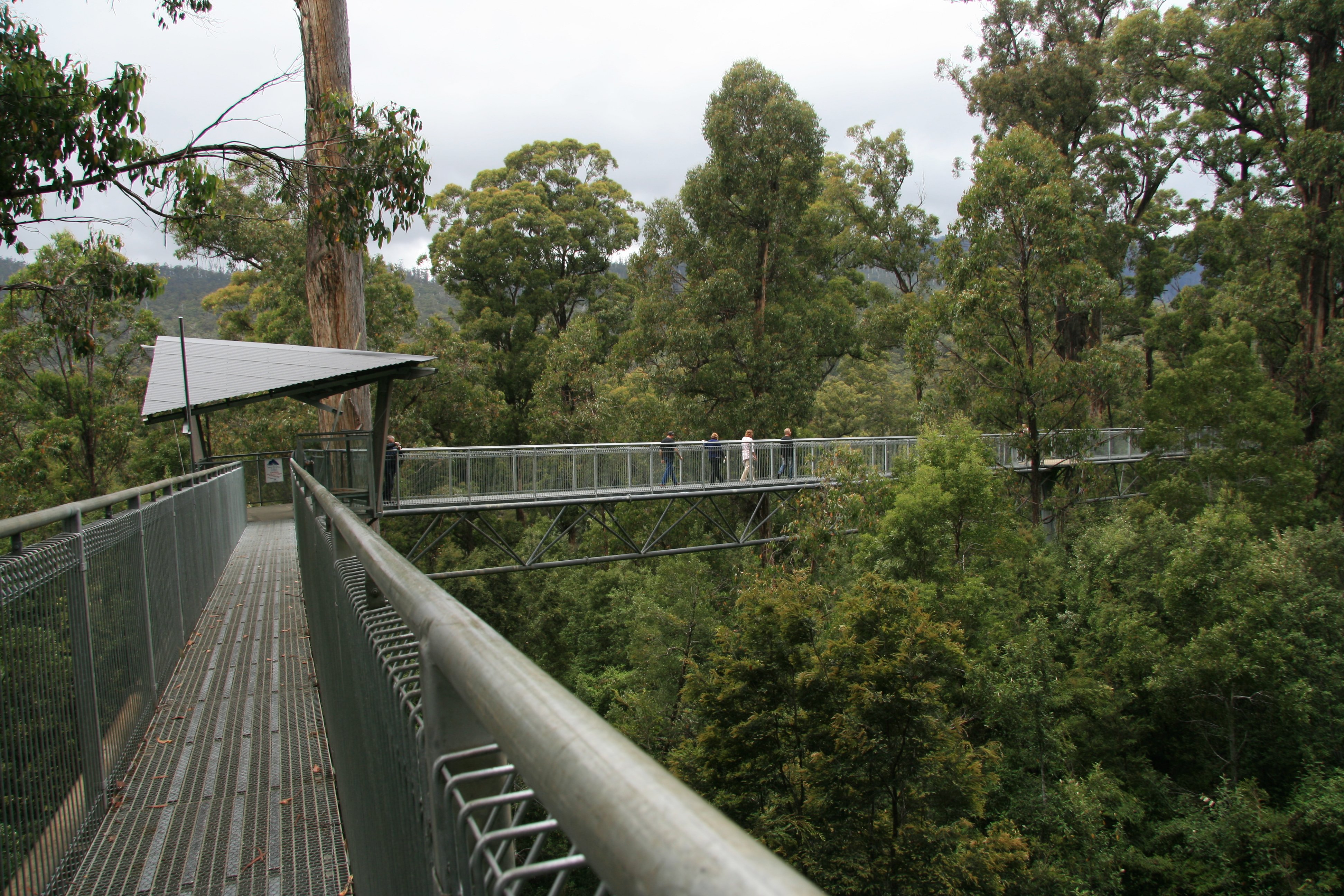 It was a nice visit. 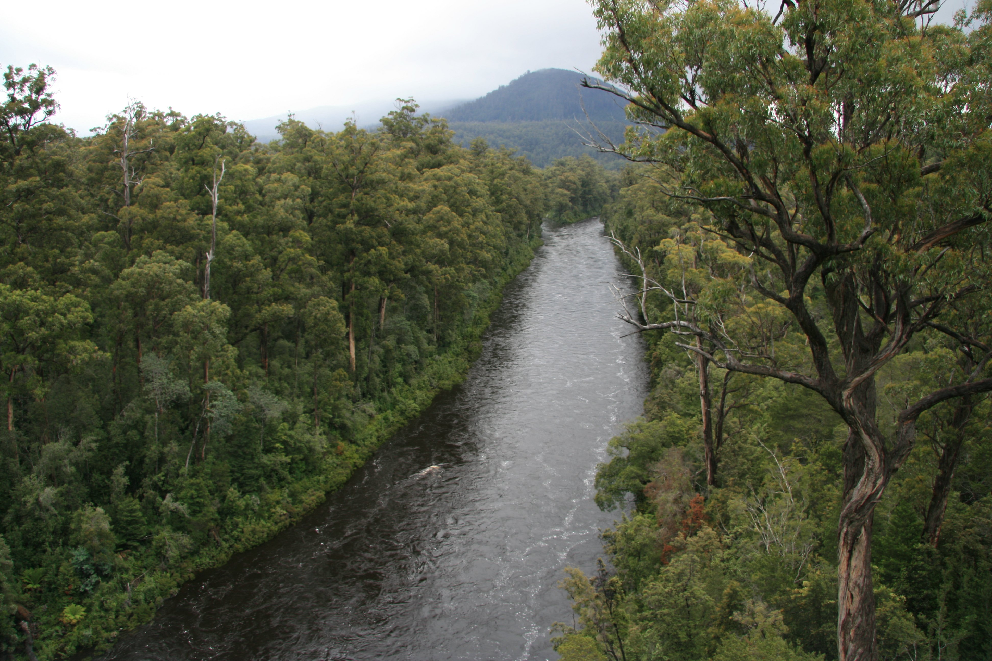 I drove back to Hobart after the airwalk. I'm starting to get used to driving on the left side of the road. I'm driving the car in the picture below. 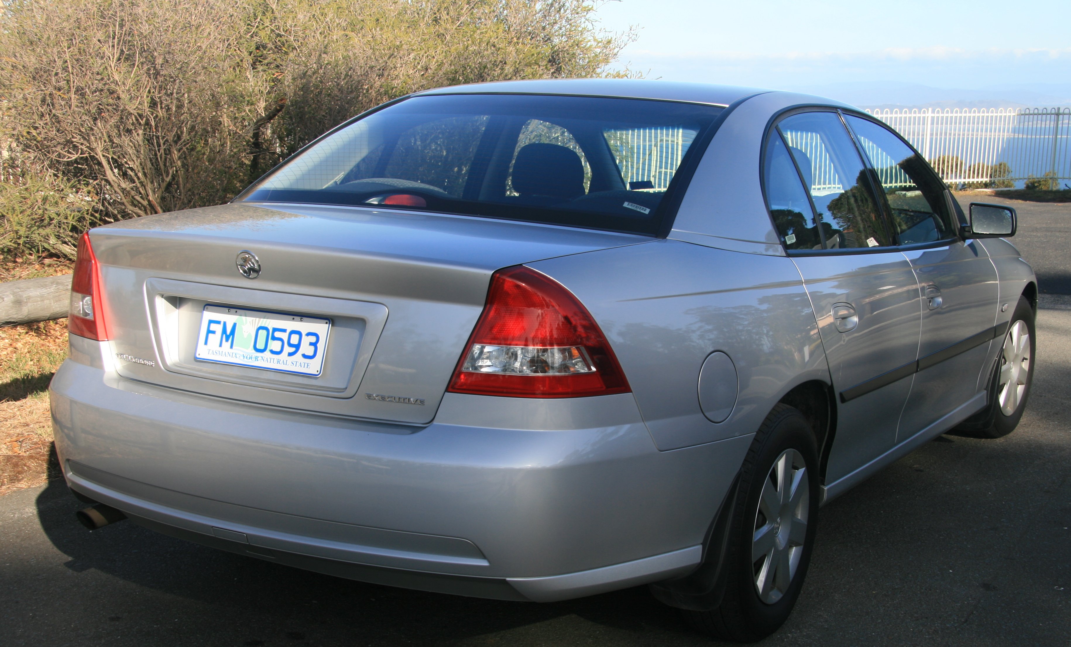 I have an all day boat excursion scheduled for tomorrow down to Bruny Island. More later, Tim |
MONDAY, JANUARY 8, 2007:
I traveled 96 miles roundtrip today on my excursion to Bruny Island.
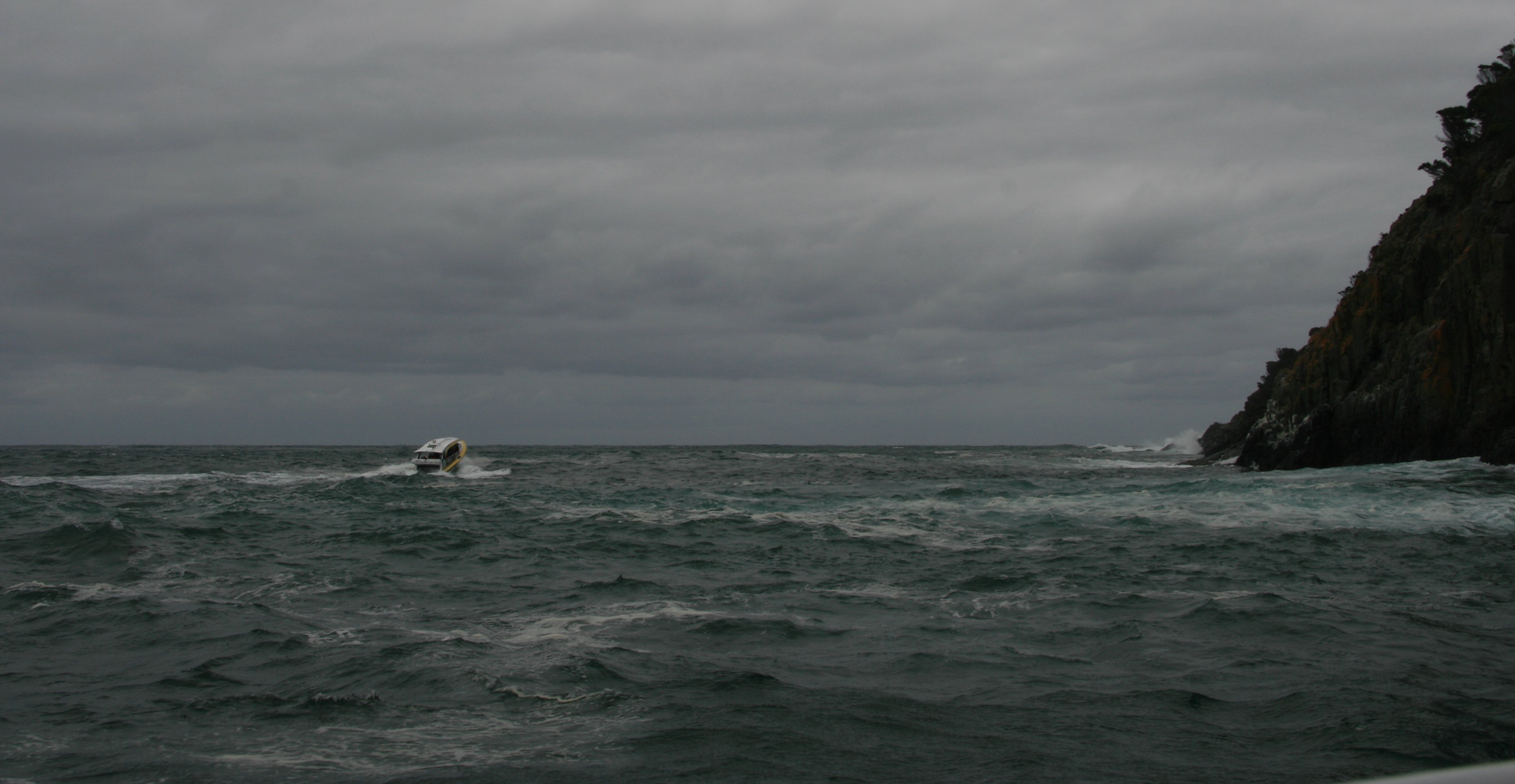
Monday's trip to Bruny Island was a bit of a disappointment.
I elected to take the tour bus down to the island. That was a mistake.
The bus was slow, making the trip down and back way longer than it needed to be.
During the cruise the sea was so rough you couldn't even steady your camera to take a picture.
Plus it was bitter cold.
The rough sea was kind of fun making it a bit of an adventure, but it also cut the trip way short.
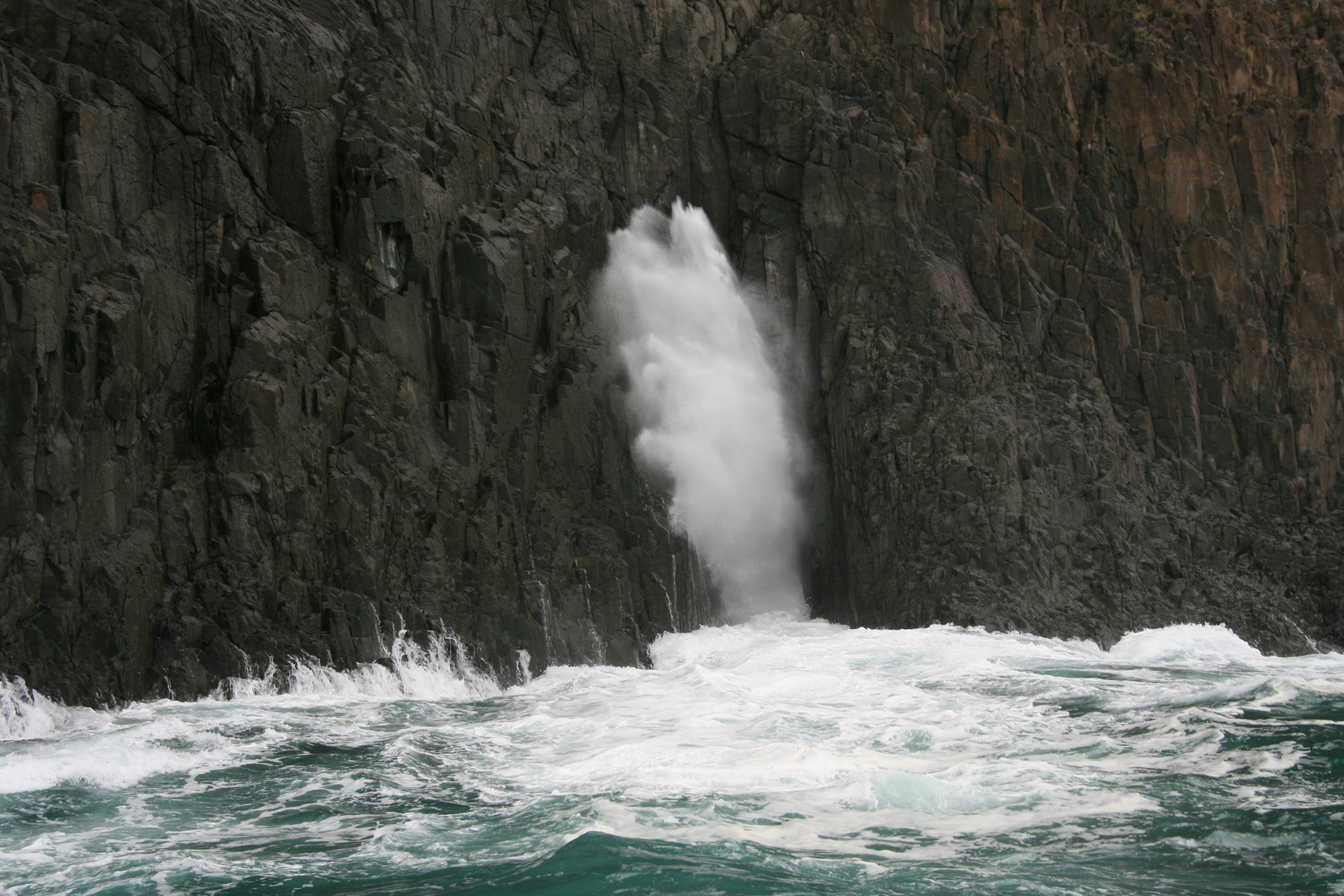
The rough sea did create a nice blow hole which you can see in the center picture below.
7 minute video of my boat trip along the coast of Bruny Island, Tasmania. |
|
Hello, Today was an interesting day. I have not decided yet if it was good or bad. Had a Bruny Island boat trip scheduled for today. Weather was still pretty ugly this morning as I met the bus that took us down to Bruny Island. It took two and a half hours to get down there. Had to travel 40 kilometers south of Hobart where we had to wait for a ferry to get us over to the island. After getting to the island it was another 40 kilometers to Adventure Bay on only partially paved roads. The picture below is Adventure Bay. 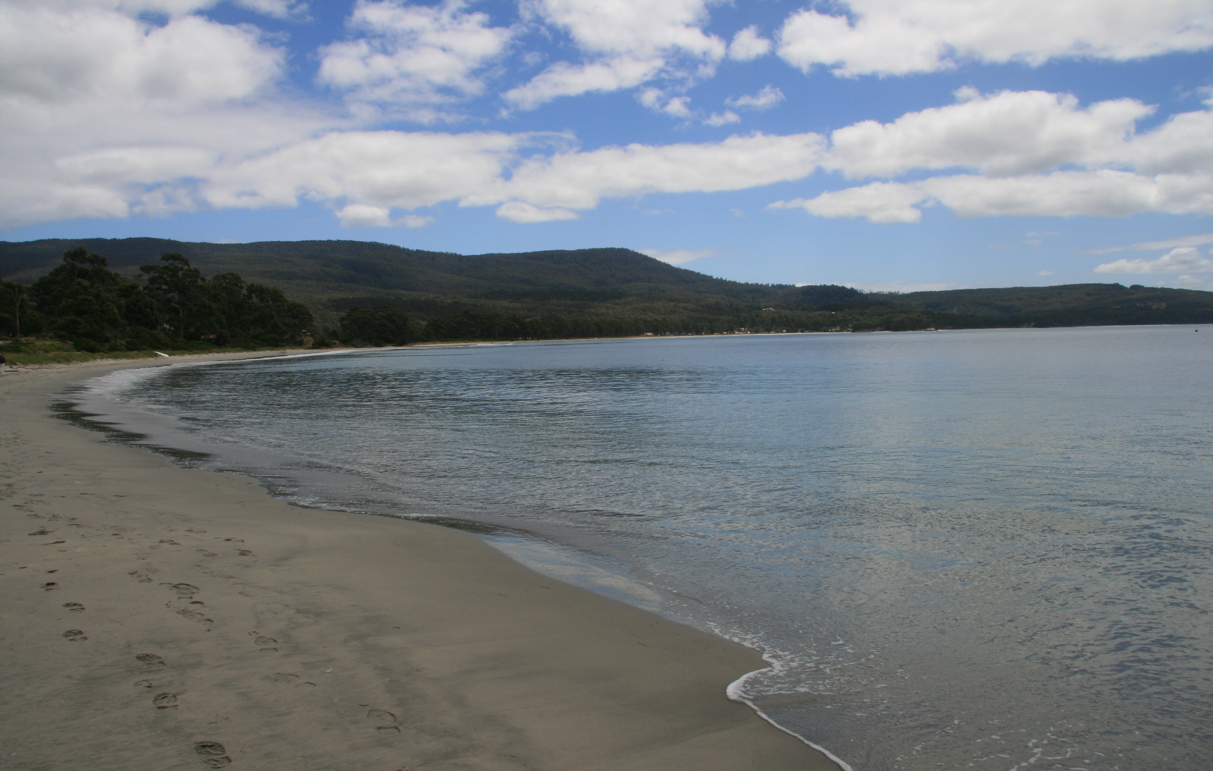 The sea was so rough. There were swells well over 10 feet high. And it was so cold. It was like riding a roller coaster. Looking at the picture below it was before the sea got really rough but even here you can see how the boat ahead is pointing in the air and the waves crashing into the coast ahead. There was a blowhole that was really awesome. But it was so rough it was hard to frame a picture. The sea cliffs, what we saw of them were beautiful. After about a half hour of bouncing from wave to wave he turned out to sea to get away from the rough current along the coast and we didn't get to see a lot of the sea cliffs which was the reason I came. It wasn't the rough sea that bothered me, that was actually fun. But it was so cold. I don't think I have ever been that cold. Wind blowing a hundred miles an hour and salt water constantly splashing in your face. I guess I don't have to worry about ever getting sea sick, if this didn't do it I don't think anything will. Below you can see a sea cave. 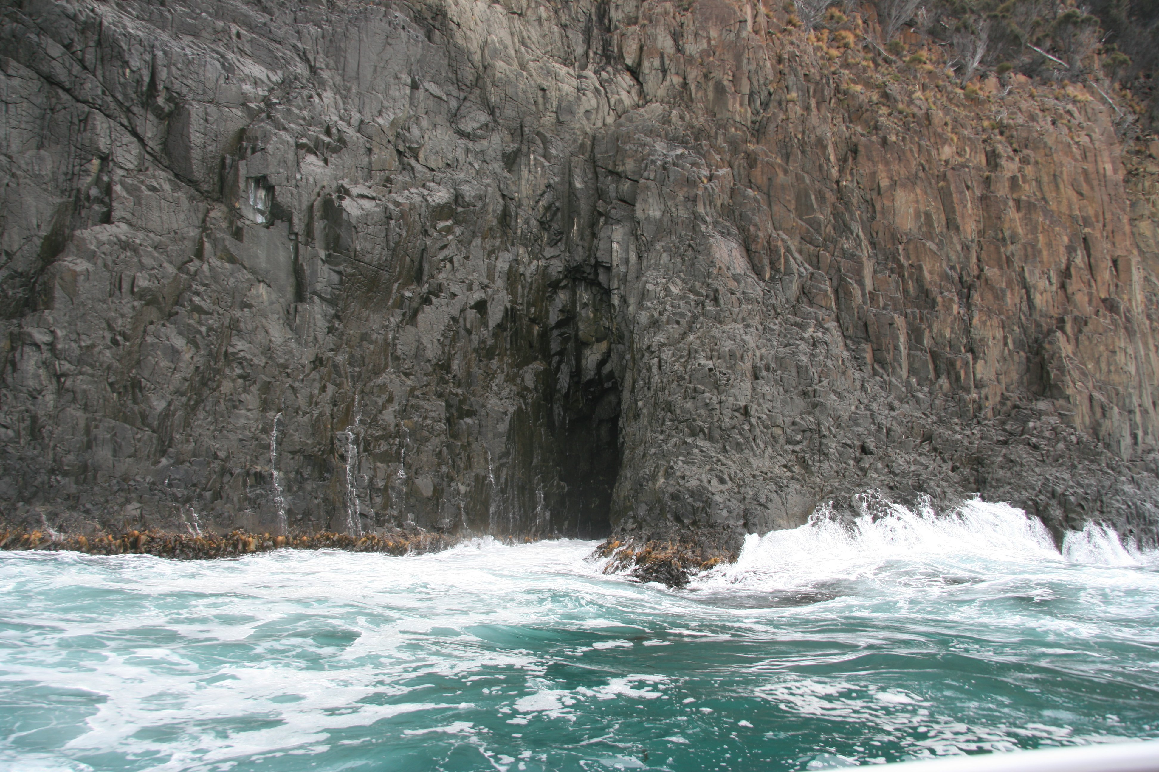 The boat trip was supposed to be three hours long and we got back after only two. They had hot pumpkin soup waiting for us when we got back to warm us up. It was pretty good. You would have thought they would have brought us back early since we got off the boat early, but no. Had well over two hours to wait before we even started back. There wasn't a whole lot to do on the island. Only about 600 people live on the entire island. On the way back to Hobart we passed the Bruny Island Fudge Castle in the picture below.  It was nearly 6:00 before we got back to Hobart. The bad weather finally passed and it was sunny and bright the second half of the day. I visited Mount Nelson Lookout this evening. 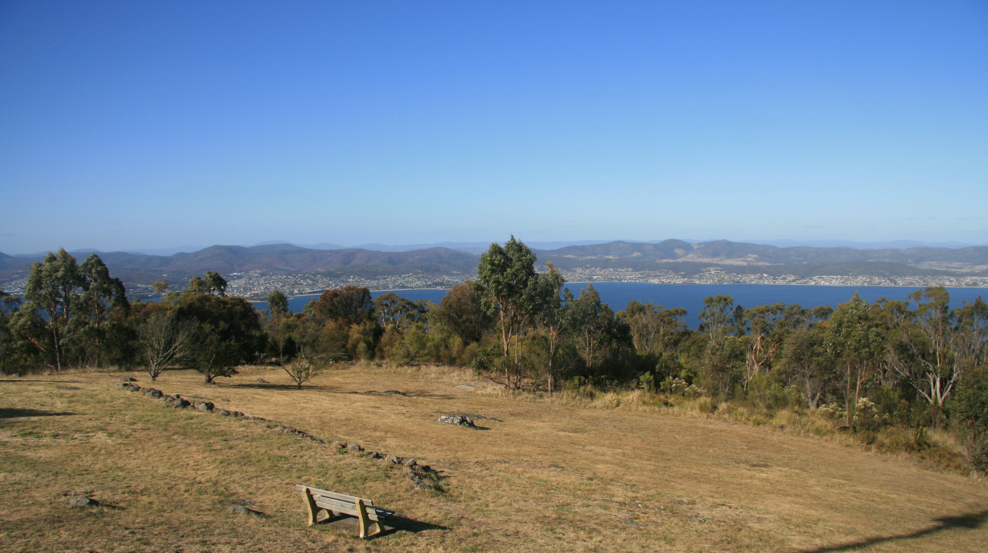 The lookout has panoramic views over Hobart. 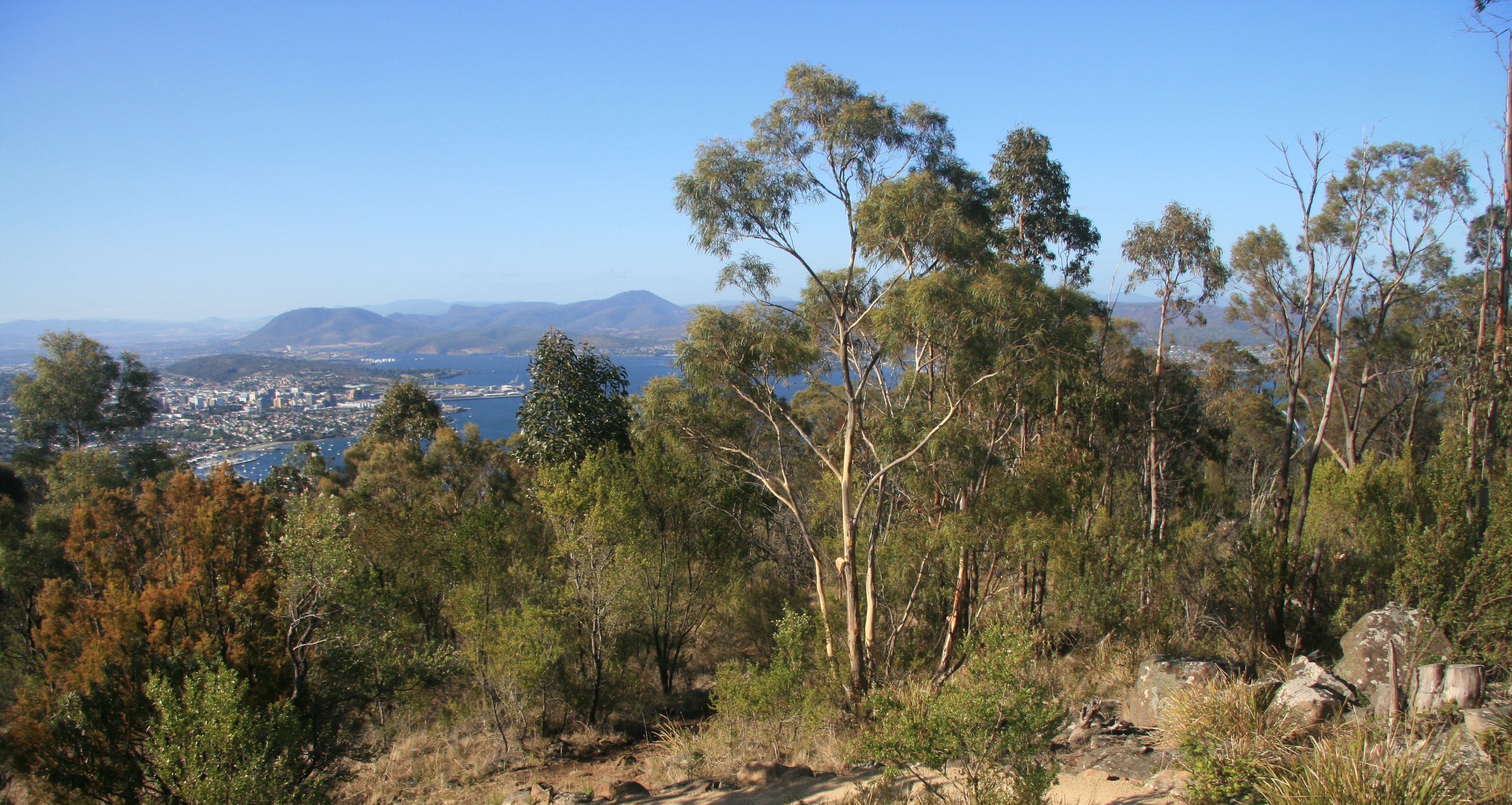 Below is a close look at the central business district. 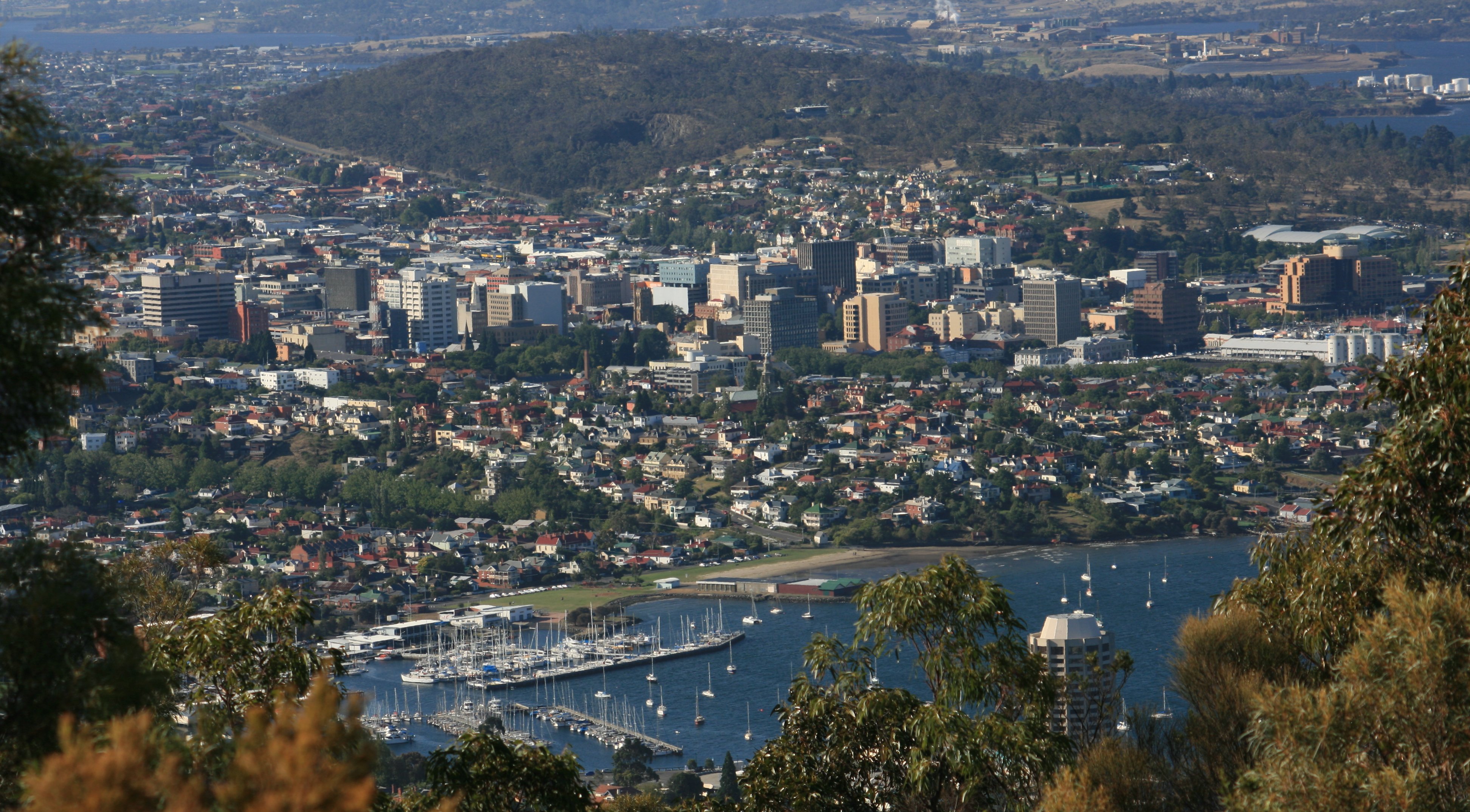 More later, Tim |
TUESDAY, JANUARY 9, 2007:
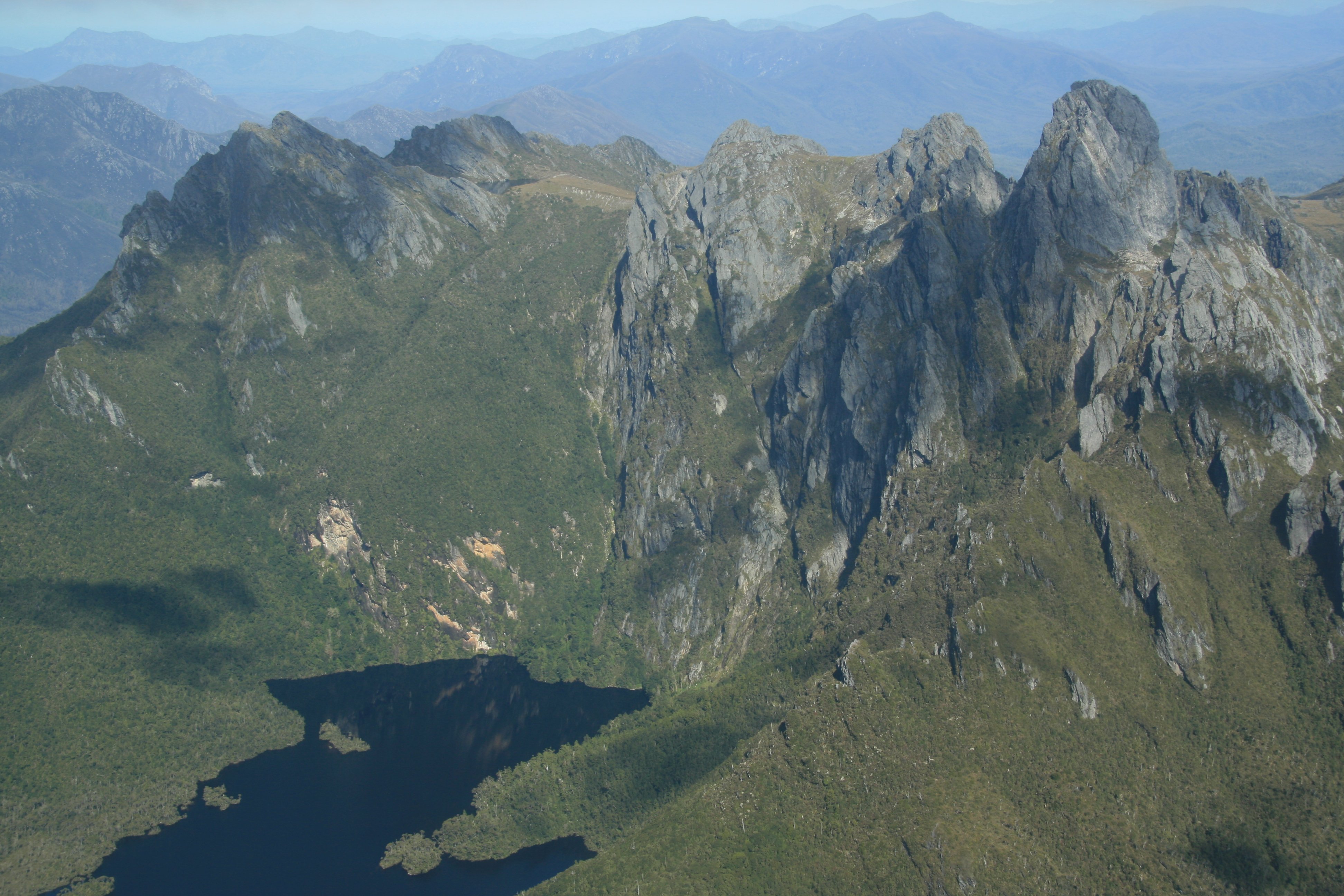
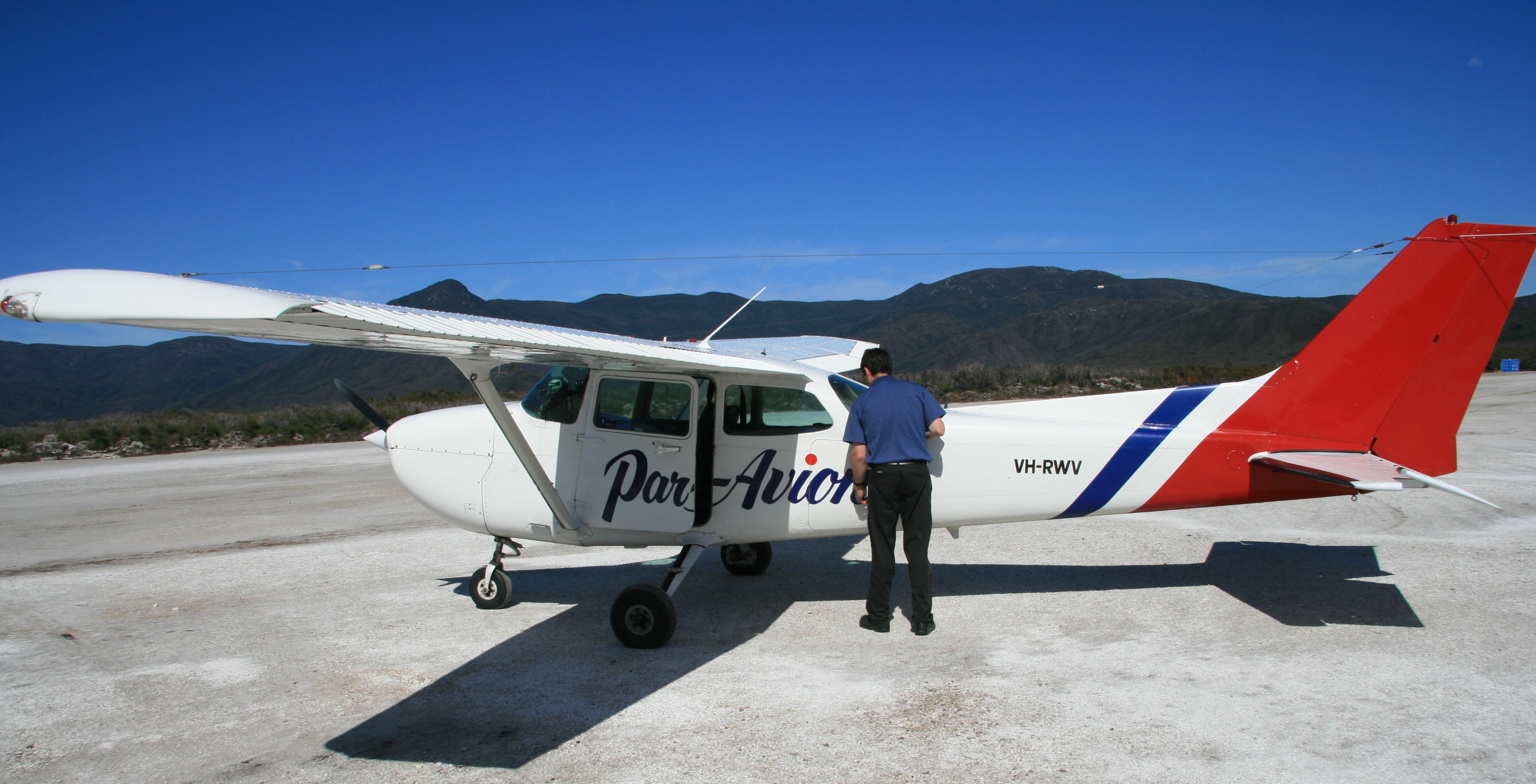
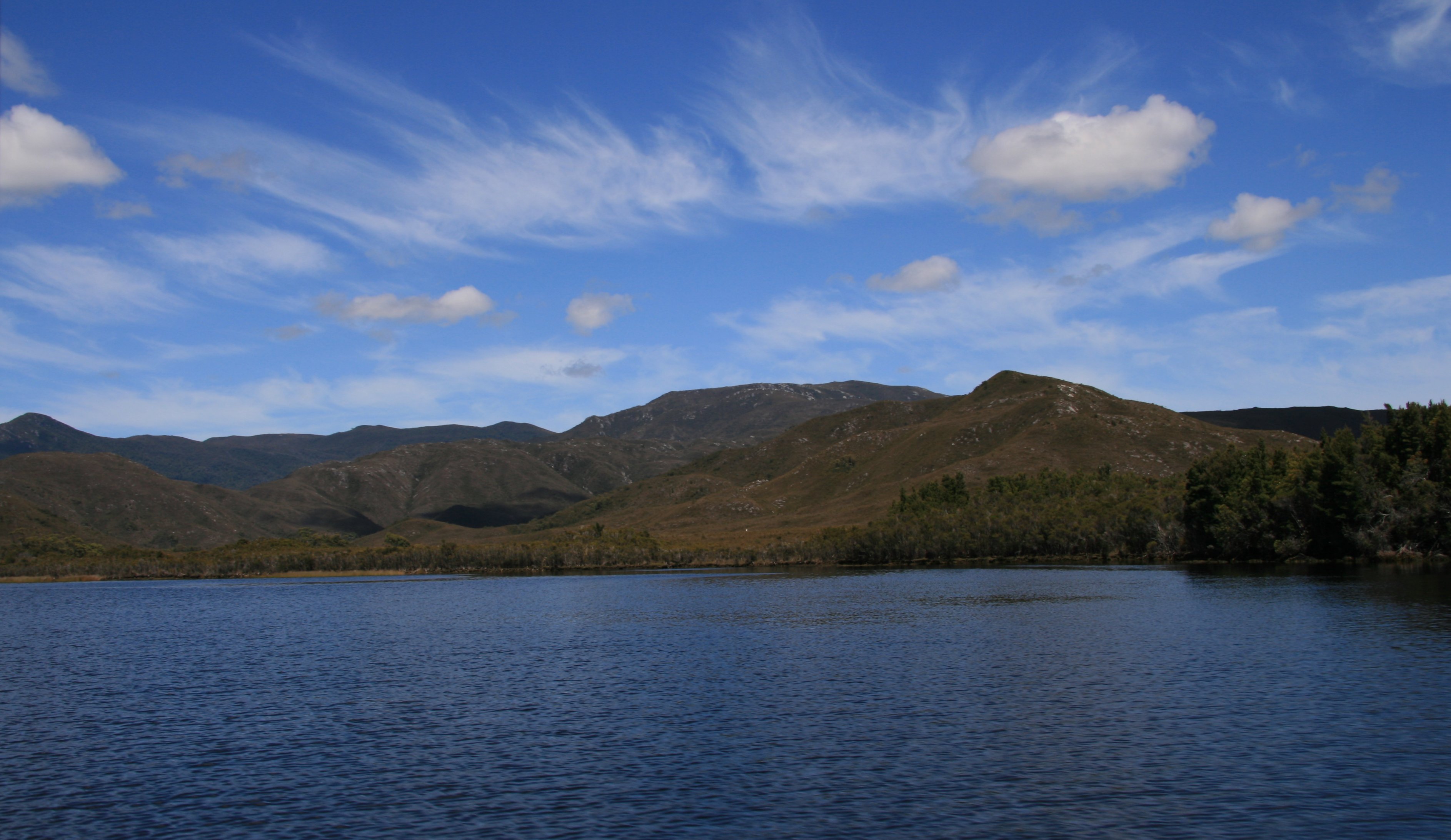
On my last day in Tasmania Par Avion flew me to the Southwest World Heritage National Park.
On the way we got nice views of Hobart, Federation Peak and Bathurst Harbour.
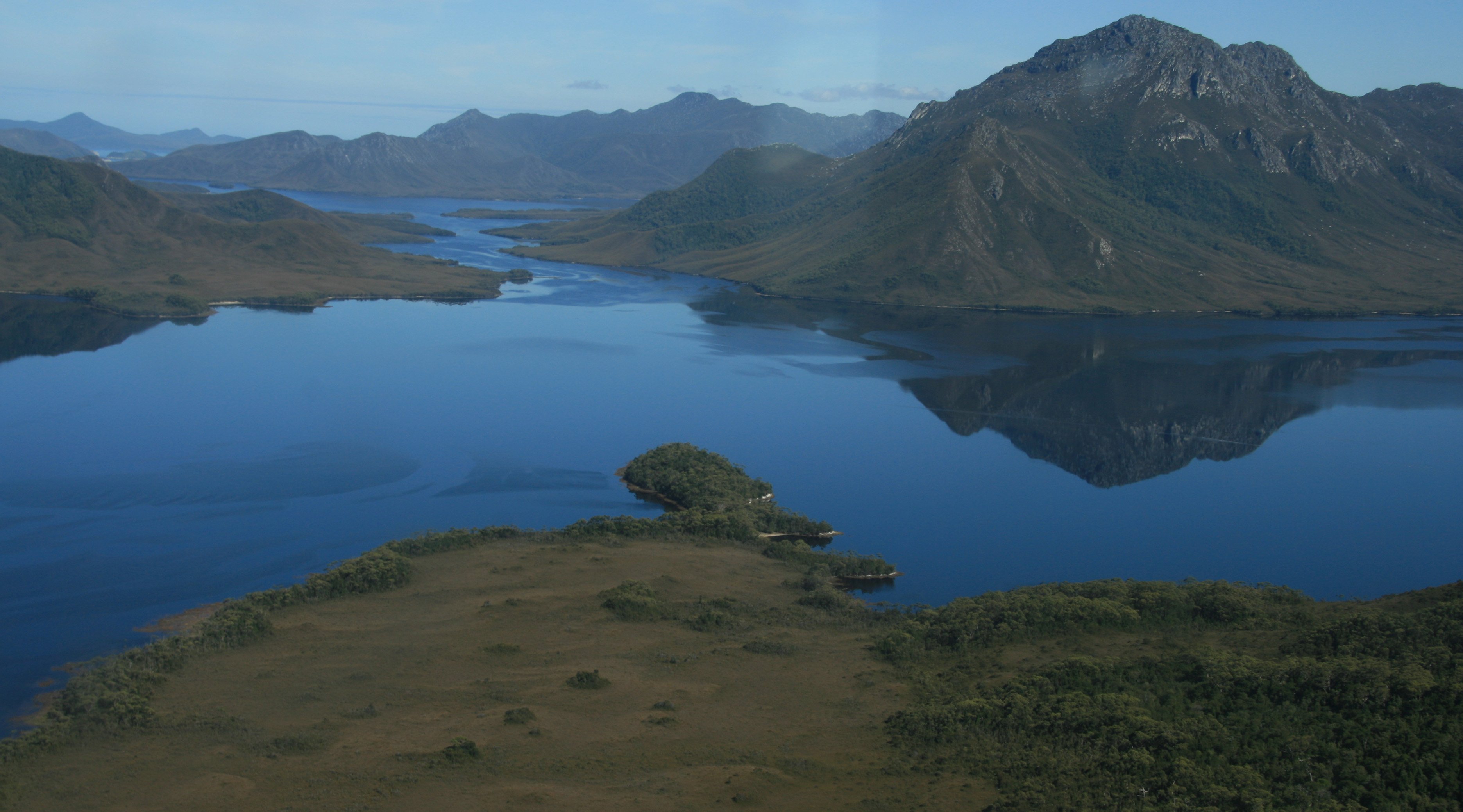
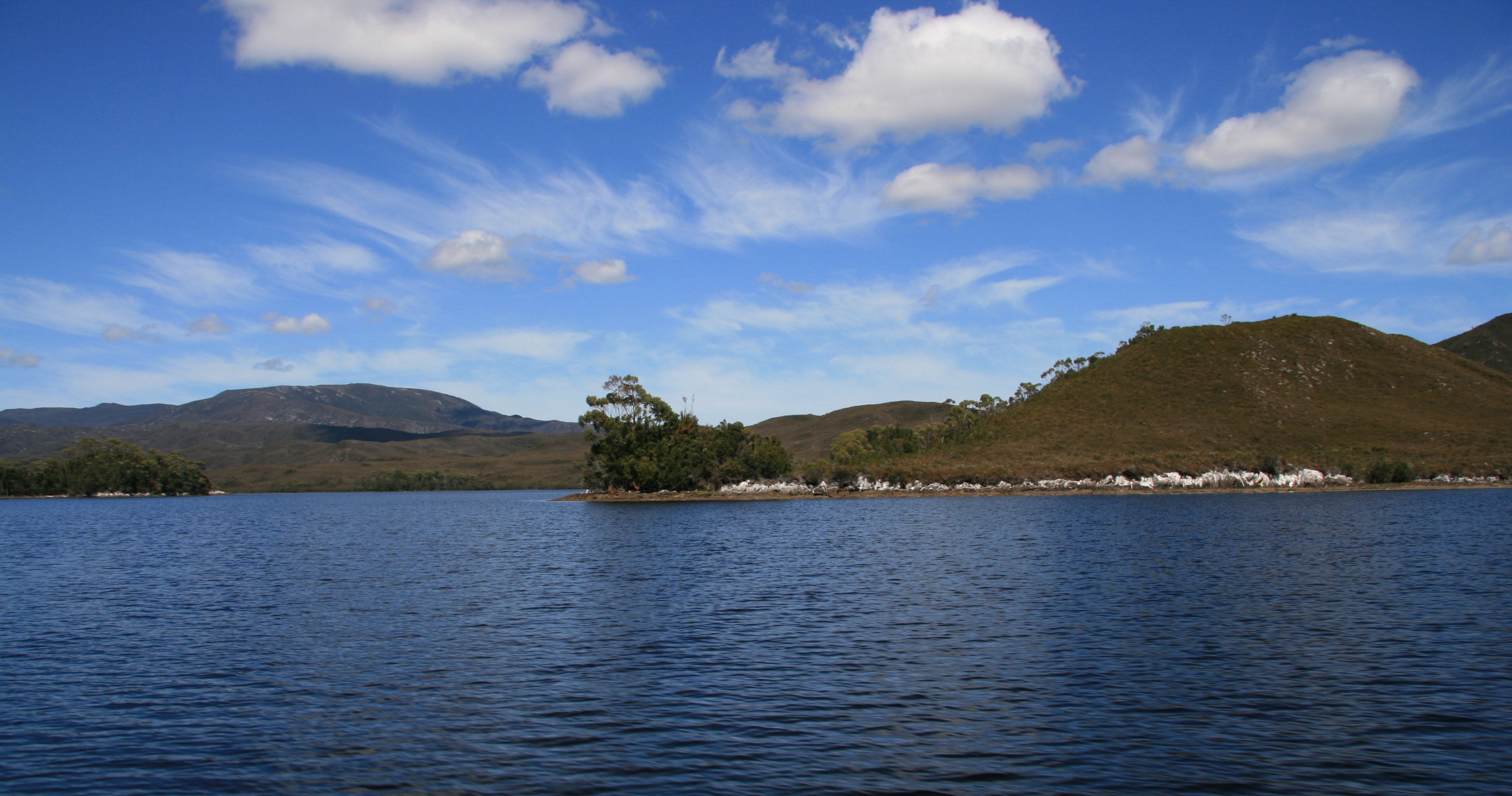
After landing at the Bathurst Harbour landing strip with took a boat cruise on the harbour.
After the boat cruise is was back on the airplane for the return flight to Hobart.
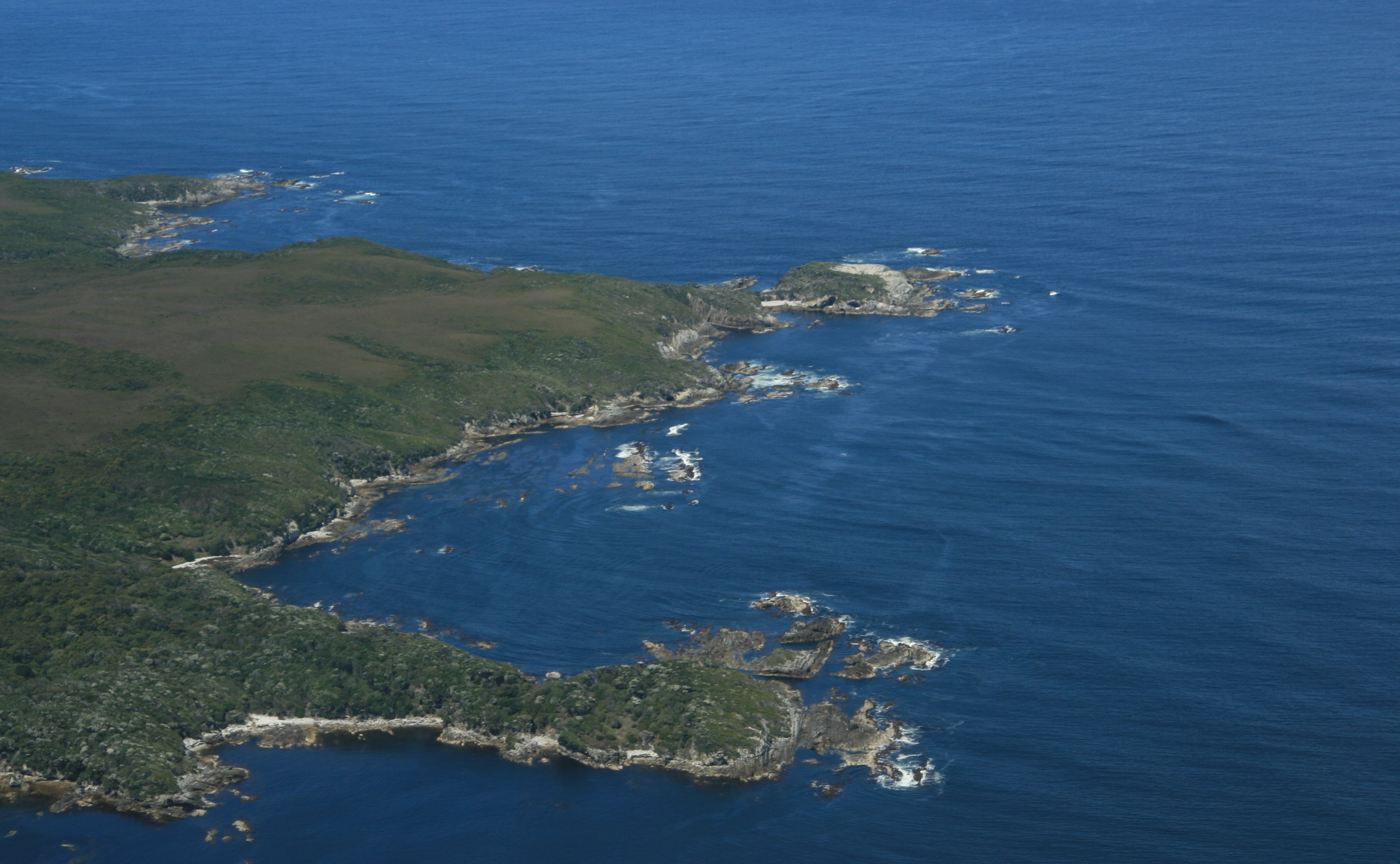
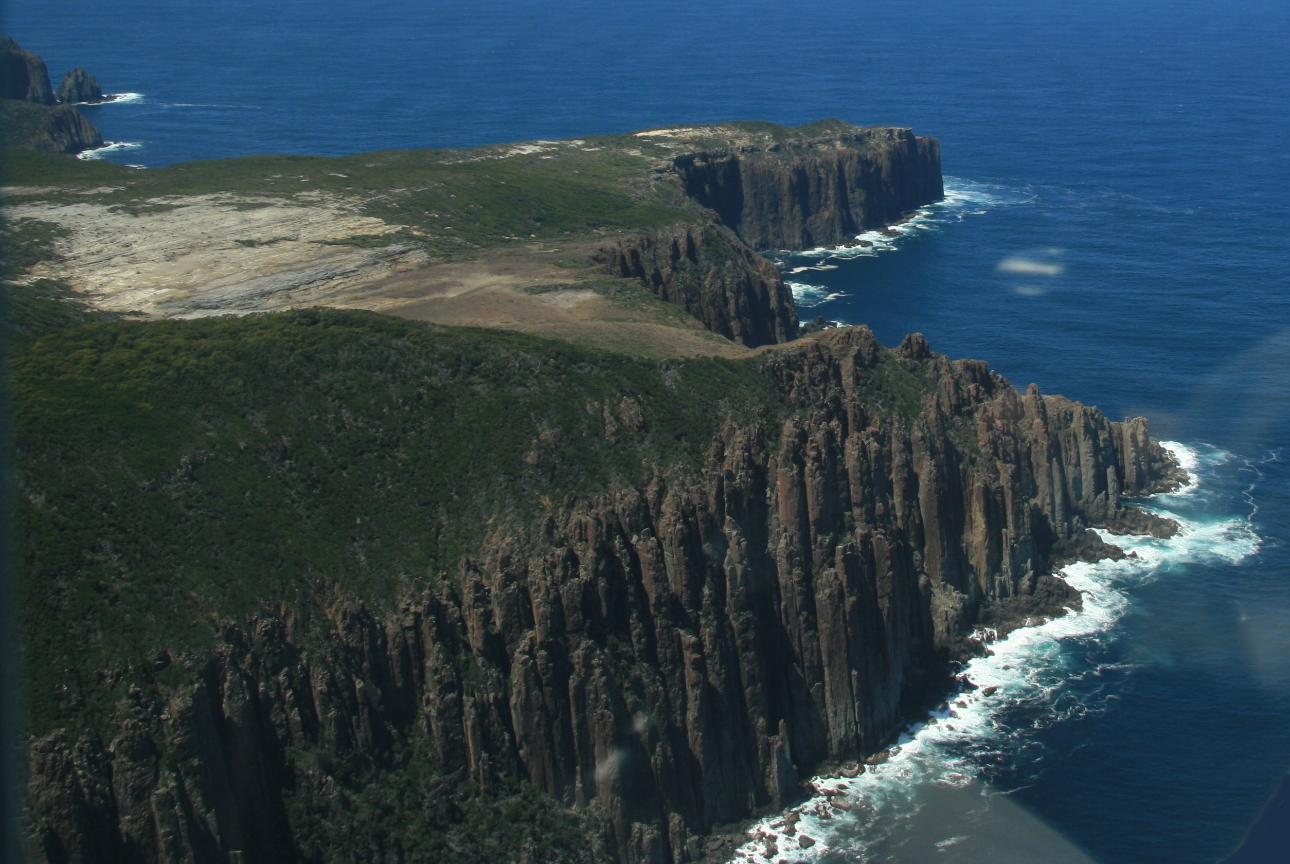
This time instead of the inland mountain route we return via the Southwest coast on the Southern Ocean.
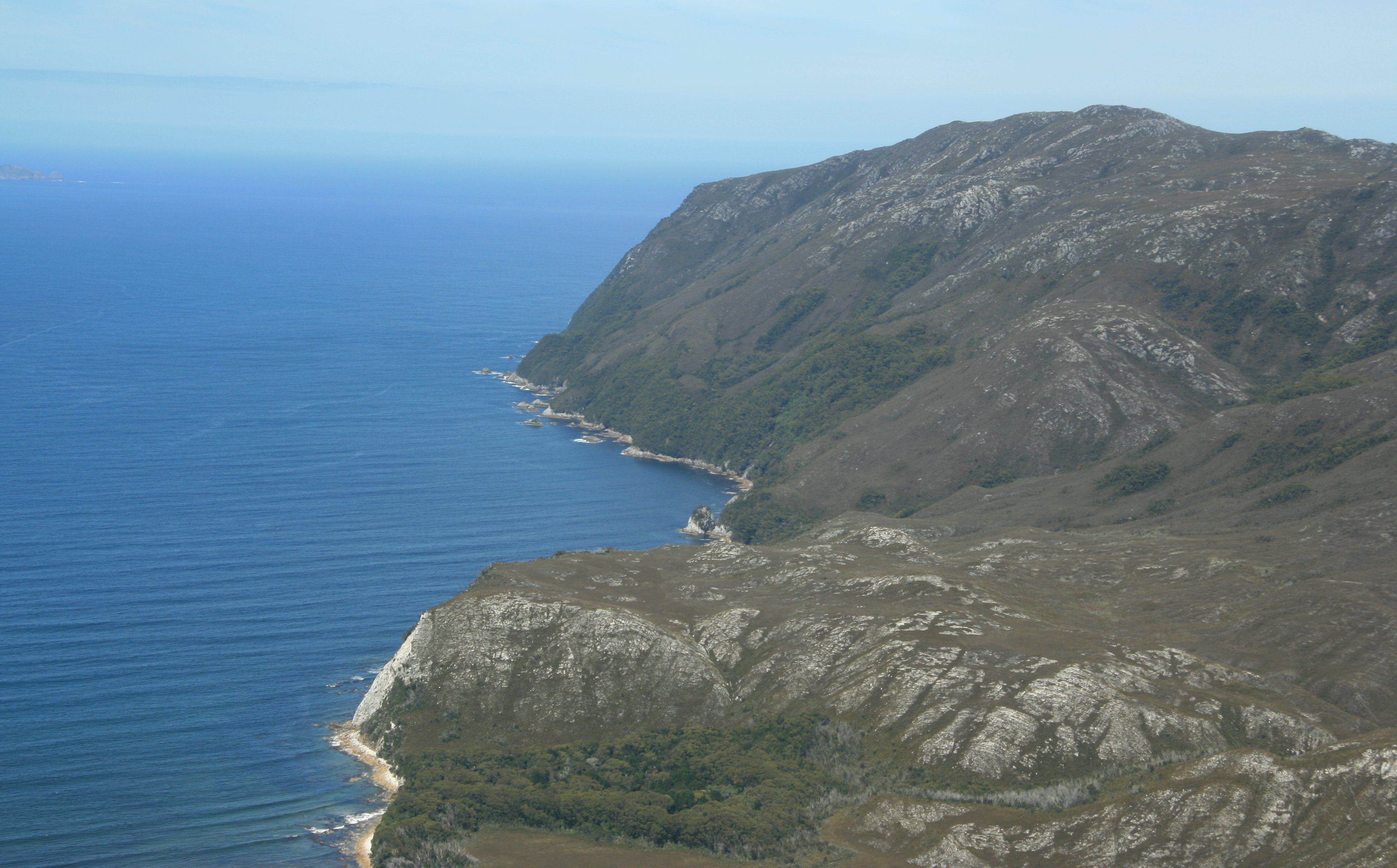
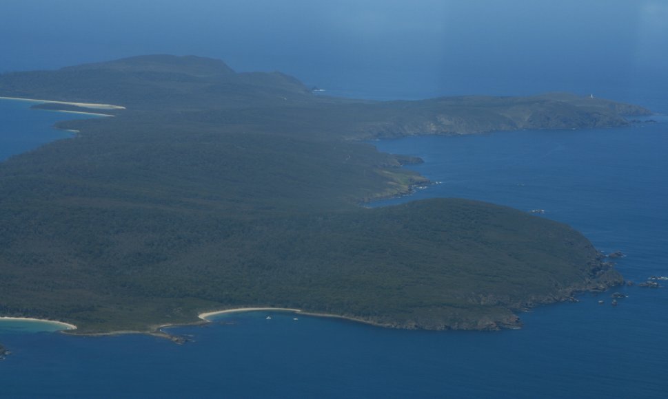
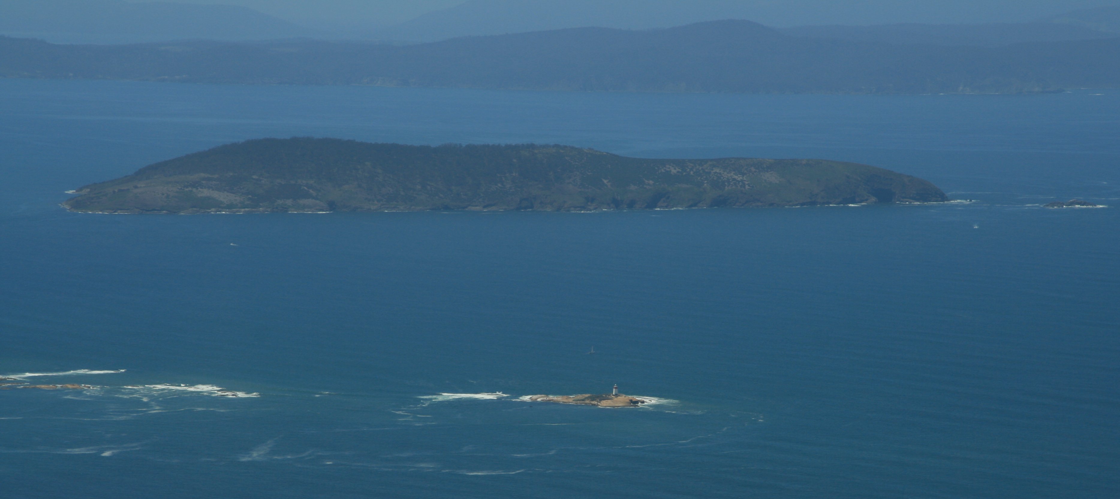
We also flew over Bruny Island and the Ironpot Lighthouse where I had been on previous days.
11 minute video of my scenic flight to Southwest Tasmania and Bathurst Harbour. |
The map below shows my travels today.
This morning I traveled to Bathurst Harbour by airplane.
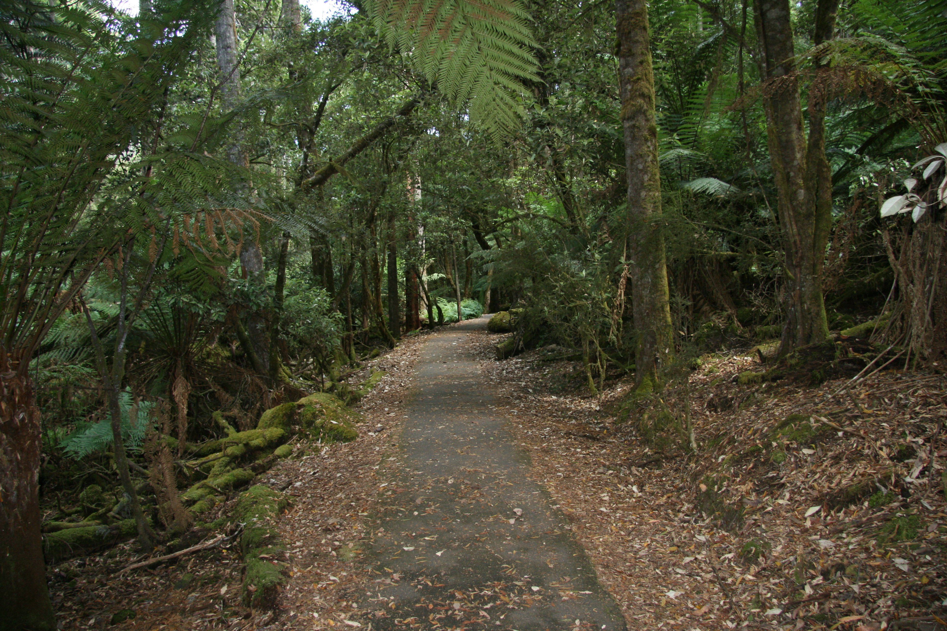
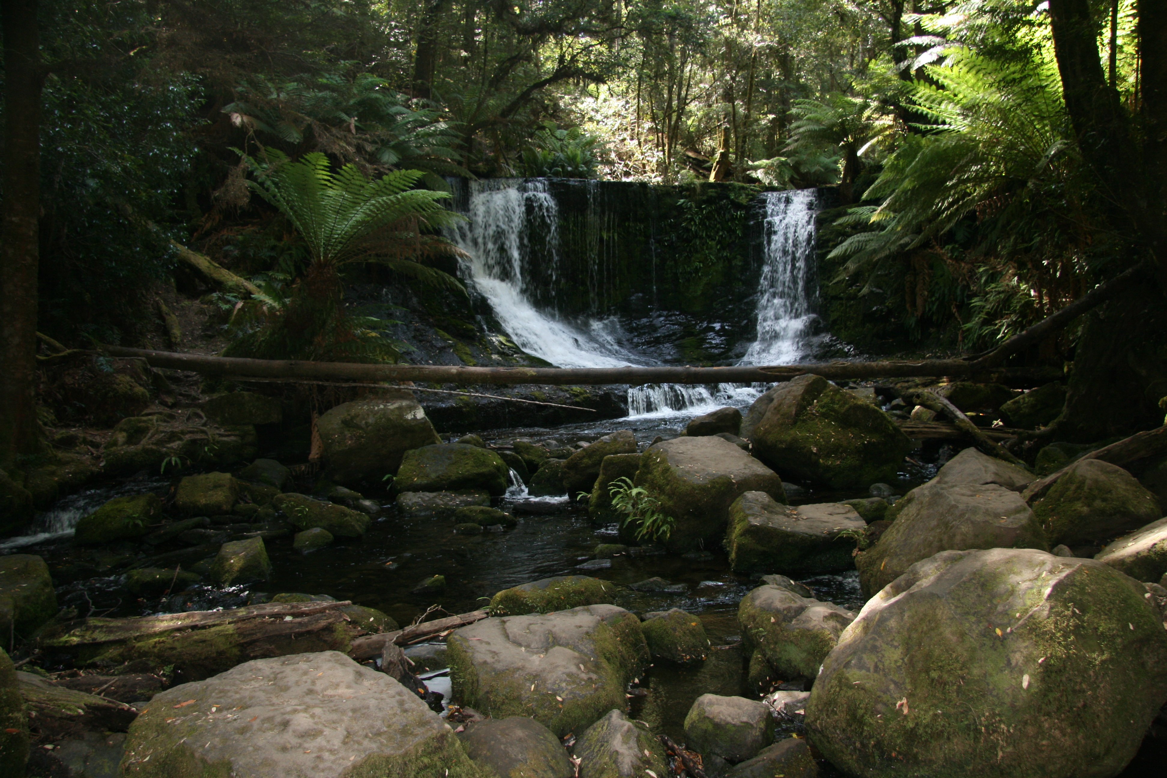
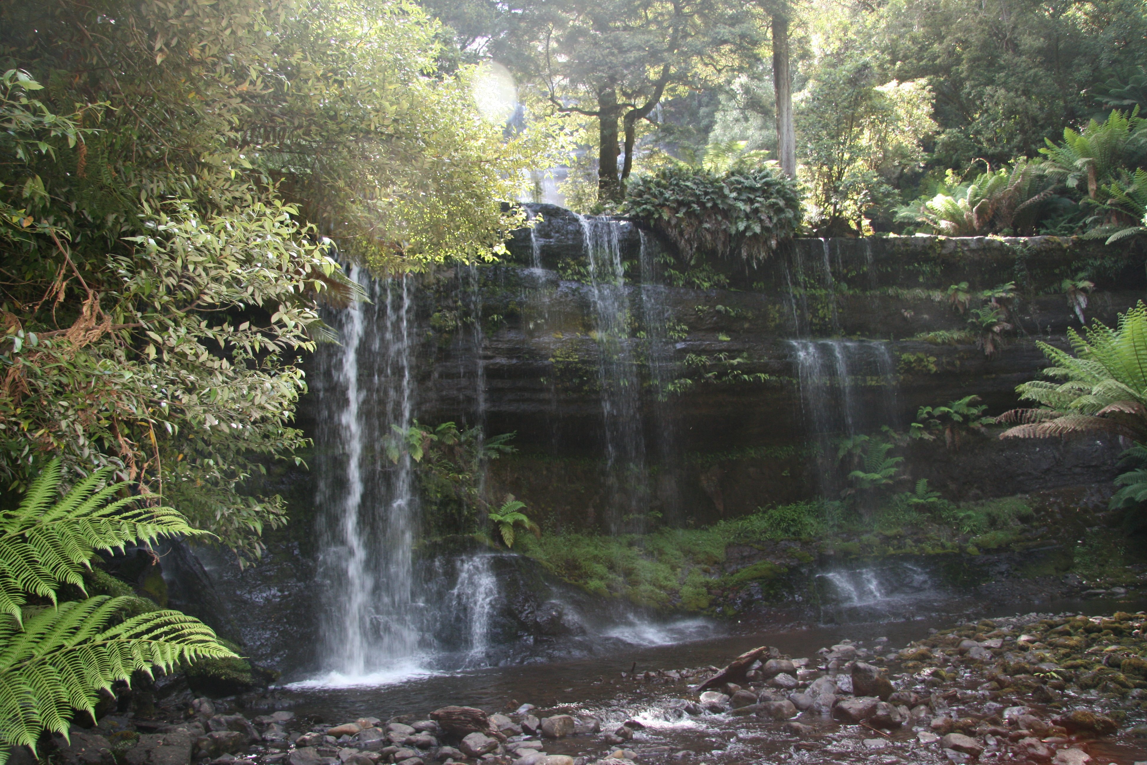
This afternoon I drove 102 miles roundtrip to Mount Field National Park.
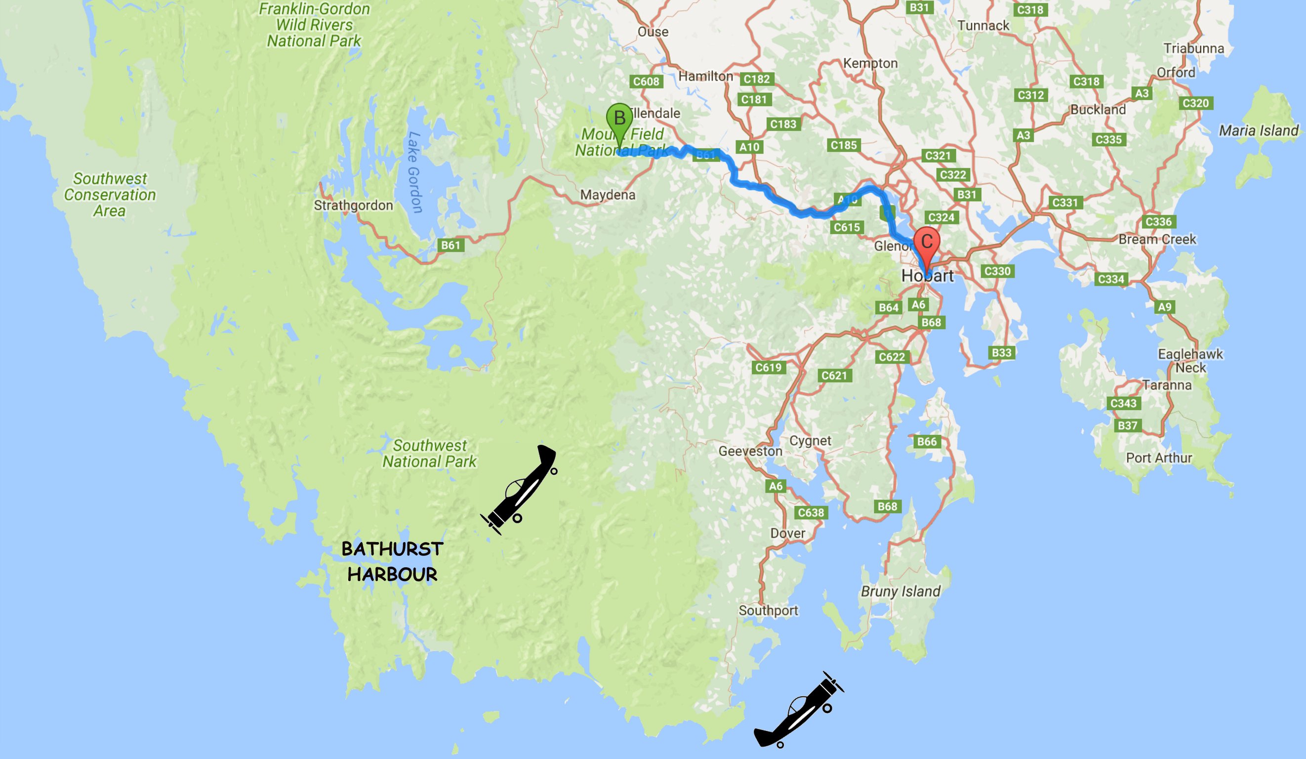
After the air tour I drove northwest of Hobart to Mount Field National Park.
There I saw Horseshoe Falls and Russell Falls.
|
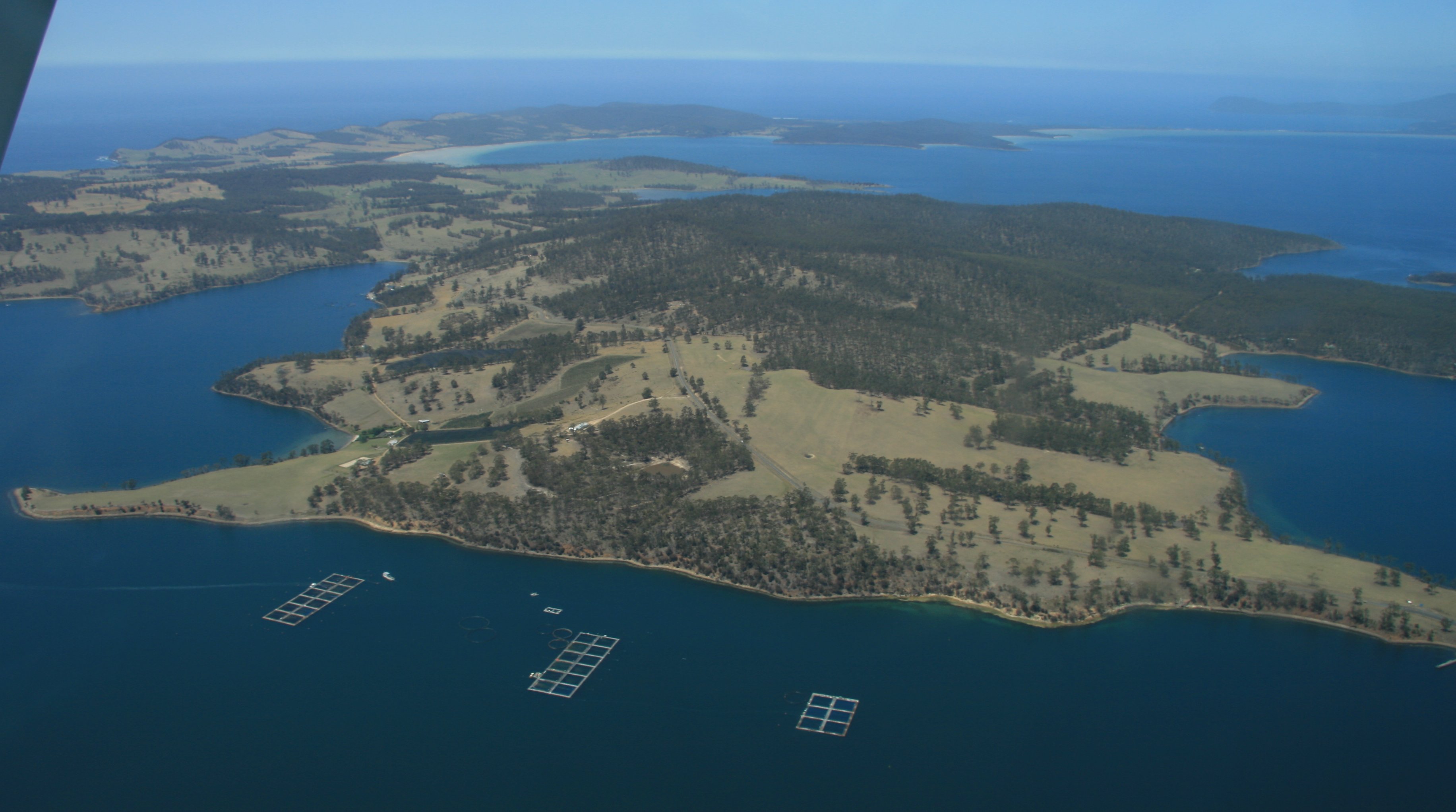
Hello everyone: My last day in Tasmania was a great one. Weather was fantastic. First thing this morning I flew on a small single engine plane to Southwest National Park. This is a very remote area pretty much inaccessible except by plane. We had great views of Hobart after takeoff, below is the Tasman Bridge. 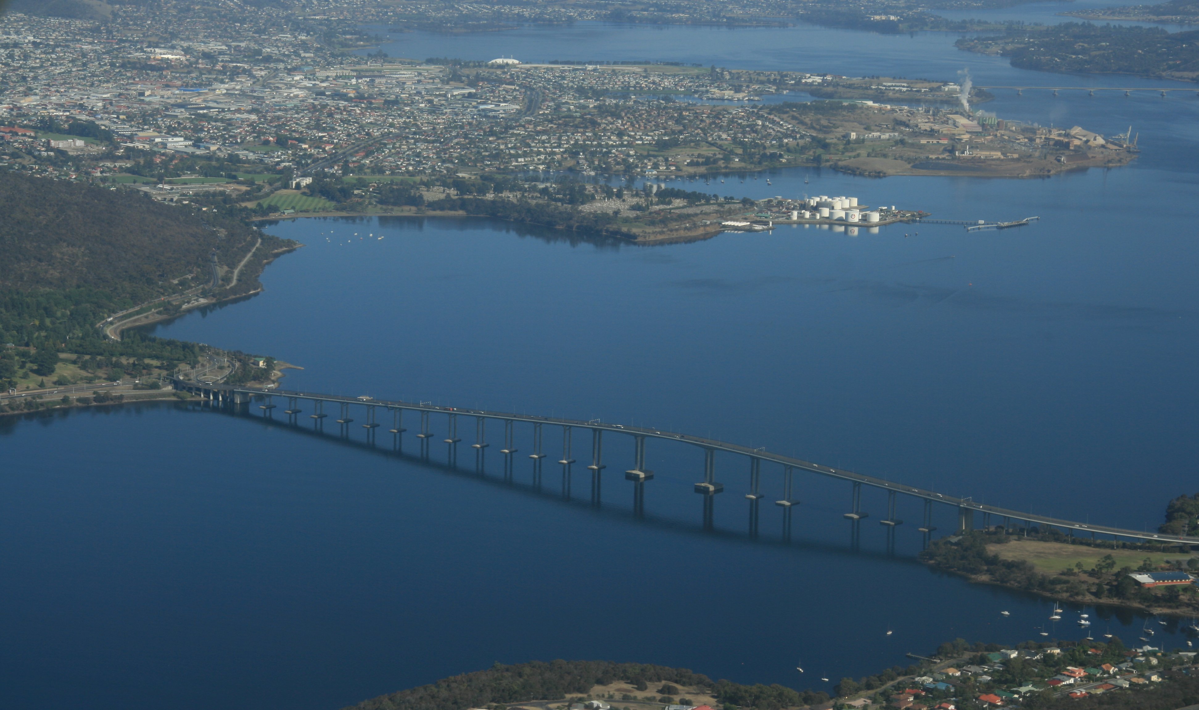 And below is another nice look at the harbour and downtown Hobart. 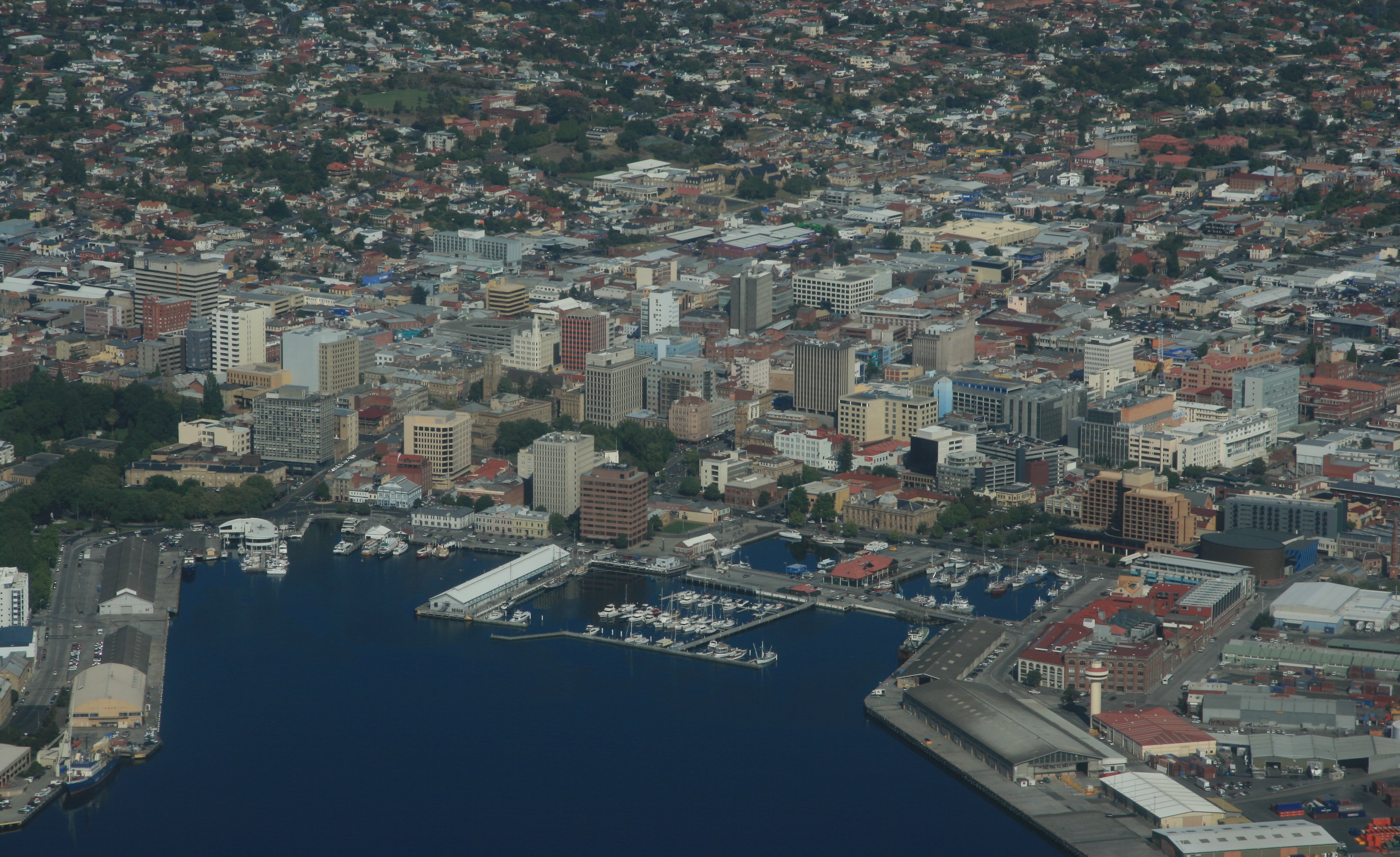 We flew past Federation Peak which is in Southwest National Park. Just prior to landing we flew over Bathurst Harbour. Bathurst Harbour has no vehicular access of any kind. Access is instead provided by either boat, air or walking. 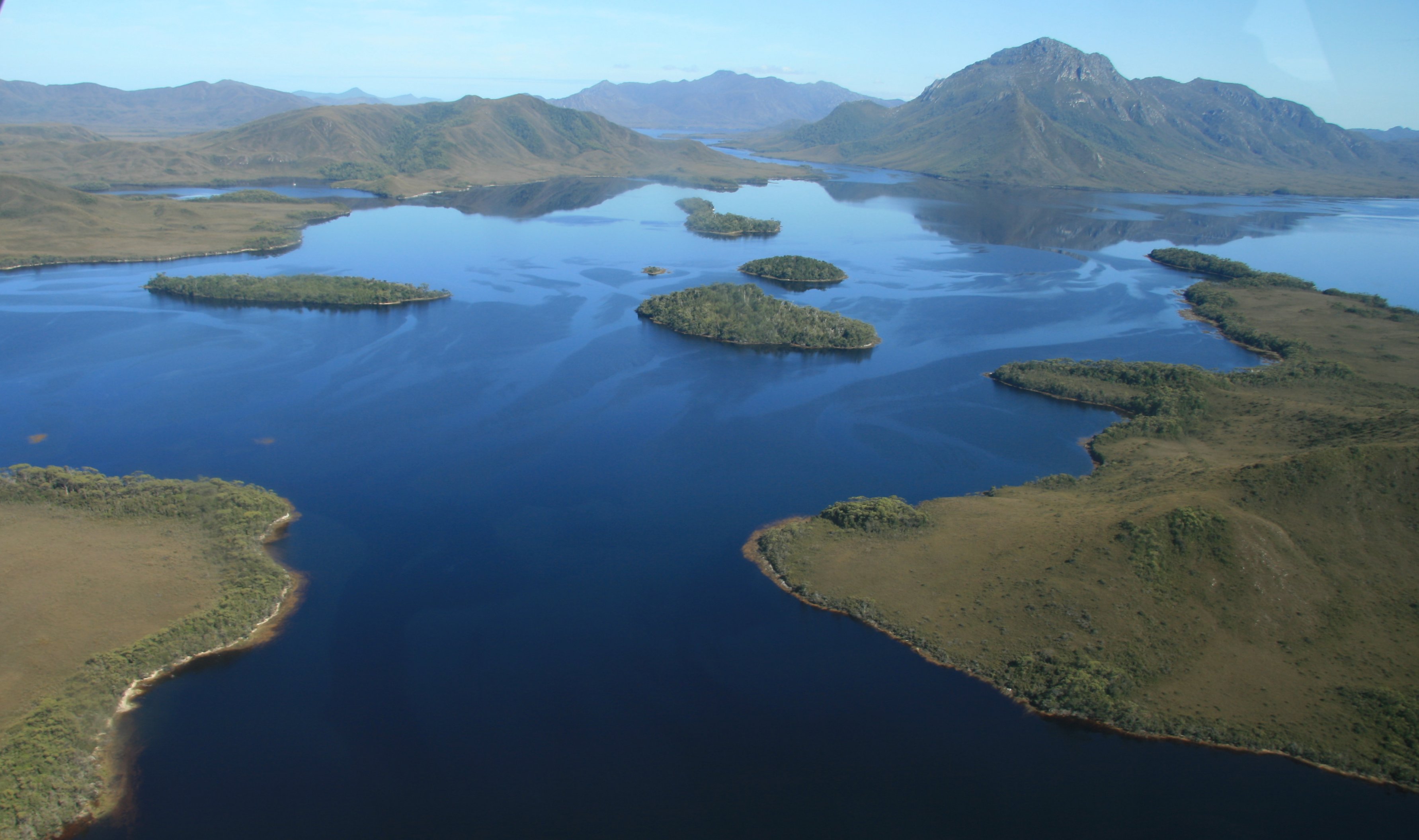 Below we are coming into the small landing strip. 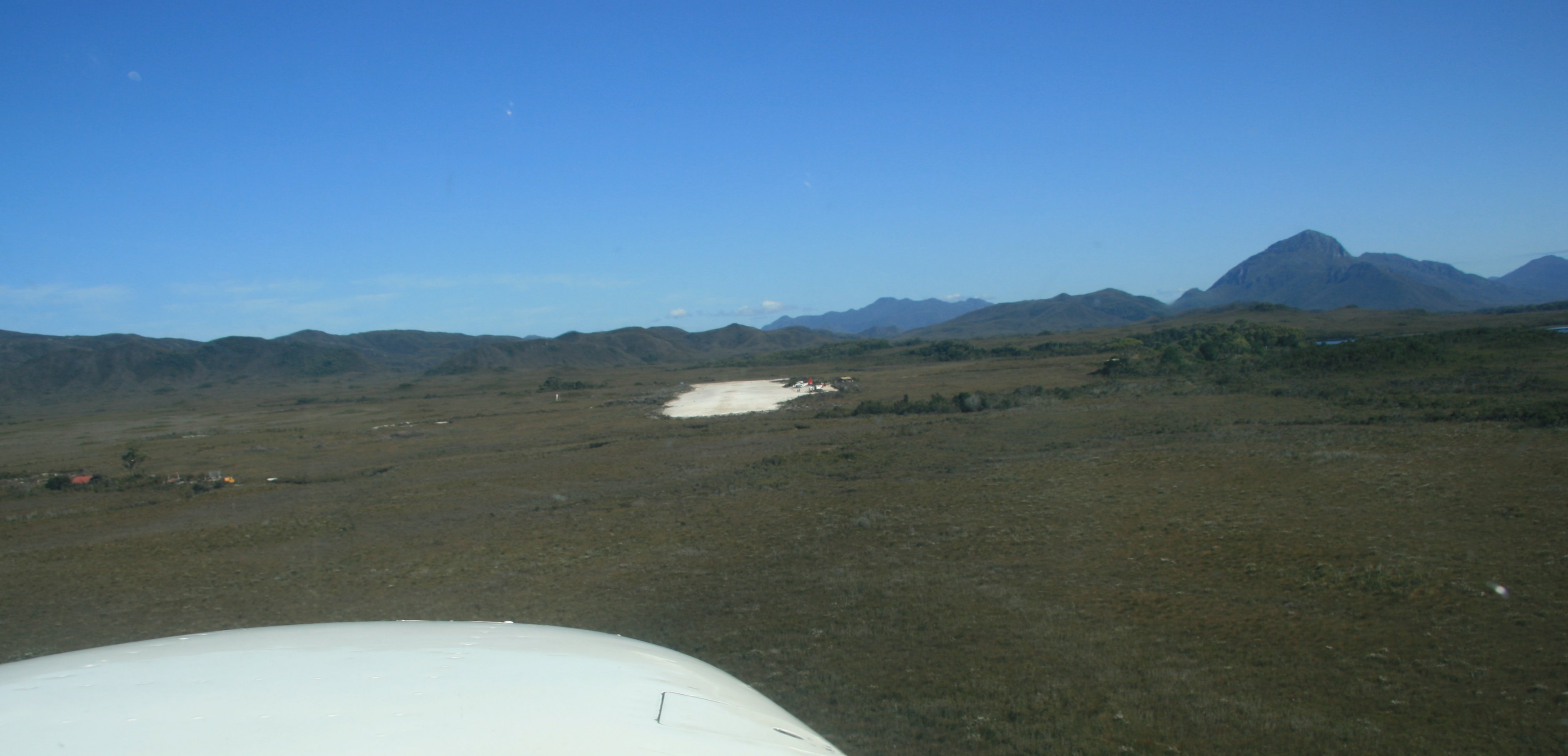 Below is my pilot for the day at the small Bathurst Harbour landing strip. After we landed at the small airstrip we took a boat ride out on bathurst Harbour. Very calm waters unlike yesterday. When out pilot killed the engine on the boat in the center of the harbour we were surrounded by beautiful mountains and complete silence, we were the only living soles for many many miles. The picture below was taken as we were walking back to the airplane. 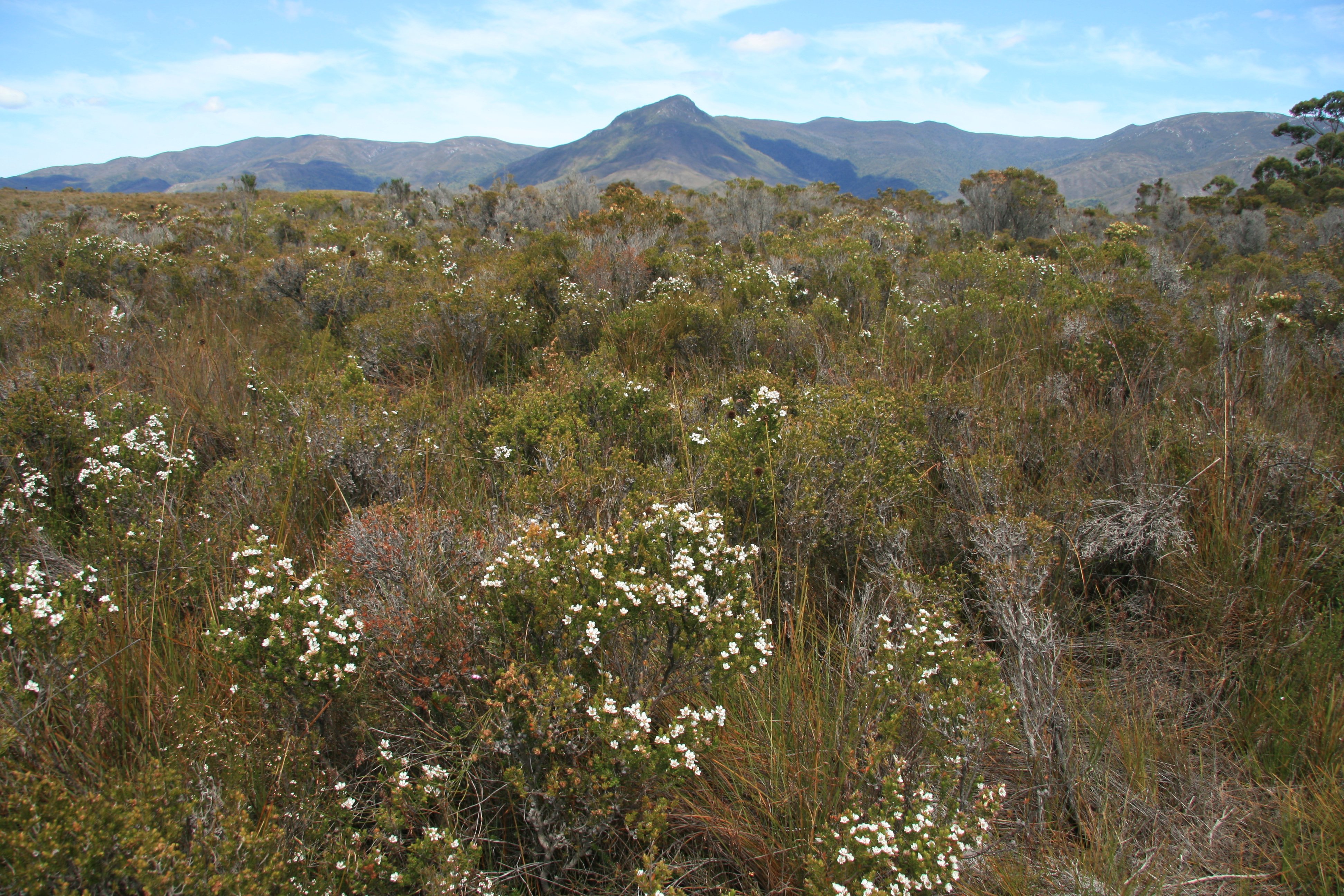 I doubt they get very many 747s landing here. 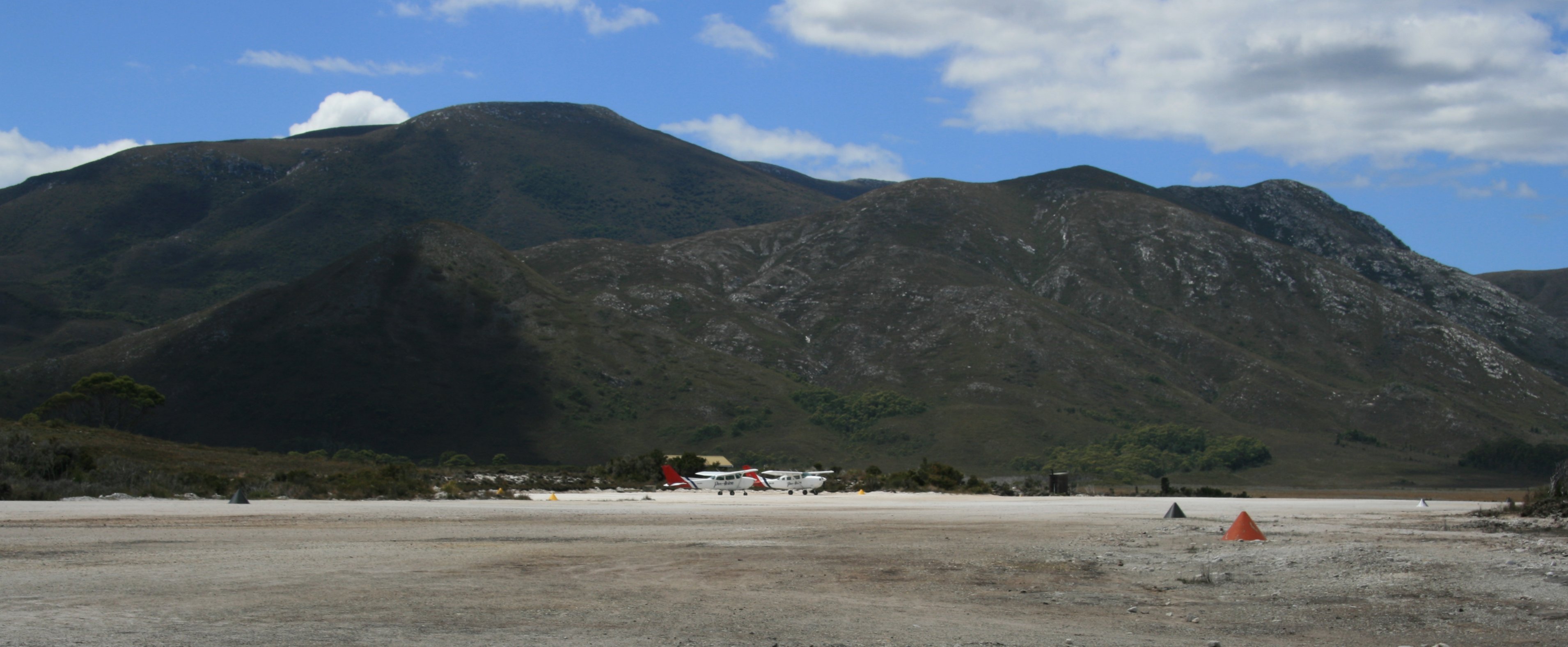 After the boat trip is was back on the plane. This time we hugged the scenic coast back to Hobart. 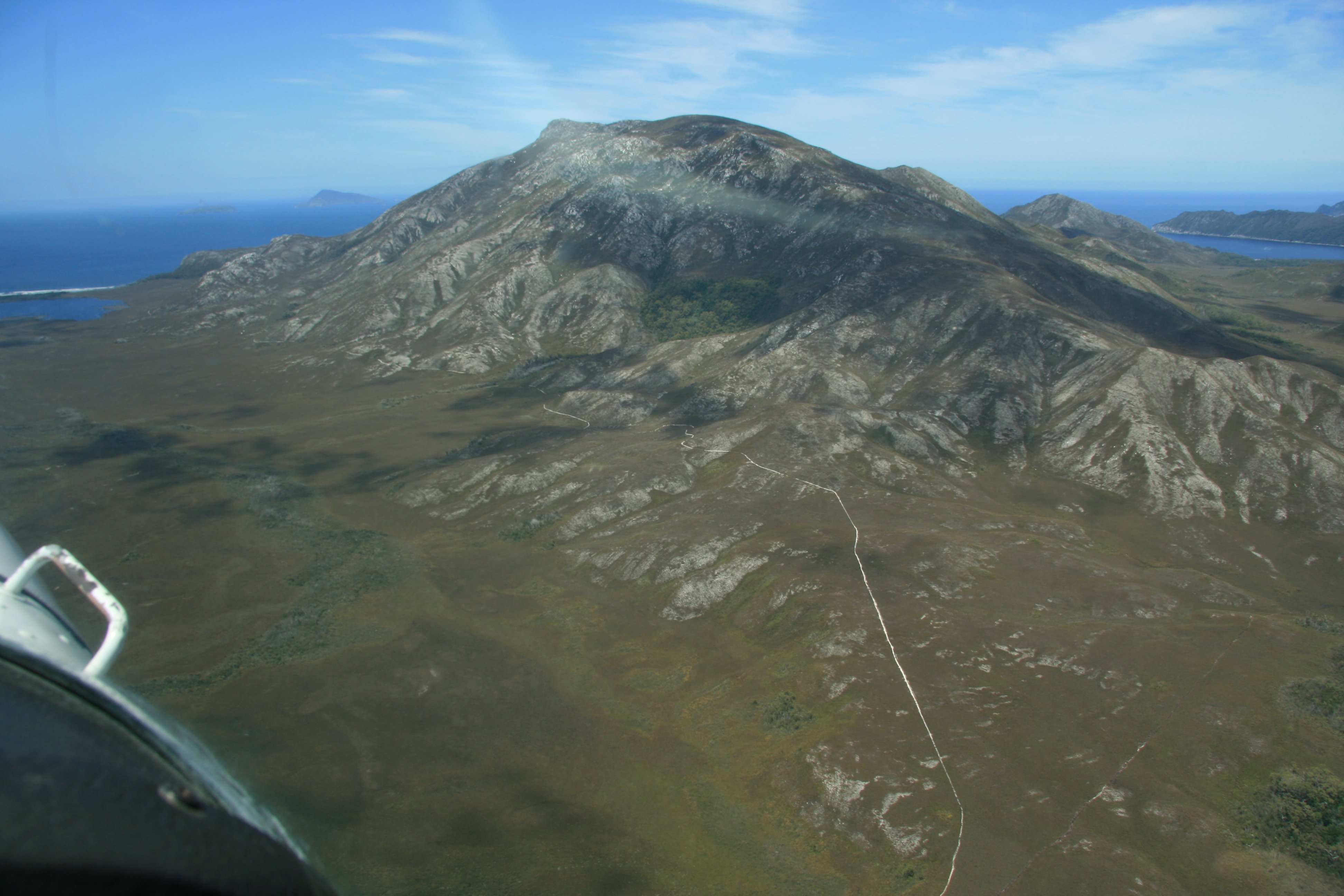 The coast line of Tasmania is beautiful. Below are some pictures from the flight back to Hobart. 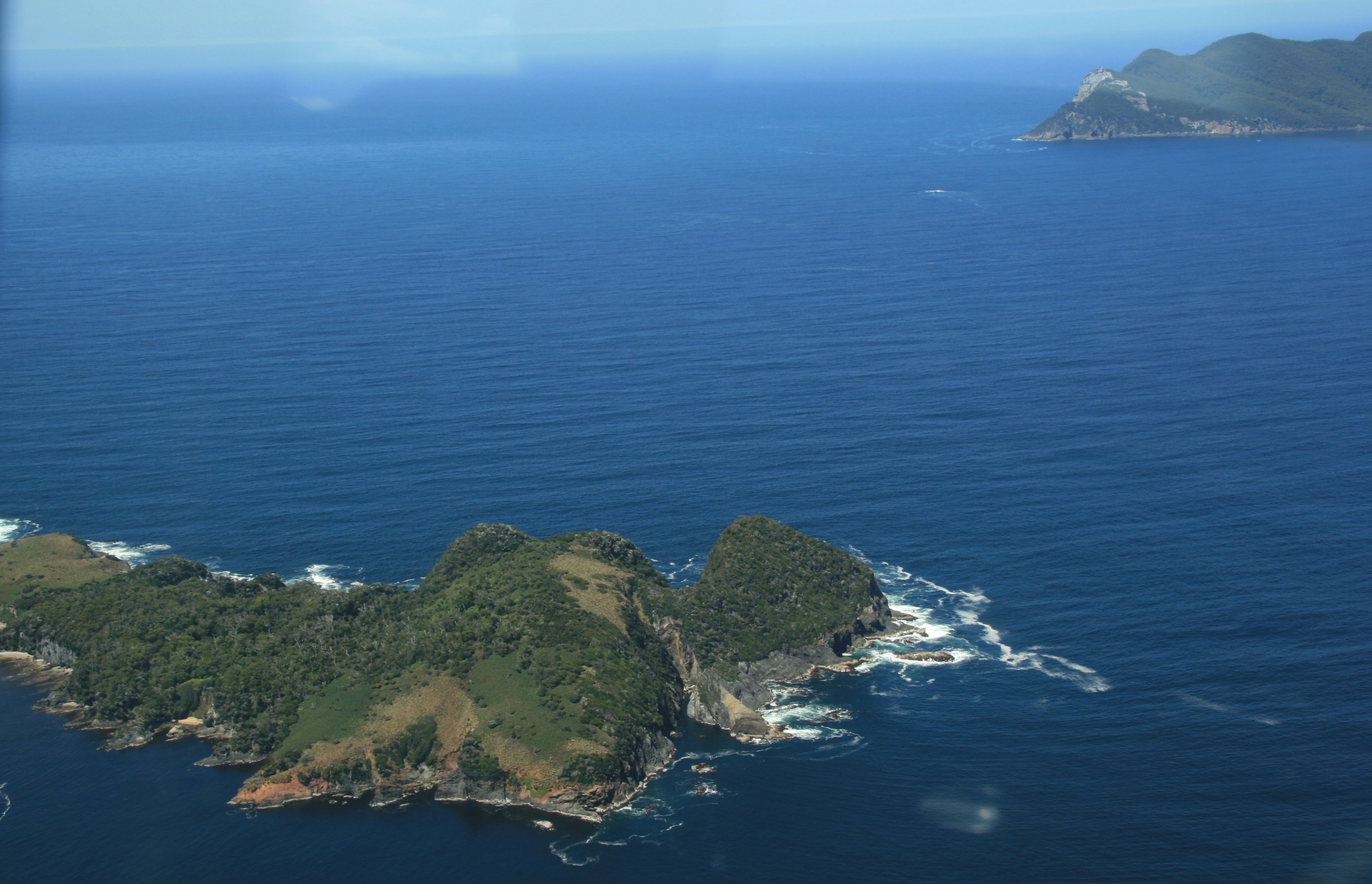 We also flew over Bruny Island where I was yesterday. 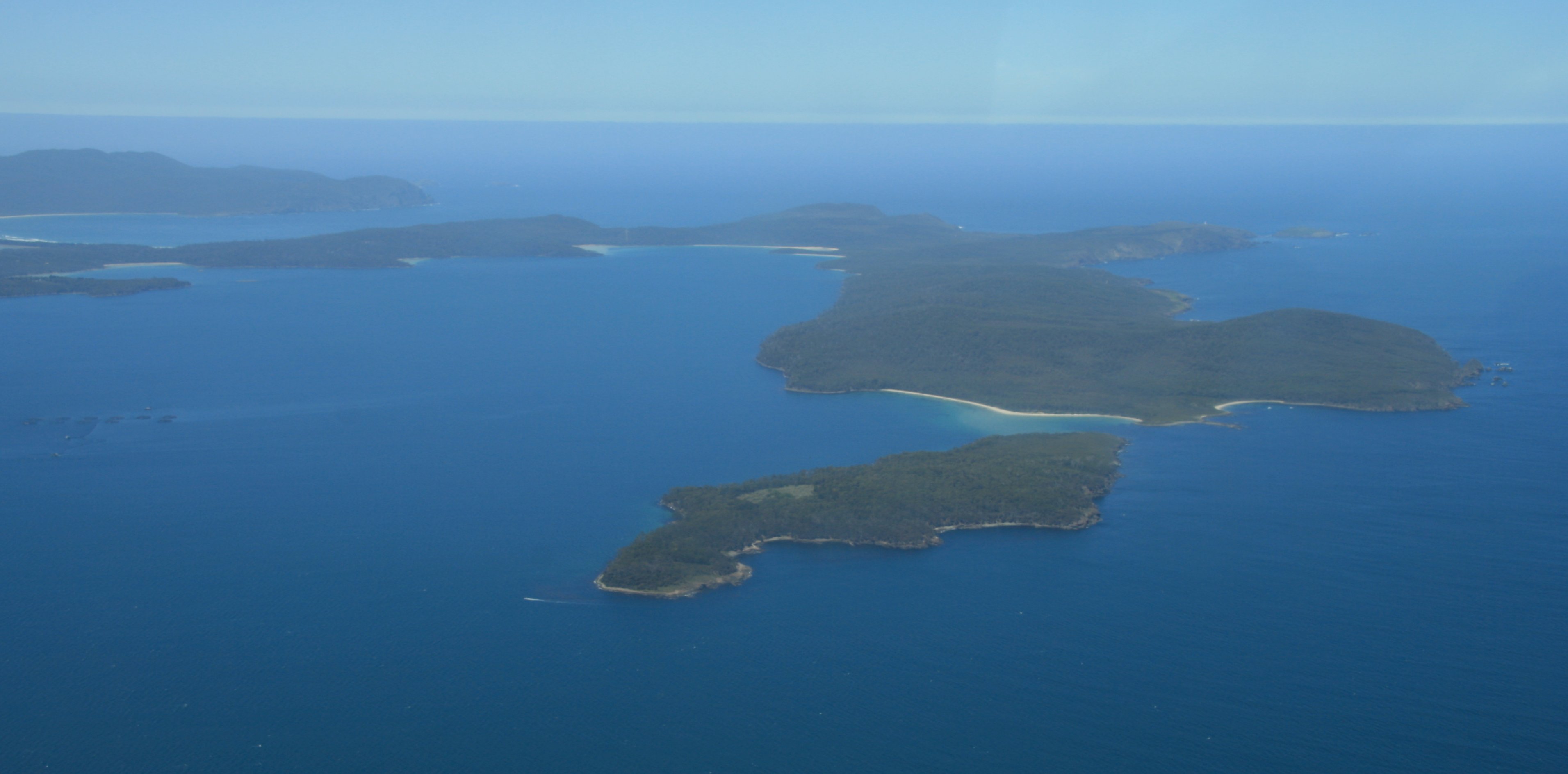 Below is North Bruny Island. Below is the Ironpot Lighthouse that I sailed past last Friday. This afternoon I drove northwest of Hobart to Mount Field National Park. It was a nice drive, about 175 kilometers roundtrip from Hobart. I didn't see any live kangaroos crossing the road, but I did see a couple of dead ones on the shoulder of the road. Below is Horseshoe Falls in the park. And below is Russell Falls while looking into the sun. Tomorrow morning I fly to Melbourne. I will write more from there. Tim |
45 minute video of my entire Tasmania visit. |

Click above to continue to my next adventure, MELBOURNE, AUSTRALIA.
| TIM'S HOME PAGE SITE INDEX | |||
|---|---|---|---|
| Areas | Description | # of Pages | |
| About Me | Current Picture of me and my home. Information about myself. | 2 | |
| Biography | Pictorial biography of myself. Pictures range from birth to adulthood. | 4 | |
| Family File | Pictures of my family and a little information about them. | 12 | |
| Local Spotlight | Pictures, Links, and Information for Indianapolis, Richmond, Plainfield, and Mooresville, Indiana. | 6 | |
| Tim's Travels | Pictures, videos and travelogs from my travels around the world. | 409 | |
| Vacation Videos | Over 1500 videos from my travels around the world. | 1 | |