All of the images below are thumbnails and can be clicked on for a larger image.
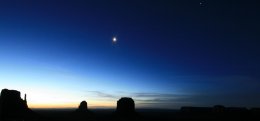
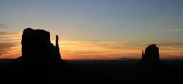
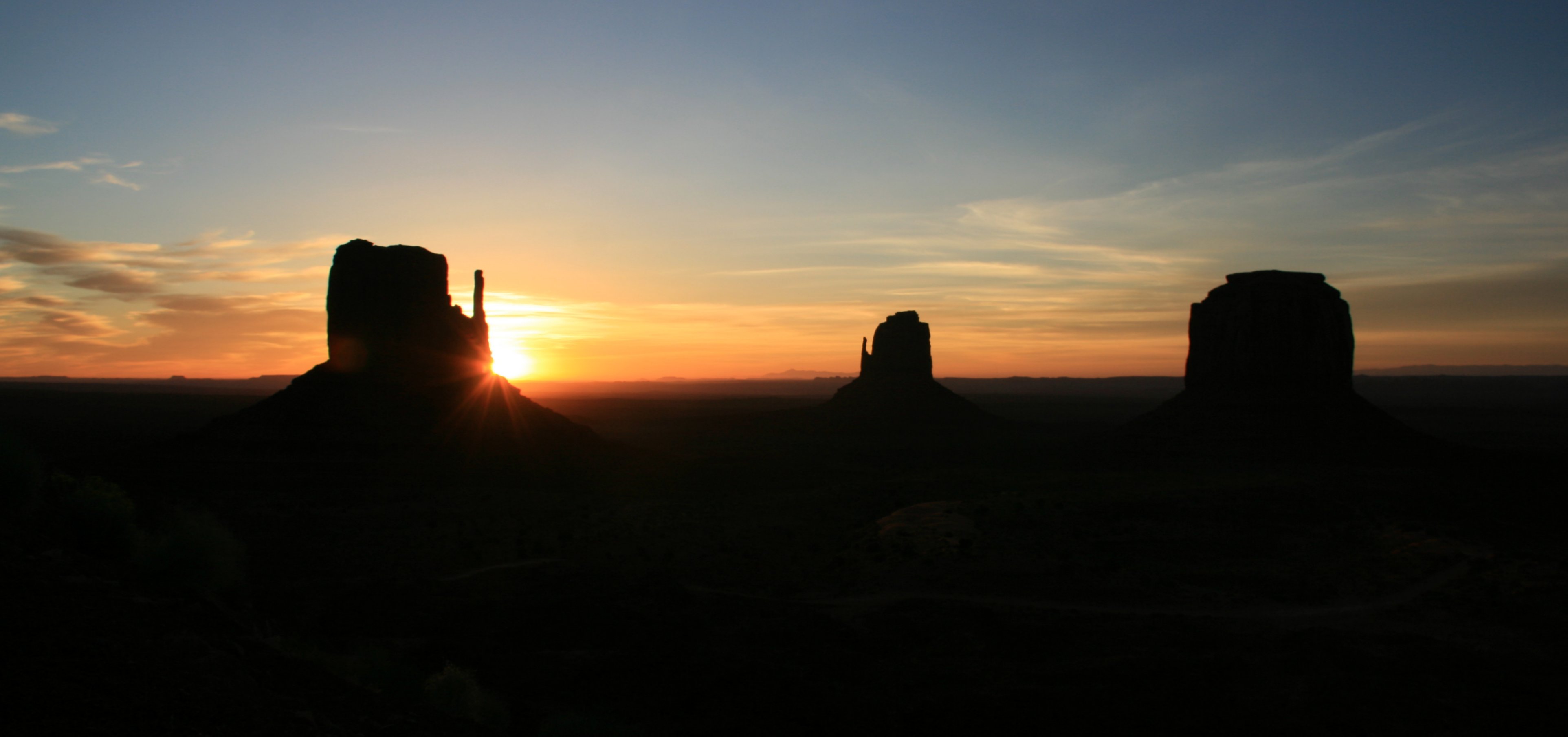
I had to get up early to see the famous sun rise at Monument Valley.
I didn't have to travel far. All I had to do was step out on my balcony.
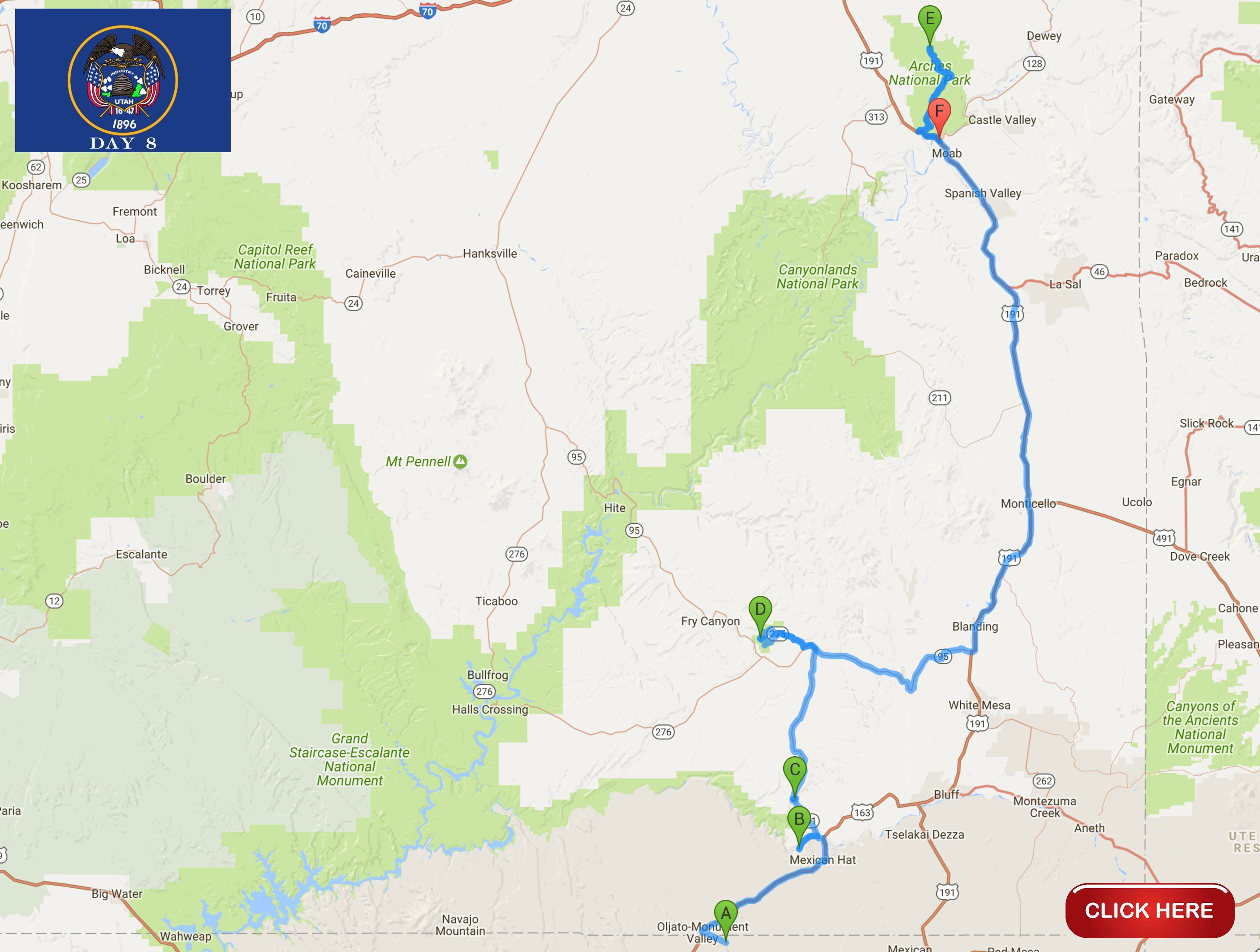
I would drive a total of 245 miles today.
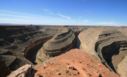
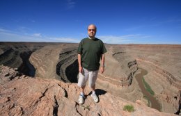
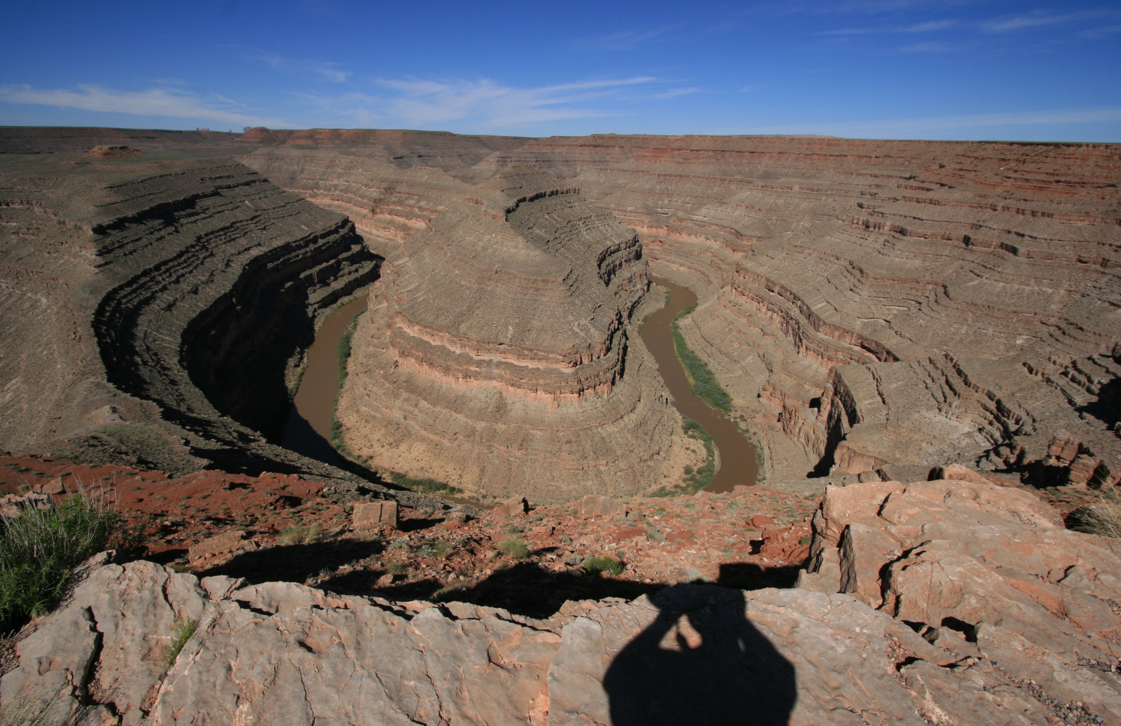
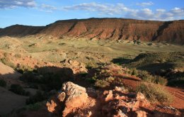
Gaze at the results of 300 million years of time, where the San Juan River winds its way through the
desert 1000 feet below. Goosenecks State Park offers spectacular views of this amazing and rare
geologic formation, known as an entrenched meander. Over a distance of 1.5 miles,
the San Juan flows for more than six miles through the twists of the entrenched meander.
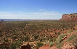
After leaving Goosenecks State Park I headed for my next stop, Natural Bridges National Monument.
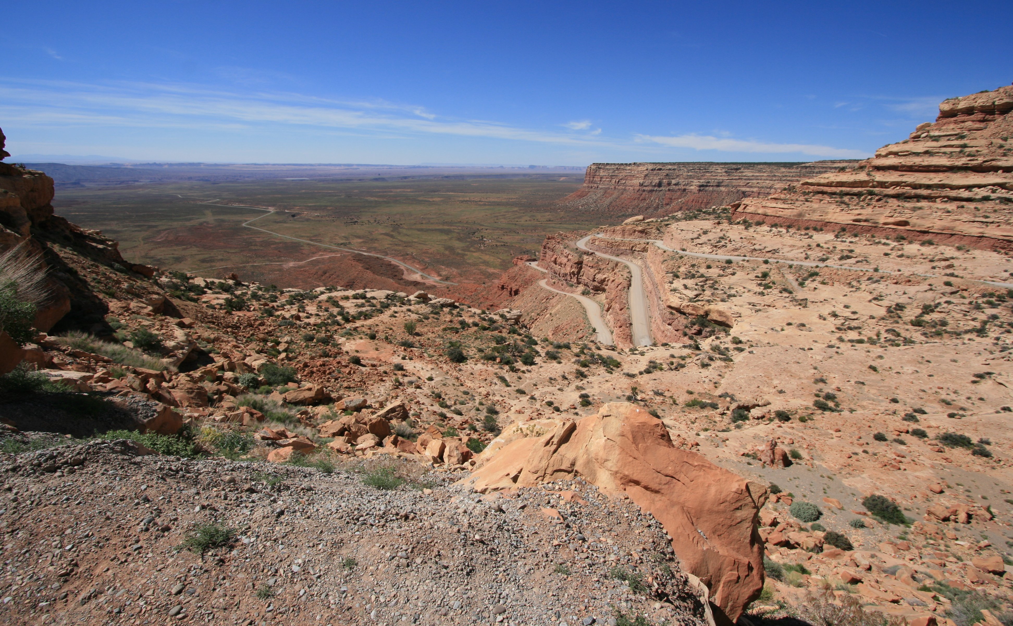
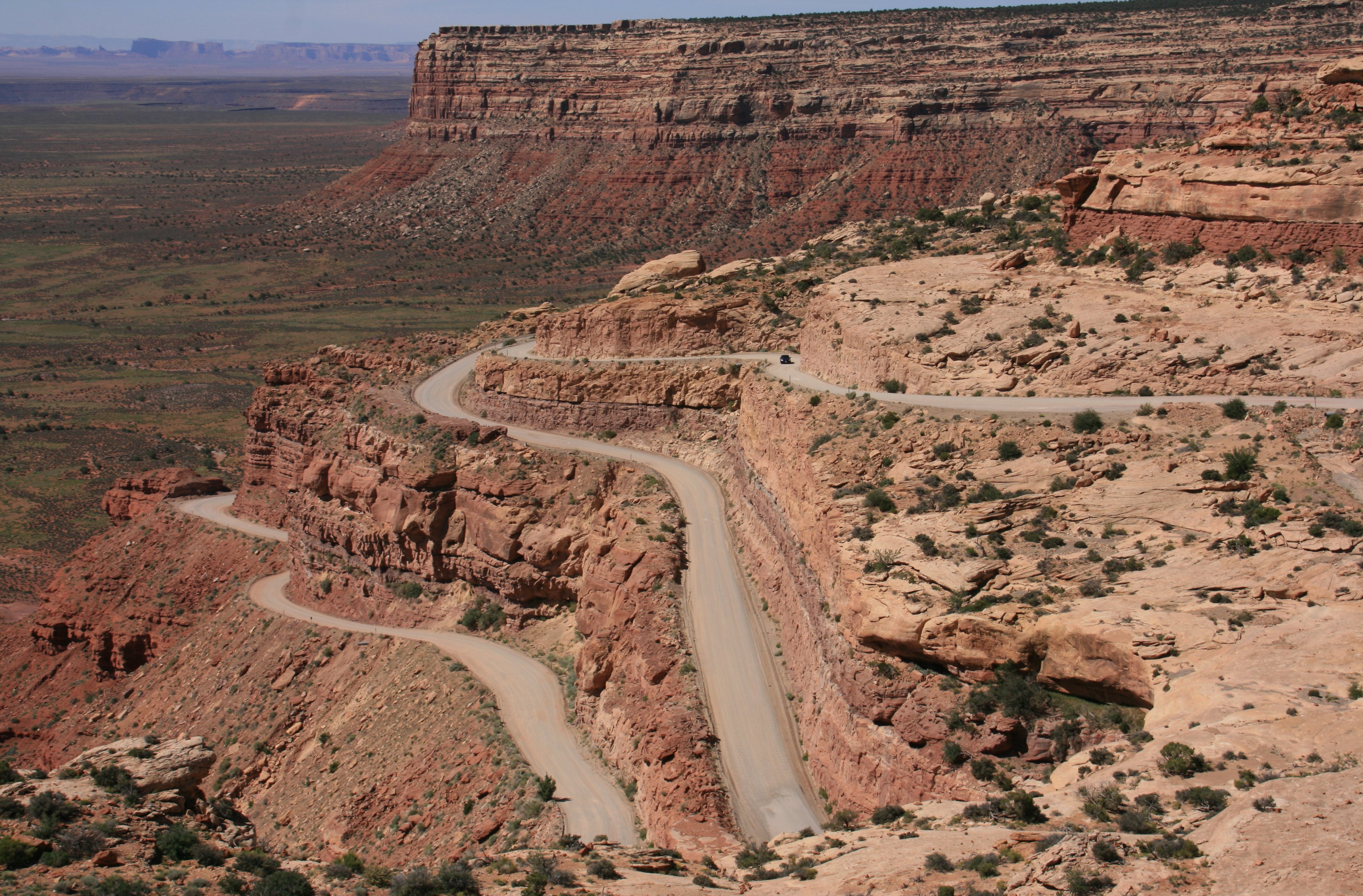
The map shows that Utah Highway 261 is the most direct route so I head down the highway.
What the map did not show was that the paved highway ended when the road had to cross Cedar Mesa butte.
6425 feet above sea level dropping 1100 feet in under 3 miles on hairpin curves at a 10% grade.
Did I mention gravel road, barely 2 lanes wide and NO guardrails?
It was great fun, with great views and an unexpected surprise in my travels.
Natural Bridges preserves some of the finest examples of natural stone architecture in the southwest.
On a tree-covered mesa next to deep sandstone canyons, three natural bridges formed when
meandering streams slowly cut through the canyon walls.
In honor of the areas Native Americans, the bridges are named Kachina, Owachomo and Sipapu.
Unfortunately you get a very poor view of the bridges from the overlooks.
I did not want to walk the steep trails with ladders in the 105 degree heat, so I did not get any good pictures.
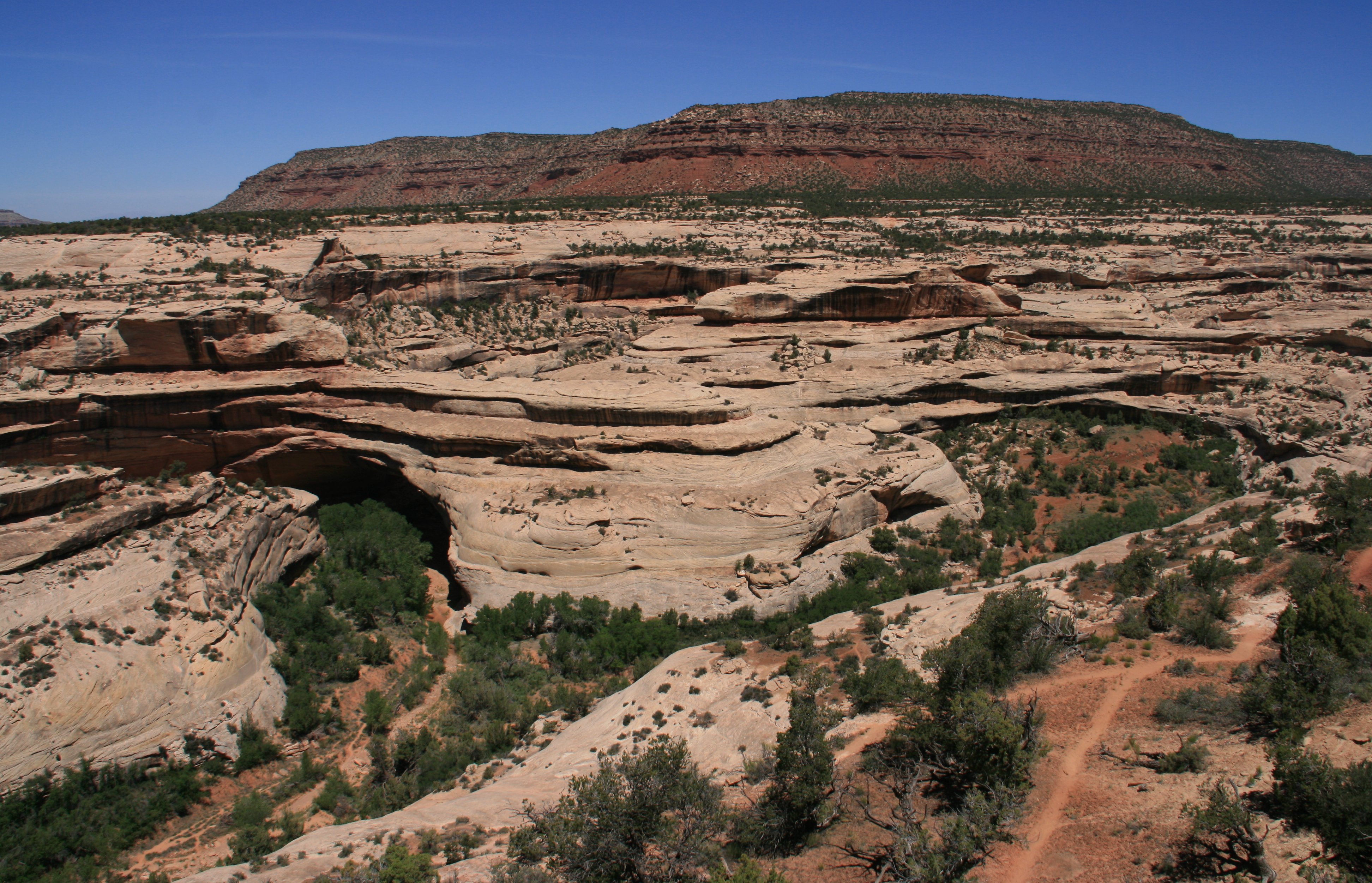
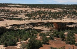
but don't expect much of the bridges themselves. |
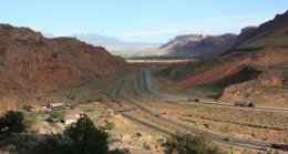
After leaving Natural Bridges it was a 106 mile drive to Moab.
I checked into my hotel, the Holiday Inn Express, where I would be staying for the next three nights.
You can check out my accommodations in the three minute video below. |
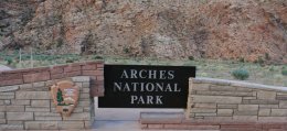
Later in the evening as the sun began to set and the
temperatures dropped, I visited Arches National Park.
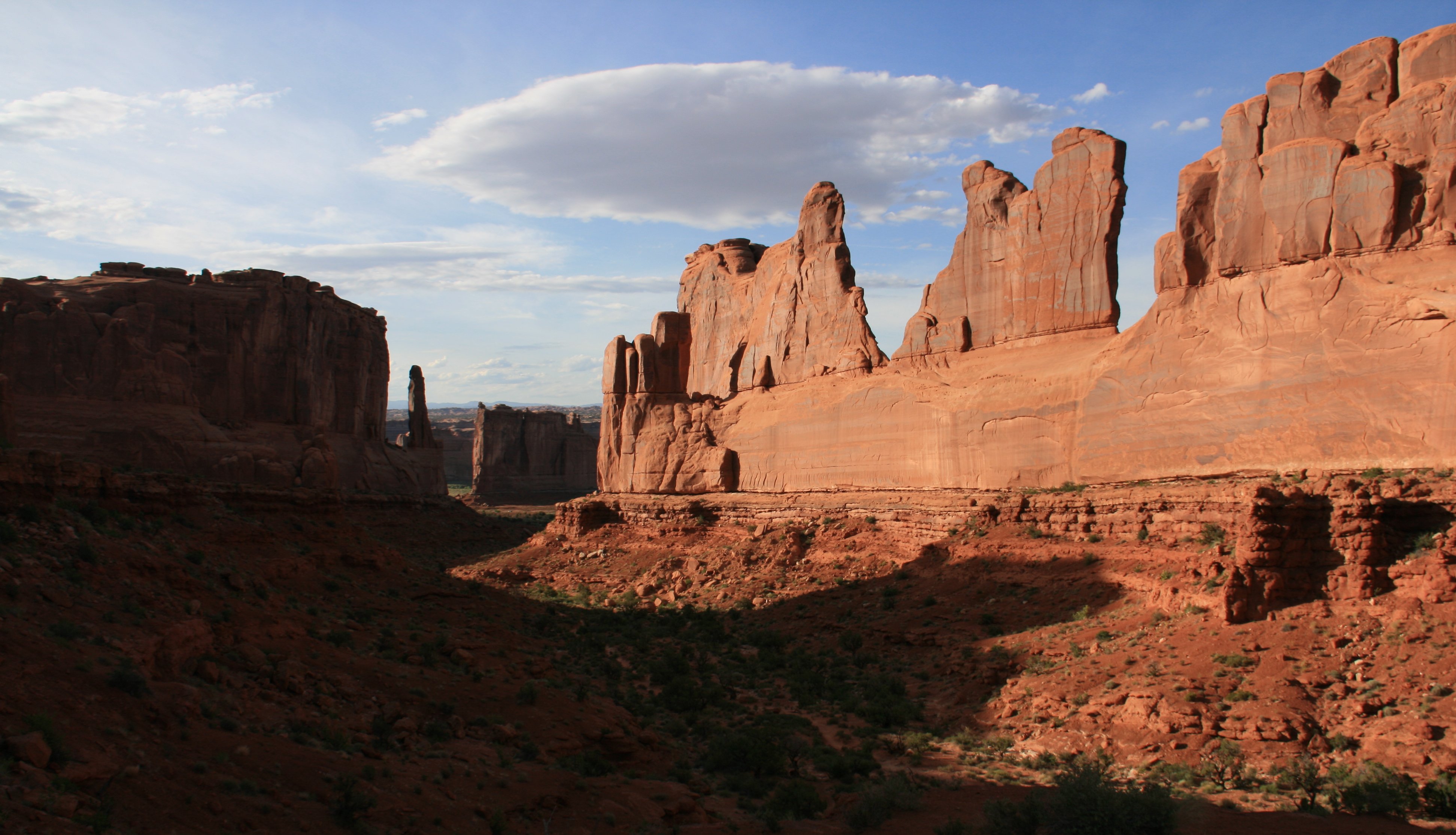
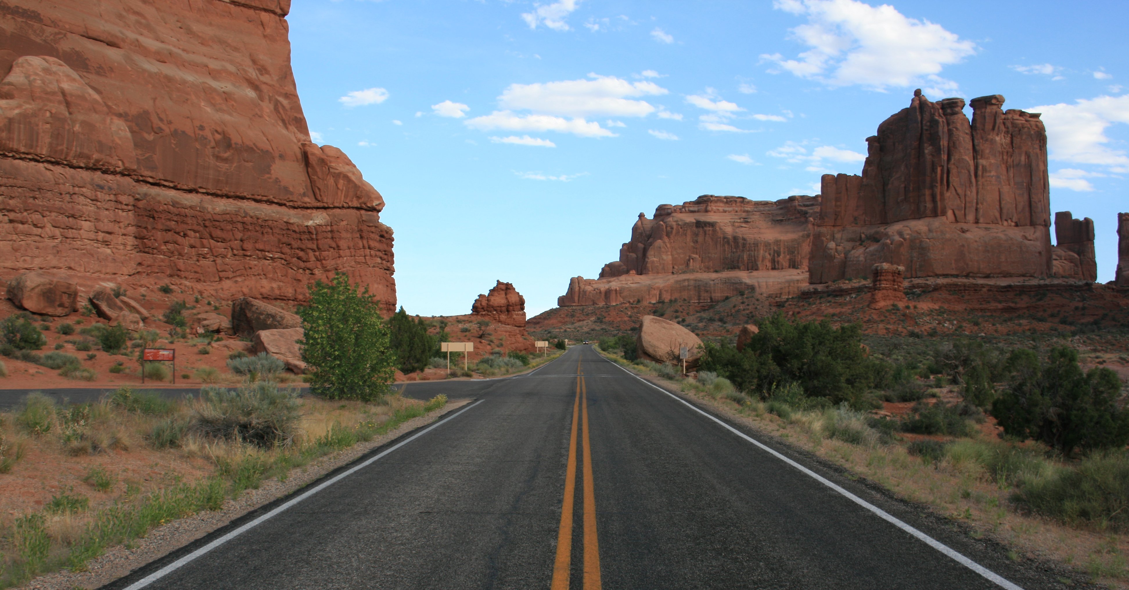
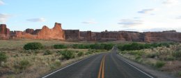
It seems that everyone's first stop at Arches is at Park Avenue, I was no exception.
You can enjoy the view of the tall, thin red rock fins from the trail at the viewpoint, or hike into the valley.
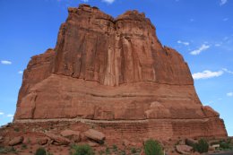
Very near Fifth Avenue is the imposing monolith called The Organ.
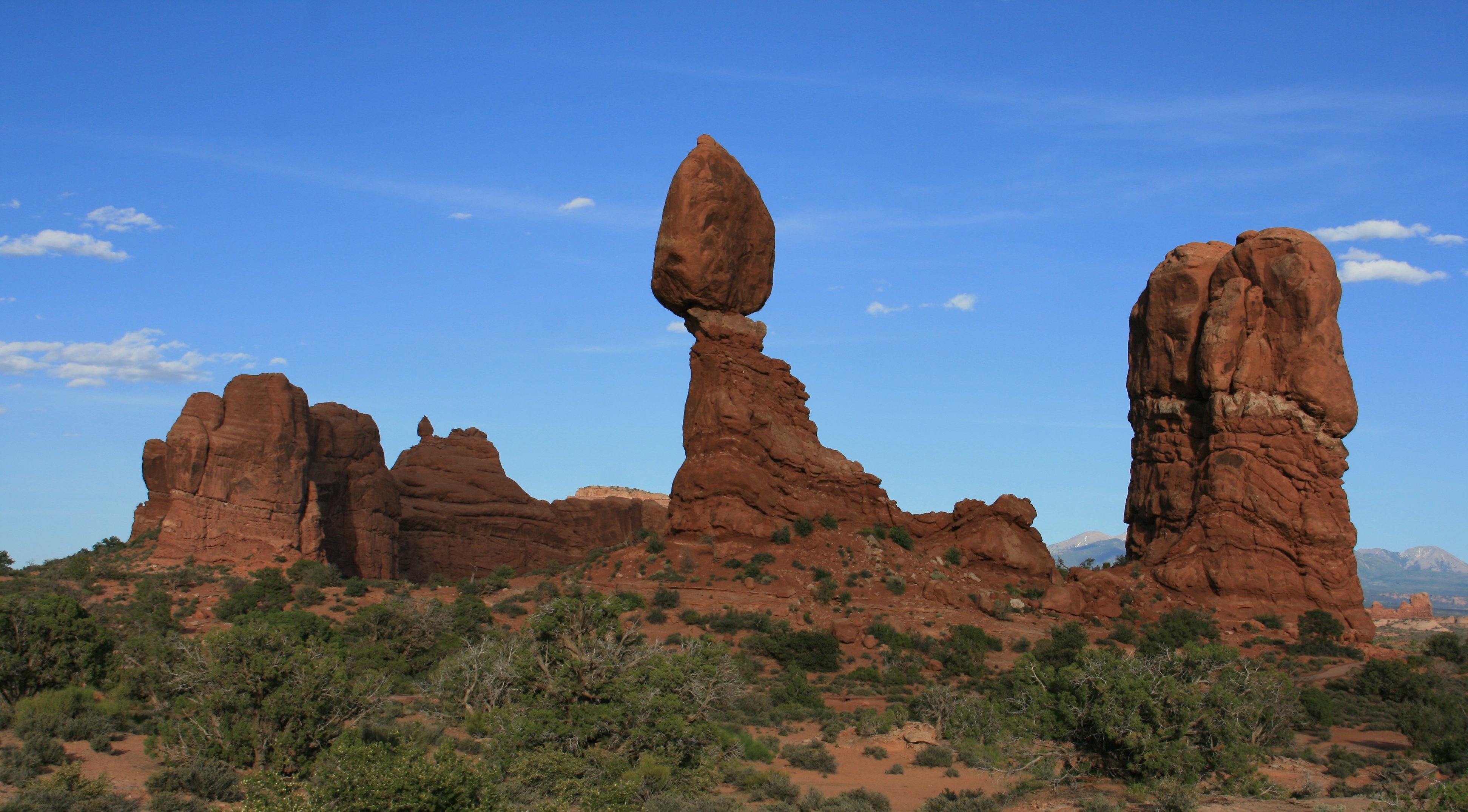
Balanced Rock is one of the most popular features of Arches. The total height of Balanced Rock is about 128 feet,
with the balancing rock rising 55 feet above the base. The big rock on top is the size of three school buses.
Balanced Rock used to have a companion, a smaller version named "Chip Off The Old Block", which fell in 1976.
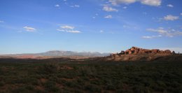
You get a nice view of the La Sal Mountain off in the distance from Arches National Park.
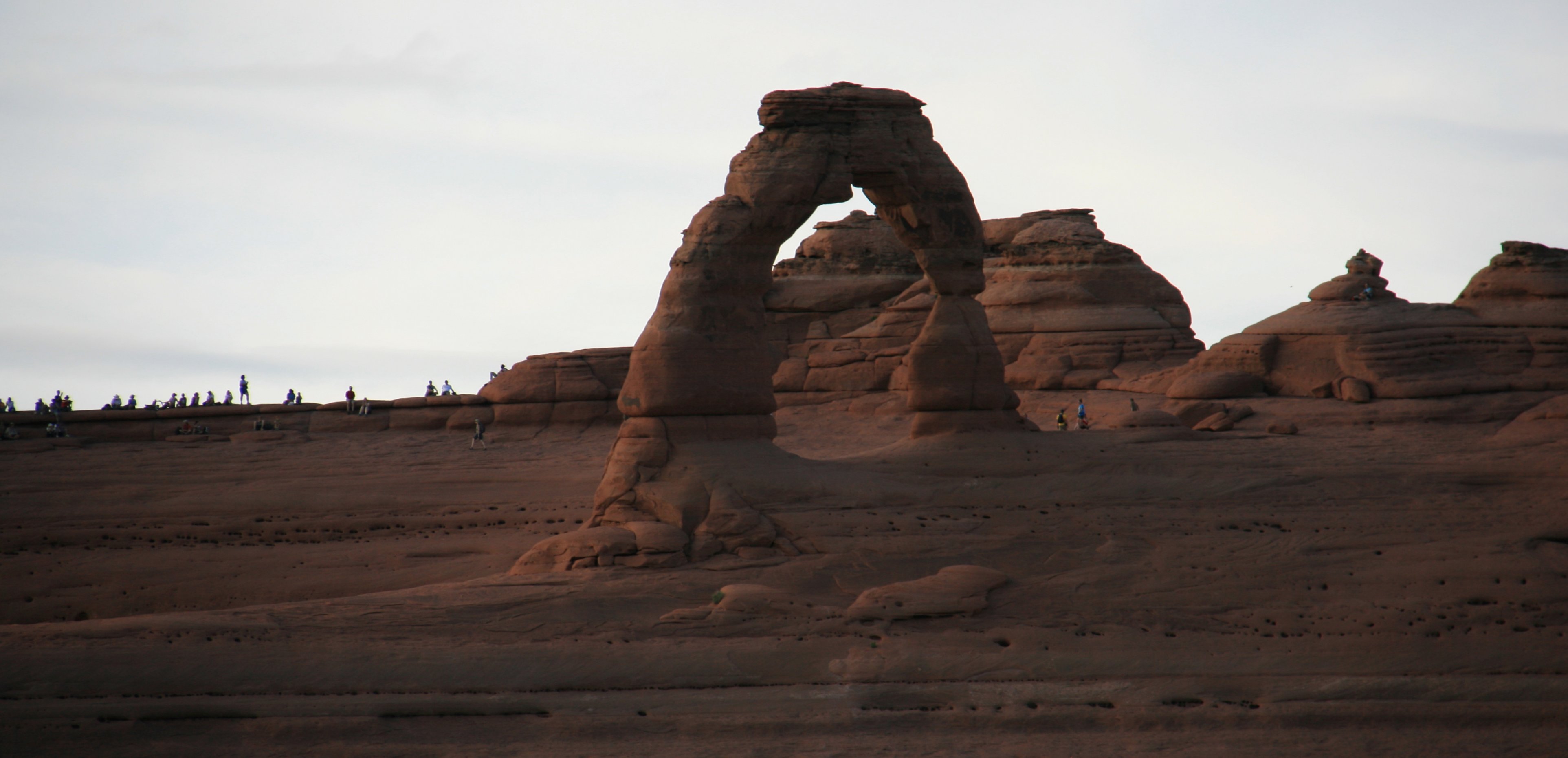
Delicate Arch is one of Utah's most famous icons. You see images of it everywhere: on magazine covers,
computer screen savers and license plates. But photos do not adequately convey the stunning beauty that
hits you as you come over the ridge and see the arch in person for the first time.
About out of Sunlight I had to leave the park, but I would return in a couple days.
There are more videos of Arches ahead on June 10. |
|
Hello again, Last night here at the hotel they showed old John Wayne movies on a big outdoor screen. The movies were filmed here in Monument Valley. I set the alarm for 5:00am so I could watch the sun rise from my balcony. Then I went back to bed. When I finally did get up I had a 250 mile drive ahead of me. I made some stops along the way. My first stop was at Goosenecks State Park. My next stop was going to be Natural Bridges National Monument. We had to cross this butte on the way. The map didn't show that the highway ended and you had to cross the butte on a narrow, gravel road at a 10% grade with 180 degree hairpins turns. Barbara, I thought of you while I was climbing the butte. Looks like your ideal vacation spot to me. It was great fun and the views were great. An unexpected surprise. Much more enjoyable than the place I was traveling to. Natural Bridges National Monument didn't turn out to be much. The views of the bridges from the overlooks were poor. From the elevated overlooks you could hardly tell they were bridges. There were trails down to the bridges for better looks, but they were steep and long and not something I wanted to do in 100 degree heat. Can you tell that's a natural bridge up there. The park has the largest concentration of natural bridges in the world. I then drove on up to Moab next. I got here at 2:30 and took a break until about 6:00 to beat the heat of the day. Then I went over to Arches National Park. I waited a little too long as the sun was too low in the sky for a lot of the views. But I did get a few nice shots as the sun was setting. Below is Park Avenue. It was a pretty drive. The temps drop quickly when the sun starts to set so it was very comfortable. Below is Balanced Rock. I hiked up to the Delicate Arch viewpoint. I wouldn't have wanted to do that during the heat of the day. Going to be here in Moab for a few days so I will go back to Arches again before I leave. That's it for today. Will write again soon, Tim |

Click on the arrow above to see tomorrow's adventures!
| TIM'S HOME PAGE SITE INDEX | |||
|---|---|---|---|
| Areas | Description | # of Pages | |
| About Me | Current Picture of me and my home. Information about myself. | 2 | |
| Biography | Pictorial biography of myself. Pictures range from birth to adulthood. | 4 | |
| Family File | Pictures of my family and a little information about them. | 12 | |
| Local Spotlight | Pictures, Links, and Information for Indianapolis, Richmond, Plainfield, and Mooresville, Indiana. | 6 | |
| Tim's Travels | Pictures, videos and travelogs from my travels around the world. | 409 | |
| Vacation Videos | Over 1500 videos from my travels around the world. | 1 | |