(Panama Flag)
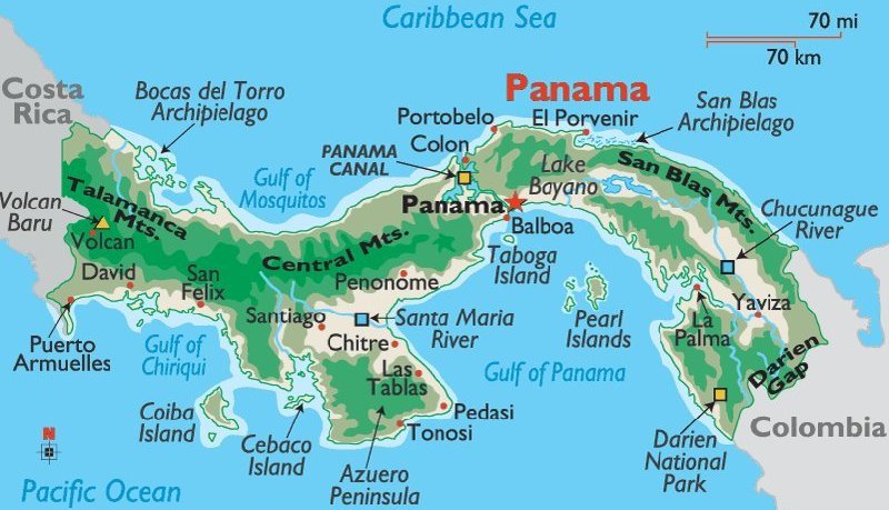
(Panama Map)
All of the images below are thumbnails and can be clicked on for a larger image.
TUESDAY, DECEMBER 14, 2010:
Prior to our arrival in Panama City there had been terrible weather here causing massive flooding.
The Panama Canal was even closed for a while for only the third time in its nearly 100 year history.
The showers we had today weren't too bad considering what they had to endure before we got here.
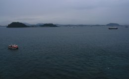
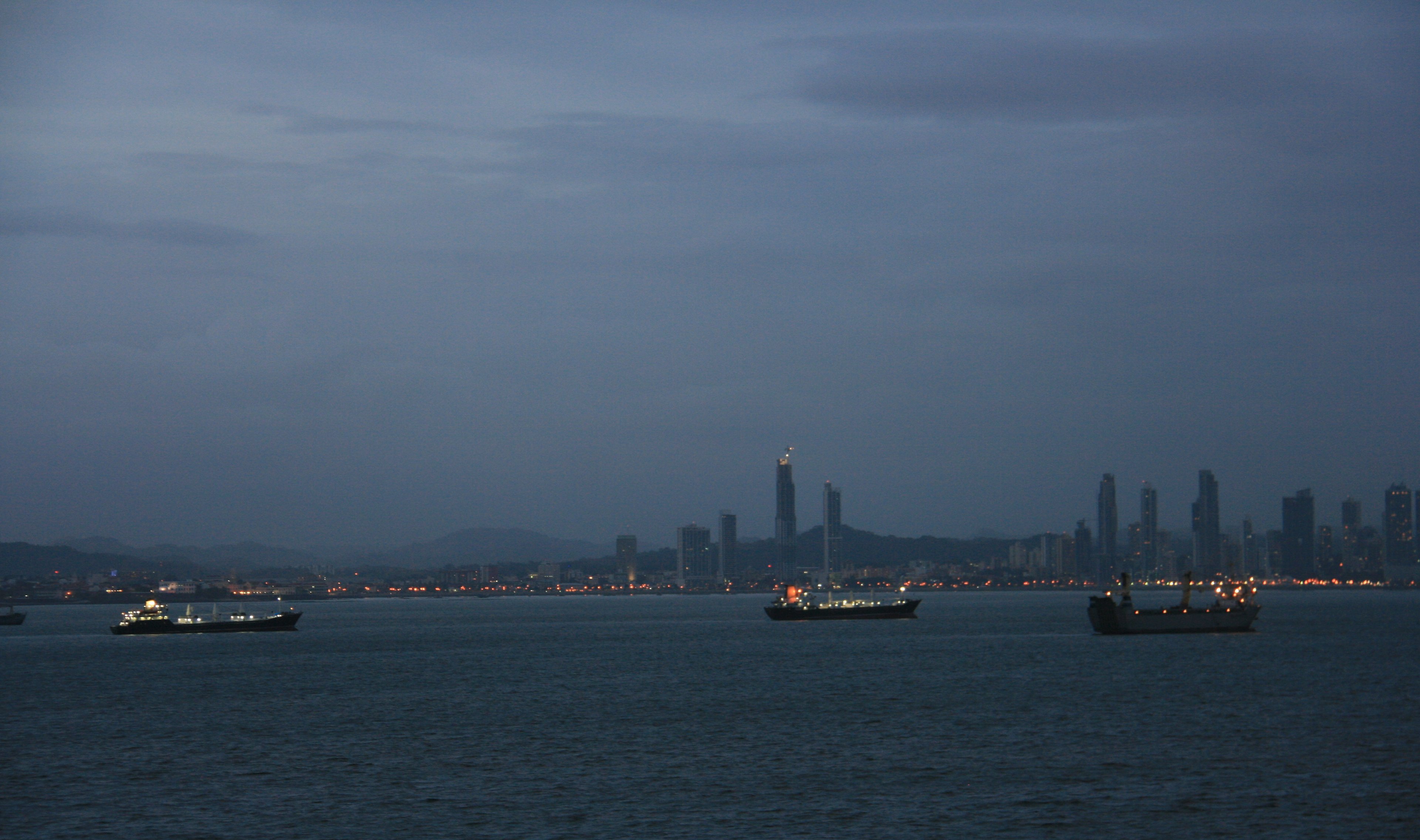
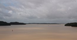
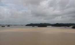
We anchored the ship off the coast of Panama City in Puerto Amador around 8:00am.
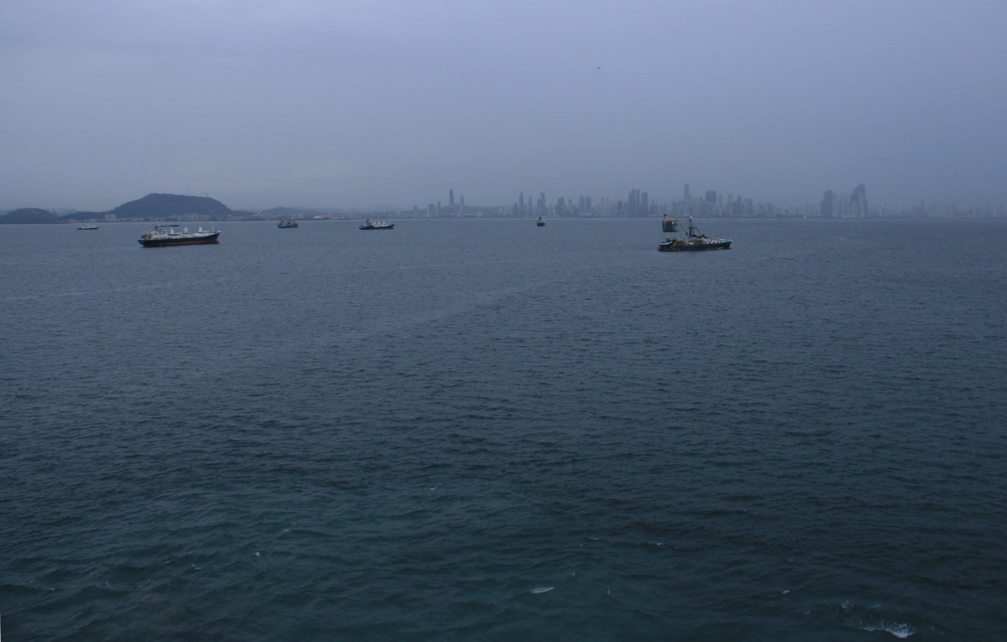
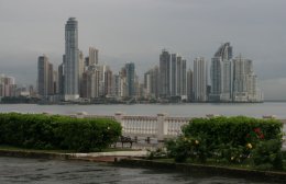
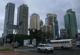
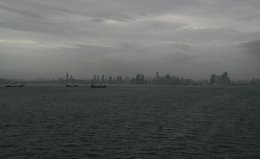
These pictures show the city's rapidly growing skyline. A large portion of the building are still under construction.
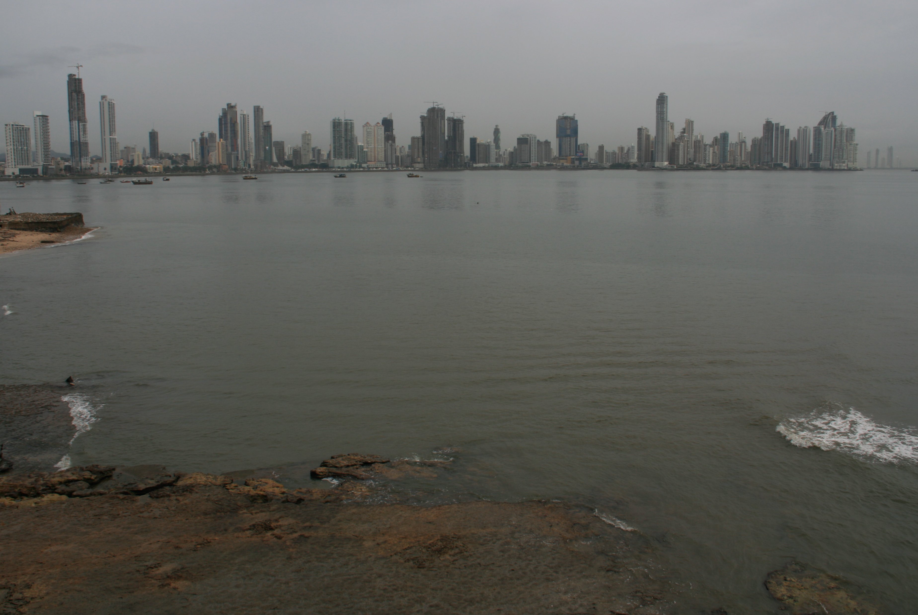
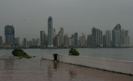
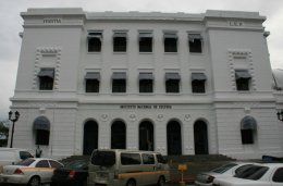
We had an absolutely awful tour guide, so I can't identify some of the buildings in these pictures.
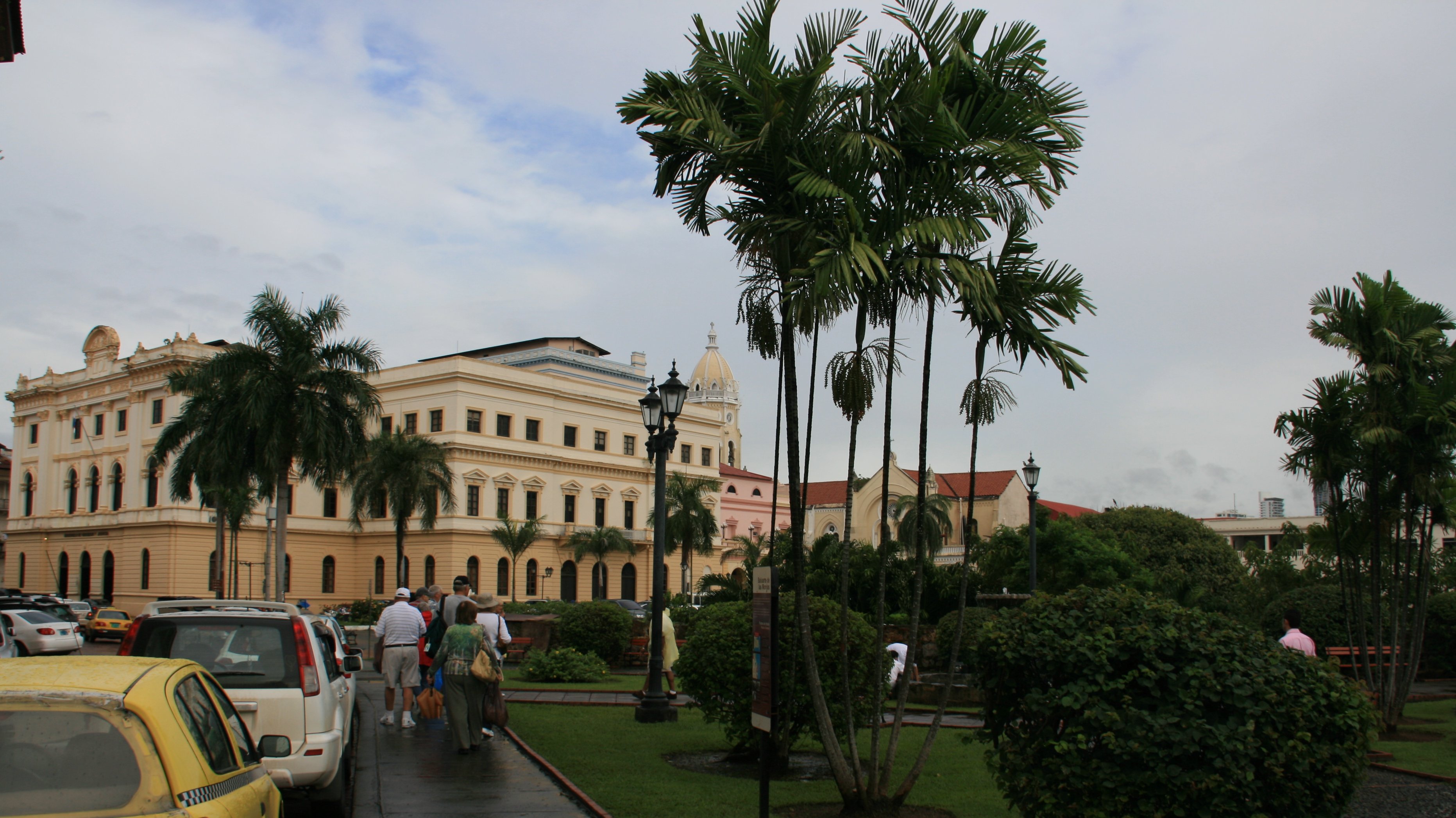
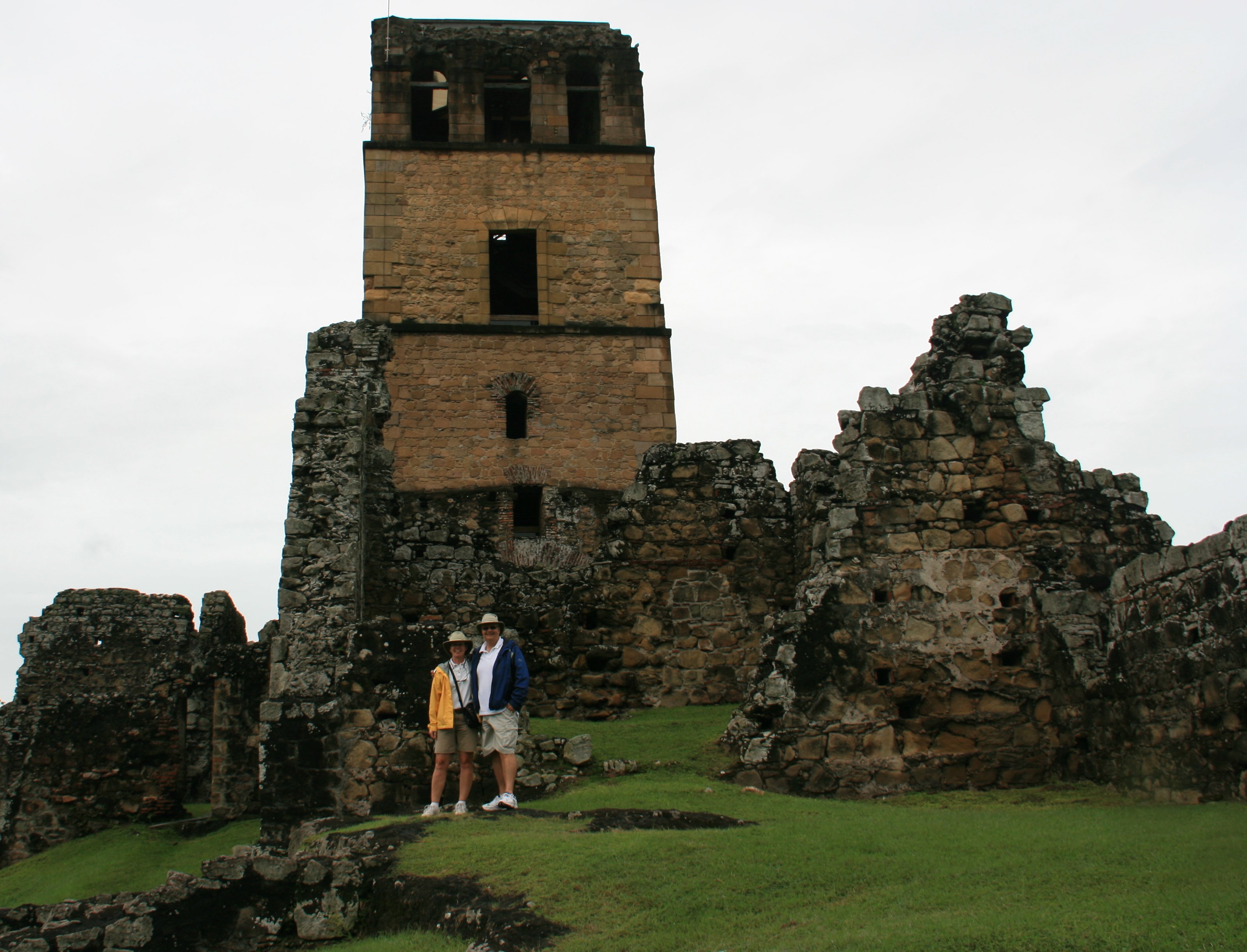
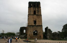
Two miles from the center of Panama City are ruins of the first capital, known as Old Panama, founded in 1519.
Fragments of walls and arches recall the splendor of the Spaniard's first settlement on the Pacific.
The most impressive structures remaining are the cathedral, with a massive bell-tower, and the Bishop's House.
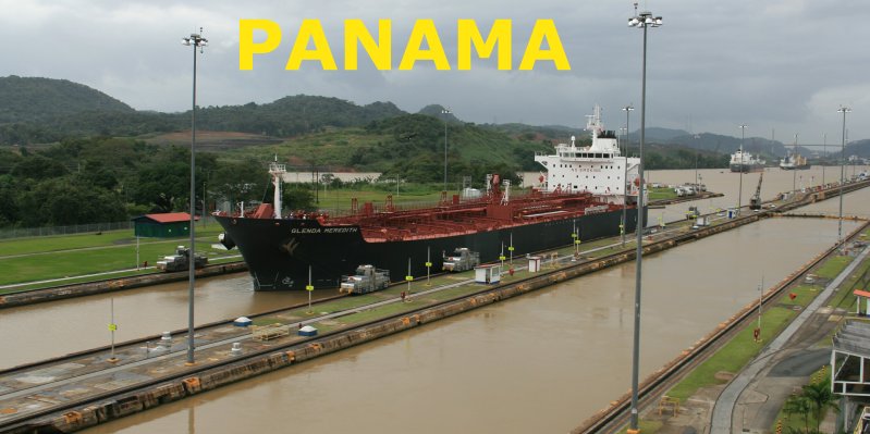
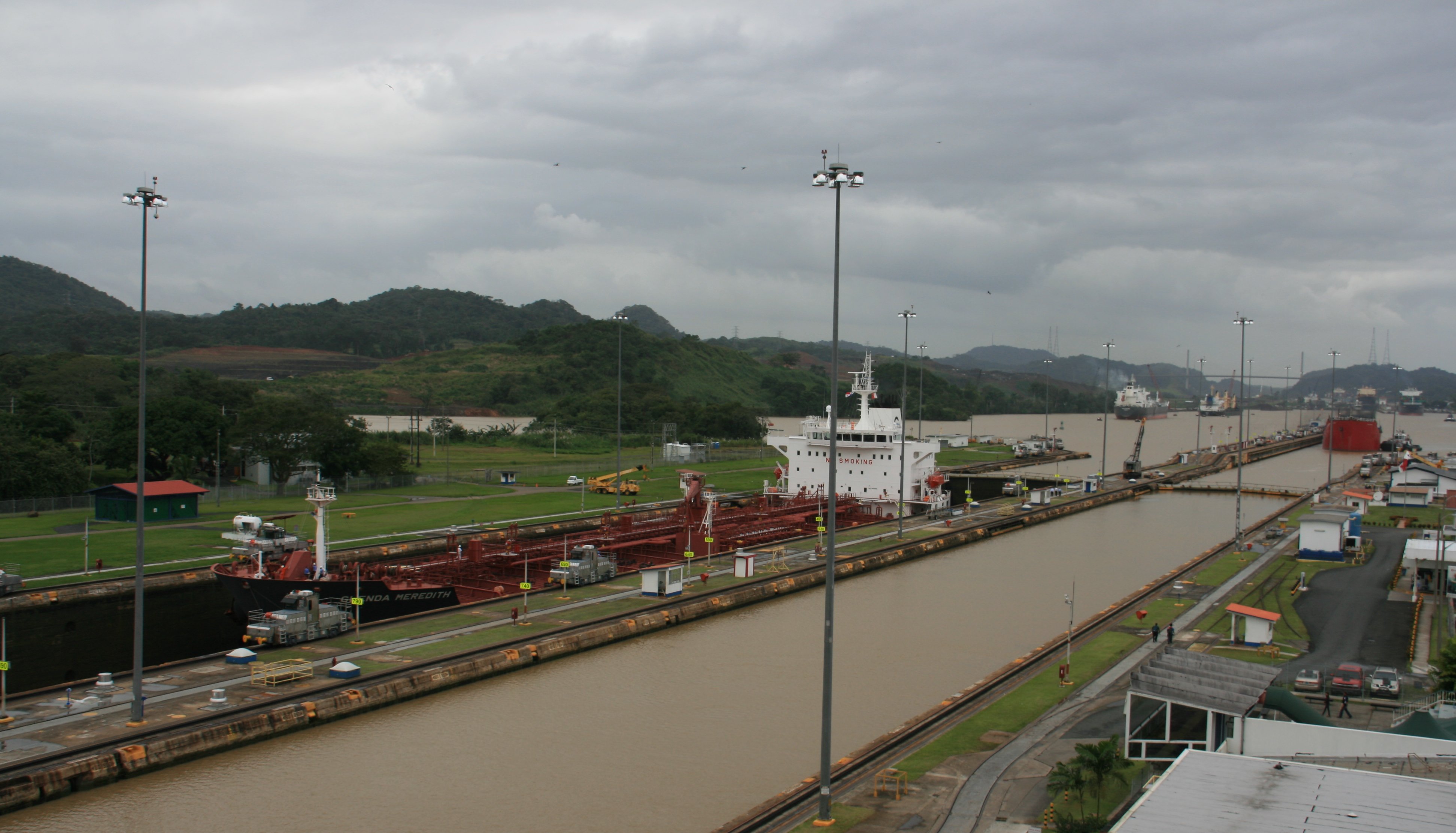
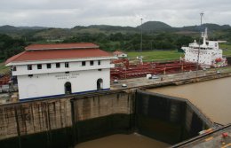
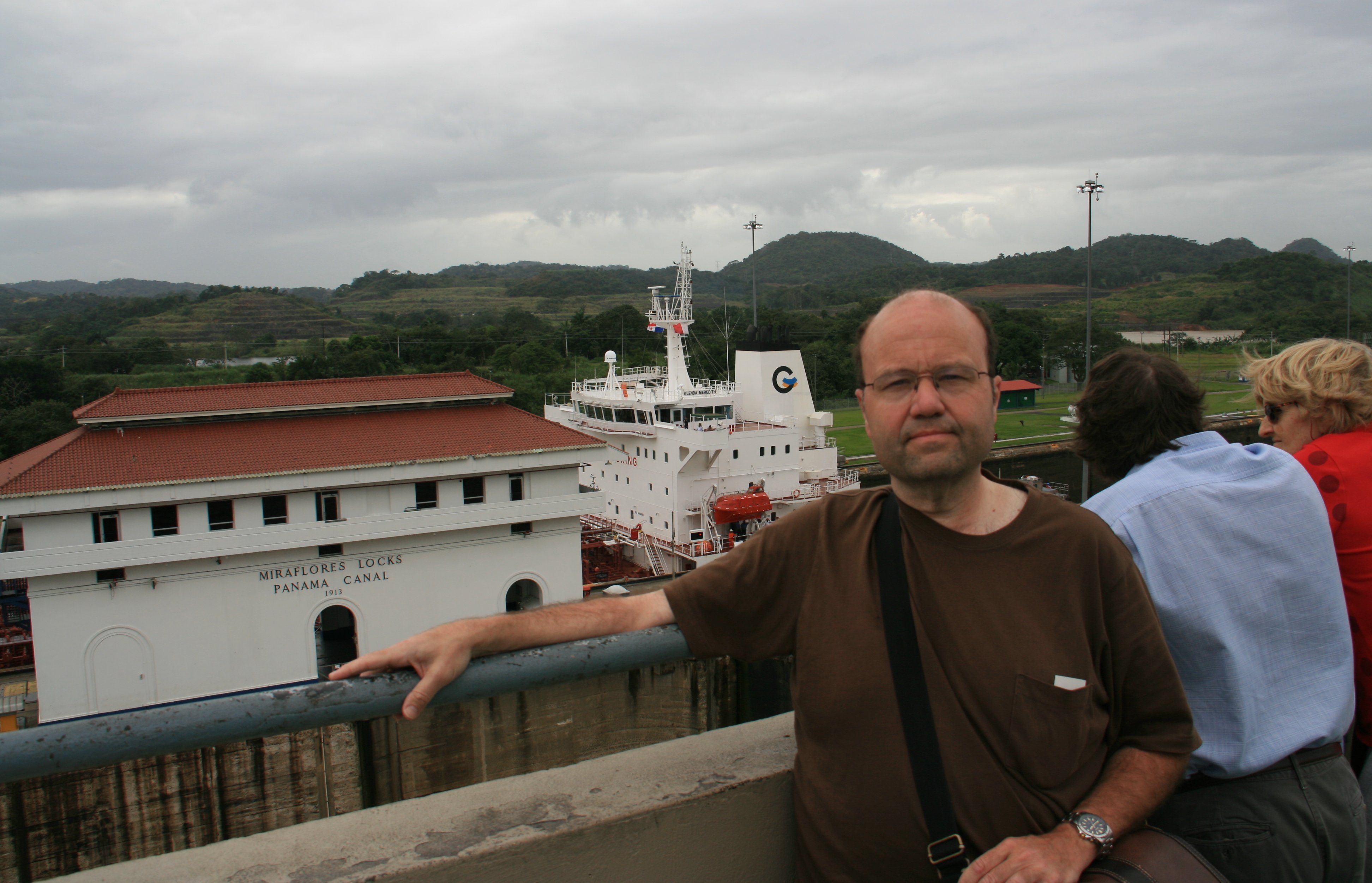
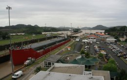
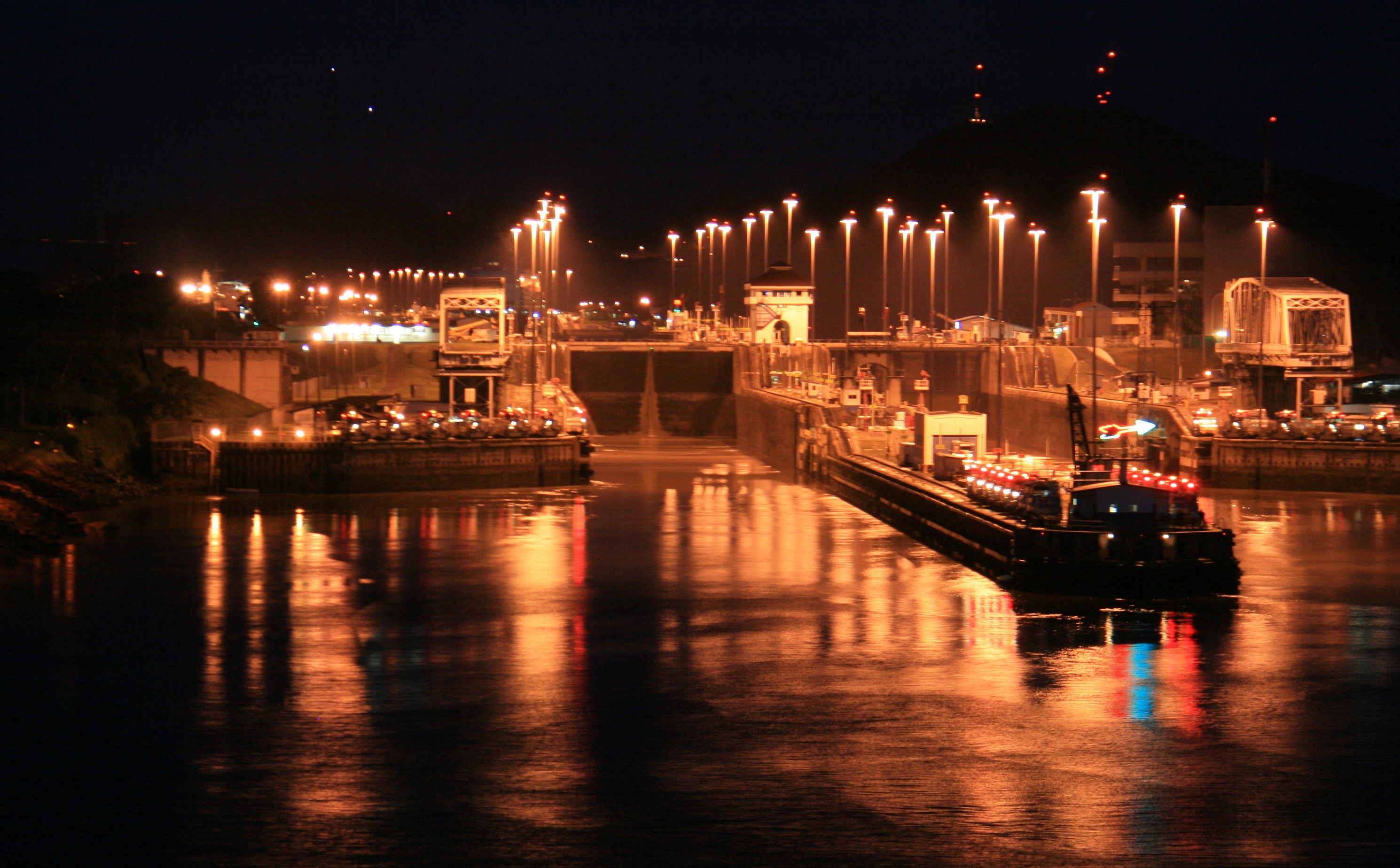
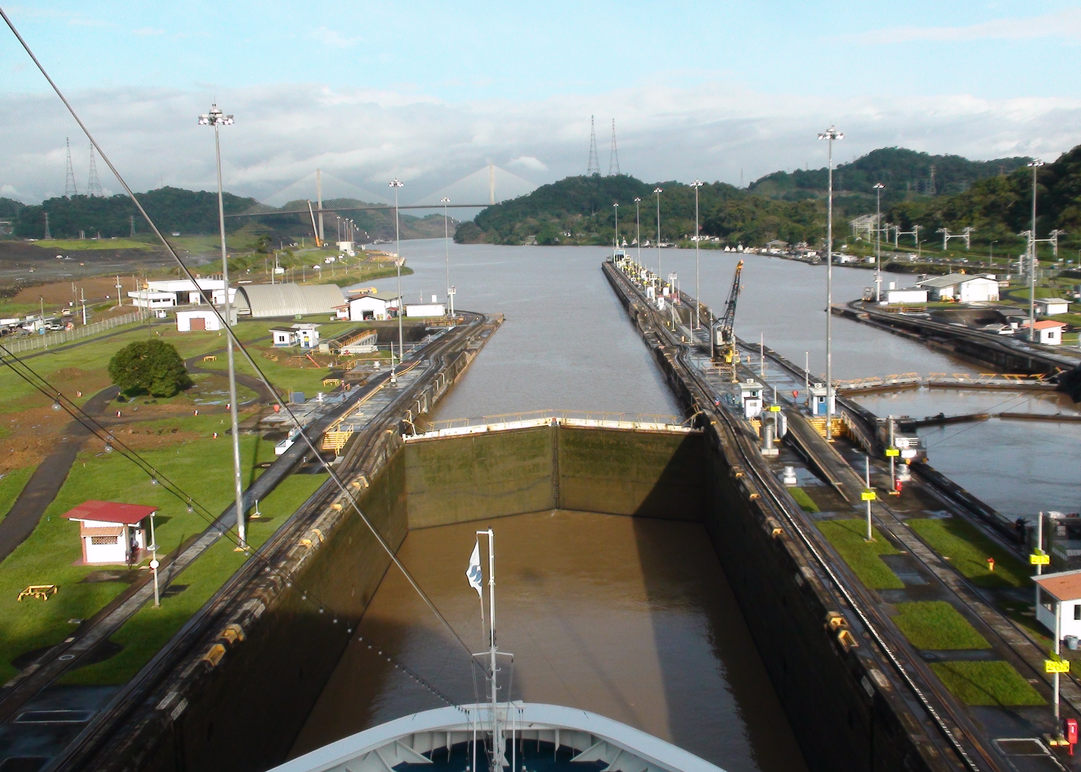
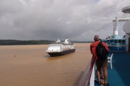
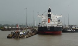
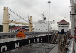
I took another shore excursion out to Miraflores Locks in the afternoon.
Much better experience and tour guide on this one.
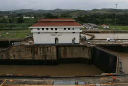
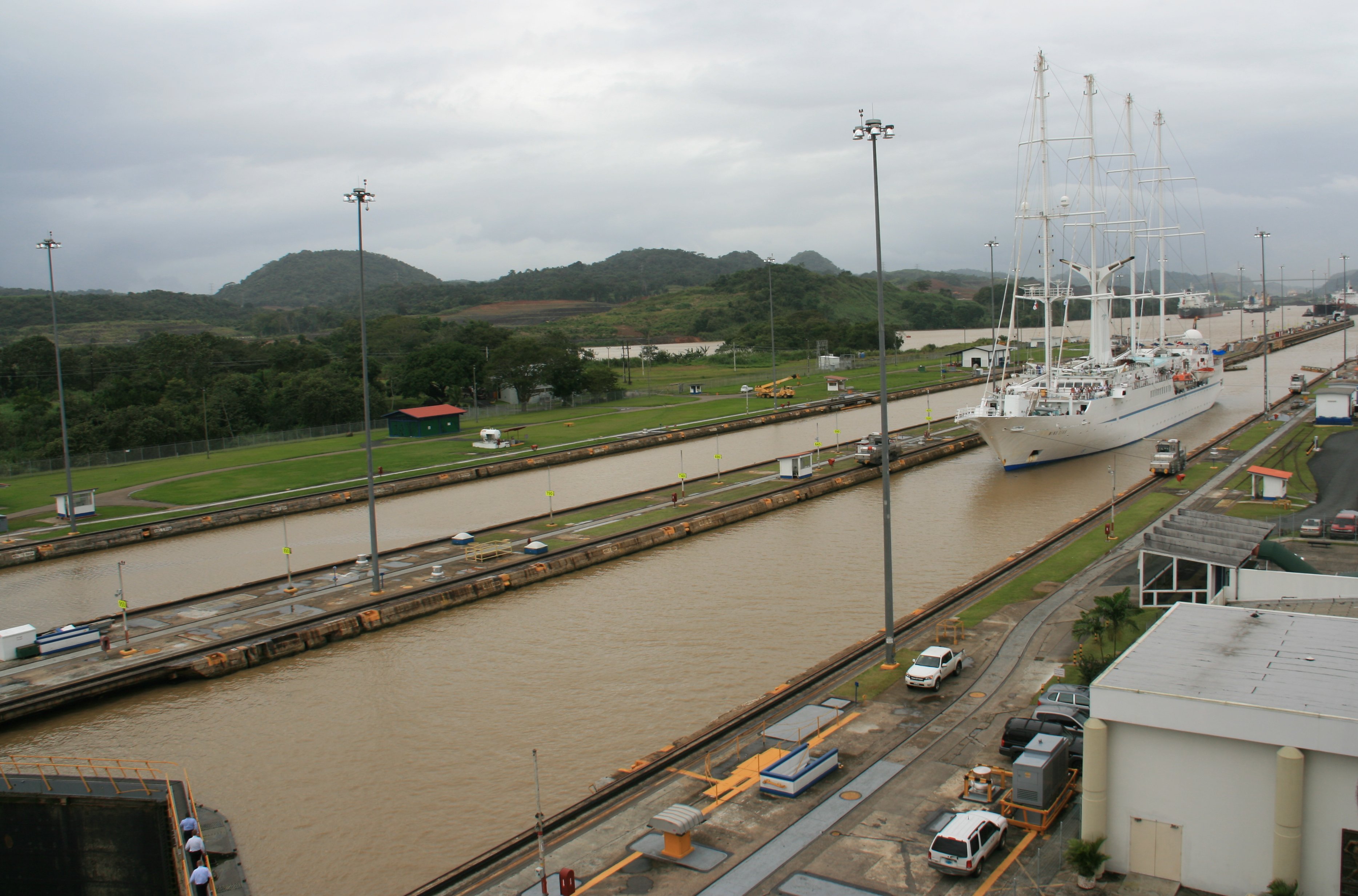
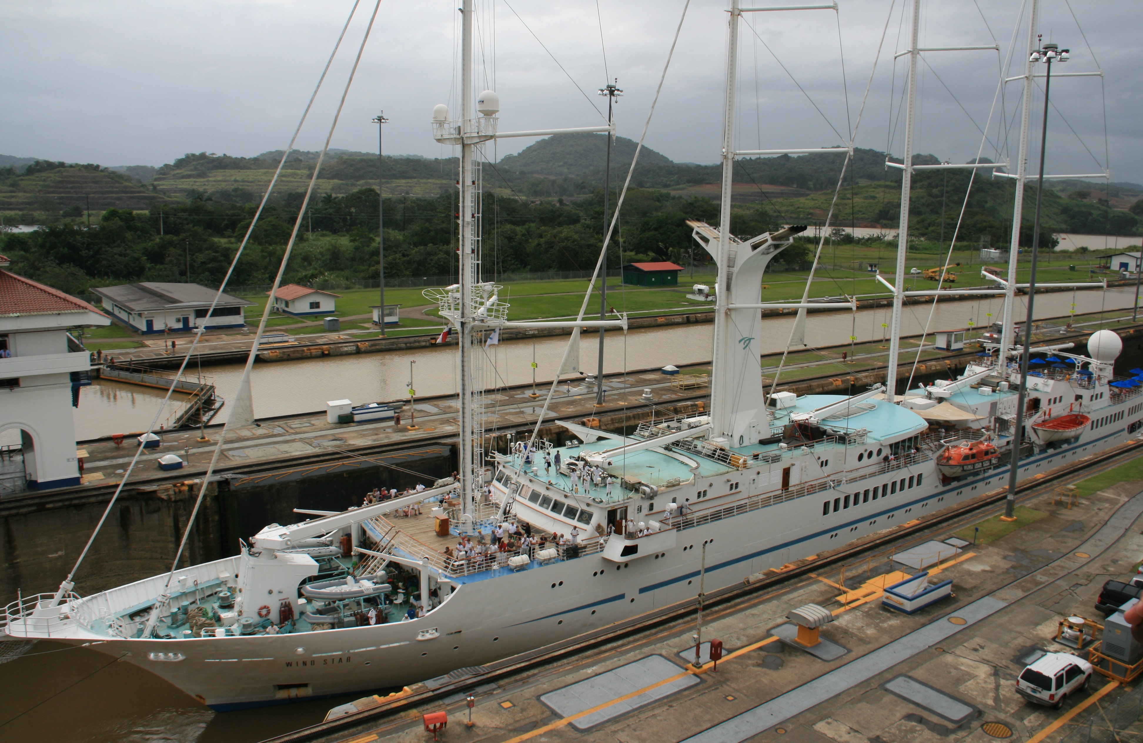
It was fun watching the traffic go through the canal.
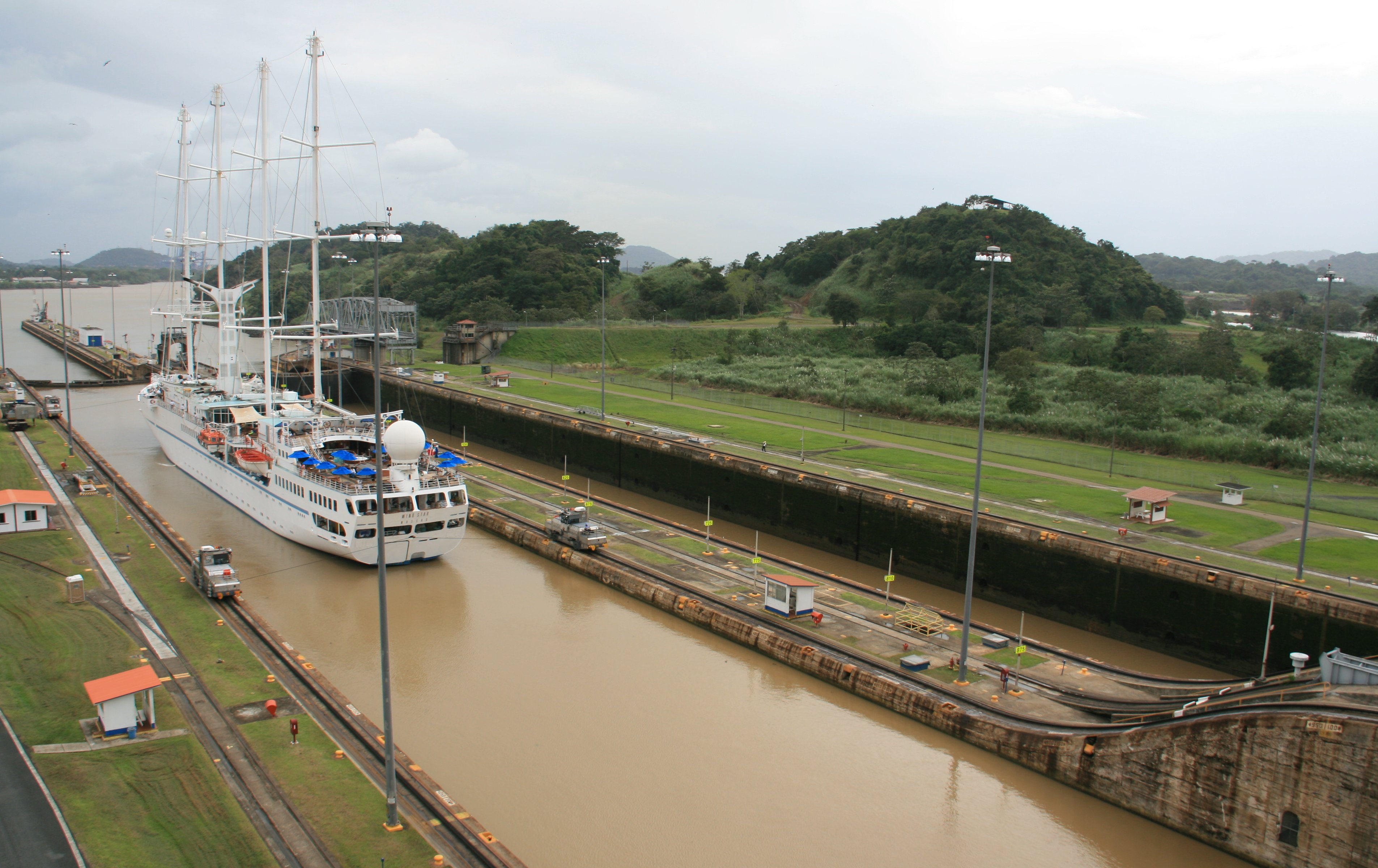
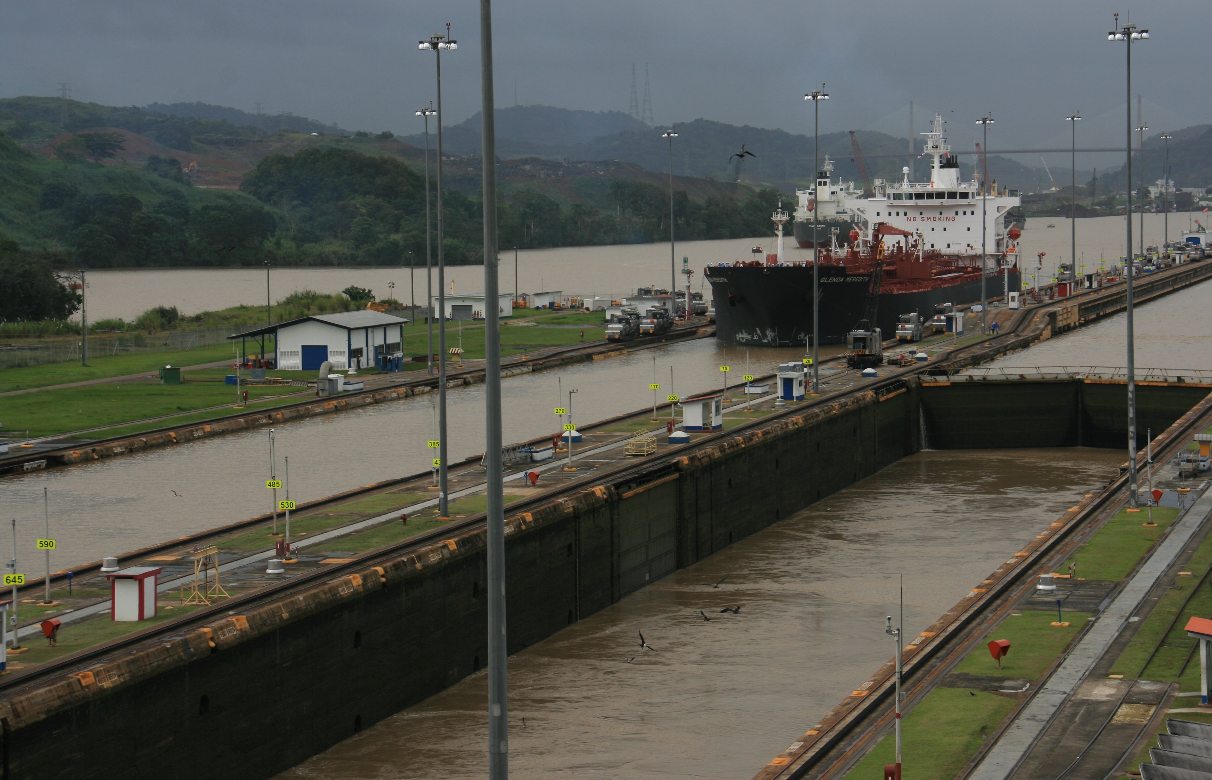
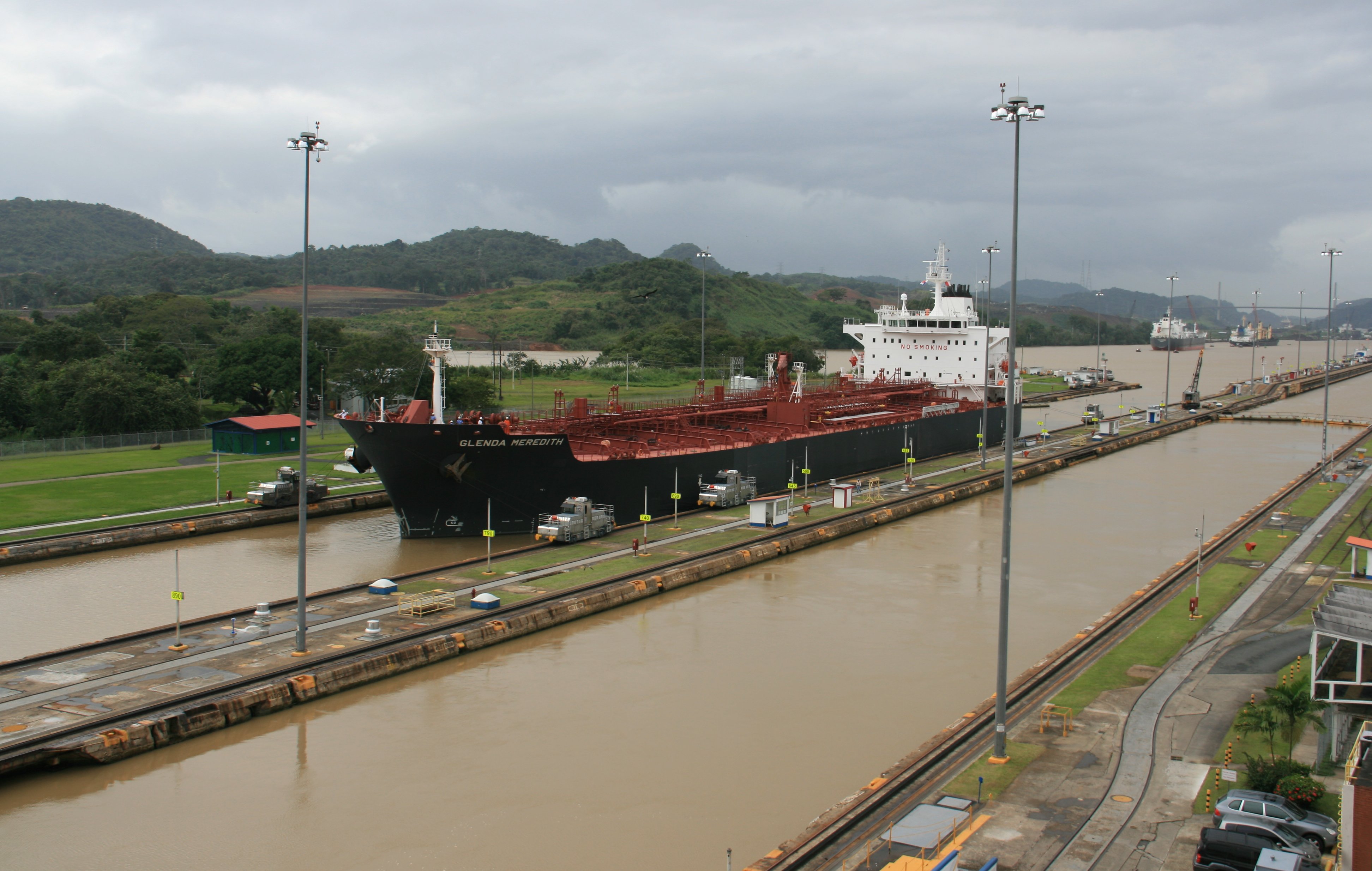
The weather was much improved in the afternoon, no rain.
After leaving the locks we returned to the ship for the evening.
The video of the Panama Canal is after Wednesday's pictures. |
|
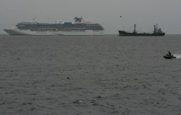
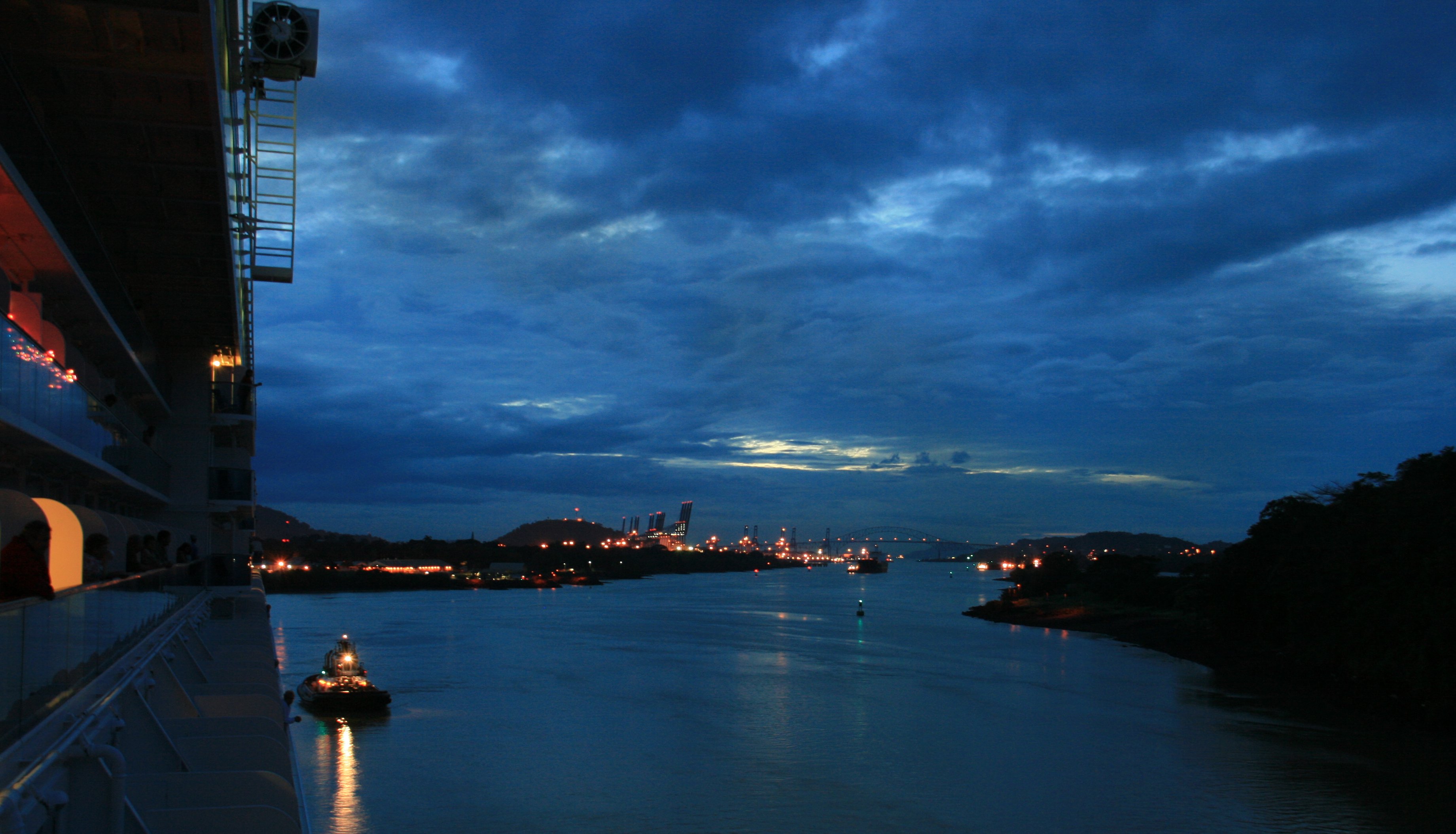
Hello folks, It wasn't a very nice day in Panama. But compared to the horrible weather they had before we got here, it wasn't too bad. We dropped anchor at 7:00 this morning. The picture below was taken from my balcony as we sailed in this morning. As you can see by the picture above it was not a very clear day. It misted rain all morning. This morning I took a tour of Panama City. It wasn't a very good tour. What few places we stopped we were rushed through. The only places we stopped for more than a minute were gift shops, surprise, surprise. Below is a picture of the Panama City skyline. This city is growing like a weed. About 60% of the buildings in the skyline are still under construction. I think the picture below is a colonial palace. I had to snap it quick because we only stop for gift shops. Our last stop was at the ruins of Old Panama. Below is the old cathedral. It was back to the port after Old Panama. My original afternoon tour was canceled due to the floods here. So I had to wait around the tender dock for a while to see if they could fit me in on another tour that was fully booked. I was able to get on the tour. Weather this afternoon was better, it stopped raining at least. We went over to the Miraflores Locks and watched the ships go through the Panama Canal. There are three sets of locks to go through on the 50 mile long Panama Canal. The Miraflores Locks are the first set on the Pacific side. The three pictures below show a beautiful cruise ship going through the locks. After the last picture he sails out into the Pacific Ocean. They are building a new set of locks on the other side of these. The largest earth moving project ever done on Earth. Due to be done in 2014. They will be twice as wide as these. The next four pictures show a large tanker going through. Notice how much lower the ship is in the picture below. Ignore the ugly guy that needs to go on a diet in the picture below. Got back on the ship just before dark. Snapped the photo below from my balcony again. You can see the many ships at anchor waiting to go through the canal tomorrow morning. We will be going through the Panama Canal tomorrow. Hopefully weather will be nicer. More later, Tim |
WEDNESDAY, DECEMBER 15, 2010:
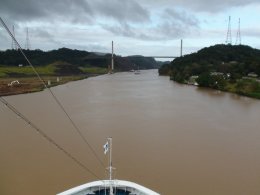
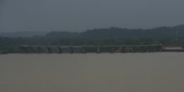
Wednesday started way before dawn as we raised the anchor and sailed under the Bridge of the Americas.
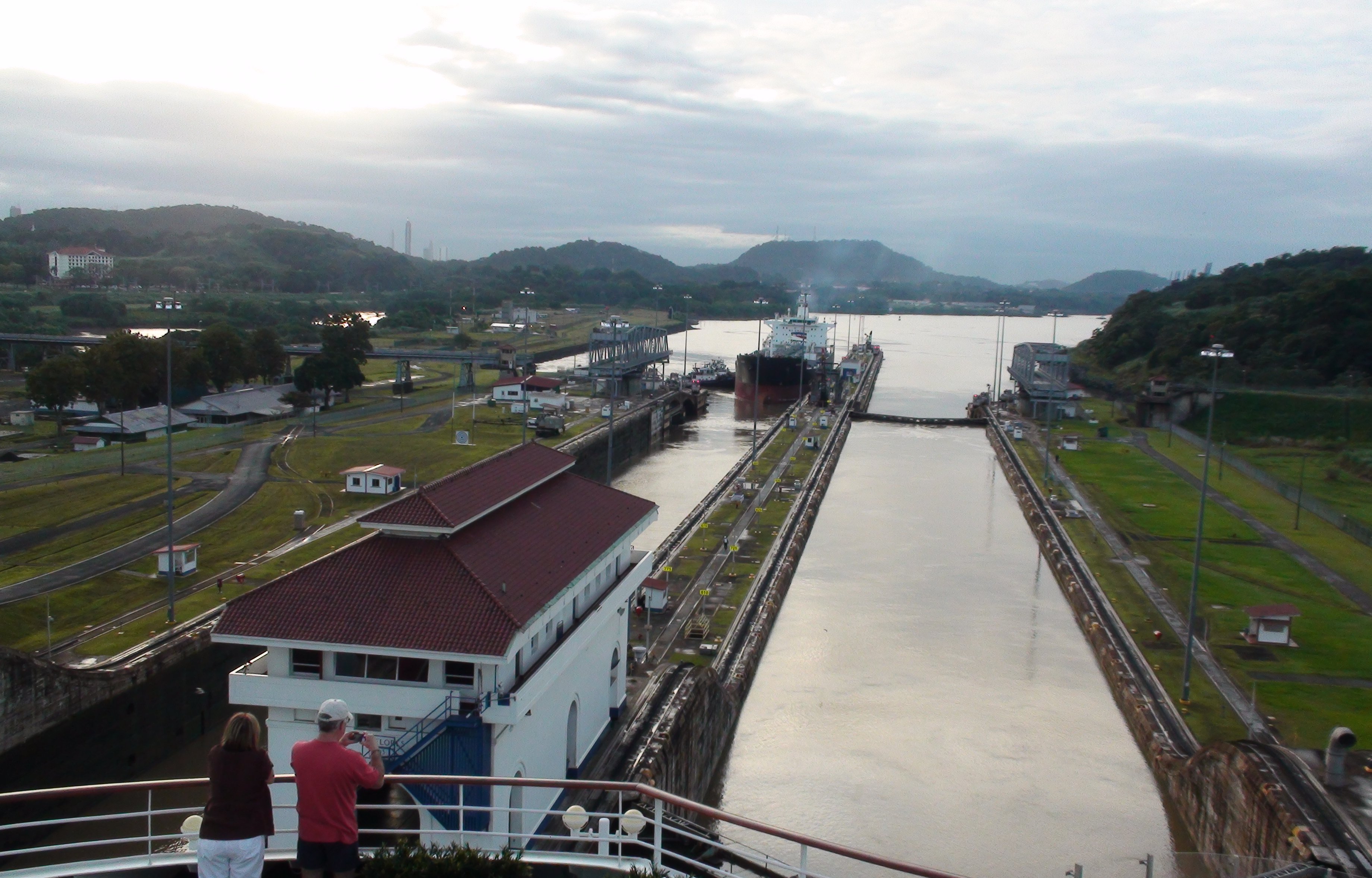
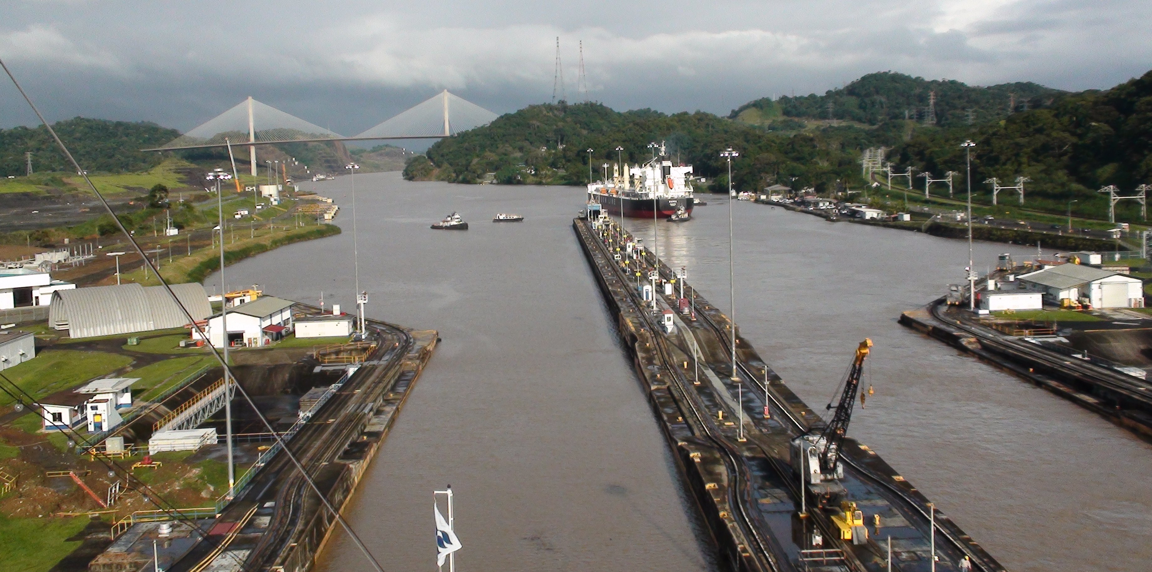
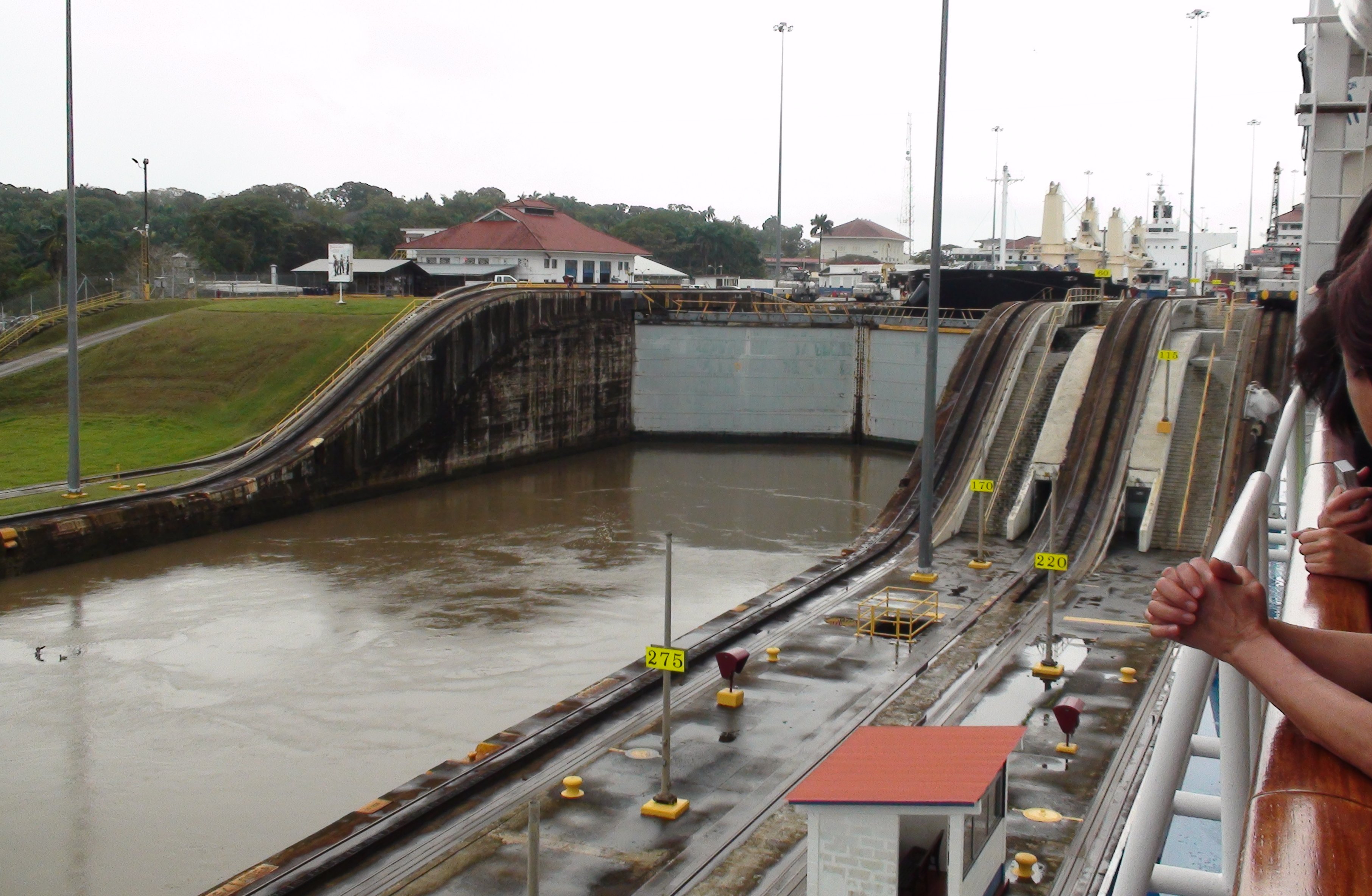
We started transiting the two chambers of the Miraflores Locks at dawn.
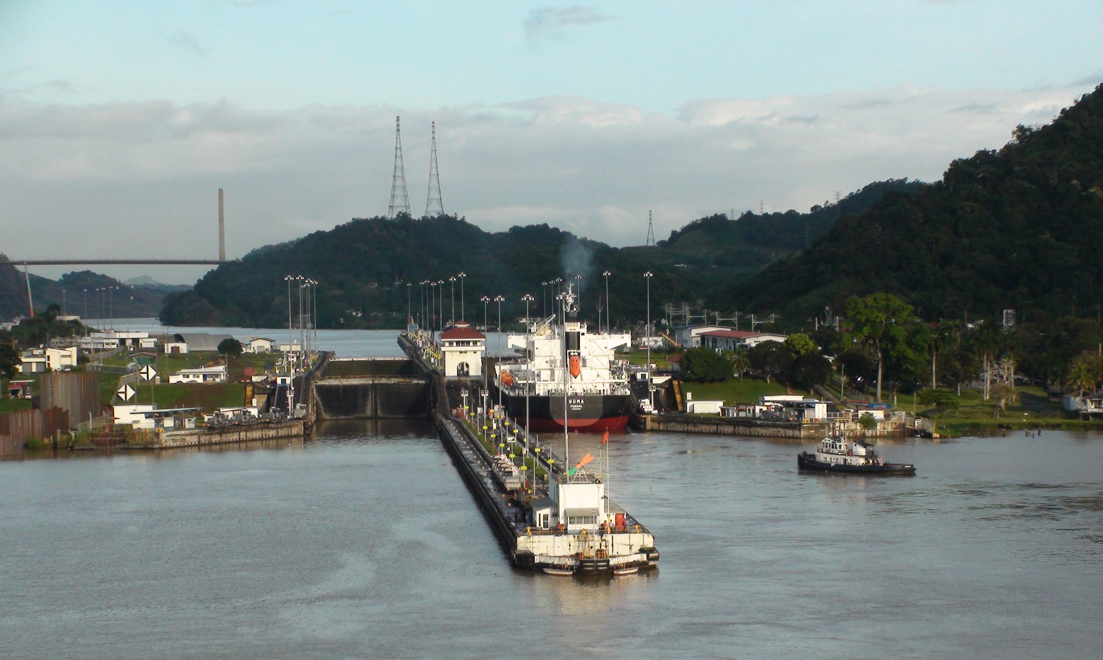
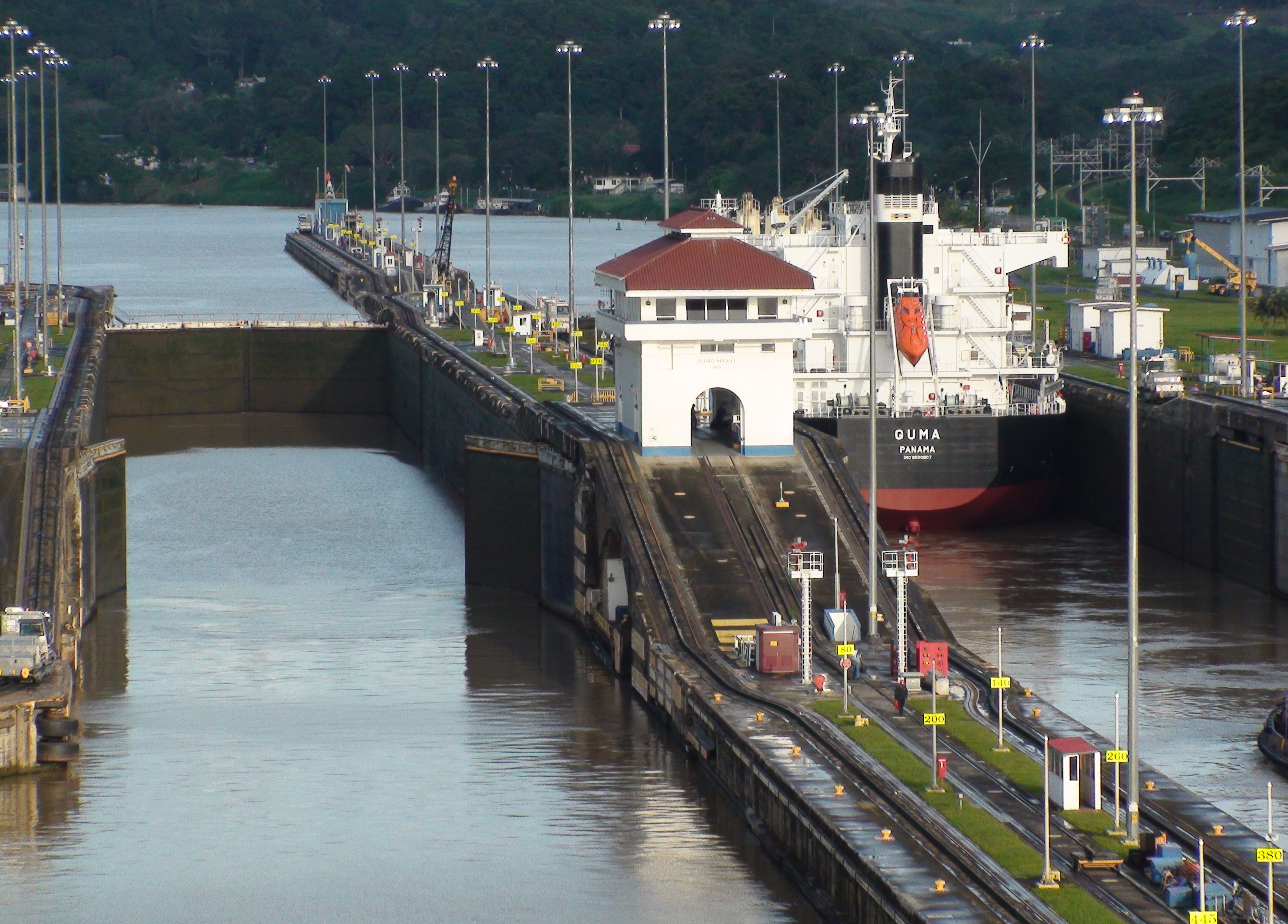
Not too long after the Miraflores Locks is the one chamber of the Pedro Miguel Lock.
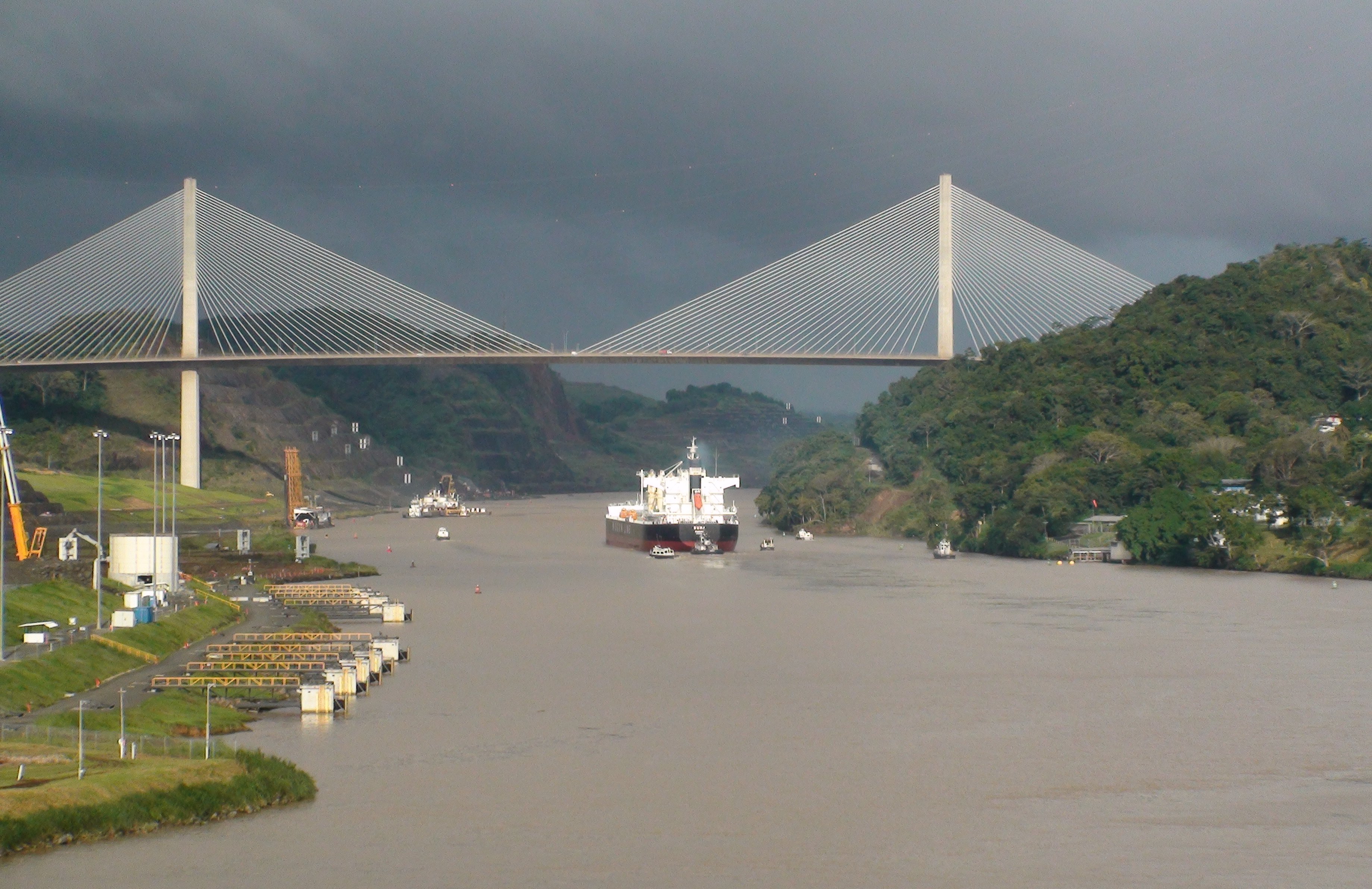
After leaving the Pedro Miguel Lock we sailed under the Centennial Bridge.
This six lane bridge now carries the Pan American Highway which makes it possible to drive from Angentina to Alaska.
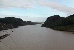
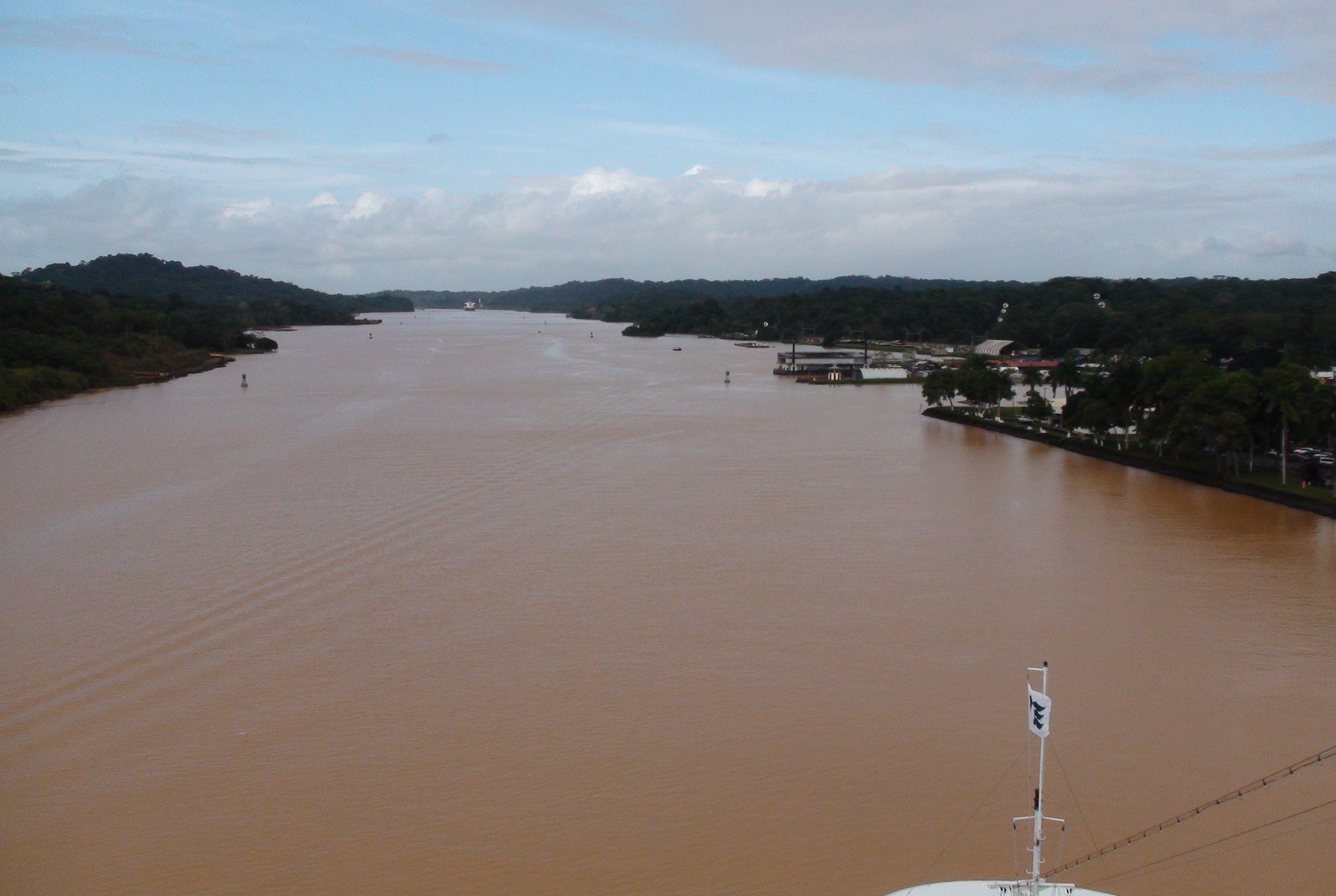
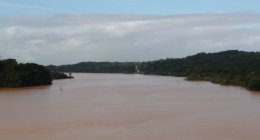
After sailing under the Centennial Bridge the canal enters the Culebra Cut,
the narrowest part of the Panama Canal other than the locks themselves.
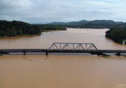
At the end of the Culebra Cut you pass the small town of Gamboa.
The one-lane bridge is the only access to the small town.
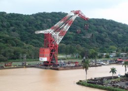
The U.S. acquired the giant Titan Crane as war booty from Hitler's Germany.
When it was built, Gatun Lake was the largest man-made lake in the world.
The fresh water from this lake provides the water for the lock operations as well drinking water for the Panimanians.
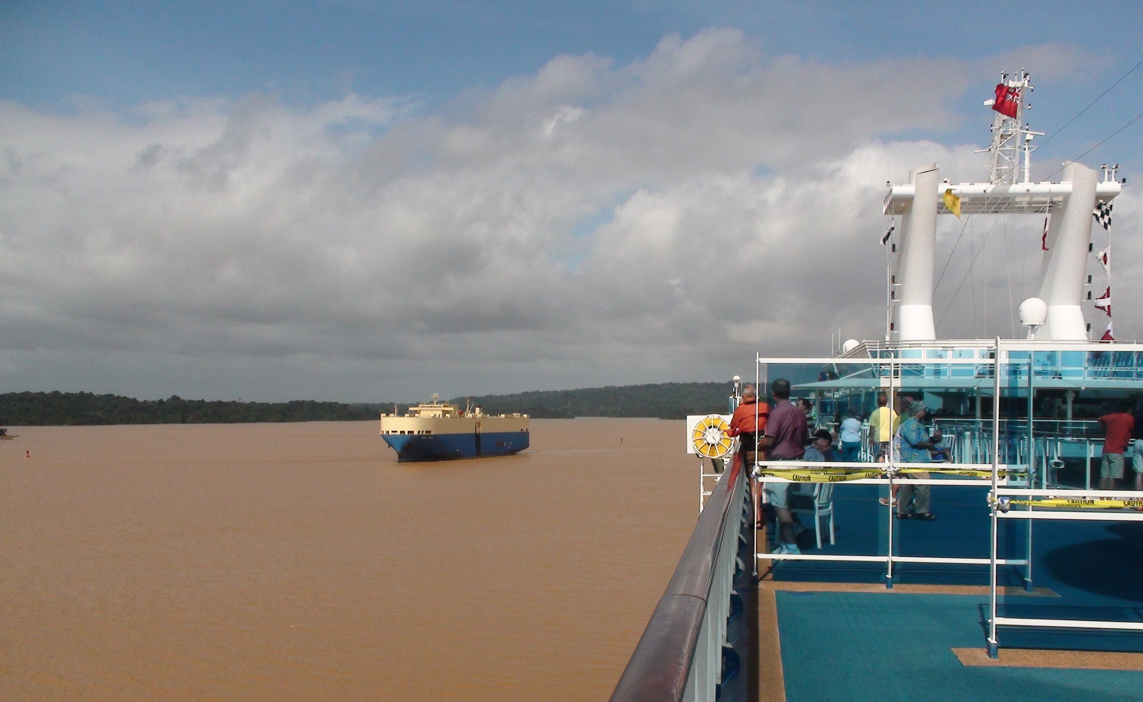
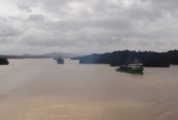
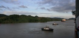
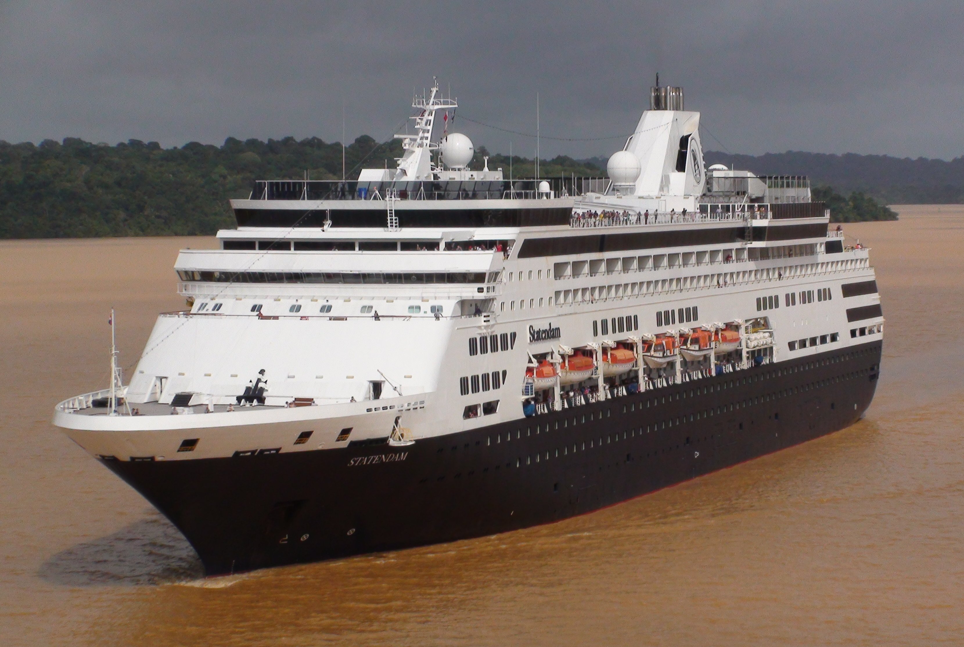
As the lake widened we passed many other ships that had started their day on the Atlantic end of the canal.
One of these ships was Holland America's Statendam.
The Gatun Dam is a large earthen dam across the Chagres River on the eastern edge of Gatun Lake.
We had a brief shower as we approached the Gatun Locks.

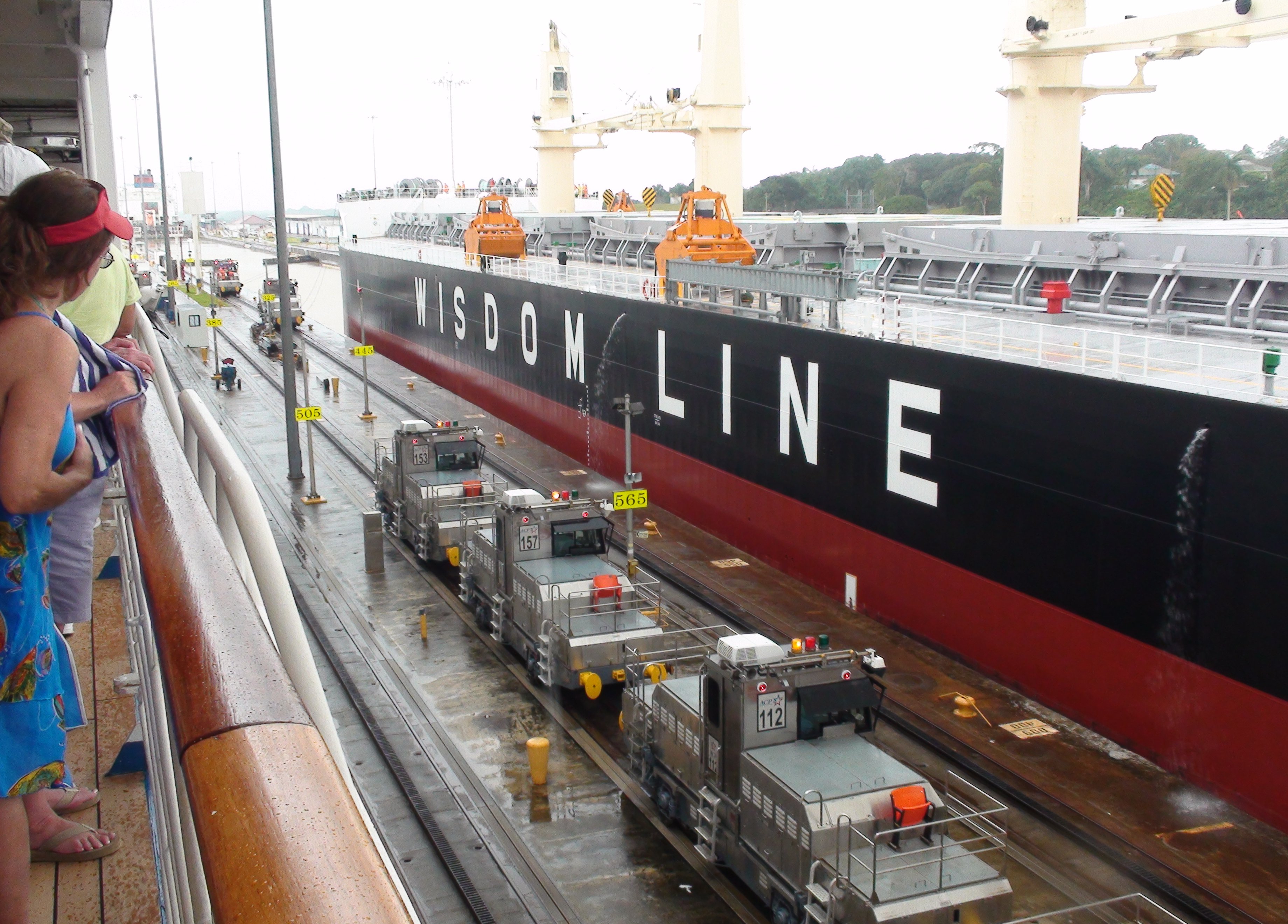
There are three chambers in the Gatun Locks.
After clearing the Gatun Locks our transit of the Panama Canal was complete some nine hours and 50 miles after it began.
We entered the Caribbean Sea and sailed toward Colombia.
and the complete transit of the Panama Canal on the Island Princess on December 15. The video includes commentary from the ships's guest lecturer about canal operations and history. |
|
Greetings Folks, I had to get up very early today. We raised the anchor before 5:00 this morning and began our transit into the Panama Canal. The picture below was taken at about 5:30 this morning. If you look closely you can see the Pan American Bridge behind us as we approach the first set of locks at Balboa, the Pacific entrance to the Panama Canal. In the picture below you can see us approaching the first set of locks before sunrise this morning. These are the Miraflores Locks, this is where I was yesterday watching the ships go through the canal. This was taken at about 5:45am. Most of the rest of the photos from today were taken with my camcorder. The resolution for still images on my camcorder isn't as good as my camera, but I didn't want to lug around two cameras all day. I concentrated mainly on video today. Below the sun is rising as we approach the first chamber of the Miraflores Lock. The Large ship in the other lane is the Guma. We pretty much shadowed each other all day. In the picture below we are snuggly nestled into the first chamber of the Miraflores Lock. Each chamber will raise the ship about 30 feet. Combine these two chambers with the one chamber in the Pedro Miguel Lock a little further up, and the ship will be raised a total of 85 to the level of Gatun Lake. 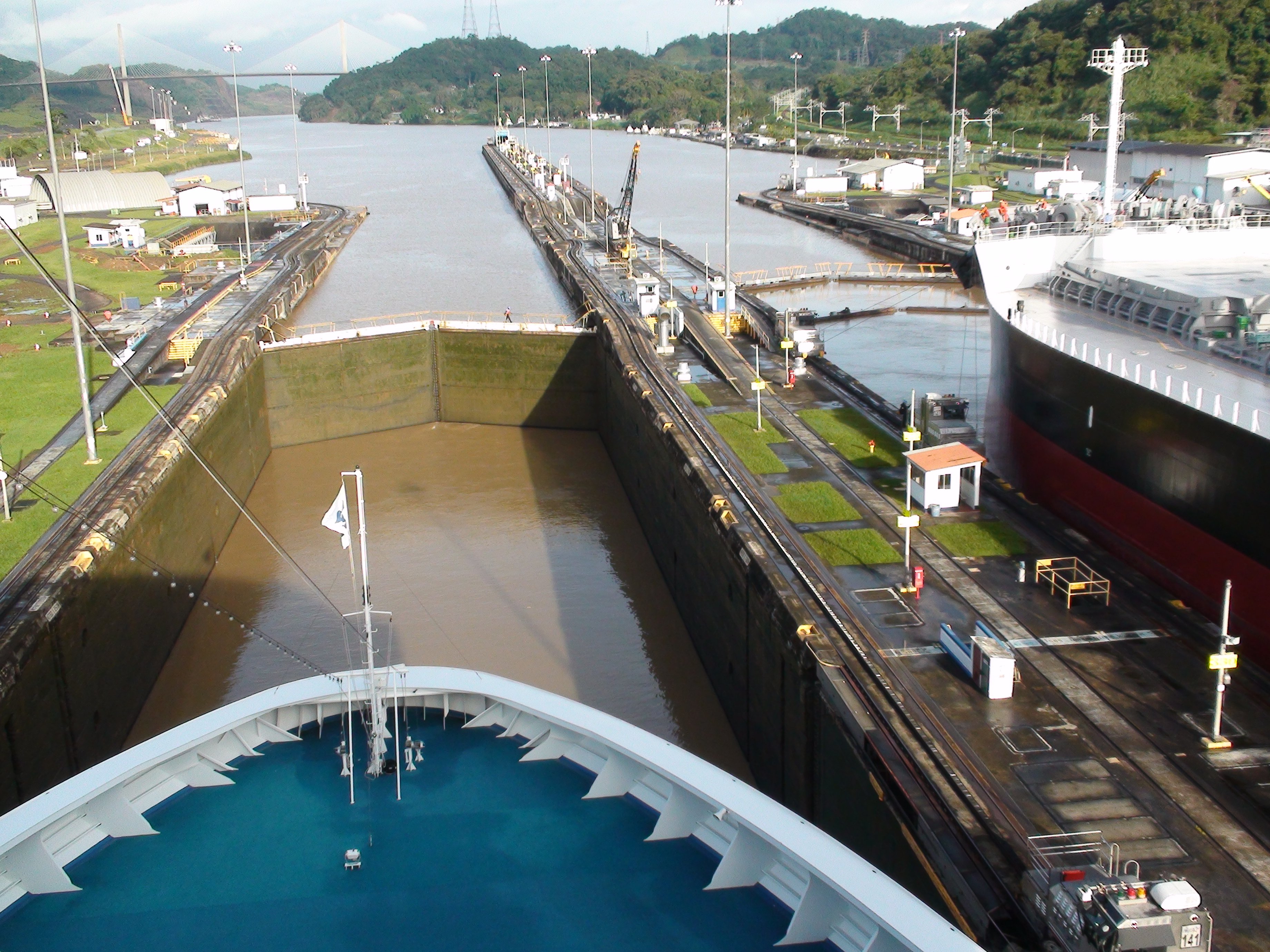 The picture below is looking the to rear of the ship after we have cleared the first chamber. The lock gate is closing behind us and we are about to be raised up again in the second chamber. You can also see another ship entering the other lane behind us. A total of 52 million gallons of fresh water from Lake Gatun is used in each lockage, which is ultimately drained into the sea. The new locks that are being built will be able to recycle and reuse a percentage of the water. In the picture below you can see us approaching the Pedro Miguel Lock. This is the second lock on the Pacific side. It wasn't too far from the previous lock. In the picture below you can see them opening the lock gate for us. Below we are exiting the Pedro Miguel Lock into Gatun Lake. We have been raised from sea level in the Pacific Ocean to 85 feet above sea level in Gatun Lake. You can also see the Centennial Bridge up ahead. Below you can see the Guma passing under the Centennial Bridge. The Centennial Bridge was completed in 2006 and the Pan American Highway now goes across this bridge instead of the Pan American Bridge. This bridge was damaged in the recent storms. I thought it was closed but there was some traffic going across it today. There are bad traffic jams in Panama City with everyone trying to use the older bridge, built by the United States, while the new bridge built by the Panamanians is out of commission. Below is the Culebra Cut. This is the narrowest stretch of the Panama Canal. After the 7 mile long Culebra cut the Gatun Lake widens. This was the area that we passed a lot of ships going the other way. These ships started their journey early this morning on the Atlantic side of the canal. Holland America's Statendam was the only cruise ship that we passed today. Gatun was the largest man-made lake on earth until China built the Three Gorges Dam. In the picture below we have almost made it across Gatun Lake and are approaching Gatun Locks on the Atlantic side. In the picture below we are proceeding through the three chambers of the Gatun Locks. As usual the Guma is right beside us. Below are the Gatun Locks. We are in either the second or third chamber. After exiting the Gatun Locks our transit from the Pacific to the Atlantic Ocean was complete. The total length of the canal is 50 miles and it took us eight hours to complete the journey. The Island Princess paid a toll of over $280,000 to pass through the canal. We are now sailing in the Caribbean Sea toward Colombia. It was a fun day. The Island Princess is probably the prettiest ship I have ever sailed on. But the upper deck is not conducive for taking pictures. The majority of the upper deck is surrounded by this annoying glass. I am sore from contorting myself to fit in small places to avoid shooting through that tinted glass. Weather wise it was a pretty good day. Weather was beautiful this morning. We did get some rain around the Gatun Lock area. More later, Tim |

Click on the arrow above to continue to the next adventure, Cartagena, Colombia!
| TIM'S HOME PAGE SITE INDEX | |||
|---|---|---|---|
| Areas | Description | # of Pages | |
| About Me | Current Picture of me and my home. Information about myself. | 2 | |
| Biography | Pictorial biography of myself. Pictures range from birth to adulthood. | 4 | |
| Family File | Pictures of my family and a little information about them. | 12 | |
| Local Spotlight | Pictures, Links, and Information for Indianapolis, Richmond, Plainfield, and Mooresville, Indiana. | 6 | |
| Tim's Travels | Pictures, videos and travelogs from my travels around the world. | 409 | |
| Vacation Videos | Over 1500 videos from my travels around the world. | 1 | |