(New Zealand Flag)
THURSDAY, JANUARY 18, 2007:
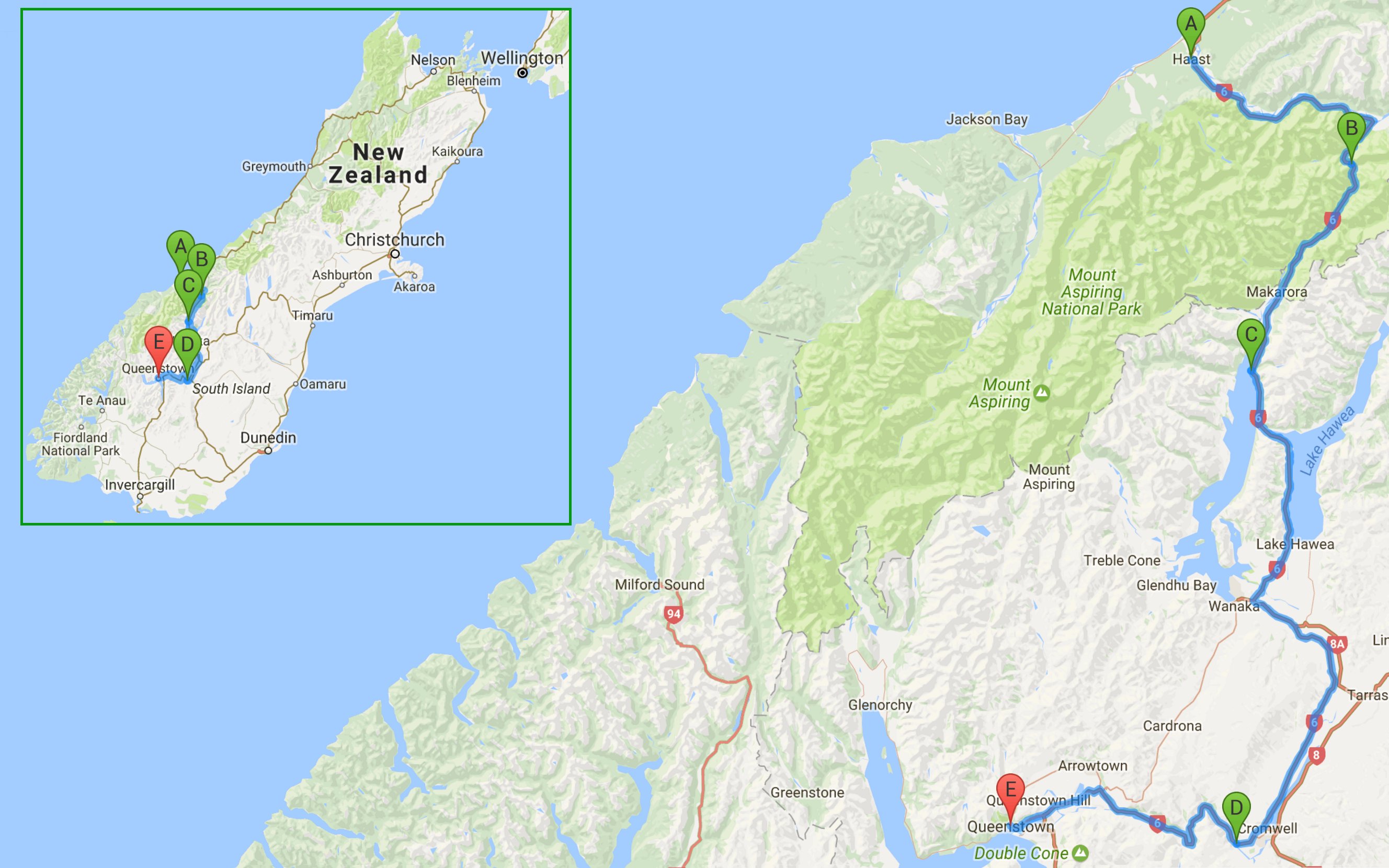
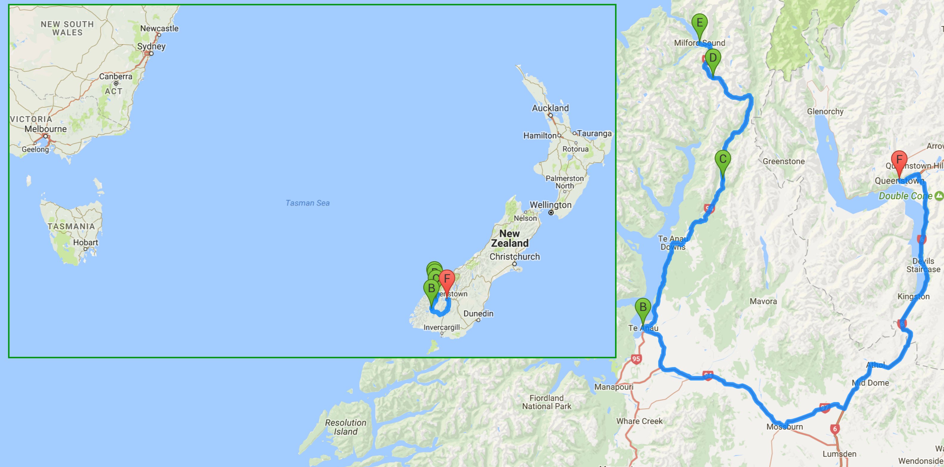
I drove 155 miles today traveling between Haast and Queenstown.
All of the images below are thumbnails and can be clicked on for a larger image.
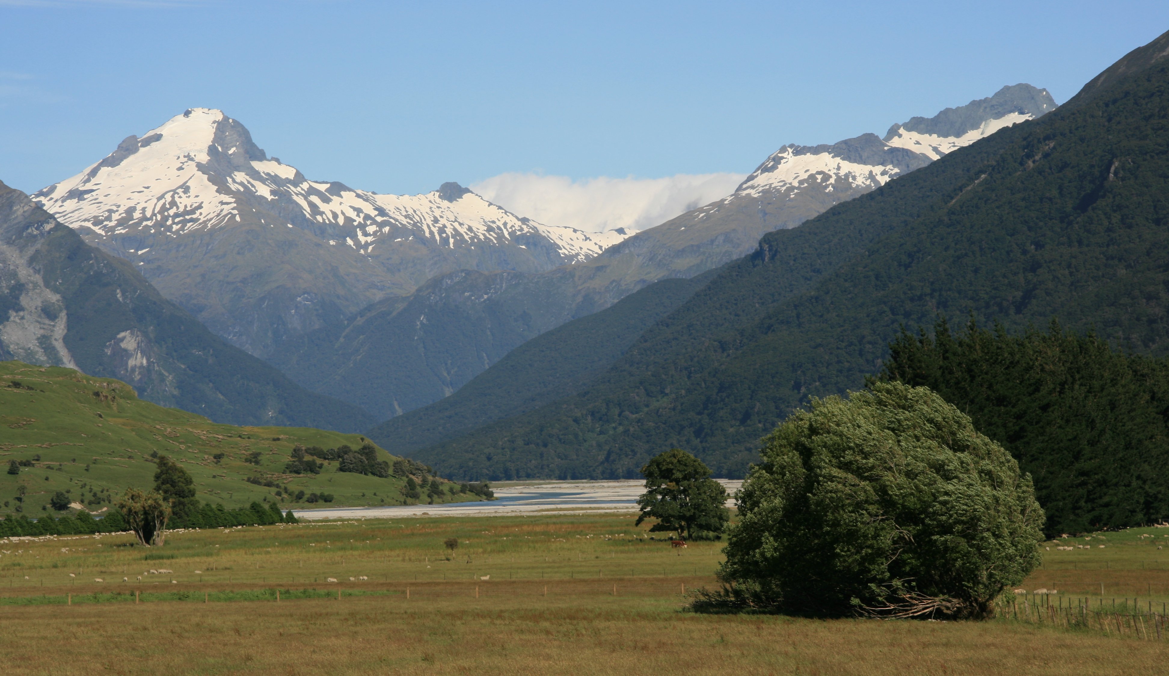
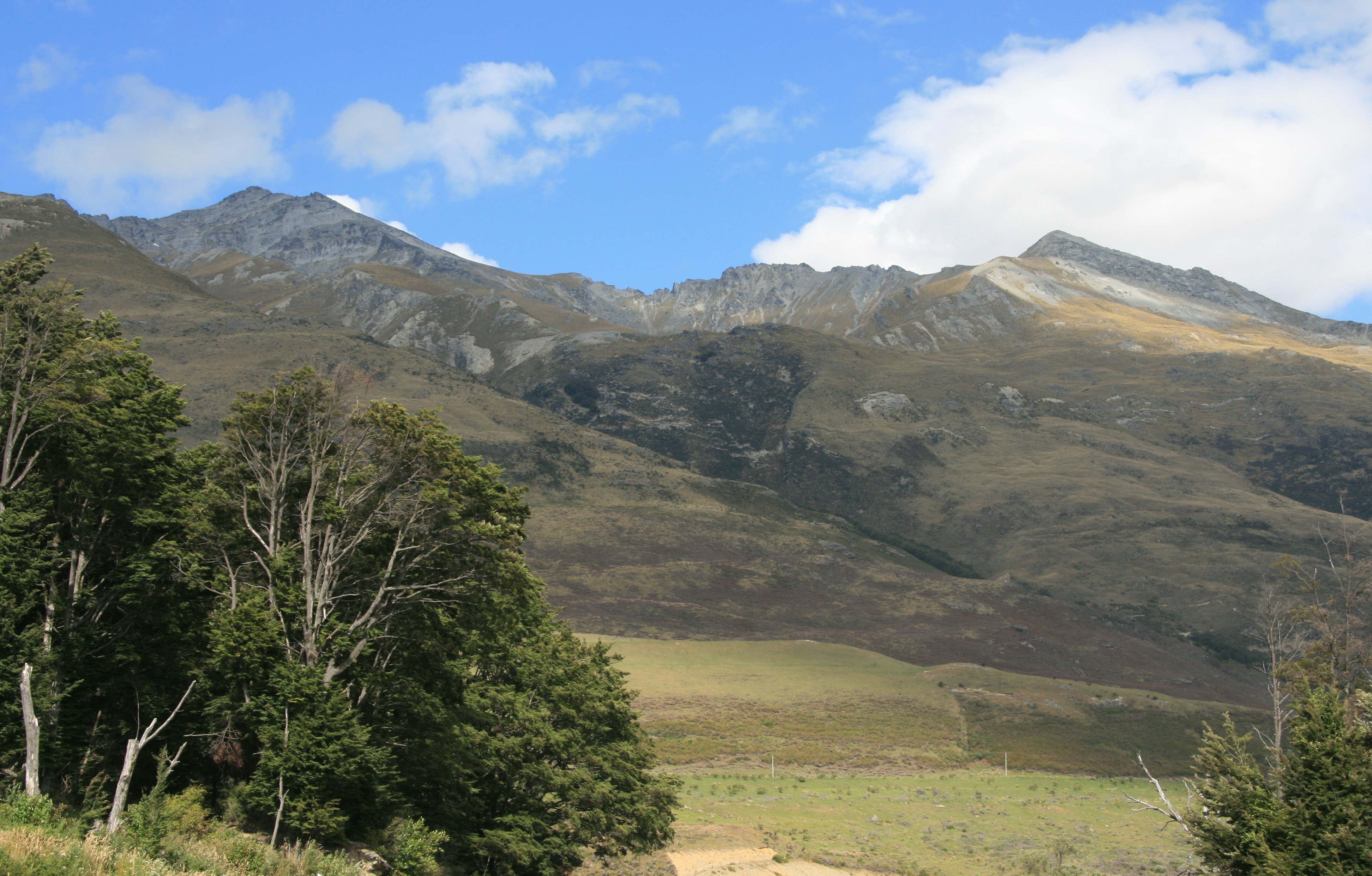
I began my day Thursday in Mount Aspring National Park.
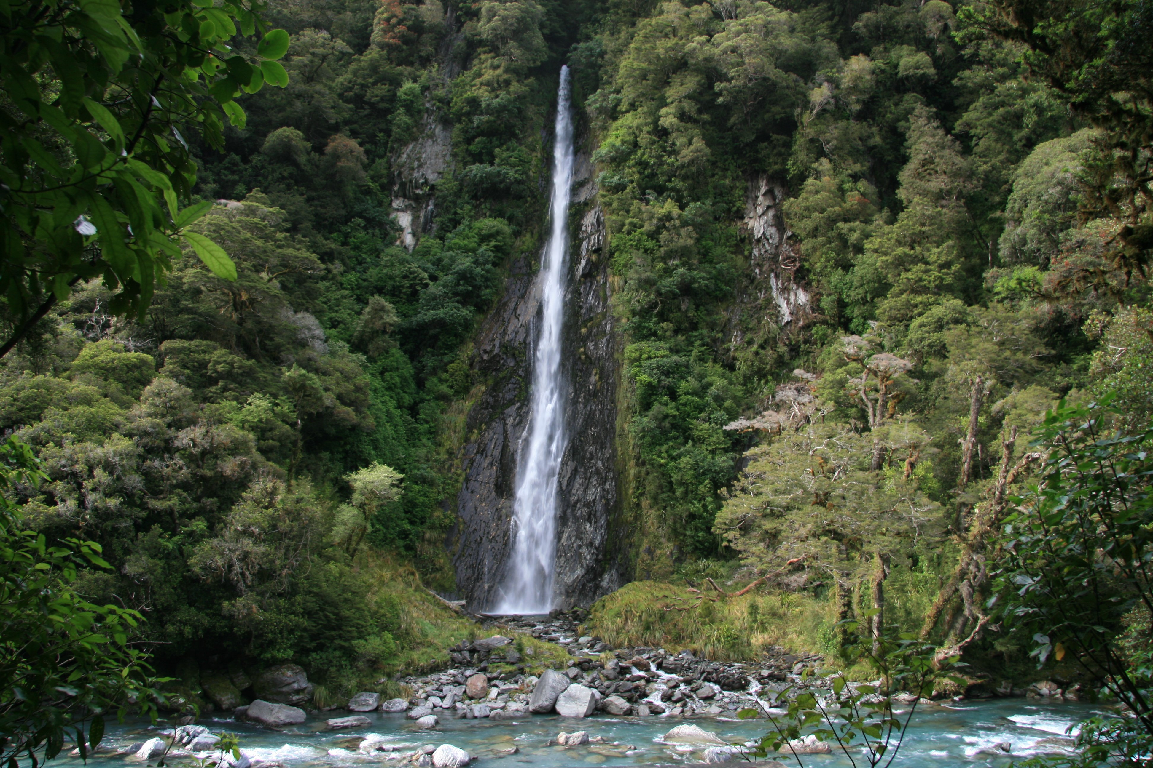
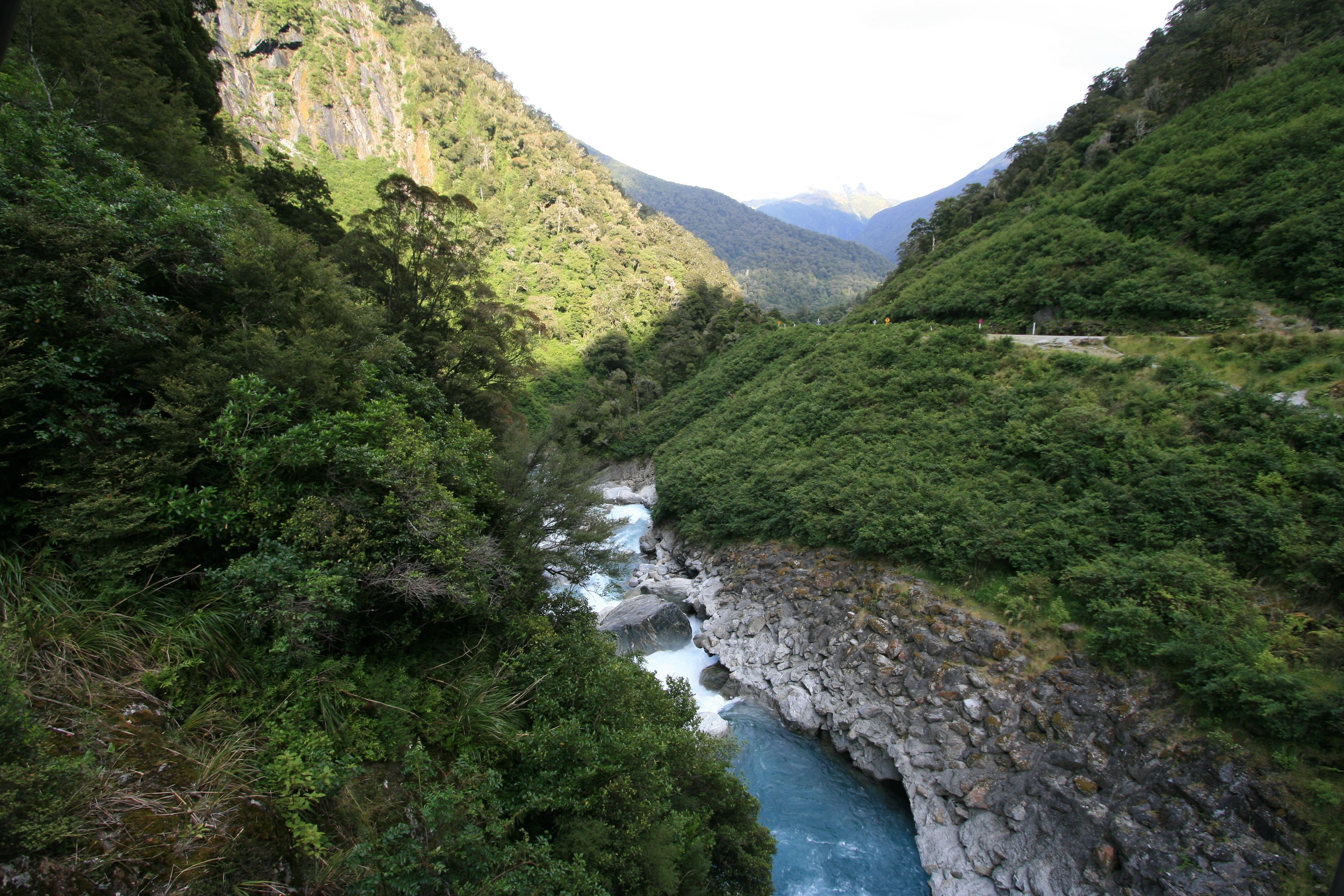
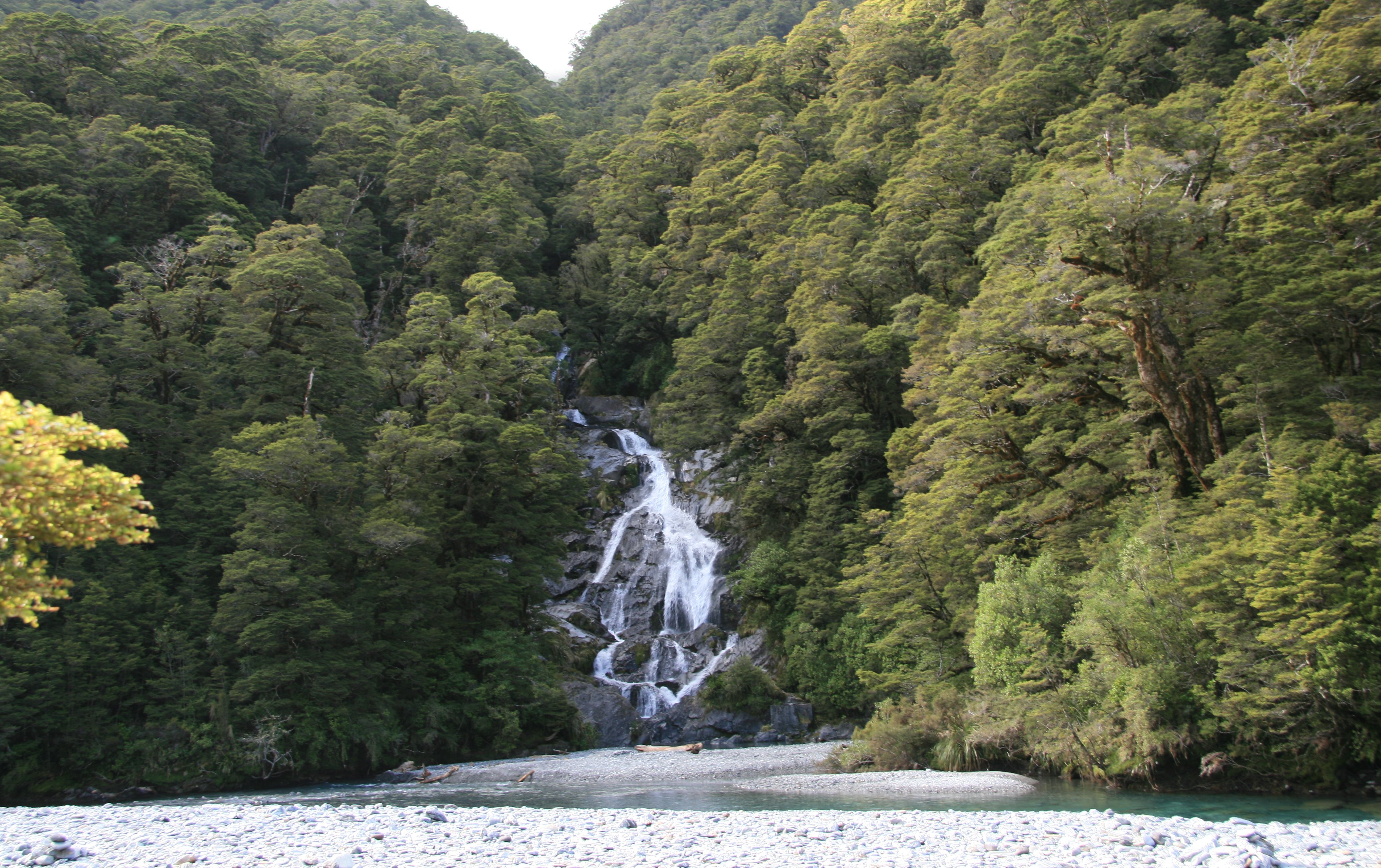
The pictures below are Thunder Falls, The Gates of Haast and Fantail Falls.
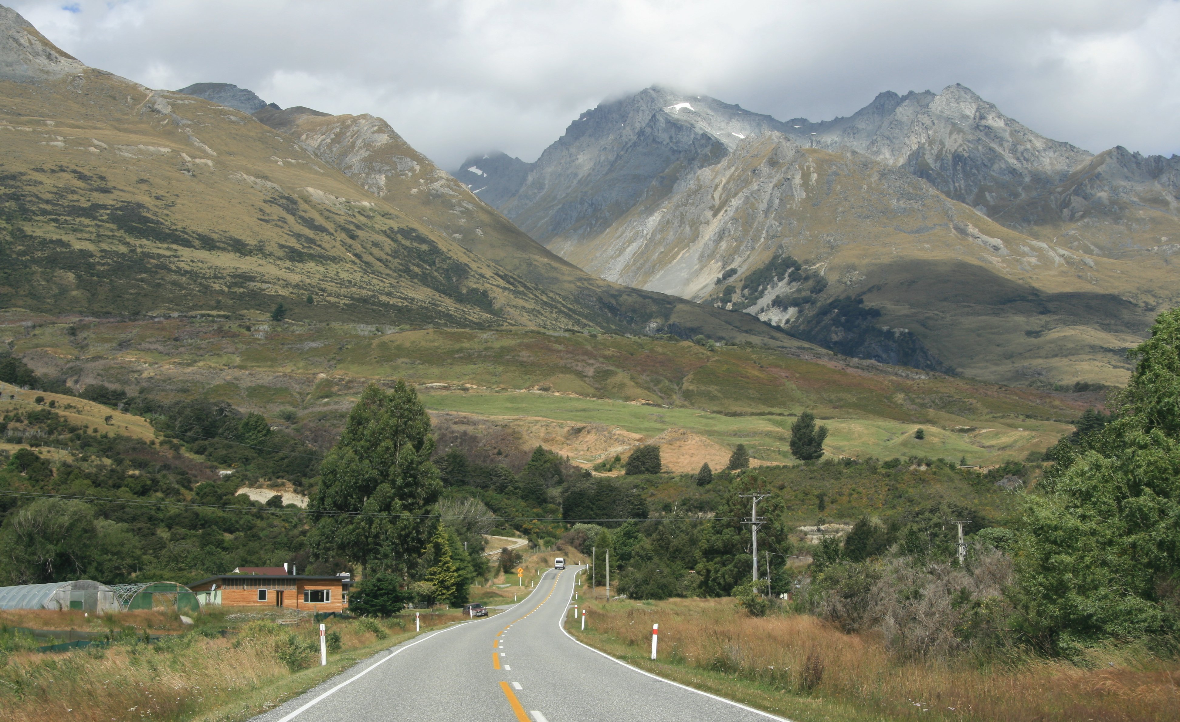
Highway 6 left the coast at Haast and headed inland but the scenery continued to be fantastic.
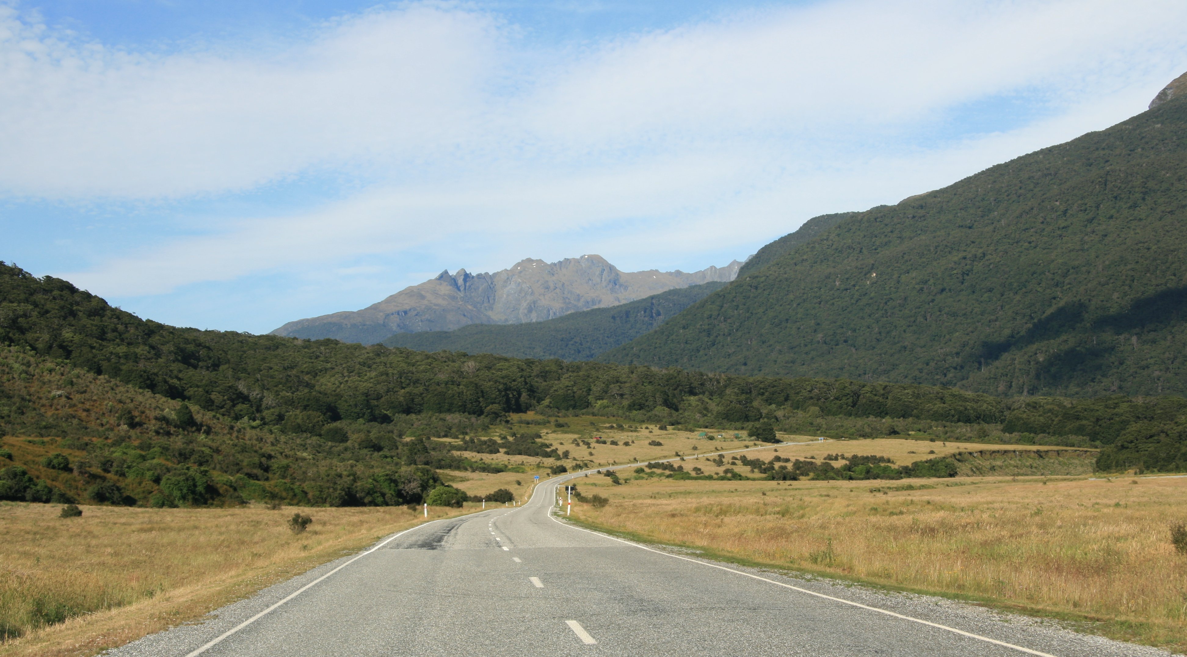
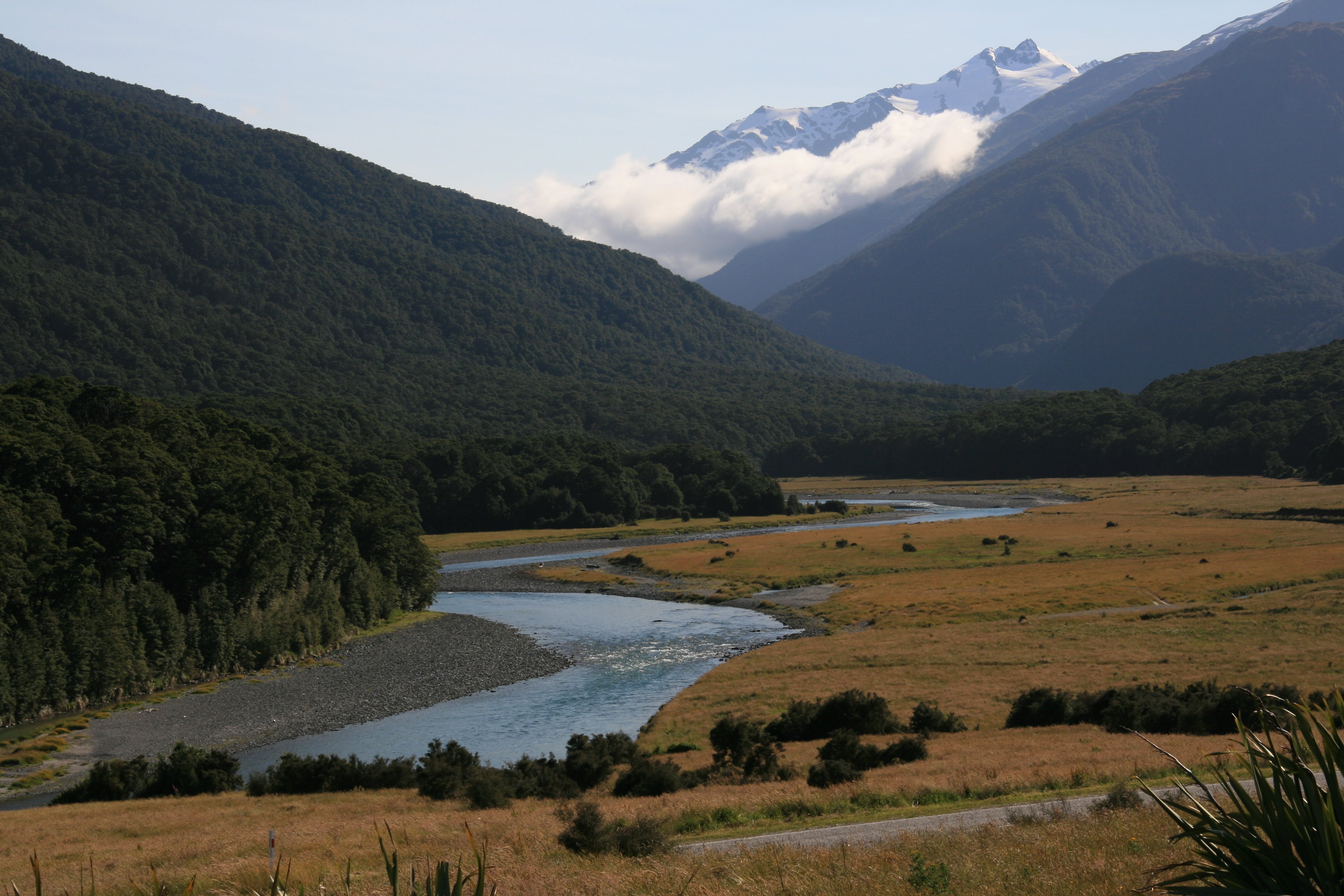
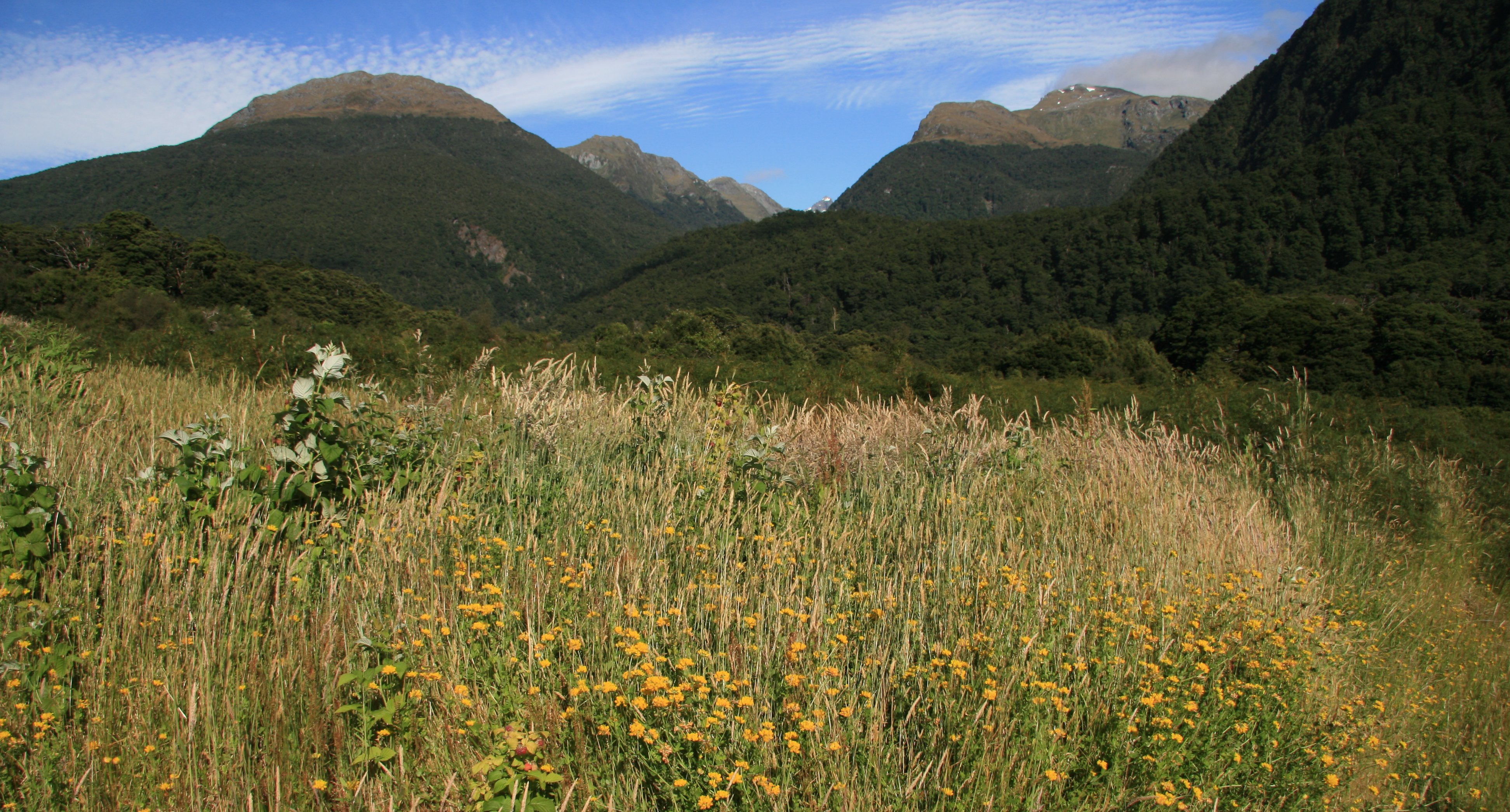
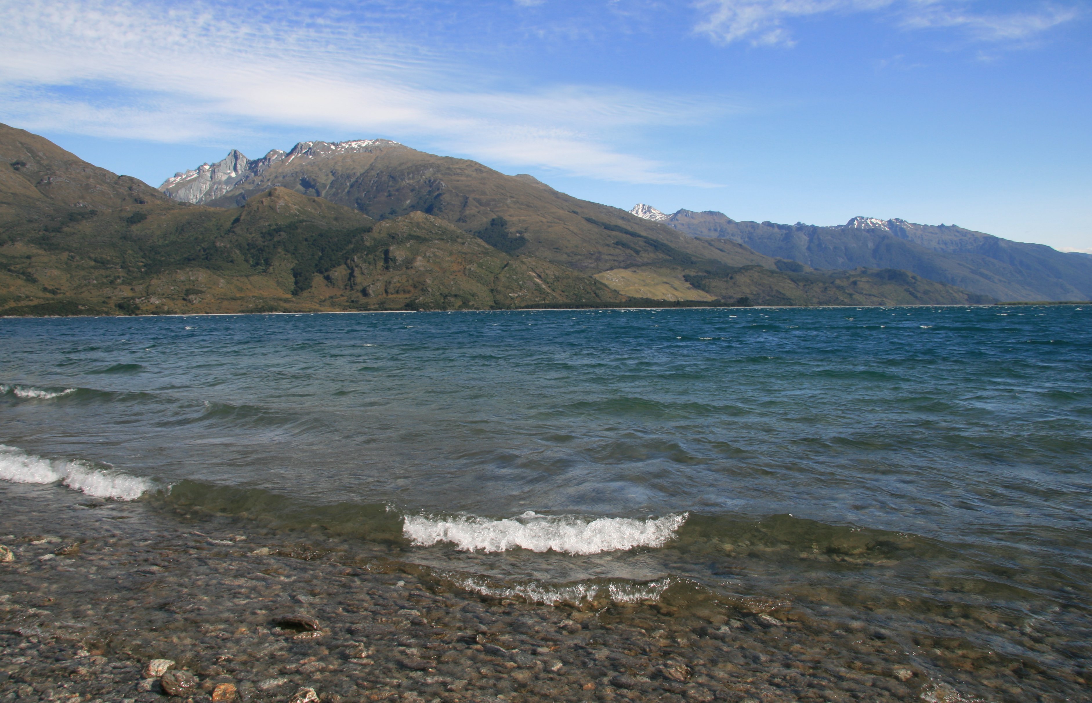
After leaving Mount Aspring National Park the road continued past beautiful Lake Wanaka.
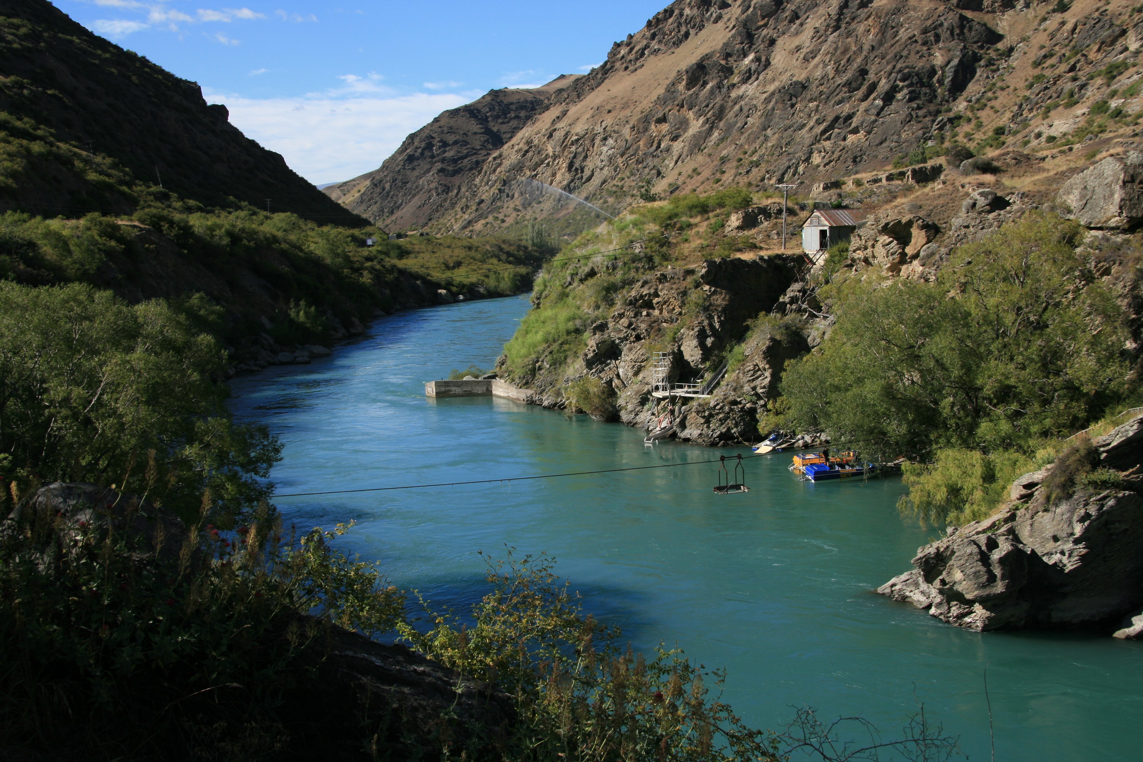
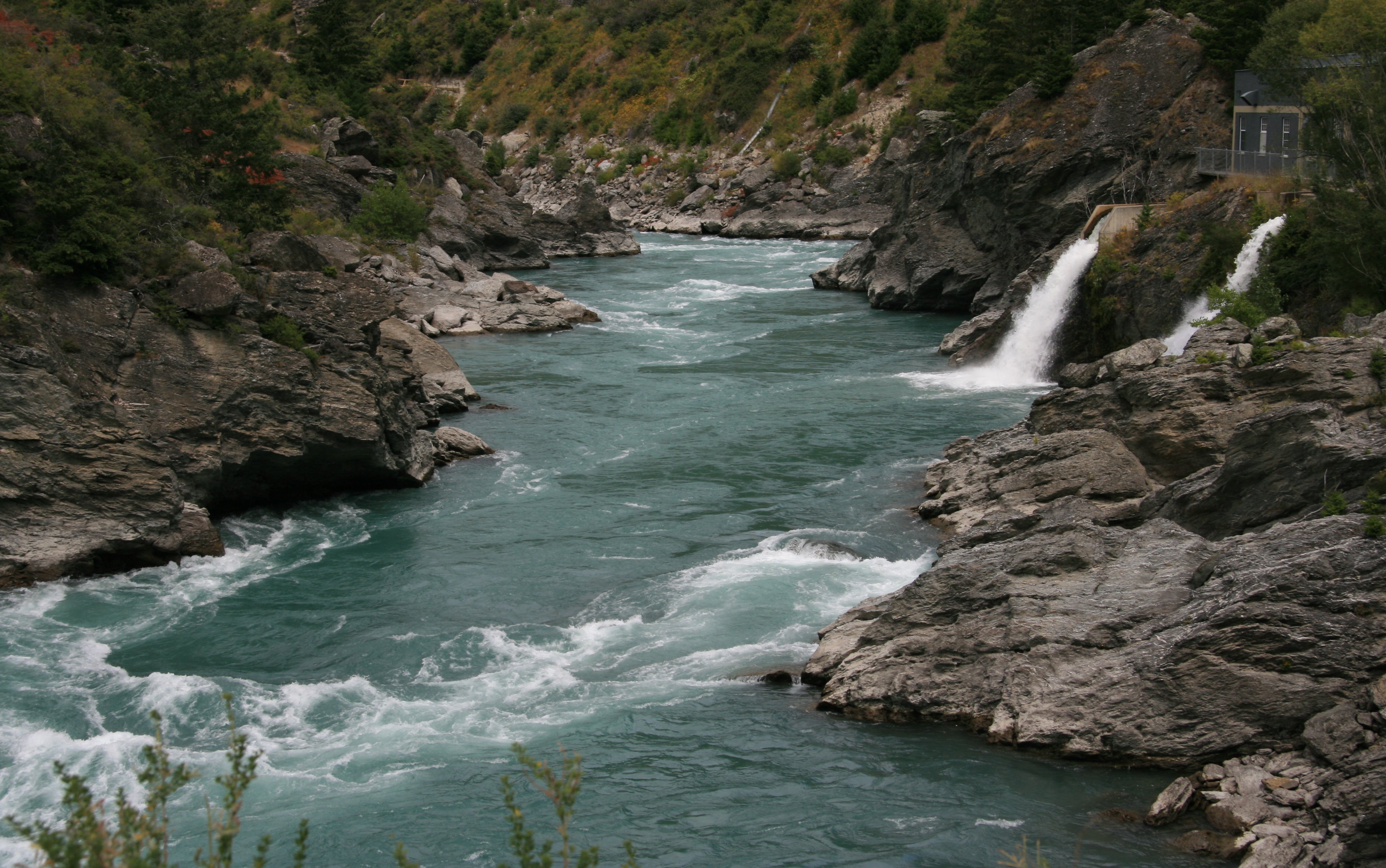
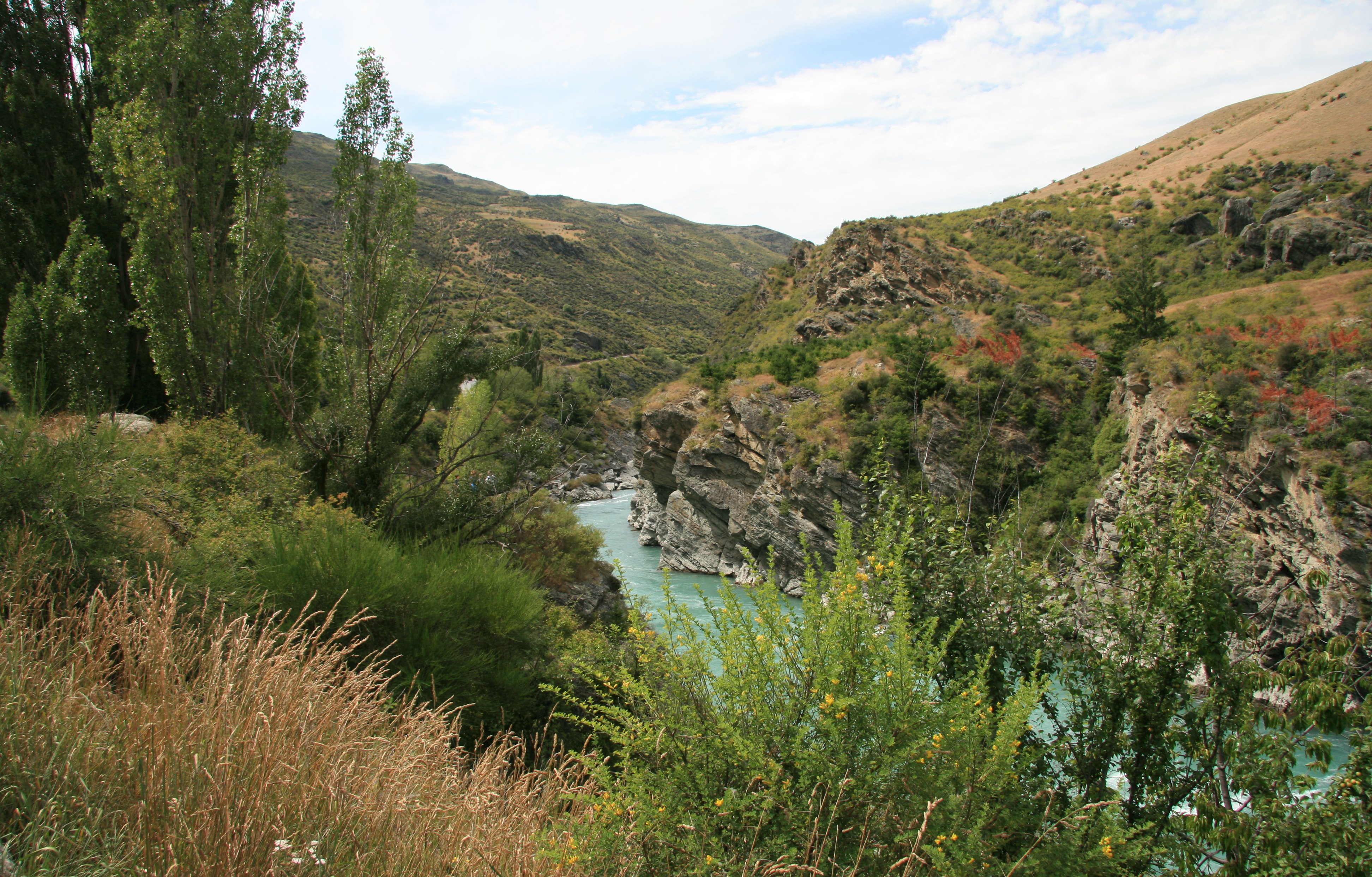
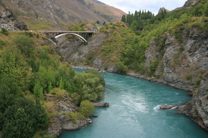
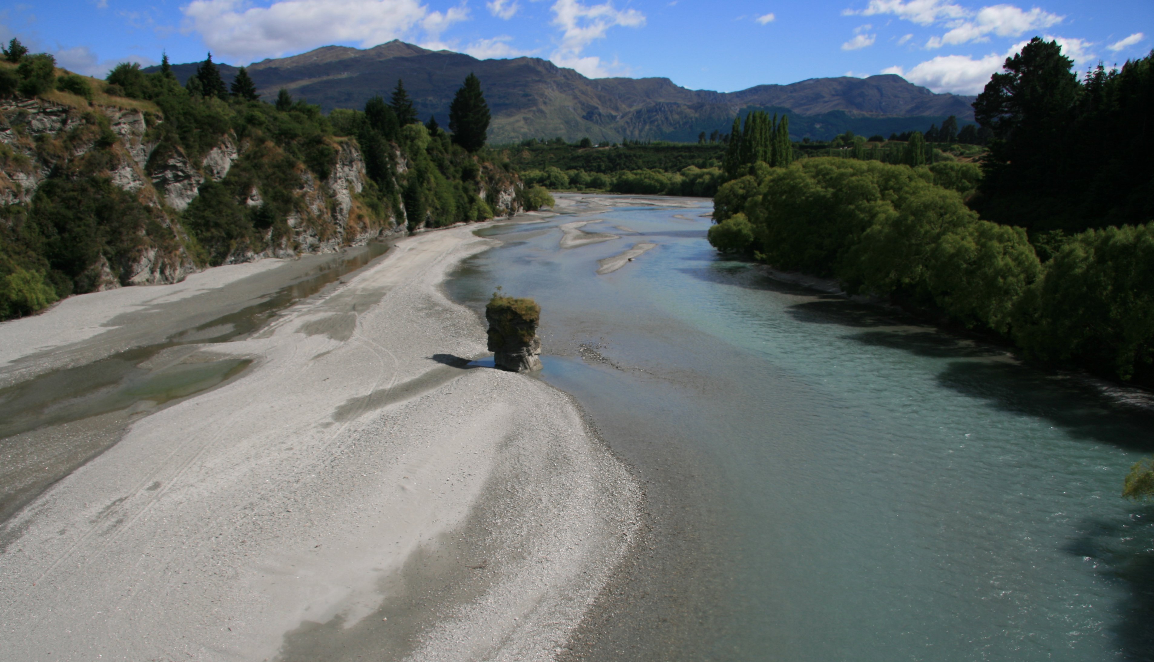
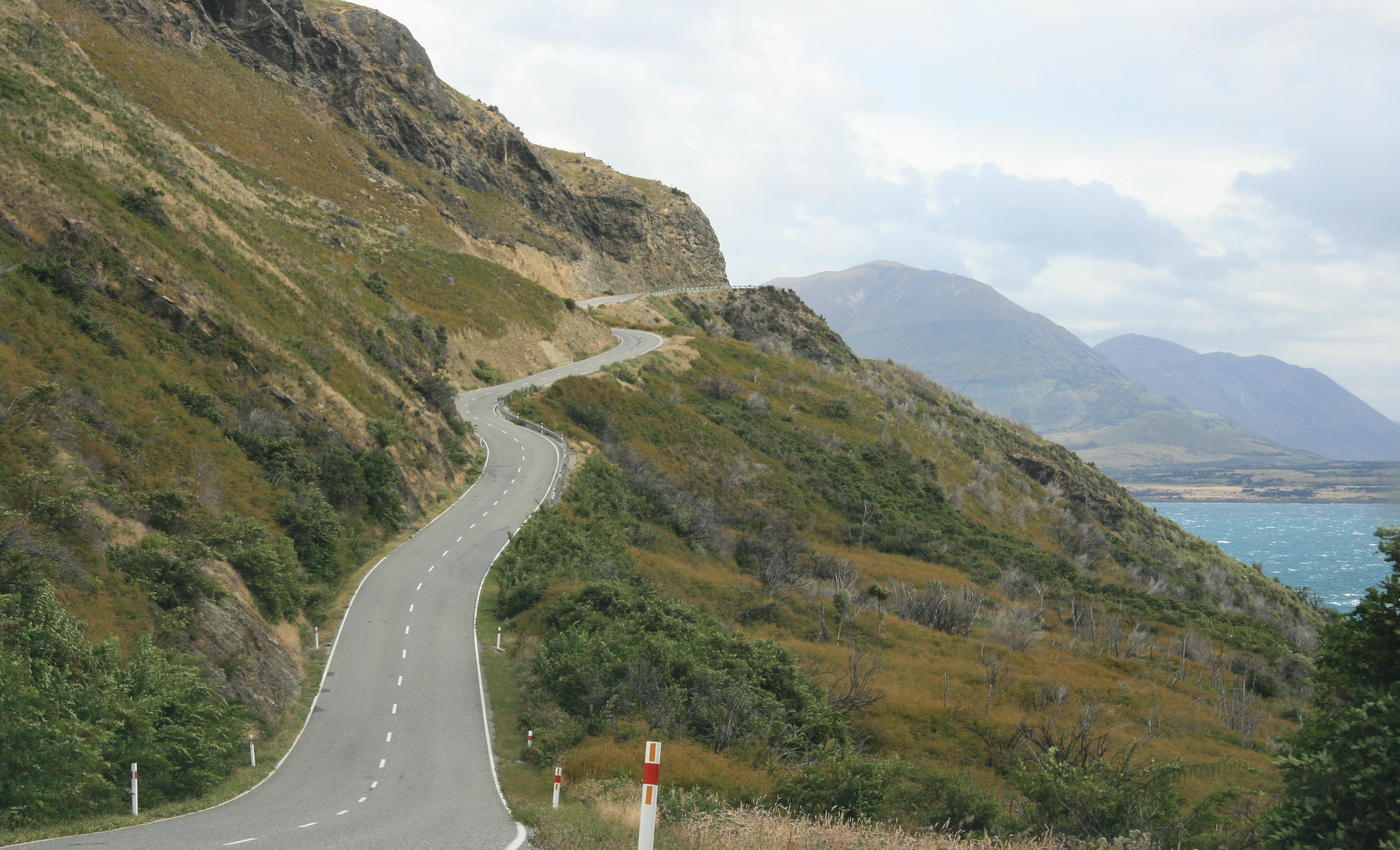
As I neared Queenstown the road went through the scenic Kawarau Gorge.
11 minute video of my road trip down the west coast of New Zealand. |
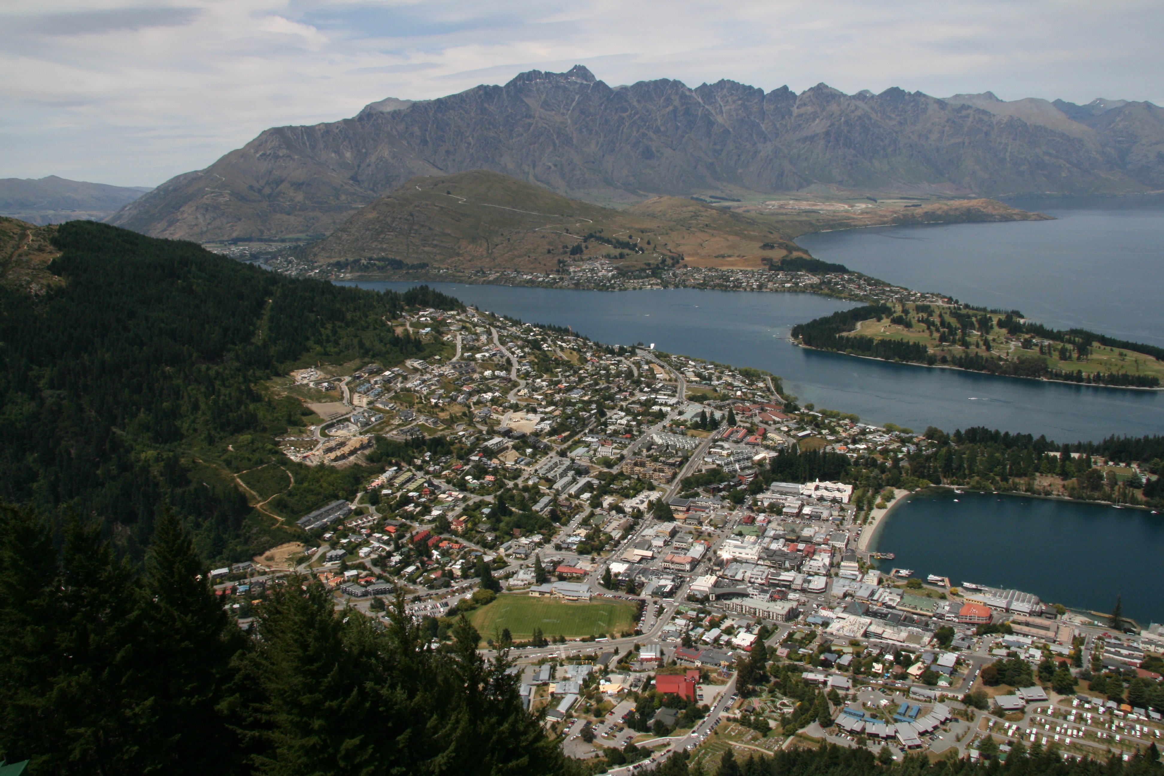
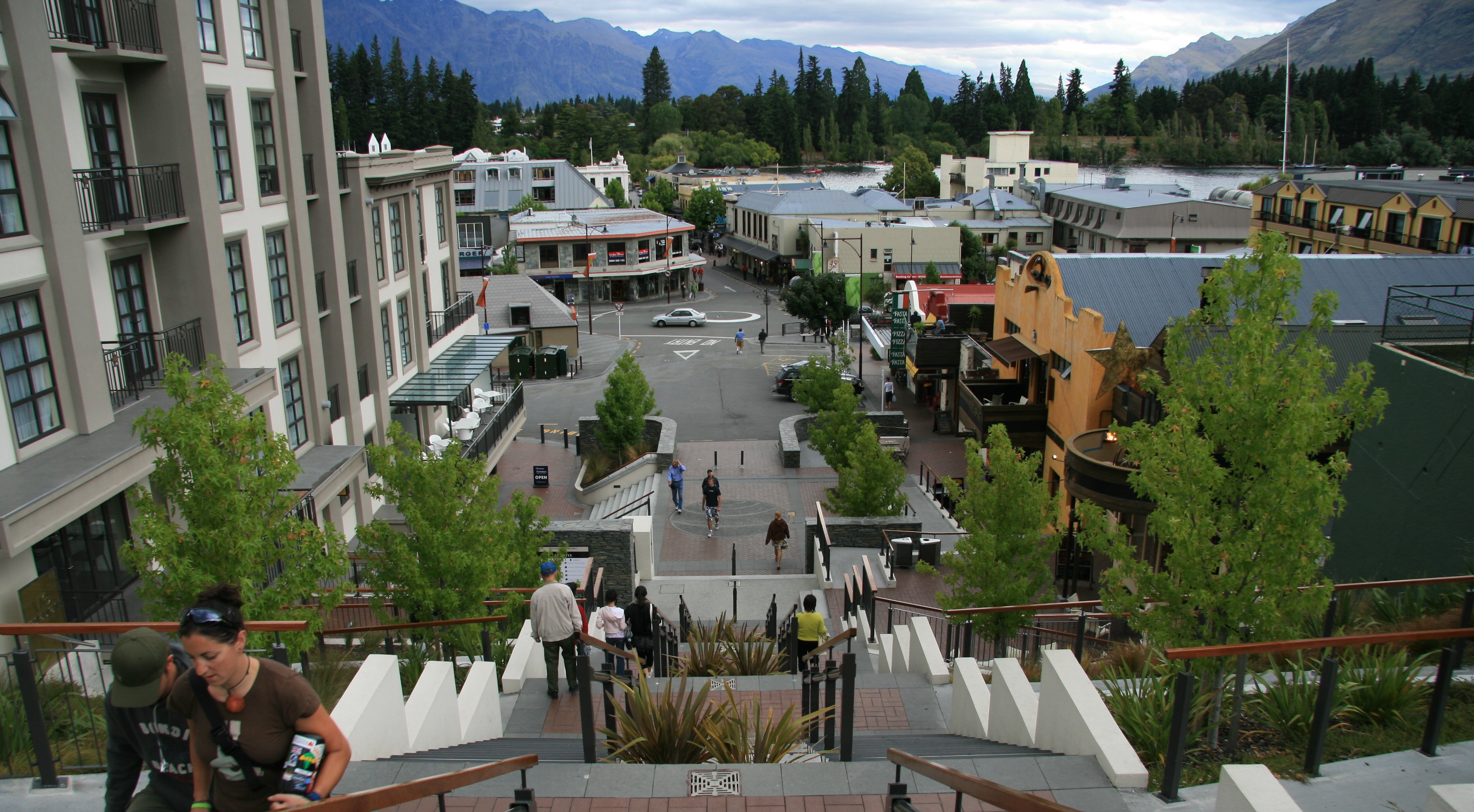
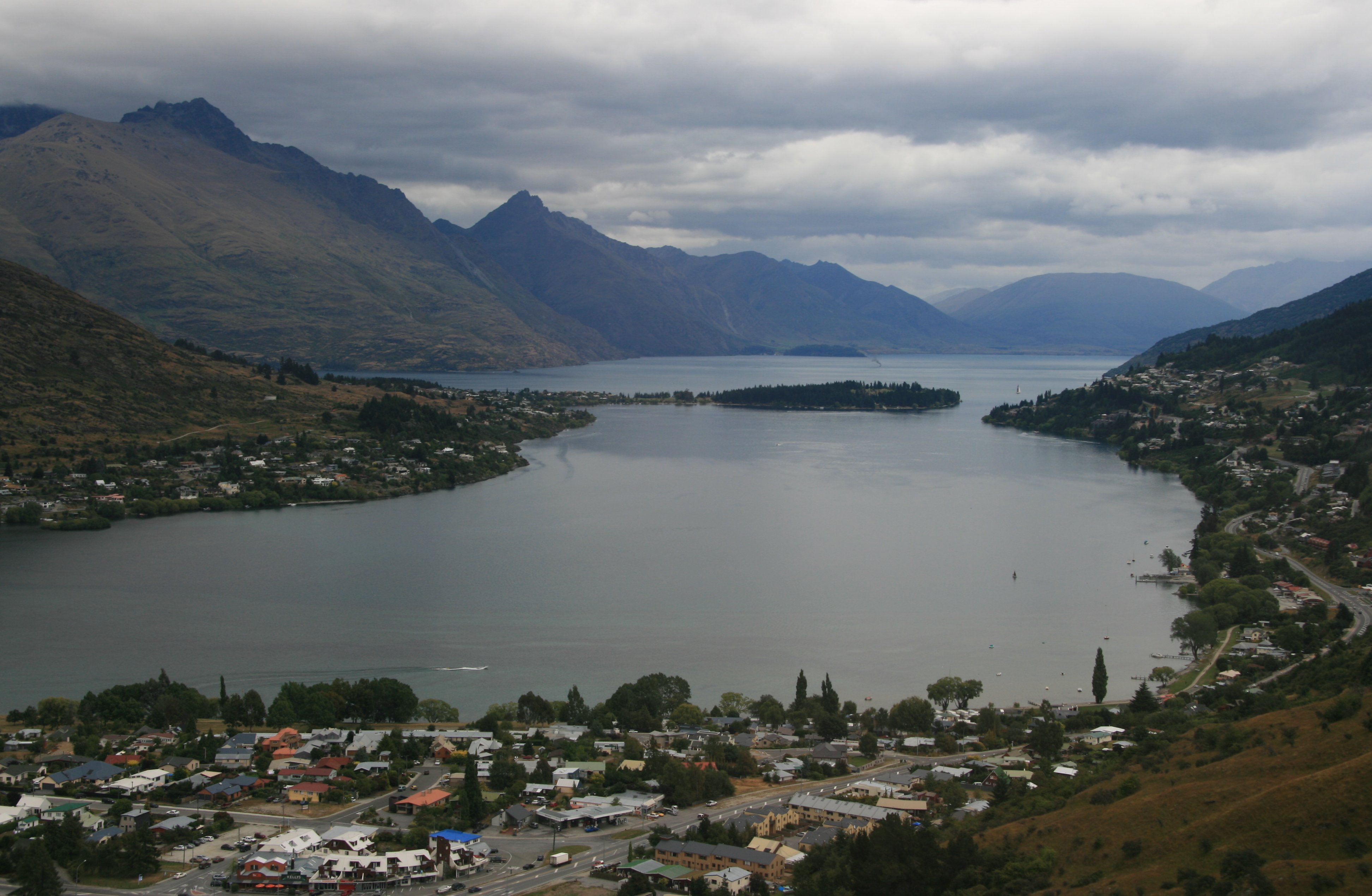
After arriving in Queenstown I road the Skyline Gondola
for nice views of The Remarkables and Lake Wakatipu.
|
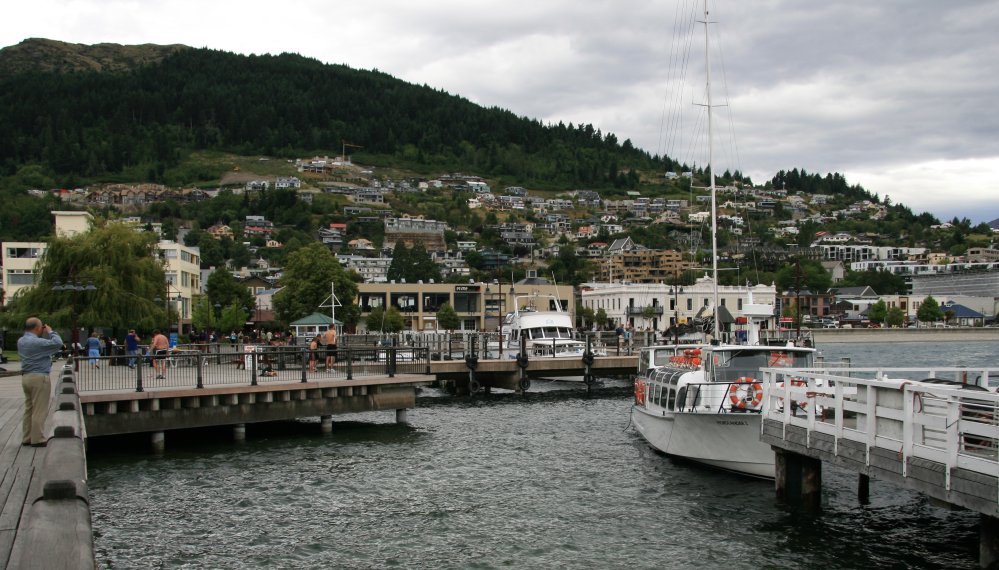
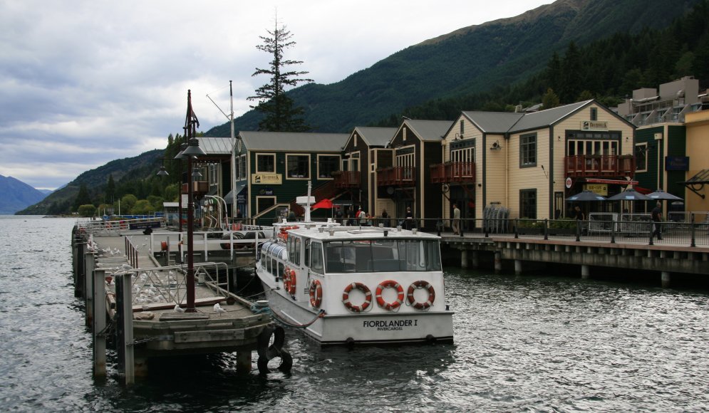
Hello everybody, I'm back online again. Two nights in a row I was cut off from the outside world. Today I traveled some 260 kilometers traveling from Haast to Queenstown. It was a very scenic drive all of the way, full of mountains, lakes, waterfalls, gorges and rivers. I traveled through Mount Aspiring National Park for a lot of the morning. My first stop was at Thunder Falls in the picture below. Next I came to the Gates of Haast. The precipitous gorge is crossed by a narrow one-lane bridge.  At the Gates of Haast gorge, many travellers stop to photograph the wild water as it crashes over the river boulders. Fantail Falls is a beautiful waterfall which drops 75 feet into the crystal clear Haast River. It is a very scenic drive on Highway 6 through the Mount Aspiring National Park. Mount Aspiring National Park is a wonderful mixture of remote wilderness, high mountains and beautiful river valleys. Of course I has to stop and photograph the wildflowers. Mount Aspiring National Park covers 1,373 square miles at the southern end of the Southern Alps. Mount Aspiring, elevation 9,951 feet, is the mountain that gives the park its name. Other prominent peaks within the park include Mount Pollux, elevation 8,340 feet, and Mount Brewster, elevation 8,264 feet. Several sheep can be seen in the picture below. After leaving Mount Aspiring National Park the road continued past beautiful Lake Wanaka. I stopped at Boundary Creek along Lake Wanaka. Lake Wanaka lies at the heart of the Otago Lakes and is New Zealand's fourth largest lake. 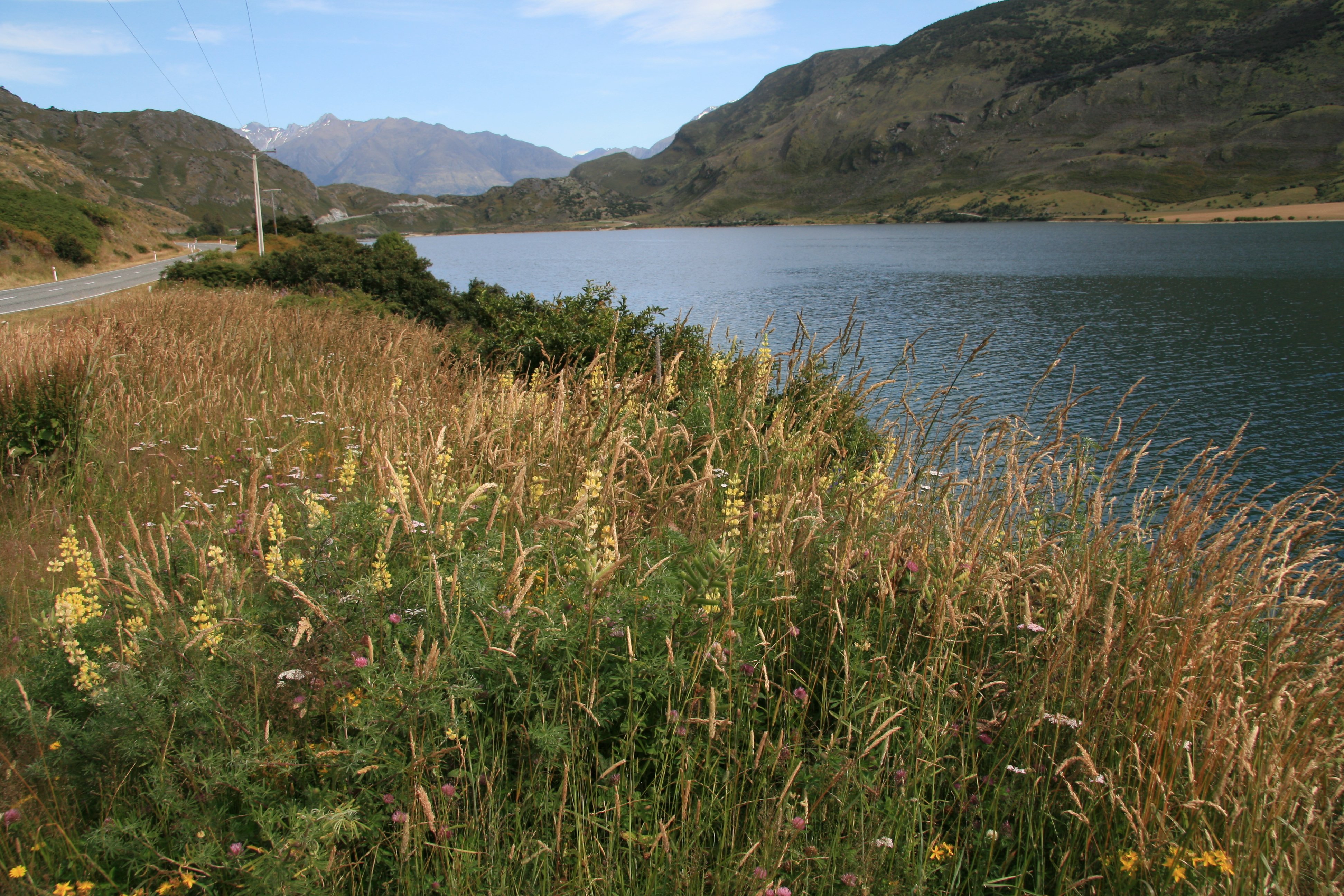 The Kawarau Gorge is a major river gorge in Central Otago. The Kawarau River flows through the gorge, which is located between the towns of Queenstown and Cromwell. State Highway 6 follows the gorge. 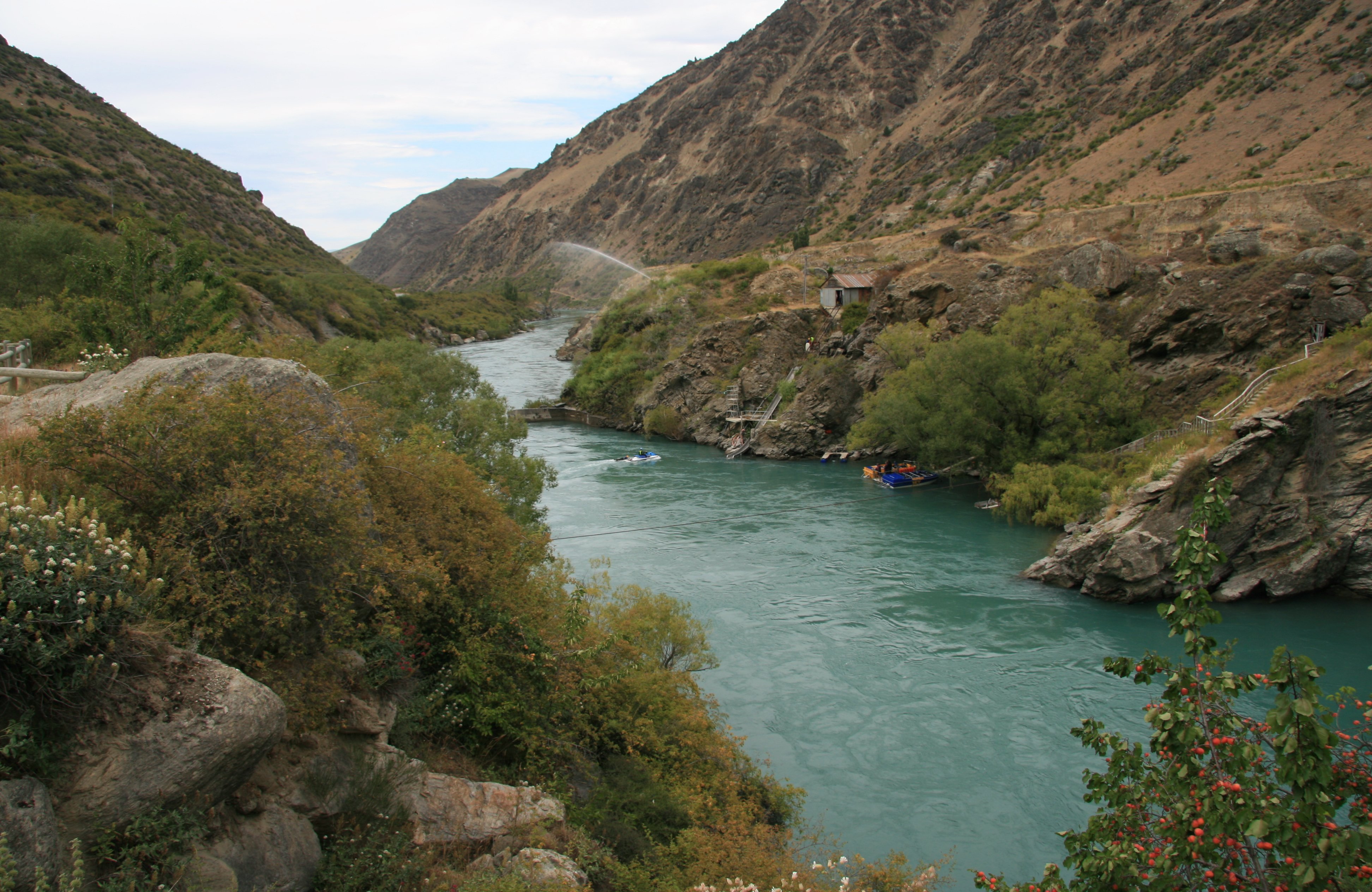 The gorge begins about 20 miles from Queenstown and continues for some 15 miles. It is of major historic significance as the Kawarau was the site of much activity during the Otago Gold Rush of the 1860s. The Roaring Meg hydro scheme and Goldfields Mining Centre are in the gorge. Below the Kawarau River flows through the Kawarau Gorge, immediately downstream from Roaring Meg tributary. Next I reached Queenstown, my home for the next five nights. Queenstown is a nice little town although quite busy. Impossible to find a place to park. My first order of business was a ride on the scenic gondola. 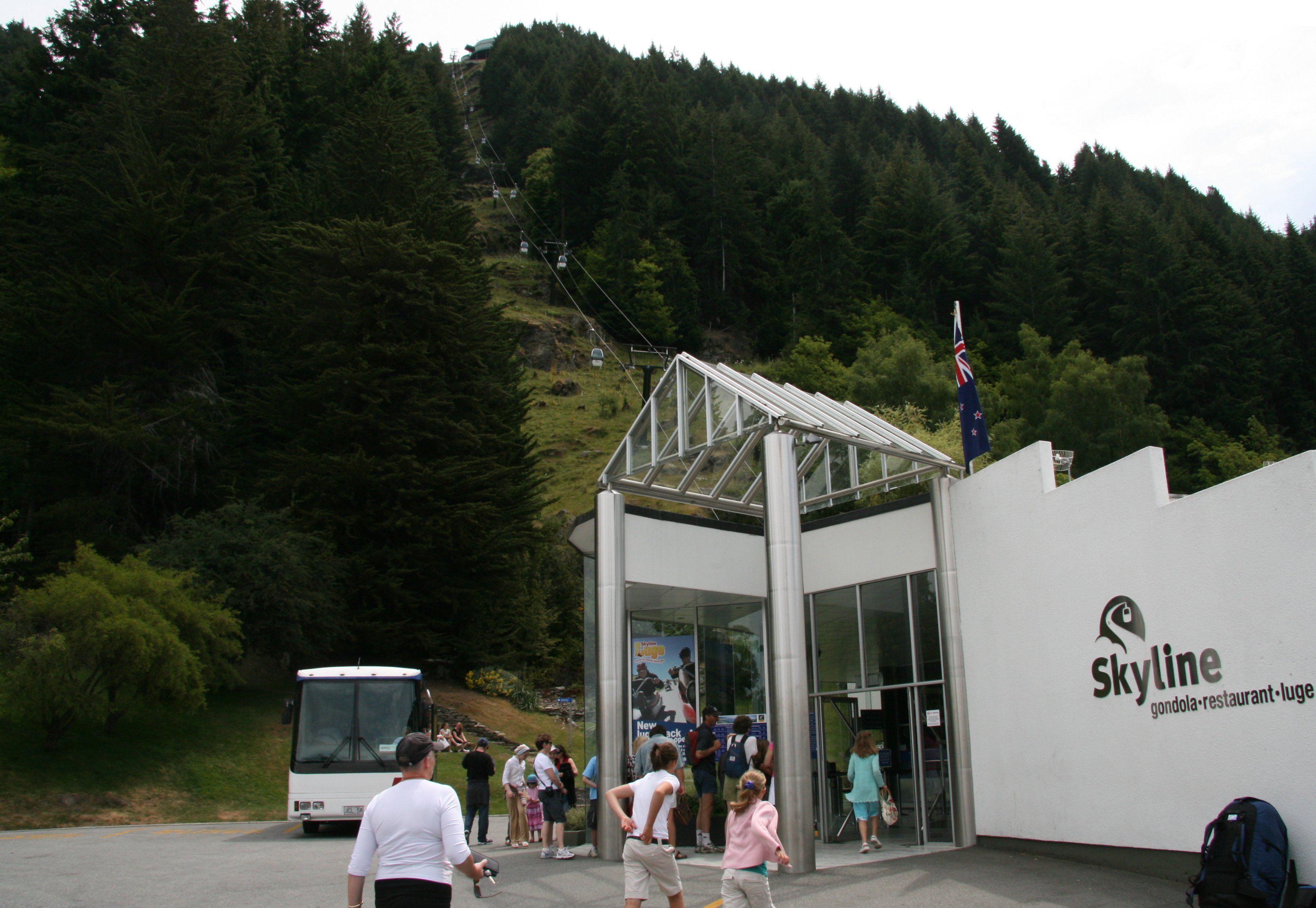 The best views in the region unfolded before my eyes as the gondola carried me 1,500 feet above Queenstown and Lake Wakatipu to the top of Bob's Peak. 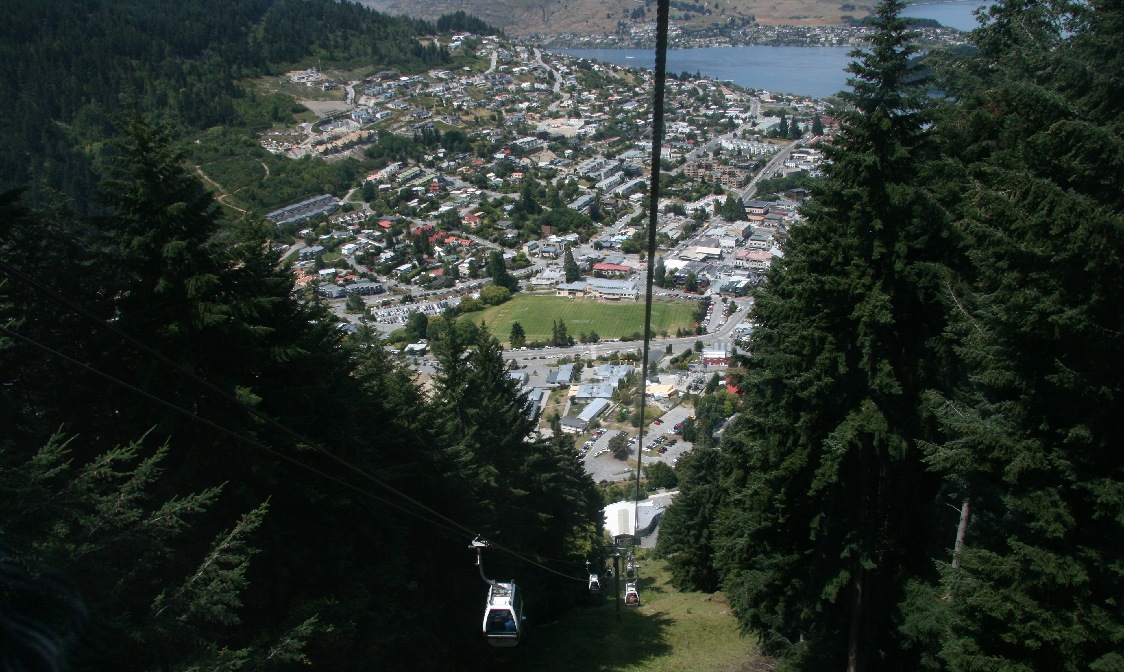 From the top there is a 220 degree panorama, with breath taking views of Lake Wakatipu, Coronet Peak, The Remarkables, Walter Peak, Cecil Peak and over Queenstown. Below you can see where they do bungee jumping.  Below is my hotel room. 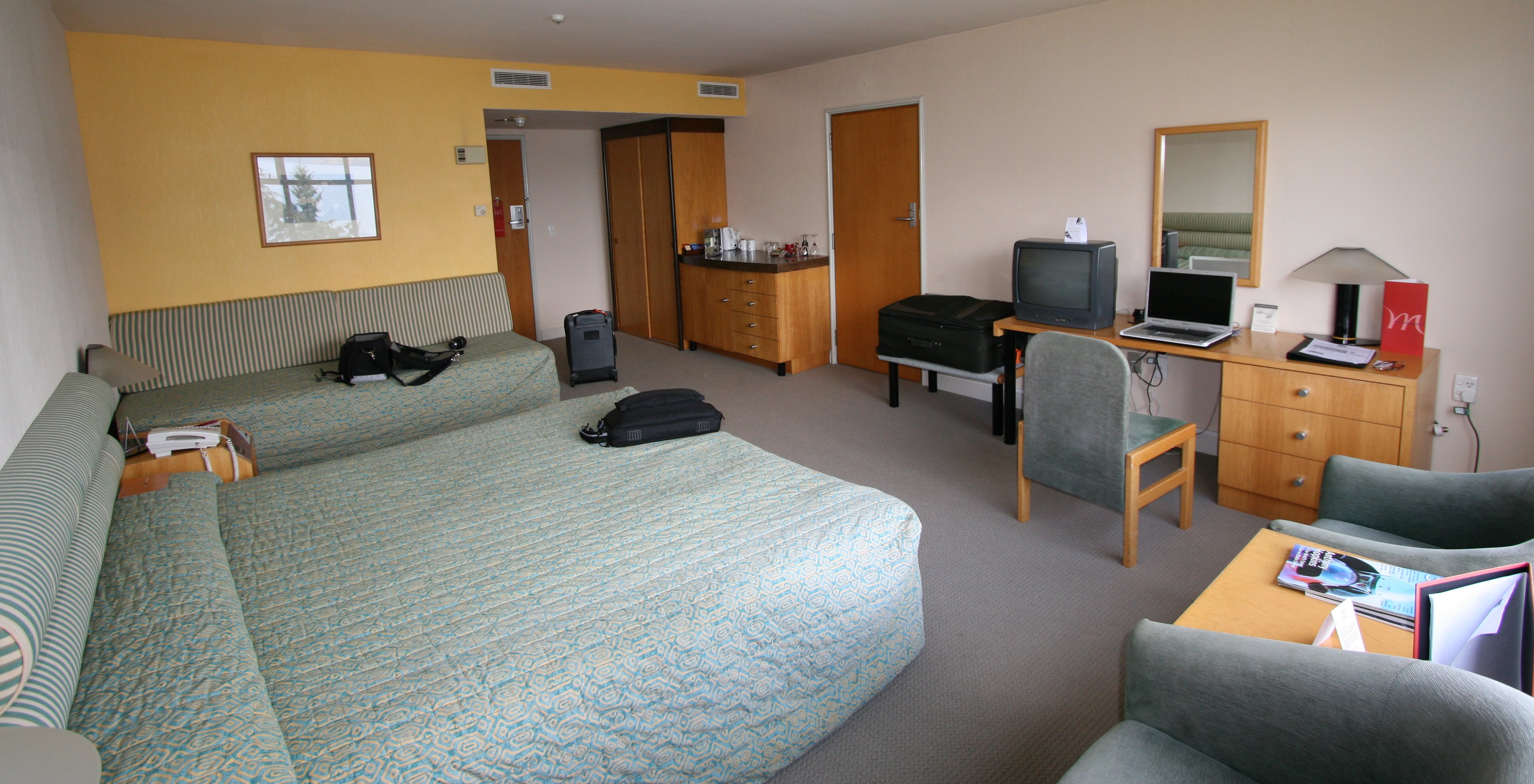 I have a spectacular view of Lake Wakatipu and the Remarkable Mountains from my hotel room. Below you can see the TSS Earnslaw making its way across the lake. 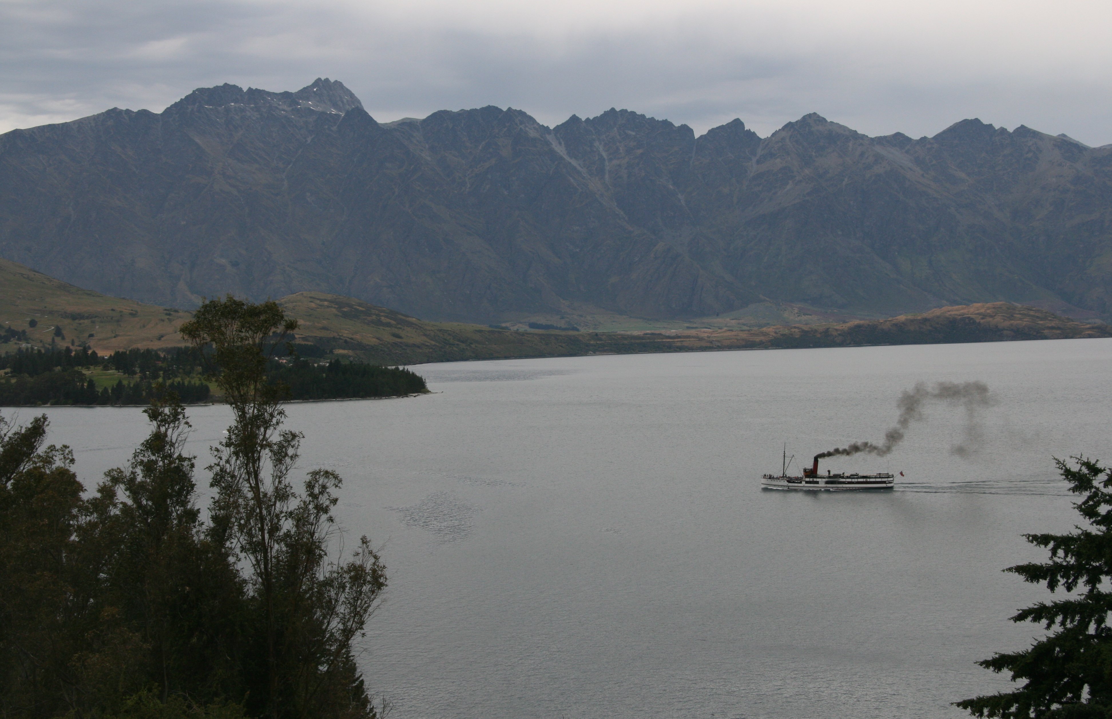 The only thing that I did today besides get here is the Skyline Gondola. Until tomorrow, Tim |
FRIDAY, JANUARY 19, 2007:
I traveled 360 miles today traveling roundtrip from Queenstown to Milford Sound.
This was probably the most disappointing day of the trip, my journey to Milford Sound.
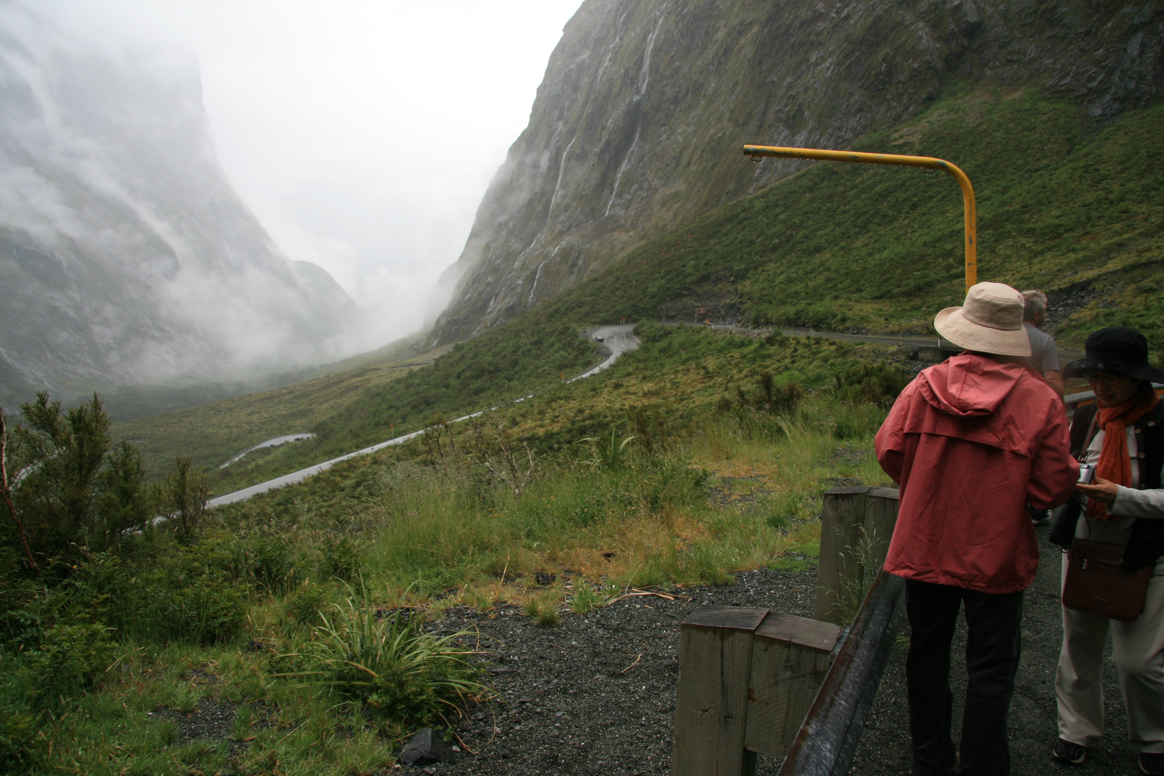
The weather down and back was not bad, but the weather at Milford Sound was awful.
You couldn't even see Mitre Peak and the other beautiful mountains surrounding the sound.
I was also supposed to fly back but due to the weather it was another LONG five hours back to Queenstown.
6 minute video of journey to Milford Sound. |
|
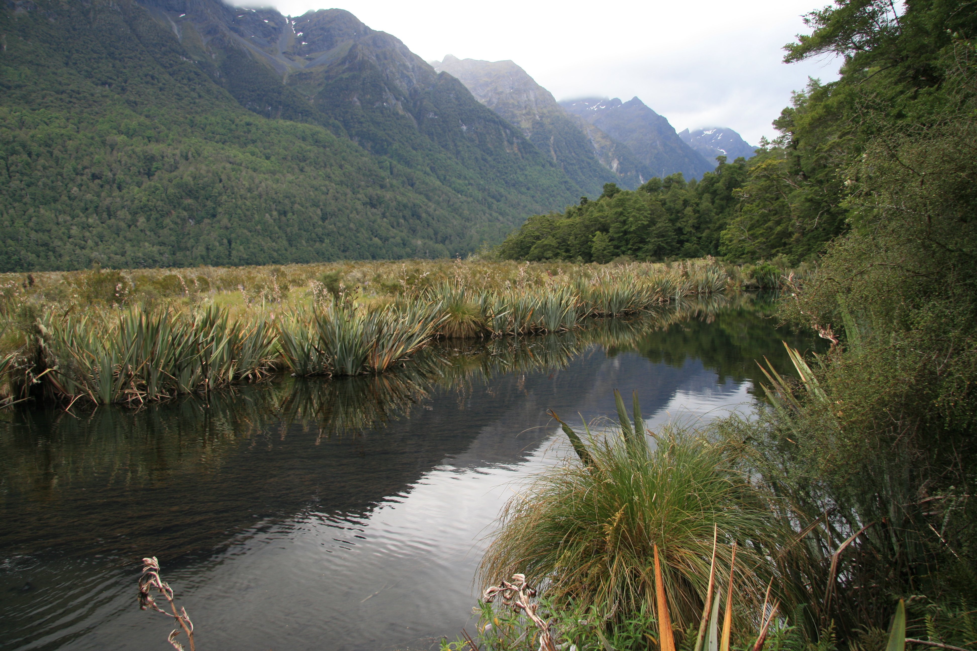
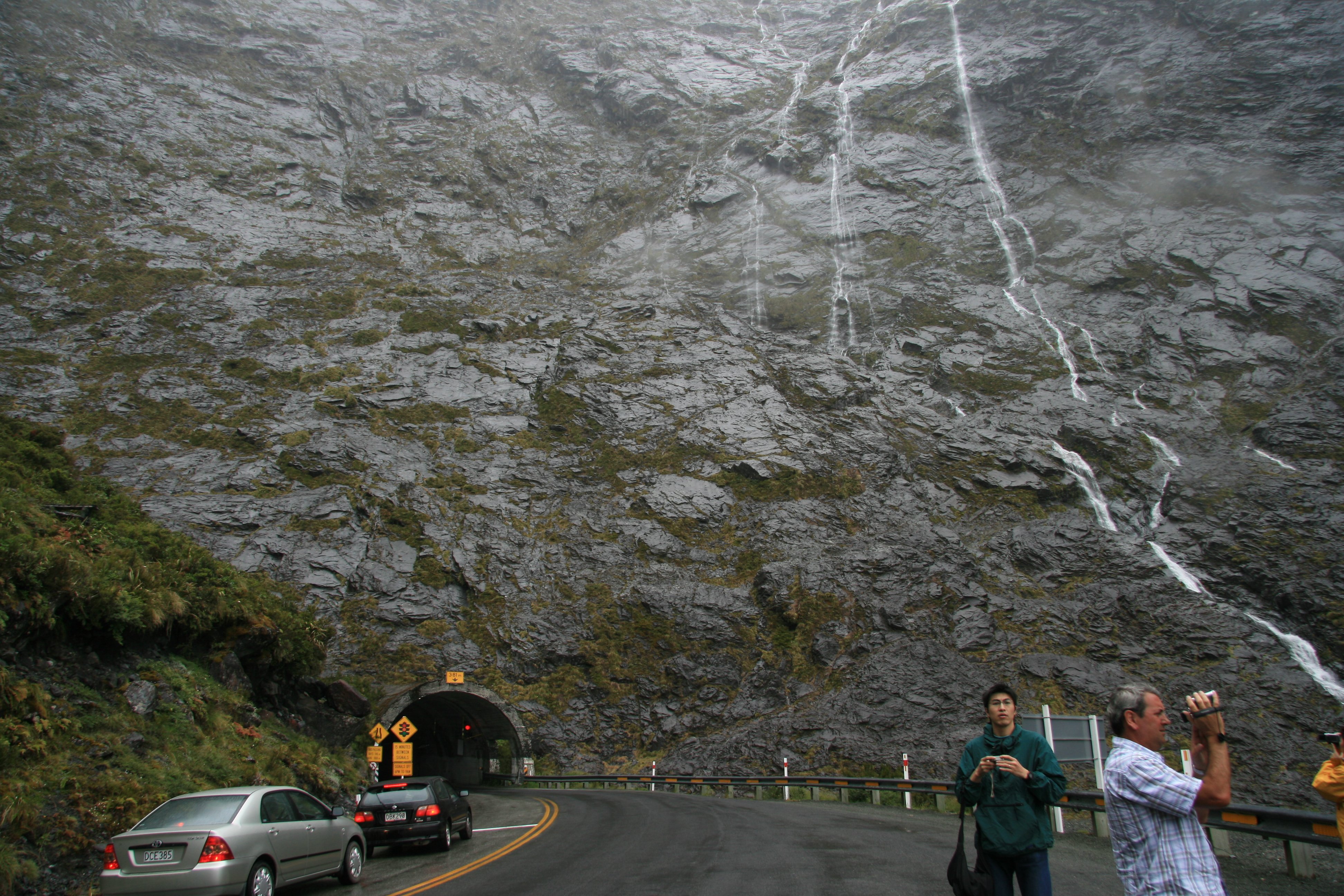
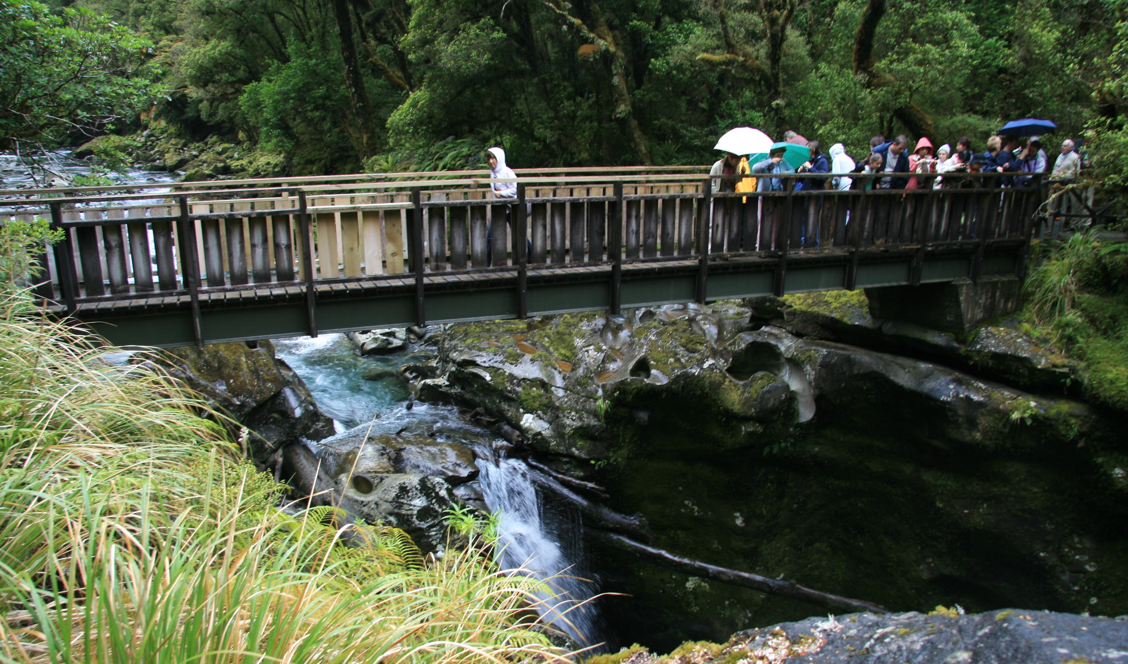
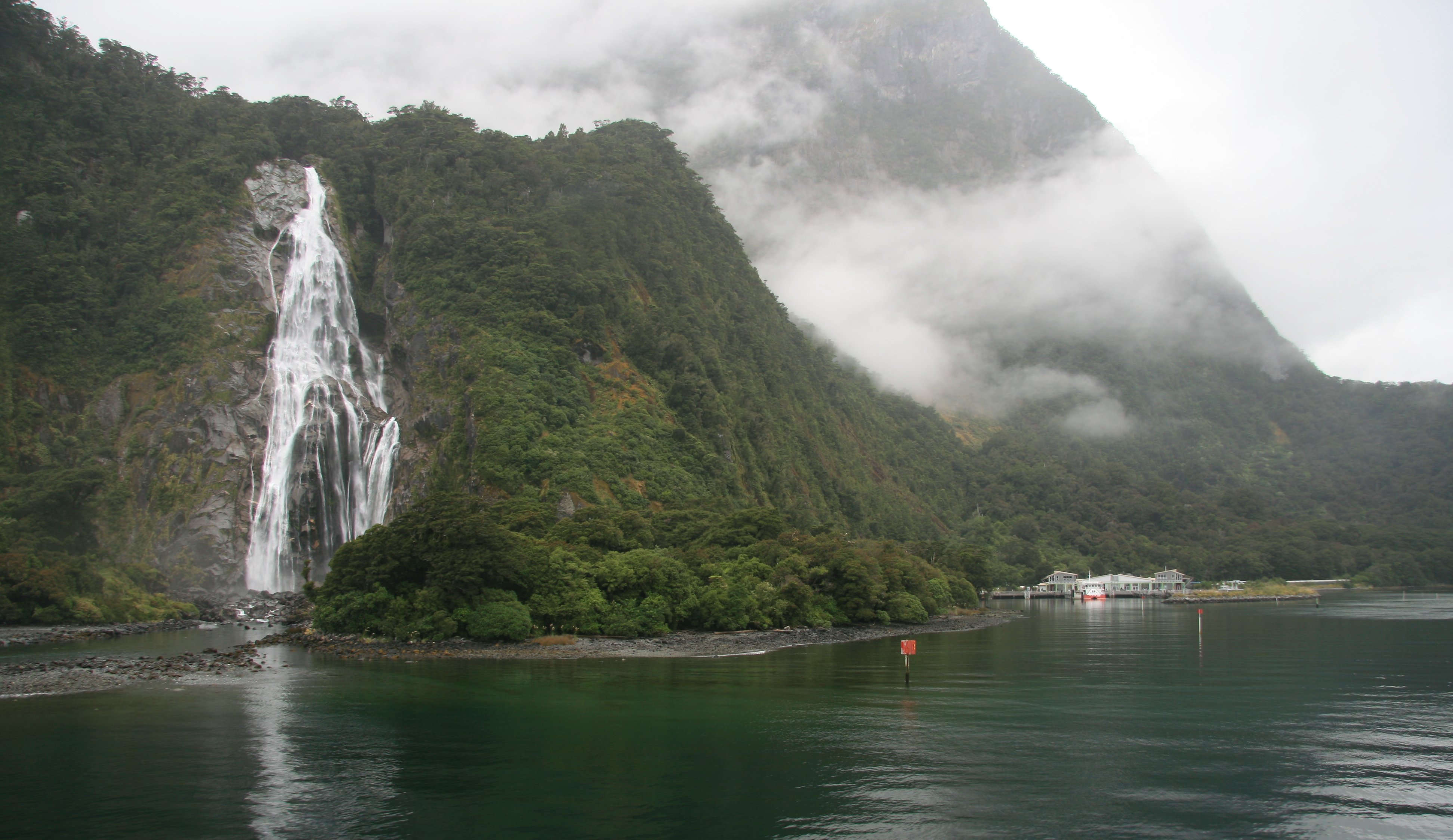
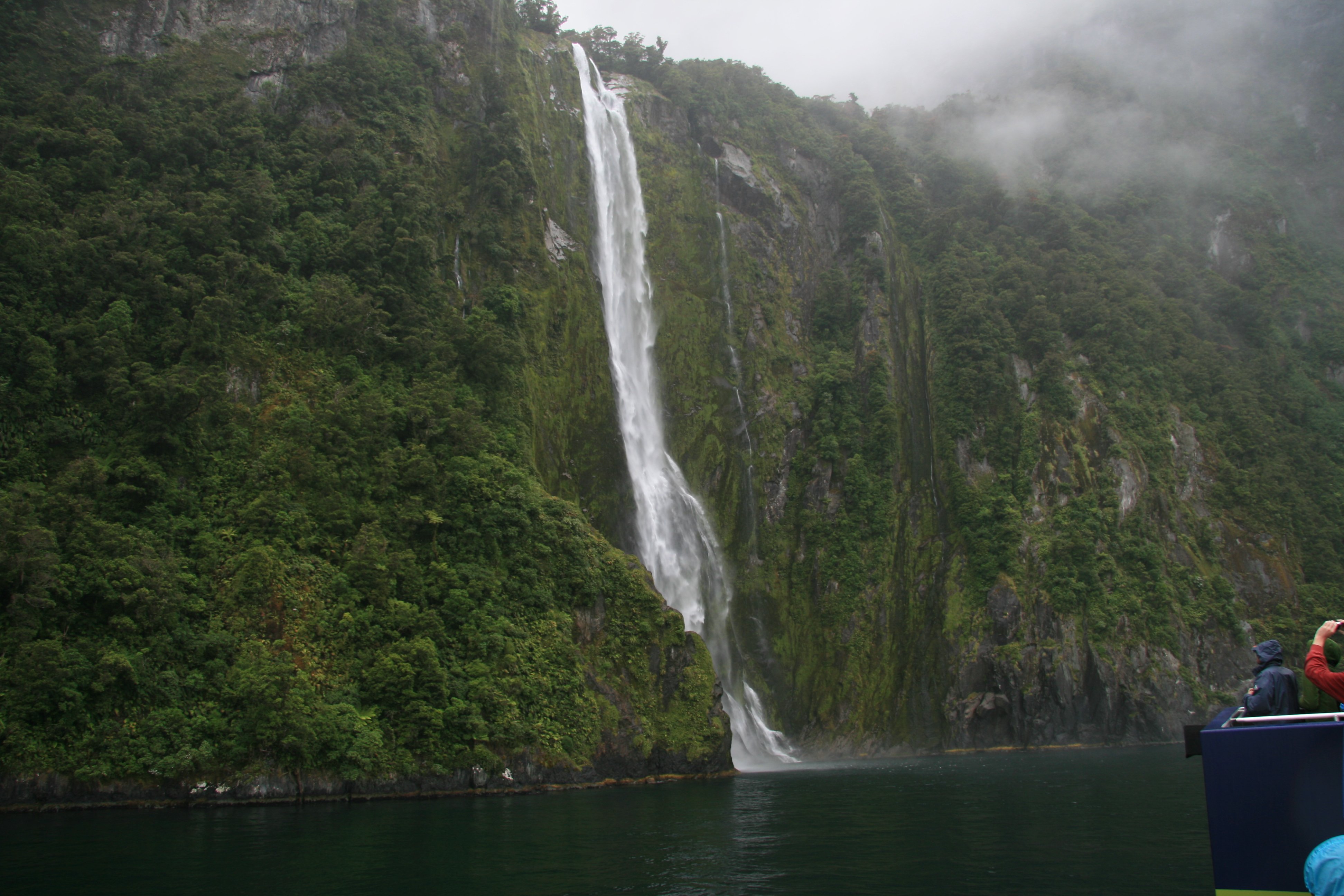
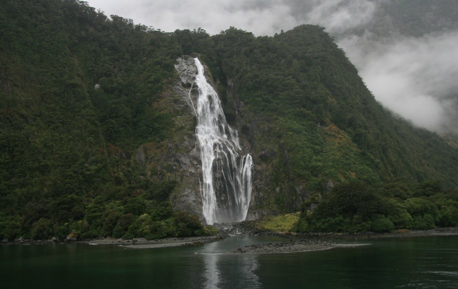
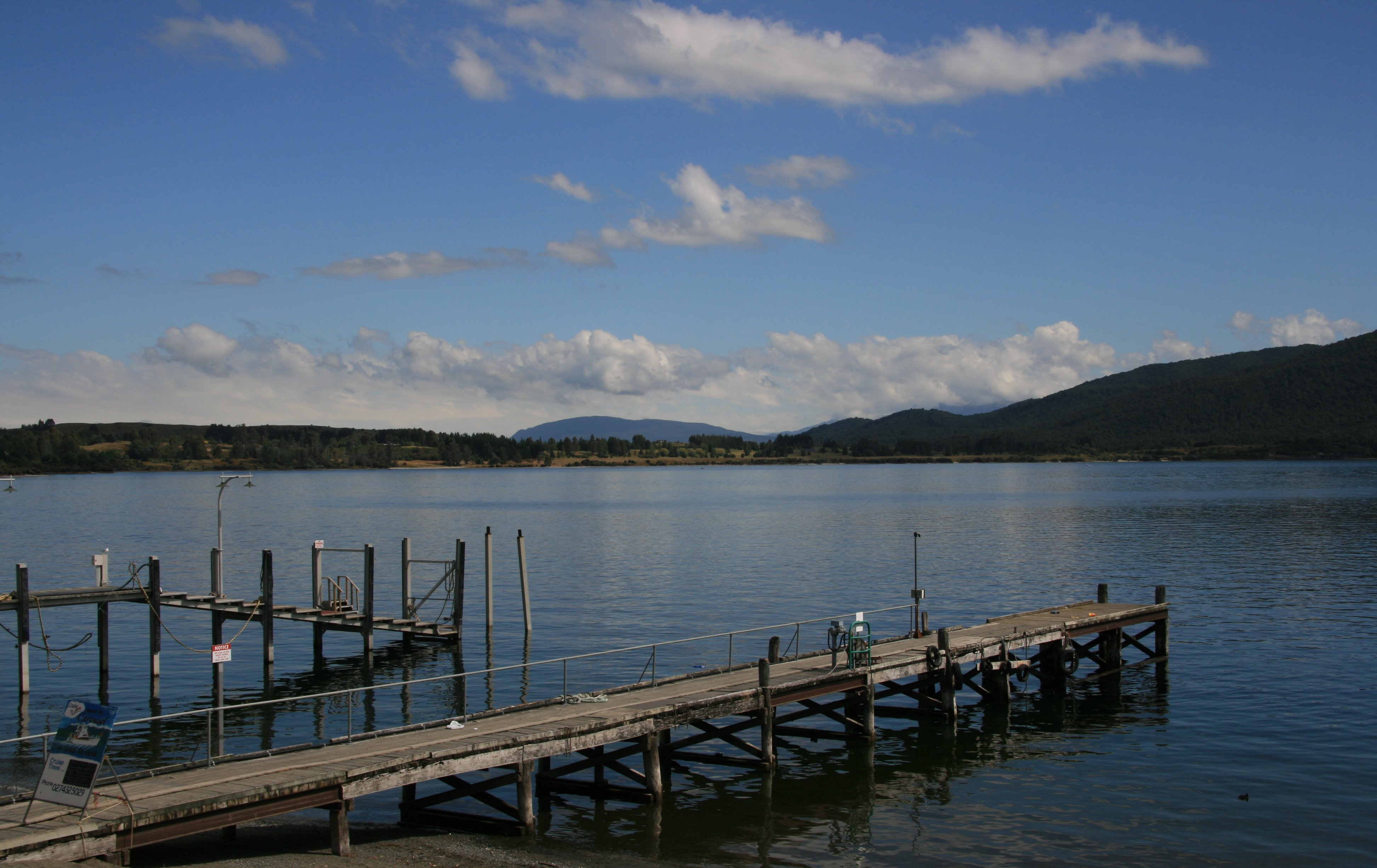
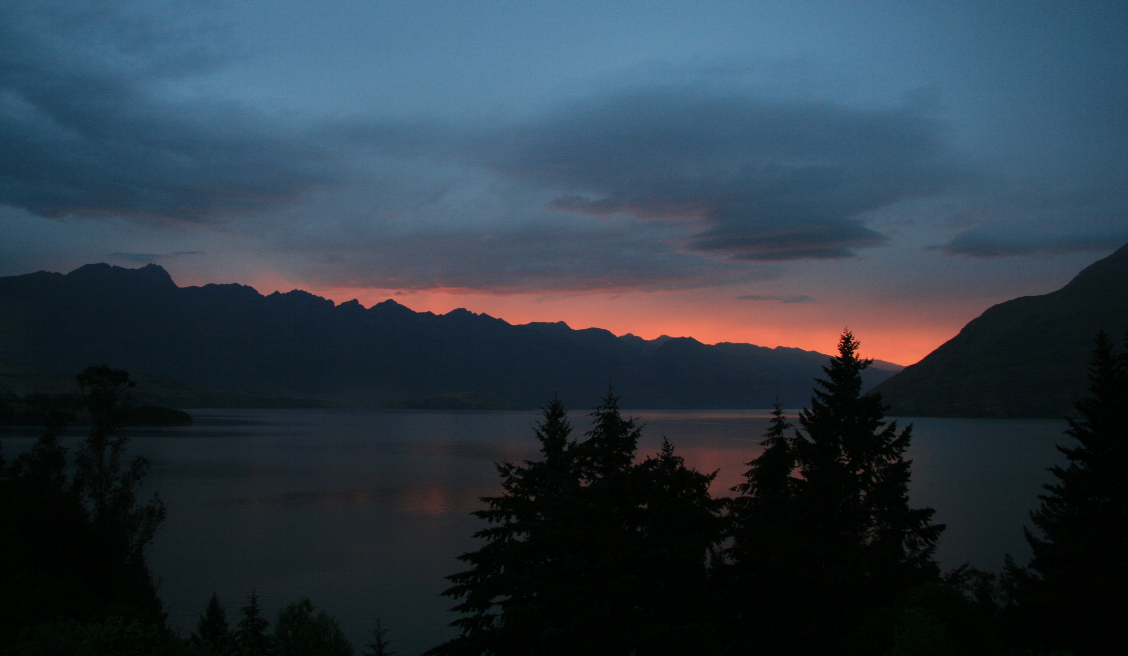
Hello Everyone, Today was by far the worst day of the trip. Today I traveled down to Milford Sound, the place I most wanted to see here in New Zealand. I went down by motor coach so I could fly back. We left Queenstown at 7:00am this morning. Weather was decent when we left town. We made a comfort stop in the town of Te Anau.  Further along the road are the Mirror Lakes - on a still day they display a perfect reflection of the Earl Mountains. This is a busy, winding road and takes much longer to drive than the distance suggests. This is the point of the trip that the weather really fell apart. 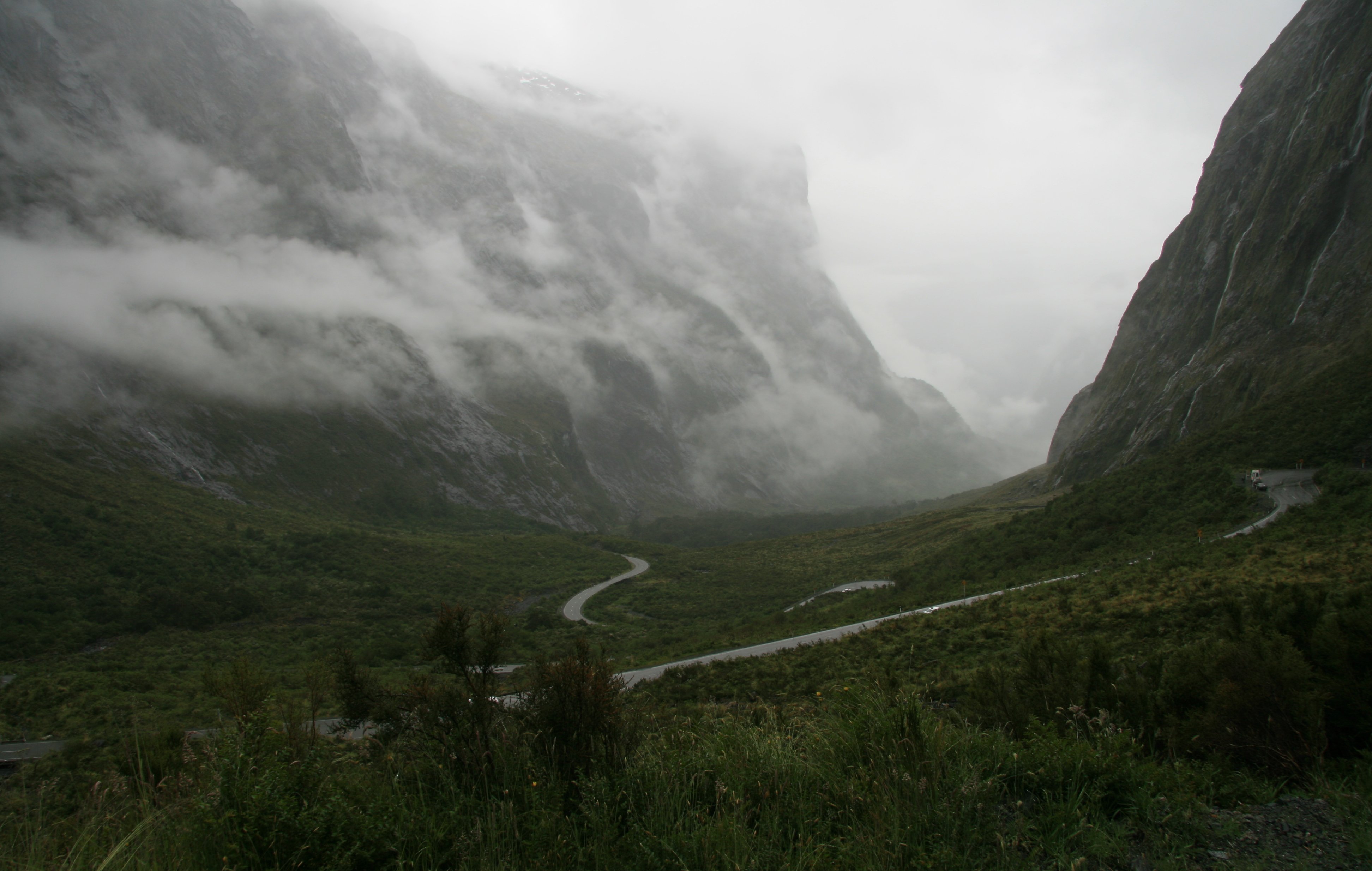 Below you can see our bus in front of some of the many waterfalls coming down the mountains. 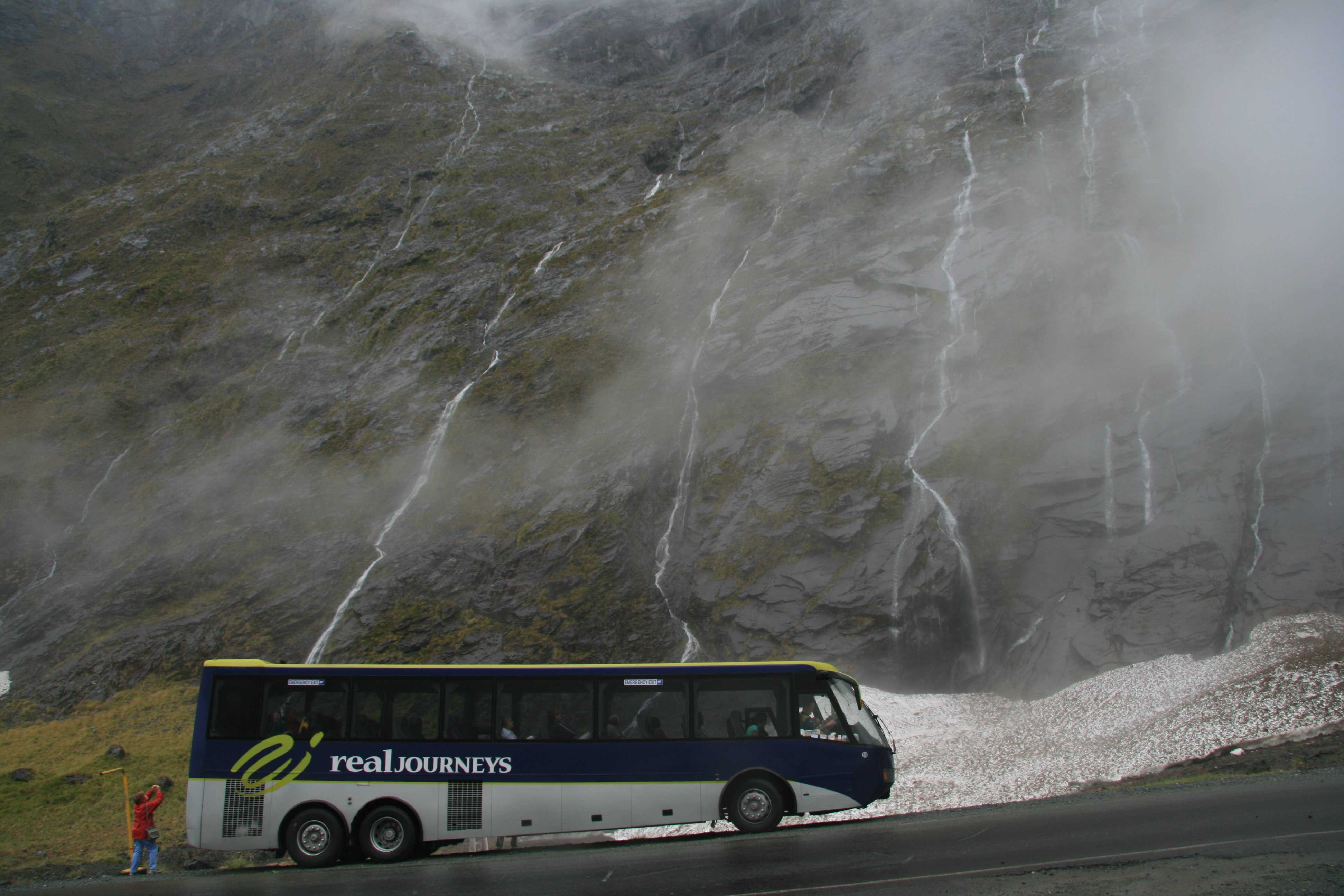 The Homer Tunnel signals your descent to Milford Sound. This tunnel, which is hewed from solid granite, took nearly 20 years to complete. From mouth to mouth it measures 4,167 feet. Below we had just traveled through the Homer Tunnel and are now on the west side of it. Before we reached Milford, we got some fresh air on the 20 minute walk that leads to The Chasm - a waterfall where the Cleddau River has scoured its way through solid rock. When we got to Milford Sound for the boat cruise the weather got even worse. Below is our boat. The two hour cruise was totally pointless, we might as well have stayed tied to the dock, the scenery would have been the same. 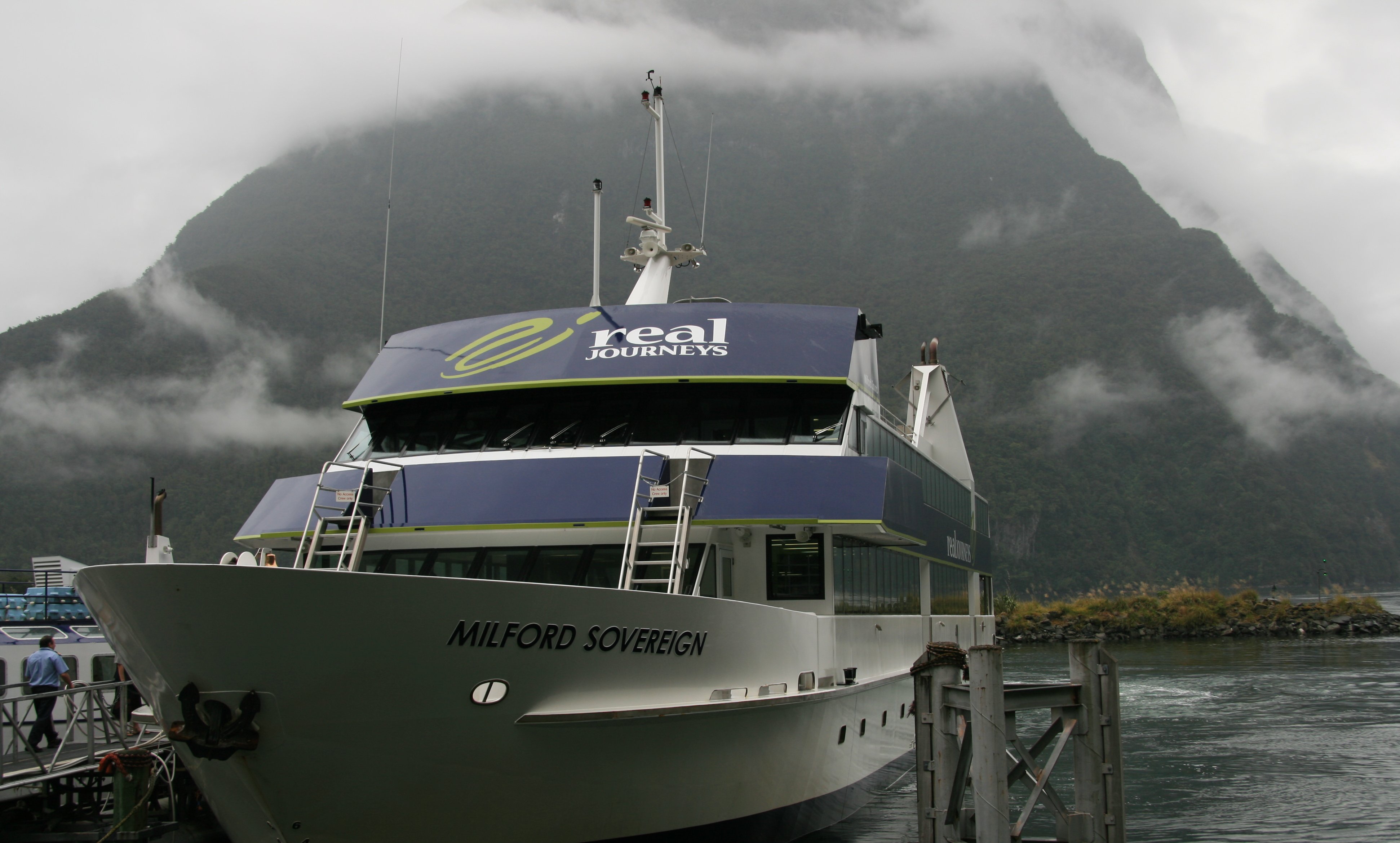 We did manage to see two beautiful waterfalls on our cruise. Bowen Falls is the highest and the most powerful waterfall on Milford Sound. The falls provide electricity for the Milford Sound settlement by feeding a small hydroelectric scheme, and are also the water source for the settlement. 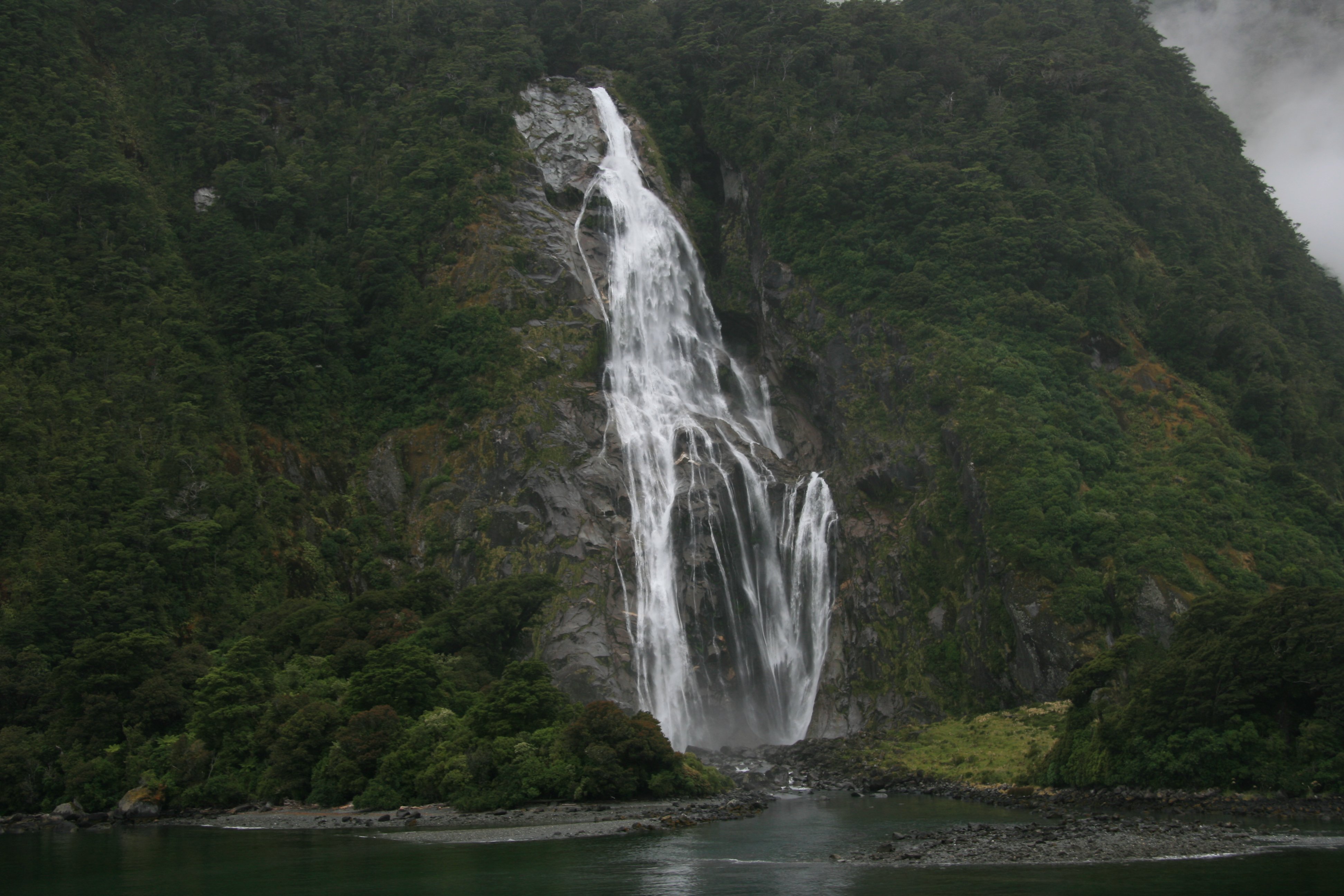 Stirling Falls was the second waterfall we encountered. Since you didn't see it from any of my pictures today, below is what I was hoping to see. It is a picture of Milford Sound borrowed from Wikipedia. 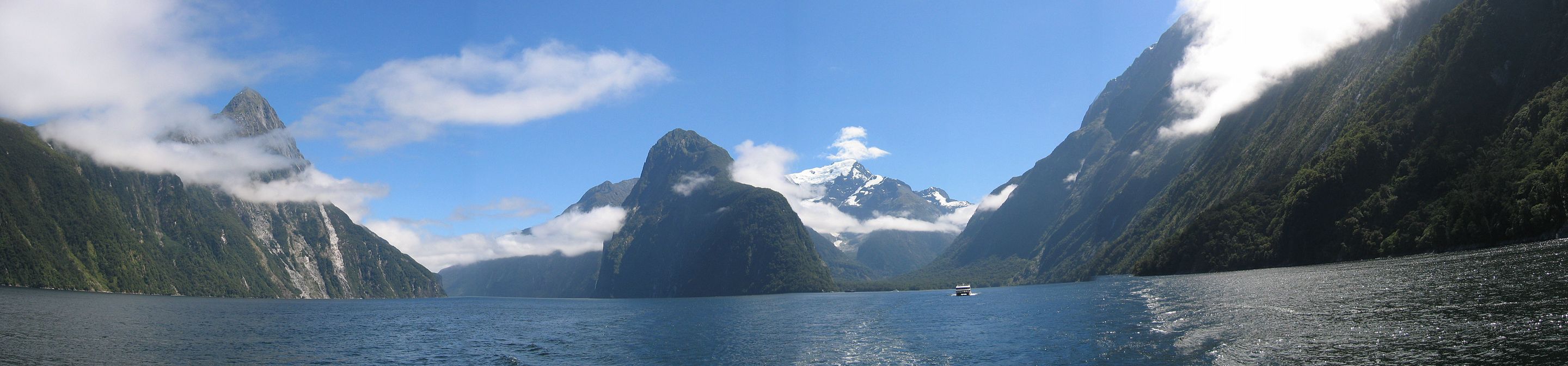 Needless to say after the cruise was over the planes weren't flying because of the weather so it was another five hours on the bus to get back to Queenstown. We made another comfort stop in Te Anau on the way back. Below is Lake Te Anau and as you can see the weather is nice agian. There was a beautiful sunset out my hotel room window tonight. A nice end to a very disappointing day. Tomorrow's another day, hopefully better, Tim |
SATURDAY, JANUARY 20, 2007:
I drove 53 miles today traveling roundtrip from Queenstown.
On and off showers on Saturday kind of hampered my planned activities.
I spent the day in and around Queenstown.
It was fun watching folks far braver than I jump off the Kawarau Bridge into the canyon below.
11 minute video of Queenstown, New Zealand. |
|
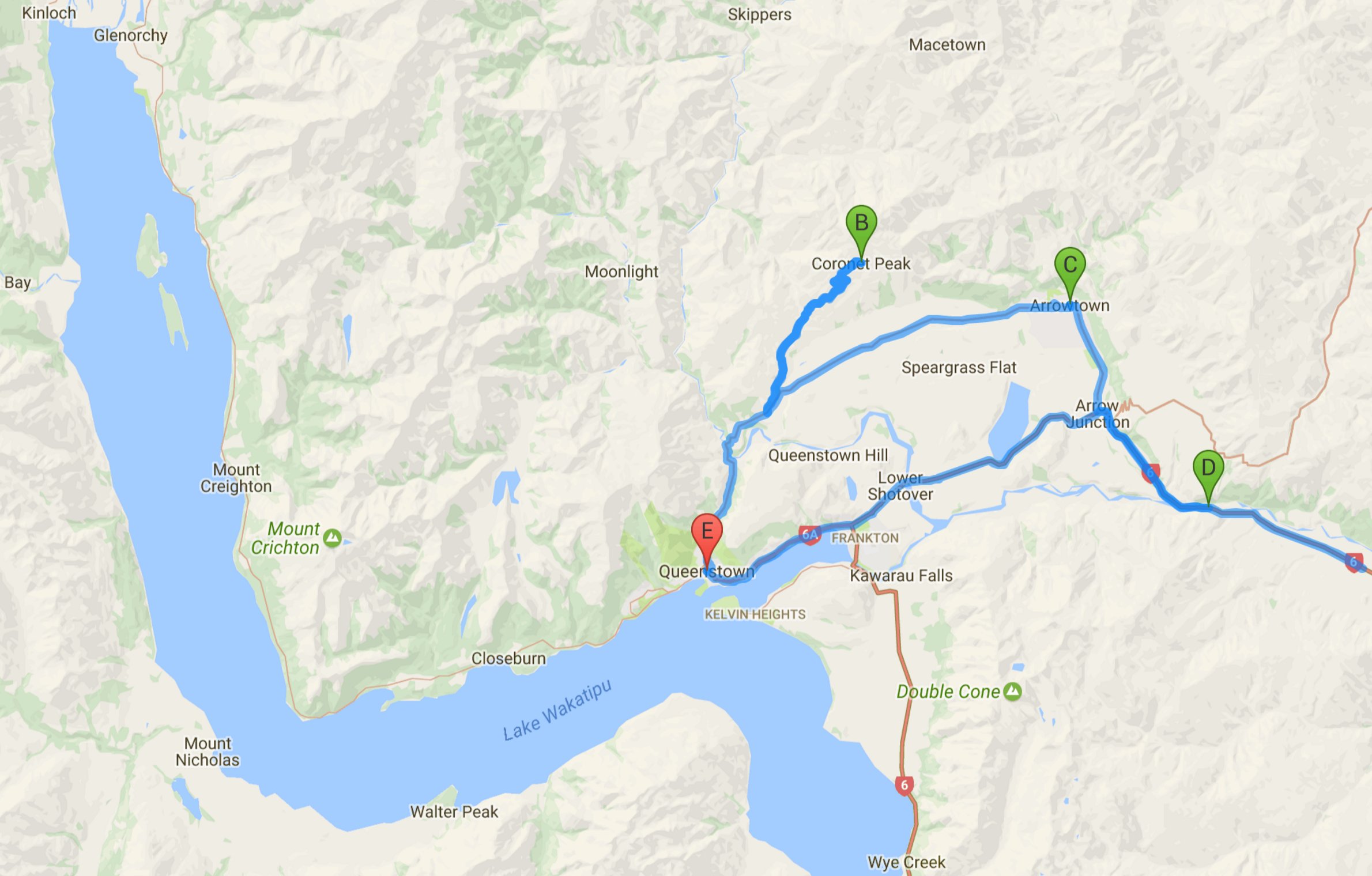
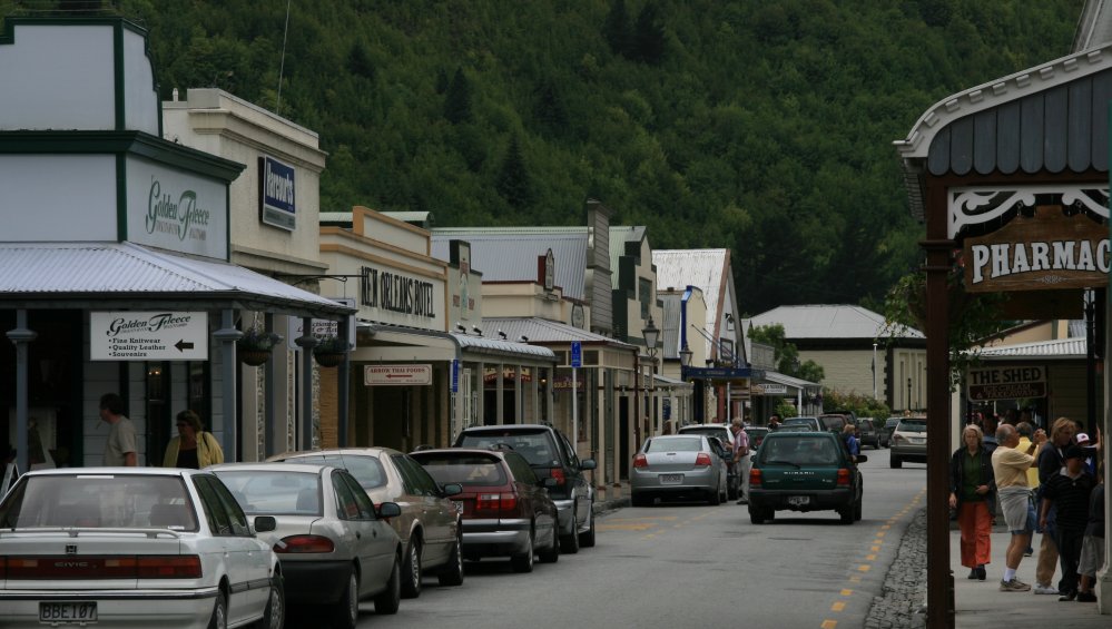
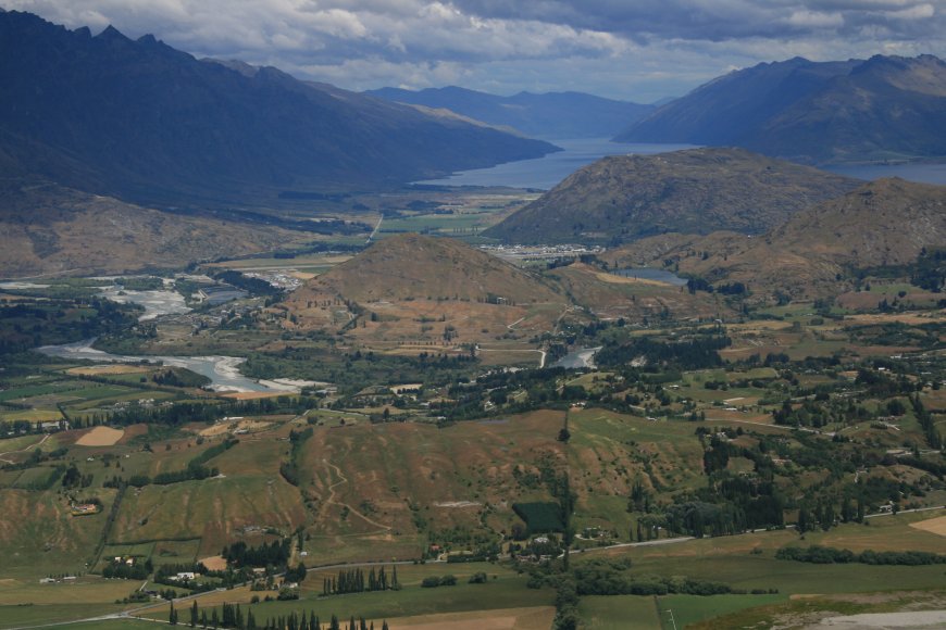
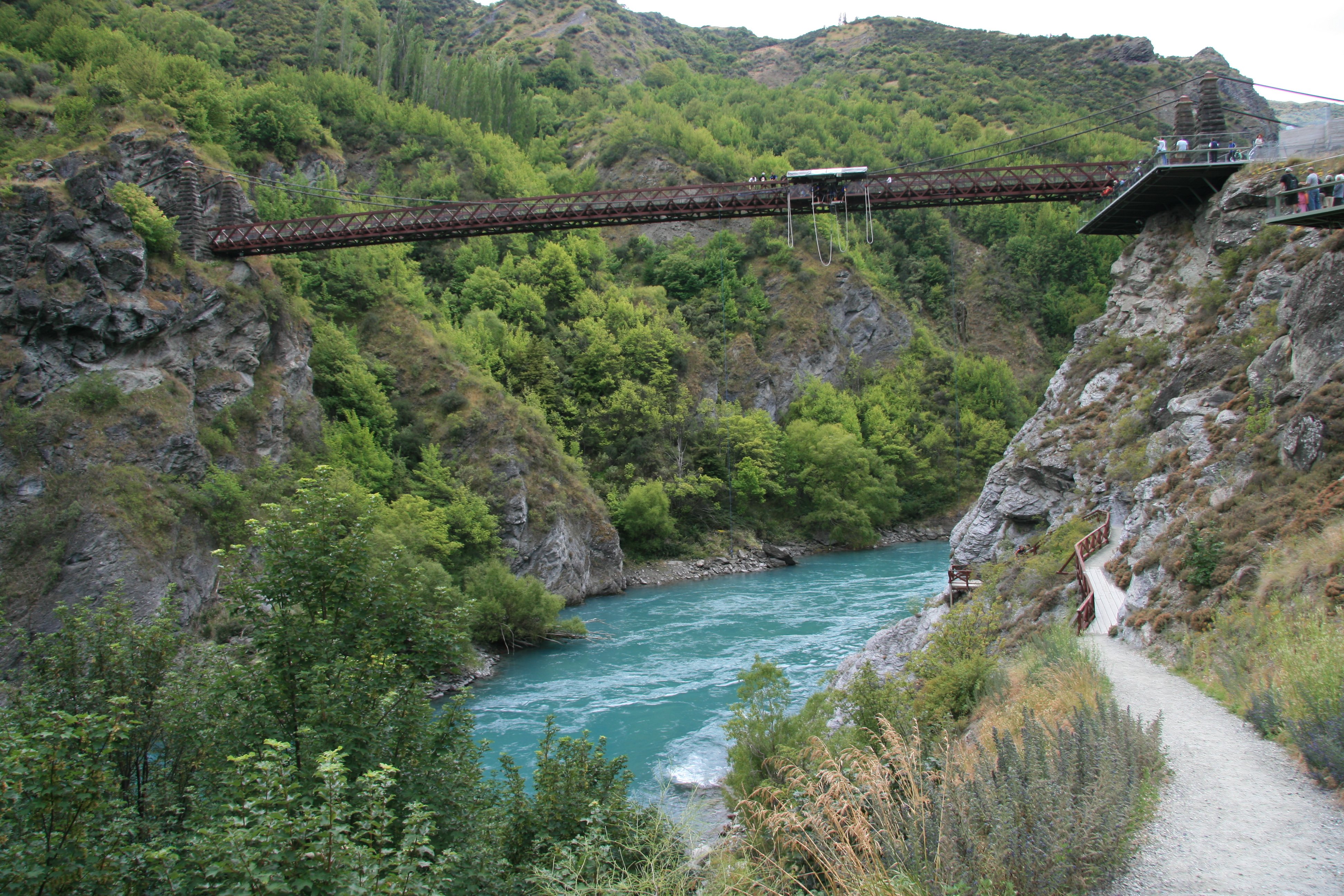
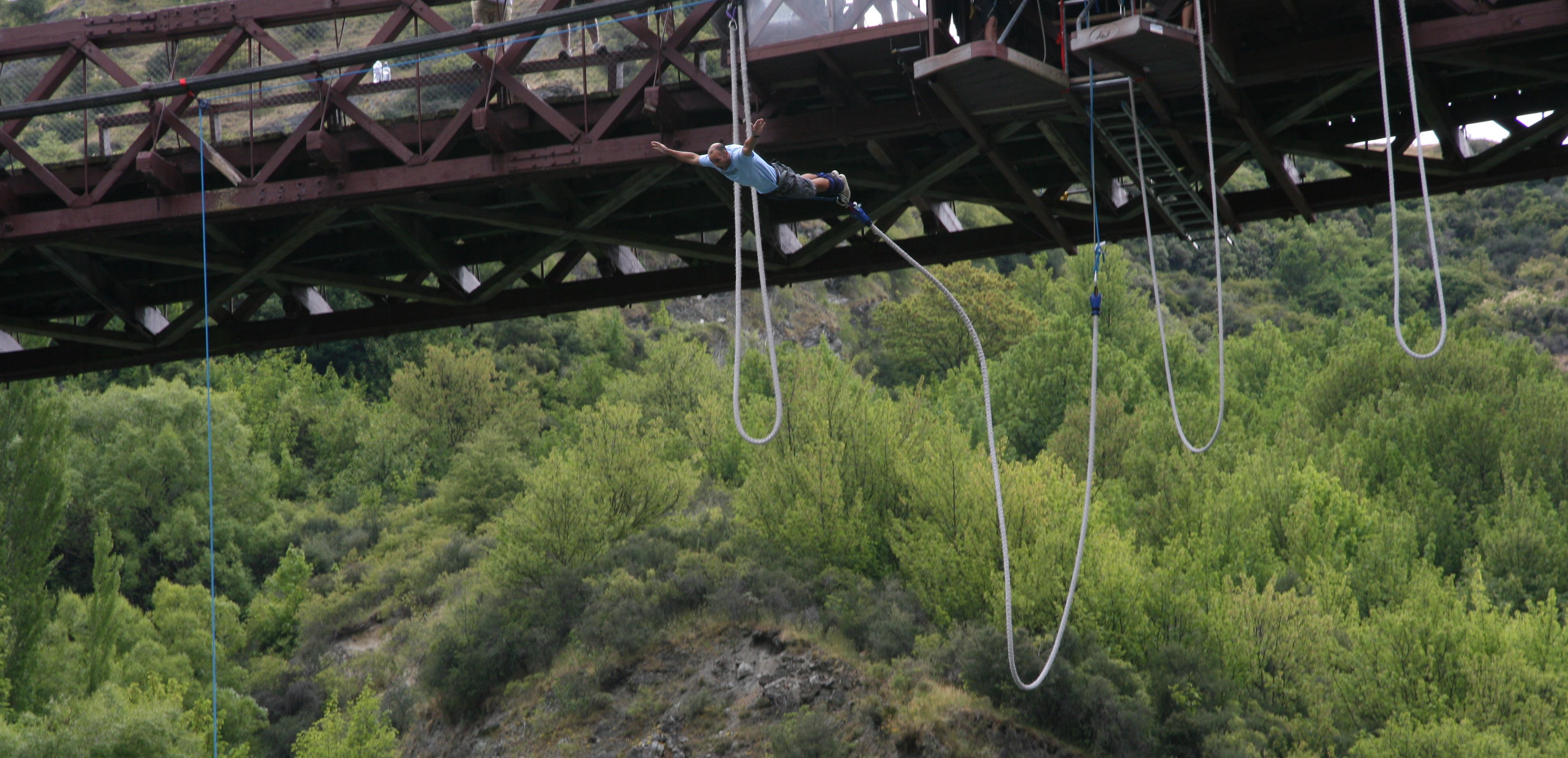
Hello Everyone! When the day started I thought it was going to be a wash out like yesterday. My plans for the day were canceled today due to the weather. The rain stopped for the most part around noon so I headed out not really sure of what I was going to do but I was for sure not going to sit in my hotel room. My first stop was Arrowtown. It's an old gold rush town about 20 kilometers from Queenstown. 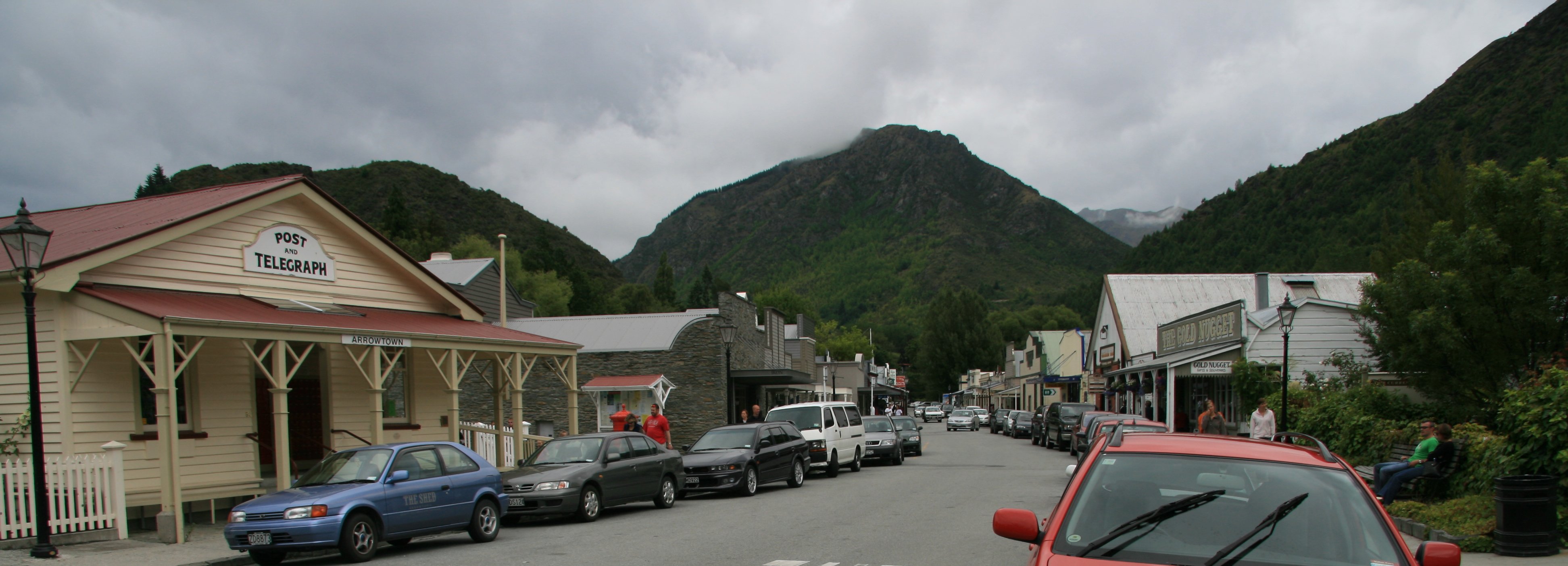 One of the most picturesque settlements in New Zealand, Arrowtown sits alongside the gold-bearing Arrow River. The town was established in 1862, during the height of the Otago gold rush. The settlement grew quickly as pioneers constructed cottages, shops, hotels and churches, more than 60 of which can still be seen today. 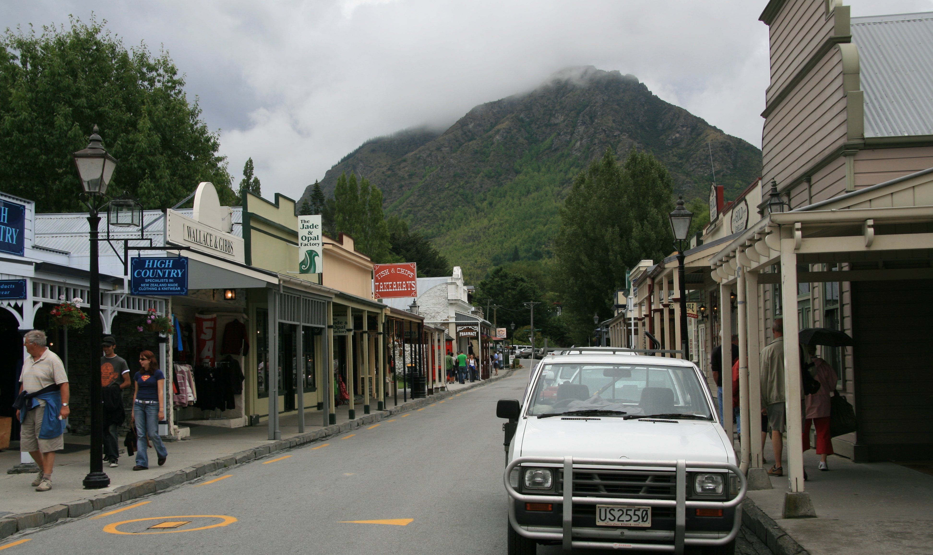 I wandered around Arrowtown for a bit and then headed to the historic old Kayarau Suspension Bridge. This is where Bungy jumping first began. This is a very scenic area. The picture below is looking down the gorge back to the highway bridge. 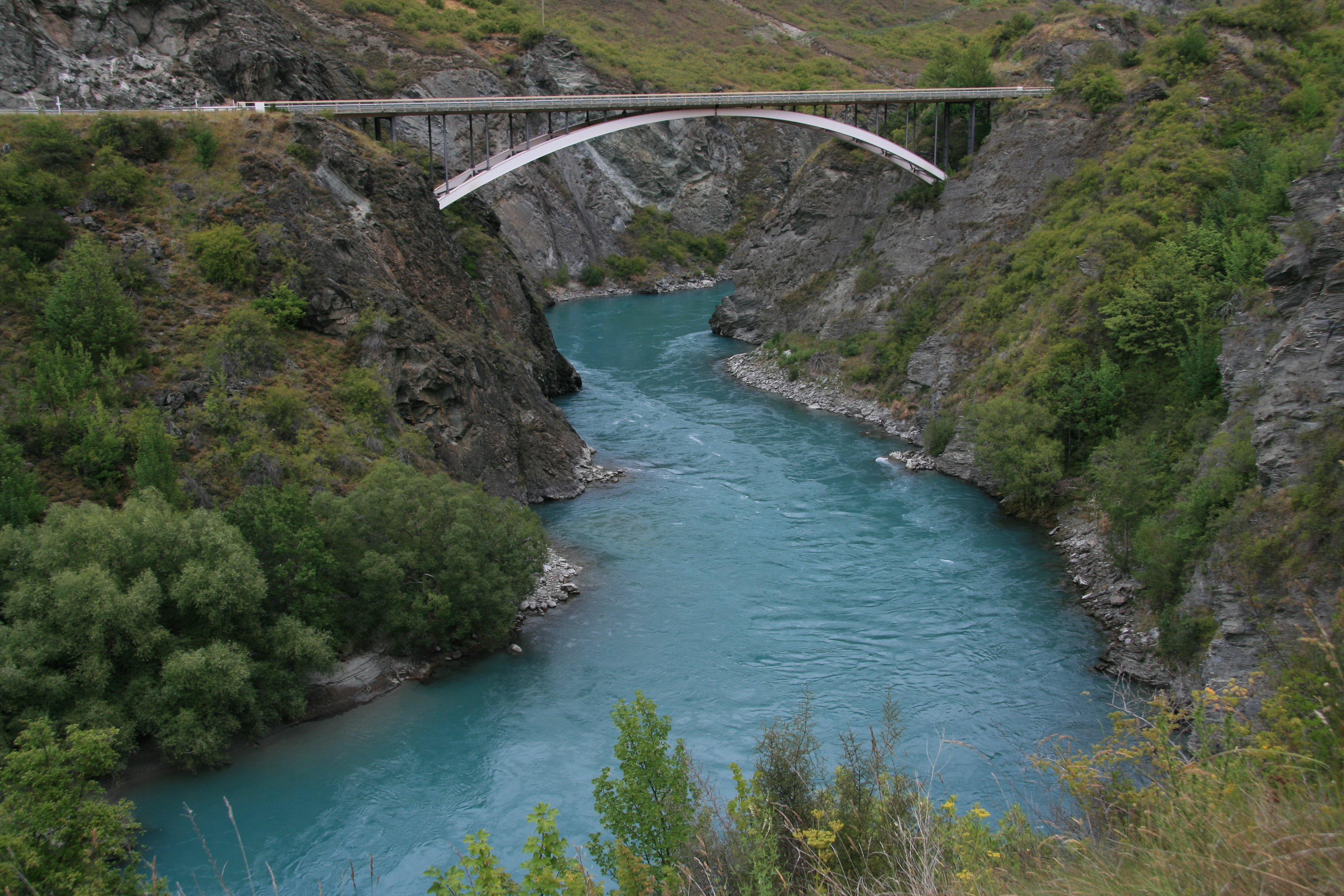 The Kawarau Gorge Suspension Bridge is an impressive structure completed in 1880. Bungy pioneers AJ Hackett and Henry van Asch jumped into the World spotlight by launching the World's first commercially operated Bungy Jumping Site, off the historic Kawarau Bridge. It was fun watching all the folks that are much braver than I leap off the bridge into the canyon below. After these fool-hardy people plunged off the bridge a boat would come by to pick them up. 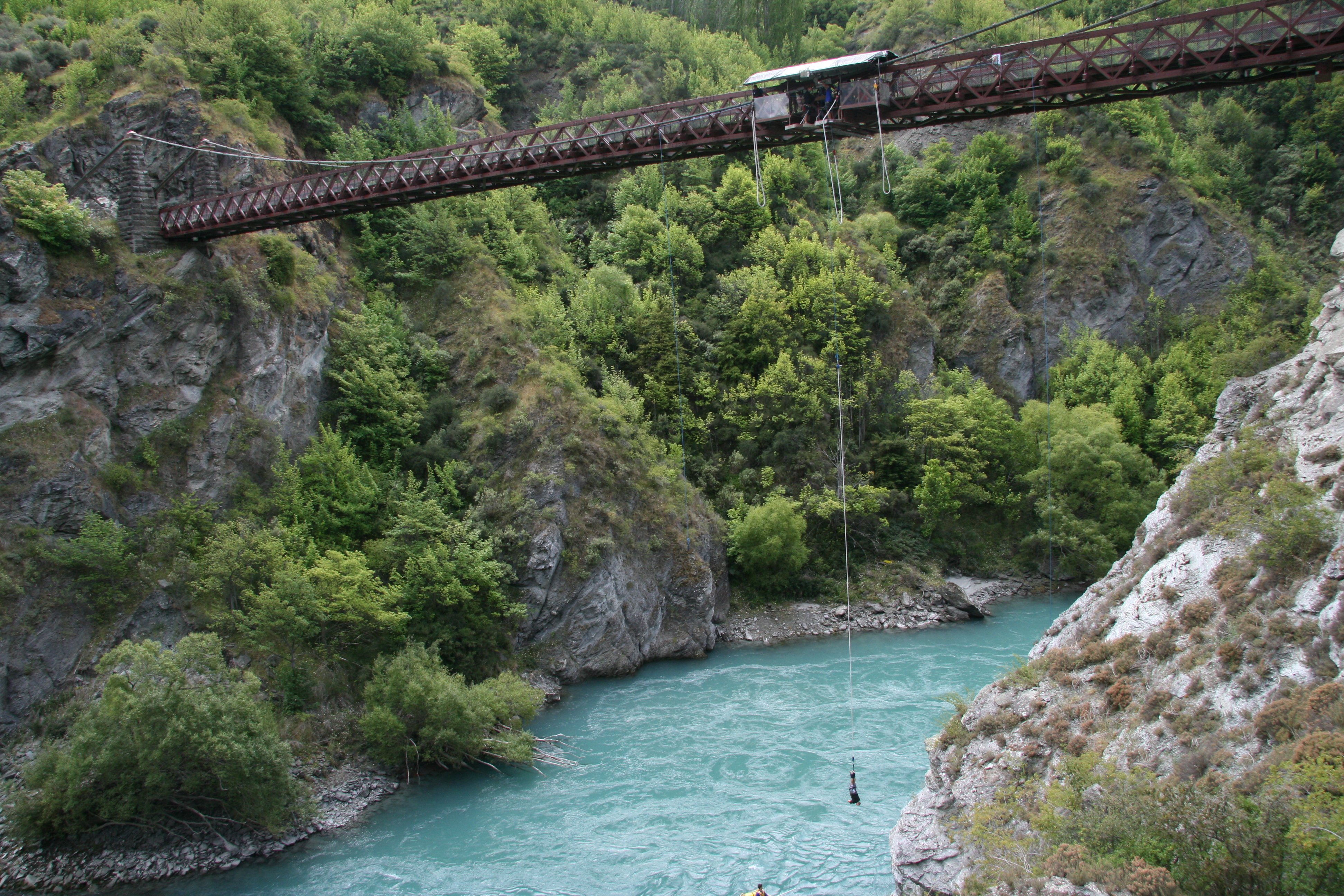 On my way back into Queenstown I saw this road going almost straight up in the air so I decided to go up and have a look. 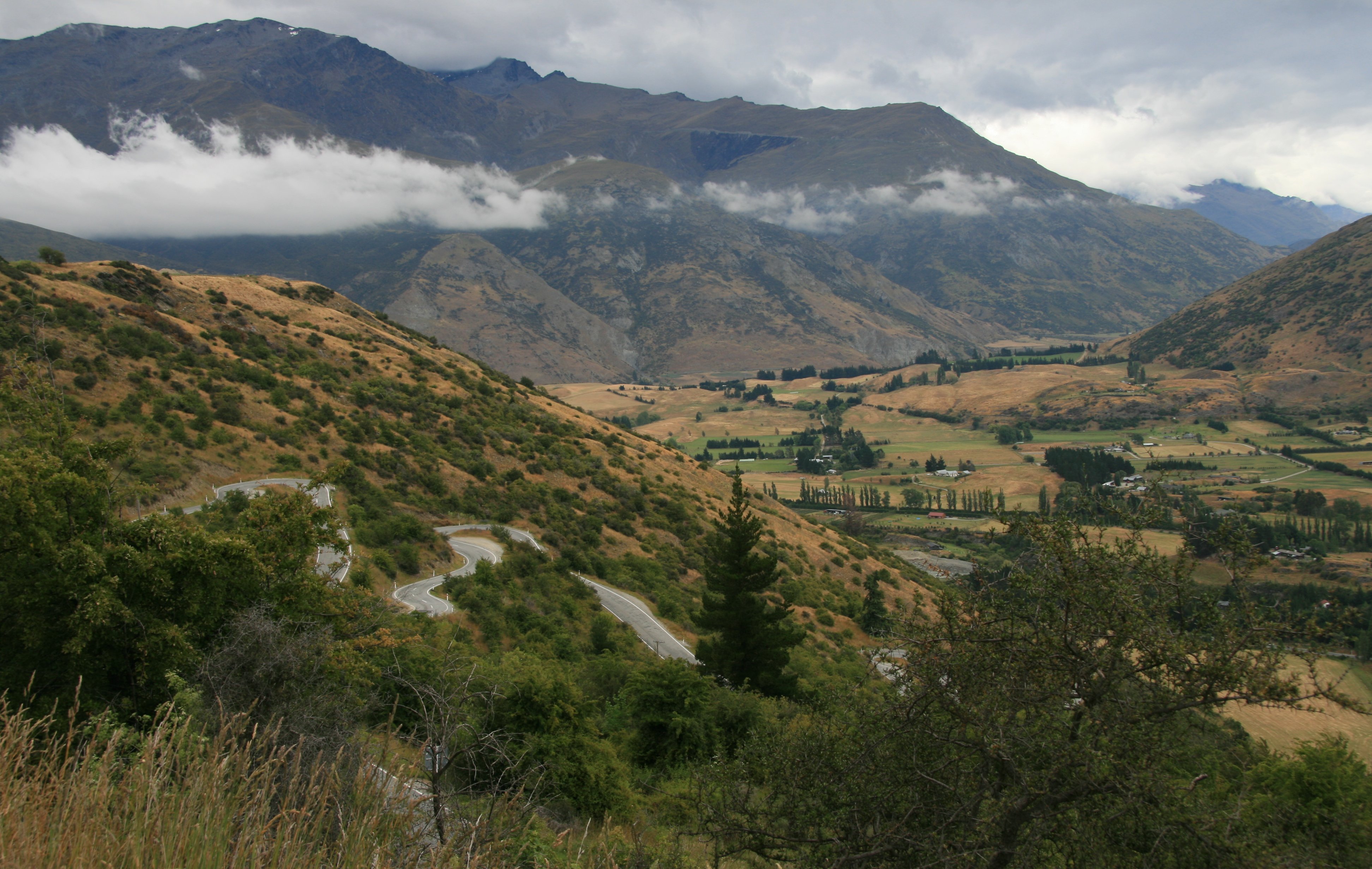 The road led to the Coronet Ski Area where there were nice views of the area. 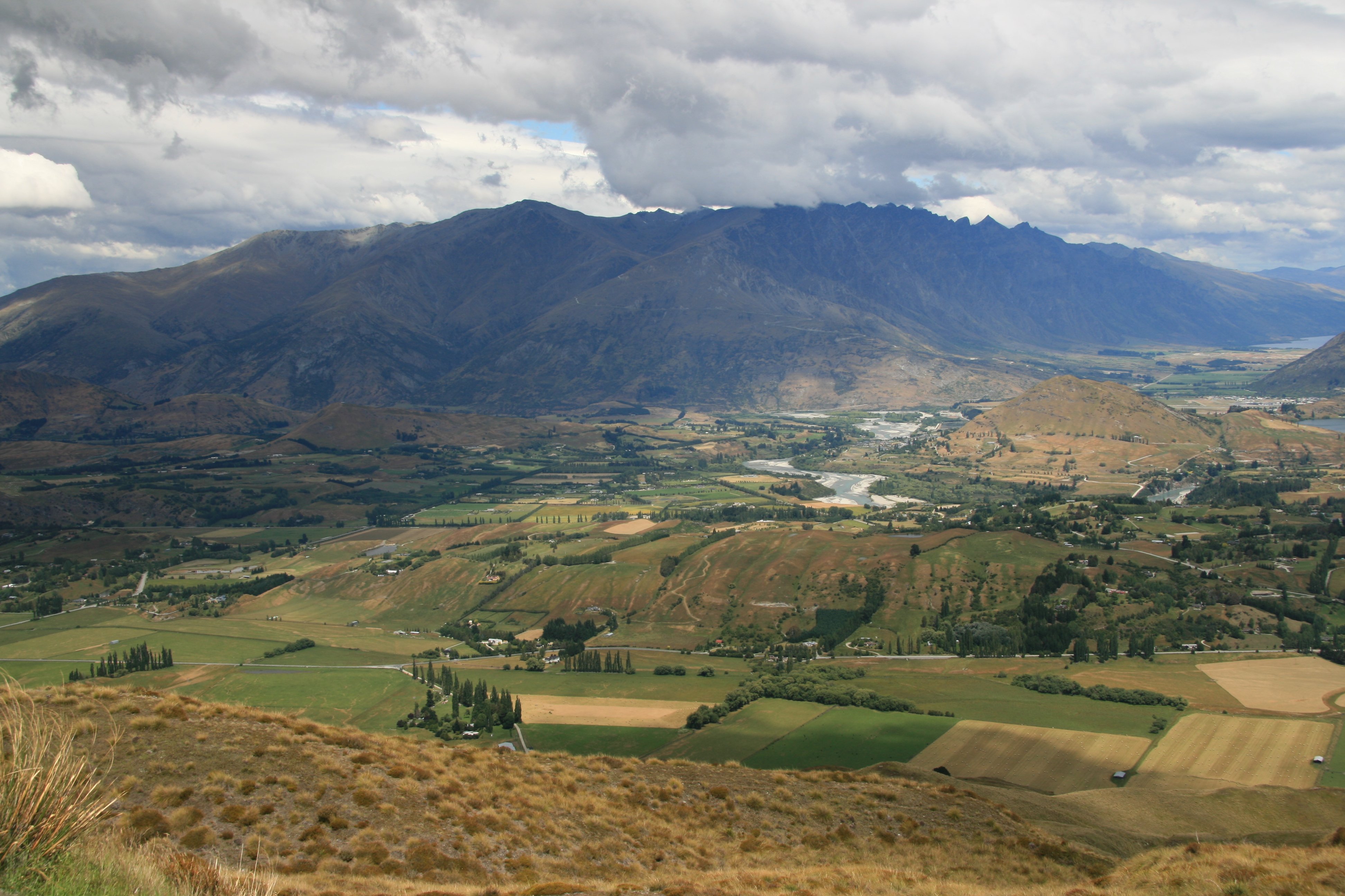 Below is a wider view. 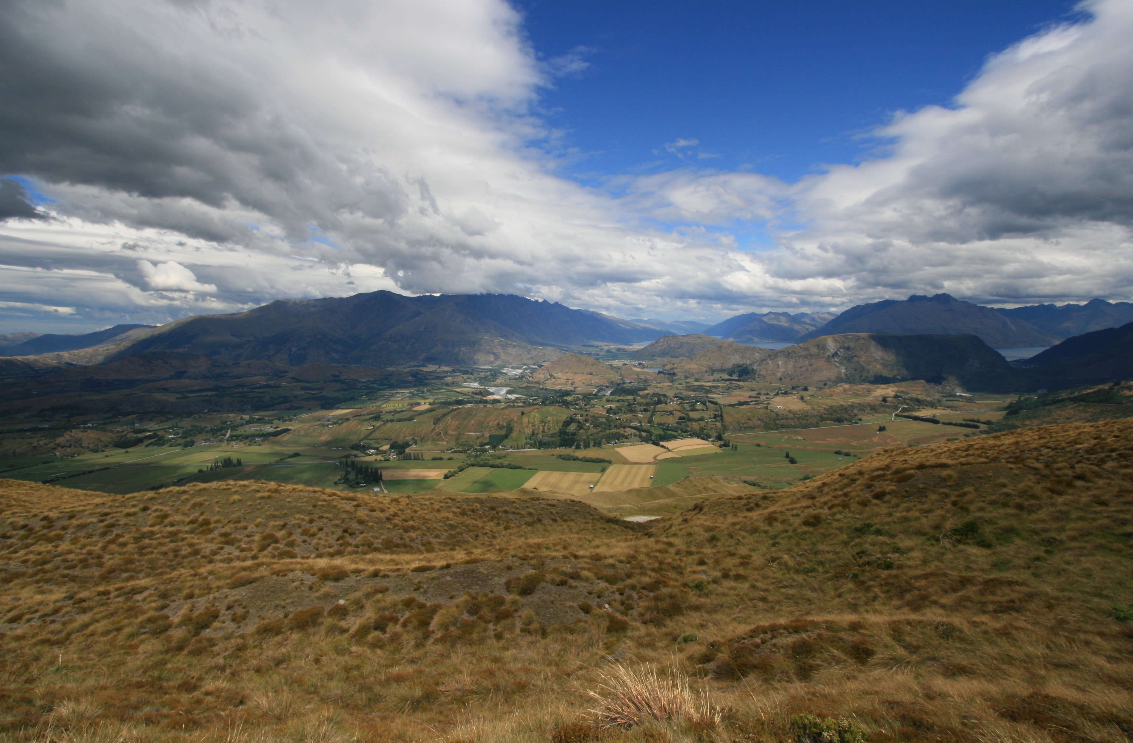 I spent the rest of the afternoon in downtown Queenstown. I had dinner at the eatery on the right in the picture below. 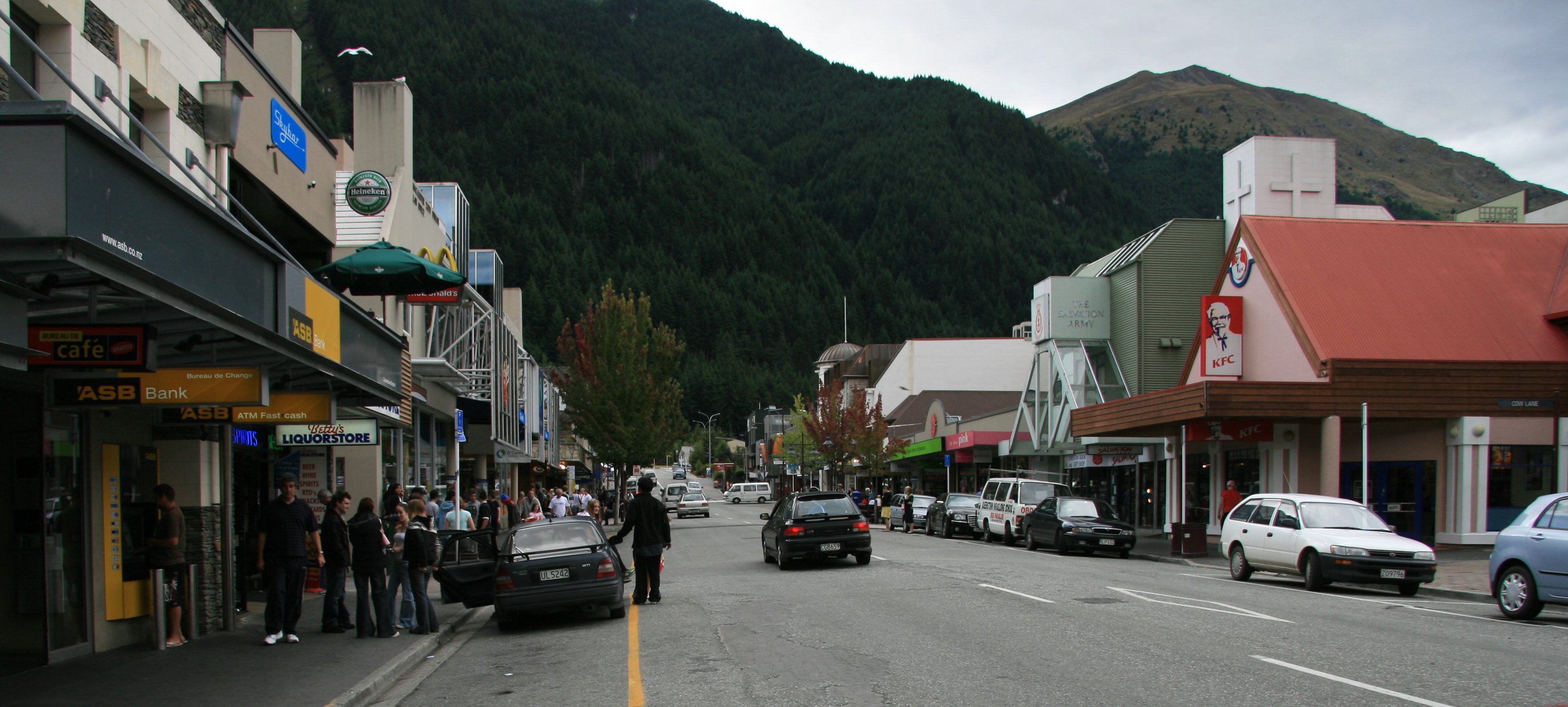 I am trying to get a helicopter to take me back down to Milford Sound. But the weather is not cooperating. I sure would hate to leave here without seeing it. I scheduled five days in Queenstown intentionally knowing the weather was unpredictable here. But I am running out of days and the forecast does not look good for tomorrow either. Looks good for Monday but don't think I can do everything I want to do in just that one day as I leave for the North Island on Tuesday. Had fun today despite the weather. Anybody know how I can watch the Colts game on the Internet? I think it would be on around 6:00am Monday morning my time. Tim |
SUNDAY, JANUARY 21, 2007:
I drove 7 miles today traveling around Queenstown.
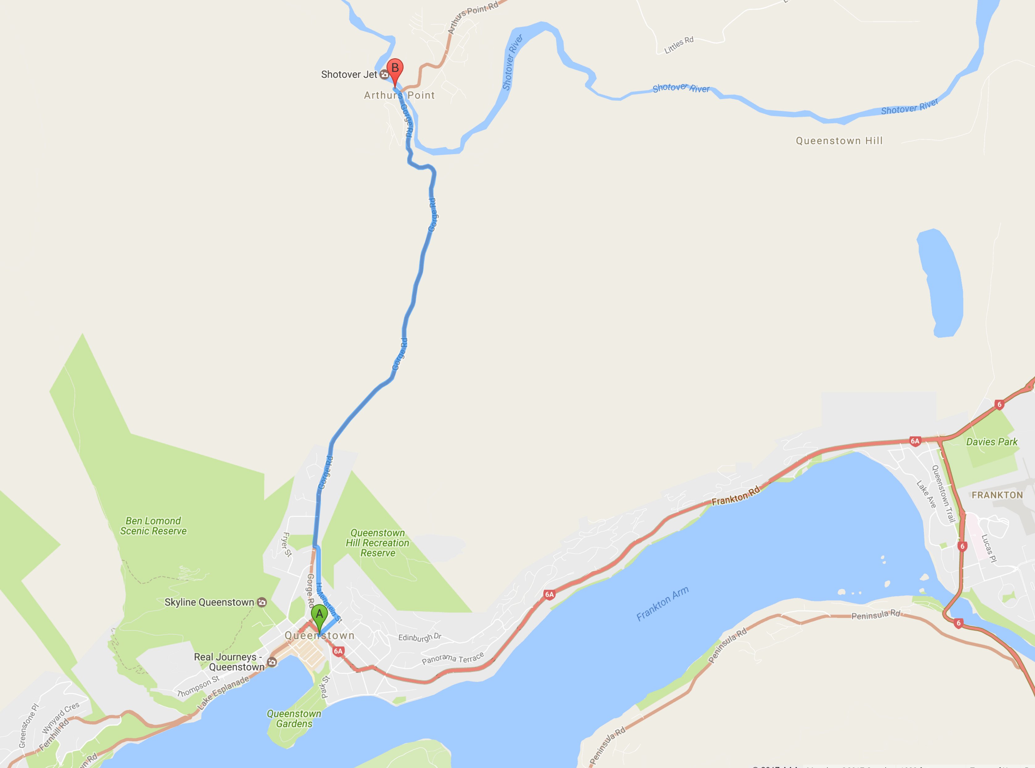
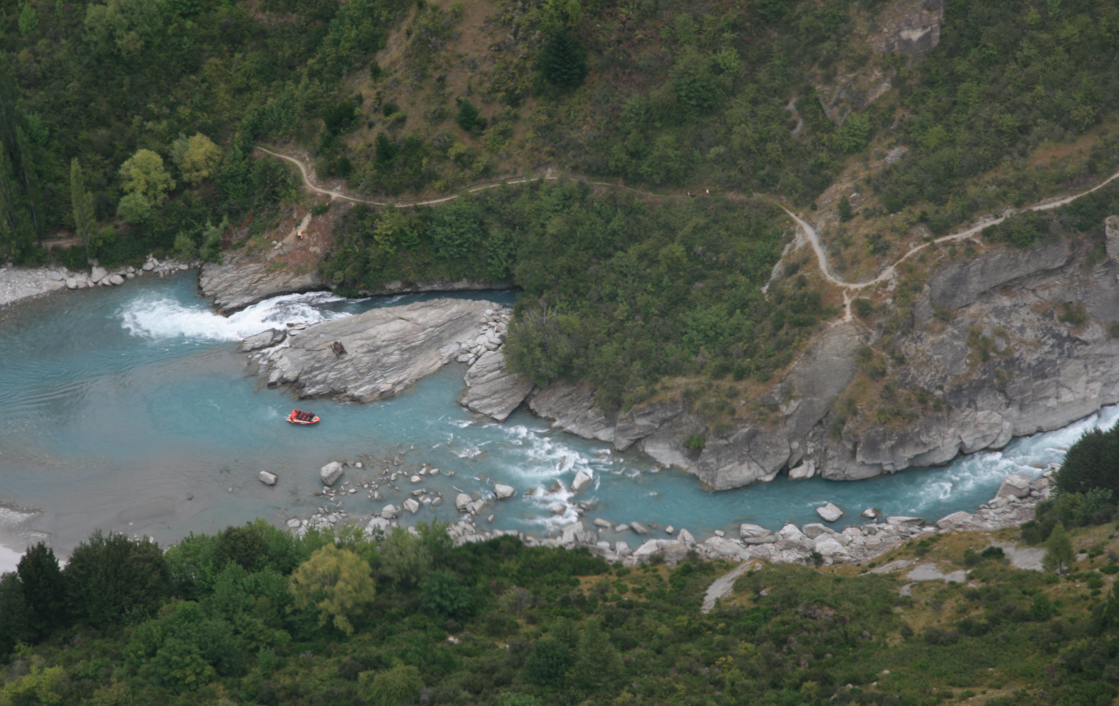
I battled the weather once again on Sunday. My first activity of the day was the Shotover Jet.
I also spent some time in downtown Queenstown.
I should have canceled this helicopter flight due to the bad weather.
|
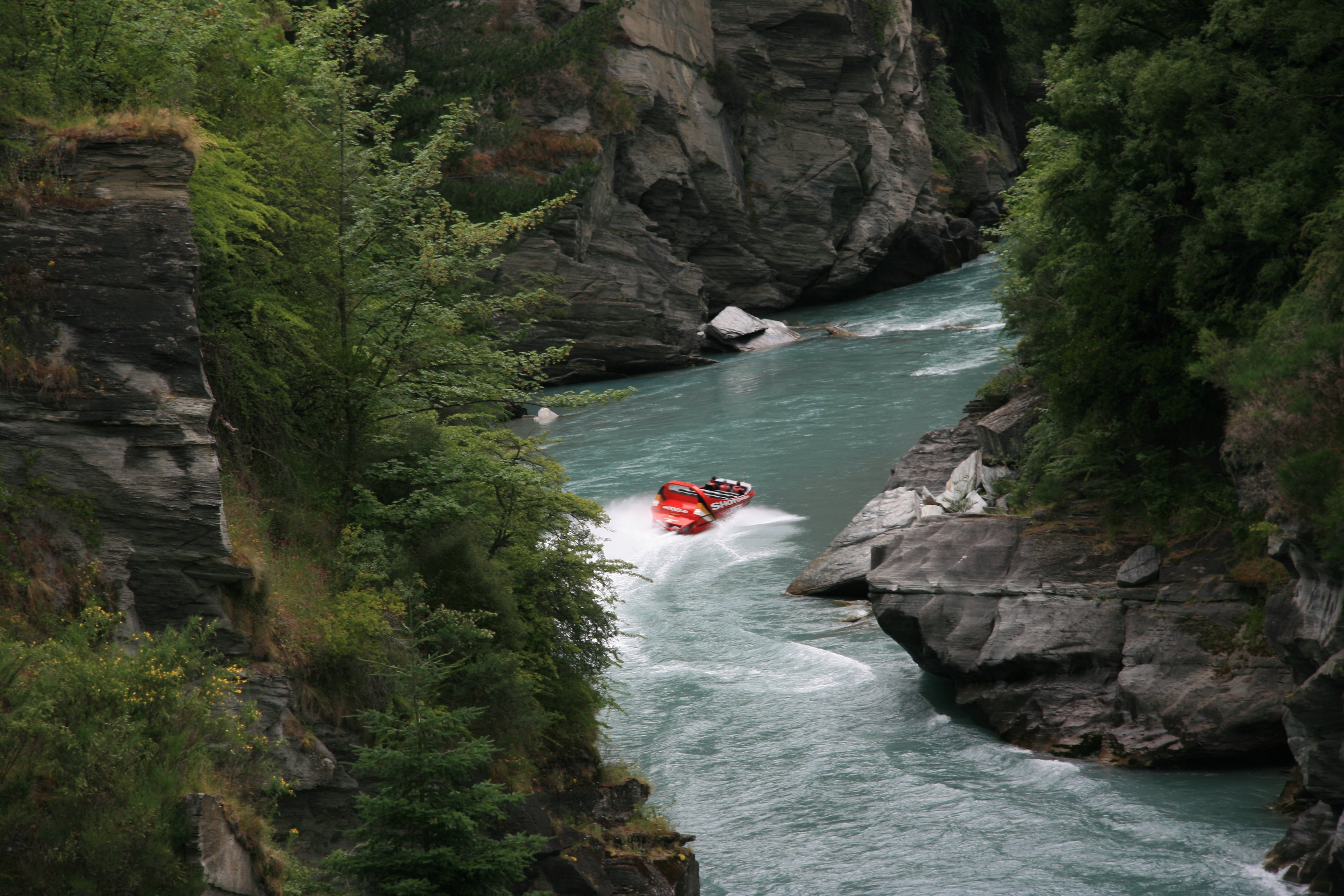
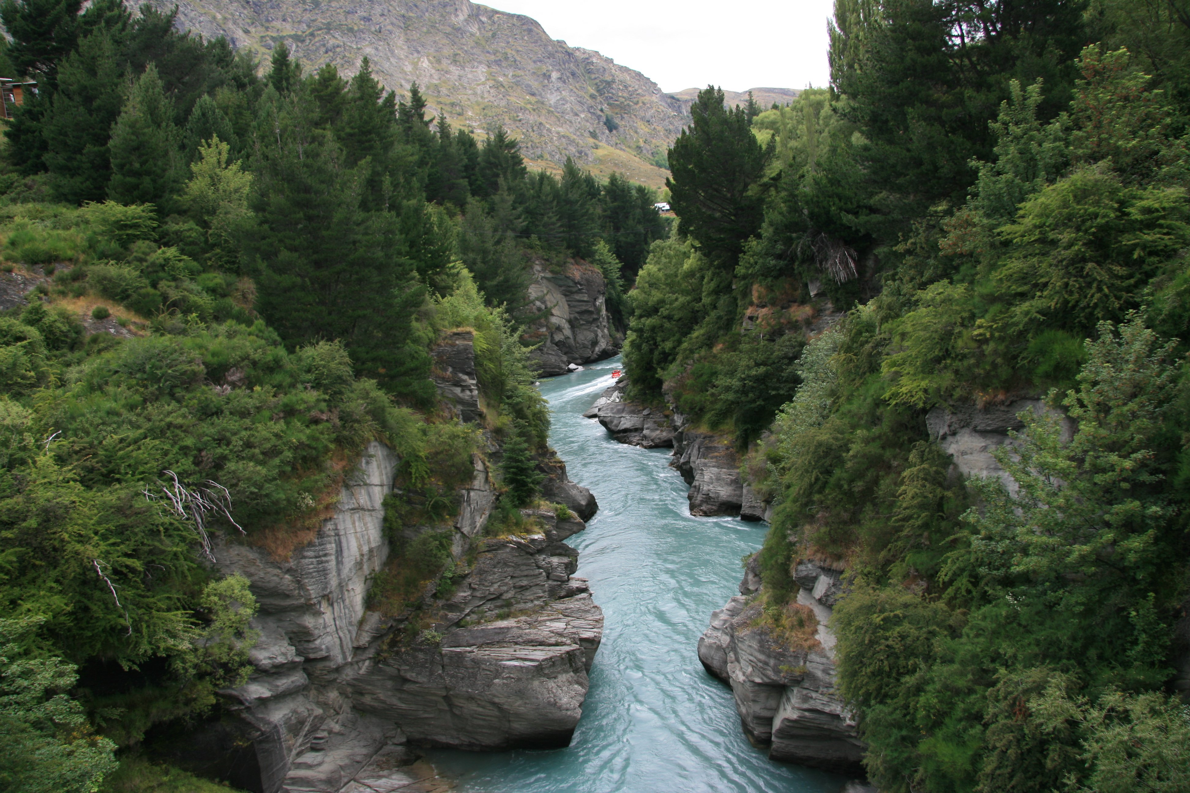
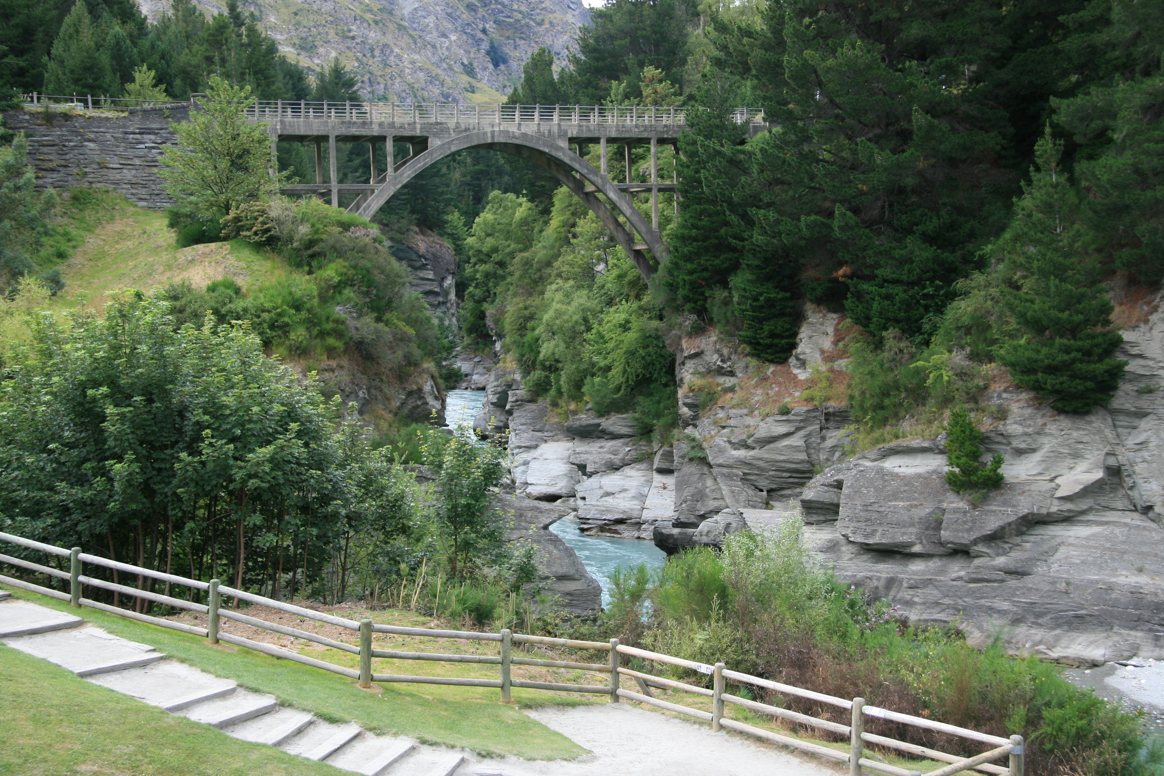
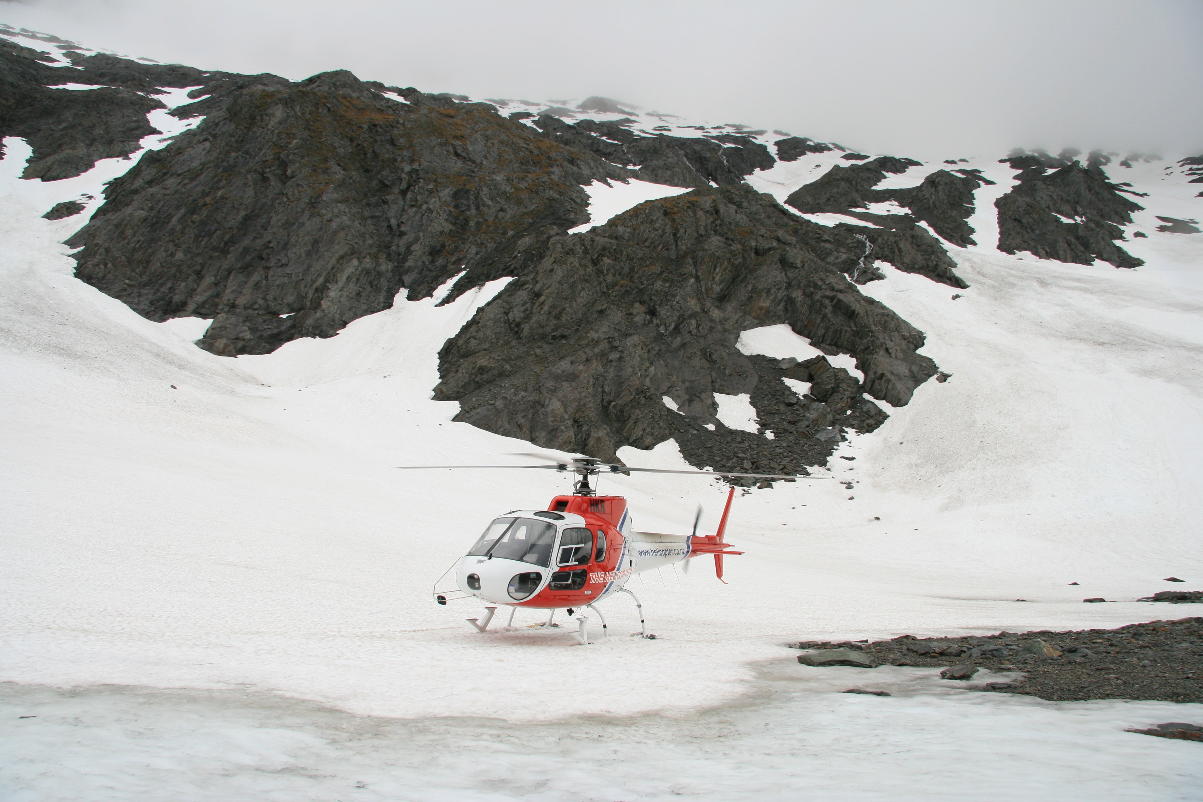
Hello, Not having any luck with the weather here in Queenstown at all. This morning before it started to rain I did the Shotover Jetboat. Below is looking down the Shotover River Canyon as I walked down to the boat. The picture above was taken from that bridge. The picture below shows them loading the boat for the trip before ours. 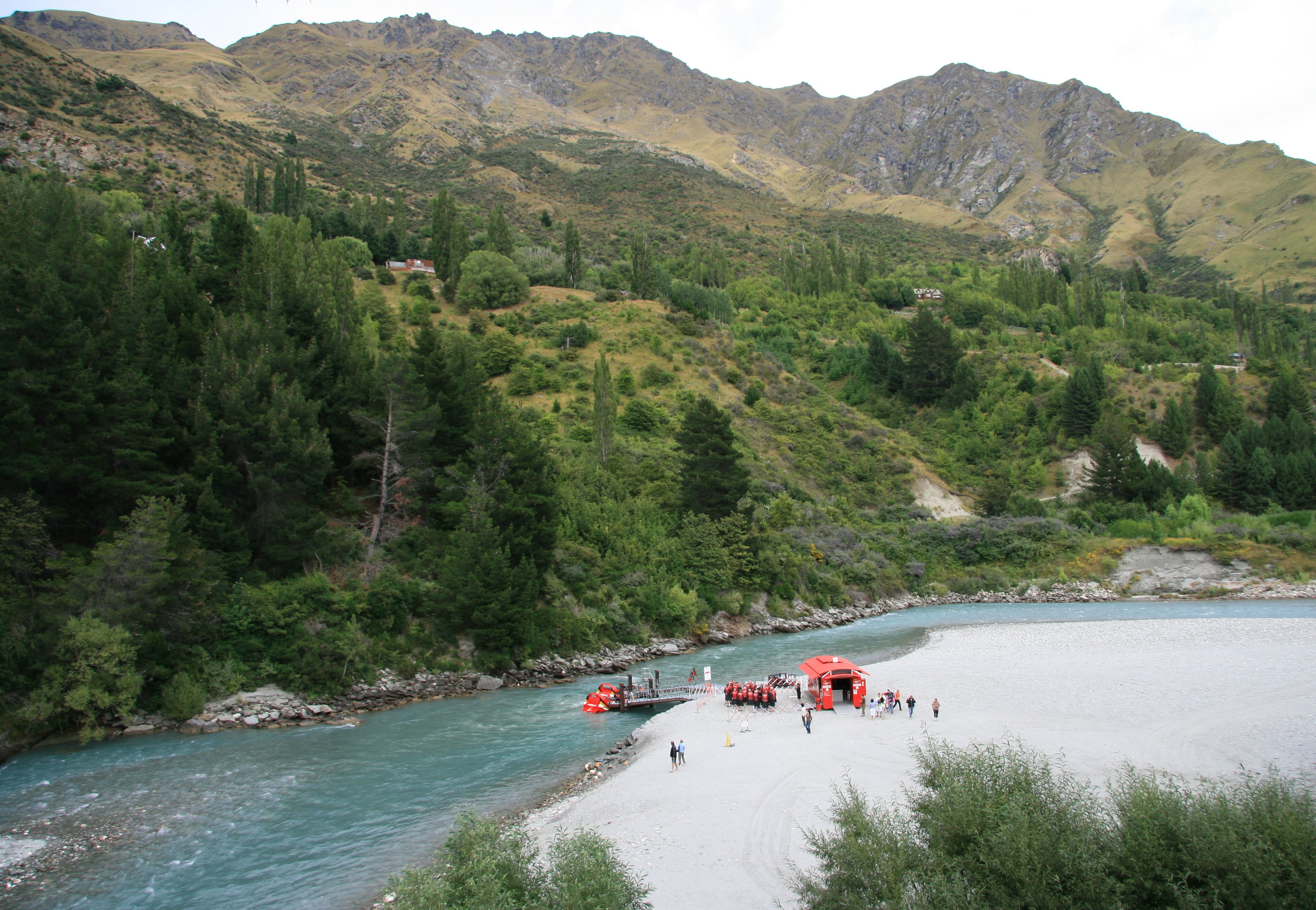 It was an amazing white water ride along the famous Shotover River and deep into the spectacular Shotover River Canyons. At 85kph our driver skillfully whipped the powerful red boat past rocky outcrops, skimmed around crags and boulders, and speed through the dramatic and narrow canyons. That was fun but only lasted 30 minutes. It pretty much rained the rest of the day. I had a helicopter trip scheduled for 1:00. I killed some time in Queenstown before the flight. I walked along the harbour. 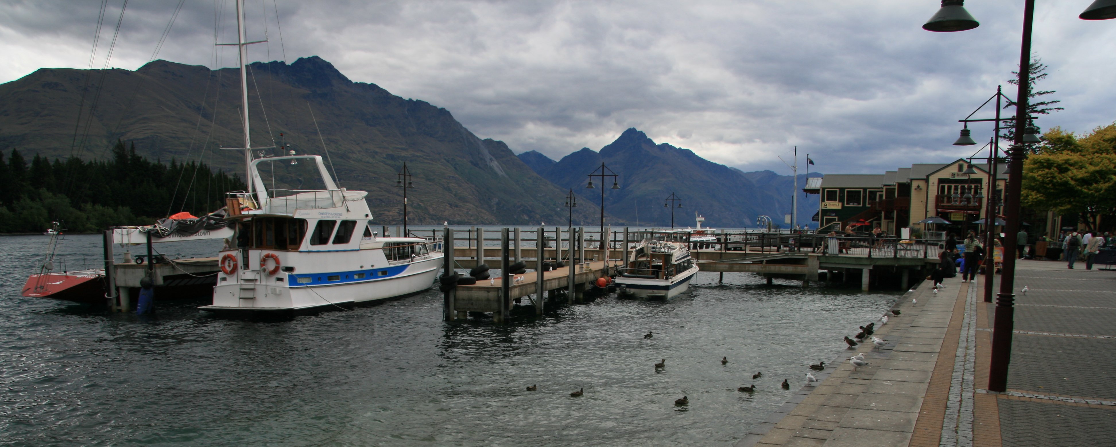 Below is Queenstown from the helicopter shortly after takeoff. Below you can see one of the boats shooting down the Shotover River Canyon. Below is a wider view of the canyon. 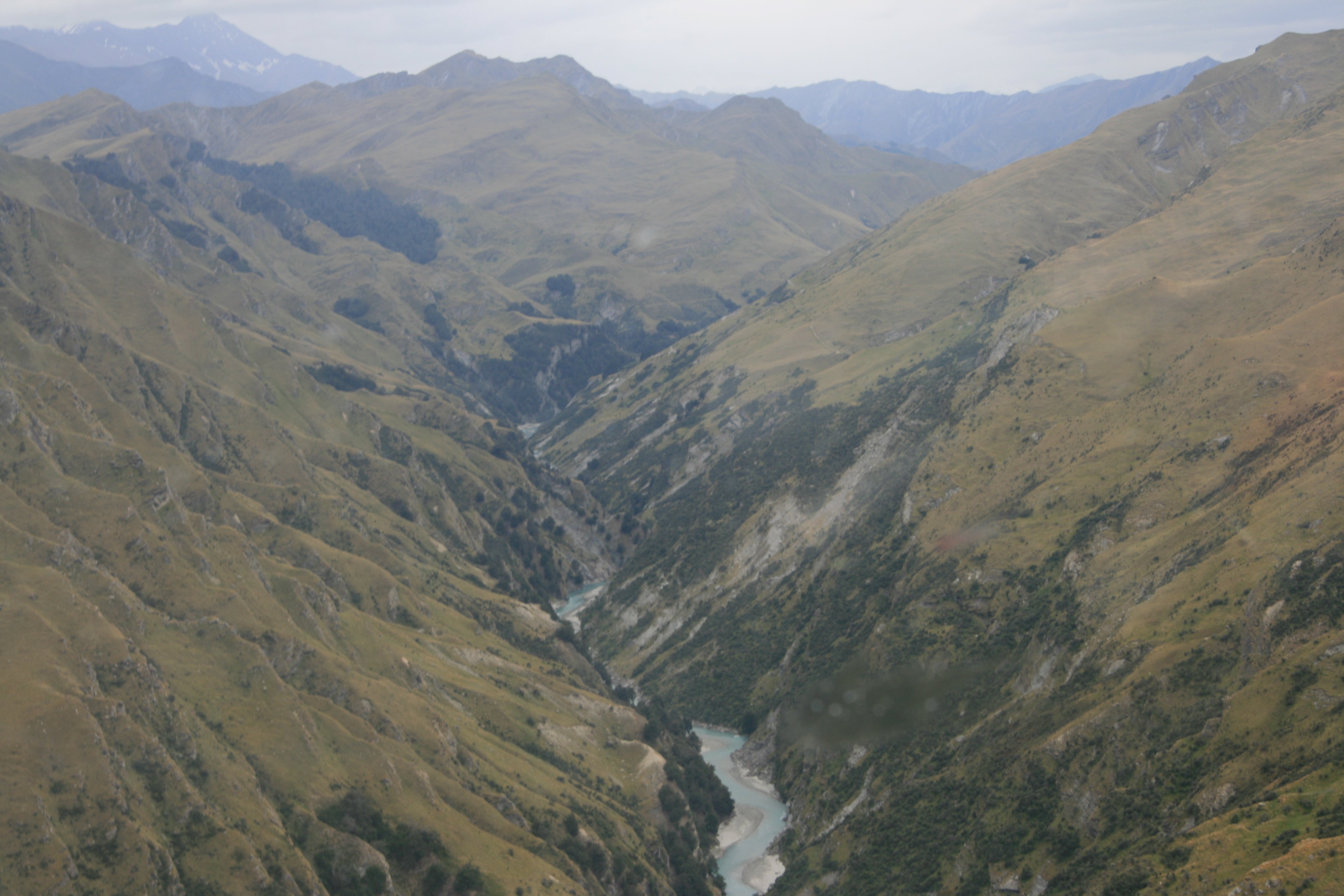 I should have canceled the flight since it was gloomy and raining but I thought perhaps we would get to a place where it wasn't, but we didn't. It was supposed to be a scenic mountain flight with a snow landing. Well he found one small patch of snow in a corner of a mountain and landed there. You couldn't even see down the side of the mountain where he landed. Not that it would have made much of a difference since it was raining with very poor visibility. The flight turned out to be a waste of time. Below we are flying past Queenstown heading for the airport. 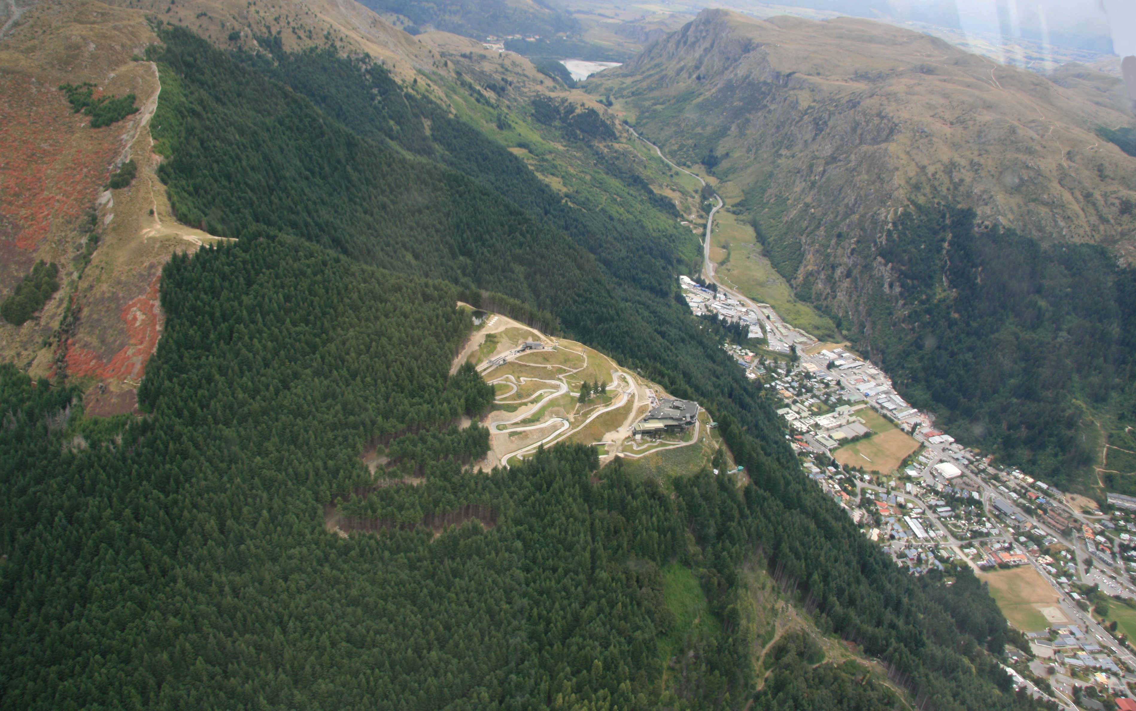 Below we are about to set down at the Queenstown Airport. 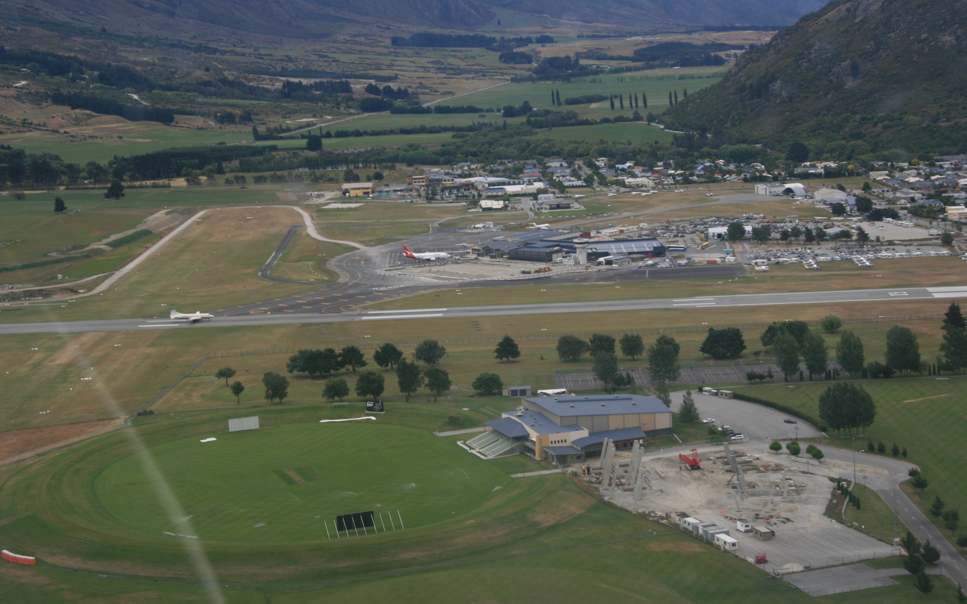 It's still raining as I write this. I spent the rest of the day updating the website. Tim |
MONDAY, JANUARY 22, 2007:
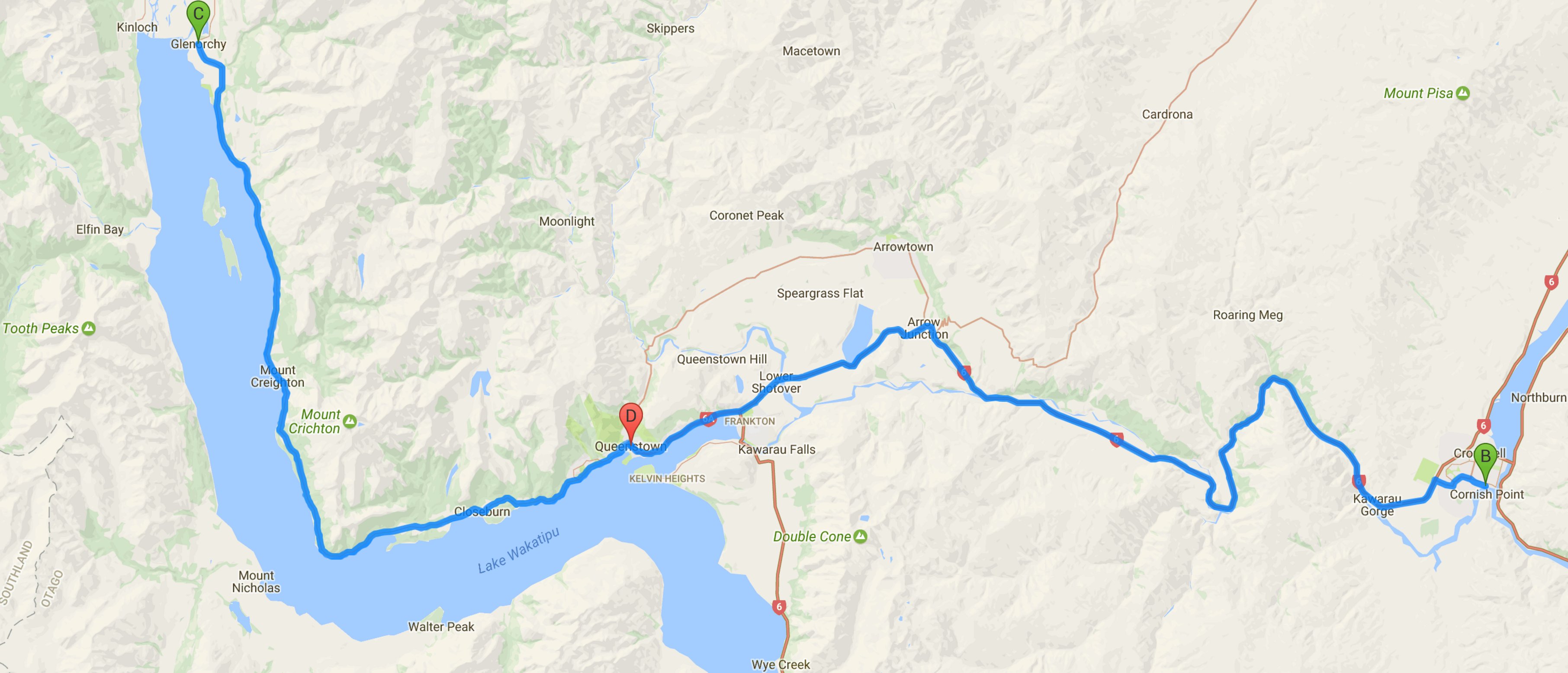
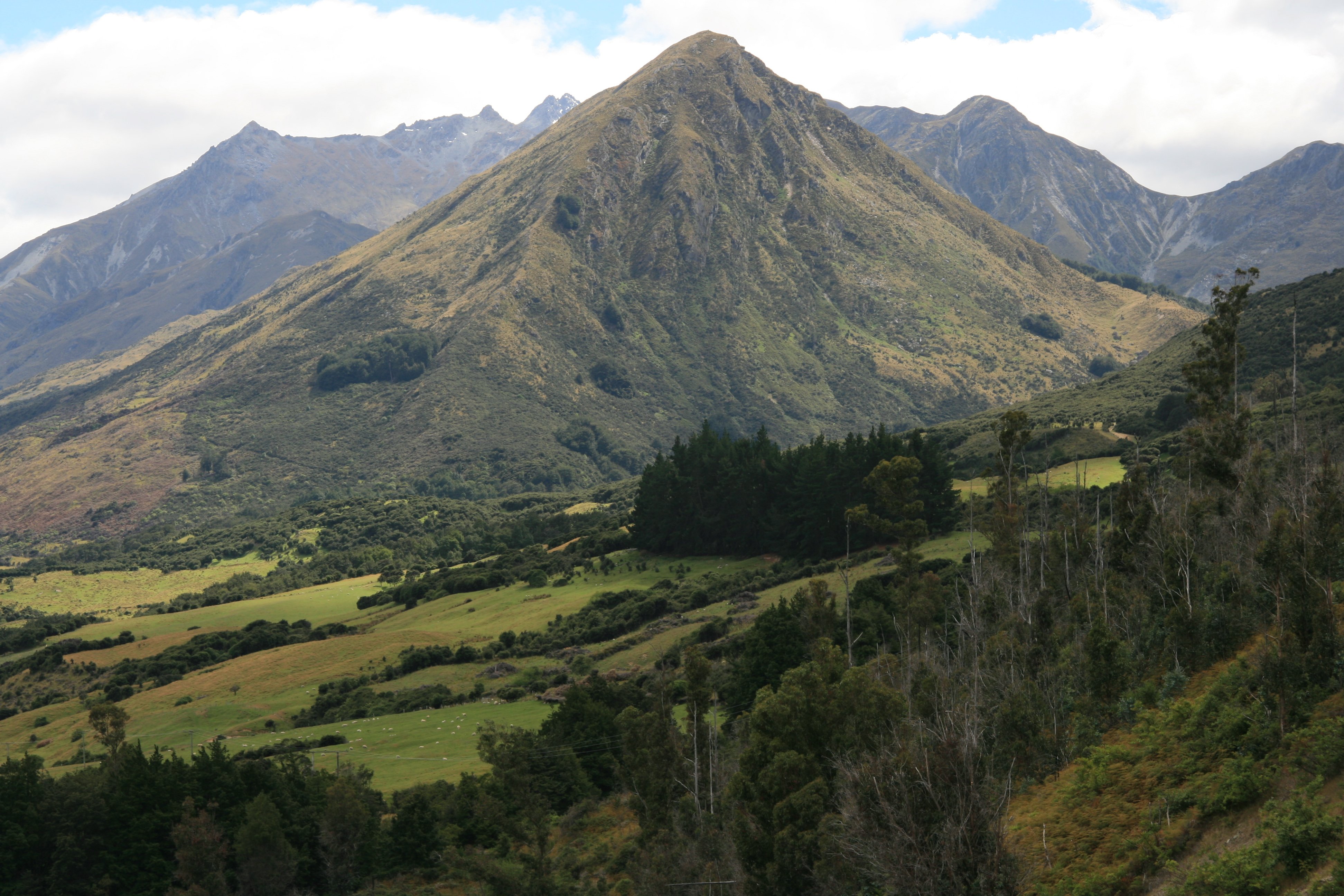
I drove 132 miles today traveling to Cromwell and Glenorchy from Queenstown.
I began my last day on the South Island driving around Central Otego.
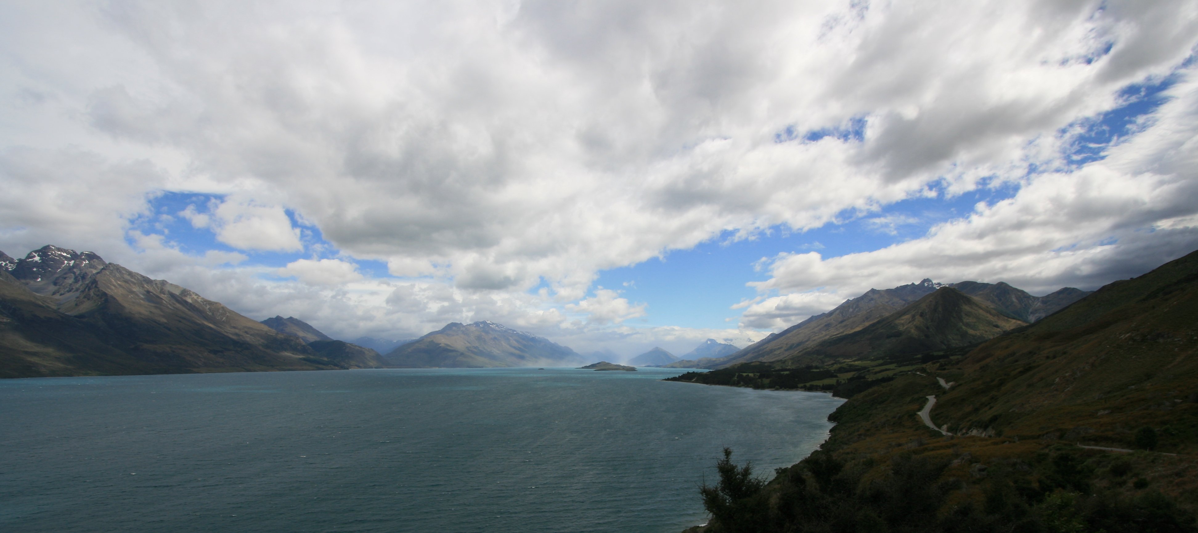
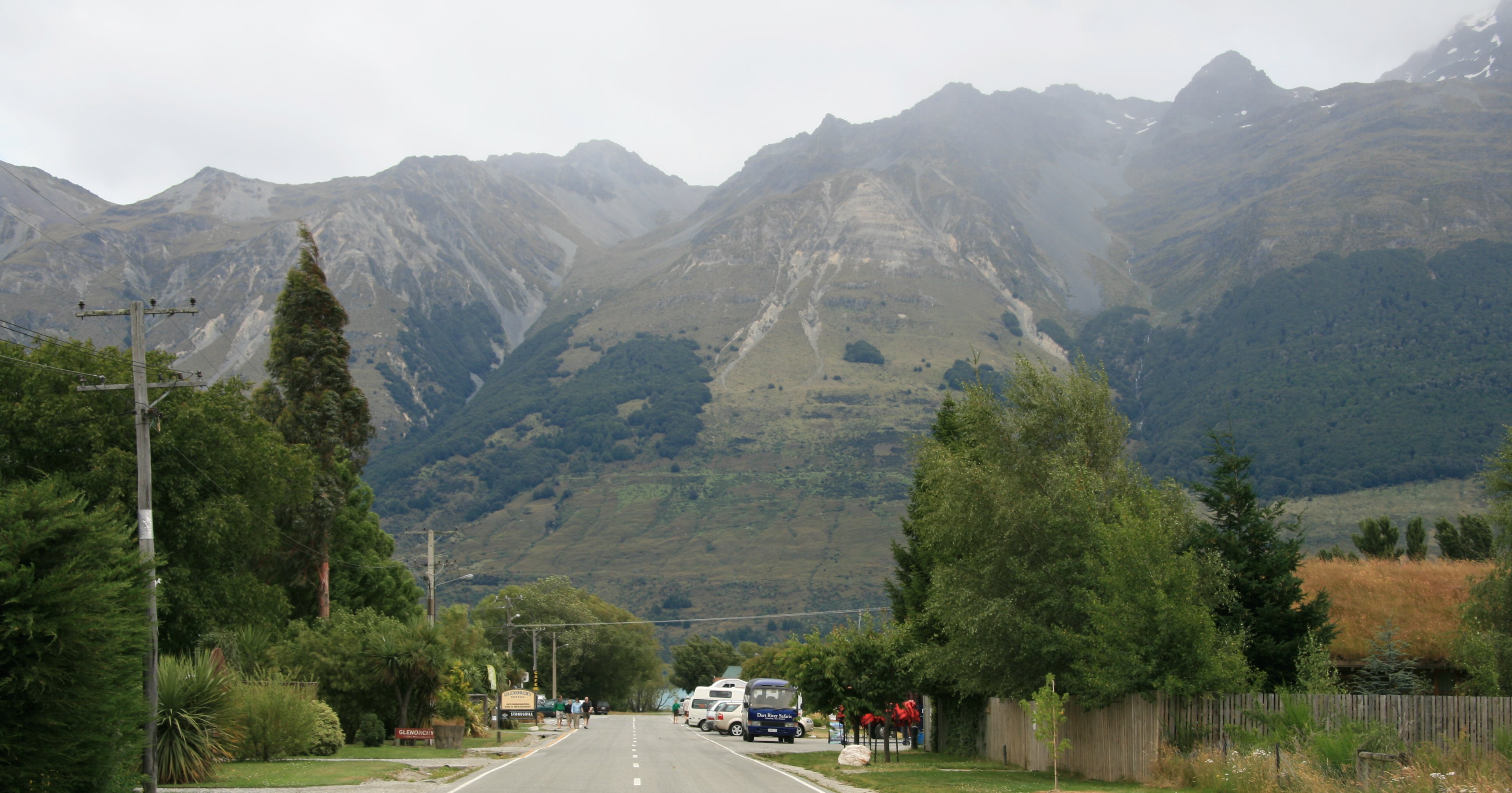
From Cromwell it was a very scenic drive to Glenorchy.
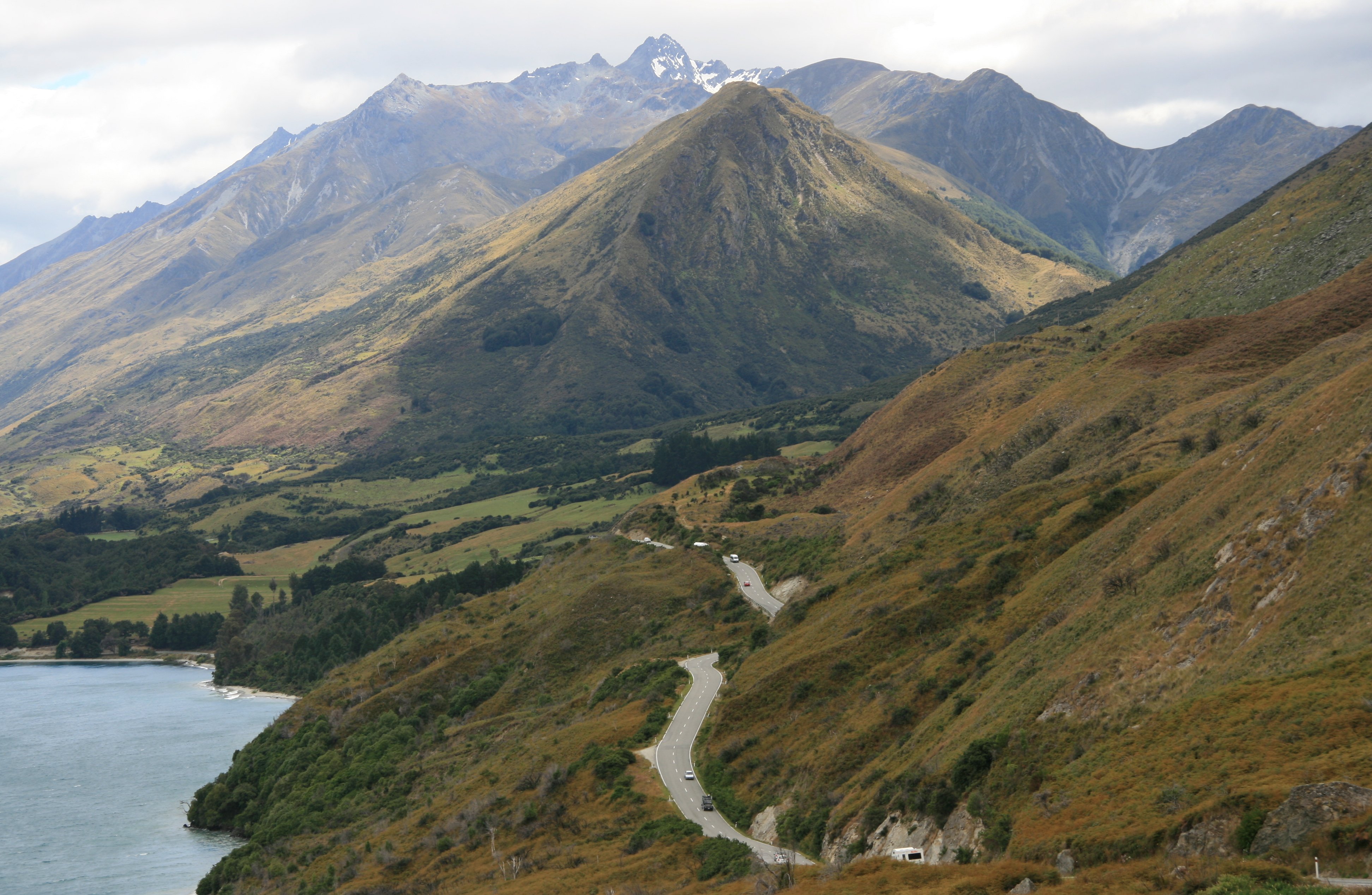
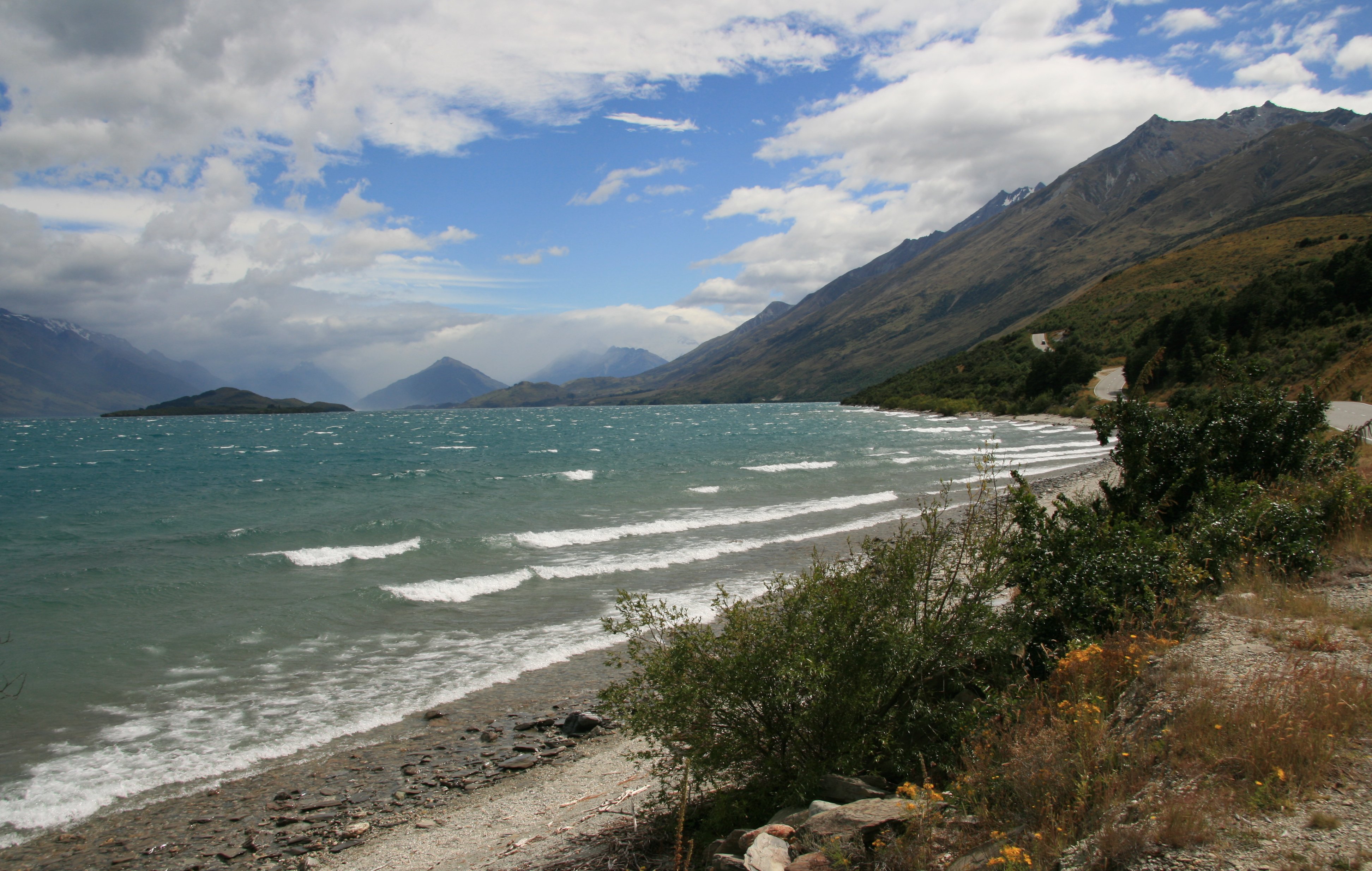
It was a very windy drive between Queenstown and Glenorchy but the scenery was spectacular.
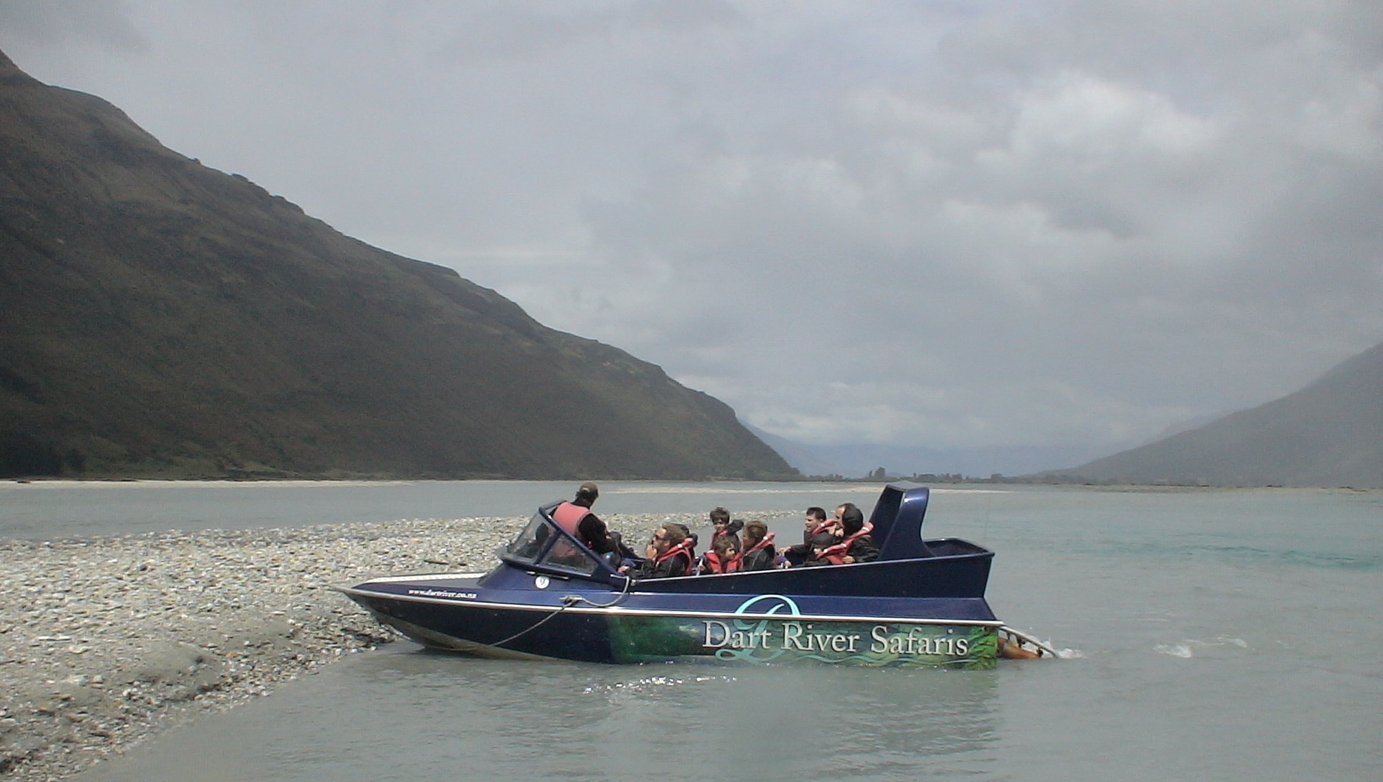
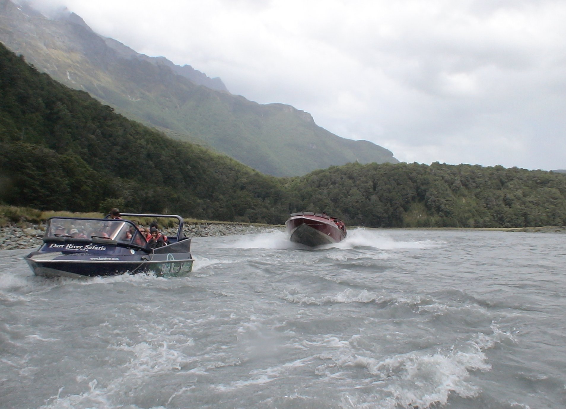
Once in Glenorchy I went on a four hour Dart River Safari.
This is the area where The Lord of the Rings was filmed along with a lot of other movies.
I returned to Queenstown on the same scenic road after the safari.
10 minute video of my jetboat journey on the Dart River in Glenorchy, New Zealand. |
|
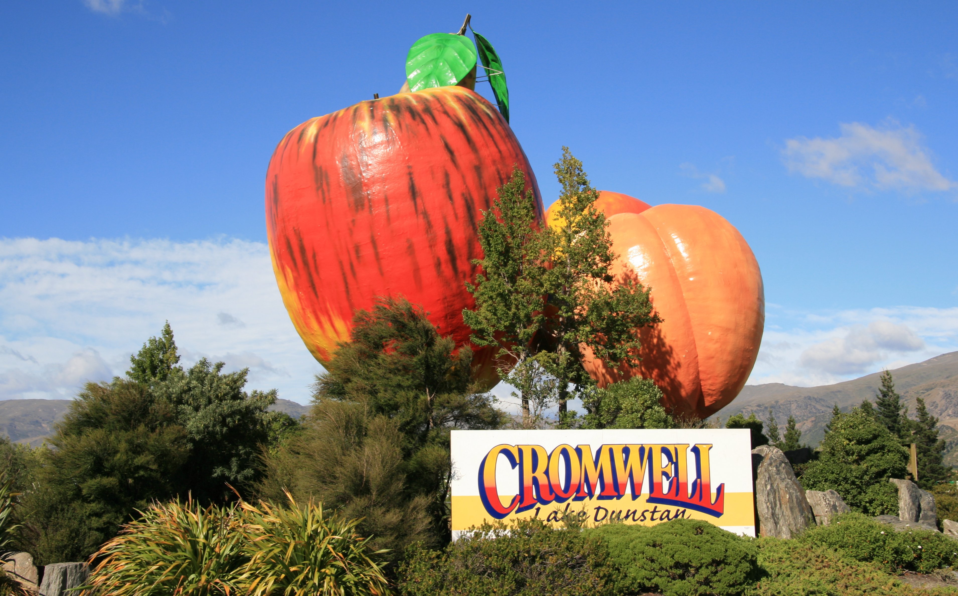
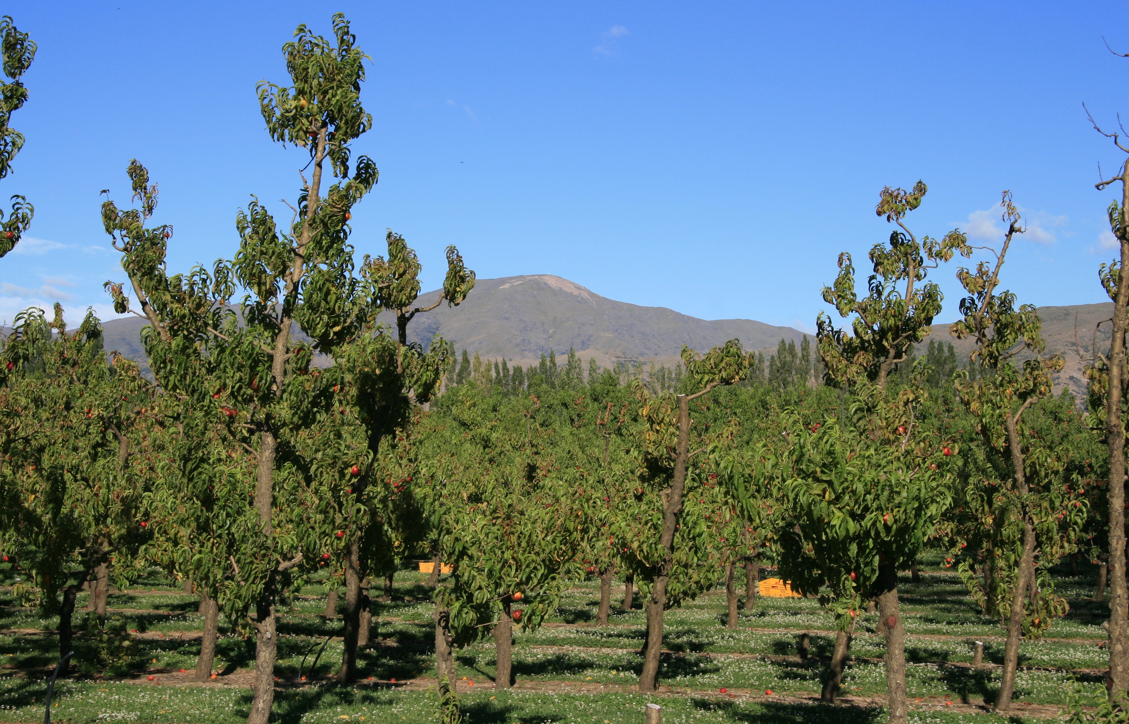
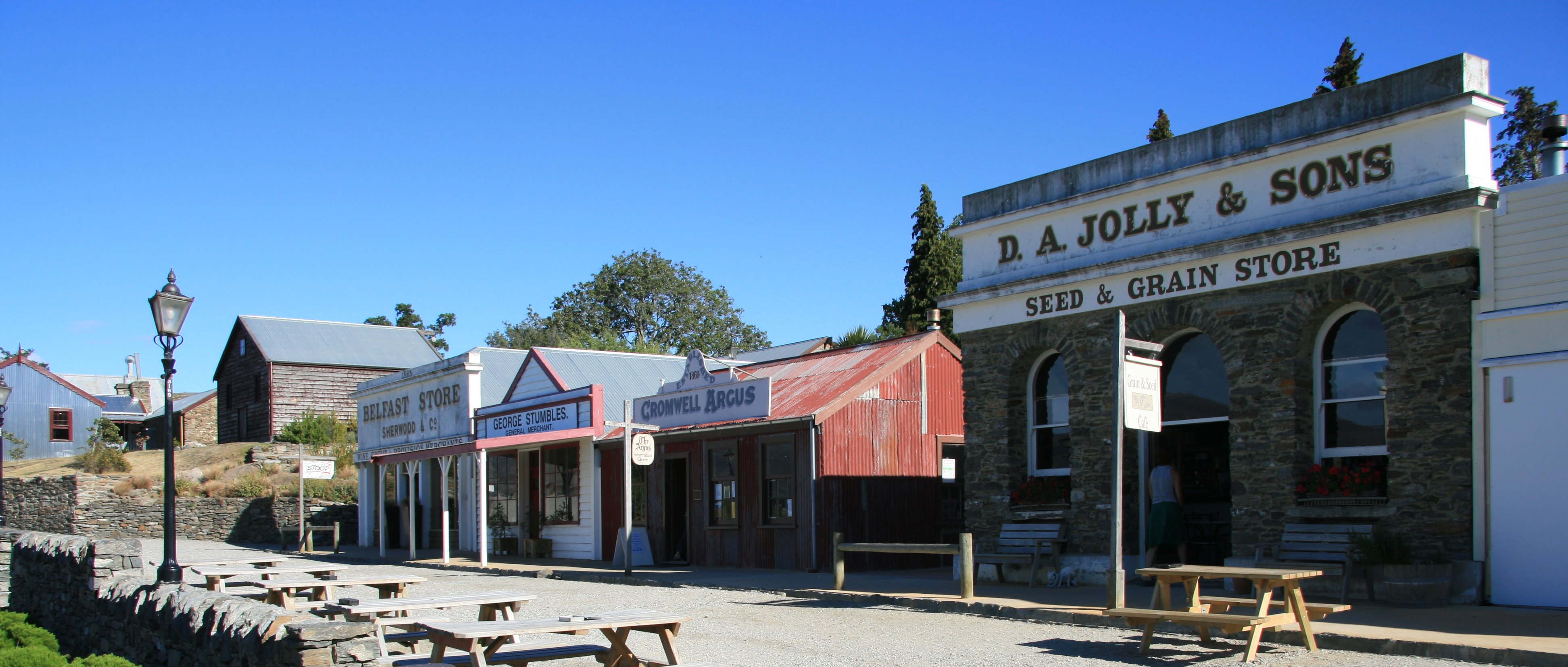
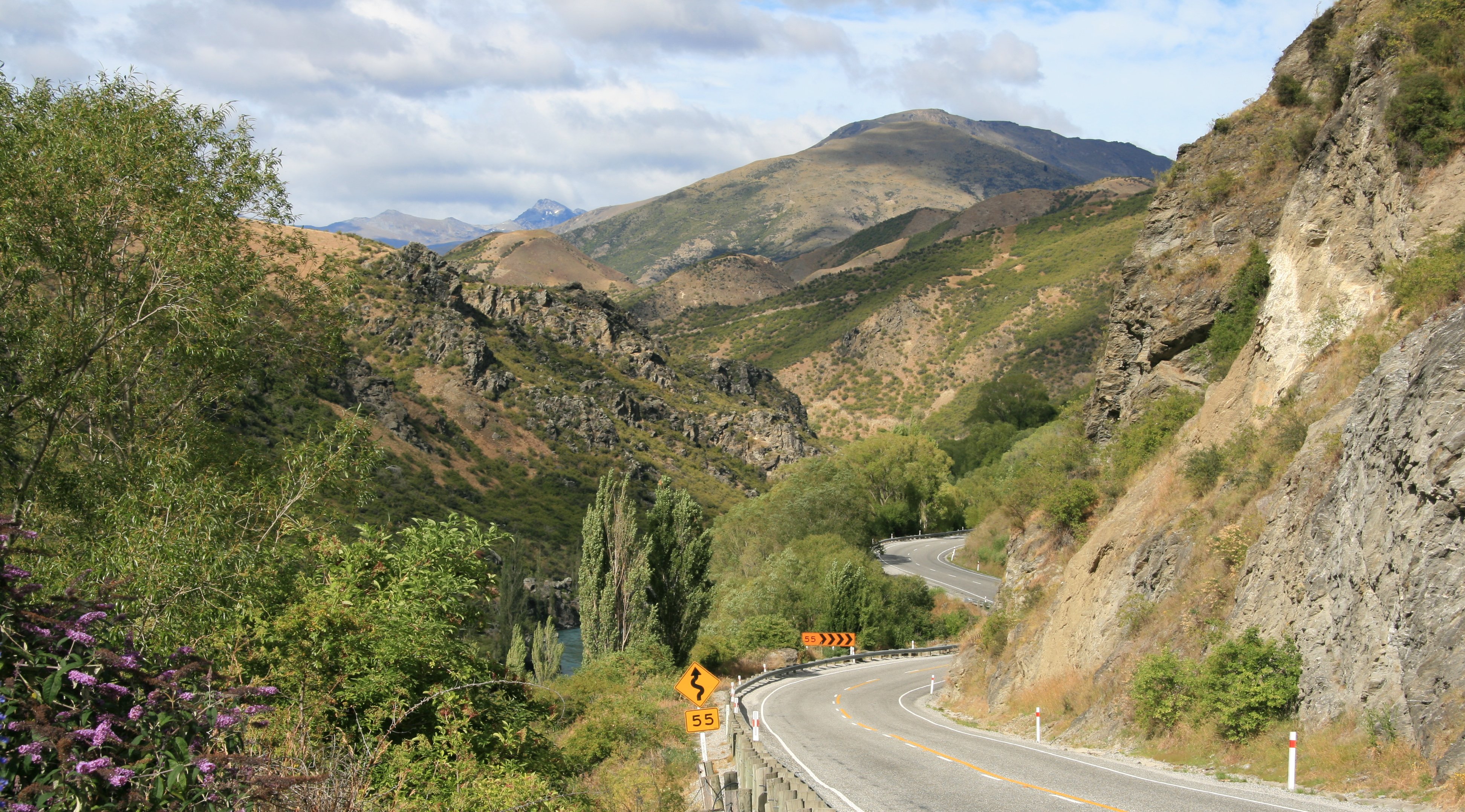
Hello Everyone, Today was an ok day. Weather wasn't awful although quite windy. This morning I drove over to Cromwell. Cromwell is known as the "fruit bowl of New Zealand." Below is Mrs Jones Orchard. I paid a short visit to Old Cromwell Town. I drove back through the Kawarau Gorge. I stopped at the Shotover River on the Old Shotover River Bridge. Below is looking toward Glenorchy, New Zealand from Bennetts Bluff. The picture below was also taken from Bennetts Bluff. You can see more of Lake Wakatipu. The wind was blowing at gale force as I took these three pictures from Bennetts Bluff. I continued my drive to Glenorchy, I stopped to take another picture of Lake Wakatipu. It was a very scenic drive between Queenstown and Glenorchy. Below is Glenorchy, New Zealand. Today I did the Dart River Safari. This originates in Glenorchy which is about 50 kilometers from Queenstown. The jet boats took us very deep into the wilderness up the Dart River. It was a very scenic trip but the clouds covered a lot of the mountains and it did rain from time to time. When you are speeding down the river at 70 kilometers an hour, the wind blowing at about that speed as well and then raindrops hit you, it's kind of like getting caught in machine gun fire. This is the area where the Lord of the Rings was filmed along with hundreds of other movies. We actually saw film crews out there filming something today. It must have been a car commercial. The ground we covered on the jetboat was all in Mount Aspiring National Park. 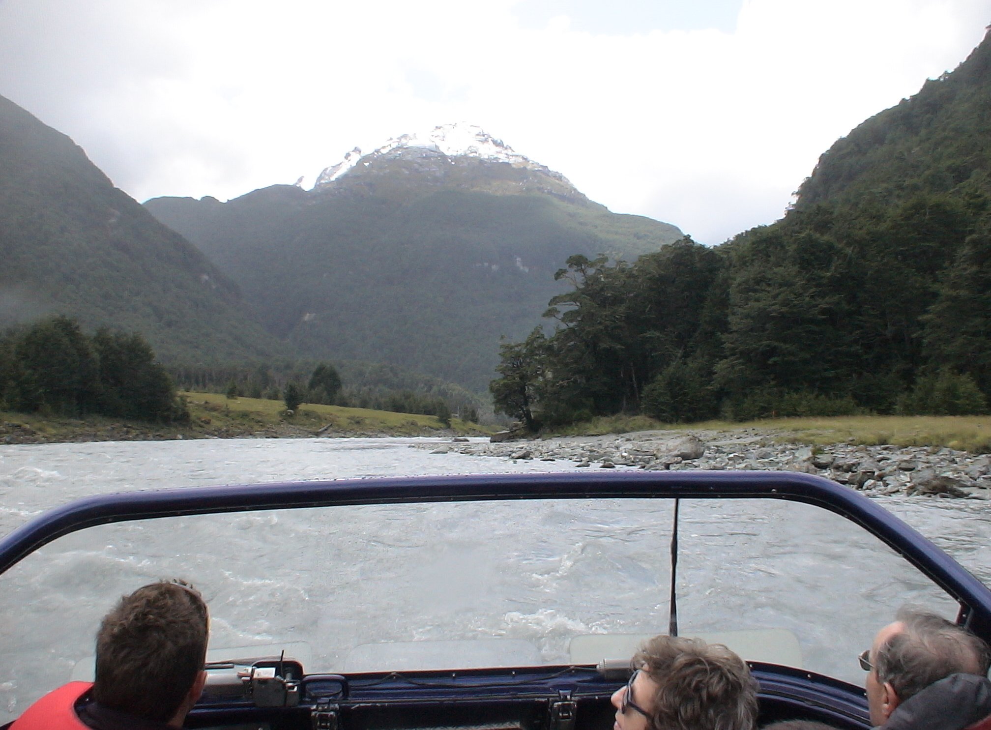 After about two hours on the jet boat we took a forest walk and then came back to Glenorchy by off-road vehicles. 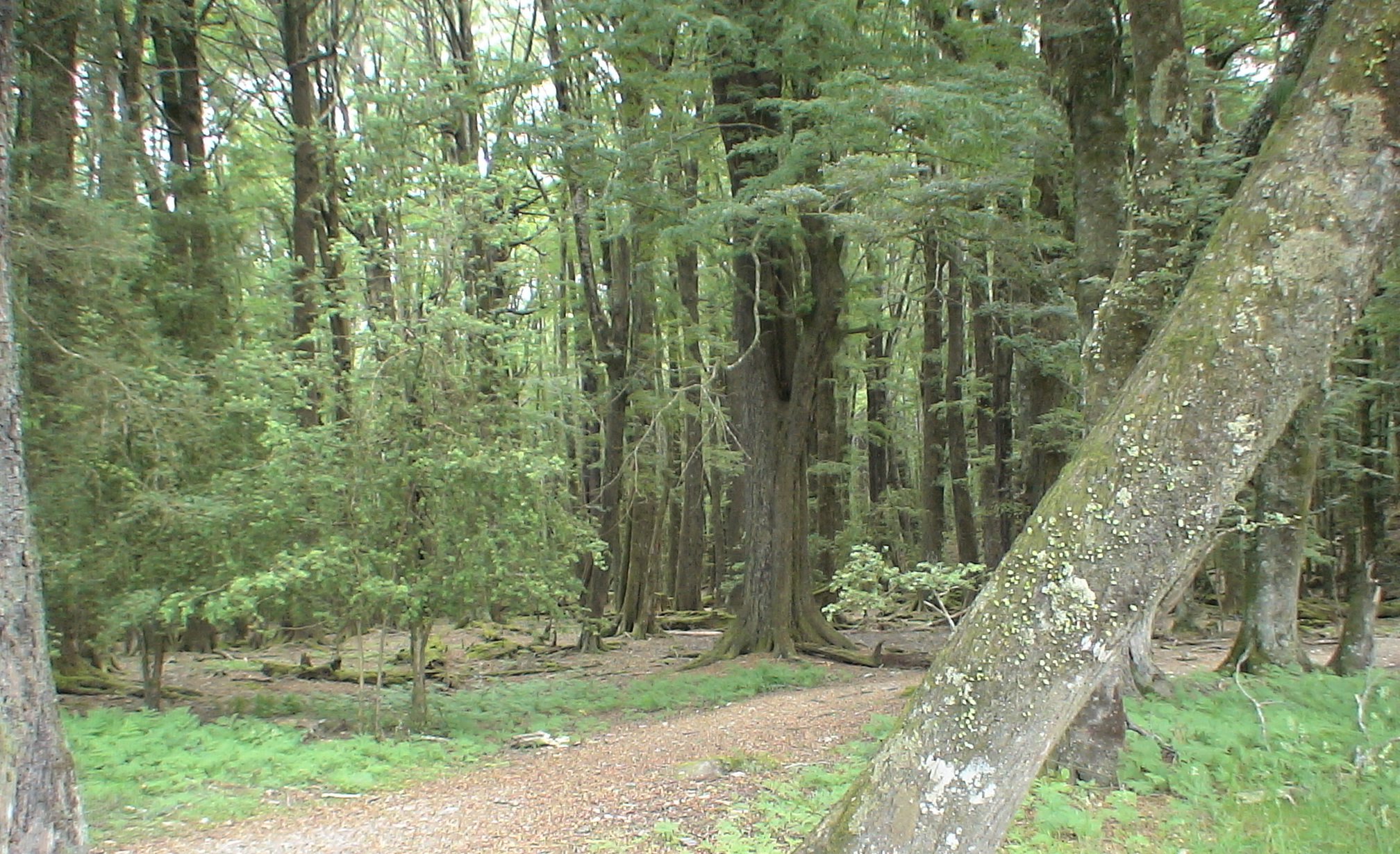 I never did get back to Milford Sound. I did have a helicopter lined up to take me there this morning. But as always the weather down there was bad and we couldn't go. Below is a picture of the scenic drive between Glenorchy and Queenstown. I am leaving the South Island tomorrow and flying to Wellington on the North Island. I will spend three nights on the North Island before flying home Friday night. Below is another picture of the scenic drive between Glenorchy and Queenstown. The best part of the day was when I got back to the hotel this evening and checked the football scores. I found a place to watch the game online but it started at noon my time and I had other plans. The Colts make it to the Super Bowl and I'm half way across the planet. Below is yet another picture of the scenic drive between Glenorchy and Queenstown. Tim |

Click above to continue to my next adventure, THE NORTH ISLAND.
| TIM'S HOME PAGE SITE INDEX | |||
|---|---|---|---|
| Areas | Description | # of Pages | |
| About Me | Current Picture of me and my home. Information about myself. | 2 | |
| Biography | Pictorial biography of myself. Pictures range from birth to adulthood. | 4 | |
| Family File | Pictures of my family and a little information about them. | 12 | |
| Local Spotlight | Pictures, Links, and Information for Indianapolis, Richmond, Plainfield, and Mooresville, Indiana. | 6 | |
| Tim's Travels | Pictures, videos and travelogs from my travels around the world. | 409 | |
| Vacation Videos | Over 1500 videos from my travels around the world. | 1 | |