
(New Zealand Flag)
MONDAY, JANUARY 15, 2007:
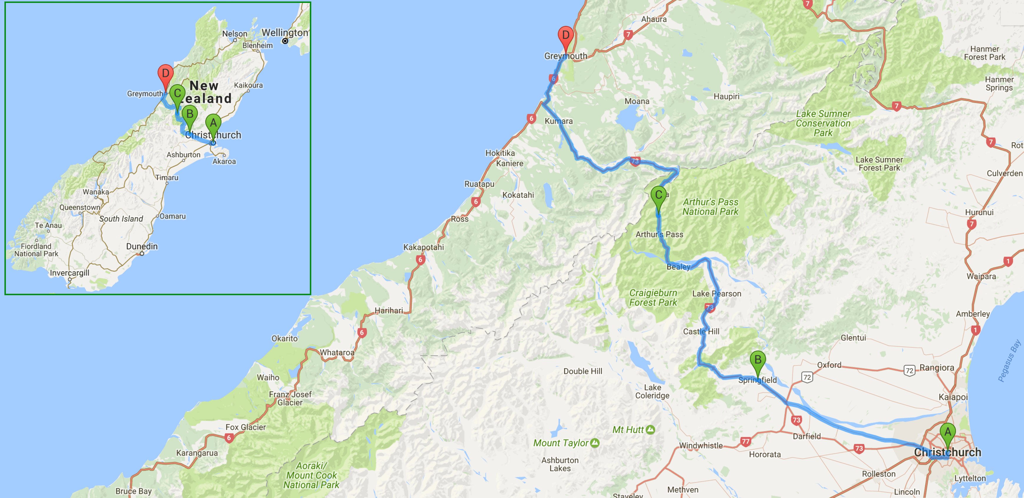
I drove 152 miles today traveling between Christchurch and Greymouth.
All of the images below are thumbnails and can be clicked on for a larger image.
Monday was a very fun day crossing the Canterbury Plain and then the Southern Alps via Arthur's Pass.
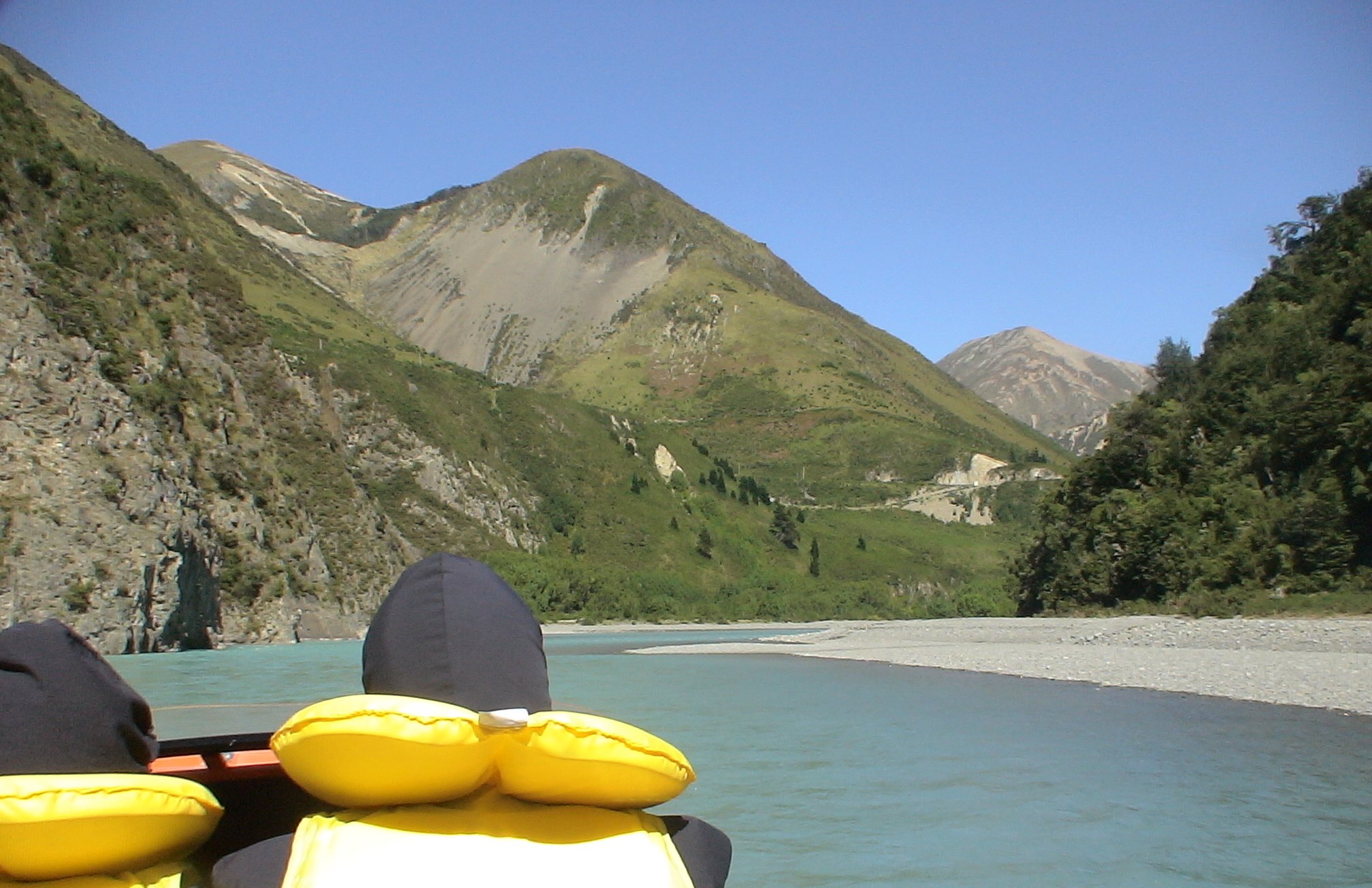
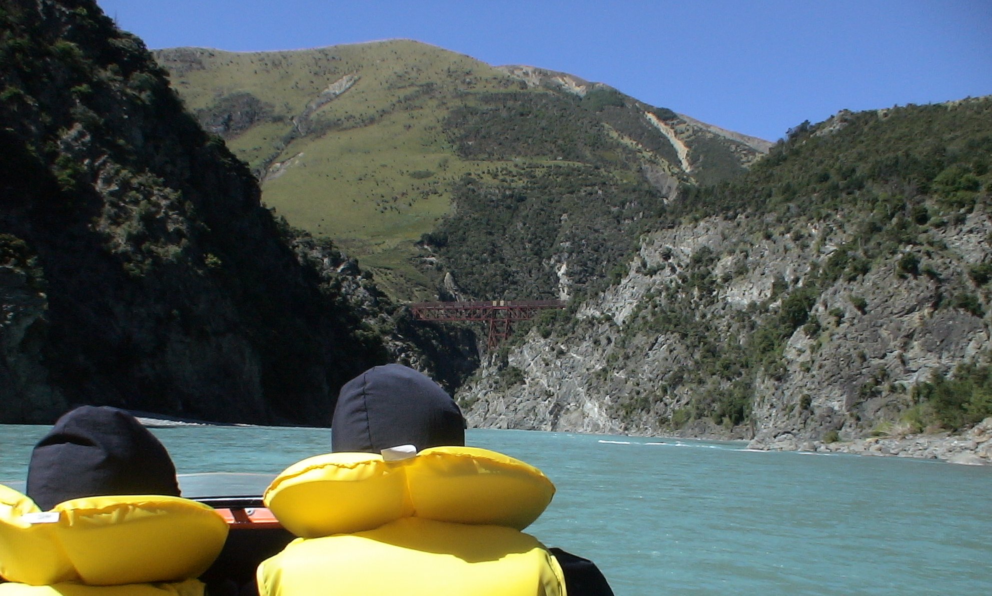
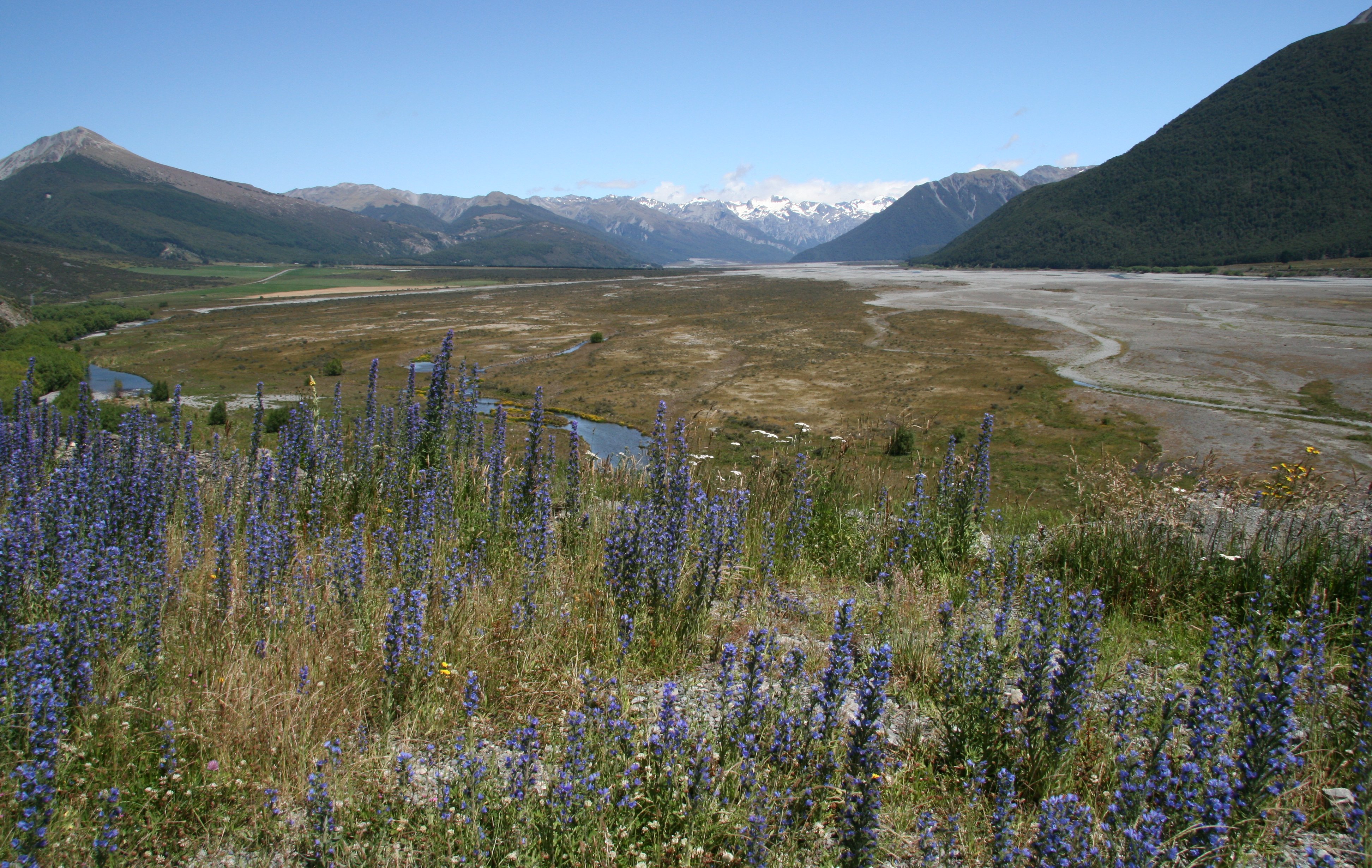
My first stop was just outside Springfield, New Zealand at the Alpine Jet along the Waimakariri River.
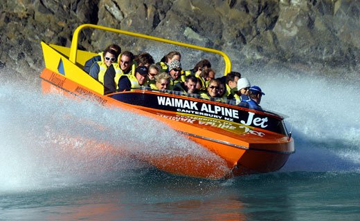
10 minute video of my jetboat ride through the foothills of New Zealand's Southern Alps. |
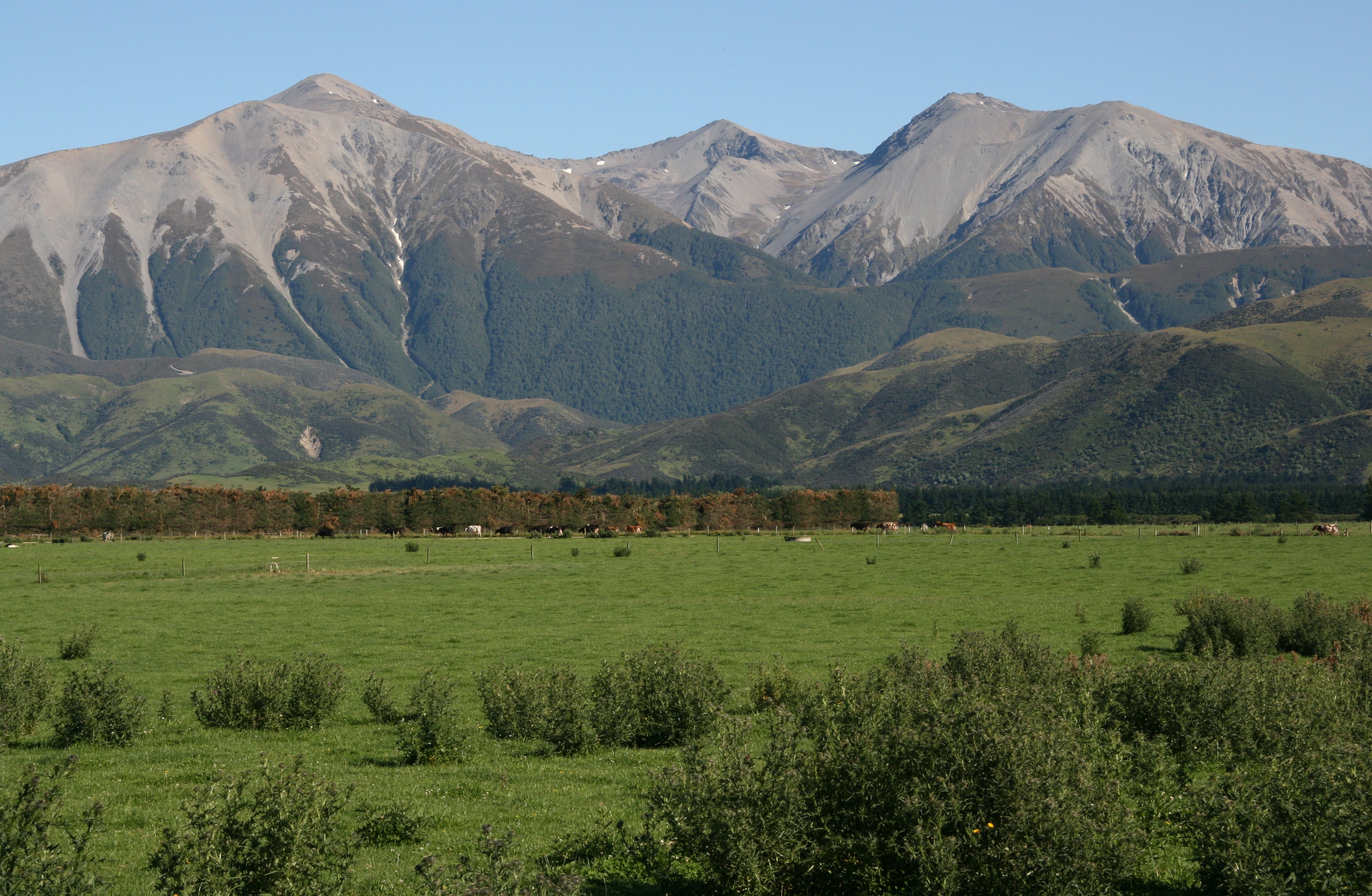
The jetboat was a blast, flying down the river with the mountains towering above us.

The bright sunshine and cloudless sky is something they had not seen here in a while.
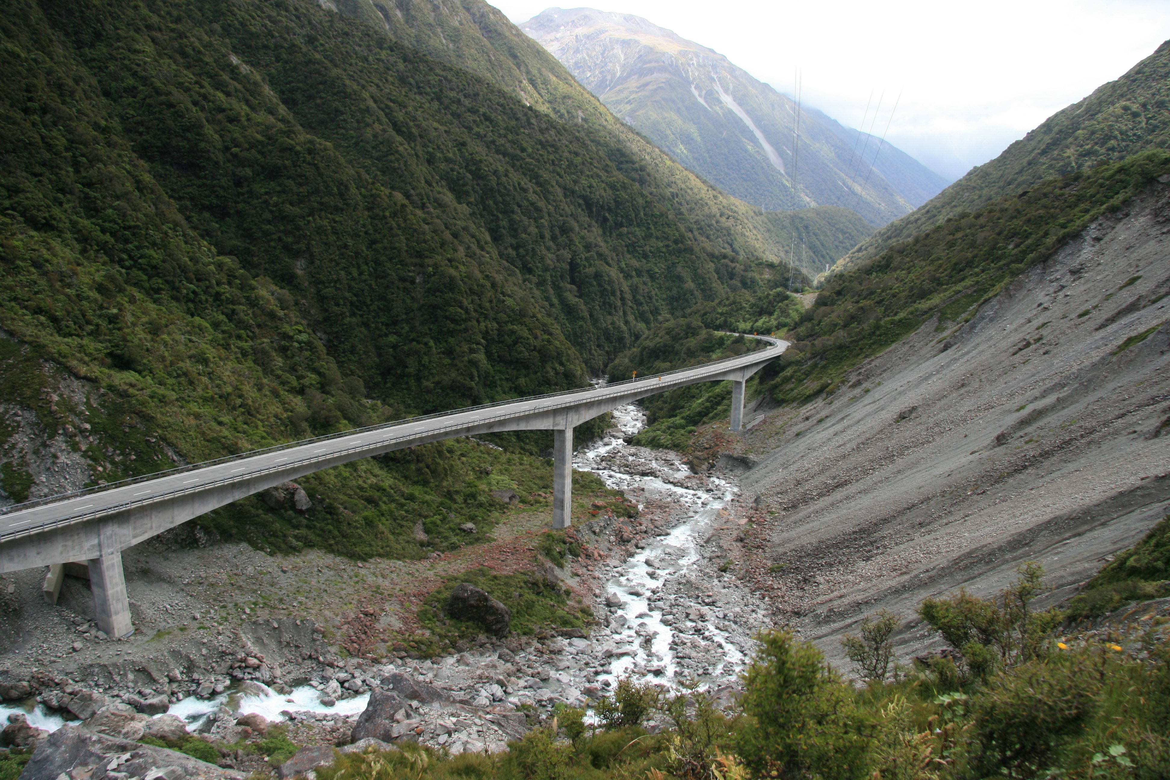
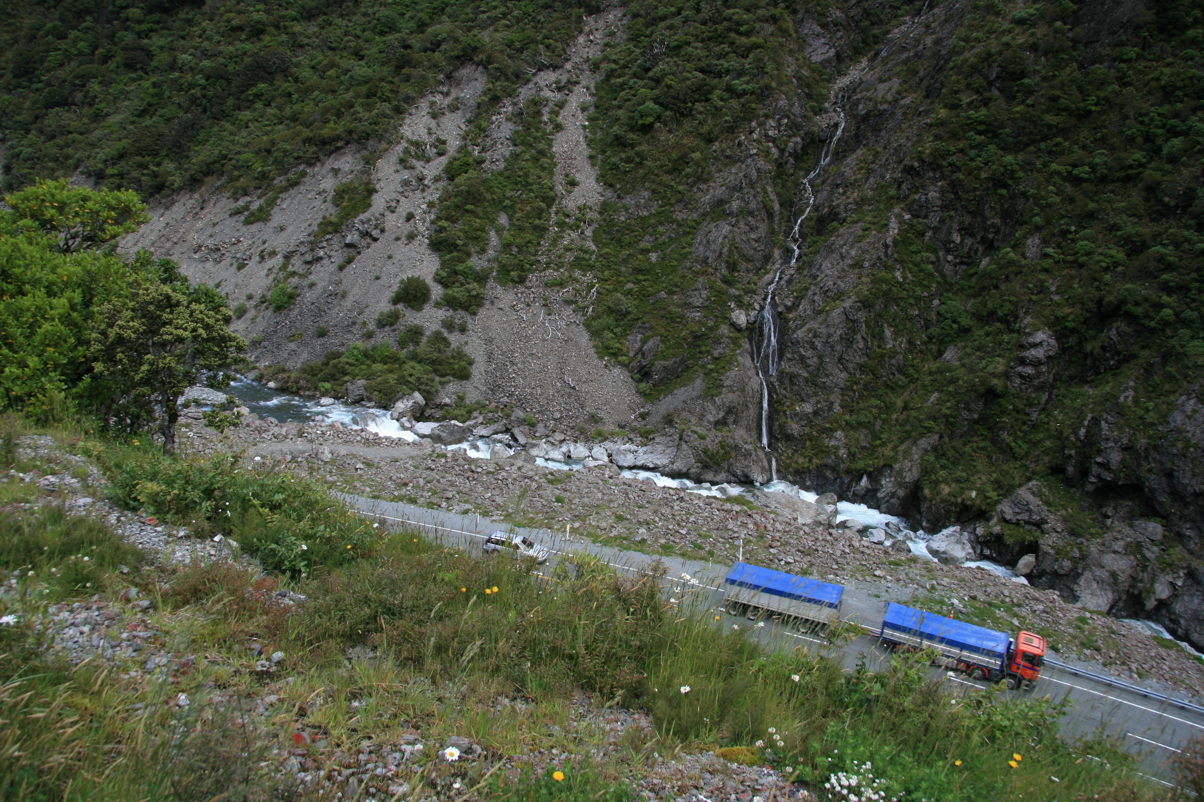
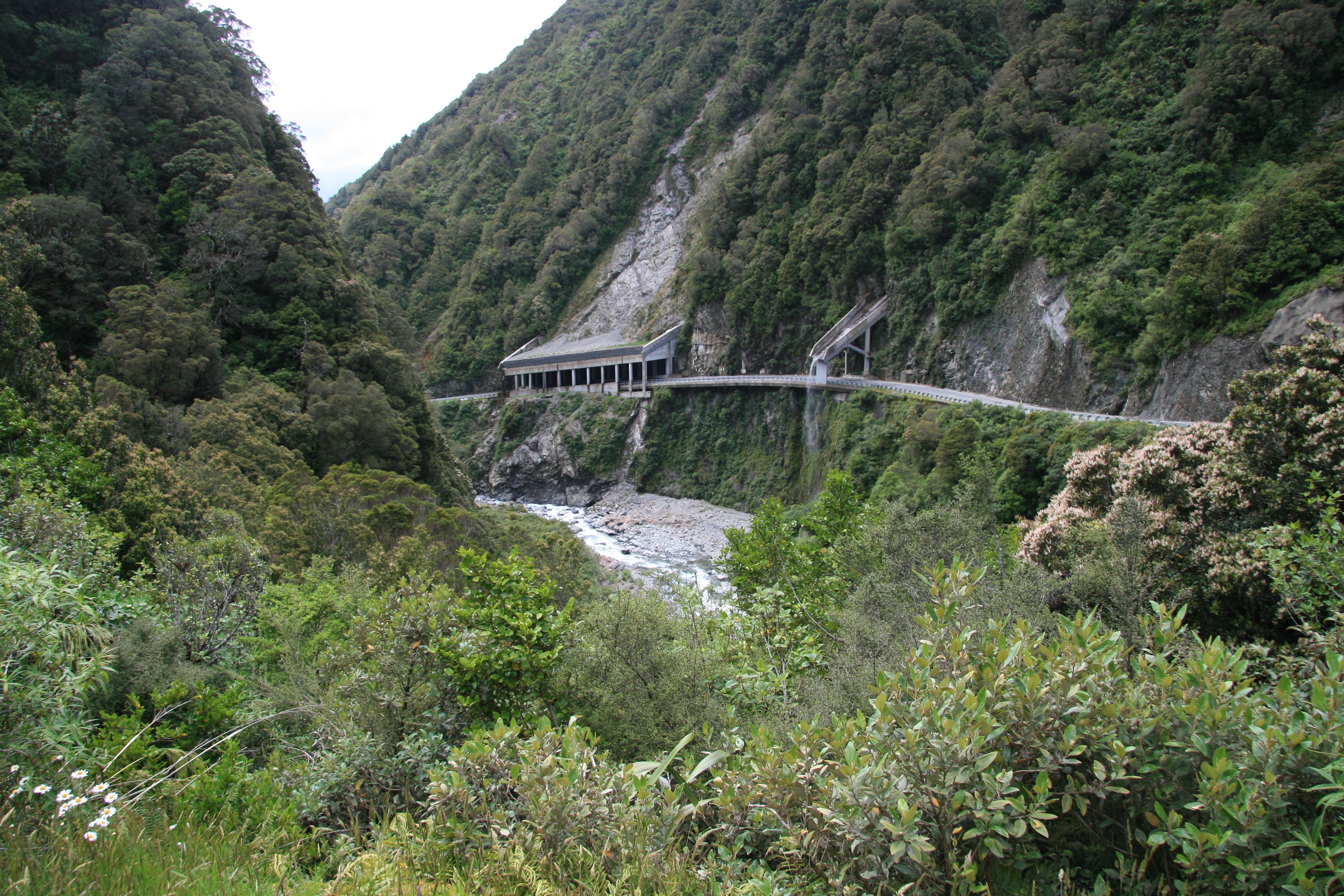
After crossing Arthur's Pass I went through the scenic Otira Viaduct.
6 minute video of my road trip across Arthur's Pass, New Zealand. |
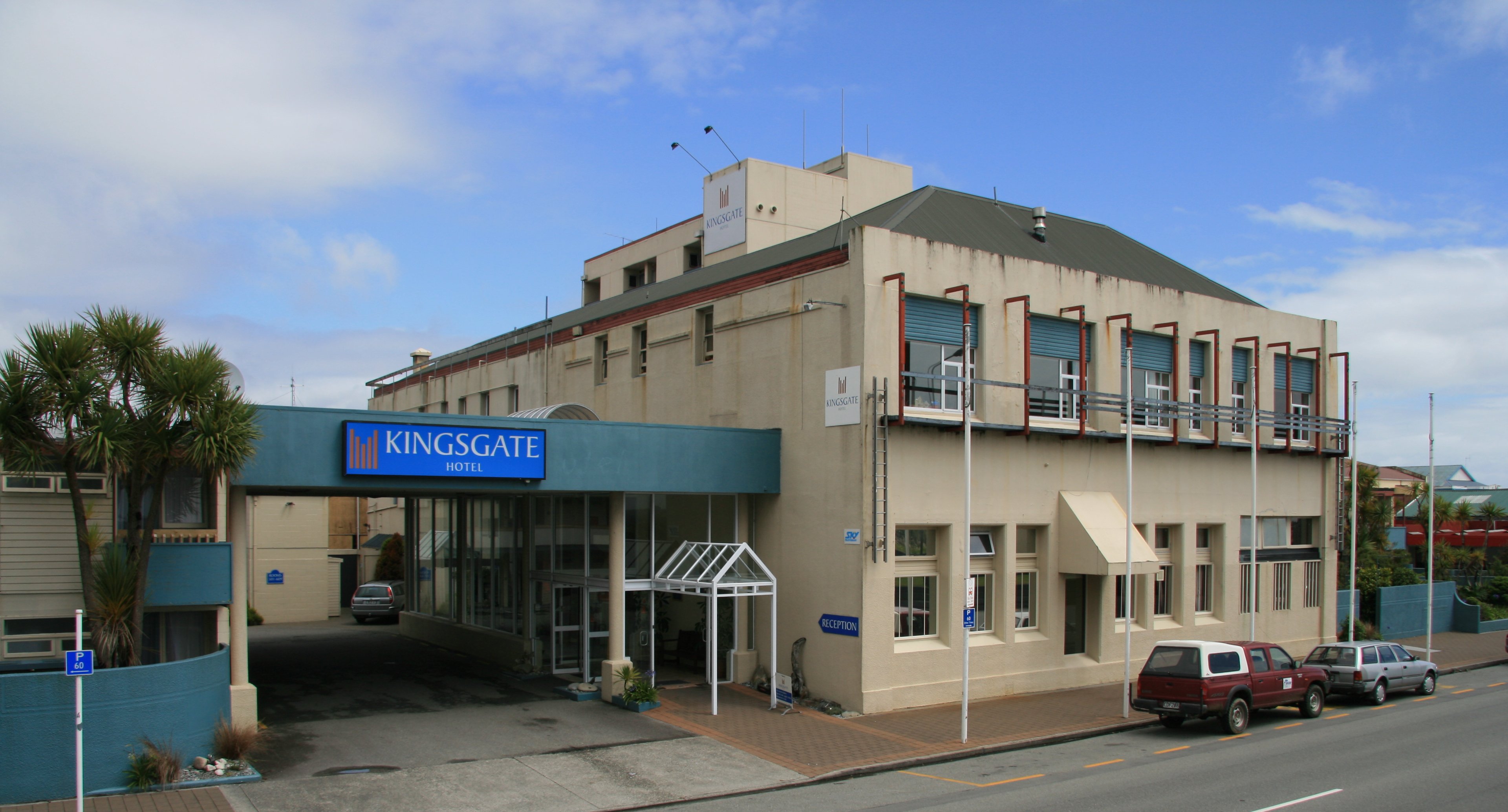
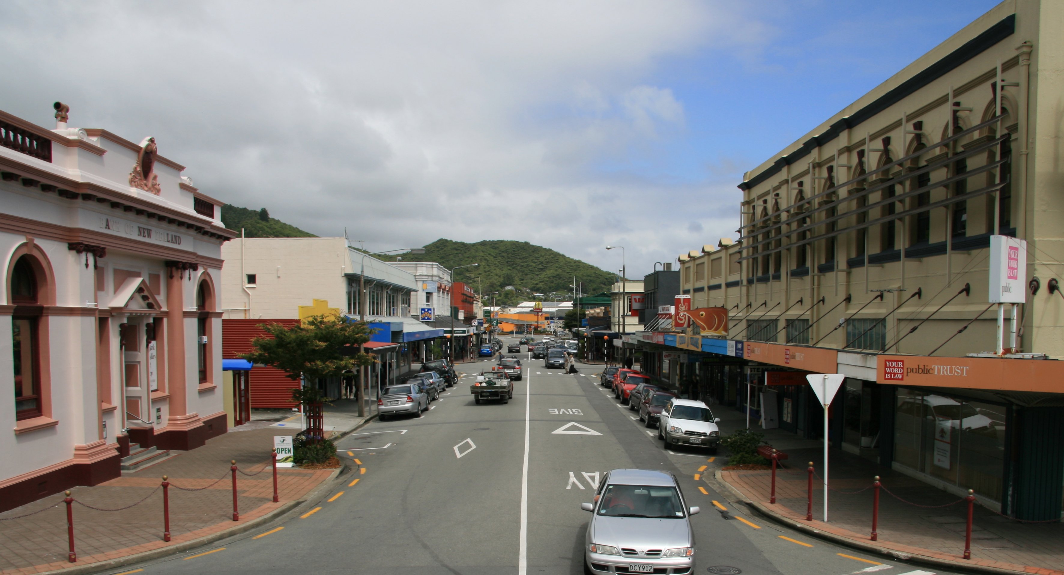
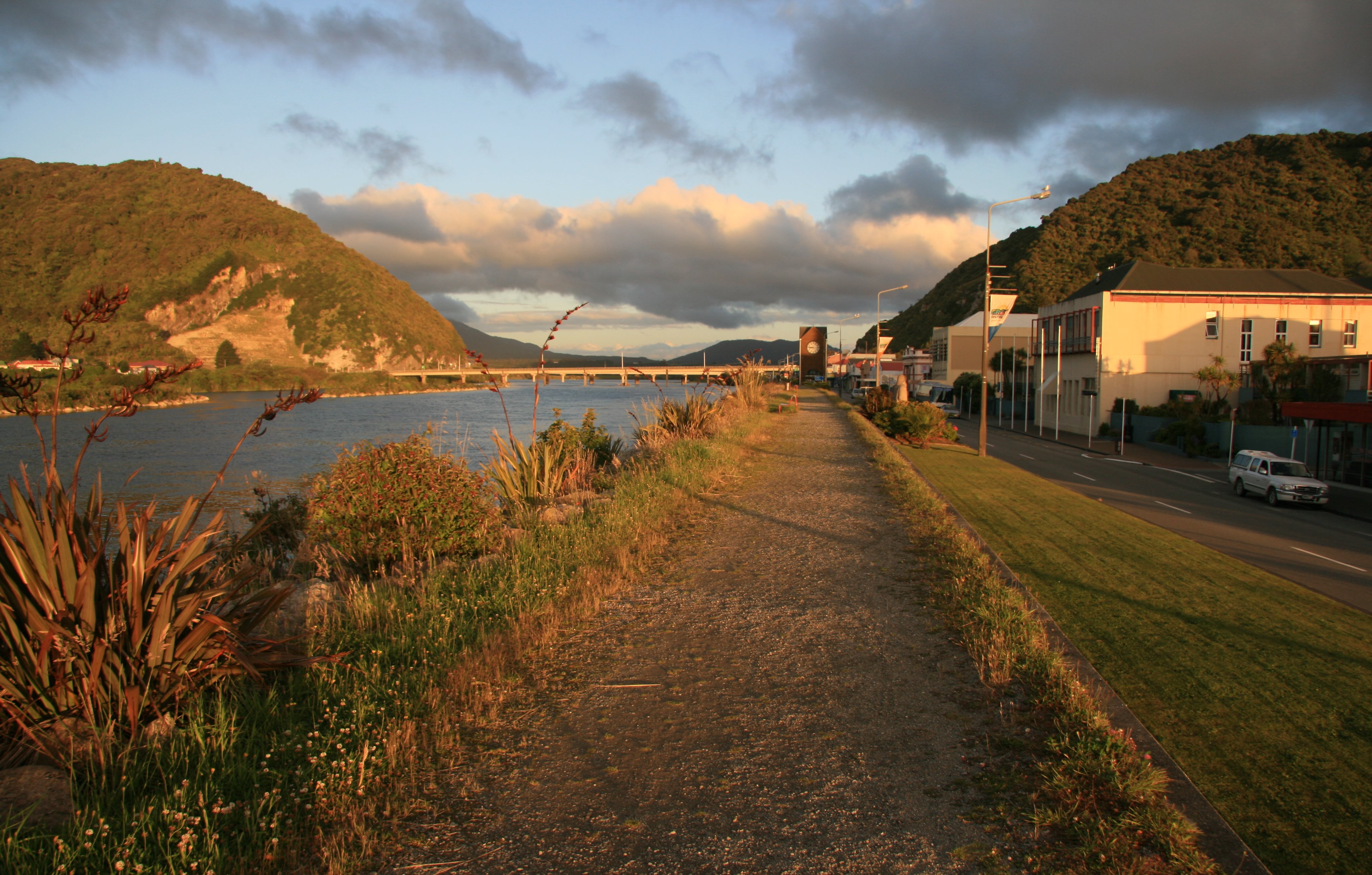
I ended Monday in Greymouth on New Zealand's west coast.
|
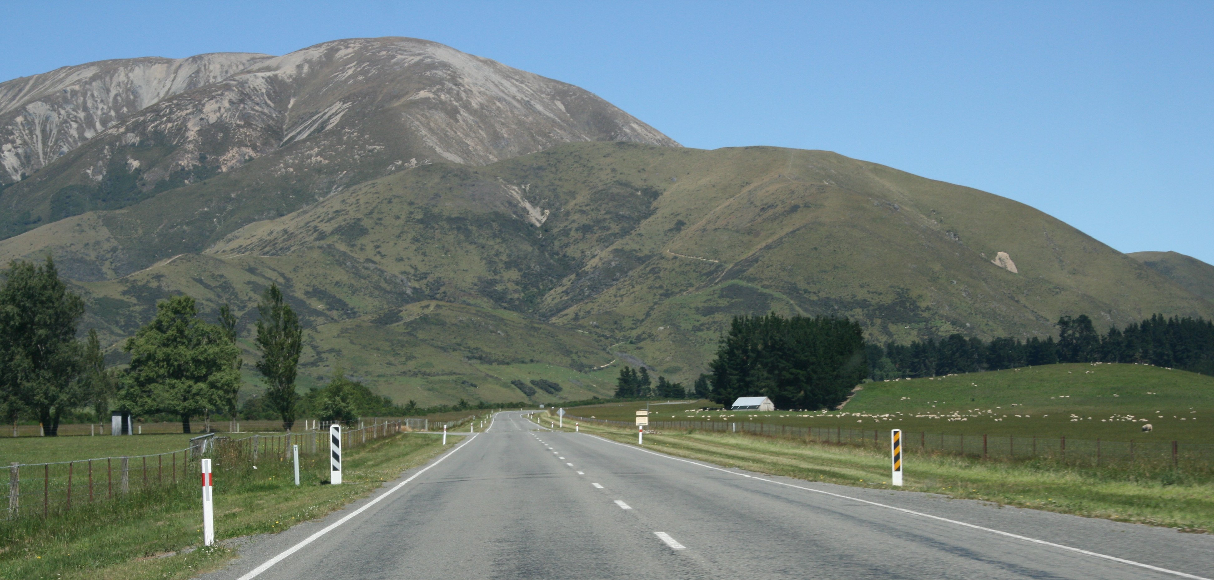
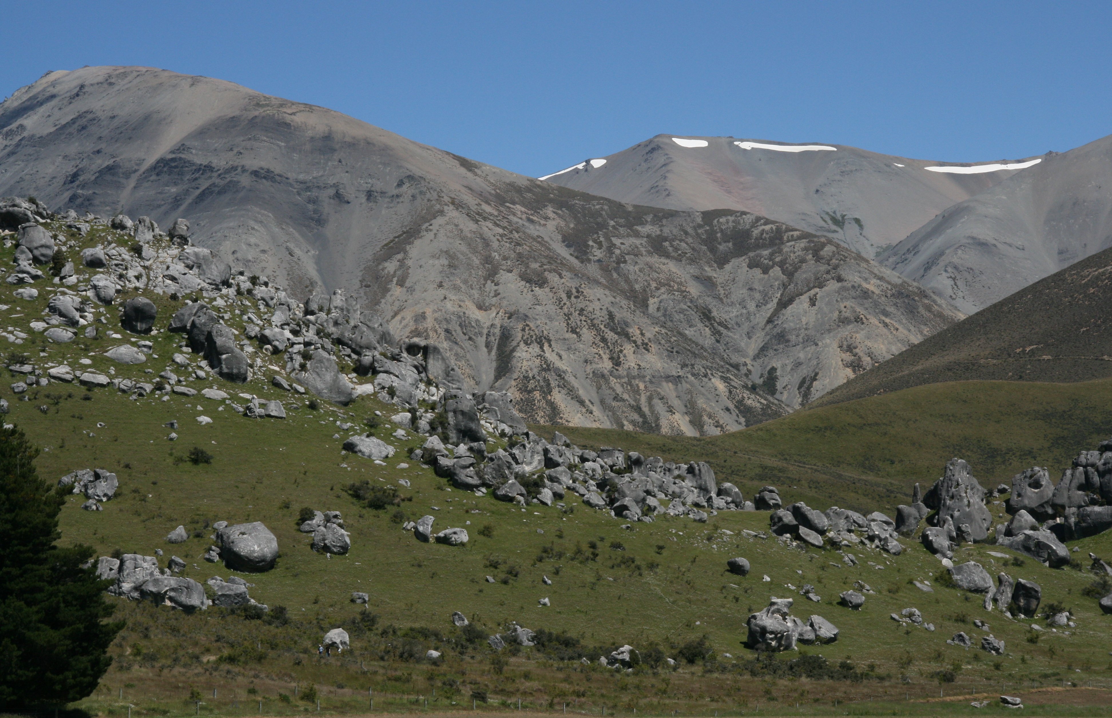
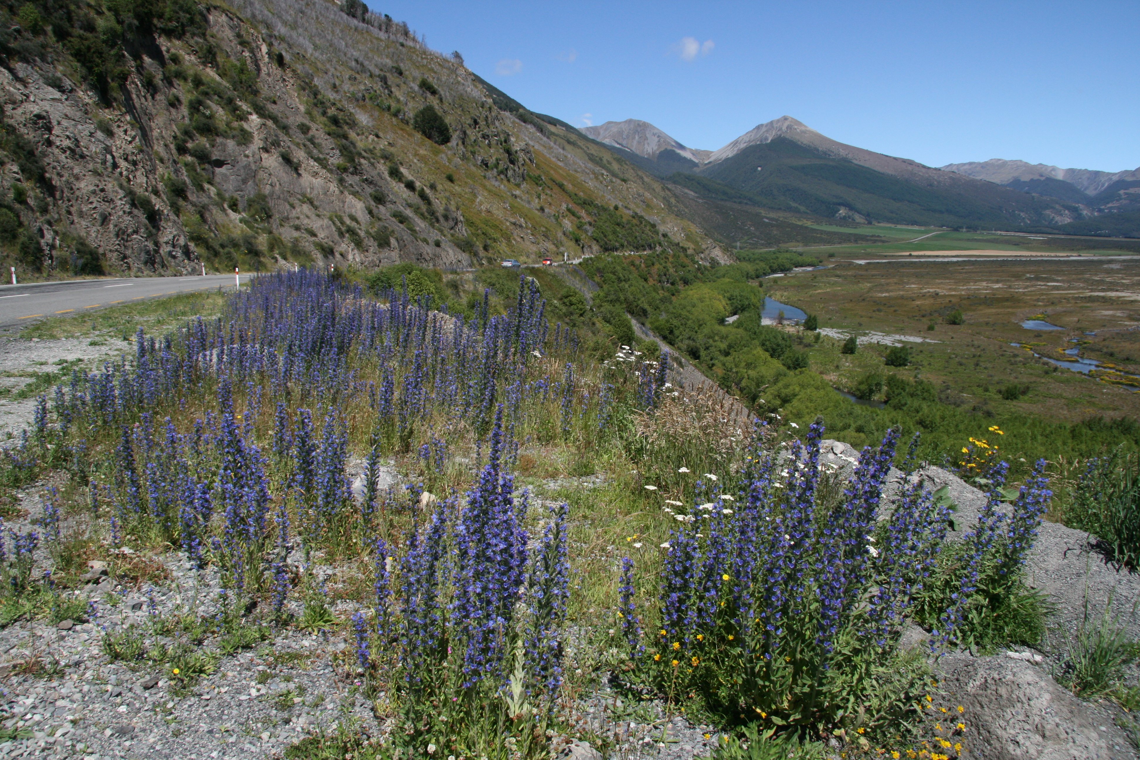
Howdy all, Wow, time sure is flying. Sure doesn't seem like I have been gone over three weeks now. Today was a fun day. Left Christchurch this morning which is on the South Island's east coast. Weather was great, not a cloud in the sky. That is a very rare occurrence here. I traveled about 80 kilometers west of Christchurch to the base of the mountains. That is where I took one of my favorite pictures. The South Island's Canterbury Plains yielding to the impressive Southern Alps of New Zealand. This is where I took a jetboat ride up the Waimakariri River. Alpine Jet is located just outside Springfield, New Zealand. There are many jetboats in New Zealand. This was my favorite of the ones that I visited. This was a blast. We were out in the middle of nowhere as we jetted up the Waimakariri River with mountains towering above us on both sides. Our pilot said he hadn't seen a day this clear all year. In the picture below you can see one of the railroad trestles of TranzAlpine Scenic Railway. After the jet boat it was time to cross the Southern Alps Mountain Range over Arthur's Pass. Not a cloud in the sky all the way up the mountain. You can see sheep grazing along scenic New Zealand Highway 73 in the picture below. Arthur's Pass is the highest pass over the Southern Alps. The bright sunshine and cloudless sky made the scenery even more breath-taking. Not a common occurance in the Southern Alps of New Zealand. How many pictures is too many? Who cares? The scenery was breathtaking. 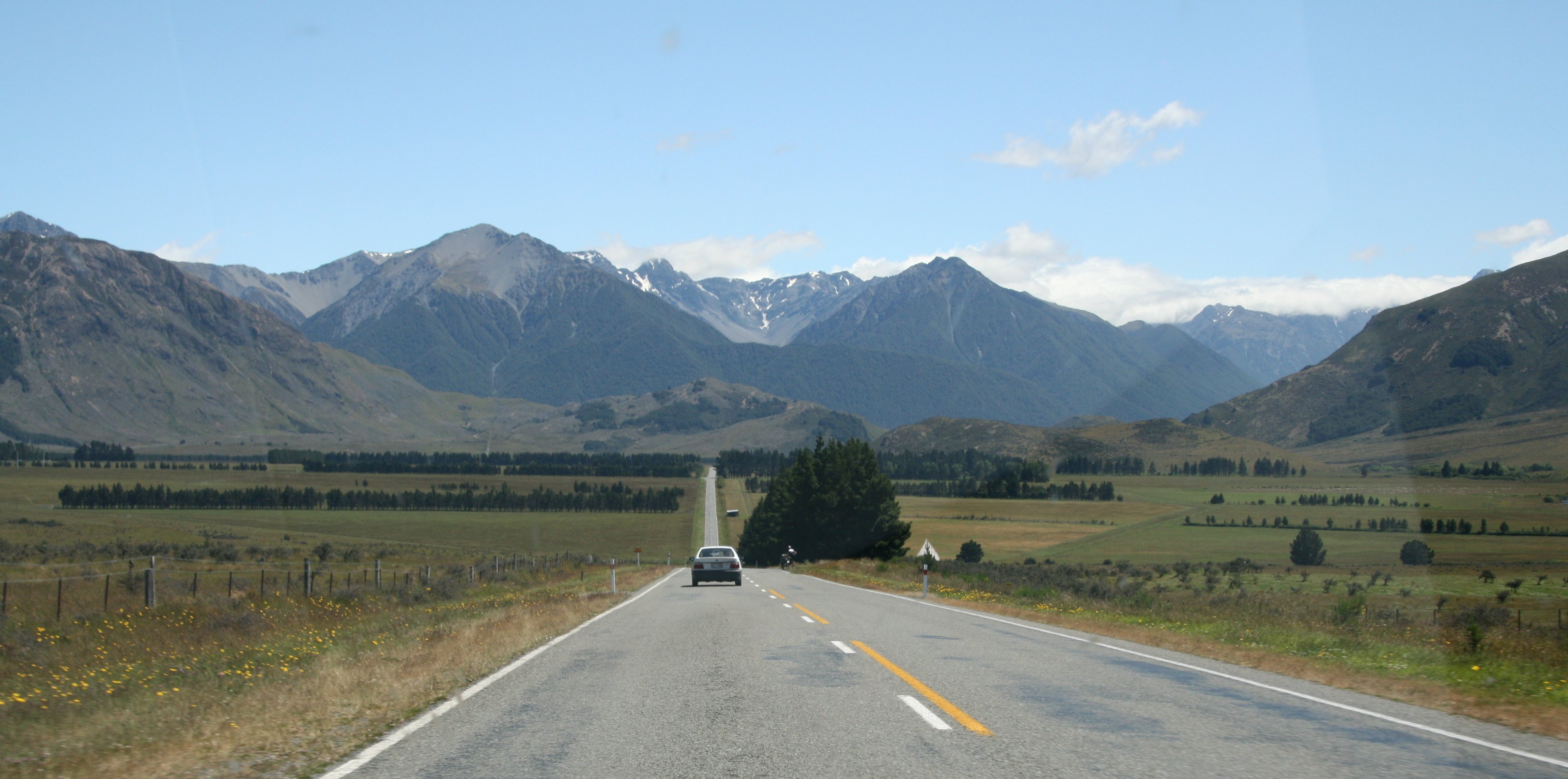 Beautiful wild flowers carpet the landscape along New Zealand's scenic Highway 73 approaching Arthur's Pass. The government here would like to get rid of these purple wild flowers as they are not indigenous to the country of New Zealand. I hope they don't get rid of these purple flowers. I think they are spectacular. 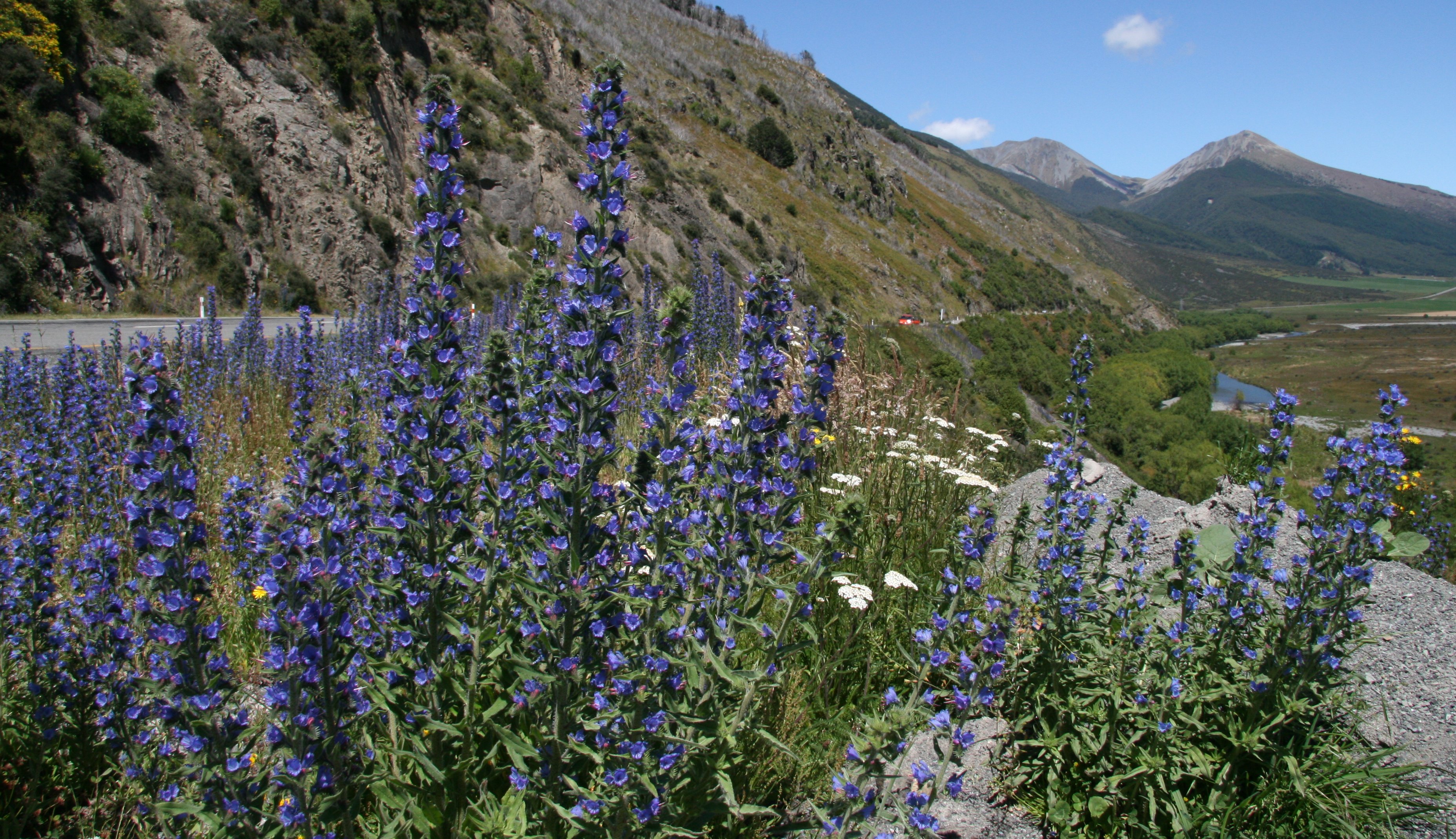 Arthur's Pass National Park includes many peaks over 6,500 feet - the highest is Mount Murchison at 7,900 feet. 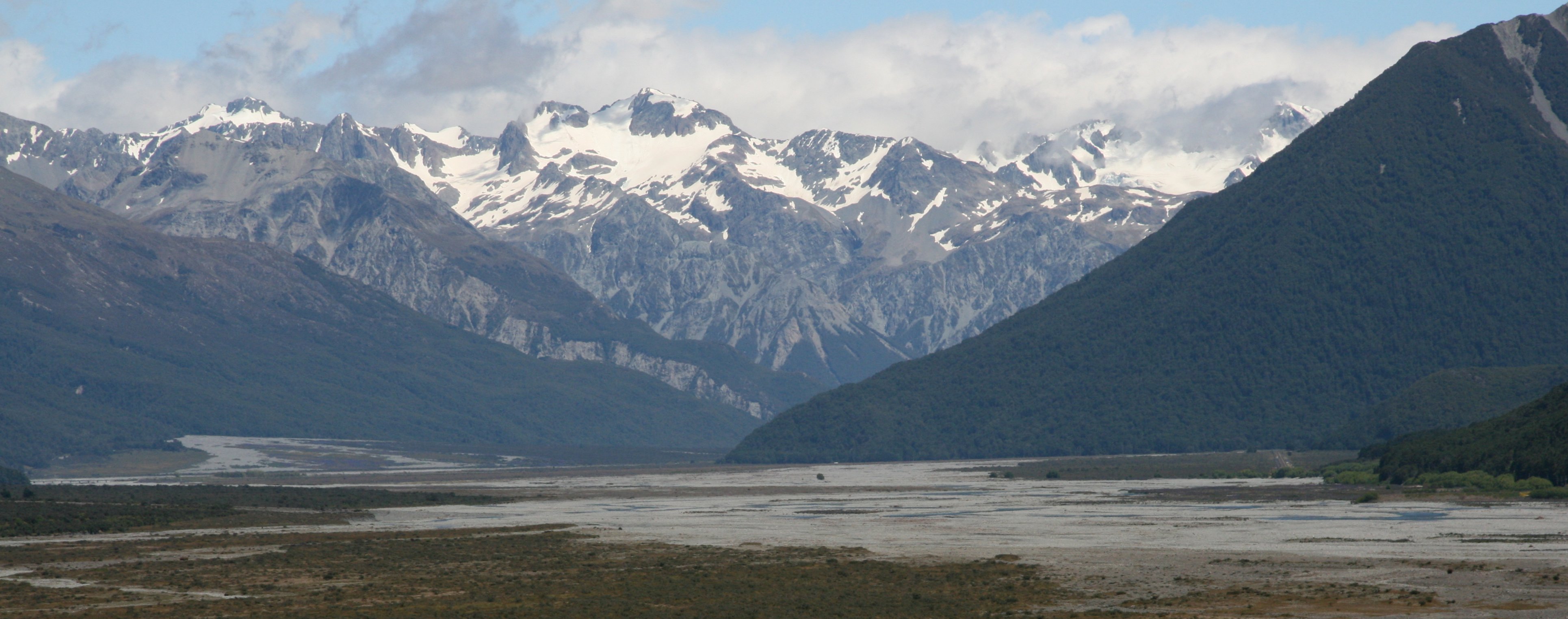 Arthur's Pass National Park is in the heart of the Southern Alps (Ka Tiritiri o te Moana). Its high mountains with large scree slopes, steep gorges and wide braided rivers straddle the main divide, and are the "back bone" of the South Island. 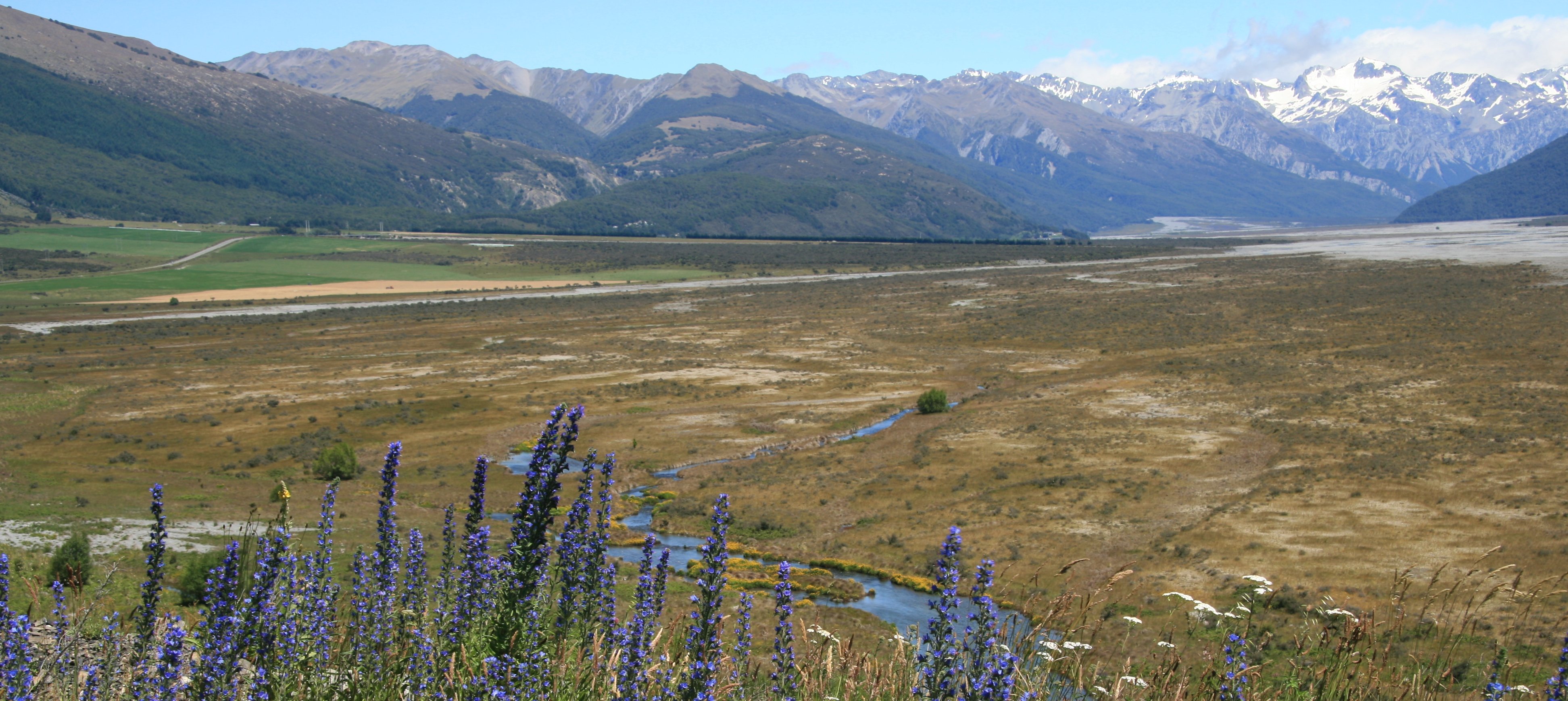 Below is the worthless car that I am driving here on the South Island. 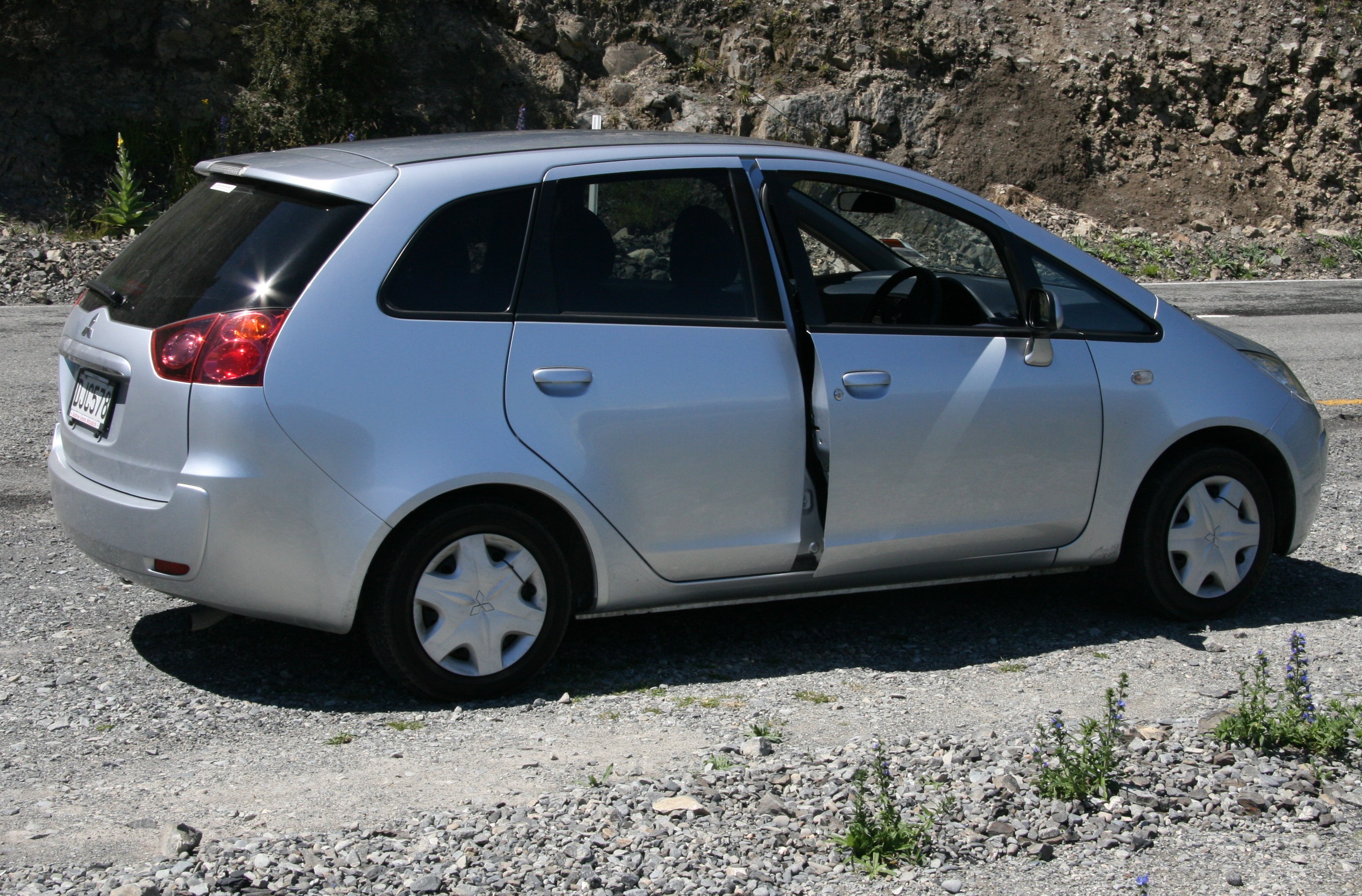 Coming down the other side I went through the Otira Gorge. Below is the east side of the Otira Viaduct. The Otira viaduct was completed in 1999. The 1,440 foot four-span viaduct carries State Highway 73 over a stretch of unstable land, replacing a narrow, winding, dangerous section of road that was prone to avalanches, slips and closures. Most people arrive in Arthur's Pass National Park by road - a spectacular piece of extreme civil engineering involving viaducts, bridges, rock shelters and waterfalls redirected into chutes. Below is the west side of the Otira Viaduct The bird below is not a Kiwi, they are wingless and flightless. Anyone know the species? A Kea maybe? 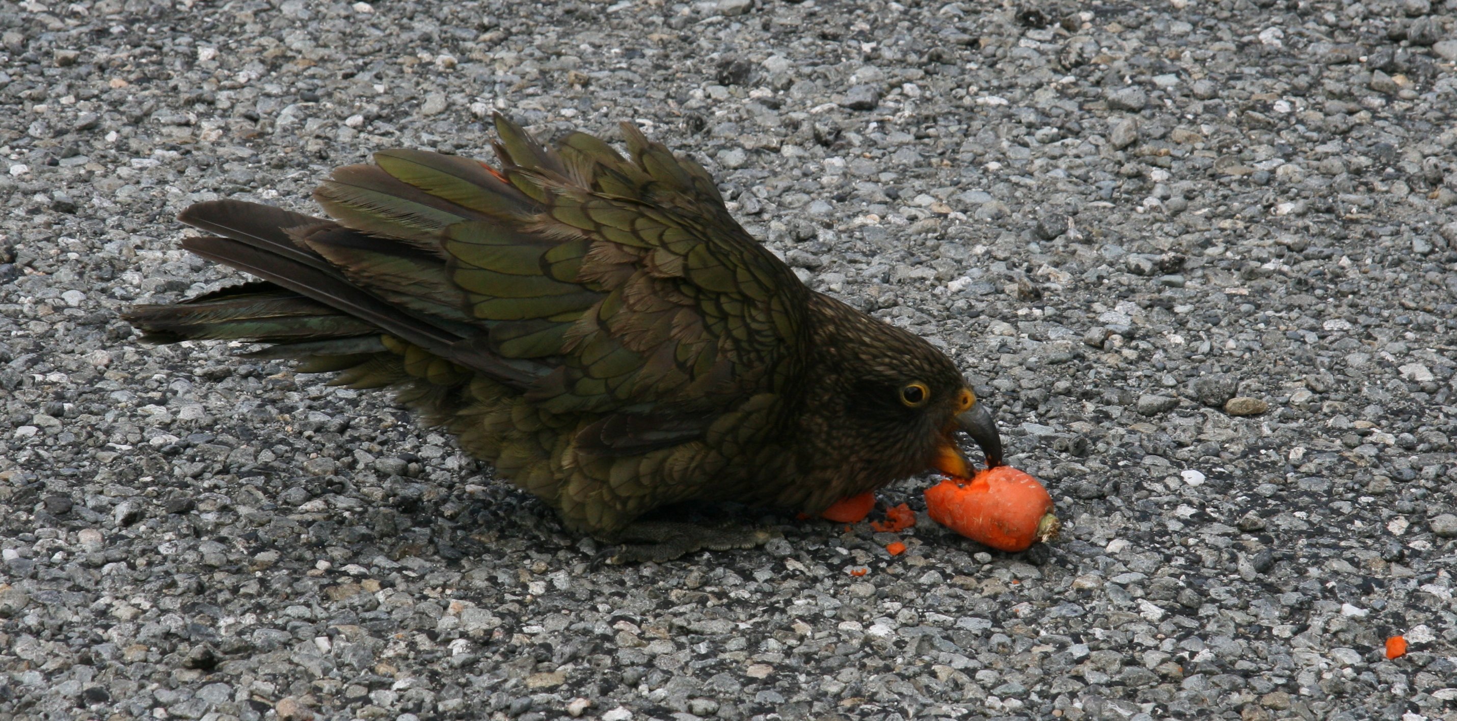 Within minutes after crossing the pass it clouded over and rained pretty much all the way into Greymouth where I am staying tonight. Greymouth is on the West coast of the South Island. I'm staying at the Kingsgate Hotel, it's definitely not the Waldorf Astoria. Below is beautiful downtown Greymouth. 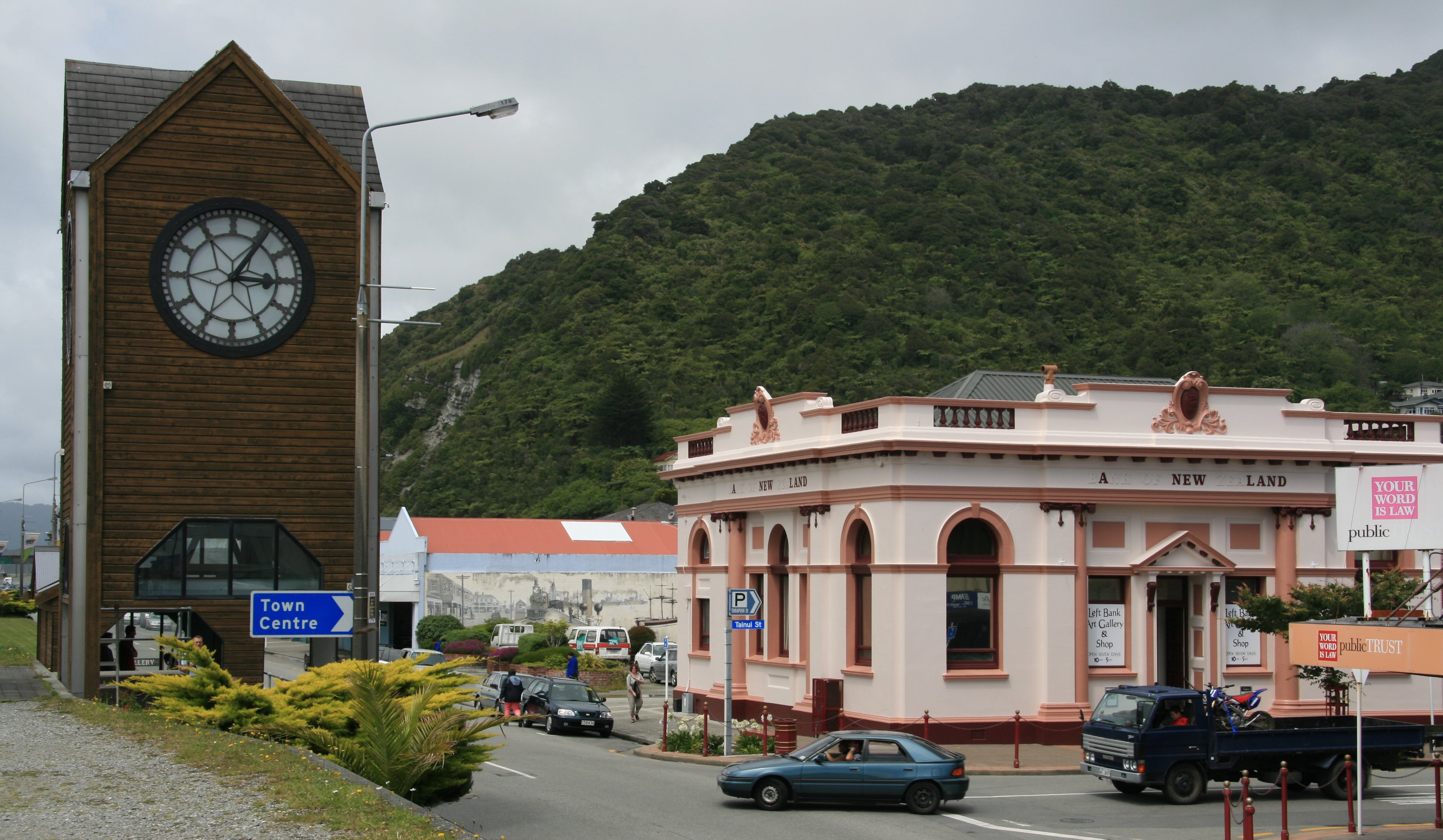 I was happy to see the Colts won on Saturday. I can't believe the Colt defense held them to six points. The Grey River drains into the Tasman Sea in Greymouth. I will write more later, 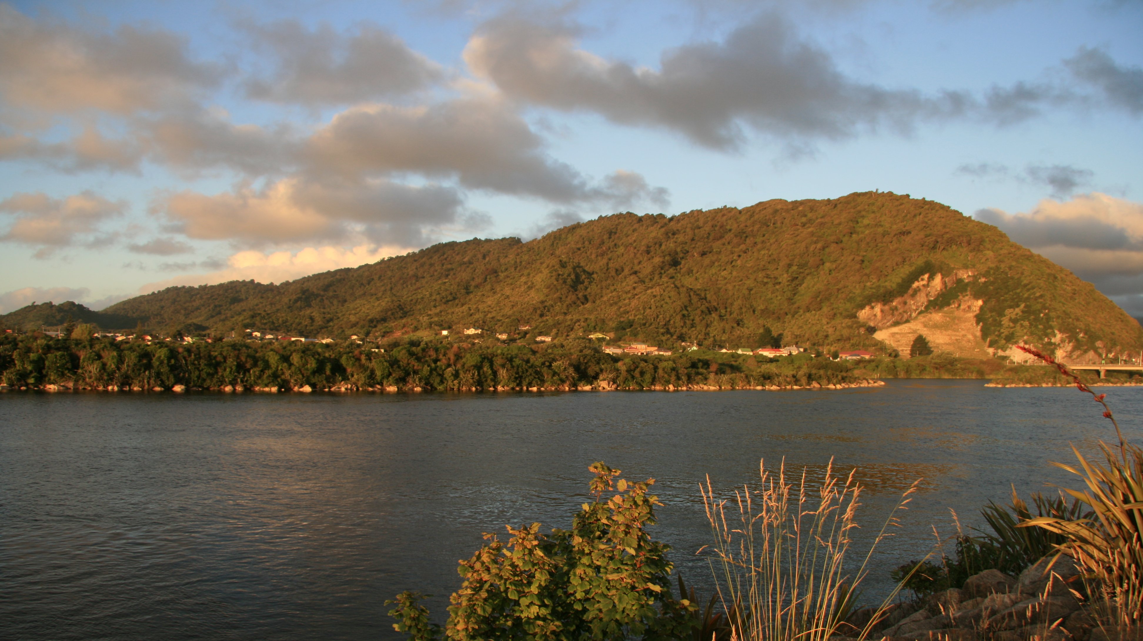 Tim |

Click above to continue to my next adventure, THE GLACIERS.
| TIM'S HOME PAGE SITE INDEX | |||
|---|---|---|---|
| Areas | Description | # of Pages | |
| About Me | Current Picture of me and my home. Information about myself. | 2 | |
| Biography | Pictorial biography of myself. Pictures range from birth to adulthood. | 4 | |
| Family File | Pictures of my family and a little information about them. | 12 | |
| Local Spotlight | Pictures, Links, and Information for Indianapolis, Richmond, Plainfield, and Mooresville, Indiana. | 6 | |
| Tim's Travels | Pictures, videos and travelogs from my travels around the world. | 409 | |
| Vacation Videos | Over 1500 videos from my travels around the world. | 1 | |