Today's journey from Fresno to Atascadero racked up a total of 297 miles.
All of the images below are thumbnails and can be clicked on for a larger image.
Kings Canyon National Park is located in the southern
Sierra Nevada, east of Fresno, California.
The park was established in 1940 and covers 461,901 acres.
The park is north of and contiguous with Sequoia National Park.
|
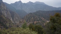
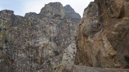
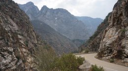
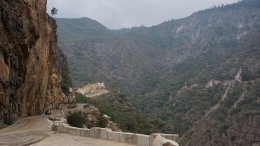
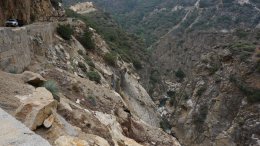
Hello Everyone, California is experiencing an extreme drought. So what does it do when I arrive? RAIN! When I left Fresno after 7:30 this morning it was raining. It was a sixty mile drive to King's Canyon National Park. There was on and off rain on the drive over. When I got to the park it was cloudy with a few sprinkles but I was able to explore the park. 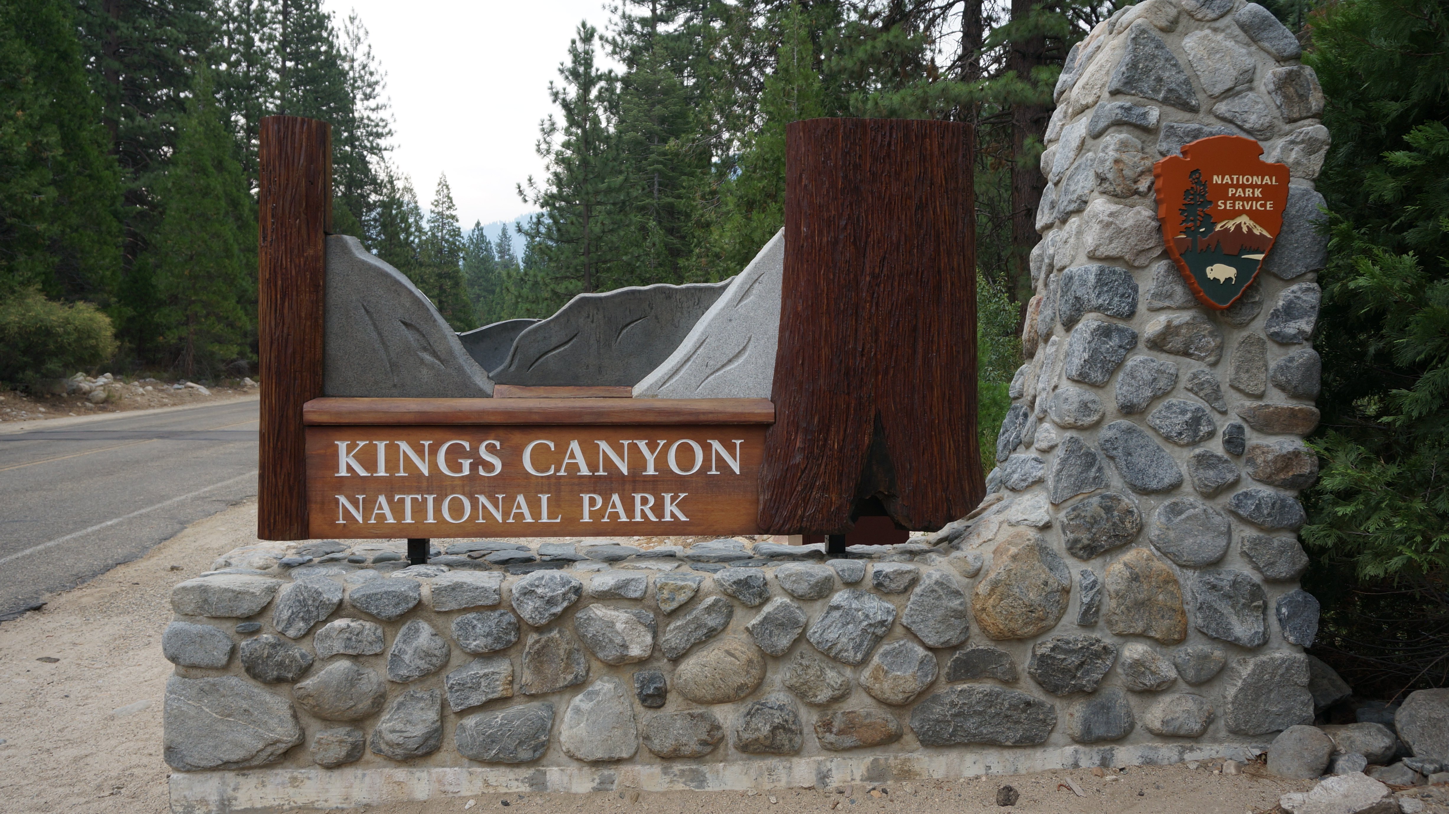 Below is a picture looking down into the canyon. As you can see it is not a clear day. 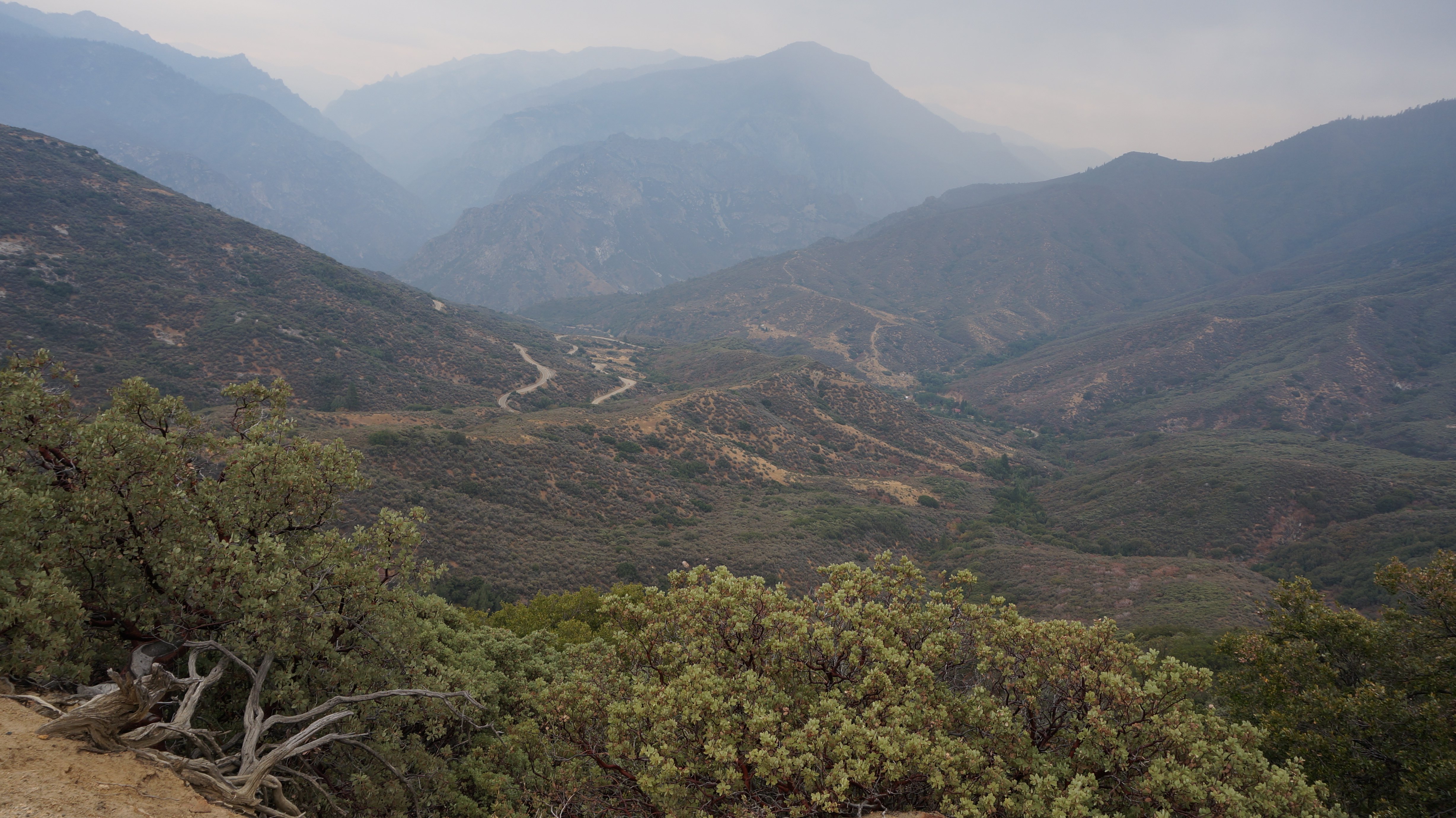 I haven't taken very many pictures with me in them this trip. I did manage to take one today from the spot you see above. 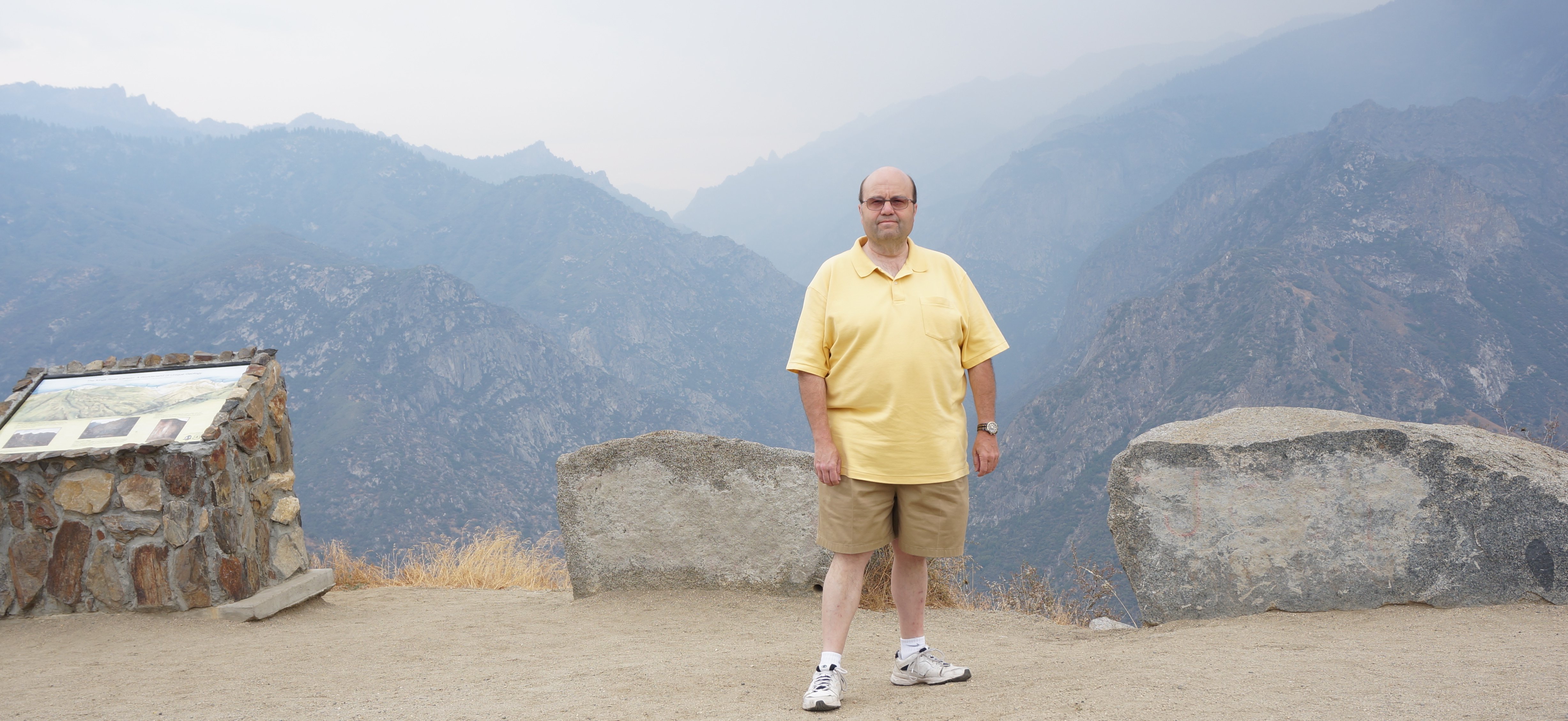 I continued my drive down into the canyon. 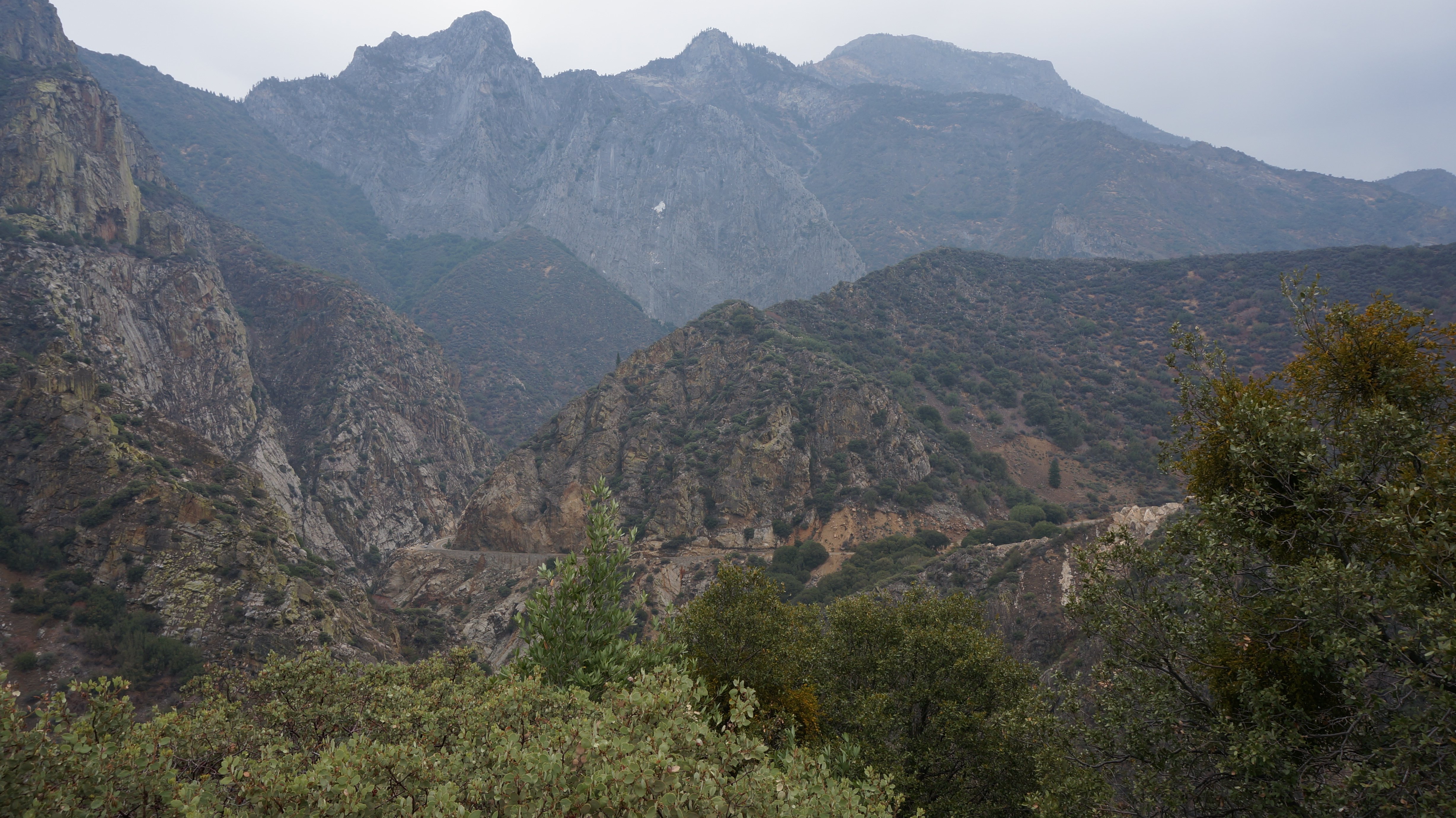 In the picture above you can see the road winding down into the canyon. Barbara would have enjoyed this very much. Below is a closer look at the road from the same place. 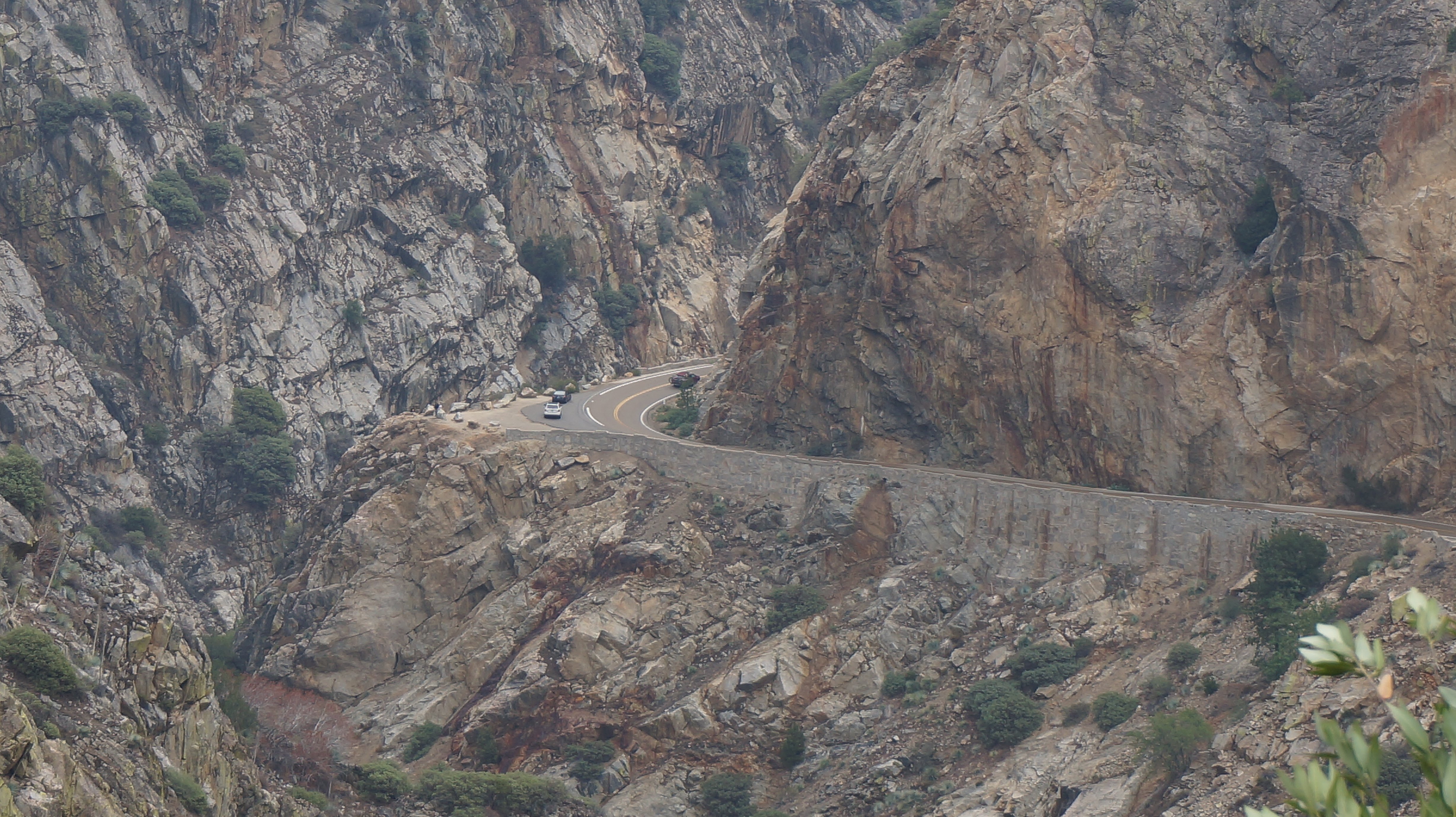 I continued downward. In the picture below I had almost reached the bottom. 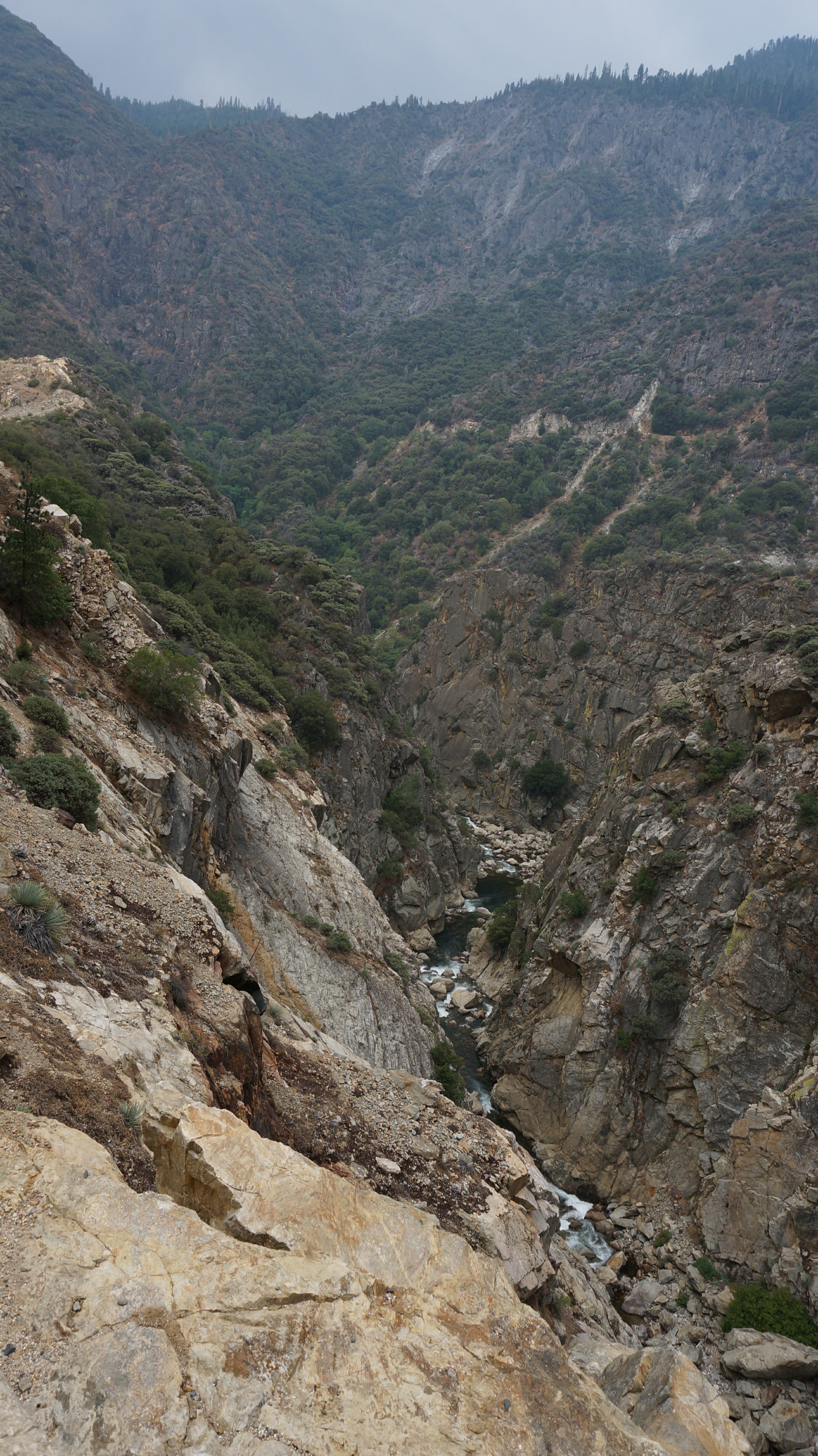 The road in and out of the canyon was 74 miles roundtrip. The road ends and you turn around and return the way you came. There was a light to steady rain all the way back. When I got back to my starting point you then enter Sequoia National Park. When I first got here I turned left and explored Kings Canyon National Park. When you turn right you enter Sequoia National Park. Well now it was time to see Sequoia. Only one problem. We started having a heavy thunderstorm. Heavy rain and pea sized hail. I couldn't see where I was driving. I also see a big warning sign saying road construction next 30 miles. I decided to exit the park instead of seeing Sequoia like I had planned. In the video from the dash camera you can see the hail bouncing off the hood but you can't really make it out from this screen grab. 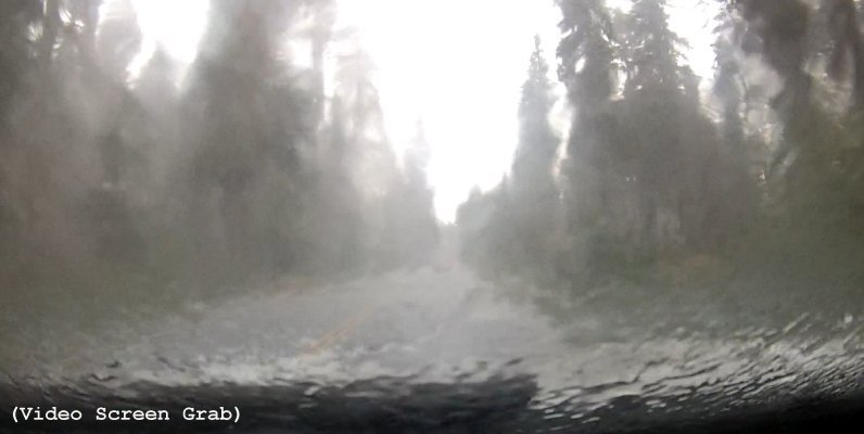 Once I descended a few thousand feet from the high altitudes in Sequoia, the rain pretty much stopped. It took me a little over an hour to get to Visalia where I had lunch at my usual place.  After lunch it was a two hour drive to where I am spending the night, Atascadero. I am staying at the usual place.  Hopefully I will actually be able to do what I have planned tomorrow. The last few days I have been doing a lot of driving for very little reward. Not too much driving left though. I am going to spend the next two days driving up the Pacific Coast Highway and then end my trip with a few days in San Francisco. Tim |

Click on the arrow above to continue to tomorrows adventures!
| TIM'S HOME PAGE SITE INDEX | |||
|---|---|---|---|
| Areas | Description | # of Pages | |
| About Me | Current Picture of me and my home. Information about myself. | 2 | |
| Biography | Pictorial biography of myself. Pictures range from birth to adulthood. | 4 | |
| Family File | Pictures of my family and a little information about them. | 12 | |
| Local Spotlight | Pictures, Links, and Information for Indianapolis, Richmond, Plainfield, and Mooresville, Indiana. | 5 | |
| Tim's Travels | Pictures, videos and travelogs from my travels around the world. | 409 | |
| Vacation Videos | Over 1500 videos from my travels around the world. | 1 | |